
Ascent Passport
RUSSIAN MOUNTAINEERING FEDERATION ФЕДЕРАЦИЯ АЛЬПИНИЗМА РОССИИ 1.1. 67 pg.1 6А3 м. 5 dated 15.03.02
-
Region, gorge, KTGV section №: Altai, Katunskie Belki ridge, Ak-kem gorge, № 1.1.34.
-
Peak: ХХ let Oktyabrya Tsentralnaya; route name: via North-Eastern wall.
-
Proposed: 6B cat. diff., first ascent.
-
Route type: combined.
-
Route elevation gain — 1150 m; length — 1400 m, length of sections with V cat. diff. — 347 m, VI cat. diff. — 310 m, average steepness: main part of the route — 73°; entire route — 65°.
-
Pitons left on the route: total — 7, drilled — 3; Pitons used: stationary drilled — 3, incl. ITO — none; removable drilled — 4, incl. ITO — 2; total ITO used — 158.
-
Team's climbing hours: 92 hours, 13 days.
-
Team leader: Afanasiev Andrey Evgenievich — MS;
Participants: Kolesov Pavel Olegovich — CMS, Salin Alexander Vladimirovich — 1st sports category, Slobodchikov Igor Vladimirovich — CMS, Khandazhapov Bair Alexandrovich — 1st sports category, Sherstnev Igor Vladimirovich — CMS.
-
Coach: Afanasiev Andrey Evgenievich — MS.
-
Acclimatization: February 11, 2002 – February 17, 2002; Departure for the route: February 21, 2002; Summit: February 28, 2002, at 11:30 local time. Control time limit: February 28, 2002, at 23:00 local time.

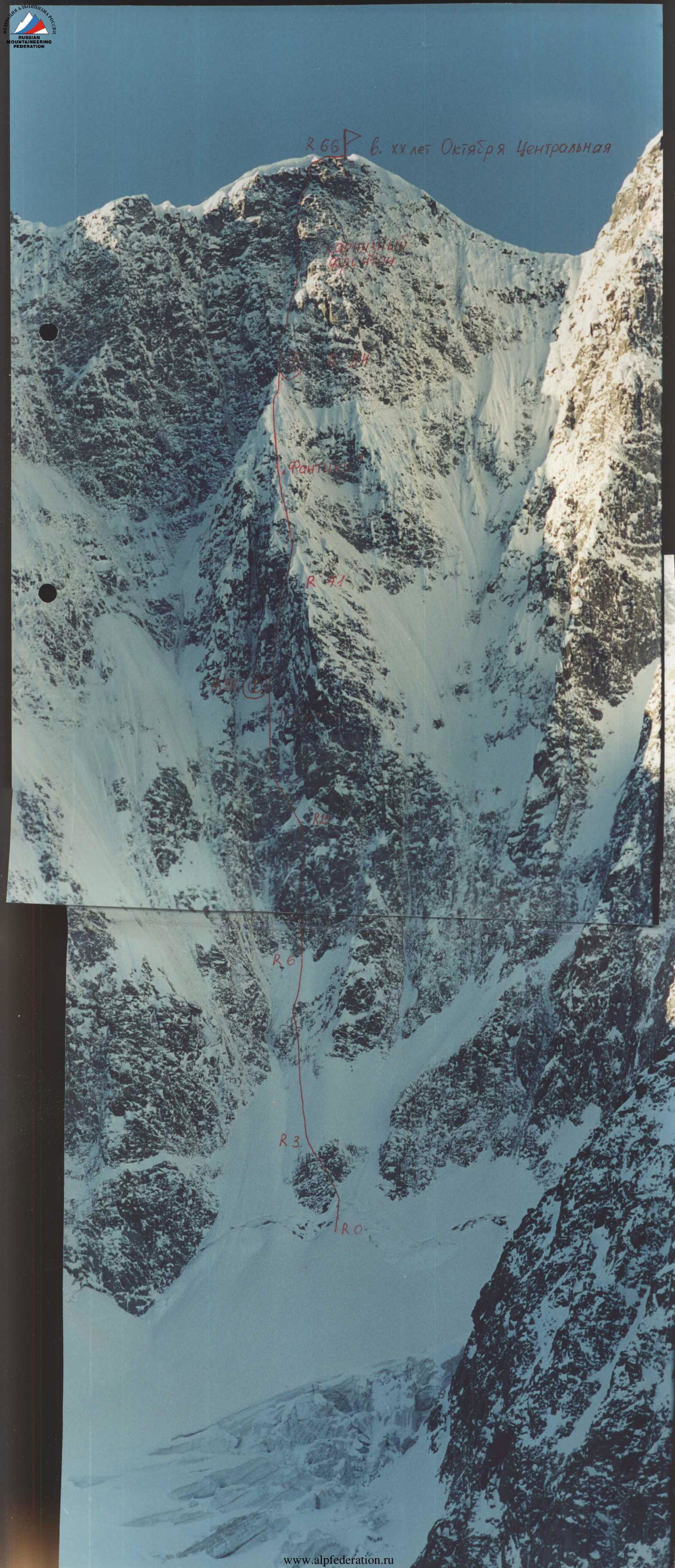
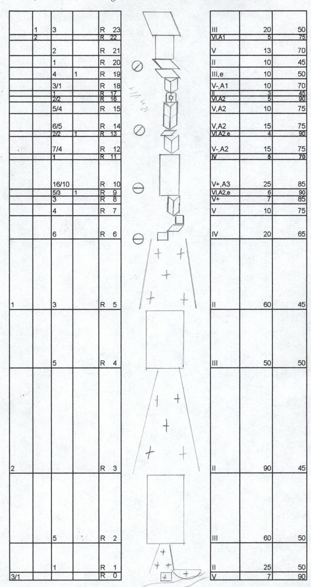
General photo of ХХ let Oktyabrya peak
4a N/A 6A 58 угт

Peak ХХ let Oktyabrya Tsentralnaya
R66 6. ХХ let Oktyabrya Tsentralnaya Фан R6 R3 R0
Area map
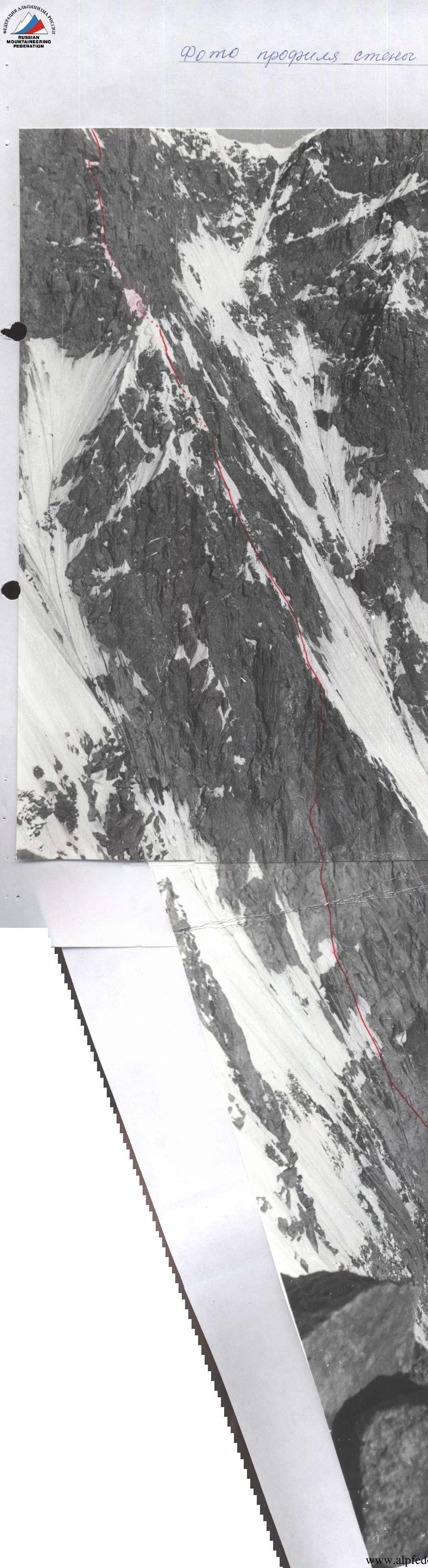
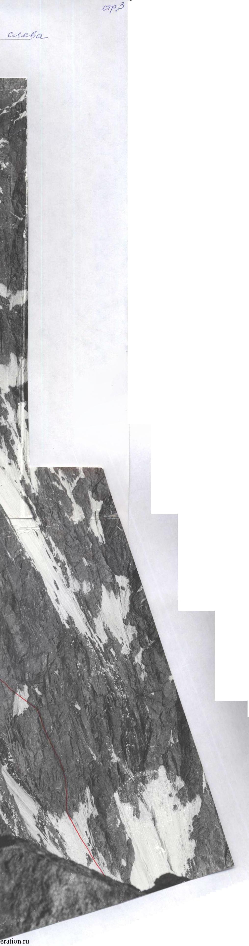
Left wall profile photo
pg. 3
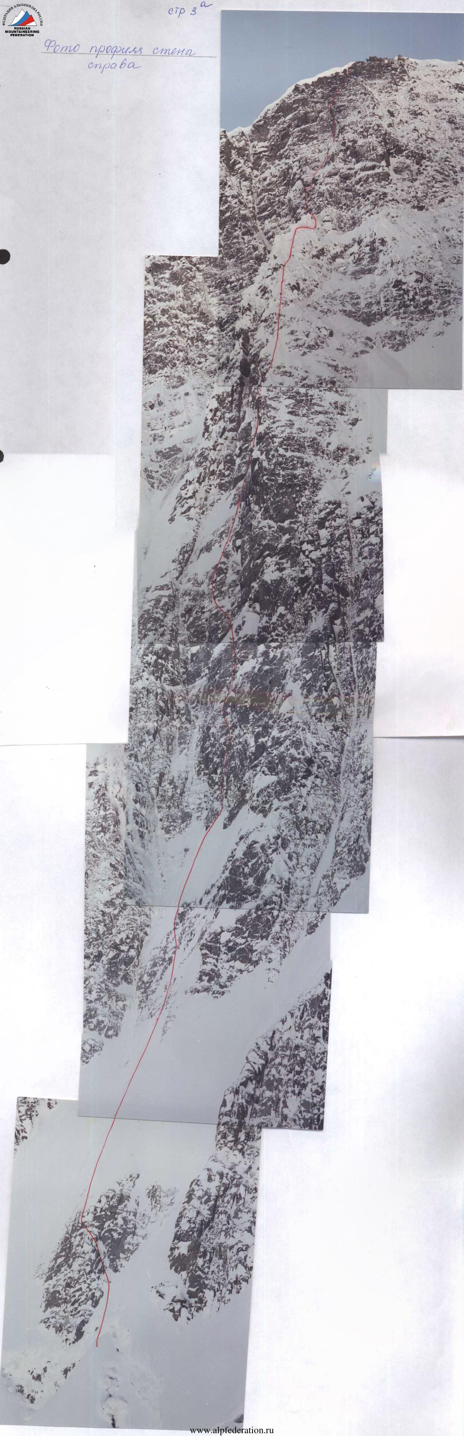
Right wall profile photo
pg. 3a
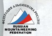
Route diagram in UIAA symbols M.1:2000
pg. 8
| Pitons (1) | Pitons (2) | Section | Cat. diff. | Length (m) | Slope (°) |
|---|---|---|---|---|---|
| 1 | 3 | R23 | 3 | 20 | 50 |
| R22 | 6 | 5 | 75 | ||
| 2 | R21 | 5 | 13 | 70 | |
| 1 | R20 | 2 | 10 | 45 | |
| 4 | 1 | R19 | 3 | 10 | 50 |
| 3/1 | R18 | 5 | 10 | 70 | |
| 2/2 | R17 | 6 | 3 | 45 | |
| R16 | 5 | 5 | 90 | ||
| 5/4 | R15 | 5 | 10 | 75 | |
| 6/5 | R14 | 5 | 15 | 75 | |
| 2/2 | 1 | R13 | 6 | 4 | 90 |
| 7/4 | R12 | 5 | 15 | 75 | |
| 1 | R11 | 4 | 5 | 70 | |
| 16/10 | R10 | 5 | 25 | 85 | |
| 5/3 | 1 | R9 | 6 | 6 | 90 |
| 3 | R8 | 5 | 7 | 85 | |
| 1 | R7 | 5 | 10 | 75 | |
| 4 | |||||
| 6 | R6 | 4 | 20 | 65 | |
| 1 | 3 | R5 | 2 | 60 | 45 |
| 5 | R4 | 3 | 50 | 50 | |
| 2 | R3 | 2 | 90 | 45 | |
| 5 | R2 | 3 | 60 | 50 | |
| 1 | R1 | 5 | 25 | 50 | |
| 3/1 | R0 | 5 | 7 | 90 |
Photo
pg.
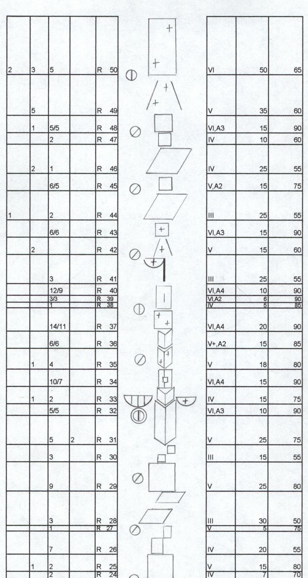
Route diagram (continued)
pg. 9a
| Pitons (1) | Pitons (2) | Section | Cat. diff. | Length (m) | Slope (°) |
|---|---|---|---|---|---|
| 2 | 3 | R50 | 6 | 50 | 65 |
| 5 | R49 | 5 | 35 | 60 | |
| 1 | 5/5 | R48 | 6 | 15 | 90 |
| 2 | R47 | 4 | 10 | 60 | |
| 2 | 1 | R46 | 4 | 25 | 55 |
| 6/5 | R45 | 5 | 15 | 75 | |
| 1 | 2 | R44 | 3 | 25 | 55 |
| 6/6 | R43 | 6 | 15 | 90 | |
| 2 | R42 | 5 | 15 | 60 | |
| 3 | R41 | 3 | 25 | 55 | |
| 12/9 | R40 | 6 | 10 | 90 | |
| 3/3 | R39 | 6 | 6 | 90 | |
| 1 | R38 | 4 | 5 | 85 | |
| 14/11 | R37 | 6 | 20 | 90 | |
| 6/6 | R36 | 5 | 15 | 85 | |
| 1 | 4 | R35 | 5 | 18 | 80 |
| 10/7 | R34 | 6 | 15 | 90 | |
| 1 | 2 | R33 | 4 | 15 | 75 |
| 5/5 | R32 | 6 | 10 | 90 | |
| 5 | 2 | R31 | 5 | 25 | 75 |
| 3 | R30 | 3 | 15 | 55 | |
| 9 | R29 | 5 | 25 | 80 | |
| 3 | R28 | 3 | 30 | 50 | |
| R27 | 5 | 5 | 75 | ||
| 7 | R26 | 4 | 20 | 55 | |
| 1 | 2 | R25 | 5 | 15 | 80 |
| 2 | R24 | 4 | 7 | 70 |
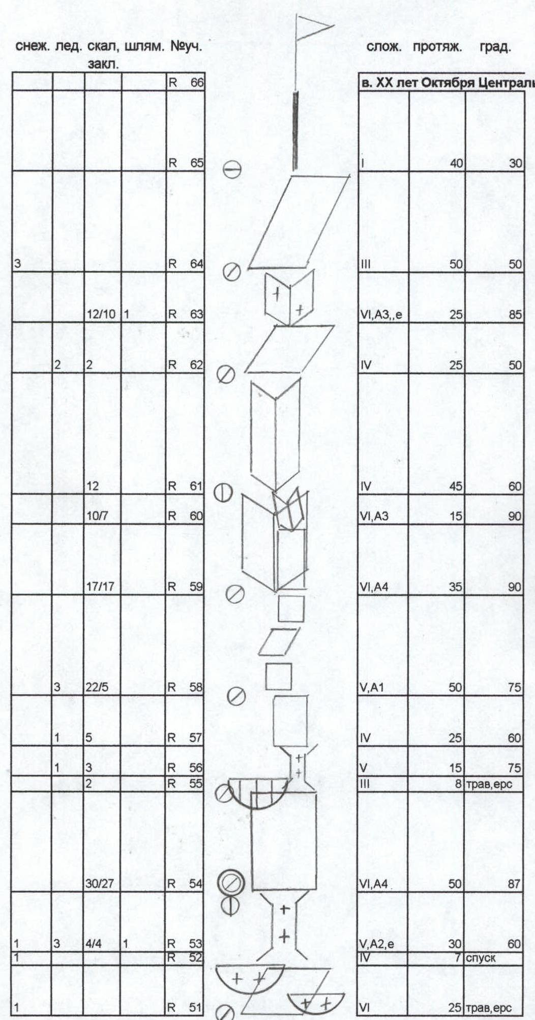
Route diagram (continued)
pg. 8b peak ХХ let Oktyabrya Tsentralnaya
| Snow | Ice | Rock | Drilled | Section | Cat. diff. | Length (m) | Slope (°) |
|---|---|---|---|---|---|---|---|
| R66 | 40 | 30 | |||||
| R65 | |||||||
| 3 | R64 | 3 | 50 | 50 | |||
| 12 | 10 | 1 | R63 | 6 | 25 | 85 | |
| 2 | 2 | R62 | 4 | 25 | 50 | ||
| 12 | R61 | 4 | 45 | 60 | |||
| 10 | 7 | R60 | 6 | 15 | 90 | ||
| 17 | 17 | R59 | 6 | 35 | 90 | ||
| 3 | 22 | 5 | R58 | 5 | 50 | 75 | |
| 1 | 5 | R57 | 4 | 25 | 60 | ||
| 1 | 3 | R56 | 5 | 15 | 75 | ||
| 2 | R55 | 3 | 8 трав, ерс | ||||
| 1 | 30 | 27 | R54 | 6 | 50 | 87 | |
| 1 | 4 | 4 | 1 | R53 | 5 | 30 | 60 |
| R52 | 4 | 7 спуск | |||||
| 1 | R51 | 6 | 25 трав, ерс |
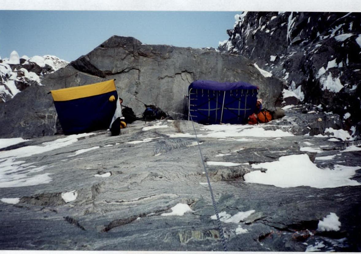
Bivouac on section R32
pg. 12
Section R50
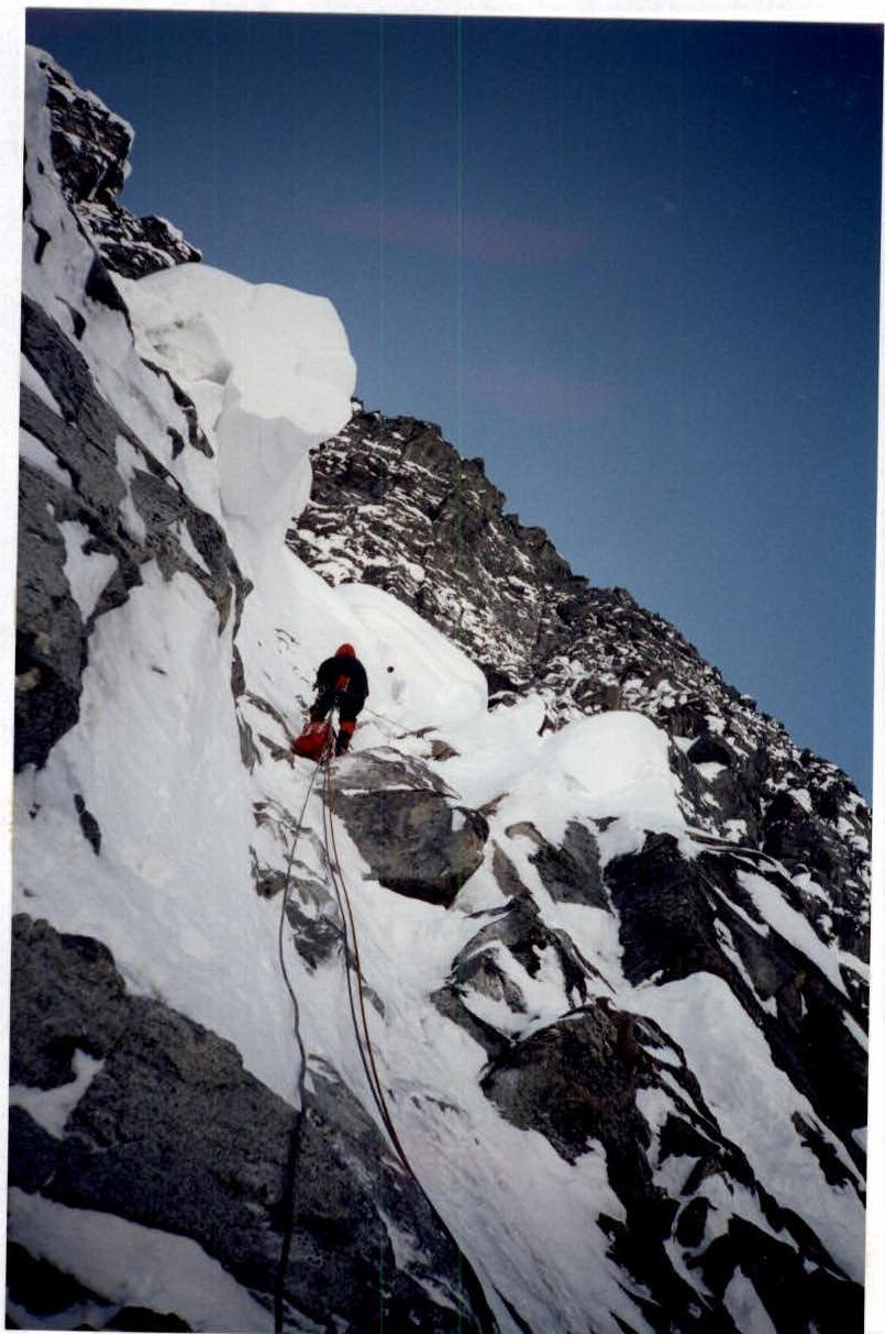
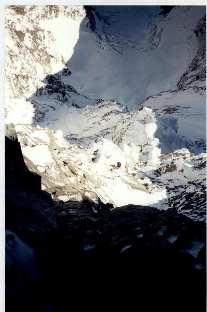
Section R57–R60
pg. 14
Section R59–R61

Comments
Sign in to leave a comment