
Ascent Passport
- Region — Altai, Akkem valley.
- XX let Oktyabrya — Belukha Zap. — Delone via East counterfort (4A) of the Western plateau, traverse.
- Proposed — 5A category of difficulty variant.
- Elevation difference 1500 m, length about 10 km. Average steepness of the wall part of the route — 55°, length — 1200 m.
- Pitons hammered: rock — 30 ice — 20
- Travel hours — 32, days — 7 (including 2 days of bivouac on the route due to bad weather).
- Overnights: 1st — a hole dug in the snow-ice slope; 2nd and 3rd — in a tent, 4th, 5th and 6th — in snow caves.
- Participants: Afanasiev A.E. CMS Kurepin S.E. 2nd sports category
- Departure to the route — September 27, 1983 Descent from the route October 3, 1983
- Ascent organized by Akkem Climbing Section.
Route Description
The traverse of the Belukha massif is of great interest as it encompasses all four peaks, the highest and most significant in the region. Both the traverse from Delone to XX let Oktyabrya and the traverse from XX let Oktyabrya to Delone are equivalent and represent a 5A category of difficulty. Although in terms of severity, these traverses, especially in winter, are very similar to high-altitude ascents. The ascent and descent in both cases follow 4A category routes. The first group to descend via the East counterfort of the Western plateau was led by Alekseev, Belov, and Mezdrikov in 1937. We propose to refer to this counterfort not as the left counterfort of the XX let Oktyabrya peak (as it appears from below), but as the East counterfort of the Western plateau — which it actually is. That is, having ascended this counterfort to the Western plateau, it is not necessary to head towards the XX let Oktyabrya peak; one can complete the Novokuznetsk tourists' pass, traverse along the plateau to Belukha Zap. peak, or continue along the well-trodden path traversing the Katunsky ridge to the west.
There is no information on who first ascended this counterfort. It is known that this route has been traversed multiple times, including by scientists — glaciologists and even tourists. Furthermore, the traverse in this direction was also completed in 1963 by a team from Tomsk, with an ascent via the central counterfort of the XX let Oktyabrya peak — 5B category, G. Andreev. Thus, the described route is a variant of Andreev's 5B. However, in this specific combination of counterfort and traverse, the route has been completed for the first time. As time has shown, the route has become popular (downwind), hence the rationale for its classification.
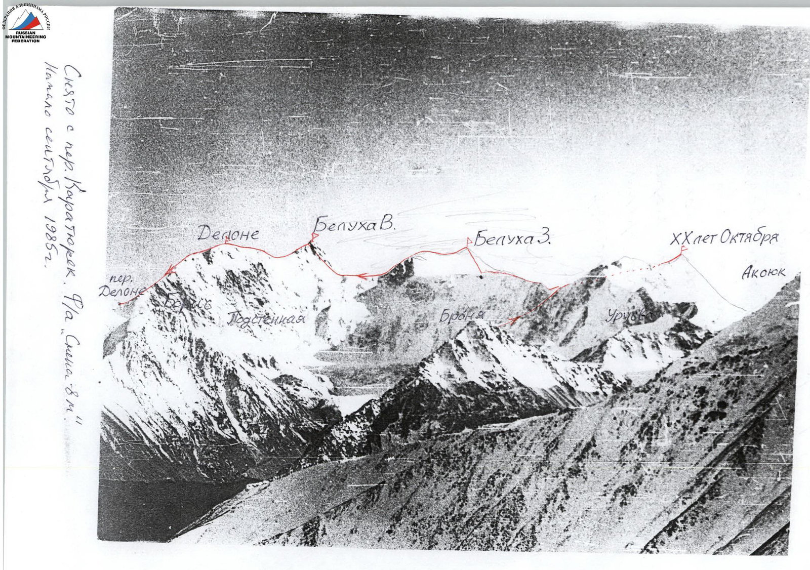 General view photo. Taken from Karatyurek pass. "Smena-8M" camera. Early September 1985.
Photographs
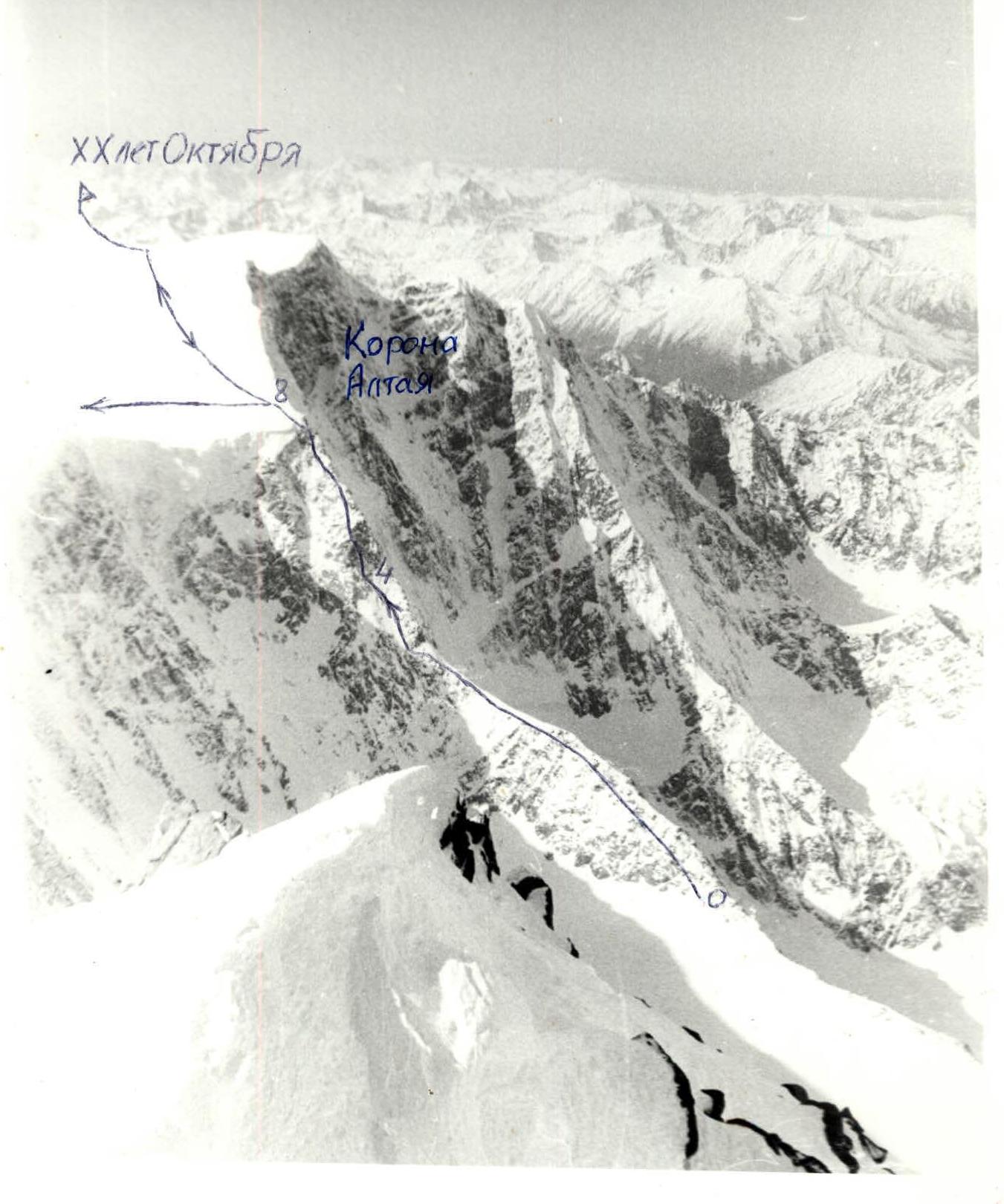 Photo of the wall part of the route. Taken from Belukha East. "Smena-8M" camera. October 3, 1983.
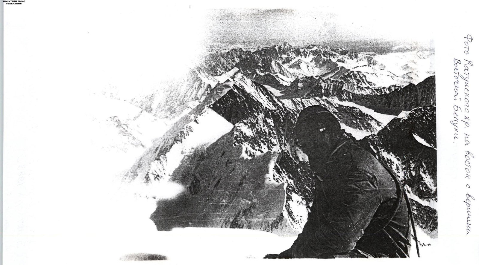 Photo of the Katunsky ridge to the east from the Eastern Belukha peak.
 On the Eastern Belukha peak in 1983, there was a statue of Ilyich.
Route Description
R0–1: 200 m, 20°, I. Left of the rocky ridge along large rocky debris. R1–2: 300 m, 10°, I. Snow ridge. R2–3: 30 m, 45°, II. Bypass the gendarme on the left along the ice slope with rocky outcrops. R3–4: 200 m, 40°, II. Left of the ridge along ledges. R4–5: 40 m, 85° V. Key to the route. Chimney in the left part of the gendarme. R5–6: 300 m, 45°, III. System of ledges and walls left of the ridge. R6–7: 40 m, 80°, IV. Gendarme, traversed centrally. R7–8: 50 m, 45°, II. Snow-ice slope. R8–9: 800 m. Firn plateau. Bypassing the snow dome of Kazn peak on the left. The summit control tour of XX let Oktyabrya peak is on the saddle. R9–10: 100 m, 40°, III. Snowy sharp ridge, with a cornice in the upper part. XX let Oktyabrya peak — a large spur. R10–11: Return to section 8 and then along the Western plateau towards Belukha Zap. slopes, to the right part of the massif. ≈ 3 km. R11–12: 300 m, 40°, II. Snow slope. R12–13: 3 m, 90°, V. Bergschrund. R13–14: 350 m, 45–50°, III. Snow-firn slope. Ascent to Belukha Zap. peak 4435 m. R14–15: 1000 m, II. Gentle ridge, to the Northern subpeak. Cornices to the right! R15–16: 800 m, descent to the Saddle 4050 m. 5 sports. R16–17: 800 m along the Saddle under the western slope of Belukha East. R17–18: 200 m, 40°, I. Snow slope to the bergschrund. Passed easily without issues. R18–19: 400 m, 45°, II. Slope transitioning into a couloir. R19–20: 100 m, 50°, III. Ice gully. R20–21: 80 m, 55°, IV. Narrow ice gully with outcrops. Ascent to the NE ridge leading to Delone peak. R21–22: 150 m, 15°, I. Summit ridge and Belukha East peak 4506 m. R22–23: Descent to section 21 and then to the saddle towards Delone peak – 500 m. R23–24: 250 m, 20°, II. Snow ridge with three humps. Cornices to the right! Delone peak 4260 m. Descent via 3B category route to Delone pass.
Comments
Sign in to leave a comment