
Report
On ascending to the summit of Asan via the 5B category complexity route by the team Temerev Ivan – Kashevnick Anton 9–11 July 2024
Ascent Passport
| 1. General Information | ||
|---|---|---|
| 1.1 | Full name, sports rank of the team leader | Temerev Ivan Mikhailovich, Master of Sports |
| 1.2 | Full name, sports rank of the participants | Kashevnick Anton Alexandrovich, Candidate for Master of Sports |
| 1.3 | Full name of the coach | Temerev Ivan Mikhailovich |
| 1.4 | Organization | Tomsk Alpinism Federation |
| 2. Characteristics of the Ascent Object | ||
| 2.1 | Region | Gissar-Alay |
| 2.2 | Valley | Karavshin |
| 2.3 | Number of section according to the 2013 classification table | 5.4.3 |
| 2.4 | Name and height of the summit | Asan, 4230 m |
| 3. Characteristics of the Route | ||
| 3.1 | Route name | Left part of the SW wall, Terekhin–Khvostenko route 2019 |
| 3.2 | Category of complexity | 5B |
| 3.3 | Degree of route exploration | Second ascent after the initial description |
| 3.4 | Relief characteristics of the route | Rocky |
| 3.5 | Height difference of the route | 870 m |
| 3.6 | Route length | 1000 m |
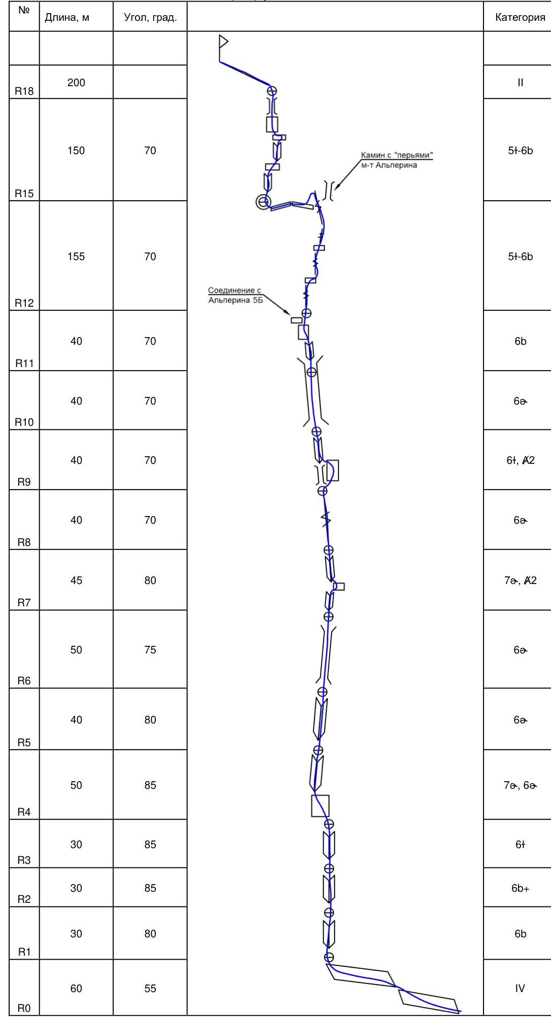
| 3.7 | Technical elements of the route | II, III cat. compl. — 200 m. IV cat. compl. — 60 m. |
| V cat. compl. — 140 m. VI cat. compl. — 390 m. | ||
| 3.8 | Average steepness of the route | 65° |
| 3.9 | Average steepness of the main part of the route | 73° |
| 3.10 | Descent from the summit | Via 4B route from the east |
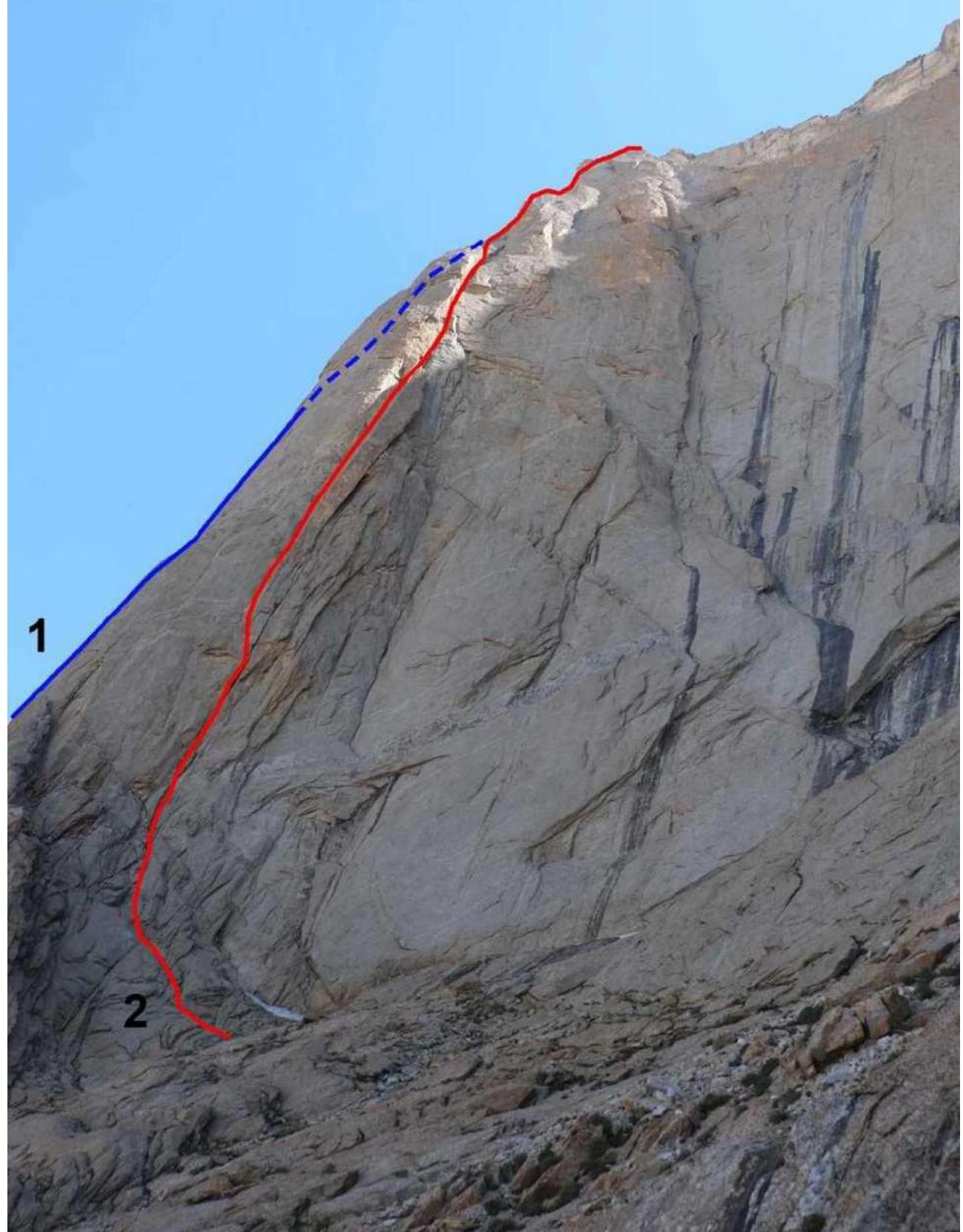
| 3.11 | Additional characteristics of the route | Upper part coincides with the left variant of Alperin's route 5B on kf 3 of the wall |
| 4. Characteristics of the Team's Actions | ||
| 4.1 | Time in motion | 29 h |
| 4.2 | Overnights | On R7, R10 bivouacs |
| 4.3 | Time spent on route preparation | - |
| 4.4 | Start of the route | 7:00 July 9, 2024 |
| 4.5 | Reaching the summit | 17:00 July 11, 2024 |
| 4.6 | Return to the base camp | 23:00 July 11, 2024 |
| 6. Person responsible for the report | ||
| 6.1 | Full name, e-mail | Kashevnick A. A. atonik@bk.ru |
- By kf 3 st, Alperin, 1987, 5B
- Left part of the SW wall, Terekhin–Khvostenko, 2019, 5B original
 Route profile
Area Description
The Karavshin area is well described; our team climbed peak Asan from different sides in different years. The NW wall of peak Asan abounds with 6A category complexity routes. Before the first ascent on peak Odessa, we decided to warm up by climbing the new route of 2019 by Terekhin–Khvostenko. The route taken by our team is located in the left part of the SW wall, in close proximity to Alperin's counterfort. In the upper part (after the key ropes), it converges with Alperin's route (we took the left variant) and leads to the saddle between peaks Asan and Usen. Further to the summit, the movement along the ridge is not difficult.
Tactical Actions of the Team
The route along the left part of the SW wall of peak Asan passes through a clearly defined monolithic relief. The route was climbed as an acclimatization ascent. On the evening of July 8, 2024, we approached the NW wall of peak Asan, prepared a ledge for the tent, partially left by the team of first ascendants, set up a bivouac, had dinner, and went to sleep. On the morning of July 9, it took 20 minutes to approach the start of the route. The plan was to climb to some ledge for an overnight stay and, if possible, hang a couple of ropes higher. We worked with two dynamic ropes, carrying:
- a bag with bivouac gear,
- a day's supply of food + emergency rations.
On the first day, we worked from 7:00 to 20:30, changed places once, reached a ledge on R7, and hung 1.5 ropes higher. We spent the night there, wrapped in sleeping bags and covered with a tent. On July 10, we started working on the fixed ropes at 7:00, almost reached the junction with Alperin's route, and spent the night on R10. The weather was not favorable that day: rain in the second half of the day made it difficult to climb many sections. On July 11, at 14:00, we reached the saddle between Asan and Usen, found ice, lit the burner, had emergency rations for lunch, climbed to the summit, and hurried back to camp due to impending bad weather. On the descent, we were caught in snow with hail, and small avalanches of the resulting substance added to our urgency.
Descent via Tugalev's 4B route.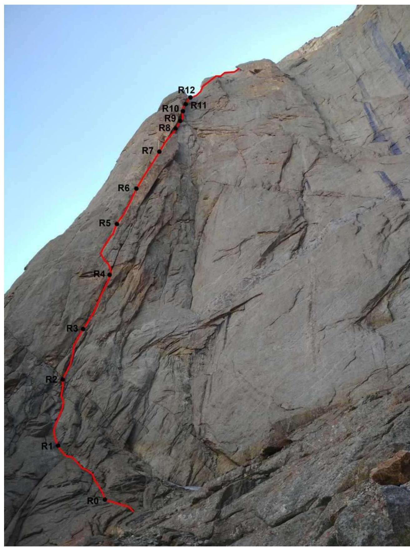
Technical photo of the route
Route scheme in UIAA symbols
Route Description by Sections (from Terekhin–Khvostenko's Report)
The approach from the base camp to the NW wall of Asan takes 1.5 hours. Climb to the base of the wall via ledges (standard approach to the NW wall routes). Traverse to Alperin's counterfort. From the start of Alperin's route, descend slightly, then continue traversing upwards to the base of the SW wall. There's a good spot for a tent here, with snowfields at the base of the wall. From the spot, climb towards the left part of the wall.
R0–R1. Up to the left via simple rocks. 60 m, III–IV.
R1–R4. Climbing through an internal corner and cracks, three sections of 30 m:
- Section 1: 30 m, 6b
- Section 2: 30 m, 6b
- Section 3: 30 m, 6c. Total length: 90 m, 6b–6c.
R4–R5. Traverse left into another internal corner, bypassing a huge overhanging "ogurtsov". 20 m, 6c–7a. A station can be set up after the traverse or continue moving through the crack and corner for another 30 m, 6a.
R5–R6. Continue climbing through the internal corner to the start of a chimney. 40 m, 6a.
R6–R7. Climbing through the chimney. A bolt was placed in the middle of the section for safety. Above the bolt, after 10 m, there's a jam. After the jam, exit the chimney to the left into an internal corner. Station in the corner, 8 m shy of the top of the "ogurtsov". 50 m, 6a.
R7–R8. Tense climbing through a crack for 8 m. Reach the top of the "ogurtsov". Then:
- Through the left corner
- Traverse right
- Through a thin crack with ITO
- Climb through a cornice
- Enter the right wide crack
45 m, 7a, A2.
R8–R9. Up through a system of cracks. 40 m, 5c–6a.
R9–R10. Attempt to climb a slightly overhanging wide crack (off-width), which widens downwards. Large camalots are necessary for safety, №5, 6. Can be bypassed on the right through a monolithic slab. There are 2 old bolts on the slab, with holes for skyhooks between them – ITO A2. After the slab, return left into the corner. 40 m, 6c, A2.
R10–R12.
- Two sections of 40 m through a large fault — crack, chimney
- Reach Alperin's bastion
- Good ledge for an overnight stay
80 m, 5c–6b.
The route then coincides with Alperin's 5B route. The description can be found on the FAR website. For example, https://alpfederation.ru/api/files/3451 ↗.
R12–R15. From the ledge upwards through a wide crack (6b) and further up through a system of cracks and ledges. Three ropes. Approach a chimney with "feathers". 155 m, 5c–6b. Did not enter the chimney, traversed left around the corner for 30 m to a good ledge for an overnight stay.
R15–R18. From the overnight stay, climbed straight up through a system of corners and ledges. Reliable monolithic relief. Three ropes to the saddle. 150 m, 5c–6b.
Along the ridge to the summit, 200 m of simple rocks.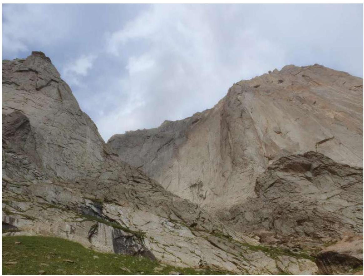
Approach to the route.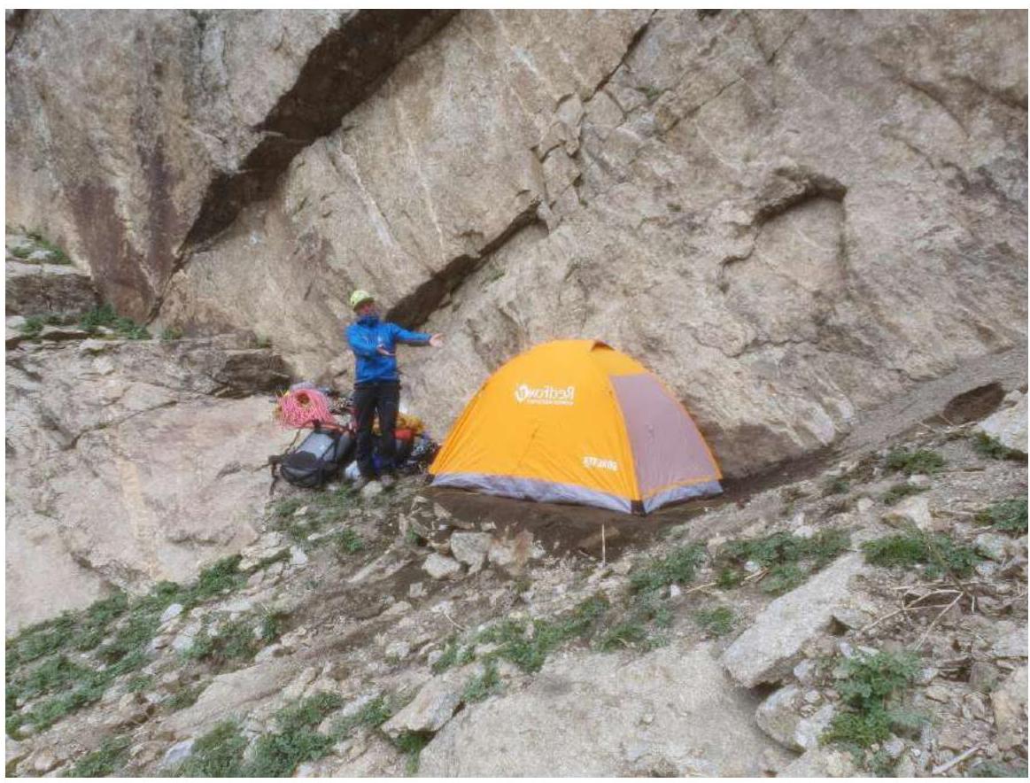
Bivouac spot at the base of the SW wall, July 8, 2024.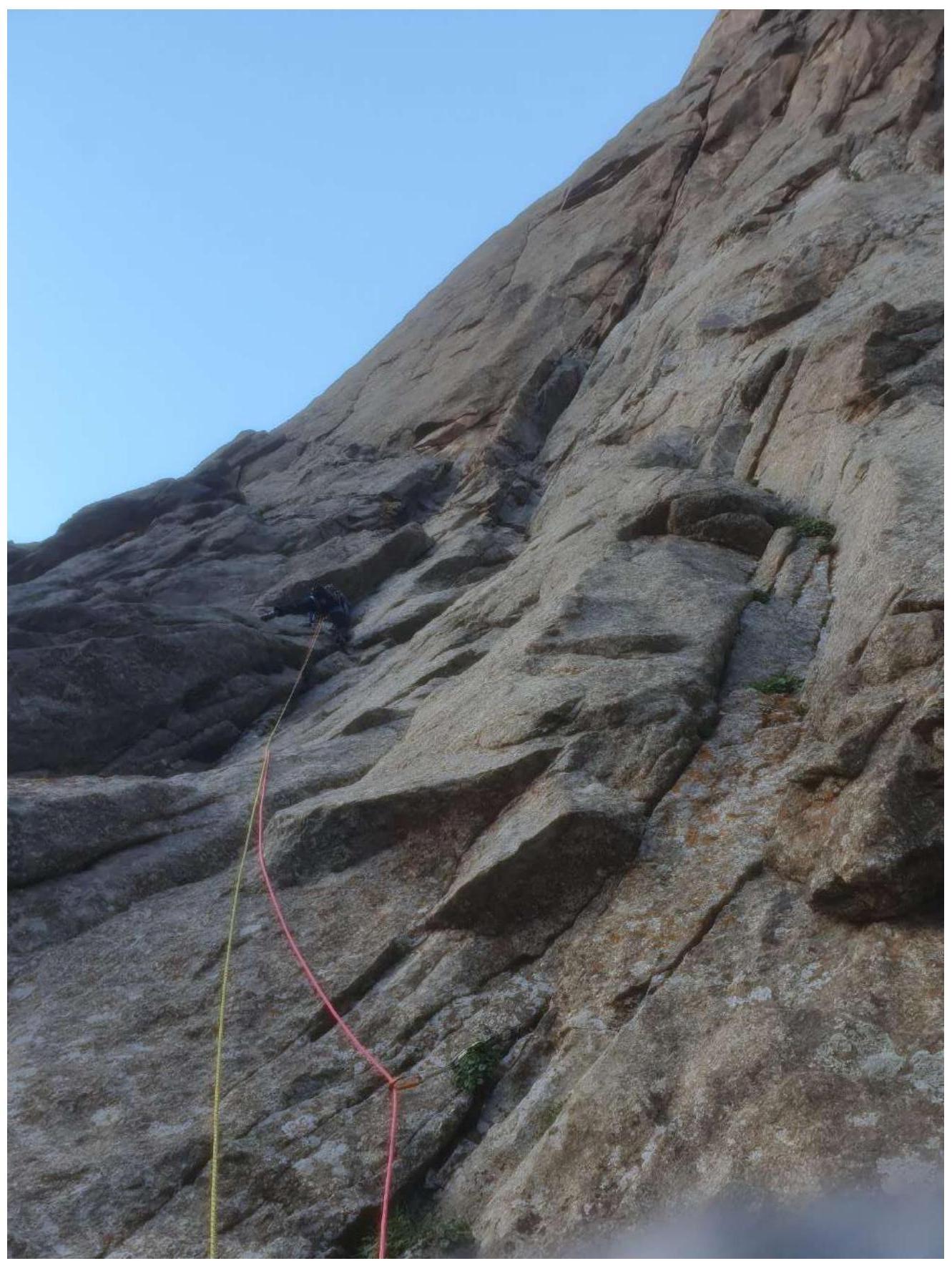
R0–R1 section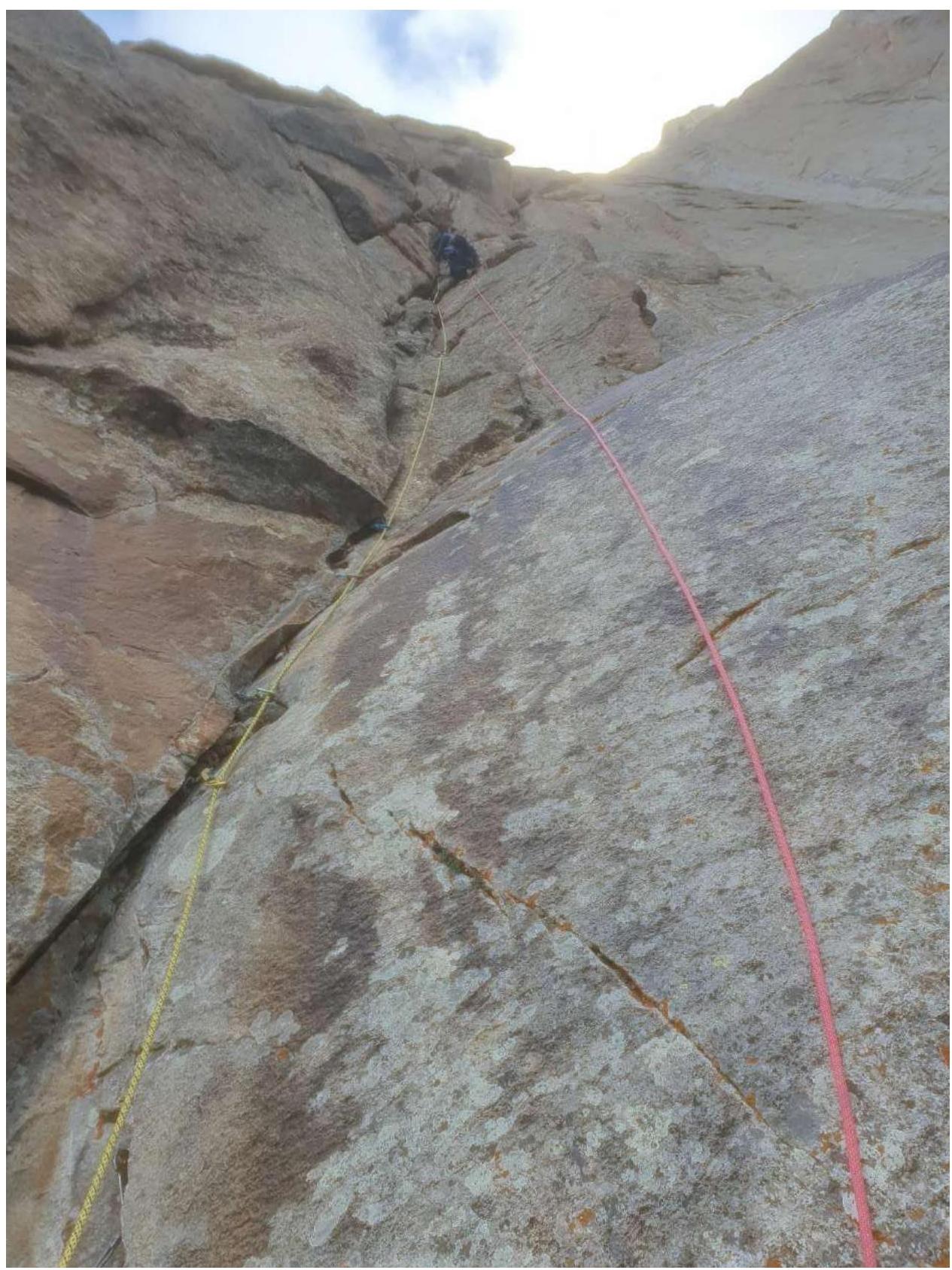
R1–R2 section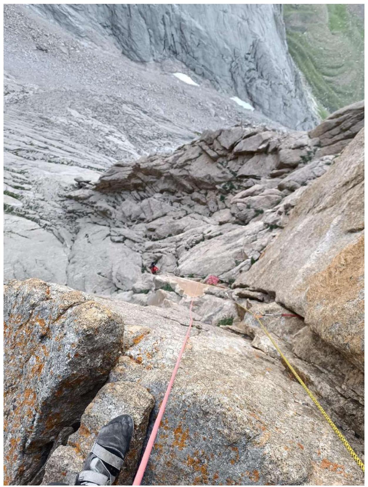
R2–R3 section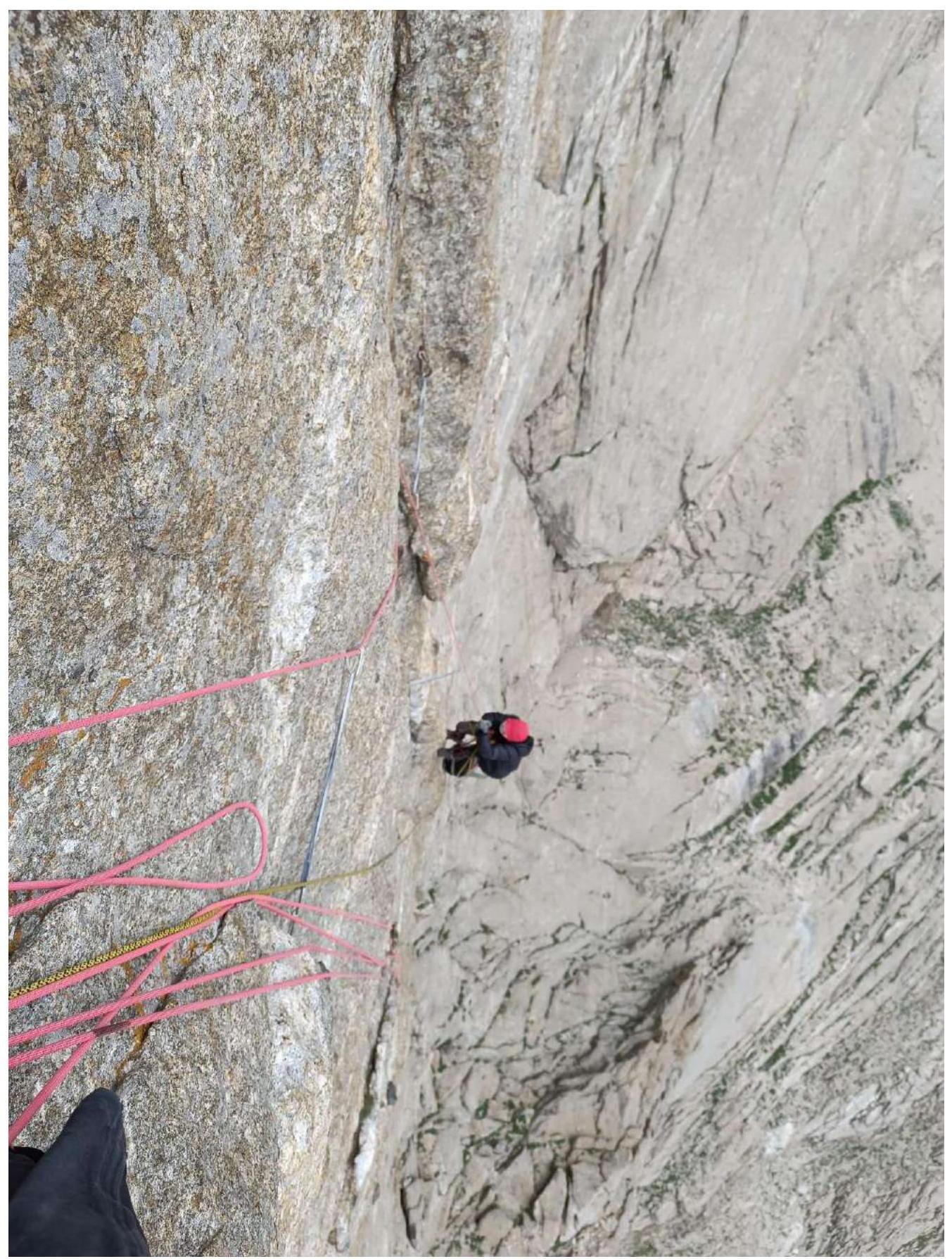
R4–R5 section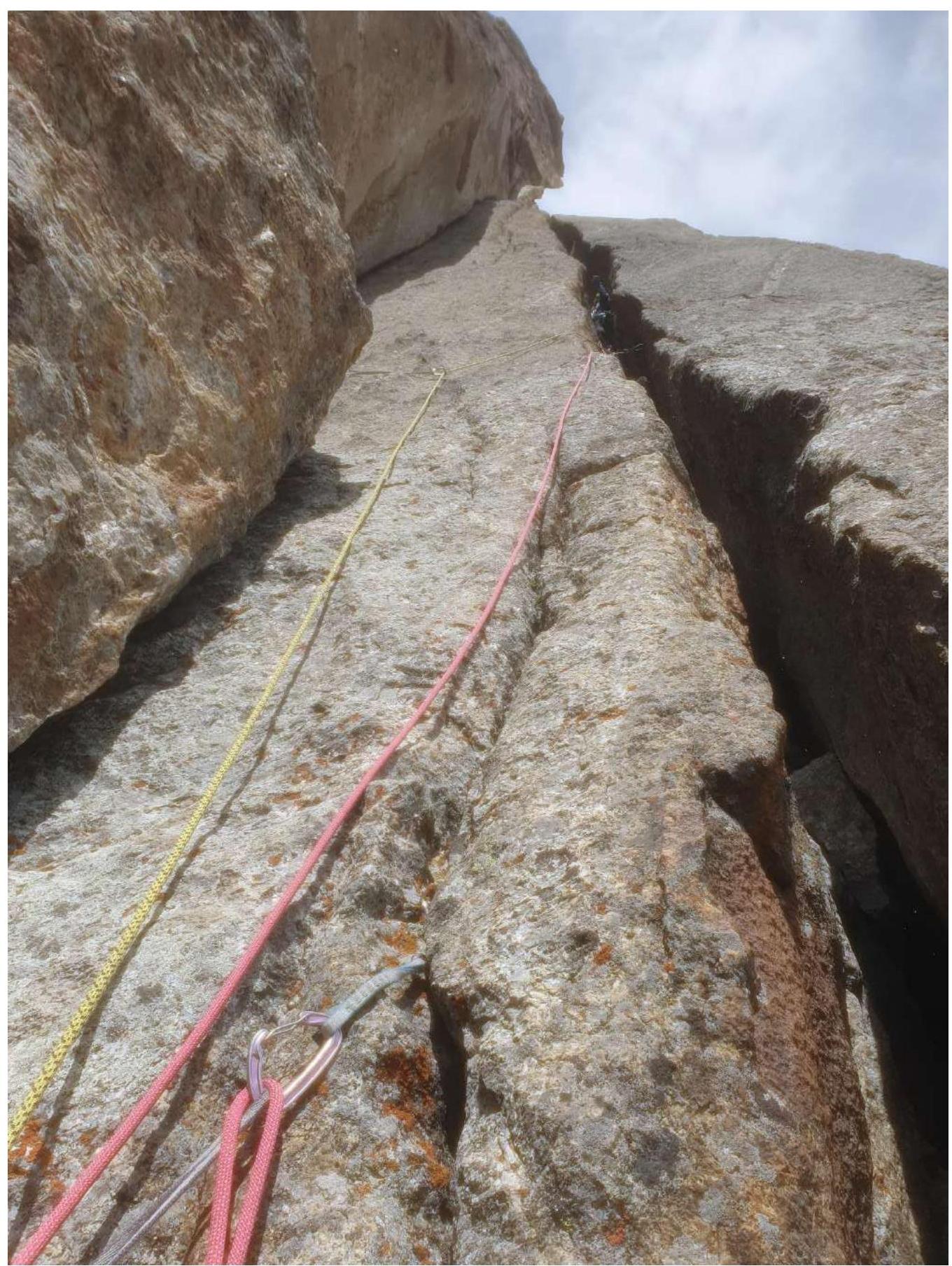
R6–R7 section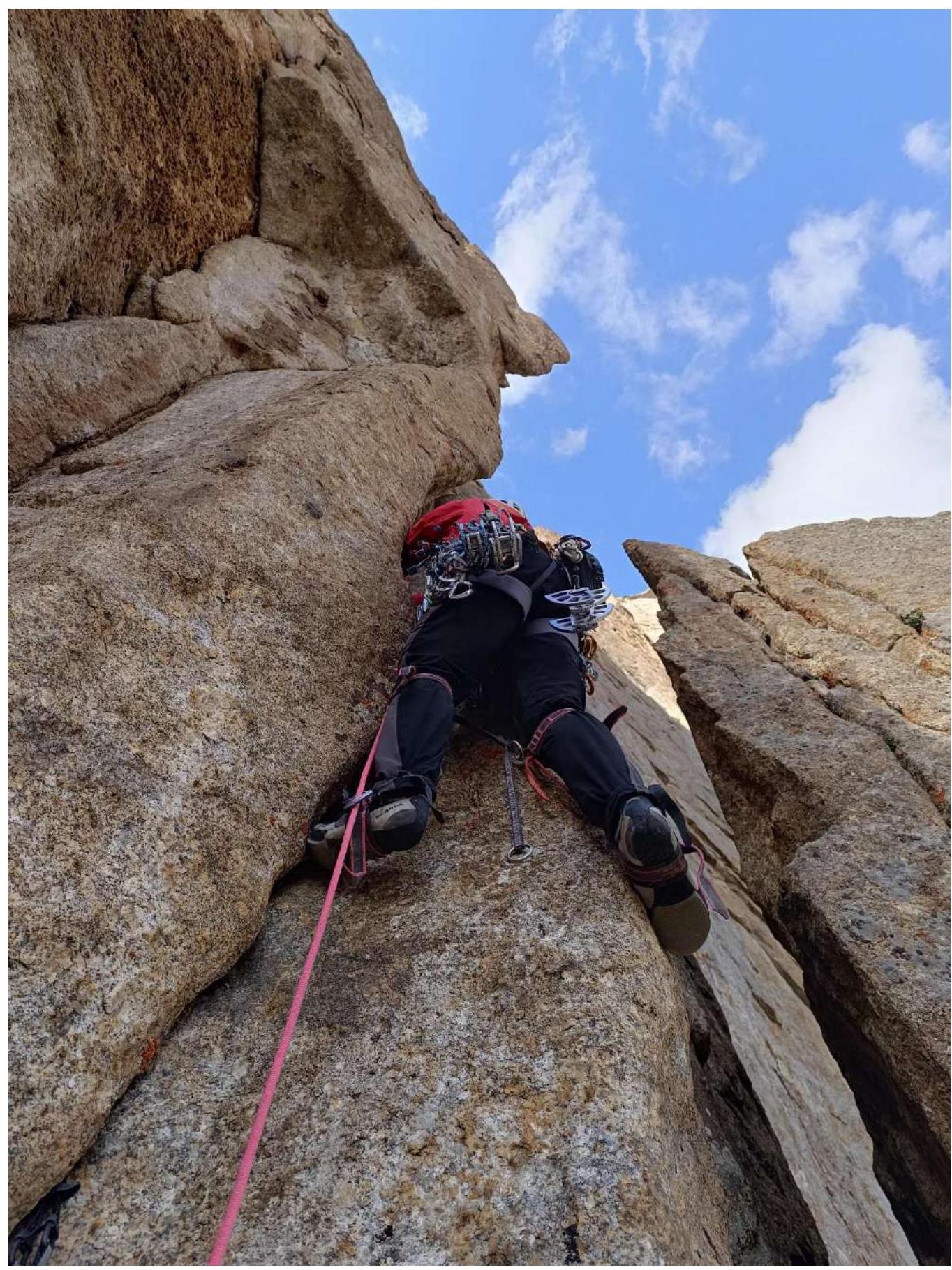
R7–R8 section.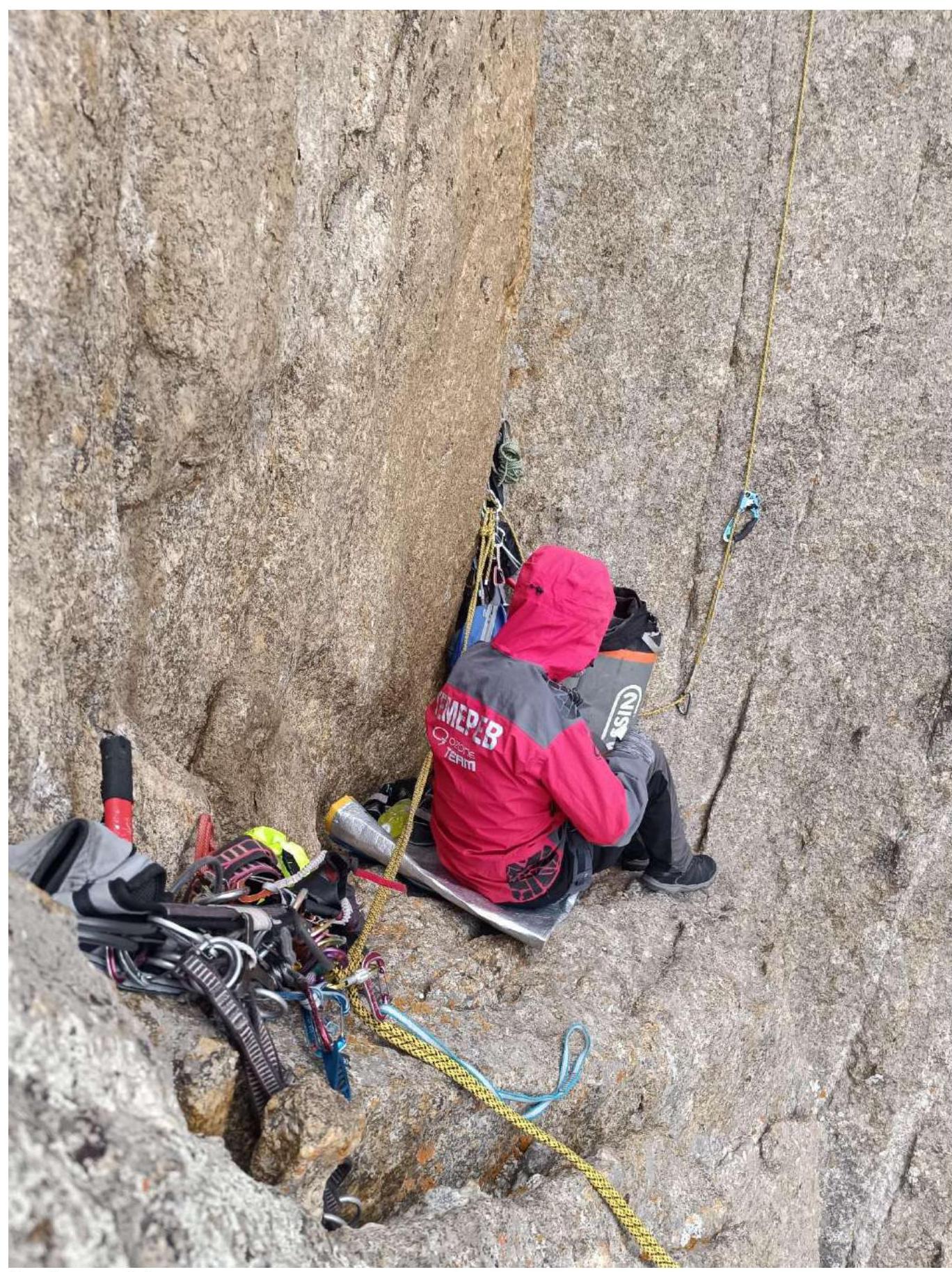
Overnight stay on R7.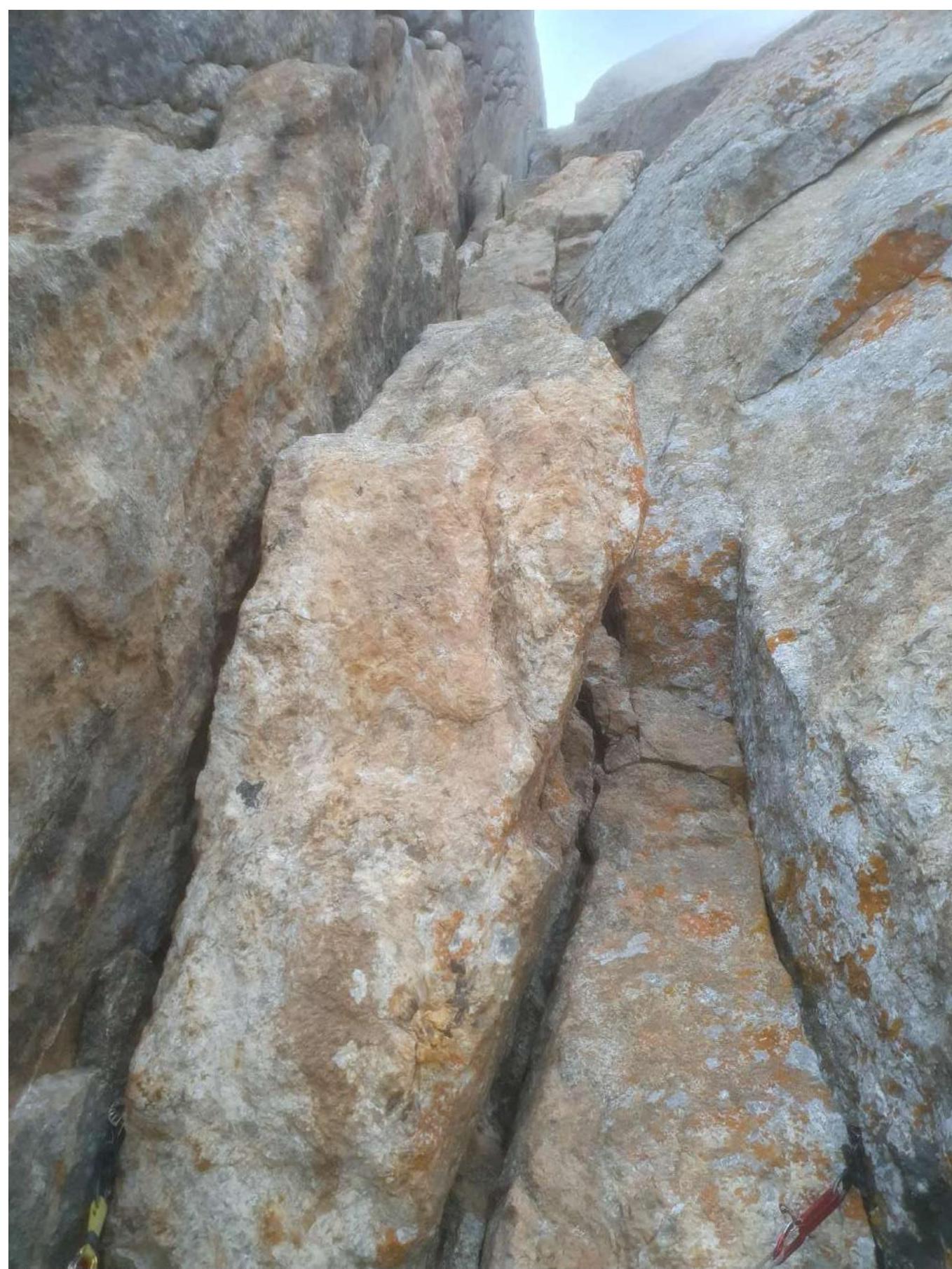
R9–R10 section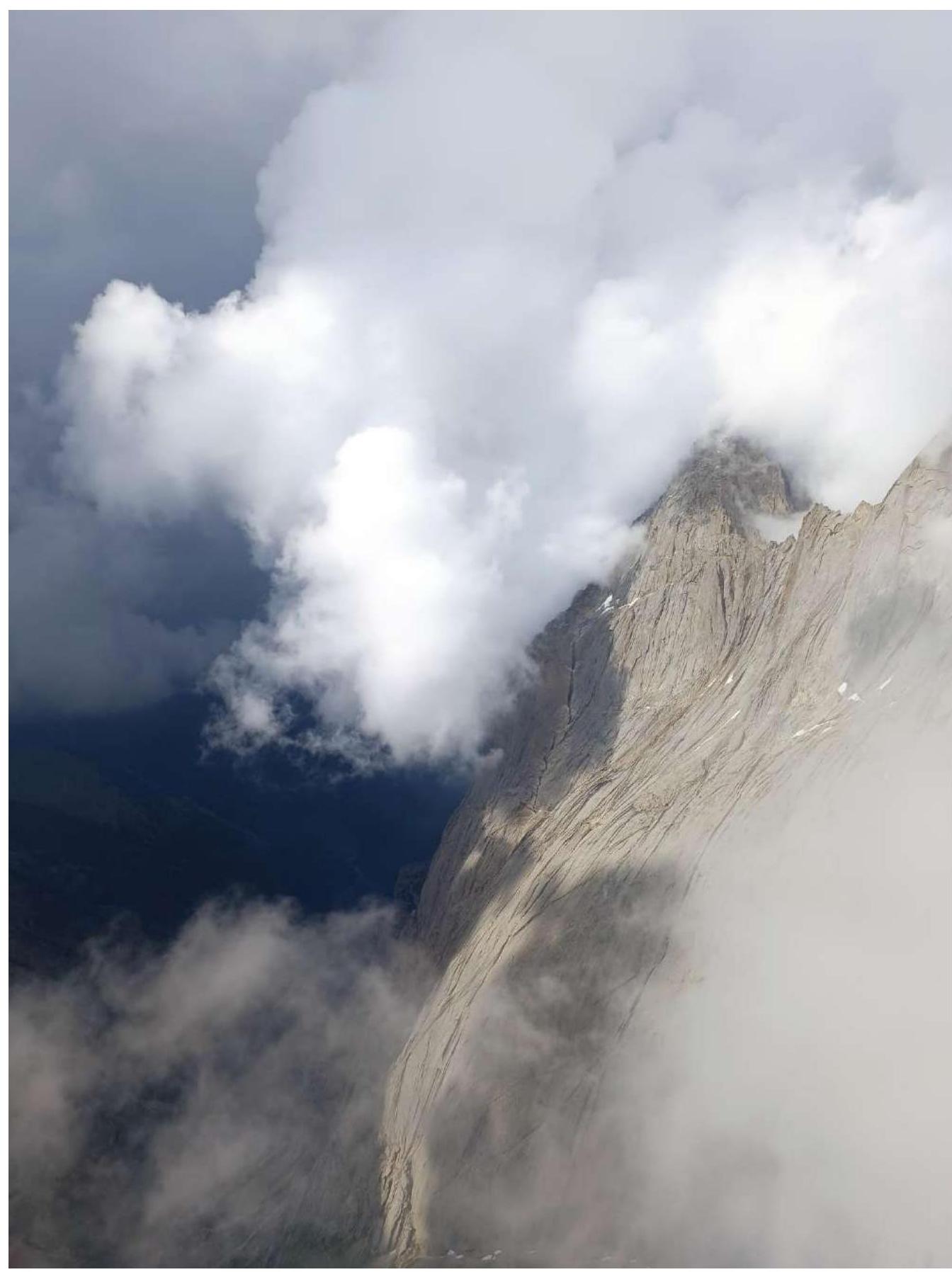
View from the summit, waiting for the weather to worsen.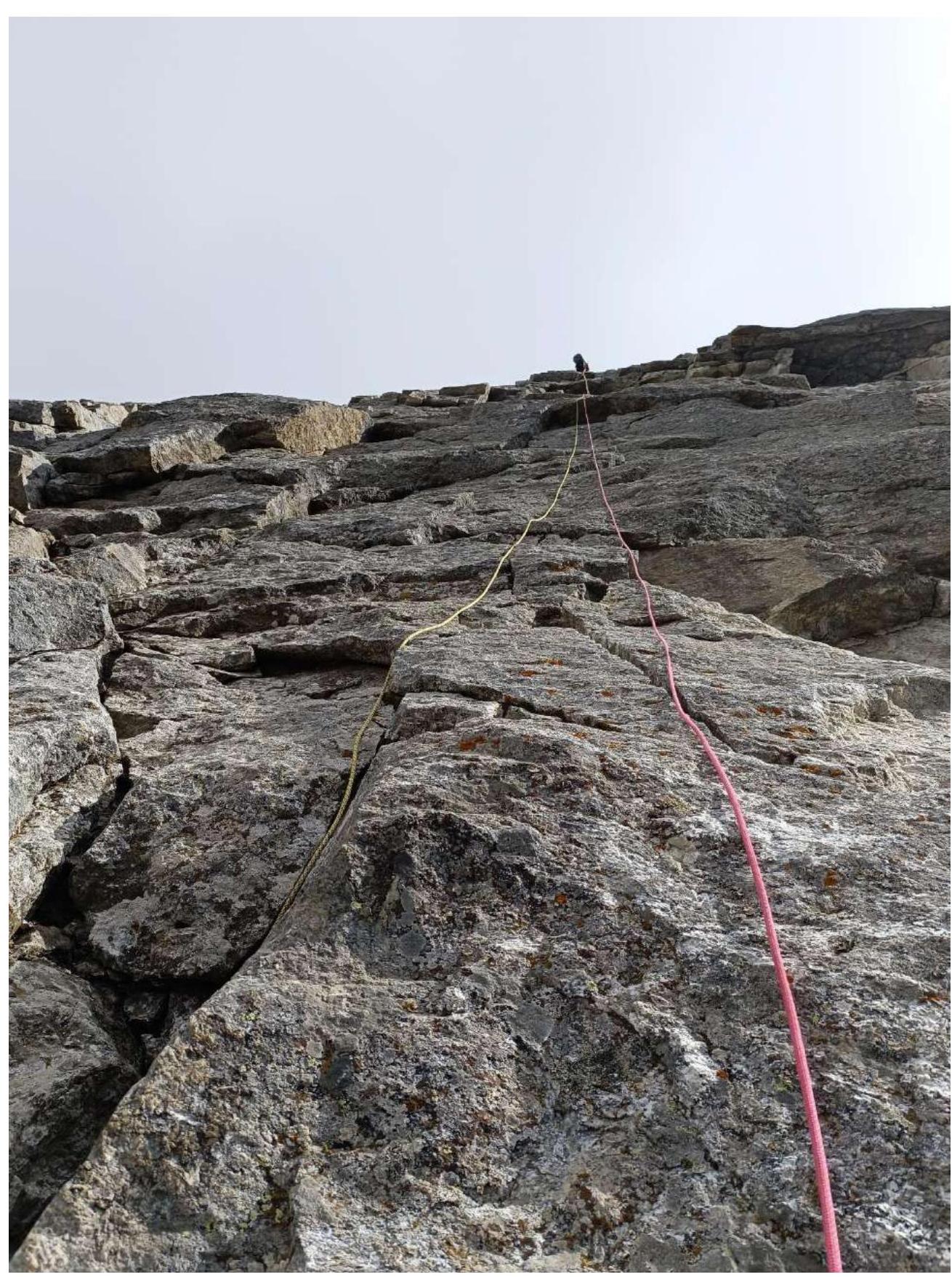
Working on the descent.
Comments
Sign in to leave a comment