
Report
On the ascent to the summit of Maly Asan via the "Fur einen Freund" route, category 4A by the team Oleg Khvostenko – Ratmir Mukhametzyanov (Krasnoyarsk Krai)
July 22, 2019
Ascent Passport
| 1. General Information | ||
|---|---|---|
| 1.1 | Full name, sports rank of the team leader | Khvostenko Oleg Valerievich, Master of Sports |
| 1.2 | Full name, sports rank of the participants | Mukhametzyanov Ratmir Nurmukhametovich, Master of Sports |
| 1.3 | Full name of the coach | Zakharov Nikolai Nikolaevich, Honored Coach of Russia; Valeiry Viktorovich Balezine |
| 1.4 | Organization | Ministry of Sports of Krasnoyarsk Krai |
| 2. Characteristics of the Ascent Object | ||
| 2.1 | Region | Gissar-Alay |
| 2.2 | Valley | Karavshin |
| 2.3 | Section number according to the 2013 Classification Table | 5.4.3 |
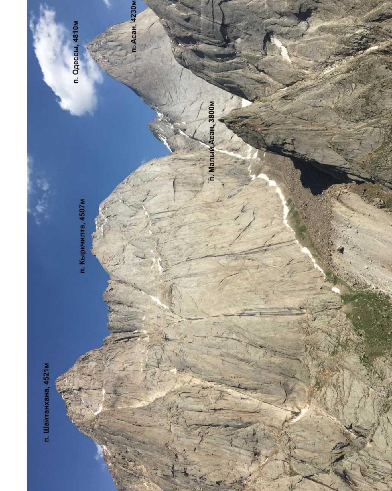
| 2.4 | Name and height of the summit | Maly Asan, 3800 m |
| 3. Characteristics of the Route | ||
| 3.1 | Name of the route | Via the north ridge "Fur einen Freund" ("For Friends", Germany, 2003) |
| 3.2 | Difficulty category | 4A |
| 3.3 | Degree of route exploration | - |
| 3.4 | Relief characteristics of the route | Rock |
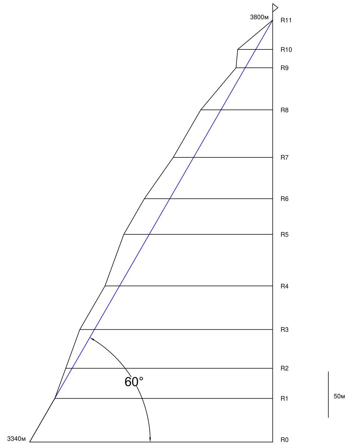
| 3.5 | Elevation gain of the route | 460 m |
| 3.6 | Length of the route | 540 m |
| 3.7 | Technical elements of the route (total length of sections of varying difficulty with indication of relief character (ice-snow, rock)) | II, III cat. rock — 125 m. IV cat. rock — 140 m. V cat. rock — 55 m. VI cat. rock — 220 m. Free climbing level up to 6B+ on the French scale |
| 3.8 | Average steepness of the route, (°) | 60° |
| 3.9 | Average steepness of the main part of the route, (°) | 60° |
| 3.10 | Descent from the summit | Via the E wall |
| 3.11 | Additional characteristics of the route | |
| 4. Characteristics of the Team's Actions | ||
| 4.1 | Time in motion | 5 h |
| 4.2 | Overnights | - |
| 4.3 | Time spent on route preparation | - |
| 4.4 | Start of the route | 9:00, July 22, 2019 |
| 4.5 | Reach the summit | 14:00, July 22, 2019 |
| 4.6 | Return to the base camp | 16:00, July 22, 2019 |
| 6. Person Responsible for the Report | ||
| 6.1 | Full name, e-mail | Khvostenko O.V., 79039240941@yandex.ru |
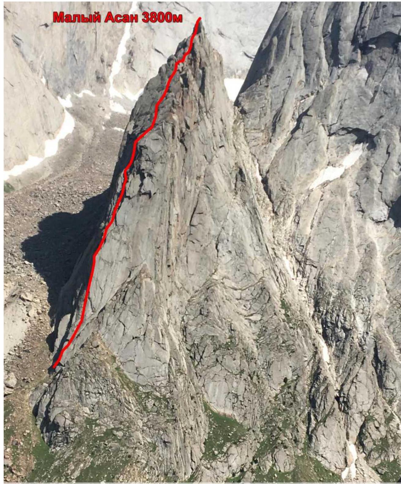
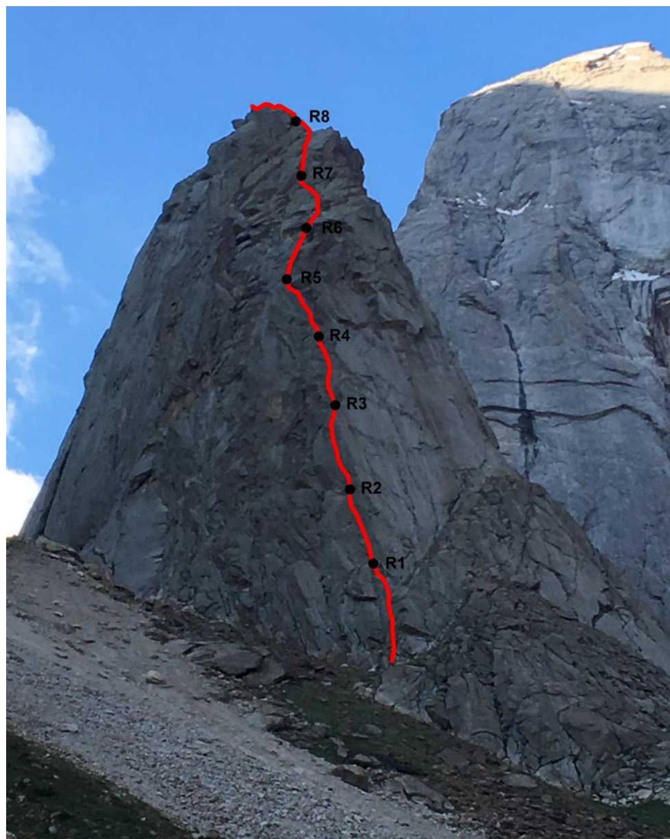
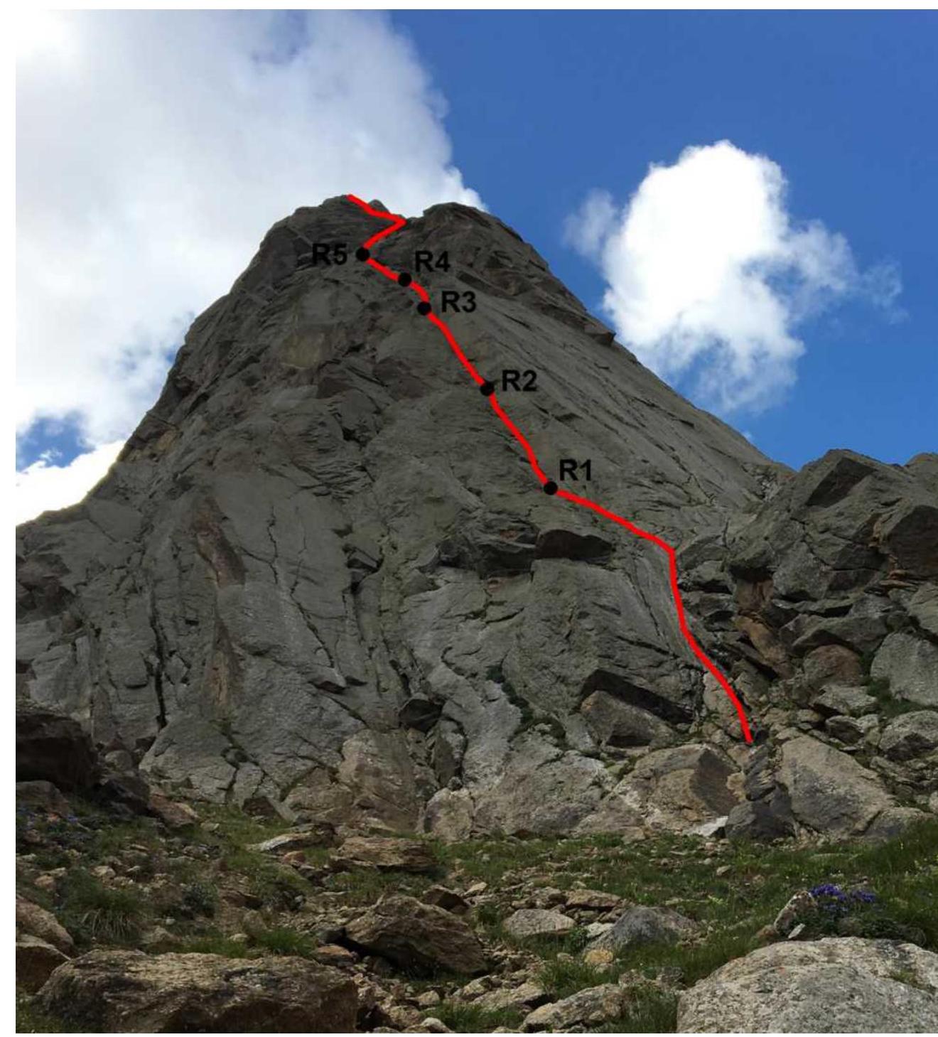
From the "For Friends" group, GER 2003, Mukhametzyanov–Khvostenko, 2019, 4A category. Taken from the Yellow Wall viewpoint. July 2019. Route profile on the left

- descent path. Route profile
 Shaitankhana peak, 4521 m
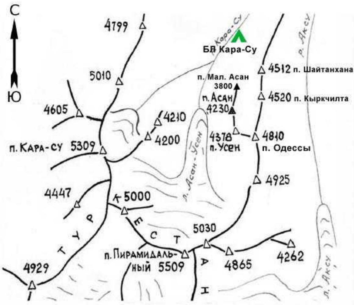
Area Map
Area Description
The Karavshin area is well described. The Maly Asan peak is located in the northern spur of the Asan peak. Several routes have been laid out on Maly Asan by foreign climbers. This summit is very popular among them because it is close to the Karasu base camp. The approach to the routes takes 30–60 minutes. The length of the routes ranges from 300 to 600 meters. To date, there are no routes on Maly Asan in the Russian classifier. Meanwhile, its close location and the presence of rappel loops for descent allow for quick training ascents of 3A–4B difficulty categories. This is particularly relevant:
- for training groups;
- as well as for ascents in unstable weather conditions.
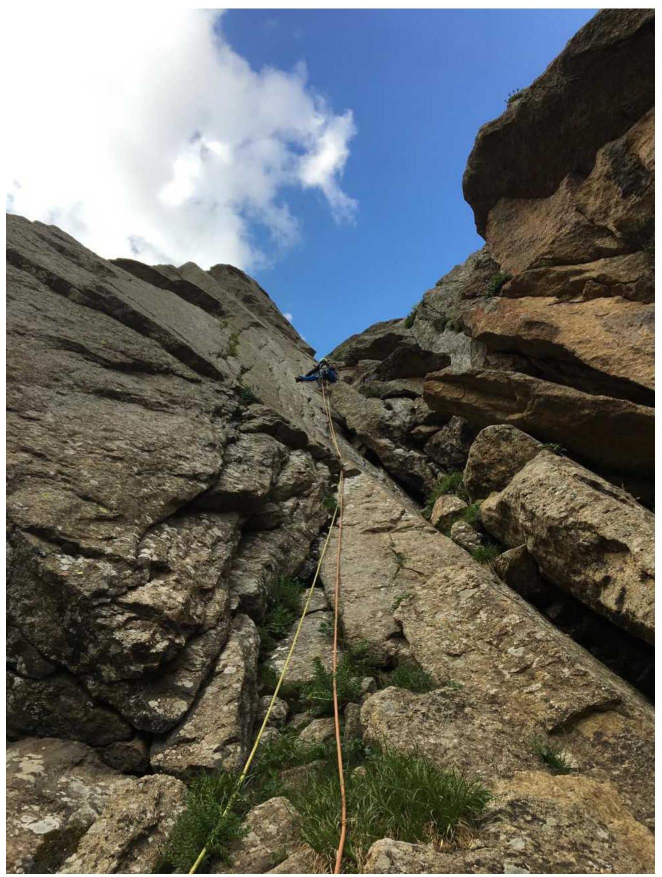
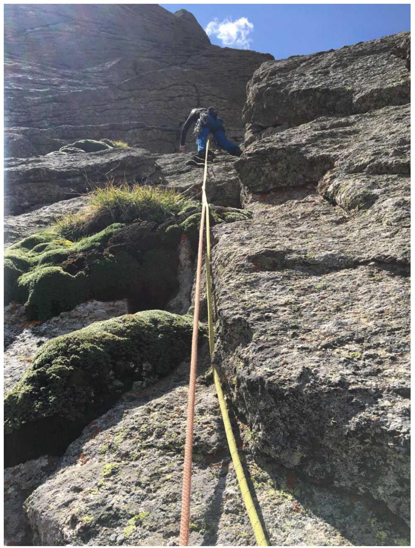
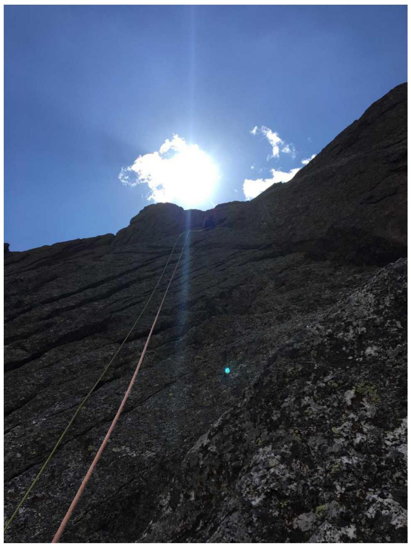
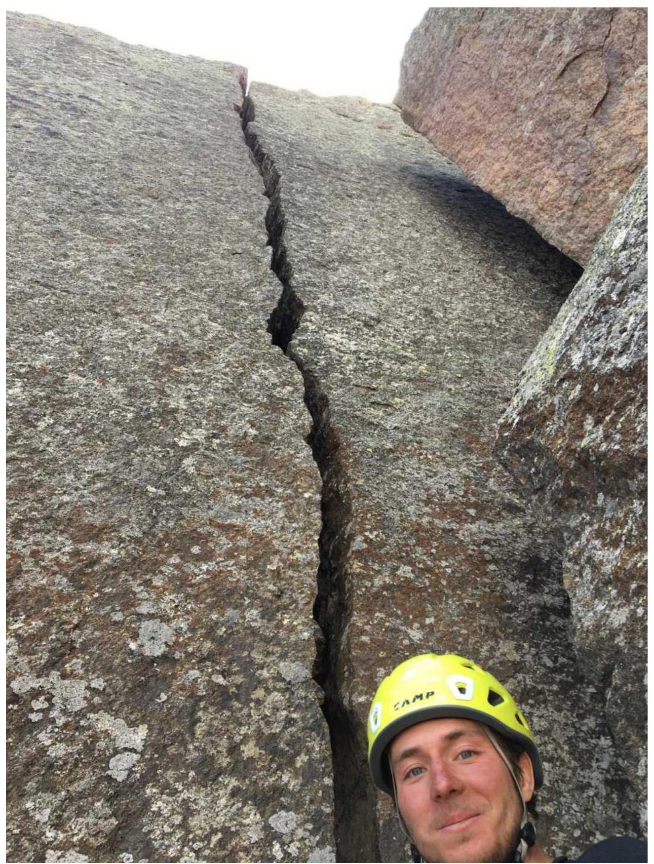
 Technical photo of the route
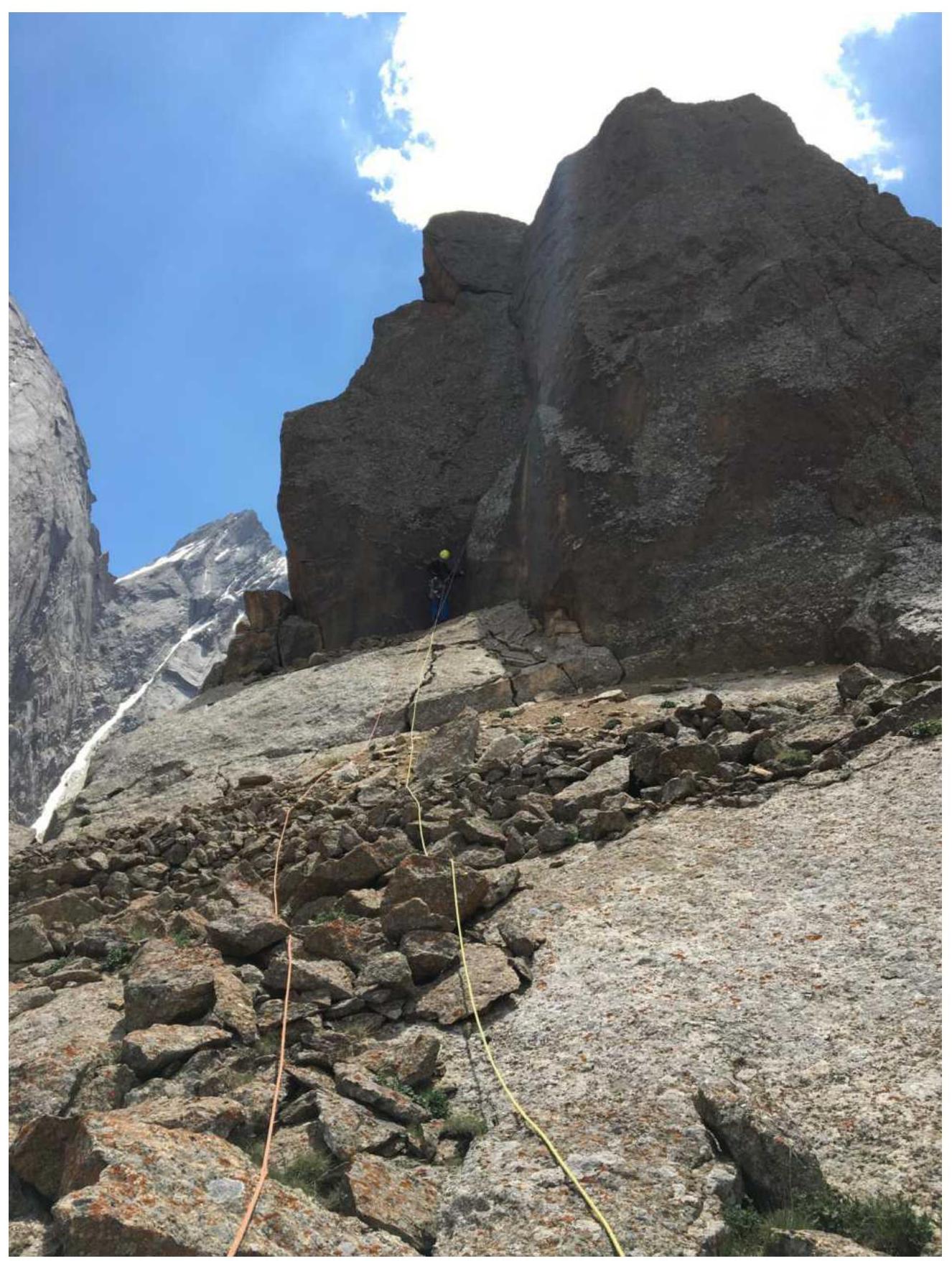
 Start of the route
Route diagram in UIAA symbols
| № | Length, m | Angle | Category | |
|---|---|---|---|---|
| R11 | — | — | — | |
| R10 | 50 | 40° | II, 6А (15 m) | |
| 20 | 85° | 6Б+ | ||
| R8 | 60 | 50° | II, III | |
| 60 | 60° | III, IV | ||
| R7 | 55 | 55° | IV | |
| 45 | 60° | 6А | ||
| R5 | 60 | 70° | 6А+ | |
| 55 | 60° | IV | ||
| R3 | 45 | 70° | 6Б | |
| 35 | 70° | 6А | ||
| R1 | 55 | 60° | 5С |
Tactical Actions of the Team
The route was climbed after consultations with German climbers who made the first ascent of this route in 2003. The ascent was made with the goal of adding the route to the Russian classifier. The entire route was climbed free by both participants. Ratmir Mukhametzyanov led. The weather during the ascent was good. No notes were found at the summit.
Descent from the Maly Asan summit via the east wall (towards Kyrkchilta peak) involved 7 rappels, equipped with rappel loops.
Route Description by Sections
Approach from the base camp along the trail to Asan peak takes 20 minutes, then up the slope to the foot of Maly Asan peak.
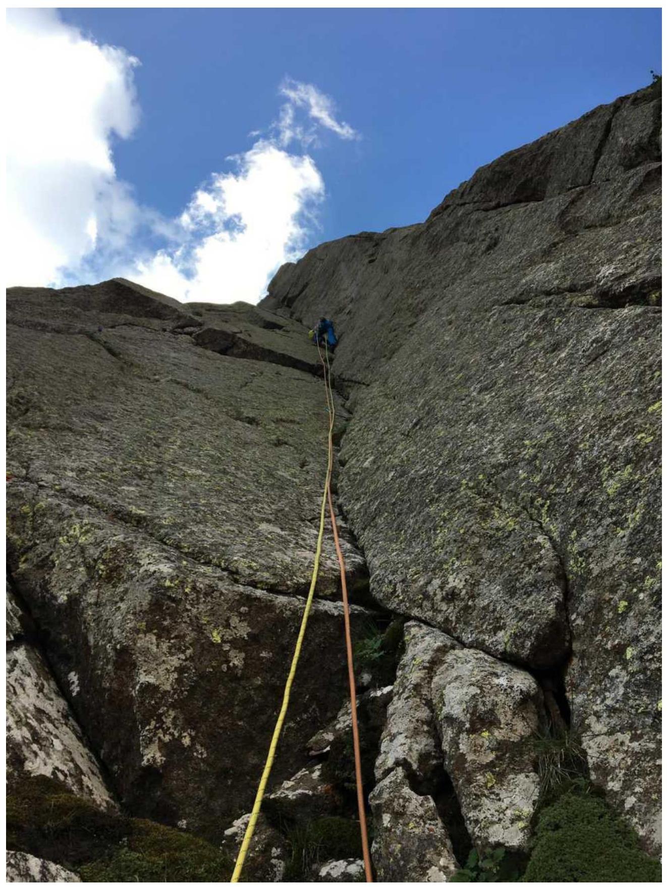
R0–R1: Start along a large internal corner, then along the wall. Exit left to a good ledge. 55 m, 5C.
R1–R2: Along a monolithic internal corner to a small ledge. 35 m, 6A.
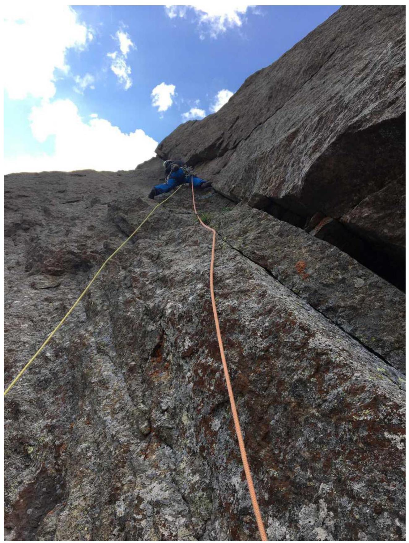
R2–R3: Continue the corner in the upper part, turning into an overhanging chimney. Move along the left wall. Exit beyond the lip. 45 m, 6B.
R3–R4: A gentle internal corner, then a system of ledges and corners. 55 m, IV.
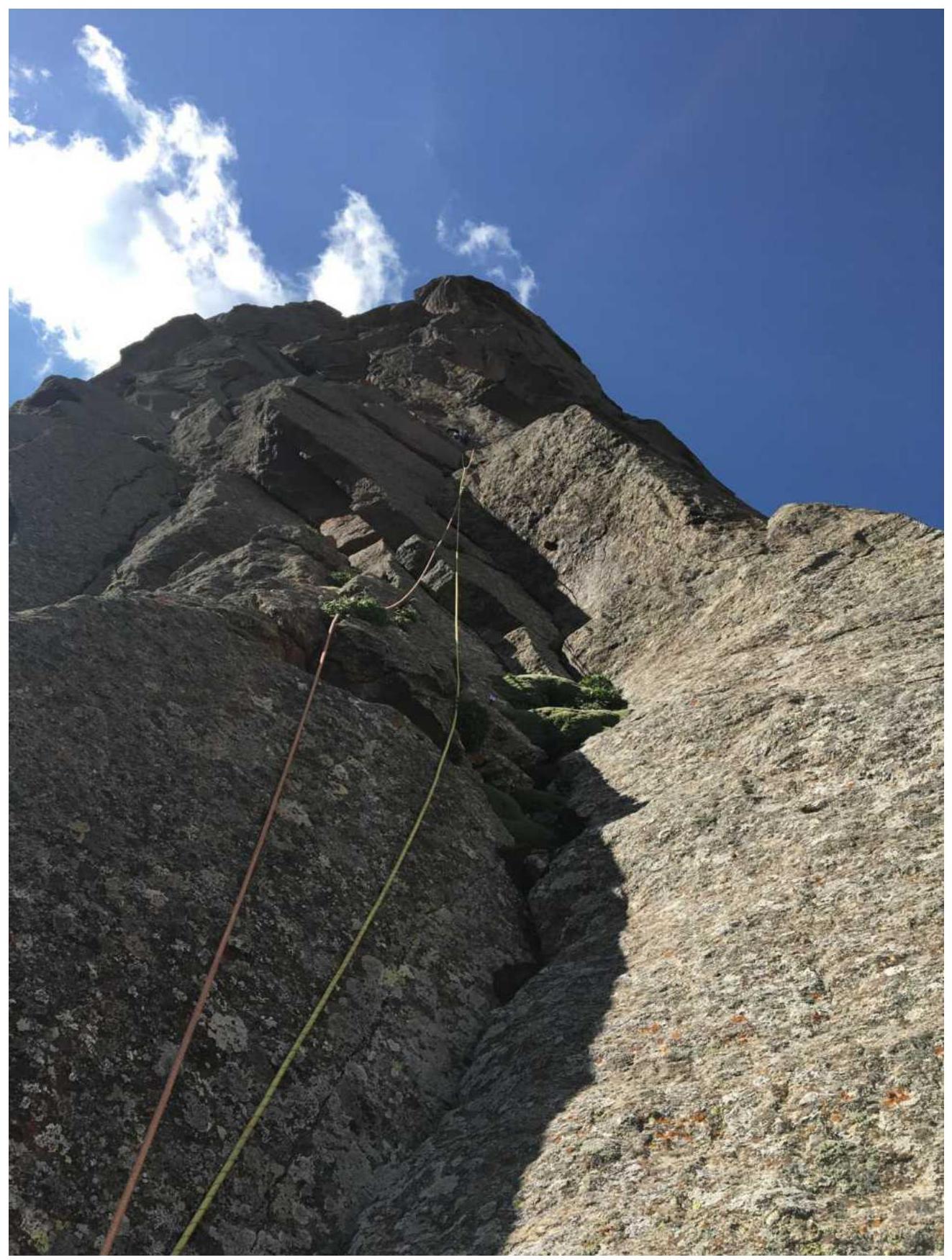
R4–R5: Along a large internal corner ending in an overhang, which is bypassed on the left. Exit beyond the lip. 60 m, 6A+.
R5–R6: System of corners and ledges. 45 m, 6A.
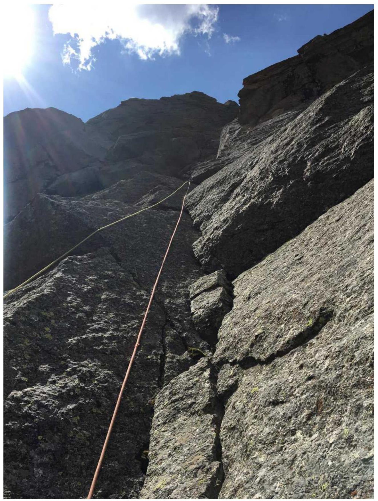
R6–R7: Continue the system of corners. Exit to a large ledge via a chimney. 55 m, IV.
R7–R8: Along a system of corners, walls, and ledges, exit to the shoulder. 60 m, III, IV.
R8–R9: Traverse along the ridge, approach the wall with a wide crack along a ledge. 60 m, II, III.
R9–R10: Wall with a wide crack is climbed in an off-width style, exit to a large ledge with rocks. 20 m, 6B+. Possible to bypass on the left.
R10–R11: Along the ledge to an internal corner — 15 m. Then along the ridge to the summit — 50 m, 6A (15 m).
Descent
From the summit, a short rappel towards Shaitankhana. Descend along ledges, veering south (towards Odessa peak). Six full rappels from a blue loop along the east wall of Maly Asan peak.
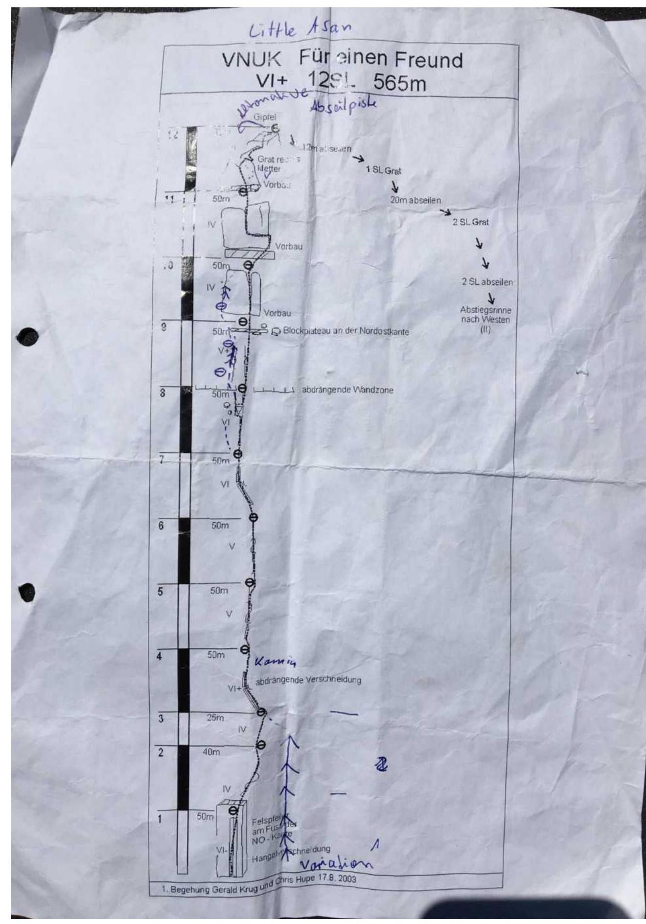
Route diagram (topo) provided by German climbers
Section R0–R1
Section R1–R2
Section R2–R3
Section R3–R4

Section R4–R5
Section R5–R6
Section R6–R7
Section R7–R8
Section R9–R10
Section R10–R11
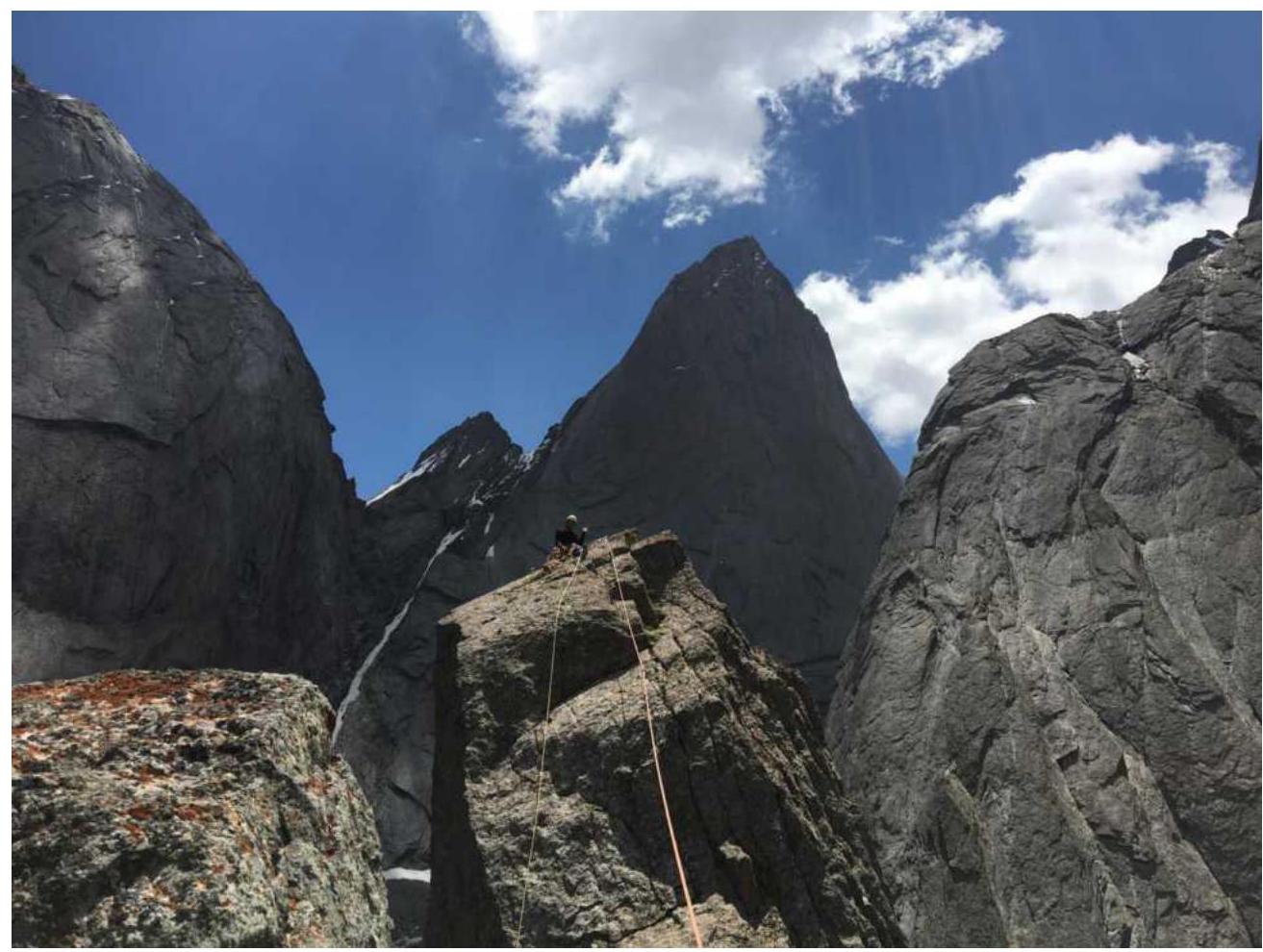
Ratmir Mukhametzyanov at the summit
Comments
Sign in to leave a comment