Peak 5010
(Pik Sibiryak)
5010 m
Report
Tomsk Region Team (TFA) report on the ascent to Peak 5010 (Pik Sibiryak) via the eastern ridge and southern crest.
"2A"
Participants:
- Temerev I.M.
- Kopytov F.A.
- Terekhin V.A.
Ascent Passport
- Kyrgyzstan, Pamir-Alay, Karavshin gorge (Kara-Su river valley), 5.4.3.
- Peak 5010 — proposed name Pik Sibiryak, ascent via the eastern ridge and southern crest.
- Presumably first ascent, proposed 2A category of difficulty.
- Route type: combined.
- Route elevation gain — 890 m.
Total route length — 1930 m.
Section lengths:
- 1st category of difficulty – 1350 m.
- 2nd category of difficulty – 540 m.
- 3rd category of difficulty – 40 m. Average steepness:
- main part of the route — 35°
- Protection used on the route:
- ice screws – 0 pcs;
- pitons – 0 pcs;
- chocks – 0 pcs.
- Team's total climbing time: 4 hours 20 minutes, 1 day.
- Team leader:
- Temerev Ivan Mikhailovich — Master of Sports Participants:
- Terekhin Vasily Andreevich — Master of Sports
- Kopytov Fedor Alexandrovich — Master of Sports
- Departure from the bivouac under Pik Serebryanaya Stena (near the upper ruined kosh): 6:10 AM, July 23, 2014. Start of ascent: 6:40 AM, July 23, 2014. Entire group reaches the southern crest: 10:00 AM, July 23, 2014. Temerev I. reaches the summit: 11:00 AM, July 23, 2014. Entire group returns to the bivouac: 1:45 PM, July 23, 2014.
- Organization: Tomsk Alpinism Federation.
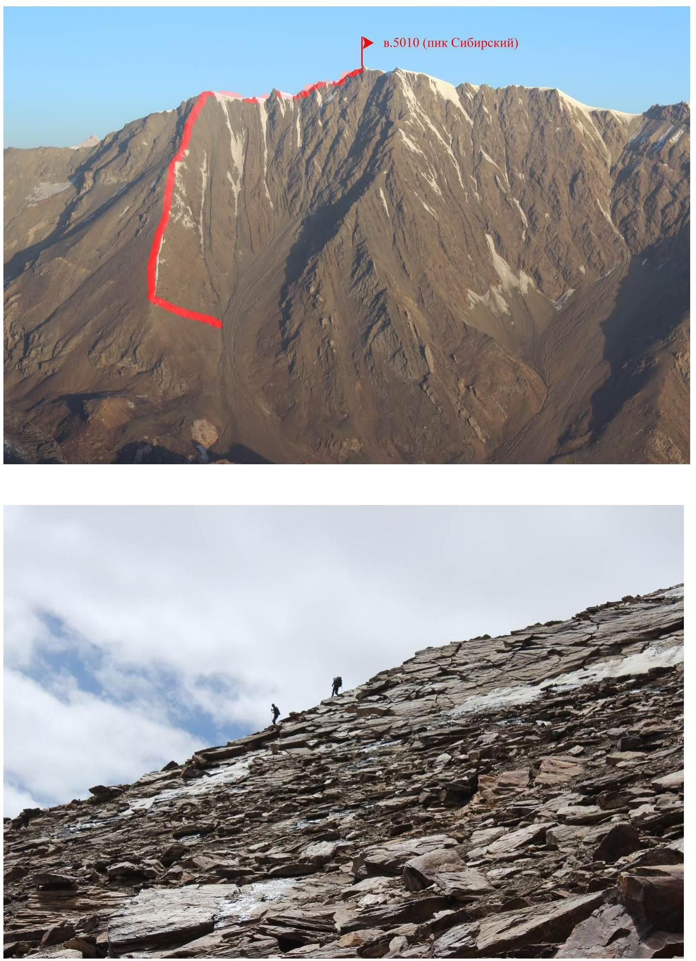
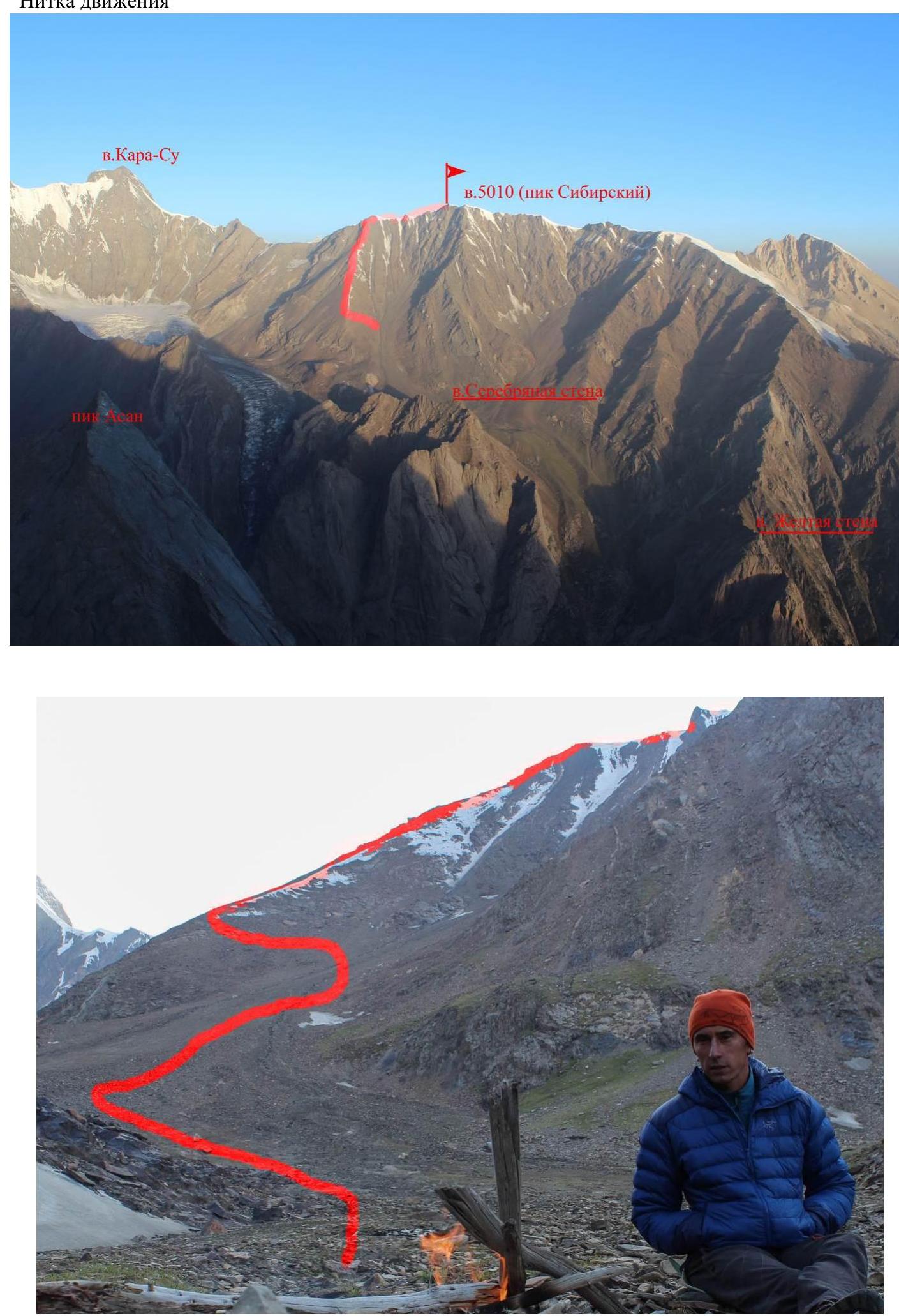
Photo of the general view of the peak

Photo of the route profile.
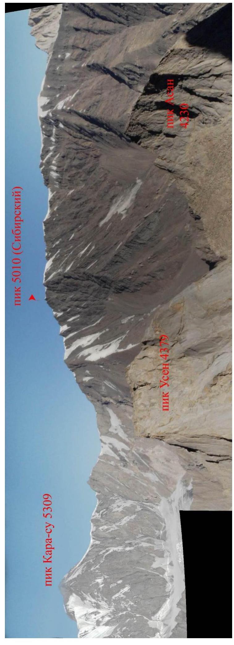
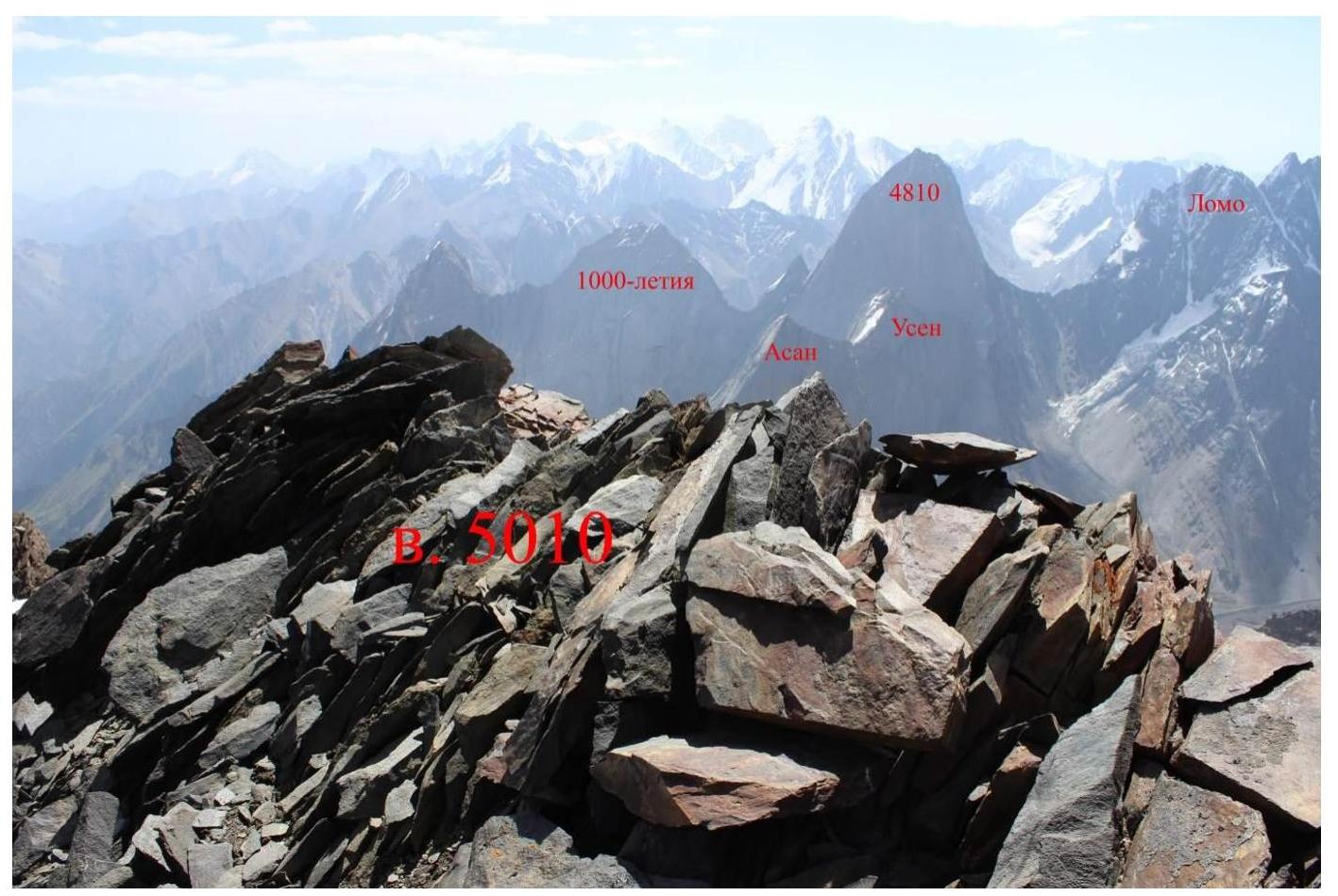
Panorama of the area.
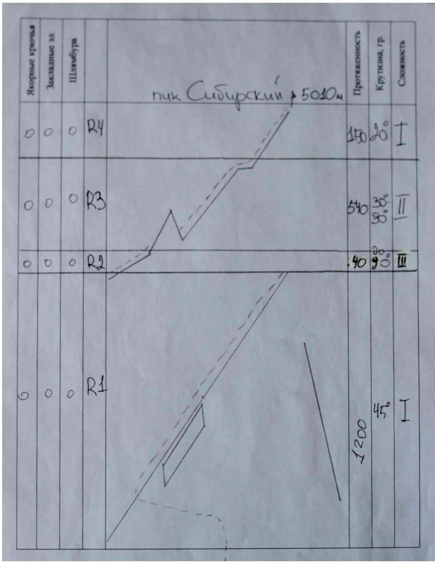
UIAA route diagram
Route description by sections
The ascent was done as acclimatization. We carried bivouac gear to about 3700 m near the ruined kosh under the western slopes of Pik Serebryanaya Stena. After an overnight stay, we started at 6:40 AM. Move towards the couloir on the eastern slope. In a convenient place in the scree couloir, move to the right (orographic) slope and reach the eastern ridge. Ascend the eastern ridge to the southern crest. Then follow it to the summit.
- R1: 1200 m, 1st category, 35–50°. Move along the eastern ridge with trekking poles.
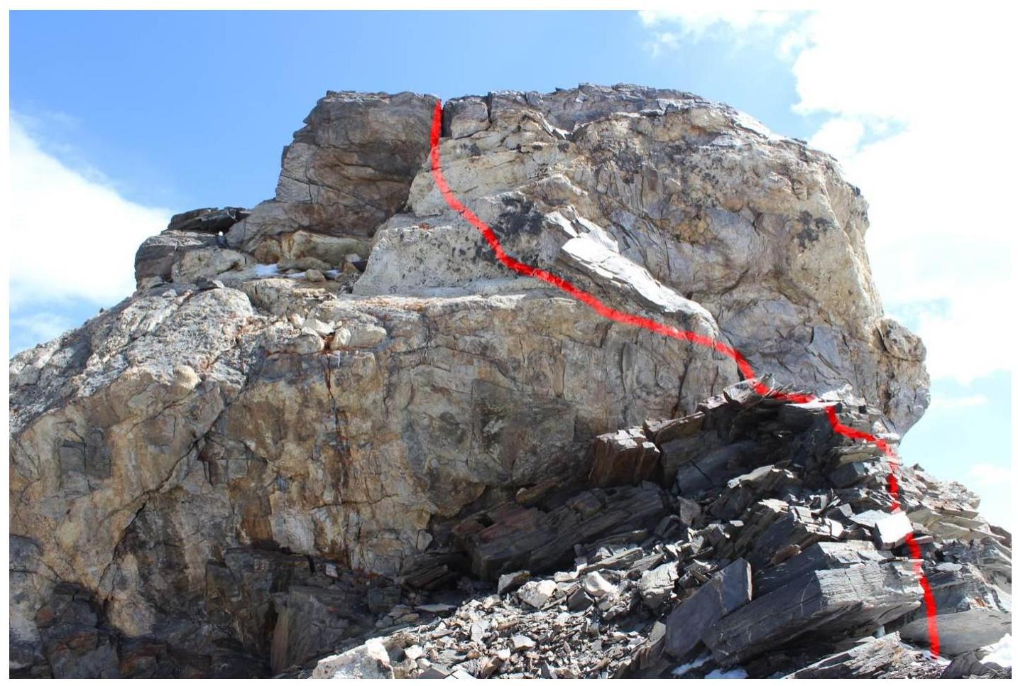
- R2: 40 m, 3rd category, up to 90°. Move along the southern crest. It is recommended to rope up and have 1-2 pairs of crampons per rope team as the crest is partially icy.
- R3: 540 m, 2nd category, 30–90°. There are several rock "gendarms" on the crest. They are mostly passed on the western side of the crest.
- R4: 150 m, 1st category, 20°.
My teammates felt unwell and did not continue after reaching the crest. I decided to check the feasibility of the route and cautiously reached the summit.
Route track
Route track
Photos of route sections
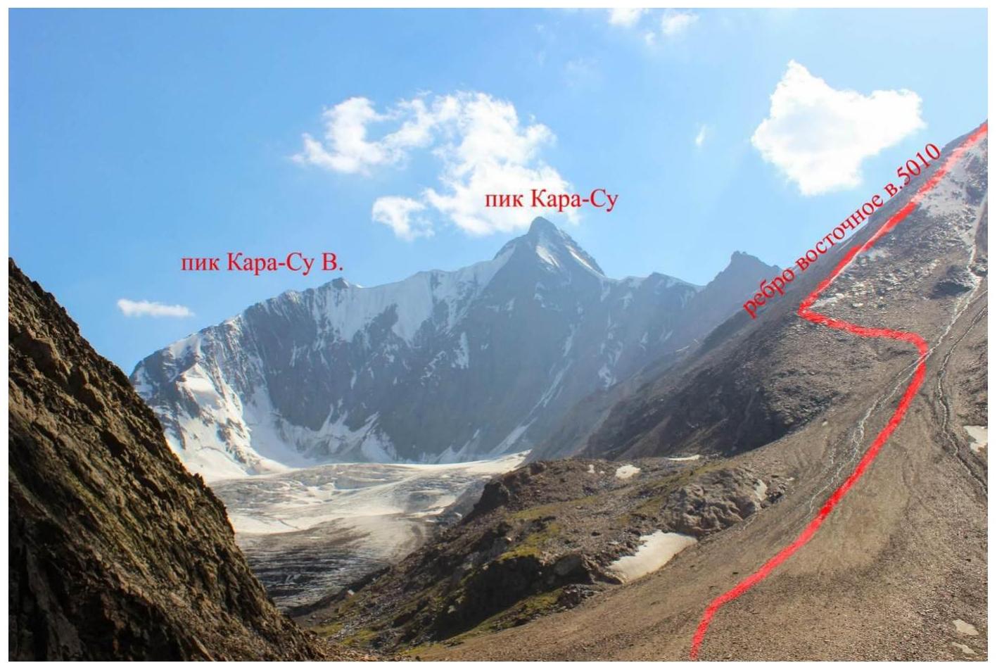
The eastern ridge is marked red on the left.
The southern crest is facing the photographer. The photo is taken from the summit of Peak 5010.
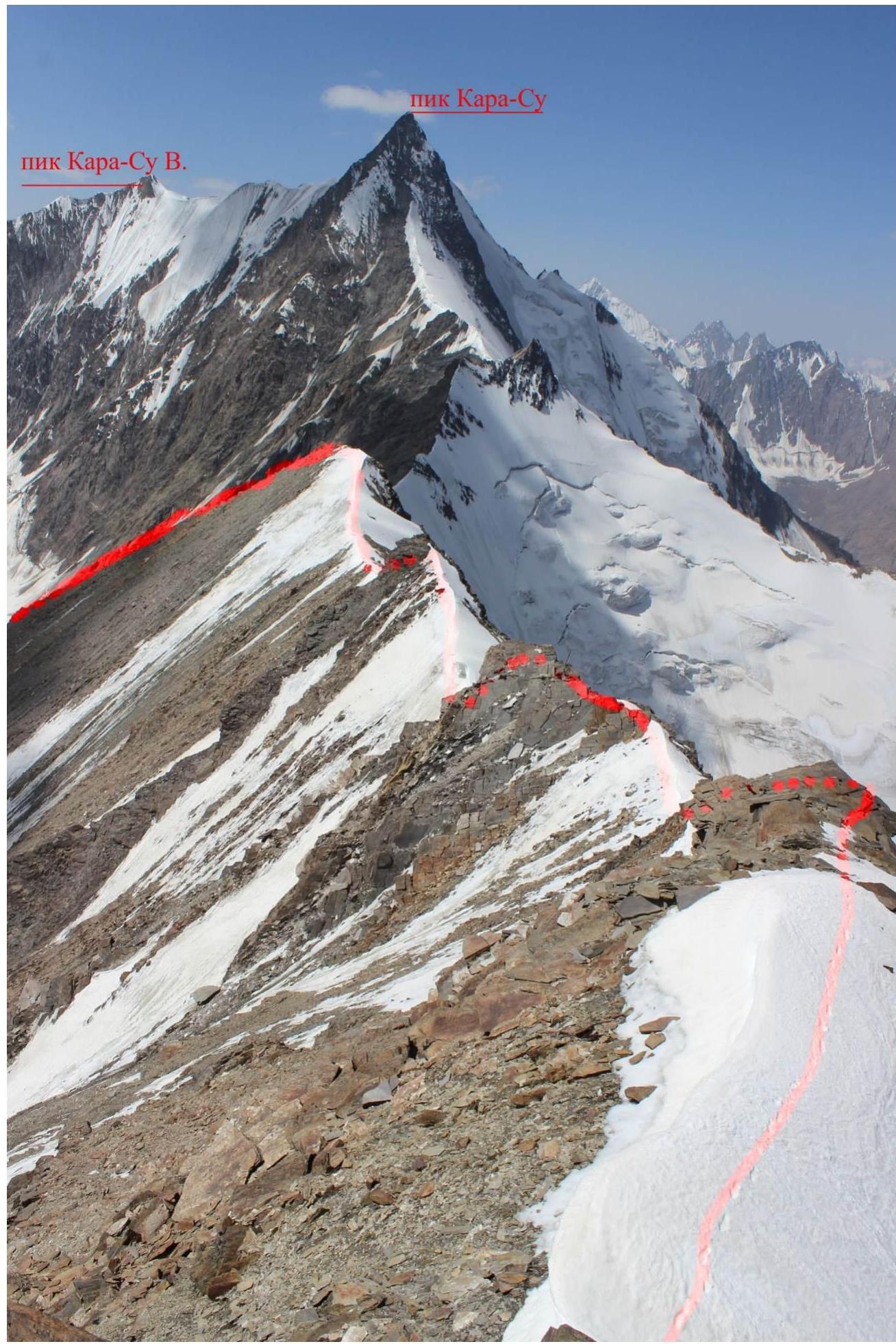
R2. View of the southern crest from the exit onto it via the eastern ridge.
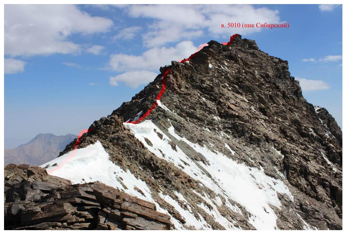
R2. View of the summit ascent from the middle of the southern crest of Peak 5010.

R2. Section of 3rd category of difficulty in the upper part of the summit ascent on the southern crest.
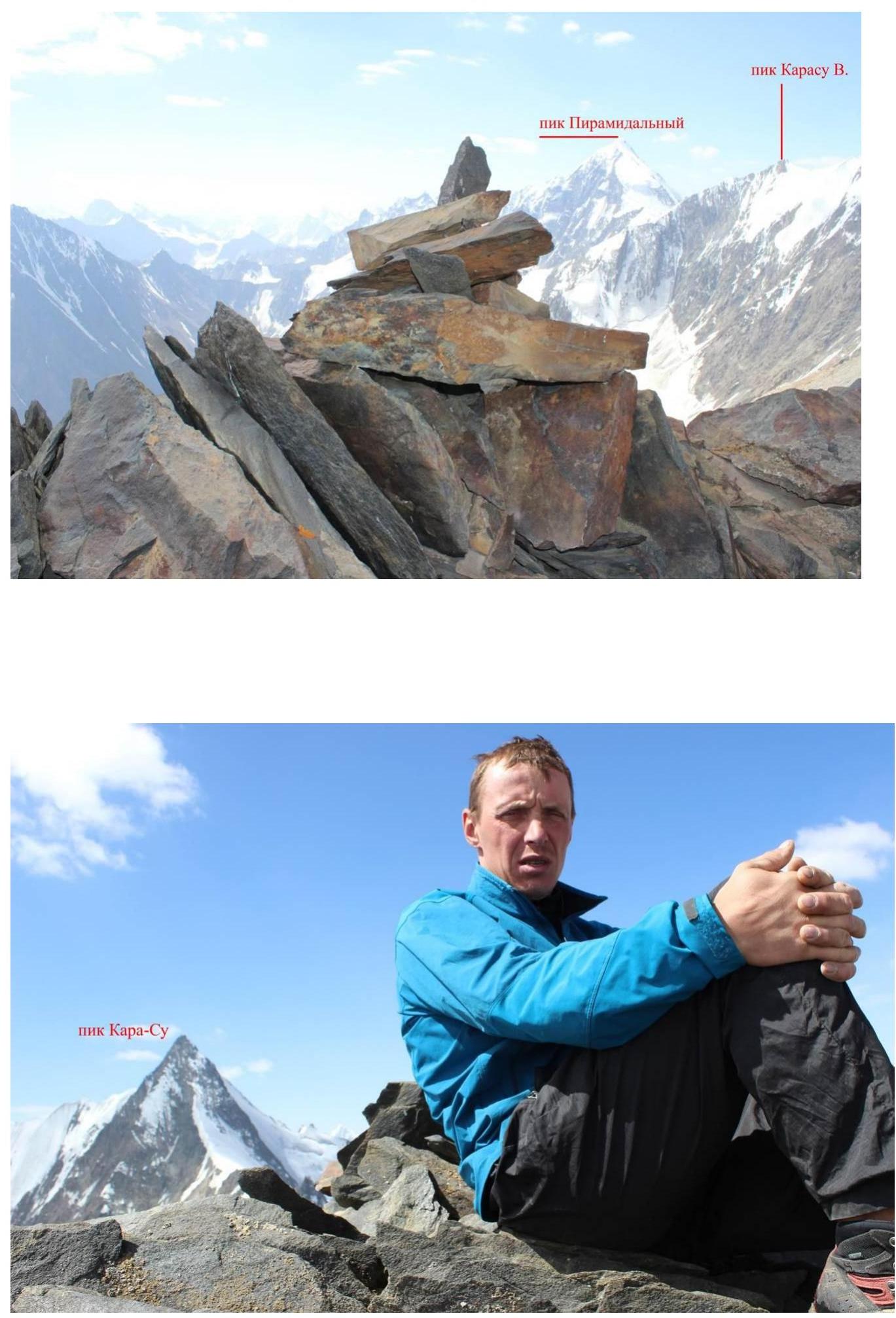
At the summit (before building a cairn).
Peak 5010 (Pik Sibiryak). No notes or cairn were found.