Passport
- Traverse class
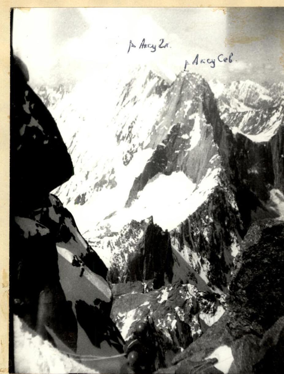
- Alay Range, Ak-Su valley, Pamir
- Traverse peak A. Blok (East) — A. Blok (Main) — peak 4600 m — Ak-Su (North) — Ak-Su (Main)
- Proposed — 6B category of difficulty, first ascent
- Length — 10,230 m
Length of sections with 5B–6B category of difficulty — 1040 m. Average steepness of the main part of the route — 61°, of which 6B category of difficulty — 85° (4600–4915)
- Pitons hammered: rock – 223, bolted – 0, chocks – 234, ice – 18. Additional: rock – 21, bolted – 0, chocks – 6, ice – 0.
- Team's walking hours — 103, days — 10
- Overnights — all overnights are bivouac, on the ridge
- Leader — Titkin Evgeny Georgievich, Master of Sports
Members: Solovey Oleg Matveevich, Master of Sports, Sirotin Vladimir Ilyich, Candidate for Master of Sports, Masaltsev Valery Stanislavovich, Candidate for Master of Sports, Gordey Dmitry Leonidovich, Candidate for Master of Sports, Tikhonenko Vasily Vasilyevich, Candidate for Master of Sports, Pisarchik Alexander Nikolaevich, Candidate for Master of Sports
-
Coach — Shabunya Stanislav Ivanovich
-
Start of the route: August 6, 1987 peak A. Blok (East) — August 8, 1987 peak A. Blok (Main) — August 10, 1987 peak 4600 m — August 11, 1987 peak Ak-Su (North) — August 14, 1987 peak Ak-Su (Main) — August 15, 1987 Return — August 16, 1987
-
Organization — State Committee for Sports of the Byelorussian SSR

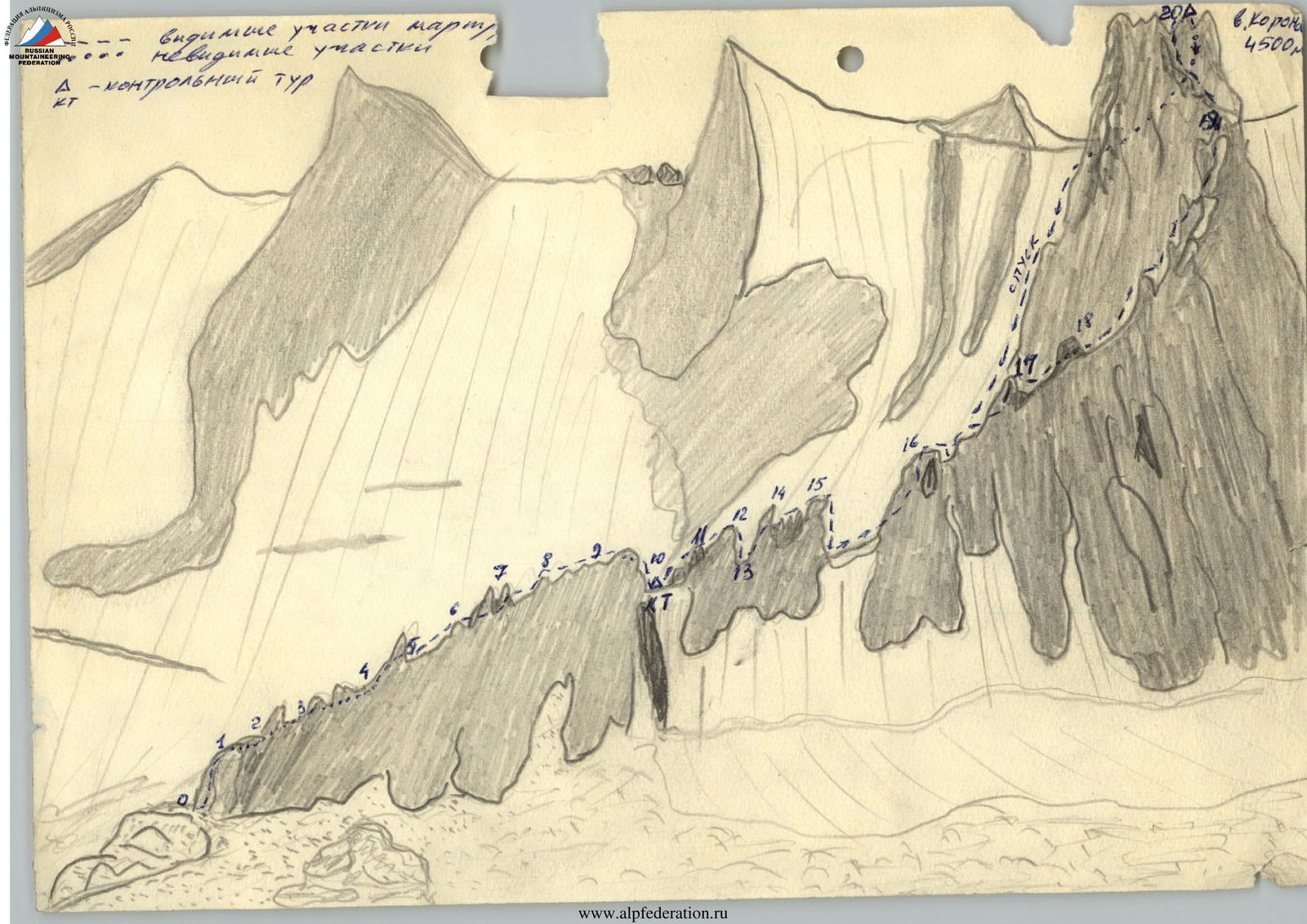
General photo of the traverse
Visible path of the team
Invisible sections
Elevation marks and bivouacs
Peaks and their elevations
1976 route – 5B category of difficulty
1984 route – 5B category of difficulty
Taken by S. L. Sapovol, M. Iskander. Location: distance 3.5 km, at an altitude of 4200 m, July 18, 1987. Lens: Industar 104, f=28 cm. No. 2.

Description of the route by sections
- The route on sections R1–R19 is a system of walls cut by icy crevices, climbing is mostly 4–5 category.
- Section, starting from R19 to peak East Blok — mostly not very difficult climbing, 4–5 category.
- Ridge, starting from peak East Blok and to the bastion of North Ak-Su has mostly 4–5 category of difficulty.
- Ascent to peak North Ak-Su has undoubtedly 5th category, with sections of 6th category of difficulty. The ridge between peaks North and Main Ak-Su has 3rd category of difficulty.
Descent from peak Blok Main on August 10, 1987. Industar 104, H=5000 m.
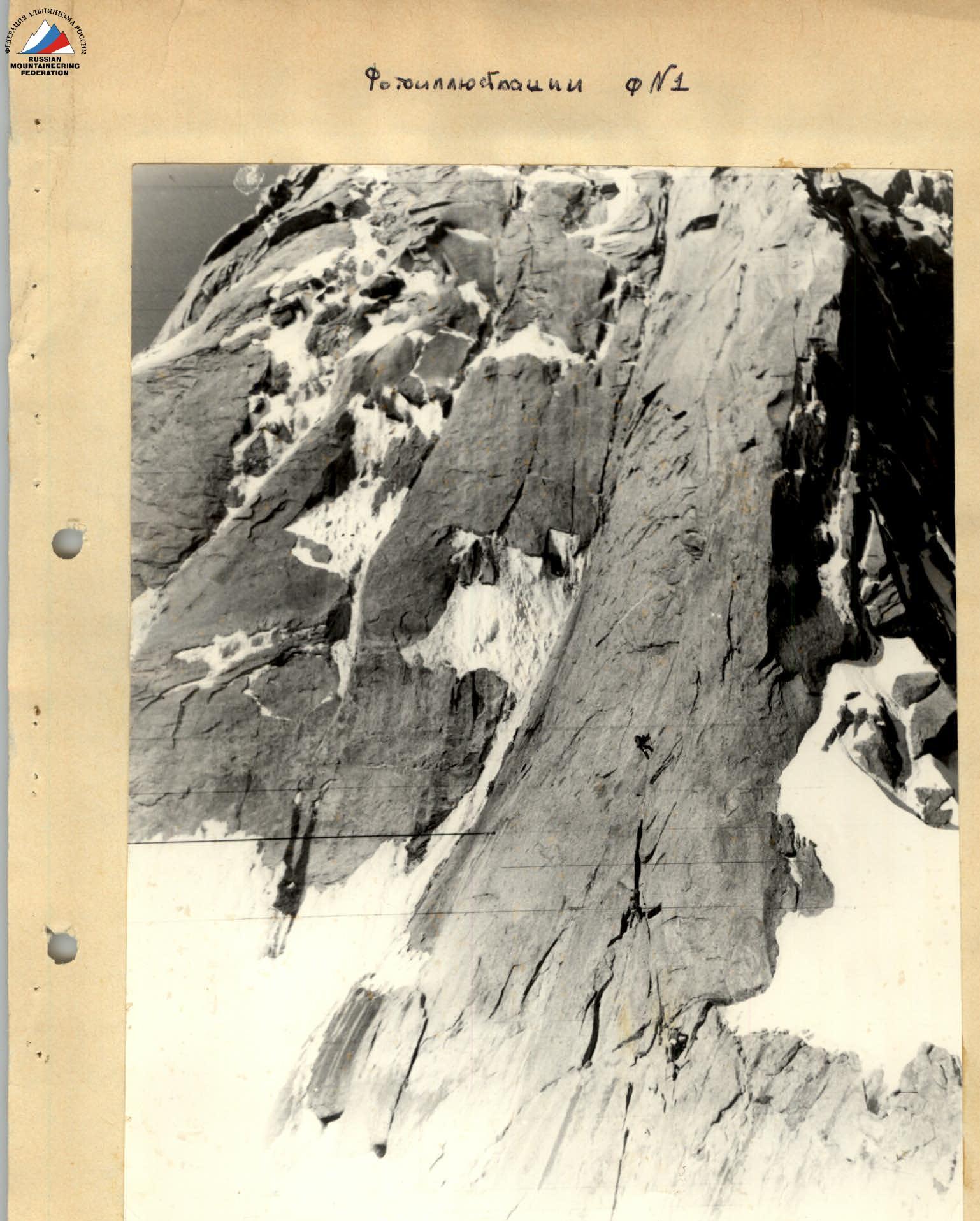
Photo illustration #1 Ascent to the bastion of peak North Ak-Su. August 14, 1987. Taken from the ridge of peak North Ak-Su, distance: 200 m, H=4700 m, Industar-104, f=28 cm.
This plan was executed by us with some deviations. So on August 14, the group refused to process the lower part of the route, as a result of visual observation it became clear that it did not contain technically difficult sections. The group reached the summit and descended to the assault camp on August 15. On August 16, the group together with observers descended to the base camp at Koshdeba meadow.
Observers were: Volodya Beletsky and Lena Varzhapityan. Observers, being in the assault camp, observed the climbers visually with the help of a 25x telescope. The group of climbers had stable radio communication on the VHF radio station "Vitalka" on the day of the ascent with observers every 2 hours, starting from 8:00. On the days when observers were in the assault camp, they had two times a day stable radio communication with the base camp using the "Nedra" radio station.
Taking into account the meteorological conditions of the ascent in this area, instead of a tent on the route, the group took four cloaks. When going on the route, the group had food and fuel reserve for two days.
List of equipment taken by the group on the route
- Down sleeping bags — 3 pcs.
- Down jackets — 5 pcs.
- Ice axes — 2 pcs.
- Hammers — 3 pcs.
- Main rope 12 mm × 40 m — 2 pcs.
- Auxiliary rope 6 mm × 40 m — 1 pc.
- Repschnur 6 mm — 15 m.
- Titanium carabiners (standard) — 10 pcs.
- Steel carabiners VTsSPS — 15 pcs.
- Instructor cloaks — 4 pcs.
- "Dwel" primus stove — 1 pc.
- Pot (primus stove packaging) — 1 pc.
- Ice pitons — 2 pcs.
- Various titanium rock pitons — 16 pcs.
- Sunglasses — 5 pcs.
- Flashlights — 2 pcs.
- 1-step ladders — 2 pcs.
- 2-step ladders — 1 pc.
- "Vibram" type boots — 2 pairs
- Tricouni crampons — 3 pairs
- Galoshes — 3 pairs
- Crampons — 1 pair
- Belay harnesses — 5 pcs.
- Special harnesses — 3 pcs.
- Canvas gloves — 5 pairs
- Protective helmets — 5 pcs.
- 2-liter fuel flask — 1 pc.
- VHF radio station "Vitalka" — 1 pc.
- First aid kit — 1 pc. Total weight: 44 kg. In addition, each participant was dressed in woolen socks, a sweater, a T-shirt, 3/4 pants and had two pairs of spare socks.
All samples of non-standard equipment have been used by group members for several years and are not new to them. All types of this equipment have been tested for strength. The test results significantly exceed the established strength standards specified in the methodological letter of the USSR Alpine Federation of 1970.
Stain — 15 m, with a steepness of 50°. Then to the left to the top of the gendarme along a slab and a strong rock wall — 25 m, 80°. Rocks 4B, 5A category of difficulty. (Exr.)
Section R12–R13. From the top of the gendarme, rappel into the gap — 25 m, to the saddle under the "Sharp" gendarme. Rappel in the lower part is negative with a pendulum to exit to the saddle 3–4 m. On the saddle, there is a sharp chip of a slab, which helps to perform the pendulum (hold on by hand). A rappel loop and three pitons are left.
Section R13–R14. Ascent to the "Sharp" gendarme straight on, along two crevices in the direction of a pronounced chip. Difficult climbing 30 m. Exit to the edge below the top of the gendarme 5 m to the right. (3 pitons.)
Section R14–R15. A very sharp edge with three "feathers" 35 m leads to the "Feather" gendarme, steeply breaking off to the saddle. You can descend to the saddle in two ways:
- Negative rappel from the top of the sharp "Feather" (15 m).
- Two sports descents to the left of the sharp "Feather" 7–8 m each, then to the right and up along a narrow shelf to the saddle. The saddle is snowy, pronounced, clearly visible from the camp on Levin Glacier (2 loops left).
Section R15–R16. From the saddle straight up the wall 40 m. Rocks are quite strong, durable. The path is along a crack in the direction of the tooth and then to the left and up along smooth rocks — exit to the top of the gendarme (2 pitons.)
Section R16–R17. Descent 5 m and movement along the edge under the "Split" gendarme. Ascent along the inner corner with smooth walls. Inside the steep corner — a cork made of large rock blocks. Exit through the cork along the inner corner to a single cork in the upper part of the corner. From the cork, exit to the left wall along a crack 5–6 m up — very difficult climbing. (2 pitons.)
Section R17–R18. Movement along the edge towards the round gendarme, bypassing the gendarme to the left along a shelf and exit up to the edge.
Section R18–R19. Movement along the edge under the summit tower. The edge is a series of 8 gendarmes, each 10–15 m high (all gendarmes are passed head-on). The average steepness of the edge is 40–45°. Below the ridge, 10 m to the left, there is a narrow, steep, stone-prone couloir like a "chimney", also leading under the summit tower. Movement along the couloir is stone-prone. To the right of the edge, there are two snowfields, 30 m each, along which it is possible to bypass the 6th and 7th gendarmes. (4 pitons.)
Section R19–R20. The summit tower is a vertical wall 40 m, of strongly destroyed rocks. In some places, the rocks are a white marble crumb. Exit to the summit from the saddle:
- first to the right and up along a vaguely expressed shelf
- then to the left and up along the inner corner under the wall with an overhanging cornice made of a slab (2 m)
- and then straight up 7 m to the middle part of the summit Corona. (2 pitons.)
Time R15–R20
Descent from the summit along a steep, stone-prone couloir to a snow plateau — 60 m. Then to the left along the route, bypassing the summit, 2 sports descents 40 m each along the edge of ice and rocks. Exit to a talus couloir and then down the talus to the bed of the Ak-Su river, flowing from Levin Glacier, and then up to the assault camp on the plateau of Levin Glacier. The group arrived at the assault camp at 17:45. The next day (August 16), the group descended to the base camp at Koshdeba meadow.
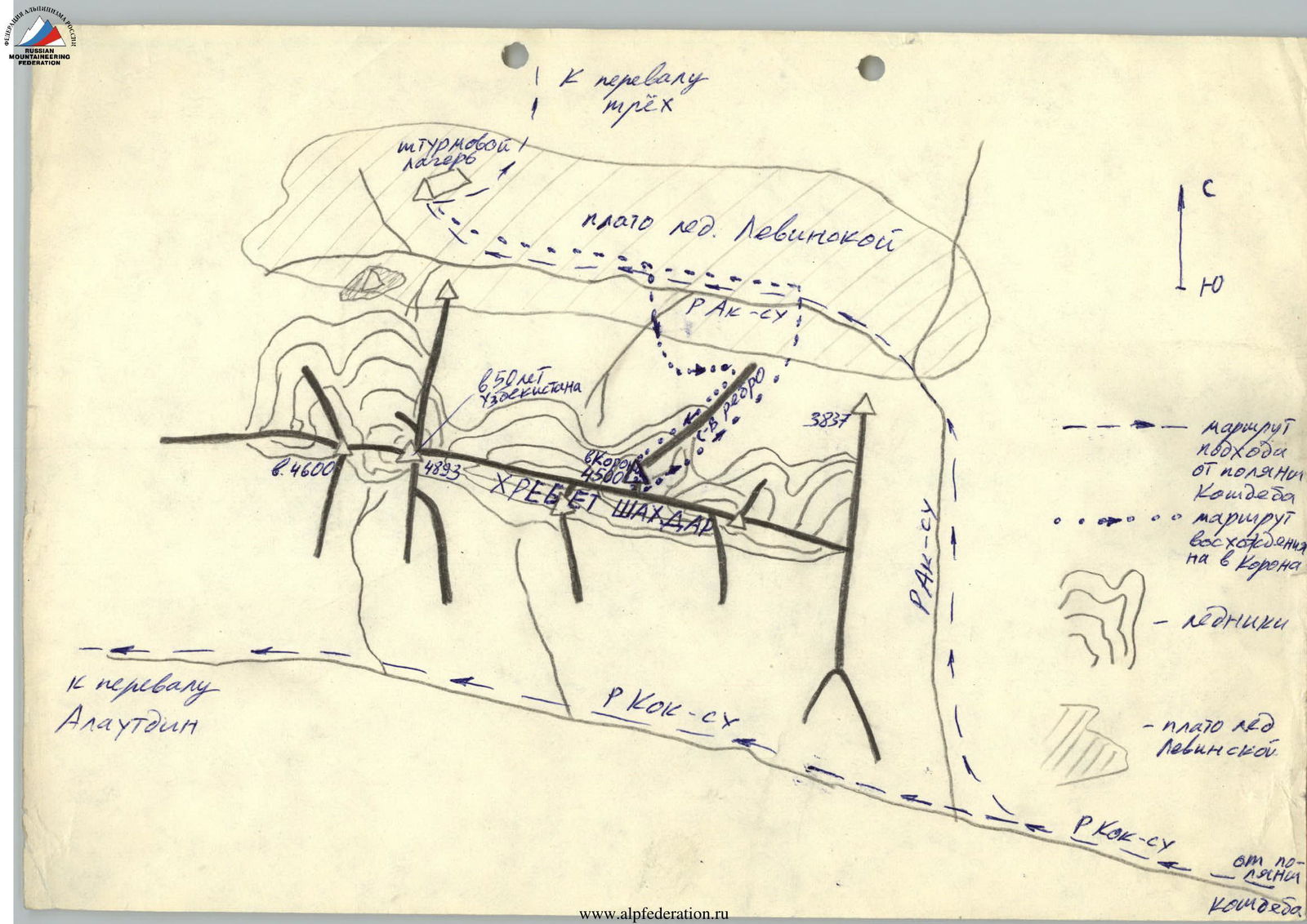
Map-scheme of the route.
Legend:
-
-
-
-
-
- Route of approach from Koshdeba meadow • • • • • • Route of ascent to peak Corona ~ ~ ~ ~ ~ ~ Glaciers
-
-
-
-
-
-
-
-
-
- Plateau of Levin Glacier
-
-
-
-
-
-
-
-
-
- Koksu River from Koshdeba meadow ^ North
-
-
-
-
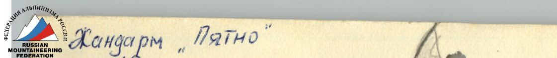
Gendarme "Spot", section R12. Red spot. Slab. Inner corner. Gendarme "Sharp", section R14.
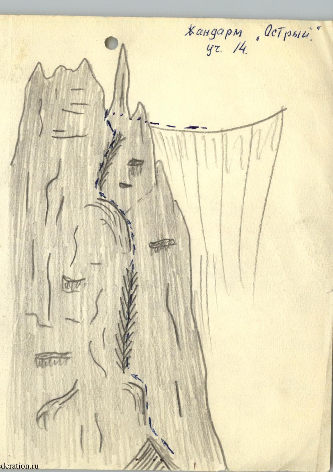
Visible sections of the route. Invisible sections. Control rope. Descent. peak Corona 4500 m.