Passport
- Class of ascent — technical.
- Region of ascent, ridge — Pamir-Alay, Turkestan Ridge, Ak-Su gorge.
- Peak, its height, ascent route — East A.Block, 5150 m, via northwestern wall and northern ridge, combined.
- Proposed difficulty category — 5B.
- Route characteristics:
- height difference — 830 m
- route length — 915 m
- wall section length — 590 m
- ridge section length — 325 m
- length of sections with 5,6 cat. diff. — 600 m
- average steepness of the route — 66°
- wall section — 75°
- ridge section — 52°
- Pitons hammered:
- for belay:
- rock — 125
- chocks — 88
- ice — 16
- for artificial support:
- rock — 34
- chocks — 29
- for belay:
- Number of climbing hours — 46.
- Number of bivouacs and their characteristics:
- 1st bivouac — lying, on moraine;
- 2nd bivouac — semi-reclining, on a 2x2 m ledge, slope 10°, ice present;
- 3rd bivouac — lying, on a ledge near the "finger", snow present;
- 4th bivouac — lying, on a shoulder under the bastion, ice present.
- Surname, name, patronymic of the leader, participants, and their qualification:
- leader: Filatkin Mikhail Alexandrovich — CMS
- participants: Metelkin Gennadiy Vasilievich — CMS
- Lapshin Dmitry Viktorovich — CMS
- Lukyanov Vladimir Sergeevich — CMS
- Team coach: Kuvatov Gennadiy Dmitrievich — CMS
- Date of departure and return:
- August 15, 1983 — departure on the route
- August 19, 1983 — return.
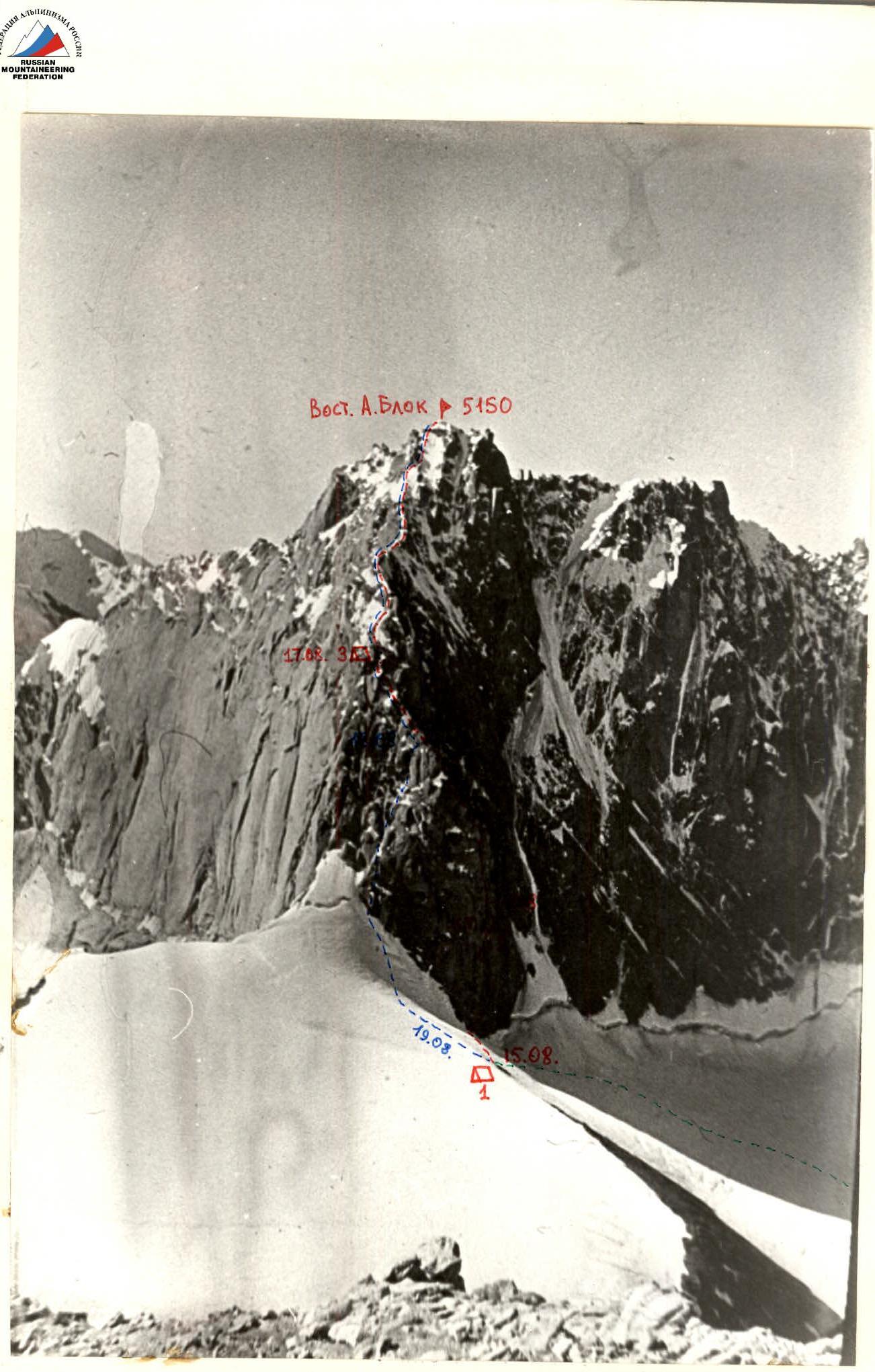
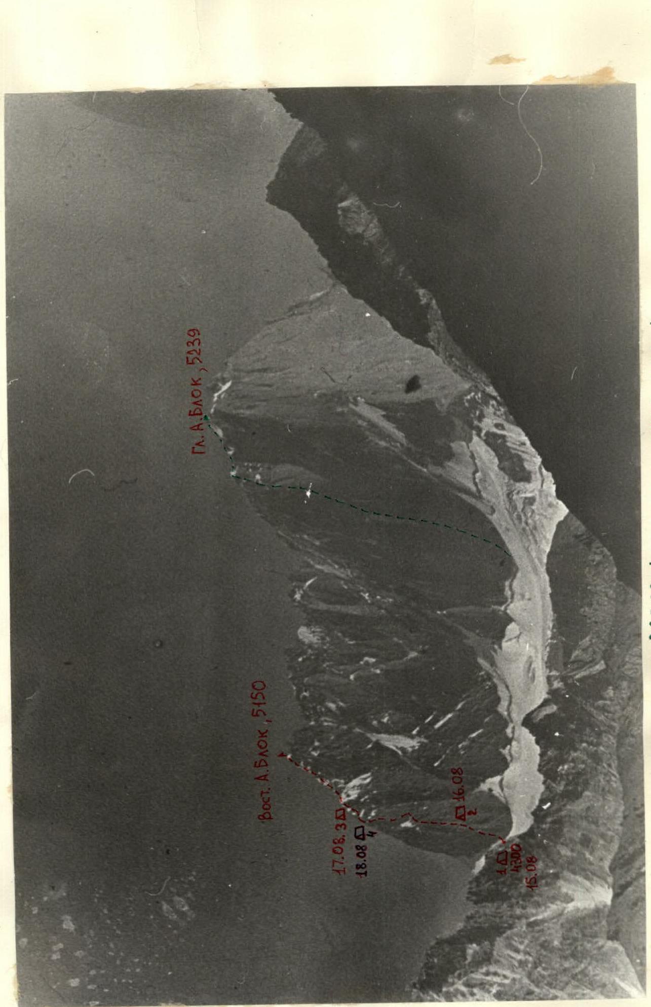
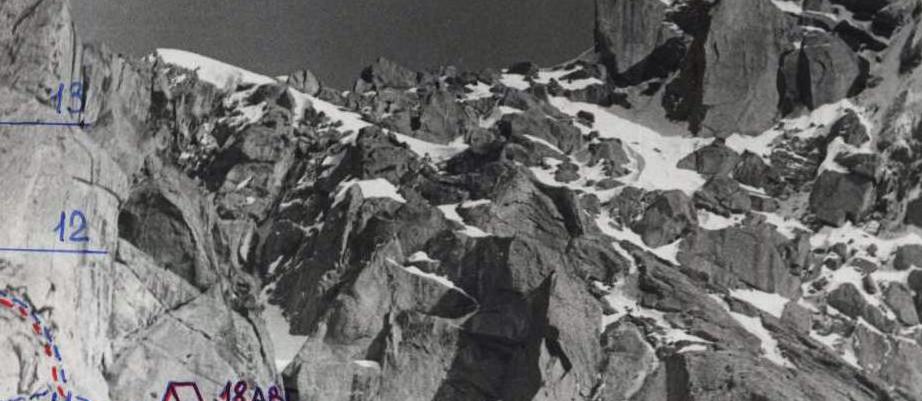
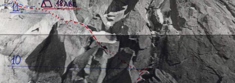
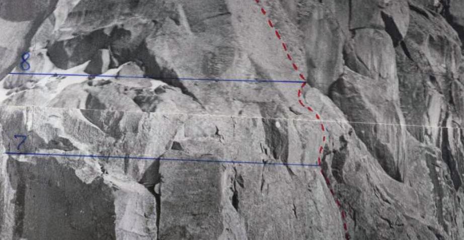
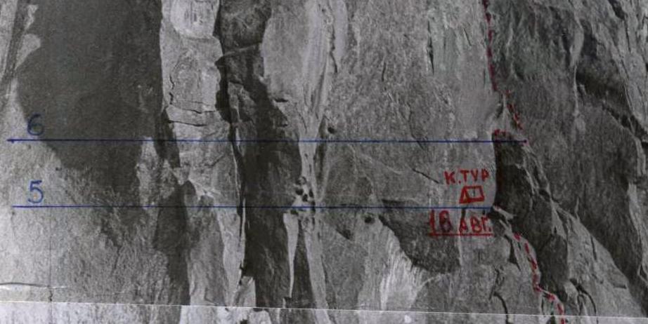
340 — Bivouac location on the route. — Ascent path — Descent path — Approach and return path to the base camp.
A.Block Massif. General view (from the northwest)
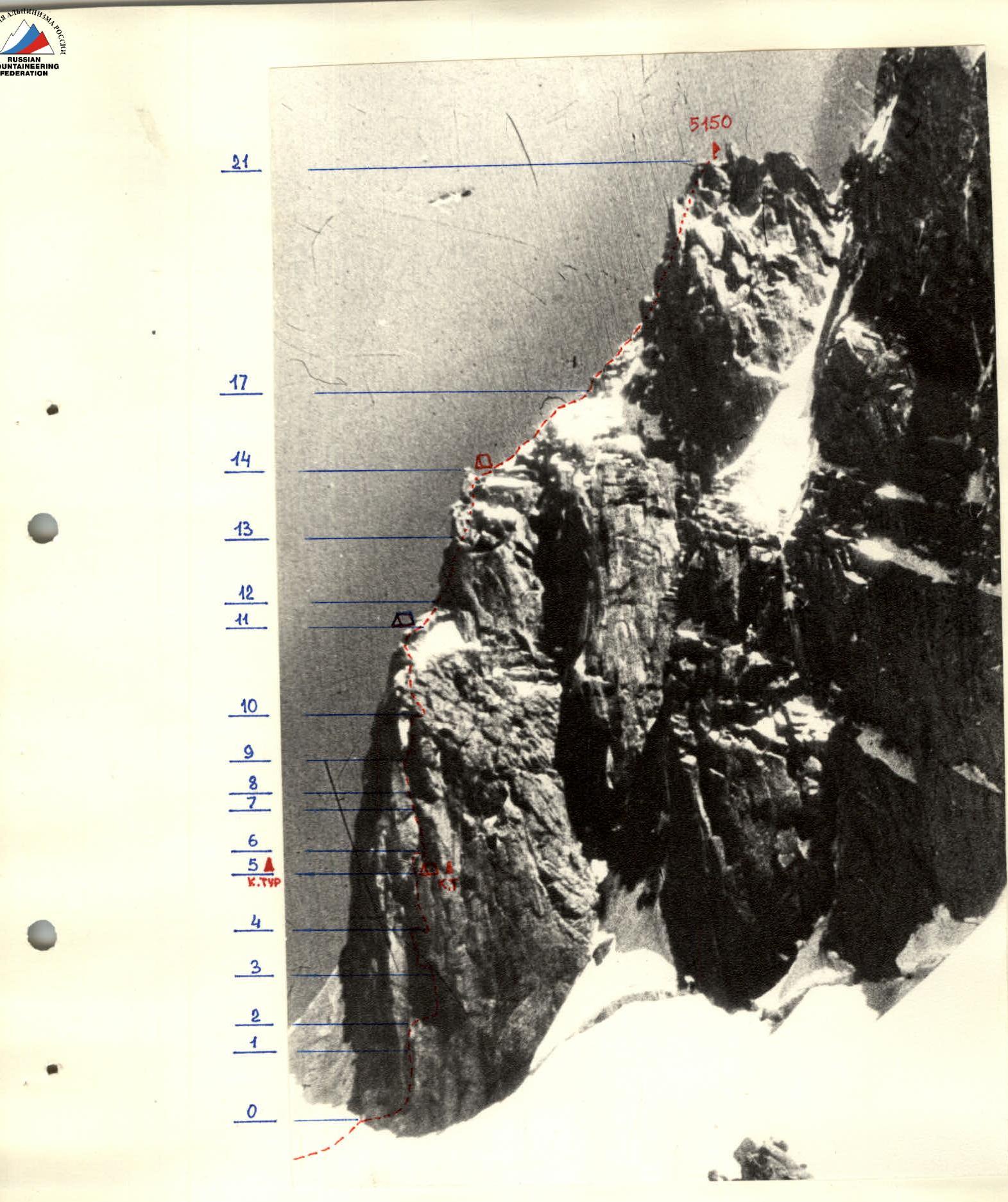
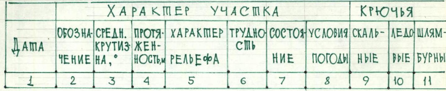
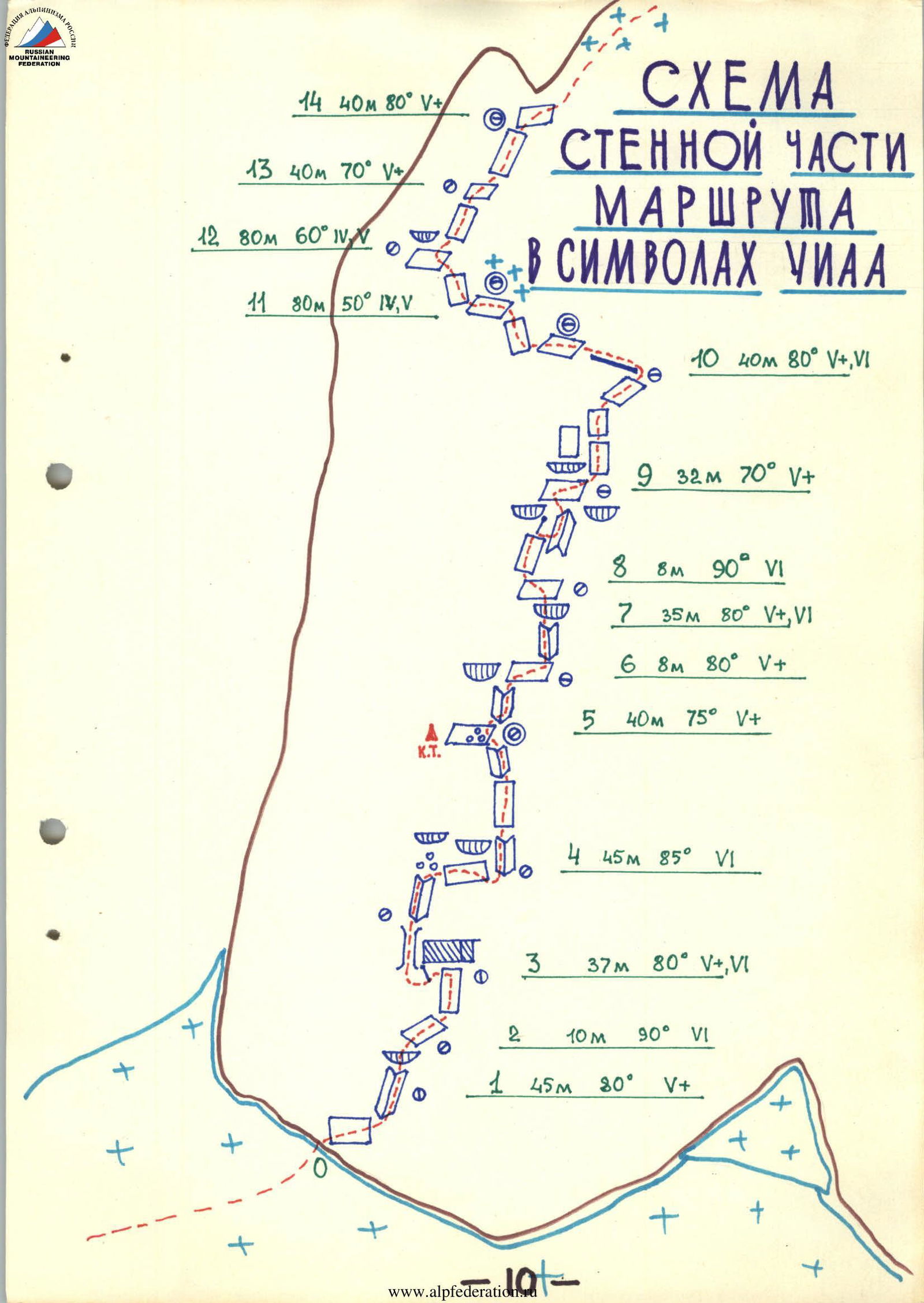
Table of main route characteristics
August 15. Route processing.
| Section | Average steepness | Length, m | Terrain character | Difficulty | Condition | Weather conditions | Rock | Ice | Bolts |
|---|---|---|---|---|---|---|---|---|---|
| R0–R1 | 80° | 45 | wall | 5+ | monolith | clear | 6, III | 5, II | |
| R1–R2 | 90° | 10 | overhang | 6 | -" - | -" - | 5, III | 2, II | |
| R2–R3 | 80° | 37 | wall | 5+, 6 | -" - | -" - | 8, III | 10, IV | |
| R3–R4 | 85° | 45 | wall, inner corner | 6 | -" - | -" - | 15, V | 10, V |
Departure from the moraine bivouac — 9:00. Descent to the bivouac — 20:00. Climbing hours — 11. Bivouac is good.
August 16.
| Section | Average steepness | Length, m | Terrain character | Difficulty | Condition | Weather conditions | Rock | Ice | Bolts |
|---|---|---|---|---|---|---|---|---|---|
| R4–R5 | 75° | 40 | inner corner, wall, inner corner, 2x2 ledge | 5+ | -" - | -" - | 12, V | 8, IV | |
| R5–R6 | 80° | 8 | inner corner, 1x1 platform | 5+ | -" - | -" - | 3 | 2 | |
| R6–R7 | 80° | 35 | inner corner | 5+, 6 | -" - | -" - | 8, III | 7, III | |
| R7–R8 | 90° | 8 | overhang, 2-person ledge | 6 | -" - | -" - | 4, III | 3, II |
Departure from the moraine bivouac — 9:00. Descent to the bivouac on the ledge — 18:00. Climbing hours — 9. Bivouac is semi-reclining.
August 17.
| Section | Average steepness | Length, m | Terrain character | Difficulty | Condition | Weather conditions | Rock | Ice | Bolts |
|---|---|---|---|---|---|---|---|---|---|
| R8–R9 | 70° | 32 | wall | 5+ | -" - | -" - | 6, II | 5, III | |
| R9–R10 | 80° | 40 | overhang, half-wall, 1-person ledge | 5+, 6 | -" - | -" - | 8, III | 10, II | |
| R10–R11 | 50° | 80 | shoulder | 4,5 | -" - | -" - | 4 | 3 | |
| R11–R12 | 60° | 80 | shoulder | 4,5 | -" - | -" - | 8 | 6 | |
| R12–R13 | 70° | 40 | wall, 2-person ledge | 5+ | -" - | -" - | 7 | (3) | |
| R13–R14 | 80° | 40 | wall | 5+ | -" - | -" - | 7, III | 5, II |
Departure from the ledge bivouac — 9:00. Stop at the bivouac near the "finger" — 21:00.
Climbing hours — 12. Bivouac is good, lying.
August 18.
| Section | Average steepness | Length, m | Terrain character | Difficulty | Condition | Weather conditions | Rock | Ice | Bolts |
|---|---|---|---|---|---|---|---|---|---|
| R14–R15 | 50° | 50 | slab, wall, ledge | 5 | ice on rocks | clear | 5 | 4 | |
| R15–R16 | 40° | 35 | wall, ridge | 5 | rocks, snow | -" - | 5 | ||
| R16–R17 | 45° | 60 | ridge, cornices | 4,5 | ice, snow | -" - | 2 | 4 | |
| R17–R18 | 45° | 80 | ridge, cornices | 4,5 | ice, rocks, snow | -" - | 4 | 3 | 2 |
| R18–R19 | 50° | 60 | slope | 4,5 | ice | -" - | 2 | 4 | 2 |
| R19–R20 | 60° | 70 | wall | 5+ | ice | -" - | 3 | 5 | |
| R20–R21 | 70° | 20 | wall, ledge | 5+ | rocks, snow | -" - | 3 | 1 |
Departure from the bivouac near the "finger" — 10:00. Reach the summit — 16:00. Descent to the bivouac on the shoulder — 21:00. Bivouac is lying.
August 19. Departure from the bivouac on the shoulder — 8:00. Descent to the moraine bivouac — 11:00. Climbing hours — 3.
Brief explanation of the table
The route begins from the black slab with a white arc on top, 30 m to the left of the lowest point of the wall's rock section.
August 15. Route processing.
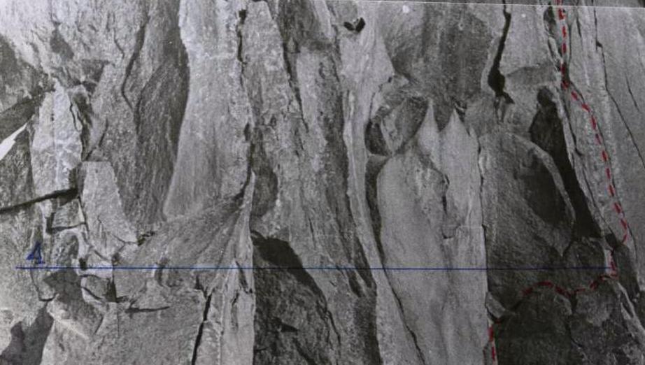
Section R0–R1. From the black slab, 5 m to the right to a crack. Up the crack, under the overhang.
Section R1–R2. The overhang is passed directly, via the crack, on artificial aids.
Section R2–R3. Along the crack in the wall, right-up to a powerful second overhang (ceiling 5x8 m).
Section R3–R4. The second overhang is passed to the left along the crack (on ladders) between the ceiling and the wall — 5 m. Then, a pendulum 4 m to the left-down to a fin. Chimney 8 m. Exit to the fin. Then up the inner corner 10 m to three hanging stones (caution!). From the stones, right along the crack 10 m behind the bend. From the start of the route, 3 ropes of 40 m. Descent to the bivouac on the moraine glacier under the start of the route.
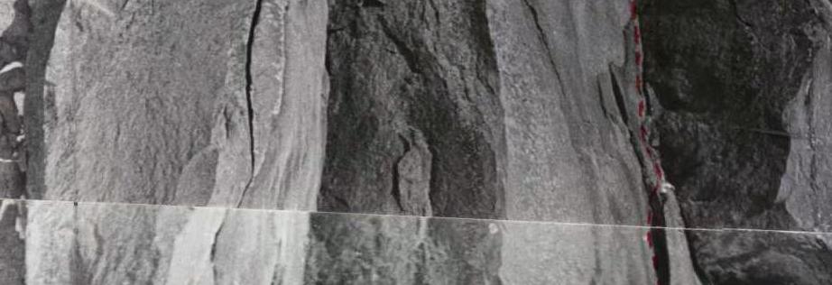
August 16. Ascent via the fixed ropes to the upper attachment point.
Section R4–R5. Straight up, along the inner corner 5 m. Transition to the right behind the bend to the wall. Along the crack in the wall up 15 m. Another 15 m along monolithic rocks to a 2x2 m ledge. Attention, large stones on the edge of the ledge! This is the bivouac site. The platform's slope is about 10°, ice is present. A "control cairn" is set — a can with a note, on a hook.
Section R5–R6. Along the inner corner up 6 m. Exit to a 1x1 m platform. Descent 2 m to a ledge, slope 10°.
Section R6–R7. From the platform, a steep inner corner goes up. Ascent 32 m.
From the start of the route, 5 ropes of 40 m. Descent to the bivouac on the ledge. Processing the bivouac site.
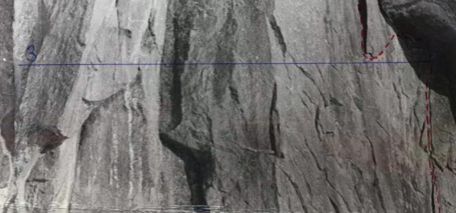
August 17, 1983. Ascent via the fixed rope 40 m.
Section R7–R8.
- Up the corner another 5 m.
- Left exit to an inclined platform — 15°.
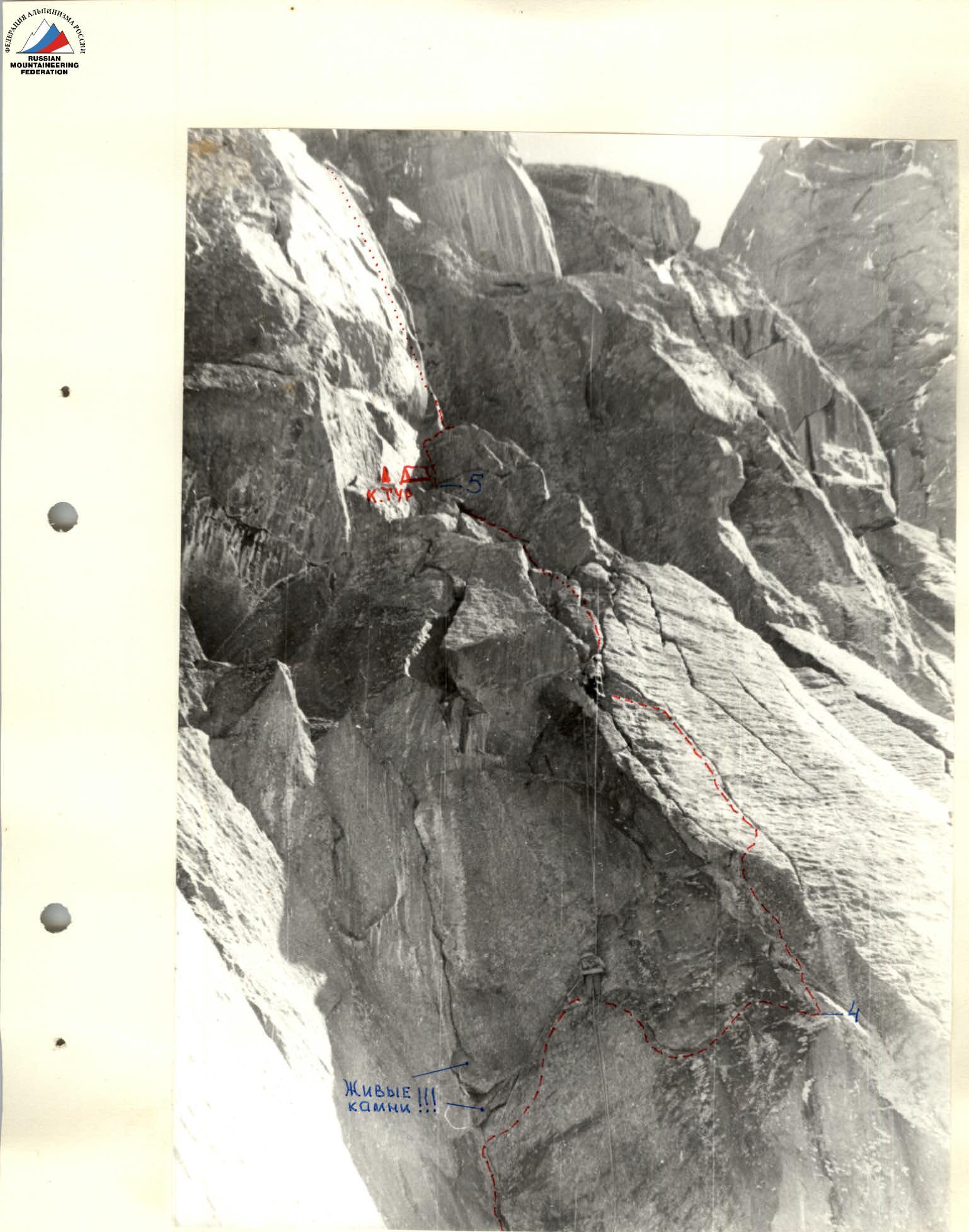
Section R8–R9.
- Up along the obtuse outer corner and further left of it, along the wall 27 m.
- Pendulum 3 m to the right, then up, under a large gray wall — an inclined ledge (about 15°).
Section R9–R10.
-
From the ledge, leaving the overhang to the left, Section R10–R11.
-
Along the slope 4–5 cat. diff.
-
Along a wide, vaguely defined ridge, in the direction of the bastion 2 ropes — 80 m.
-
Along the way, you can encounter a platform for a bivouac.
-
There is snow and ice.
Section R11–R12.
- The steepness increases.
- There are low, steep up to 80° walls.
- 2 ropes under a powerful overhang on the left side of the bastion.
Section R12–R13.
- The overhang is bypassed on the left along the wall.
- 20 m straight up.
- Another 20 m to the right–up to a small ledge for two.
Section R13–R14.
- From the ledge, 5 m up along snow-covered and icy rocks to a crack.
- Up the crack 30 m.
- Then to the right under a small gendarme, which is bypassed on the left along the wall 5 m.
- Exit to a small platform — bivouac site.
End of the wall section of the route.
August 18.
Section R14–R15.
- From the bivouac site, up 5 m along an inclined slab with a crack, another 3 m along a slab with snow.
- Right-up wall 4 m.
- Traverse to the right along a ledge 5 m.
- Up 20 m, leaving the gendarme "finger" to the left.
- 12 m up along a wide ledge, exit to the ridge section of the route behind the "finger".
Section R15–R16.
- Descent 3 m to a snow saddle, along it 8 m to a wall.
- Exit to the wall on the left, up 15 m to the ridge.
- Along a sharp rocky ridge 10 m.
Section R16–R17.
- Directly along the snowy ridge (attention, ice under the snow!!!, passage in crampons) 70 m to a rocky wall, bypassing cornices on the right along the ice.
Section R17–R18.
- Complex rock-ice section.
- Alternation of rocks and ice greatly slows down the group's movement.
- The path along the right side of the ridge is logical.
- Caution, cornices hang to the left (northeast)!
- Exit to the summit tower.
Section R18–R19.
- Steep snow-ice slope. Passed in crampons with ice axes.
- 60 m along the slope, to a narrow passage in the rocky ridge.
Section R19–R20.
- Along the rocky passage, covered with ice — 5 m.
- Then left to the ice slope.
- Gradually, the steepness increases.
- Move, sticking to the left side of the slope, as a snow-ice cornice hangs from the summit.
- Exit under the rocky wall.
Section R20–R21.
- 5 m along the rocky wall on the left side of the summit tower.
- Exit to a wide ledge with snow.
- To the right along the wall 2 m and further exit to the summit — time 16:05.
Descent from the summit
August 18. Descent started at 16:30.
Section R21–R18.
- Along the wall of the summit tower, via the ascent path 4 rappels to the ridge.
Section R18–R11.
- Along the ridge 4 sports descents via the ascent path to the gendarme "finger".
- Bypass the "finger" also via the ascent path, on the left 1 sport. descent — 50 m.
- Dismantling the bivouac.
- From the "finger" 2 rappels and 1 sport. descent via the ascent path to the platform.
- Bivouac.
August 19. Continuation of the descent.
Section R11–R22.
- From the bivouac, transition to the northern part of the shoulder of the wall.
- To the north, towards the pass between the peaks Aktubek (5125 m) and A.Block East (5150 m).
- From the shoulder, descent 5 m along the wall behind a sharp fin (pennant).
- From here, 4 rappels along the northern ridge, descent to the left part of the snow-ice slope.
- Another 1 rappel along the ice, bypassing the bergschrund, and 2 sports descents to a safe flattening of the slope.
- Further along the snow 300 m to the bivouacs on the moraine.
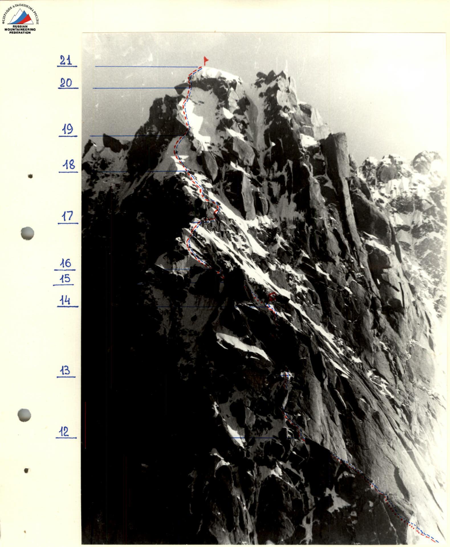
Ridge section of the route
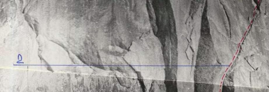
Path to the start of the route
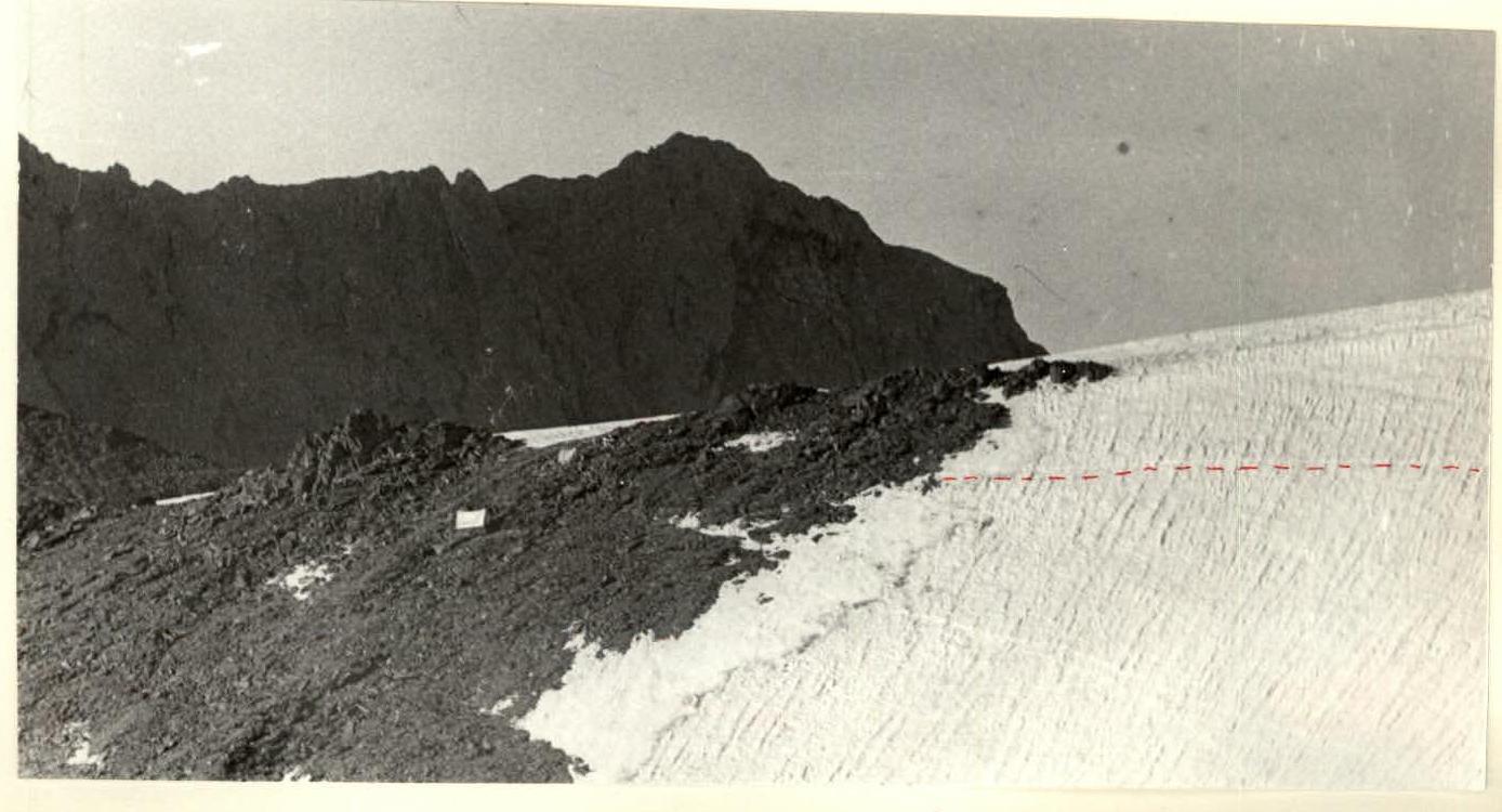
Observer camp on the moraine

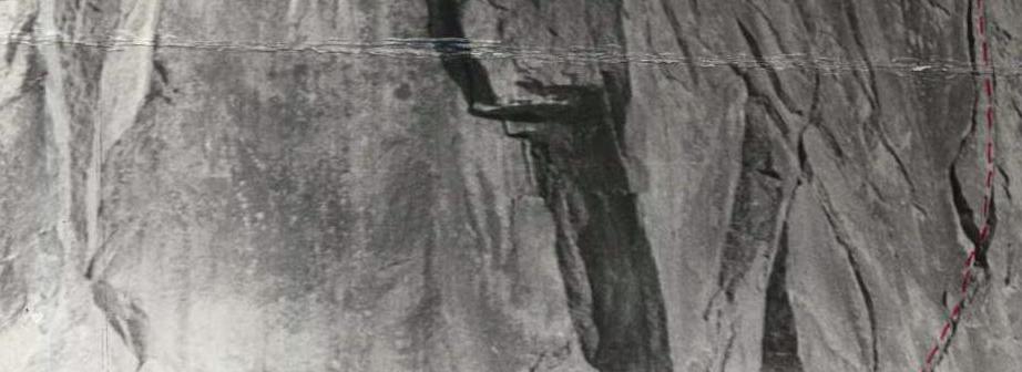
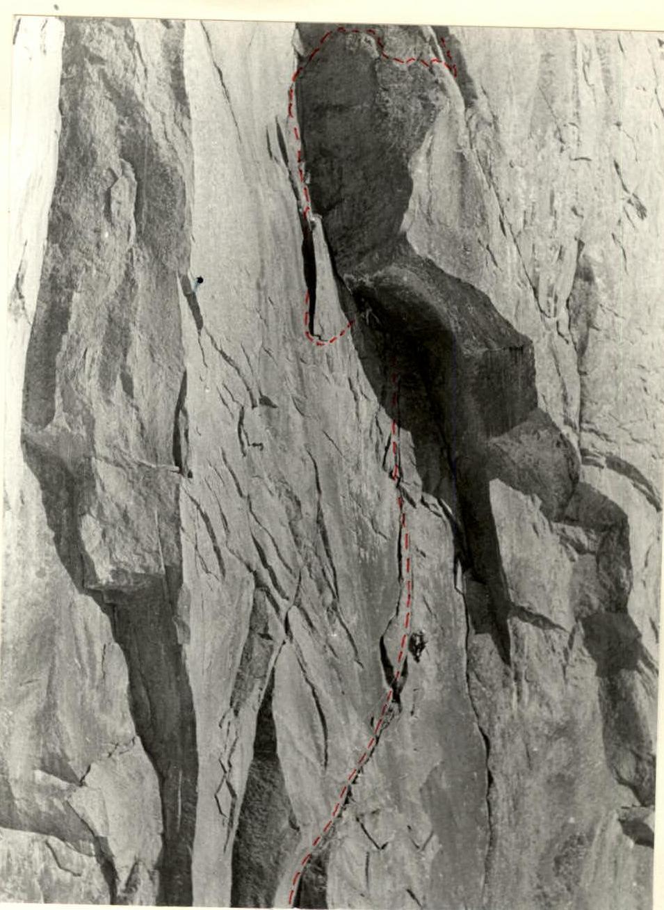
Passage of the cornice on section R3–R4
Cornice ceiling (view from below)
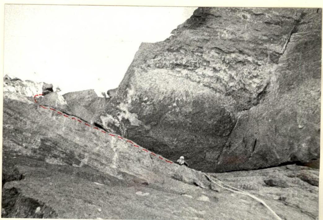
Passage of the fixed ropes on section R4–R5 (photo from the bivouacs on the moraine)