I. Technical class. 2. Turkestan Ridge. Ak-Su gorge. 3. Peak A. Blok via the central bastion of the North wall. 4. Assumed 6B, first ascent. 5. Height difference 710 m, length 800 m.
Length of 6B sections — 500 m. Average steepness of the main part of the route — 78° (4500–5100 m).
-
Pitons driven: rock: 97/62, bolted: 11/11, nuts: 245/166, ice screws: 20/0
-
Team's total climbing hours: 57 (5 days)
-
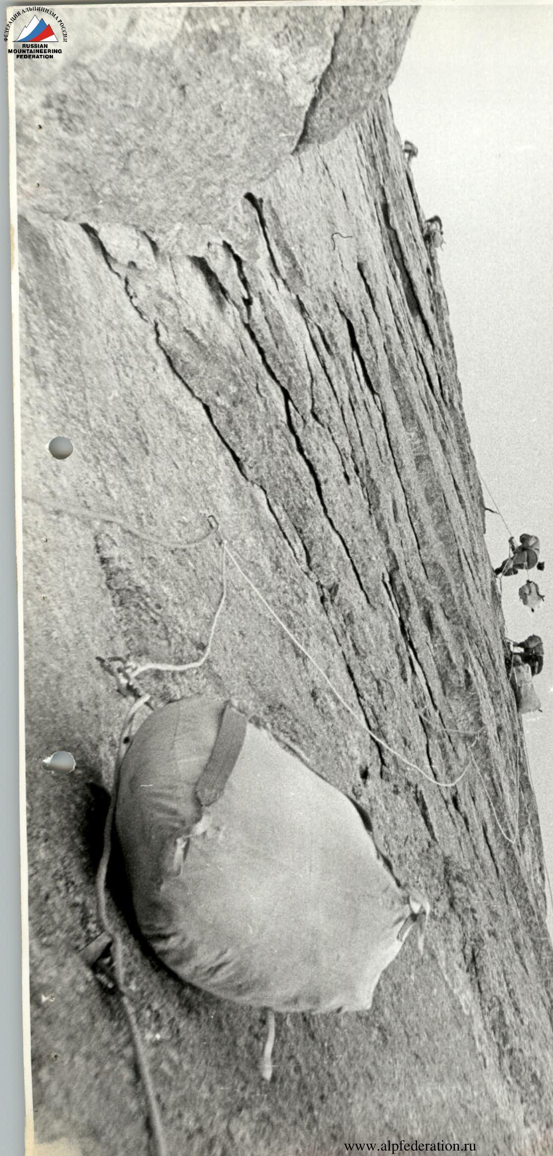
Overnights: I–II in hammocks; III–IV — two in hammocks; V on a carved snow-ice ledge.
-
Leader: Efimov Sergey Borisovich, Master of Sports of International Class
Team members:
- Lebedikhin Aleksey Veniaminovich, Master of Sports of International Class
- Vinogradskiy Evgeniy Mikhaylovich, Master of Sports of International Class
- Bryksin Valeriy Mikhaylovich, Master of Sports
- Pershin Valeriy Nikolaevich, Master of Sports
- Ostanin Viktor Vasilyevich, Candidate for Master of Sports
- Mamaev Sergey Vladimirovich, Candidate for Master of Sports
- Coach: Efimov S.B.
II. Departure to the route July 26, 1983, summit July 30, 1983, return July 31, 1983.
After the first day of work on the route, it became clear that the climbing time was limited by the water falls starting from 6–7 pm, and besides, the first two-thirds of the route were traversed almost exclusively using ladders — this meant three to three and a half ropes per day of continuous work.
This time, the team's tactics for traversing the route were changed. Usually, the leading rope team worked the entire day; here, each leader was responsible for 1.5–2 ropes and was then replaced.
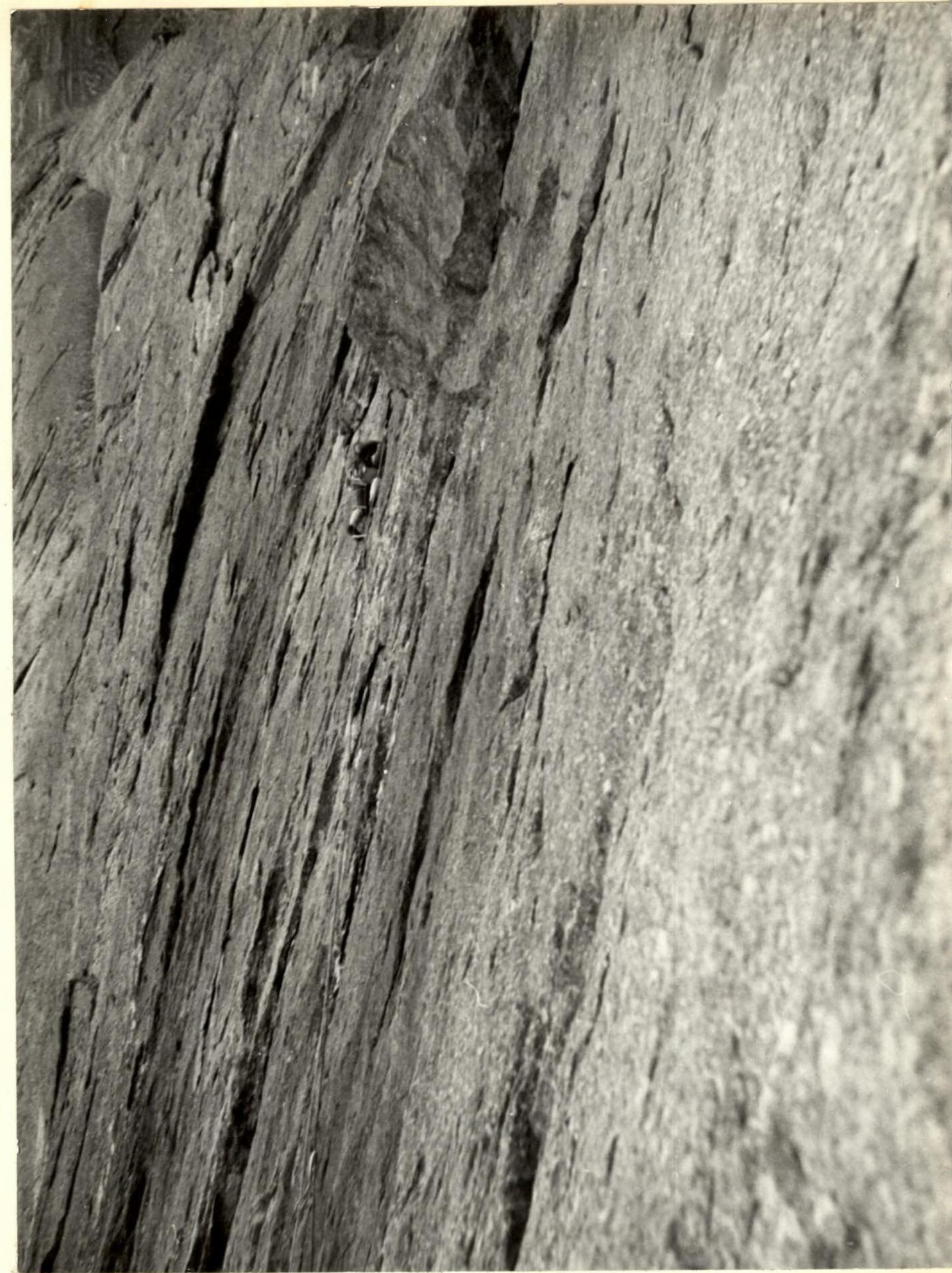
Continuous work with ladders, nuts, and pitons. The nature of the cracks and fissures varied:
- narrow or wide with various constrictions,
- filled with lichen, ice, or monolithic,
- destroyed.
Every step is a nut placement, a decision about which one to use (cam, stopper, eccentric), and continuous monitoring of the direction it works and how the load is transmitted to it.
In ice-filled fissures, it's even harder to predict the behavior of nuts because the load changes over time. Under Pershin, a nut suddenly gets pulled out while he was working on it for several minutes — a fall with hanging on the previous nut. Nothing serious, but a sign to work even more attentively.
The middle section brings additional difficulties — ice-covered internal corners of the couloir, covered with ice, alternate with smooth, sheer walls. In the morning, there's an ice crust; in the evening, water flows. "A huge polyethylene canopy helps during overnight stays."
Here, the following are used:
- nuts,
- pitons,
- "fifis" and ice axe,
- galoshes,
- crampons.
The first climber goes on a double rope and secures the belay (at least three to four junction points). The rest move along the belay. Each has a snack pack in their pocket. In the morning or evening — hot porridge or soup in any spatial conditions.
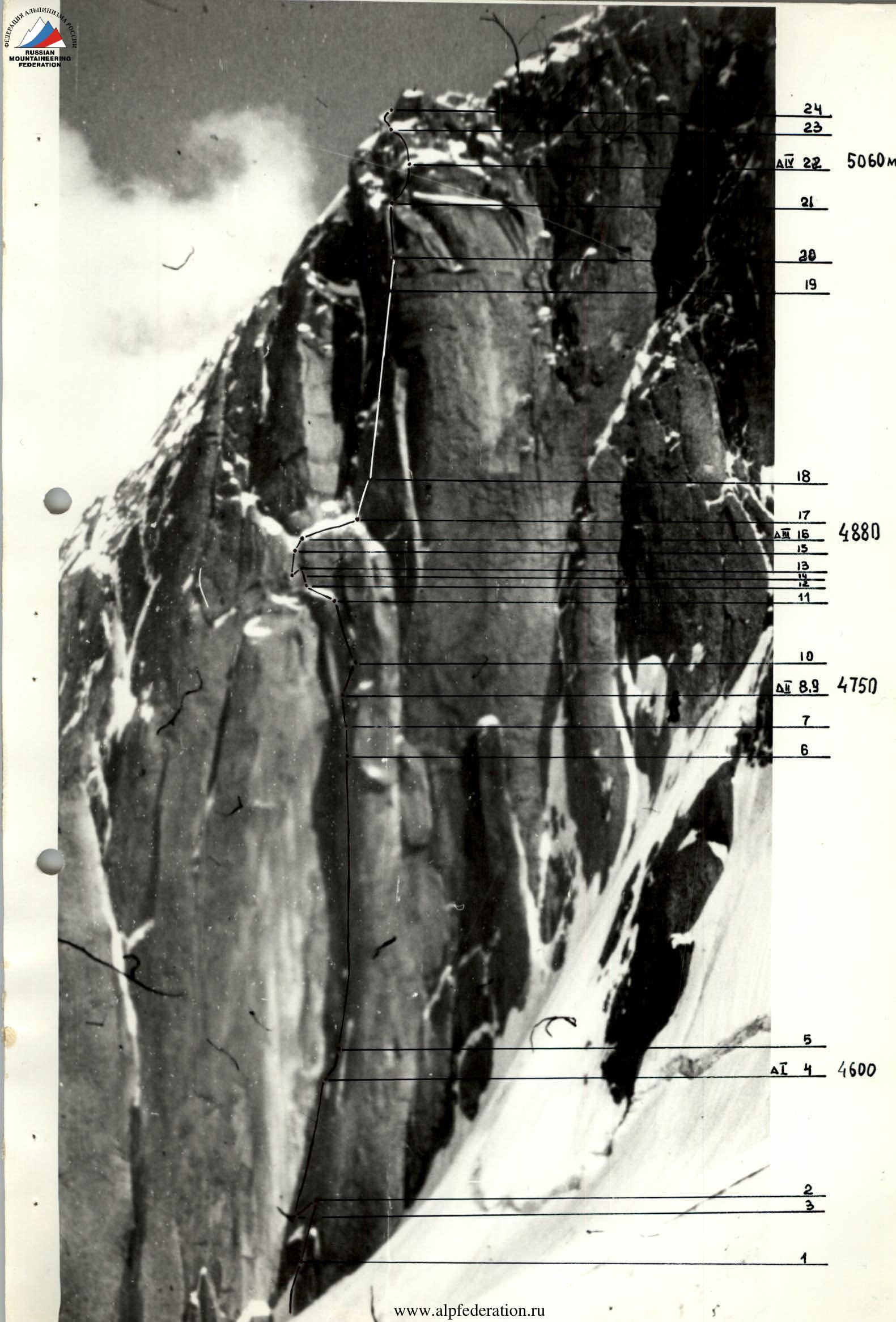
Route Diagram in Symbols
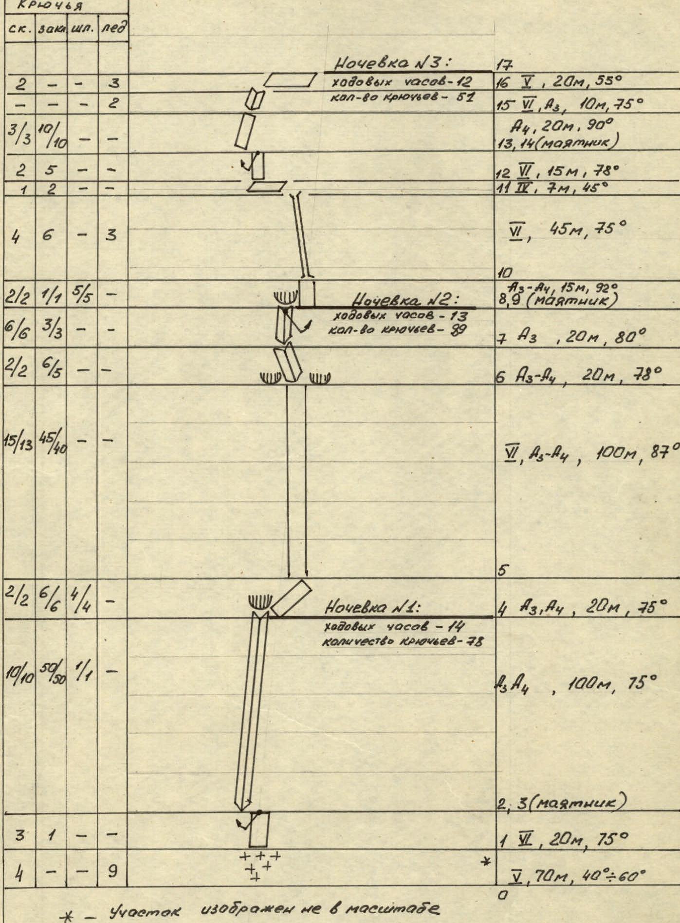
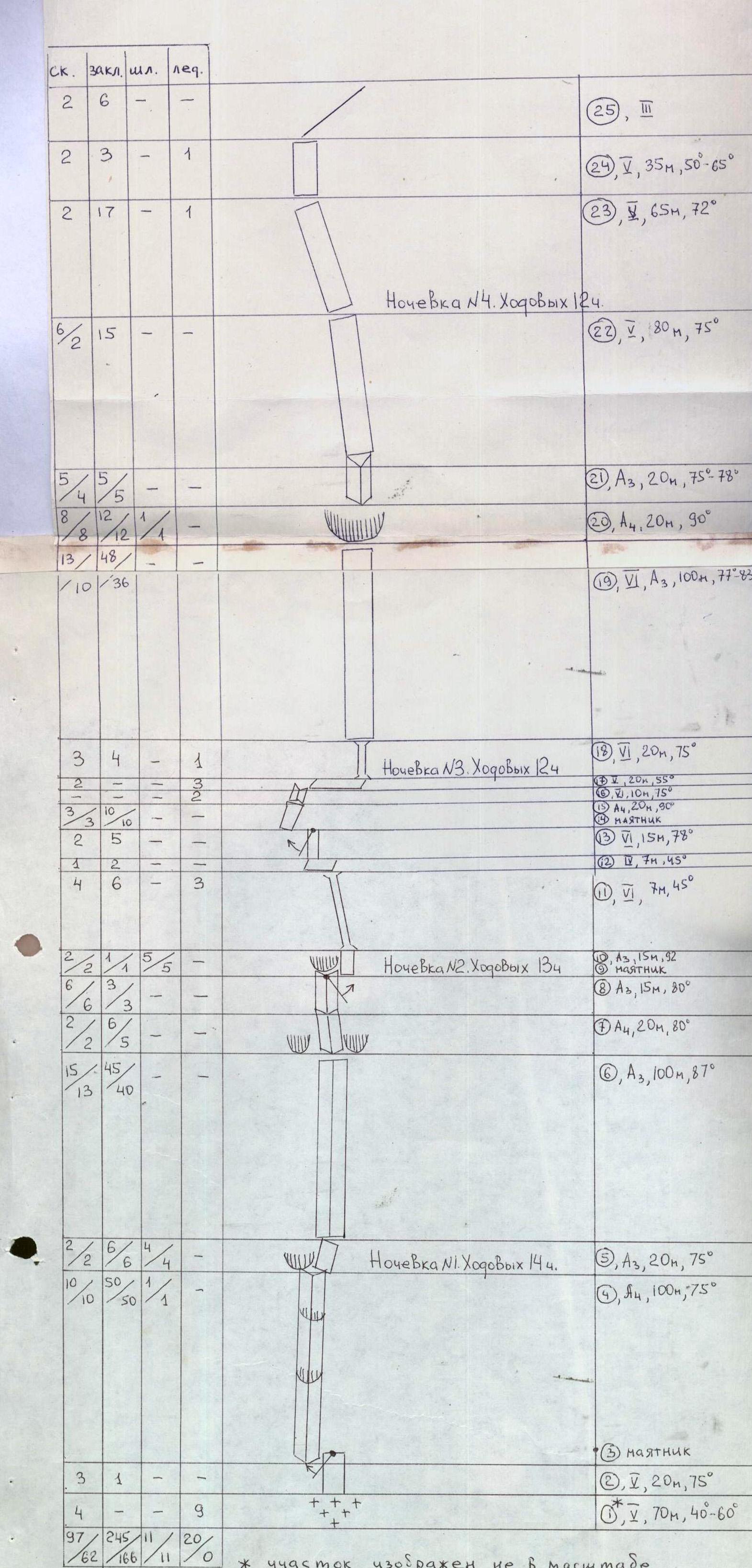
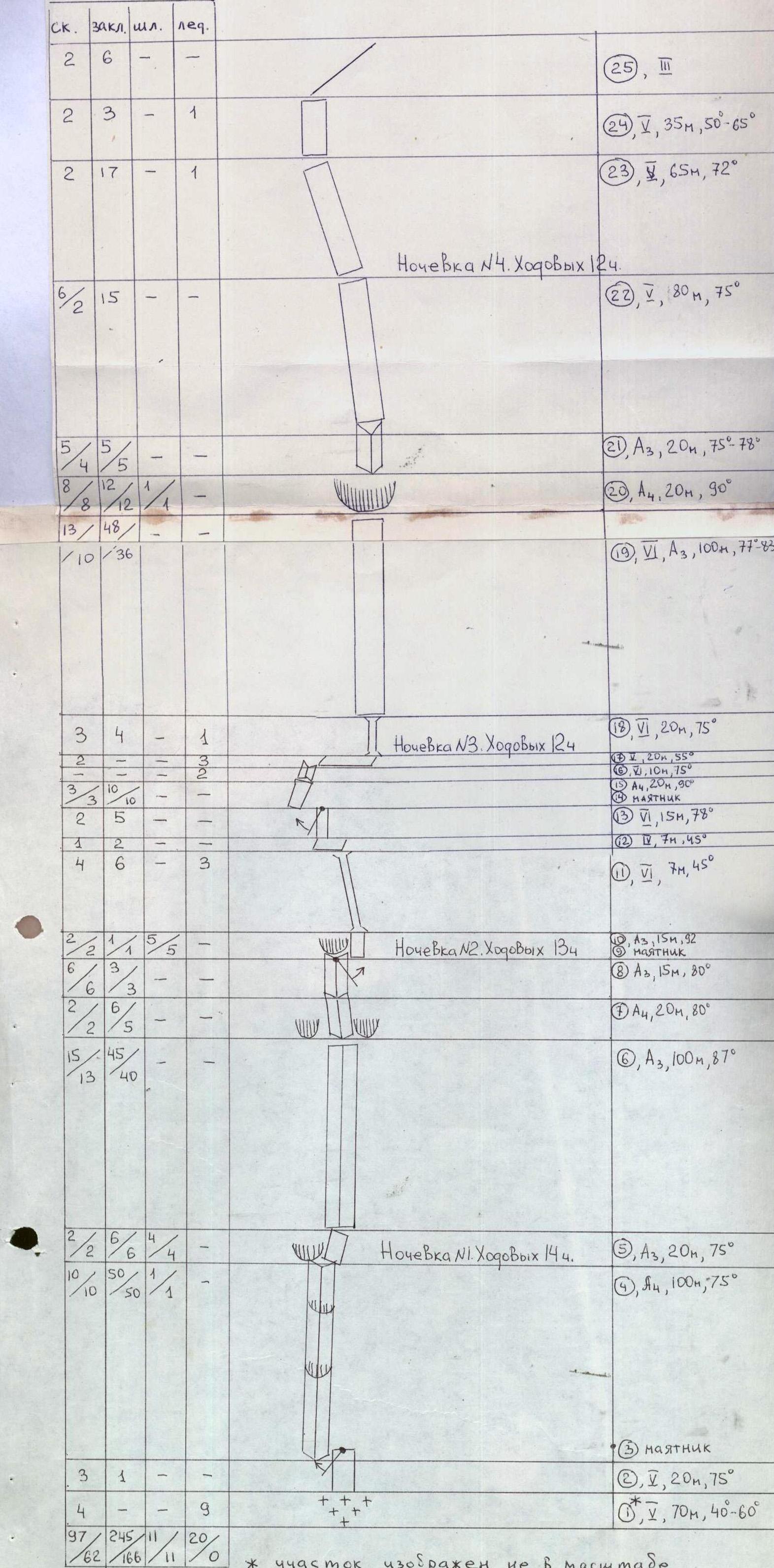 The total number of climbing hours is 57. The total number of pitons is 373
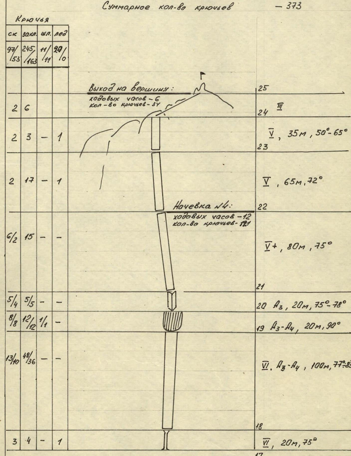
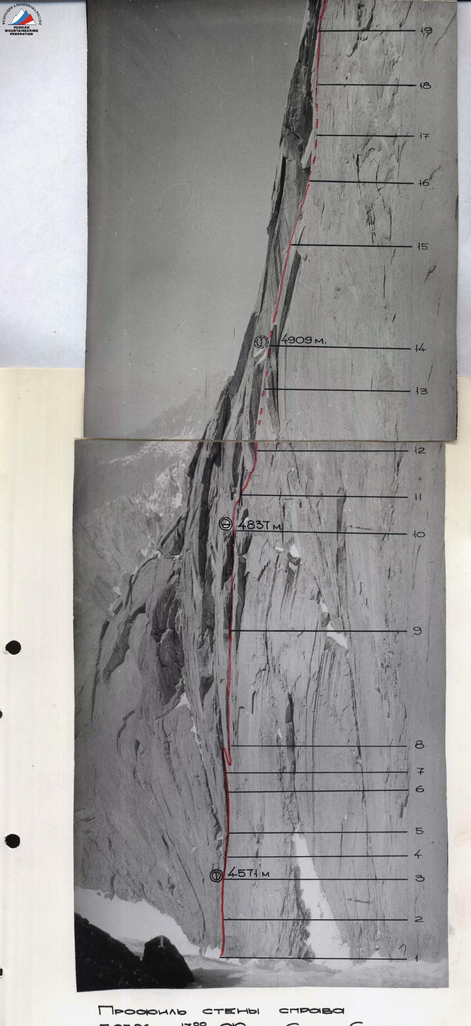
Route Description by Sections
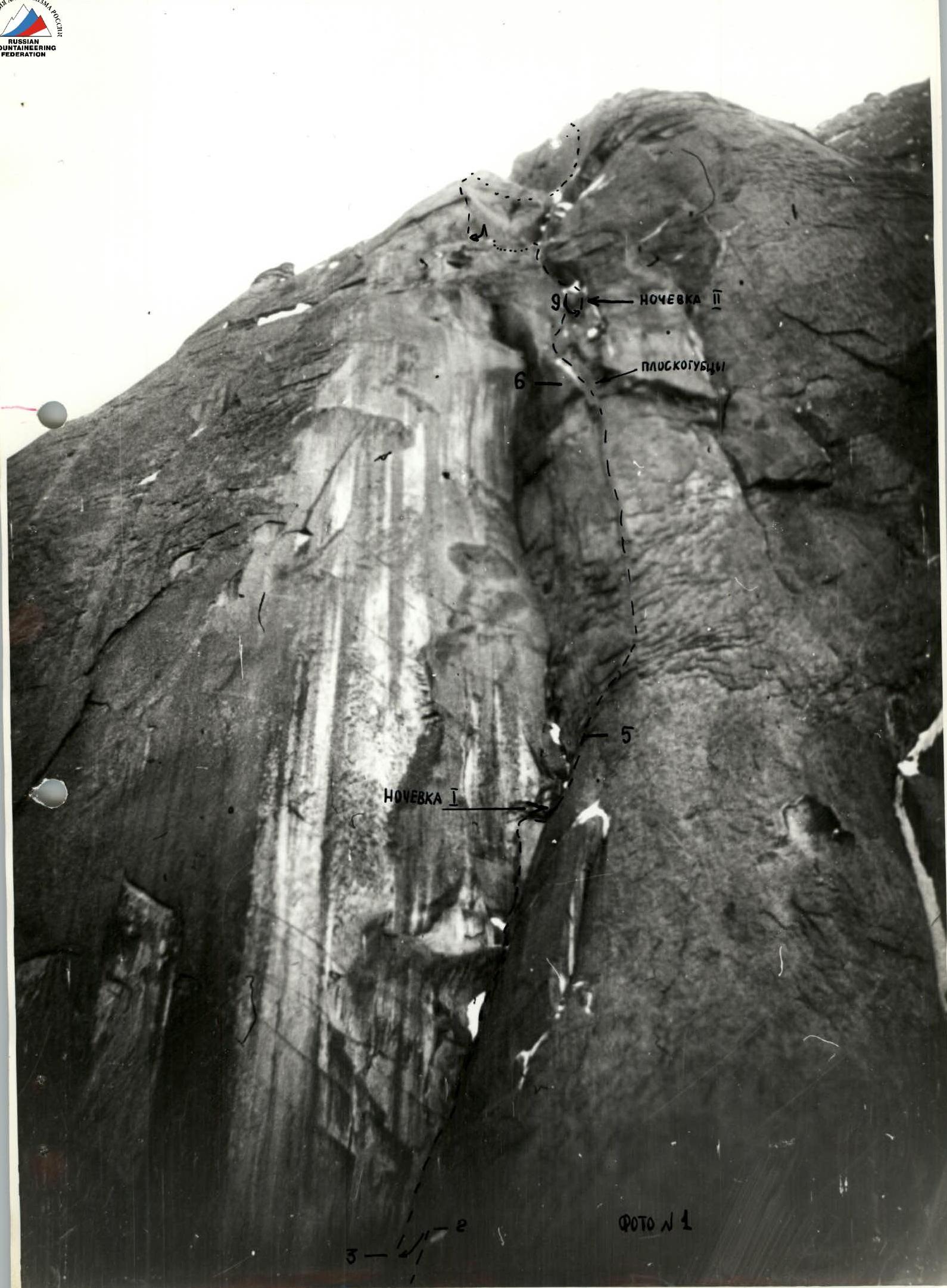
Section 1. The bergschrund is overcome via an ice bridge with the chopping of an inclined trench in the snow cornice of the upper edge of the bergschrund and exit to the ice slope with a steepness of 40–45°. Exit up the slope for 35 m to the base of a rock slab. Organization of a belay point using rock pitons at the base of the rock slab. Then 35 m around the rock slab to the left along the ice slope with a steepness of 55–60° towards a cleft in the rock slab.
Section 2. The cleft in the rock slab is traversed by free climbing in a layback. The cleft ends in a blind crack.
Section 3. A 4 m pendulum from the top of the cleft to the left into an internal corner formed by the junction of a gray slab on the right and an overhanging wall spall on the left.
Section 4. The internal corner is overcome along a fissure at the apex of the corner using artificial technical aids (IT). Relief for free climbing is absent; progression on ladders drifts to the right. Along the way, the following are overcome:
- the first cornice;
- the second cornice.
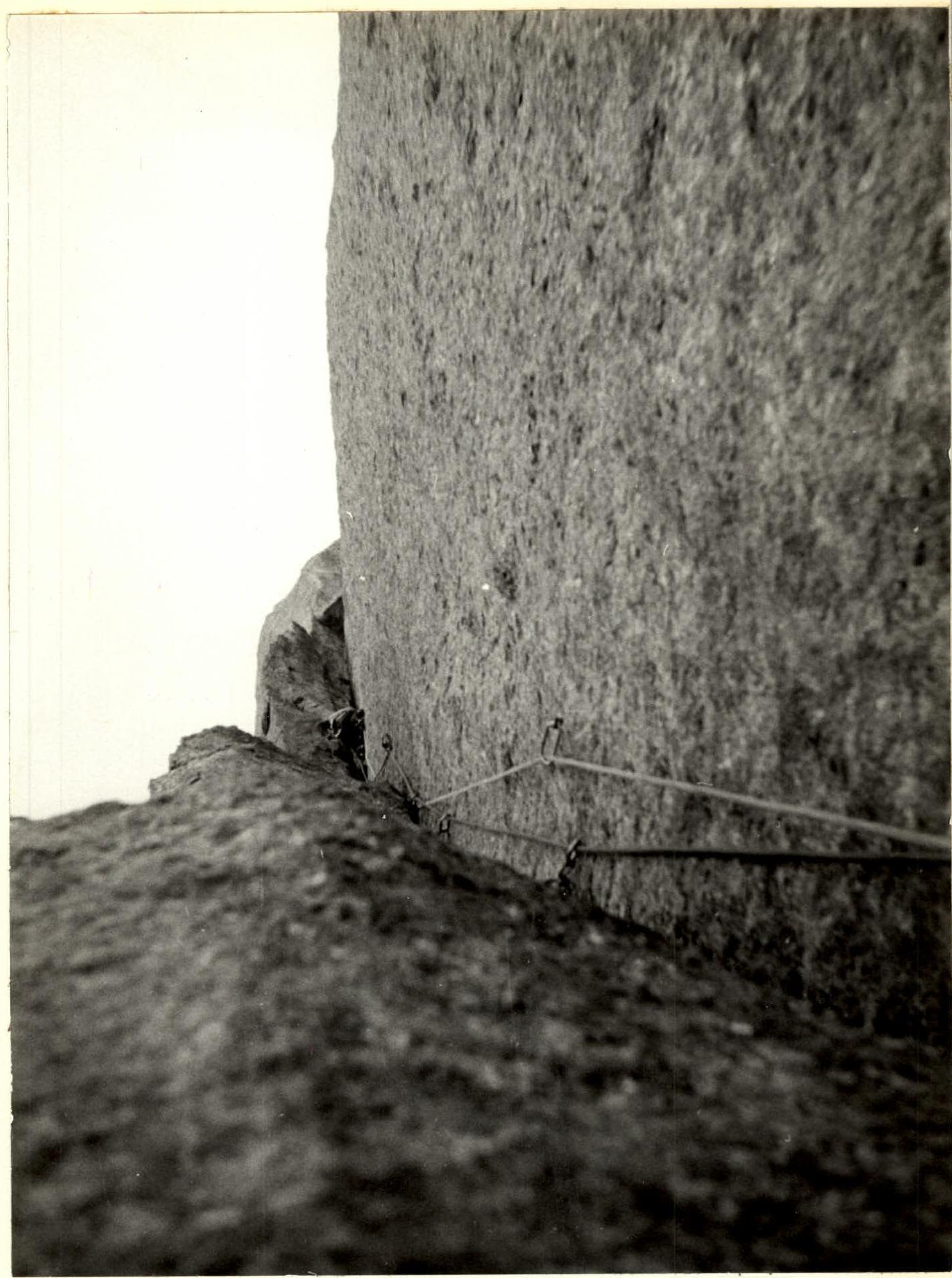
Section 5. A smooth slab is overcome using bolted pitons to the right and upwards, bypassing a cornice, and traversed under the base of a vertical bastion, in the middle of which a crack goes upwards to a rock cornice.
Section 6. Traversed (100 m) using IT and leads into an internal corner between two cornices ("pliers"). The crack is местами filled with ice; in the lower part, thin pitons are used, while in the upper part, medium nuts are used.
The crack leads into an internal corner.
Section 7. The internal corner is filled with ice accretion; traversed using IT.
Section 8. An internal corner with a thin fissure leads under an overhang. After 20 m, the fissure disappears. To the right, a path is visible along an internal corner filled with ice.
Section 9. A 5-meter pendulum to the right allows transition to the internal corner. During the pendulum, a loop made of a cordelette was left behind.
Upward movement becomes impossible — water flows from above, and evening melting has begun. Water also flows along the internal corner.
Movement is possible along the slab to the left of the corner. A narrow, meter-wide strip of the slab remains dry.
Section 10. The slab is traversed using bolted pitons straight up.
Section 11. A series of chimneys filled with ice accretion. In the middle part, the chimney forms a shaft, which is overcome. The upper part of the chimneys is steep, up to 79°. The chimneys lead to a snow ledge.
Section 12. Along the snow-covered ledge, traverse to the left under the base of a wall, behind which lies a large snowfield.
Section 13. A slab under a cornice is traversed by climbing on minor relief. To the left of the cornice on the wall, a crack leads upwards. We approach it with a pendulum (Section 14). At the top, the wall overhangs (Section 15). But further, the path goes into an internal corner leading to a snow ledge. The internal corner is filled with ice (Section 16). Crampons must be worn. On ladders (ice screws), we overcome the first two meters because the overhanging wall pushes out of the corner.
Section 17. A 50° ice ledge. Overnight stay here.
Section 18. Further, the path goes along the bastion. Exit to it via an ice-filled chimney with embedded rock spalls. Climbing in crampons.
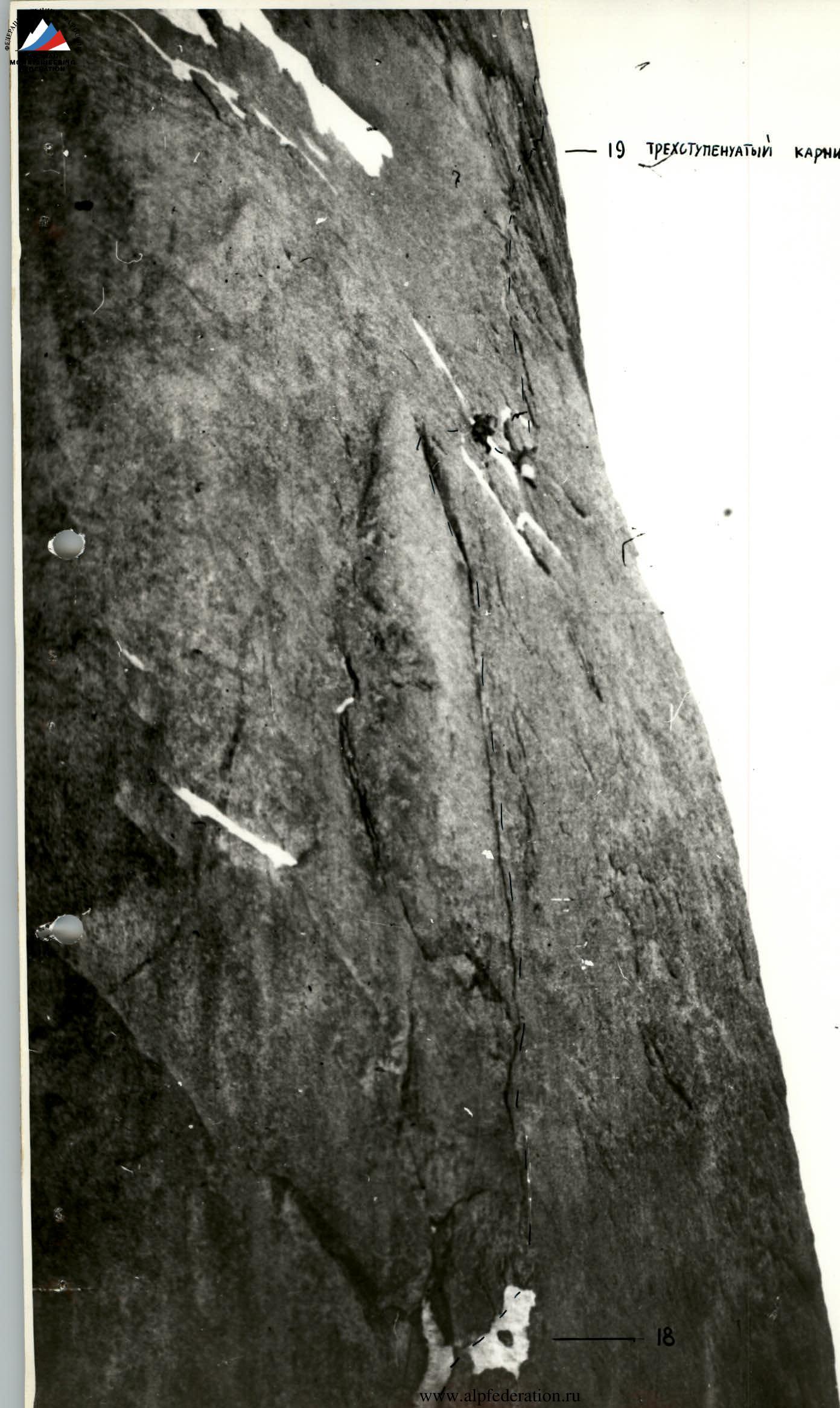
Section 19. Along the bastion, a crack passes, which gets lost in a huge three-tiered cornice (Section 20). Each tier has a projection of up to 1 m. The cornice rock is friable. Thin, petal-shaped pitons are used here. After the cornice, an internal corner with ice accretion begins, but movement is possible without crampons along the right edge with IT (Section 21). Further, from it to the right onto a wall, the steepness of which finally begins to decrease.
Section 22. A wall with smooth slabs. Last overnight stay on a snow ledge. Further, three ropes to the ridge. Rocks are filled with ice (Section 23). The last rope (Section 24) along a slope with ice accretion. Brittle, hard ice.
Section 25. A ridge with rock pinnacles and smooth 5-meter walls leads to the summit.
Descent along the western edge to a saddle, then along a snowy slope into the Ak-Su gorge.
-6
-4
LEAVING THE FIRST Overnight Stay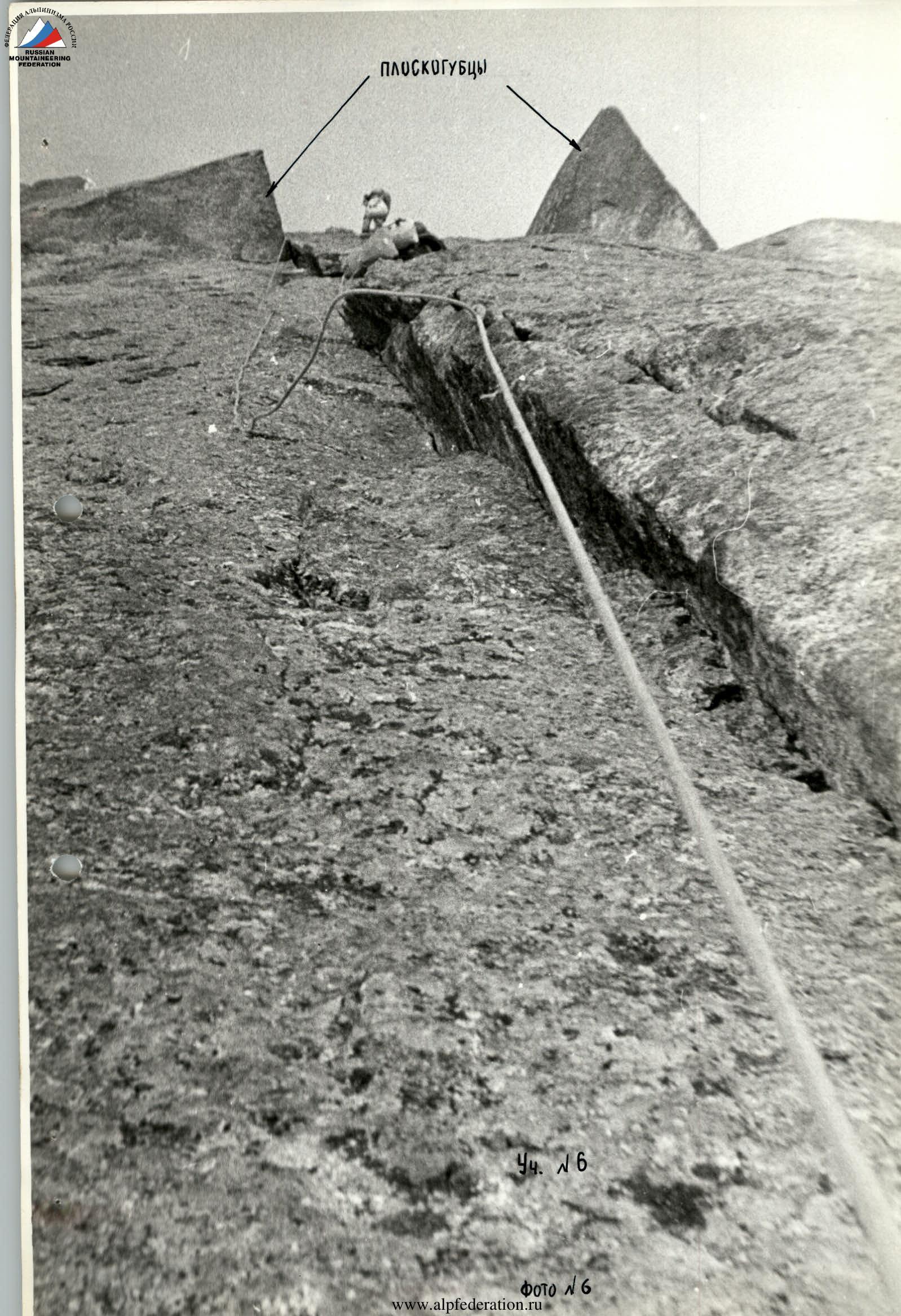
 ∞
∞
General Photo of the Summit
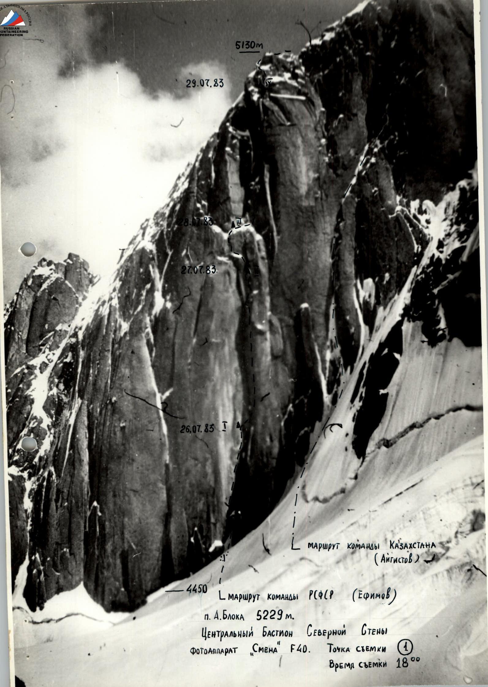
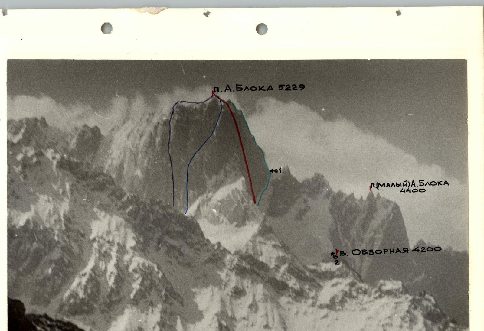
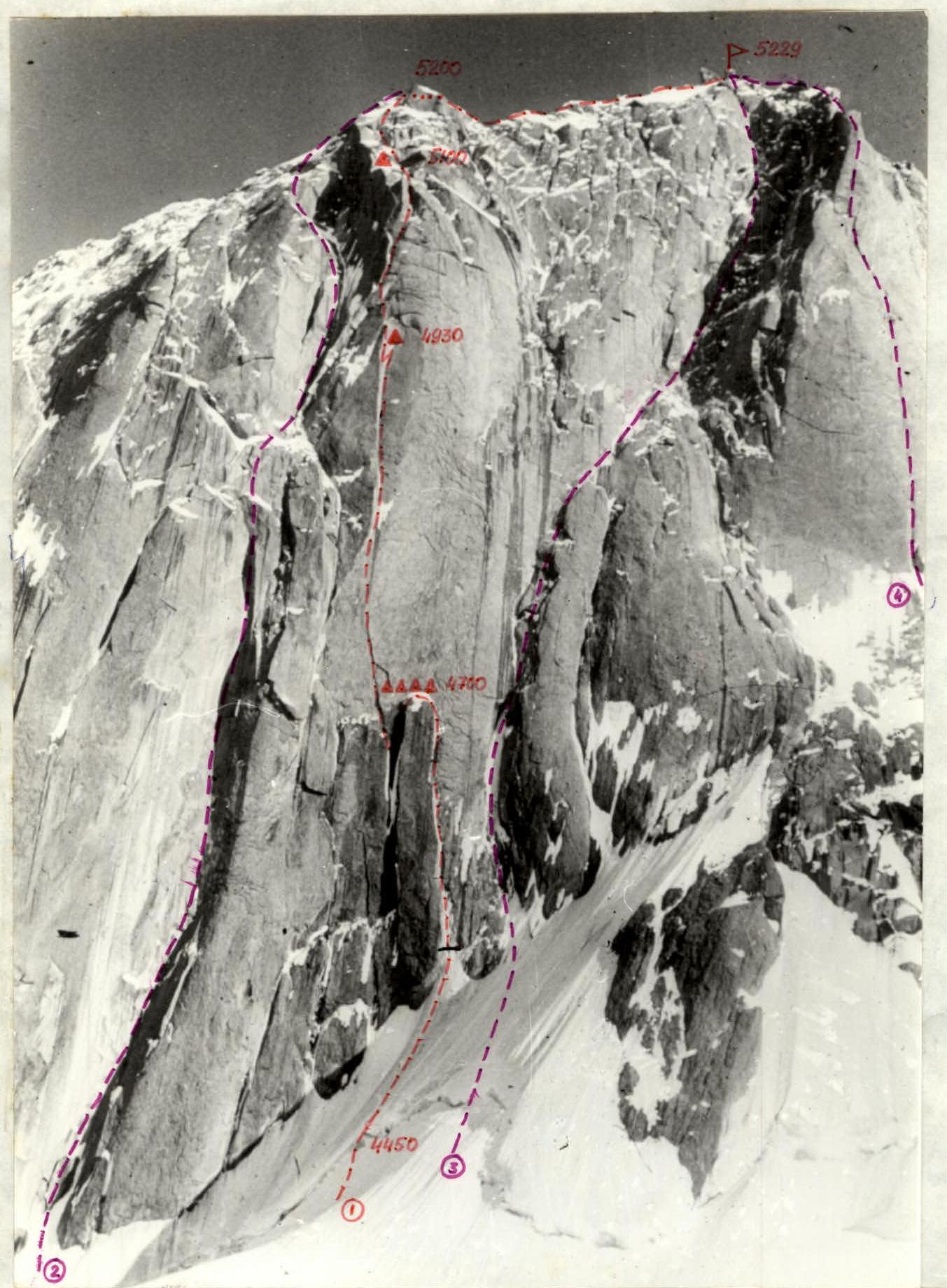
1 — route of the Moscow team, 1986 2 — Efimov's route, 1st place in the 1983 USSR Championship 3 — Aygistov's route, 4th place in the 1983 USSR Championship 4 — Klineckiy's route, 1986
TC No. 1; taken July 27, 1986; 16:30; "Smena" camera; distance — 600 m; height — 4250 m