AkSu (N), center of the North face, 6B cat. diff. by B.A. Khandzhapov
1.4.2. Report on the ascent of the team from Irkutsk to the summit of AkSu (N) via the center of the North face (Ruchkin'96) (3rd ascent)
August 2008 09.09.2008
Khandzhapov Bair
Ascent Passport
- Pamir-Alay, Turkestan Range, Laylyak valley, 5.4.2.
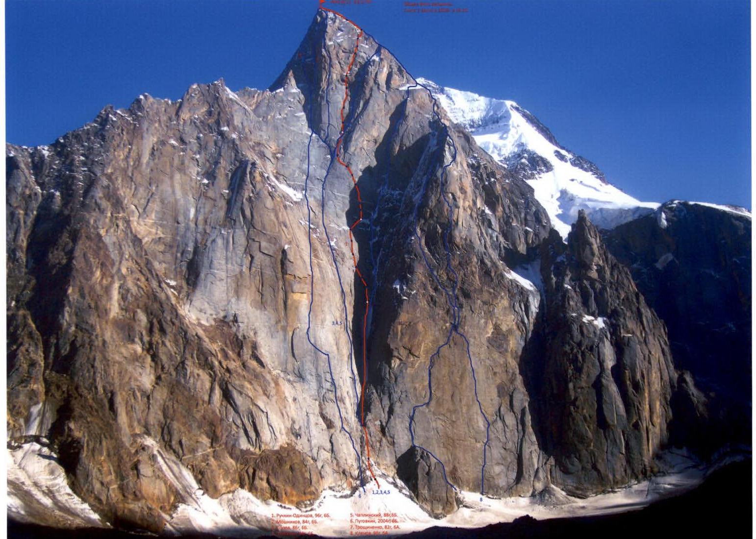
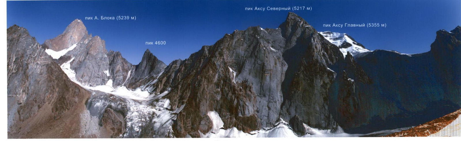
- AkSu (N), 5217 m, center of the North face.
- Proposed 6B cat. diff. (third ascent).
- Route type — combined.
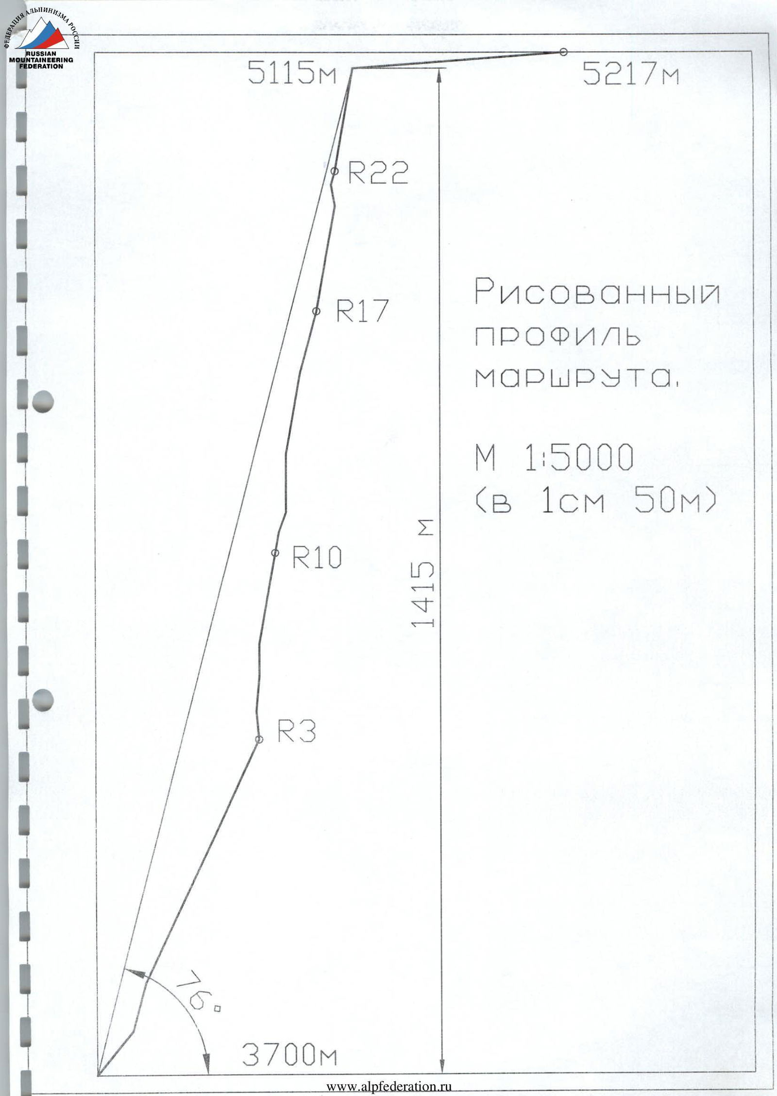
- Height difference — 1517 m, wall section height difference — 1415 m; total length — 1910 m; wall section length — 1560 m; length of sections with VI cat. diff. — 940 m. Average steepness of the main part of the route — 76°.
- Pitons left on the route: Total — 21; including bolted pitons — 7. Pitons used on the route: stationary bolted pitons — 24; including ATO — 17; removable bolted pitons — 0. Total ATO used — 316.
- Team's climbing hours — 86 h, days — 8.
- Team leader: Khandzhapov Bair Aleksandrovich — Master of Sports; Team members: Krivosheev Maxim Leonidovich — Master of Sports; Shaposhnikov Igor Gennadievich — Candidate for Master of Sports.
- Coach: Popov Valery Nikolaevich — Master of Sports.
- Approach to the route: 4:00, August 7, 2008. Summit ascent: 15:10, August 14, 2008. Return to Base Camp: 20:00, August 15, 2008.
General photo of the summit taken on August 5, 2008 at 18:30

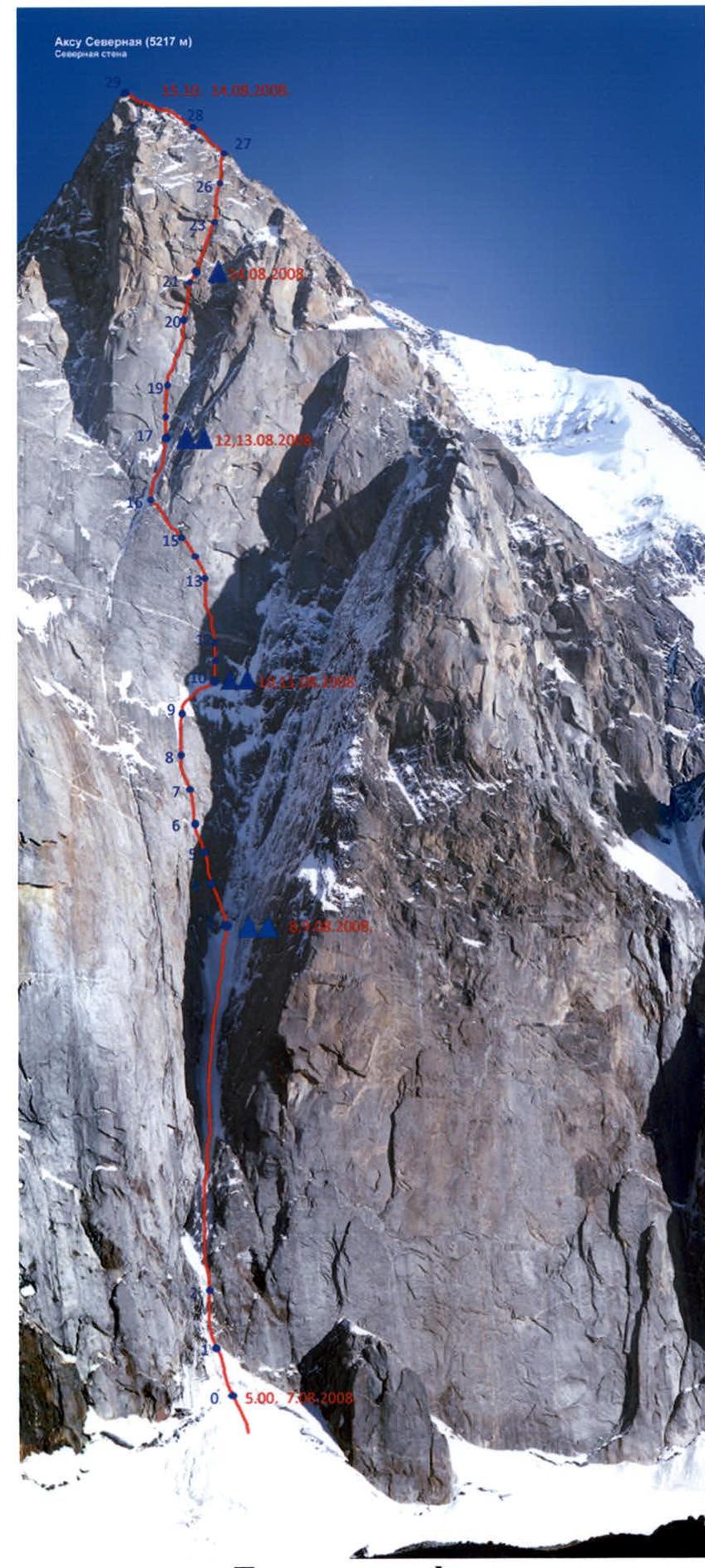
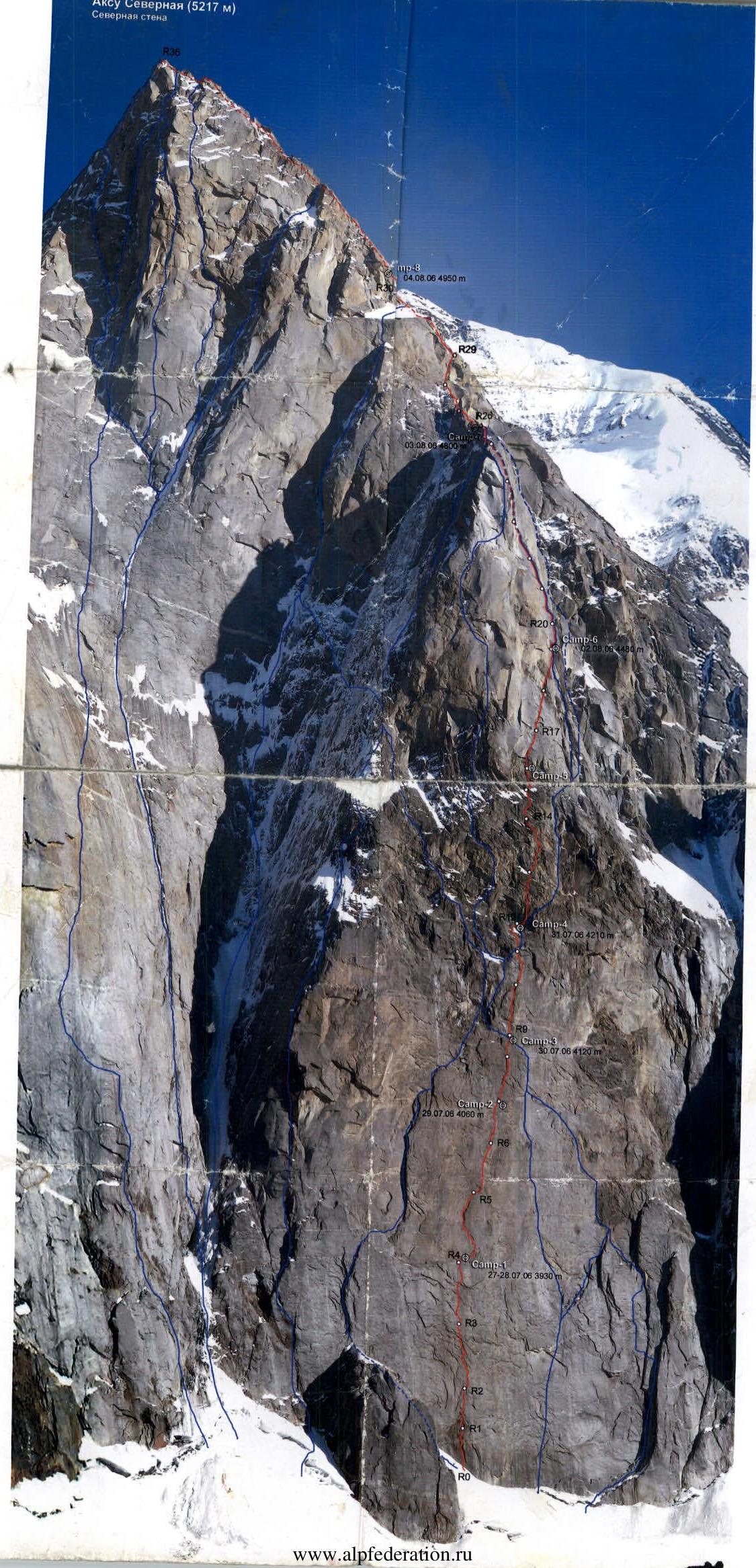
Photo of the wall profile from the left. Taken on July 26, 2006 from the overnight stay below Blok Peak.

Photopanorama of the wall. Taken on August 7, 2008, 13:57, on the north summit of Iskander.
Ascent Graph
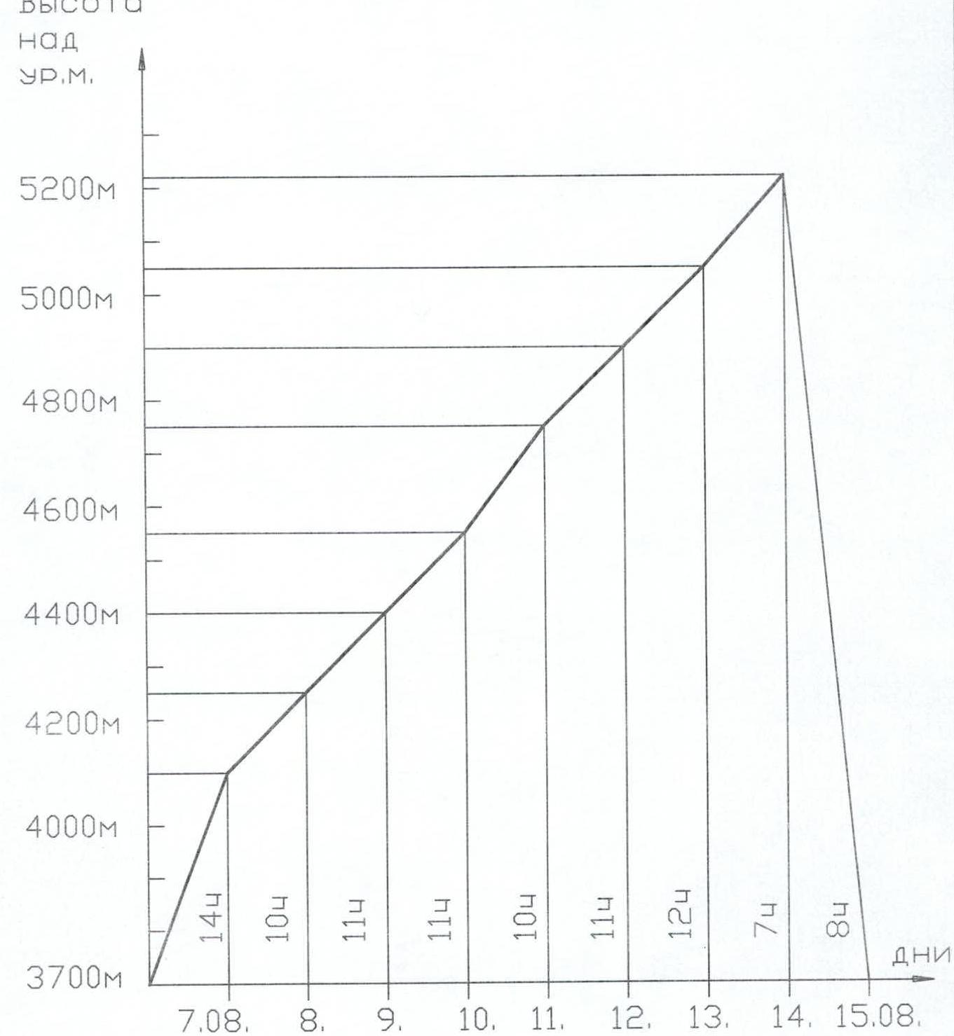
Throughout the entire ascent, except for the descent, the weather was good: cloudy, no precipitation.
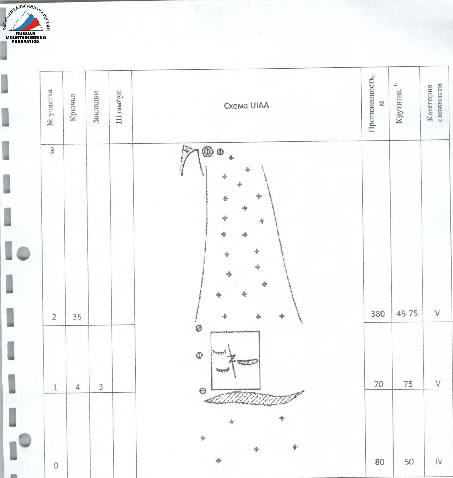
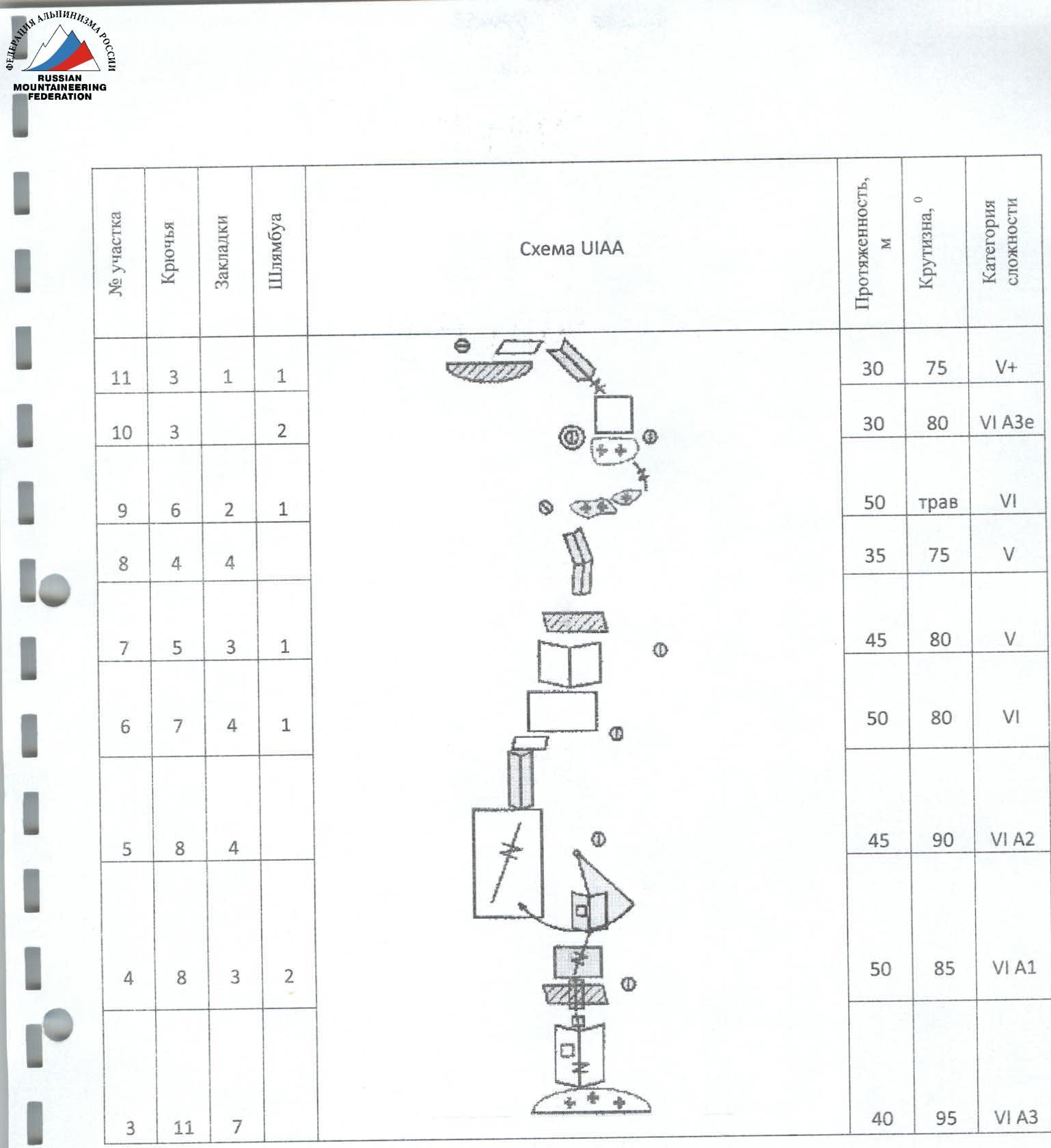
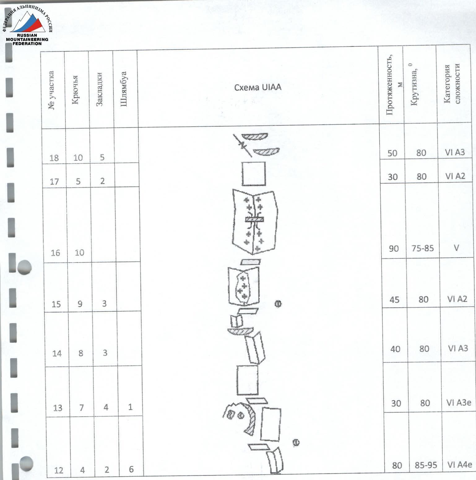
Route Description by Sections
- Section R0–R1. From the bergschrund along the ice slope 80 m.
- Section R1–R2. "Baраньи лбы" (rocky outcrops) 70 m.
- Section R2–R3. Couloir 380 m. Ice, steeper as you go up. Camp 1 was set up at the top of the ice.
- Section R3–R4. Inner corner with a small cornise in the middle part. Exit left to a ledge, stance on bolted pitons.
- Section R4–R5. Wall with cracks, moving left upwards. Ice on the ledges.
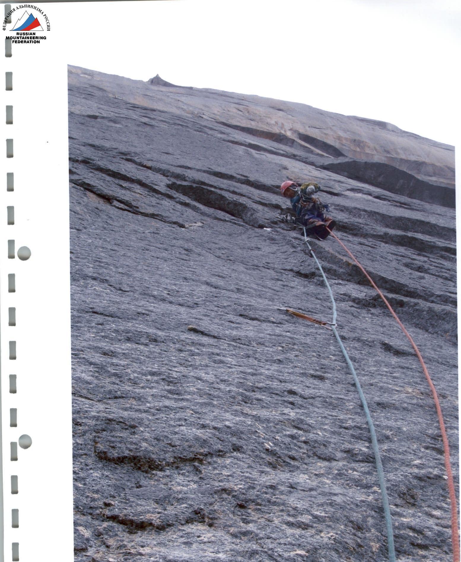
- Section R5–R6. Steep slabs with cracks. Moving straight up.
- Section R6–R7. Slabs with cracks.
- Sections R7–R8–R9. Inner corner about 80 m. Good terrain. On section R8–R9, a pendulum to the right inner corner.
- Section R9–R10. Traverse right along complex slabs covered with ice, belaying is difficult, then along a small ledge right and up. Camp 2 was set up at the end of the traverse. Control cairn on a bolted piton.
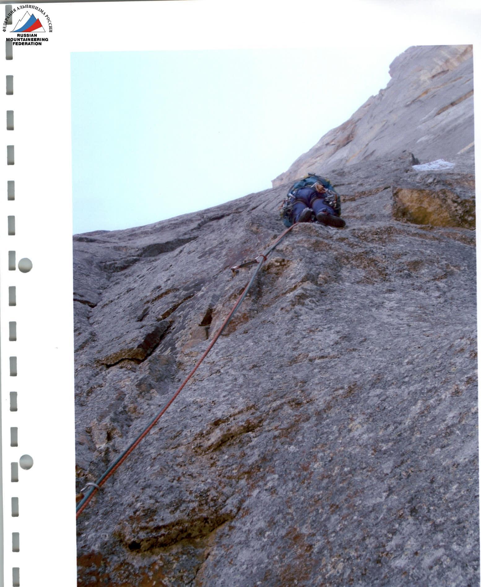
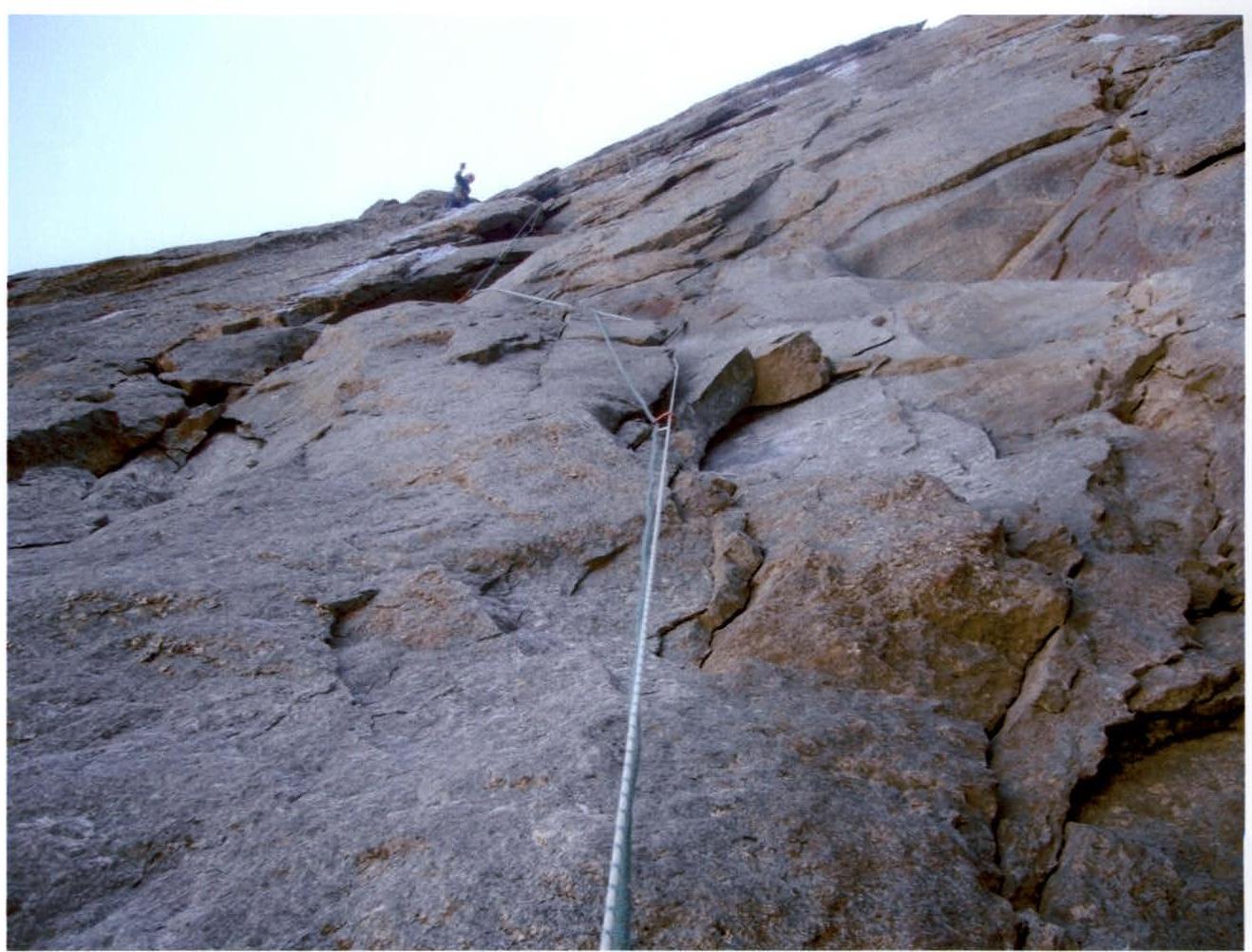
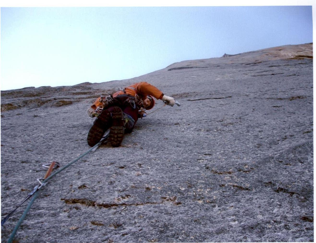
- Section R10–R11. Monolithic slab with poor terrain. Moving straight up.
- Section R11–R12. Inner corner 30 m. Exit left to a small ledge.
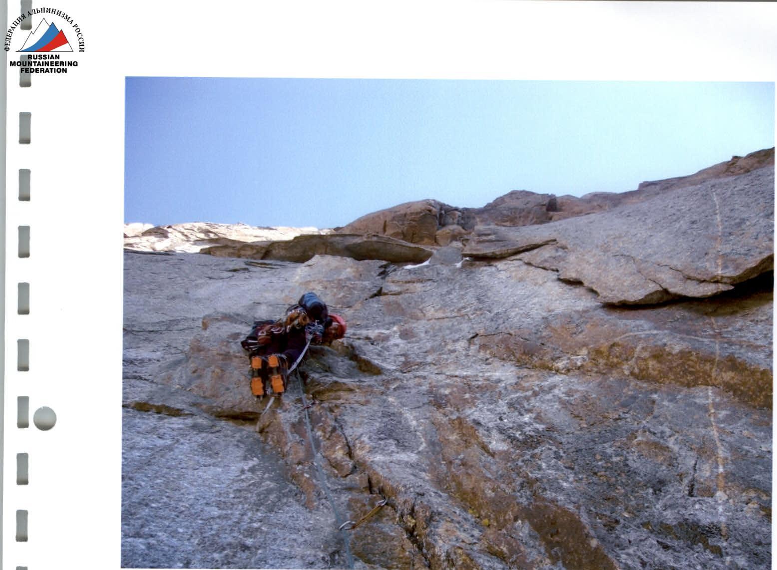
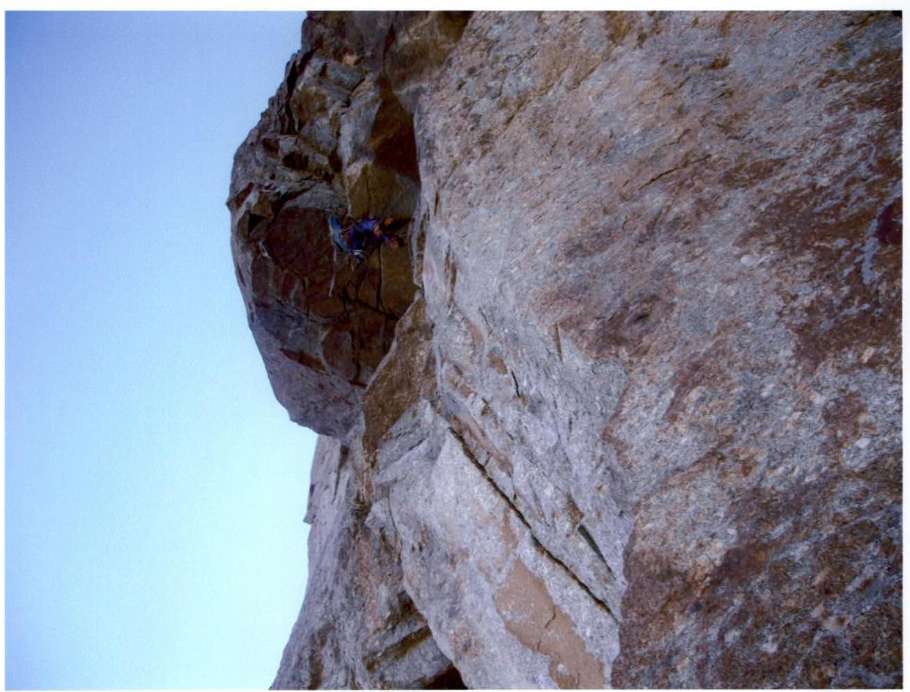
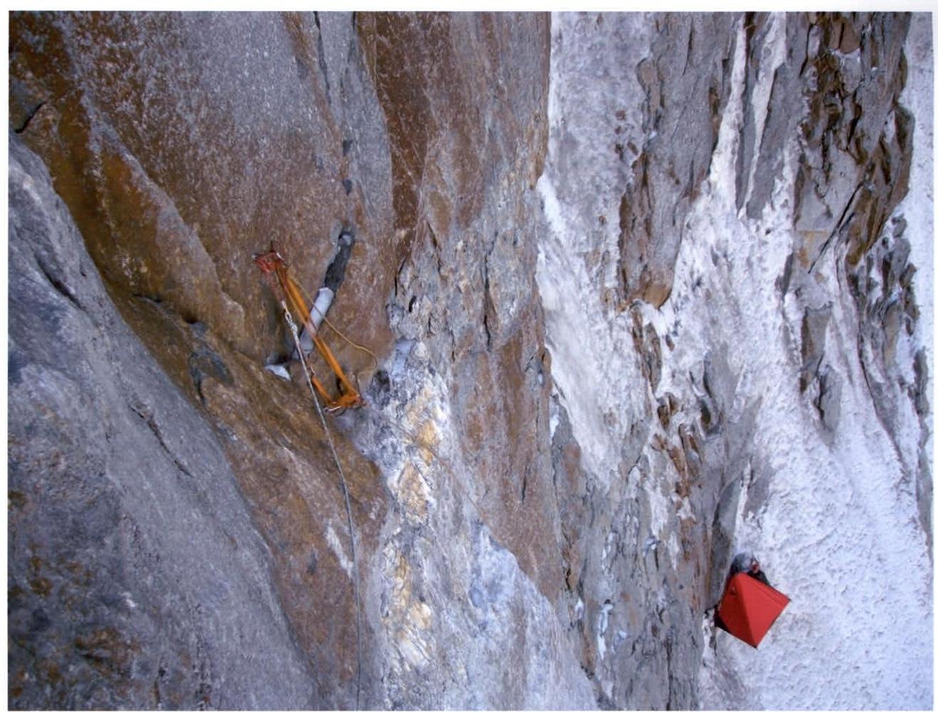
- Section R12–R13. One of the most difficult sections. Monolithic vertical slab, terrain is practically absent, ATO, skyhooks. There are several bolted pitons. Moving towards large "outgrowths".
- Section R13–R14. Very difficult section. In the first half, climbing on "outgrowths". Live blocks! Belaying is difficult. In the second half, a steep slab, skyhooks at the top.
- Section R14–R15. Non-obvious inclined inner corner to the left.
- Section R15–R16. Inclined corner to the left, leading to Chaplinsky's route.
- Section R16–R17. Ice couloir (Chaplinsky's route). Camp 3 was set up at the end of the couloir.
- Section R17–R18. Deviation left from Chaplinsky's route. Wall with cracks.
- Section R18–R19. Initially, moving up and left along live slabs, then into an inner corner with ice.
- Section R19–R20. Continuation of the corner, approach to a large cornise. Mixed terrain.
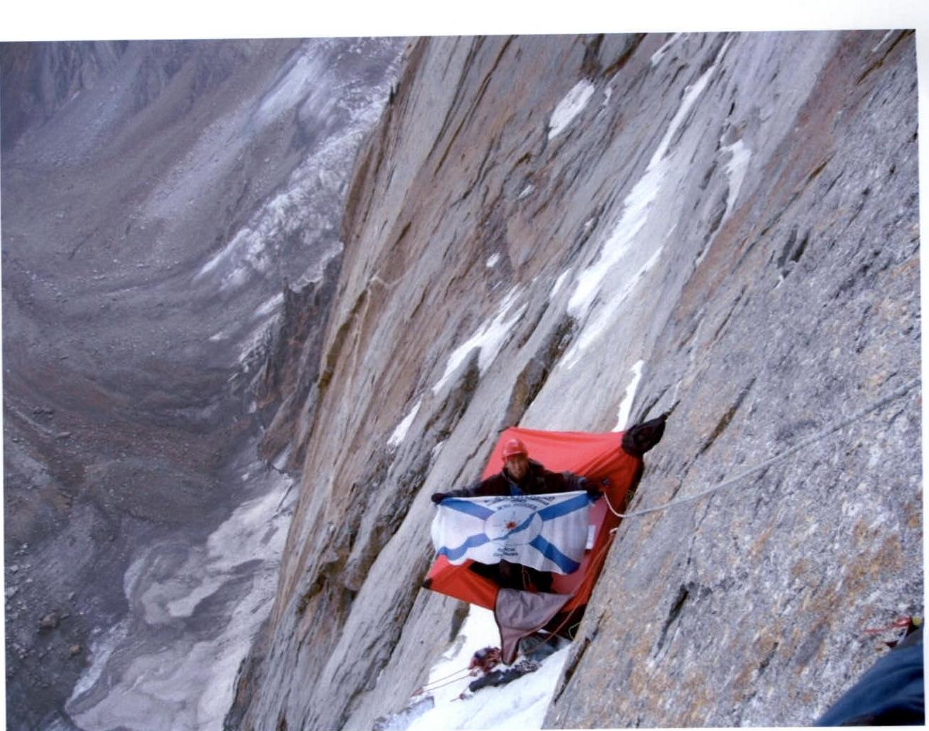
- Section R20–R21. The most difficult section. Large cornise (protrusion about 3 m). We climbed straight through the cornise along the most prominent part. Control cairn on a piton hammered into the ceiling. After the cornise, moving right and up through an overhanging crack.
- Section R21–R22. Ice couloir. Camp 4 was set up at the end of the couloir.
- Section R22–R23. Inner corner with icy rocks leading to a ledge.
- Section R23–R24. Steep wall with destroyed slabs.
- Section R24–R25. Cornise with an overhanging chimney.
- Section R25–R26. Monolithic slab with good friction. Free climbing.
- Section R26–R27. Inclined smooth ledge with an ice "board" leading through complex rocks to the ridge.
- Section R27–R28. Monolithic "gendarme" on the ridge is bypassed on the right. 5 m rappel.
- Section R28–R29. Climbing along the ridge of medium complexity with alternating and simultaneous belaying. Exit to the summit.
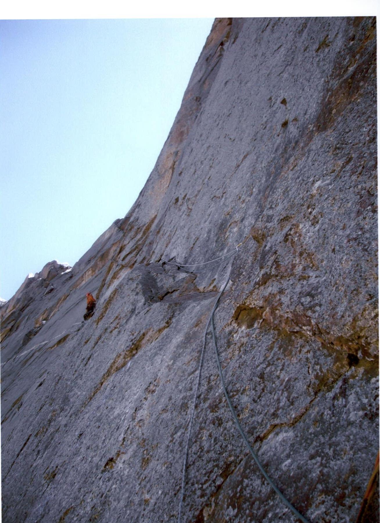
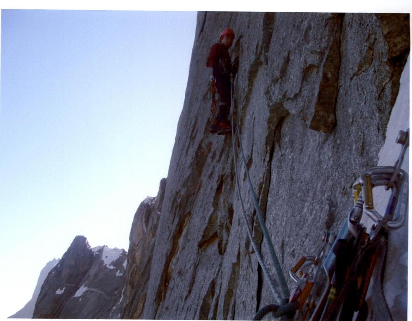
Technical Photo
No old control cairns were found on the route. We left two control cairns, including one on the ceiling of the large cornise, which previous teams bypassed on the left.
We append a note from the Irkutsk-2 team from the summit.
August 5, 2008
A team of two climbers
Veretenko L. (800) and Bashkircev E. (Djin) — Irkutsk completed an ascent to peak AkSu N via Ruchkin's route 6B. 2nd ascent. Everything is great! Good luck to everyone on the descent.
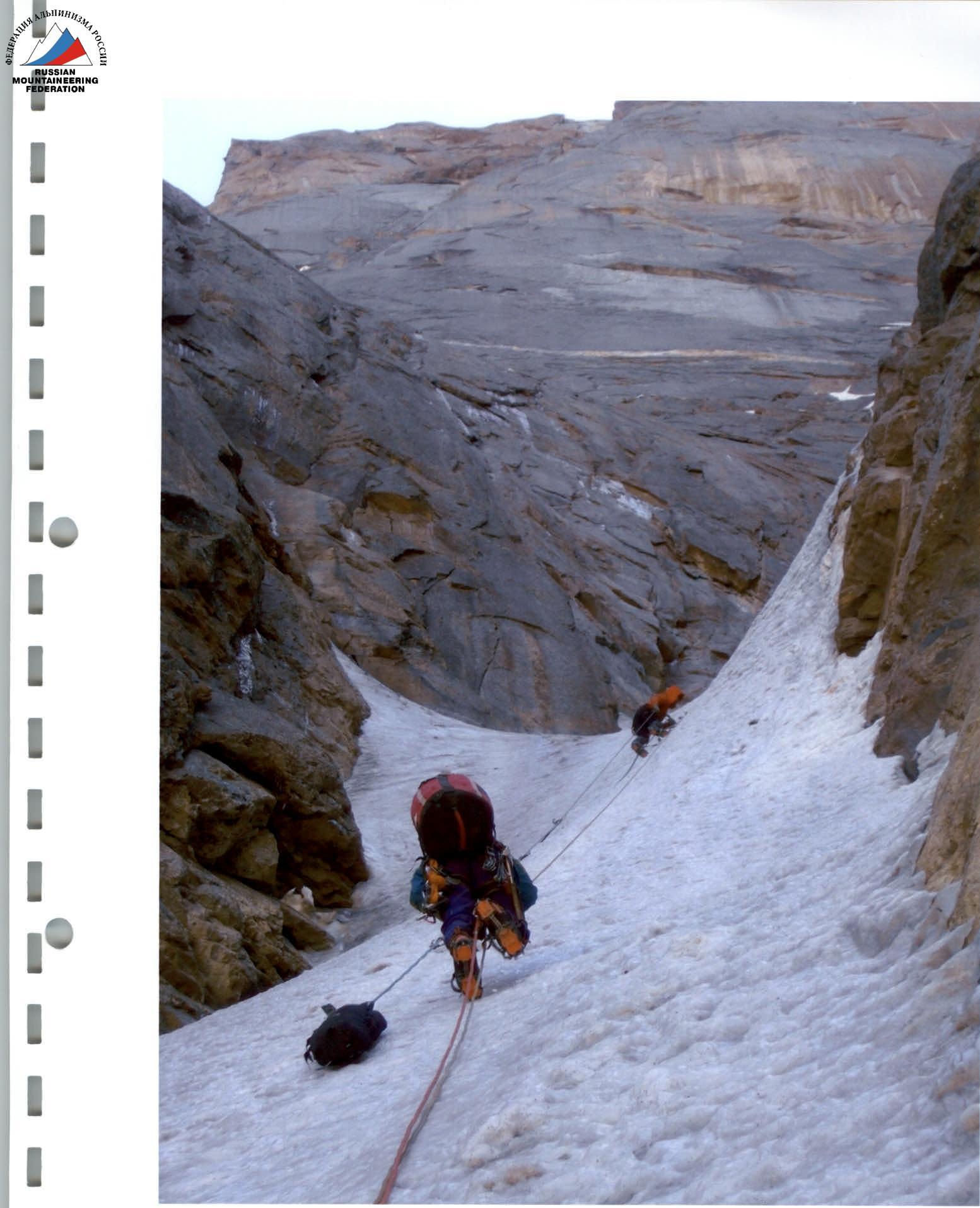
R2–R3. Load transportation.
R5–R6. Steep slabs.

R10–R11. Monolithic slab with poor terrain.
R12–R13. One of the "crux" sections. Skyhooks and "blind" cracks.
R14–R15. Non-obvious inclined inner corner to the left.
R19–R20. Approach to the large cornise.
R20–R21. Crux of the route — large cornise (protrusion about 3 m). The first team members climbed the cornise directly. Control cairn on a piton hammered into the ceiling.
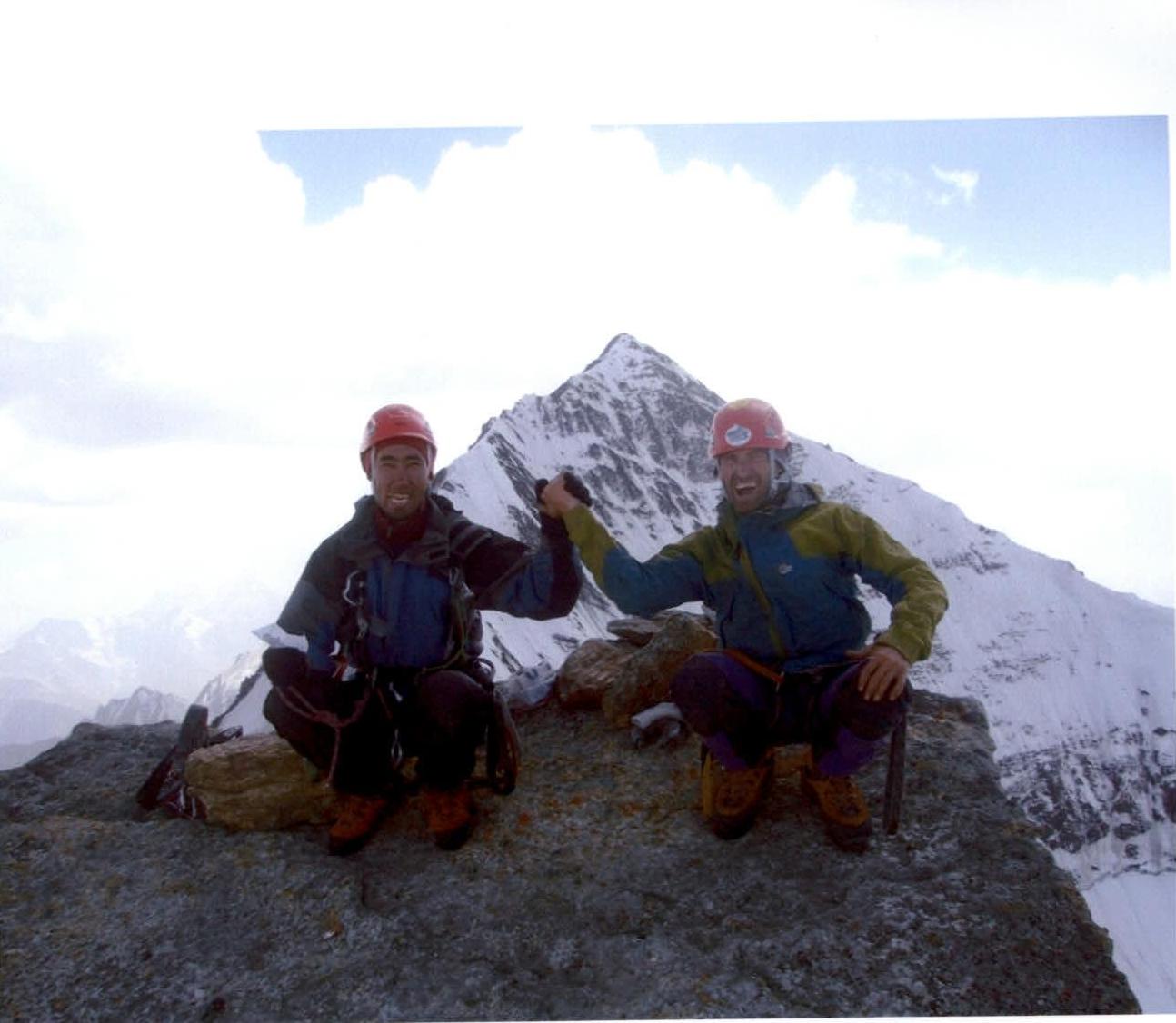
R29. Summit. AkSu Main in the background.
R10. Overnight stay after the traverse. Control cairn on a bolted piton.
R4–R5. Wall with live slabs.
R3–R4. Rappel. Overnight stay at the boundary between rocks and ice.
R13–R14. Skyhooks after "live" outgrowths.
R18–R19. Wall with live slabs.