Ascent Report
Team from Irkutsk Region to the summit of Akksu North (5217 m) via the center of the bastion on the North face, Mogila route 2006 (second ascent) Pamiro-Alai, July–August 2008
Angarsk
Ascent Passport
- Pamiro-Alai, Lyaylyak gorge area, 5.4.2
- p. Akksu (N), 5217 m, via the center of the bastion on the N face, Mogila route 2006
- Proposed — 6B cat. diff., second ascent
- Route type: combined
- Route elevation gain: 1437 m (3780–5217) Route length: 1848 m. Length of sections: V cat. diff. – 365 m, VI cat. diff. – 855 m. Average slope: main part of the route — 83° entire route — 67°
- Pitons left on the route: total — 50; including bolted pitons — 46 (left by first ascensionists) Pitons used on the route: stationary bolted pitons — 46, including ATO — 24 removable bolted pitons — 10, including ATO — 0 Total artificial points of support (ATO) used — 344
- Team's climbing hours: 120 h, 11 days
- Team leader: Veretennin Denis Anatolyevich — MS Participants: Bashkirtsev Evgeny Petrovich — 1st sports category
- Coach: Kosoturov Sergey Vladimirovich — MS
- Departure to the route: 9:00, July 27, 2006 Summit reached: 14:00, August 5, 2006 Return to Base Camp: 17:00, August 6, 2006
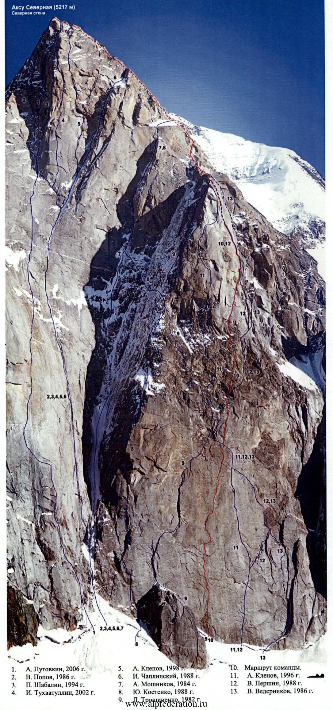
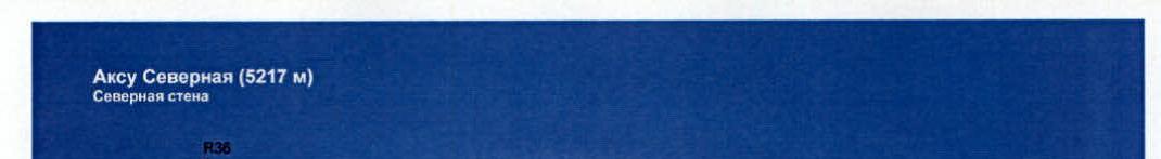
Akksu North (5217 m) North face
- A. Pugovkin, 2006
- V. Popov, 1986
- P. Shabalin, 1994
- I. Tukhvatullin, 2002
- A. Klenov, 1998
- I. Chaplynsky, 1988
- A. Moshnikov, 1984
- Yu. Kostenko, 1988
- Team's route.
- A. Klenov, 1996
- V. Pershin, 1988
- V. Vedernikov, 1986
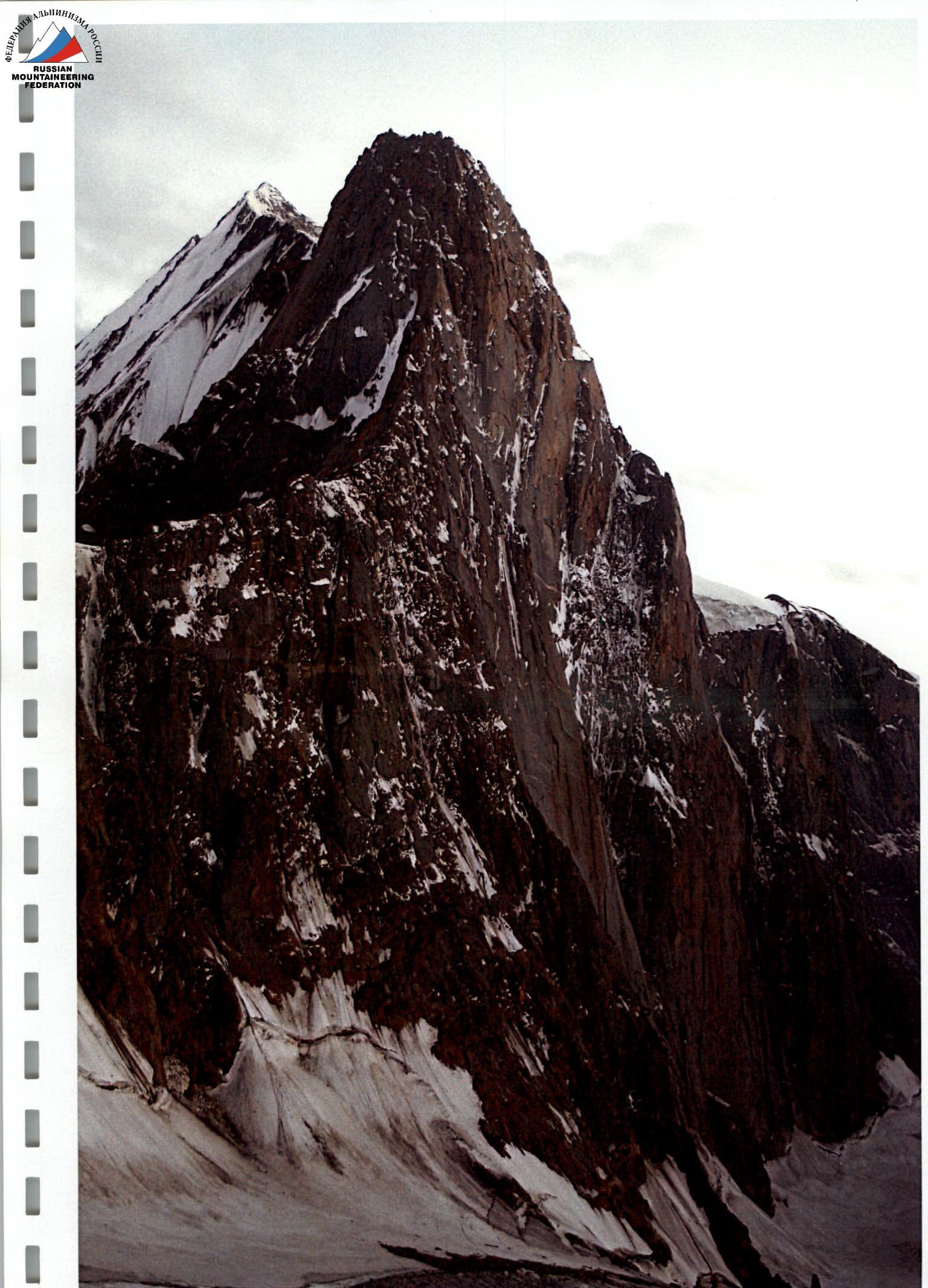
Photo of the face profile taken on July 25, 2006 from the bivouac below Peak Blok
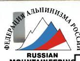
5217 m
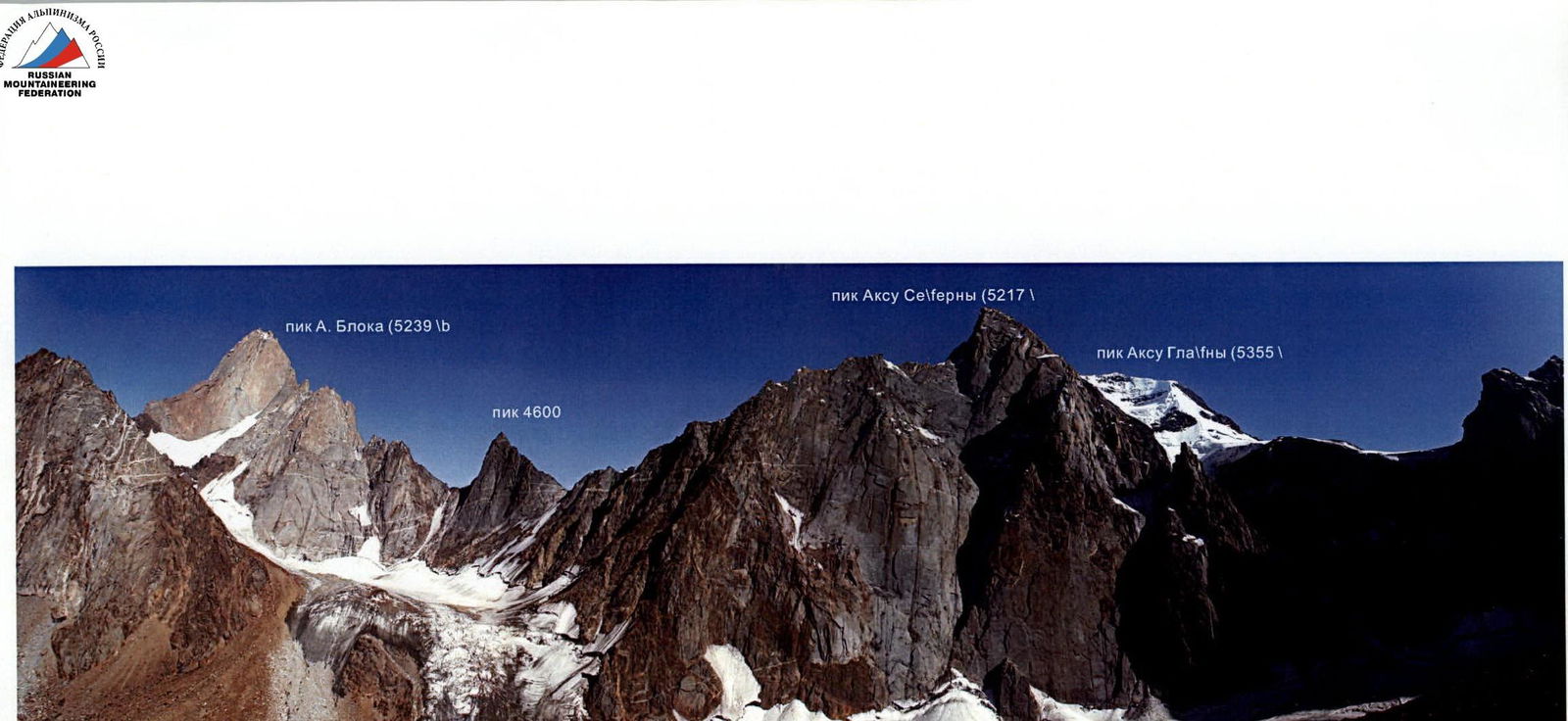
Photo panorama of the area taken on August 13, 2006 from the slope of Iskader peak
Peak A. Blok (5239 m) Peak 4600 Peak Akksu North (5217 m) Peak Akksu Main (5355 m)
Ascent Schedule
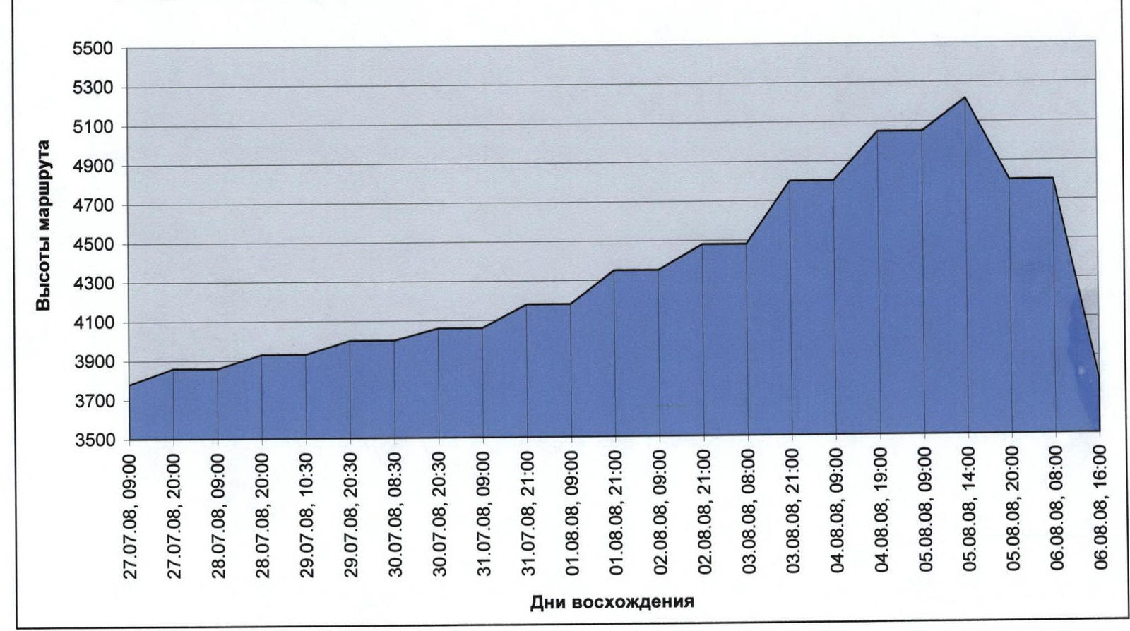
Team Movement Schedule by Sections
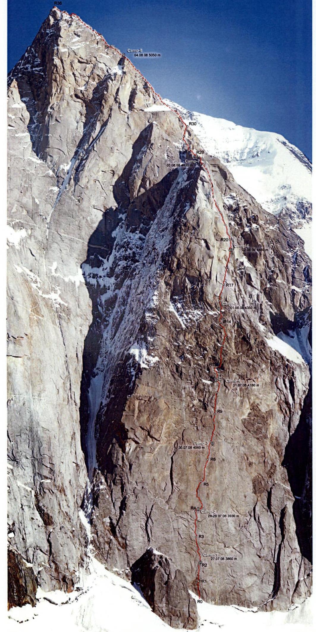
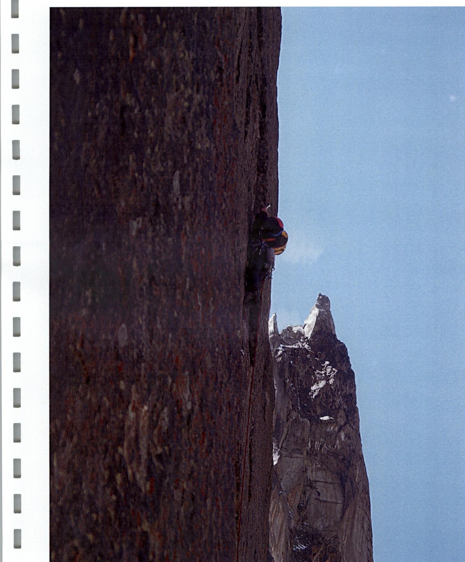
July 27, 2008, 9:00 to 20:00 — section R0–R2 completed, started processing section (R2–R3), overnight stay at Camp 1 on R2. In the afternoon, the lower part of the face is exposed to rockfall. July 28, 2008, 9:00 to 20:00 — section R2–R4 completed, overnight stay at Camp 2 on R4. July 29, 2008, 10:30 to 20:30 — processing section R4–R5 and part of section R5–R6, overnight stay at Camp 2 on R4. July 30, 2008, 8:30 to 20:30 — sections R5–R7 completed, overnight stay at Camp 3 on R7. July 31, 2008, 9:00 to 21:00 — sections R7–R11 completed, overnight stay at Camp 4 on R11. August 1, 2008, 9:00 to 21:00 — sections R11–R15 completed, overnight stay at Camp 5 on R15. August 2, 2008, 9:00 to 21:00 — sections R15–R19 completed, overnight stay at Camp 6 on R19. August 3, 2008, 8:00 to 21:00 — sections R19–R26 completed, overnight stay at Camp 7 on R26. August 4, 2008, 9:00 to 19:00 — sections R26–R32 completed, overnight stay at Camp 8 (reached the ridge of Chaplynsky's route). August 5, 2008, 9:00 to 14:00 — sections R32–R36 completed. At 14:00 — reached the summit. From 15:00 to 20:00 — started descending via the ascent route, overnight stay at Camp 7. August 6, 2006, 8:00 to 16:00 — descended via the ascent route. August 6, 2006, 17:00 — returned to Base Camp.
| rock | nuts | bolts | Route Diagram in UIAA Symbols. Sheet-1 | № | length | cat. diff. | slope |
|---|---|---|---|---|---|---|---|
| 3/1 | 15/10 | 1 | R11 | 30 m | VI, A2 | 85° | |
| 8/7 | 18/12 | 2/1 | R10 | 50 m | VI+, A3 | 90° | |
| 2/1 | 6/2 | 2 | R9 | 15 m | V+, A1 | 80° | |
| 12/11 | 12/10 | 1 | R8 | 40 m | VI, A2 | 85° | |
| 8/8 | 12/8 | 2/1 | R7 | 40 m | VI, A3 | 90° | |
| 9/9 | 8/8 | 6/5 | R6 | 50 m | VI, A3 | 95° | |
| 7/4 | 19/10 | 3/1 | R5 | 55 m | VI, A2 | 85° | |
| 9/9 | 11/9 | 8/7 | R4 | 50 m | VI, A2 | 90° | |
| 10/10 | 16/14 | 4/3 | R3 | 50 m | VI+, A4 | 95° | |
| 8/8 | 8/8 | 4/2 | R2 | 30 m | VI, A3 | 90° | |
| 9/7 | 11/9 | 3/2 | R1 | 35 m | VI, A3 | 90° | |
| R0 |
| rock | nuts | bolts | Route Diagram in UIAA Symbols. Sheet-2 | № | length | cat. diff. | slope |
|---|---|---|---|---|---|---|---|
| - | - | Camp-7 August 3, 2008 | R27 | 40 m | - | 20° | |
| 4/3 | 5/3 | - | R26 | 50 m | V, A2 | 50° | |
| 1 | 8 | - | R25 | 45 m | V+ | 75° | |
| 2 | 6 | - | R24 | 50 m | V+ | 80° | |
| 3/1 | 6/1 | - | R23 | 40 m | V, A1 | 75° | |
| 14/12 | 10/8 | - | R22 | 50 m | VI, A2 | 65° | |
| 2/2 | 14/12 | 1 | R21 | 55 m | VI, A2 | 75° | |
| 4/4 | 9/4 | 1 | R20 | 35 m | VI, A2 | 80° | |
| 6/2 | 11/10 | 1 | Camp-6 August 2, 2008 | R19 | 45 m | VI–, A2 | 85° |
| 8/7 | 12/11 | 1/1 | R18 | 50 m | VI, A2 | 90° | |
| 5/5 | 14/9 | 2/1 | R17 | 45 m | VI, A2 | 90° | |
| 3 | 6 | - | Camp-5 August 1, 2008 | R16 | 25 m | V | 80° |
| 1 | 7 | 1 | R15 | 30 m | V– | 75° | |
| 6/5 | 12/10 | 1 | R14 | 45 m | VI, A2 | 85° | |
| 9/5 | 12/10 | 1 | R13 | 50 m | VI–, A2 | 85° | |
| 3/2 | 9/4 | 1 | Camp-4 July 31, 2008 | R12 | 25 m | V, A1 | 80° |
| R11 |
p. Akksu North (5217 m)
| rock | nuts | bolts | Route Diagram in UIAA Symbols. Sheet-3 | № | length | cat. diff. | slope |
|---|---|---|---|---|---|---|---|
| R36 | 180 m | III | 30° | ||||
| 1 | - | - | R35 | 8 m | descent | ||
| 4 | - | - | R34 | 70 m | IV | 50° | |
| 4 | - | - | R33 | 40 m | V+ | 45° | |
| 5 | - | - | Camp-8 August 4, 2008 | R32 | 200 m | III–IV | 50° |
| 9 | - | - | R31 | 90 m | III | 45° | |
| 5 | - | - | R30 | 50 m | VI/A2 | 80° | |
| 6/4 | 10/5 | - | R29 | 45 m | V– | 50° | |
| 2 | - | - | R28 | 40 m | IV | 50° | |
| 4 | - | - | R27 |
Akksu North (5217 m) North face R36 Camp-8 August 4, 2008 5050 m R30 R26 Camp-7 August 3, 2008 4800 m Camp-6 August 2, 2006 4480 m Camp-5 August 1, 2008 4350 m Camp-4 July 31, 2008 4180 m Camp-3 July 30, 2008 4060 m Camp-2 July 28–29, 2008 3930 m Camp-1 July 27, 2008 3860 m R20 R17 R9 R5 R3 R2 R1 R0
Brief Characteristics of the Route and Team's Actions
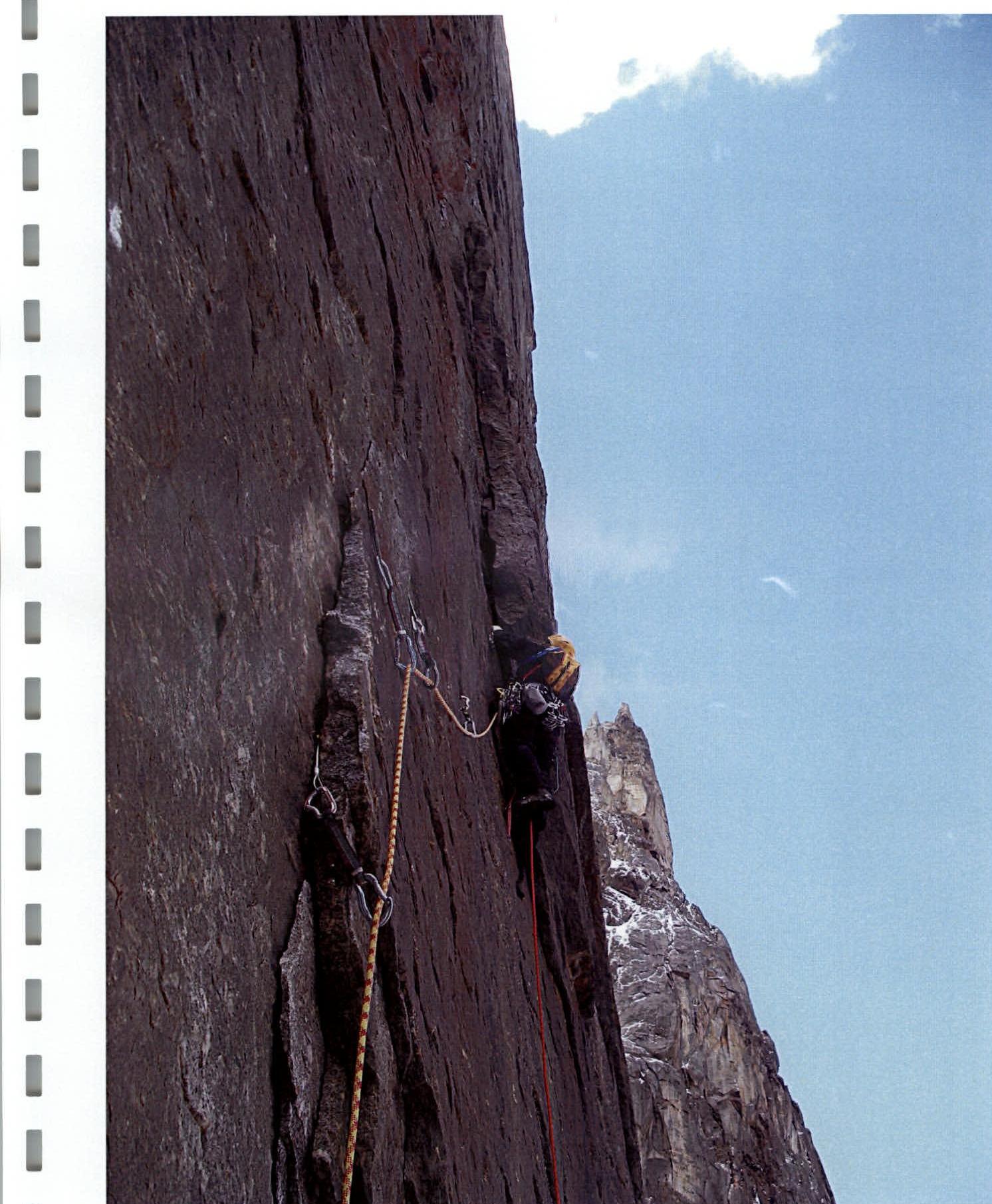
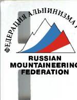
The route taken by the team passes through the center of the right bastion of the North face of Akksu (N). This face is among the longest and most challenging rock faces in the world and has become a classic object for BIG WALL ascents. The right bastion is the steepest and most monolithic part of the North face of Akksu. The exact exposure of the face is north-northwest. During the team's ascent, the bastion began to be illuminated by the sun at 15:30–16:00.
The high steepness makes the route virtually objectively safe, except for the first few ropes, which are exposed to rockfall in the latter part of the day when the bastion is illuminated by the sun. The route consists of two dissimilar parts — the bastion (the main technically challenging part) and the ridge.
The bastion is almost entirely composed of solid monolithic granites. The lower part has a very sparse, poorly articulated relief, making it difficult to move using standard mountaineering methods and organize protection without excessive use of pitons and bolts.
However, the first ascensionists managed to find a new complex and interesting route thread that did not contradict the style and logic of modern mountaineering. The route represents a system of cracks passing through almost the entire central part of the bastion. The first 200 m of the bastion are less successful but not hopeless, with virtually no possibility for free climbing. A good set of modern "big wall" equipment, a diverse set of relief sky-hooks, and anchor pitons helped, although very slowly, to move through a system of small cornice, "outgrowths," and "blind" microscopic cracks without total use of bolt-and-piton technique.
Gradually moving away from the glacier, the face becomes less "polished," and it becomes more feasible to switch to free climbing. The team managed to replenish their water supply. The route thread crosses several wet bands formed by the melting of a belt of small snow patches in the middle part of the face. Nevertheless, it is almost always necessary to carry a small (about 7 l) water reserve.
To maximize the team's capabilities and knowing each other's strengths, the following plan was chosen:
- The lower, most technically challenging part of the route was worked on first by Veretennin Denis (4 days).
- The upper part, where it became more feasible to switch to free climbing, was worked on first by Bashkirtsev Evgeny (4 days).
- The exit from the bastion to the ridge and movement along the ridge were done alternately.
The team had a compact, quickly installed, and quickly dismantled BASK platform, which allowed for relatively normal rest on the wall. The route thread passes through the center of the right part of the North face between the routes of L. Troshchinenko (1982) and V. Pershin (1988). The first 20 ropes from the base of the face to Camp-6 are a standalone part of the route. Above Camp-6, the thread coincides with V. Pershin's route.
On the ascent to the summit, 8 bivouacs were organized, 6 of which were "hanging." The team planned to descend from the summit via the ascent route, as almost all stations on the standalone, main part of the route have at least one bolted piton.
There are 46 bolted pitons on the route, most of which are "SPIT" (⌀ 12 mm, L300 mm). Almost half of them are used for organizing stations. Given the route's considerable length — 1848 m (44 ropes) — this is a good indicator for a route of such complexity.
The route was not pre-processed. Almost every day (except the second), the bivouac was moved to a new location.
The duo has significant experience in complex technical ascents and has worked together for several years. Having experience climbing walls such as:
- p. Asan,
- p. Slesova,
- p. Chapdara,
- p. Botkhana,
- winter ascent on Kodar,
- p. Erydag,
- ascents in Crimea
and much more, the ascent participants are impressed by the North face of Akksu and note not only its length and grandeur but also the exceptional technical difficulty of the route.
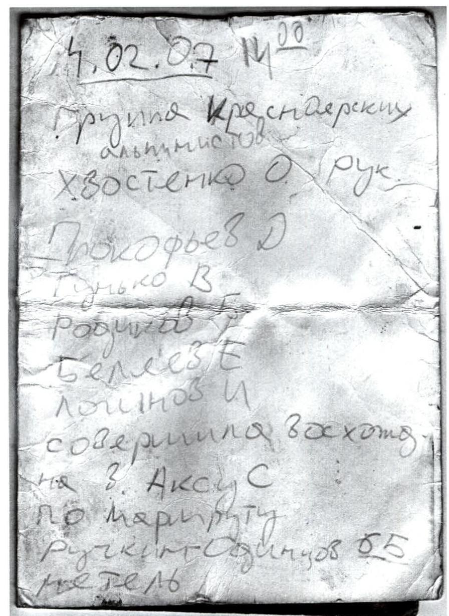
February 7, 2007
Kresnaer alpinists:
- Khvostenko O. (leader)
- Prokofiev D.
- Gunkо V.
- Rodionov B.
- Bellez E.
- Loginov I. completed an ascent to p. Akksu N via the route. Snowstorm.
February 4, 2007 14:20
Kresnaer alpinists:
- Khvostenko O. (leader)
- Prokofiev D.
- Gunkо V.
- Rodionov B.
- Bellez E.
- Loginov I. completed an ascent to p. Akksu N via the route. Snowstorm.
Note retrieved on August 5, 2008 14:00 from the summit cairn on Akksu North
Section R0–R1

Section R3–R4
Section R5–R6
Section R7–R8
Section R9–R10
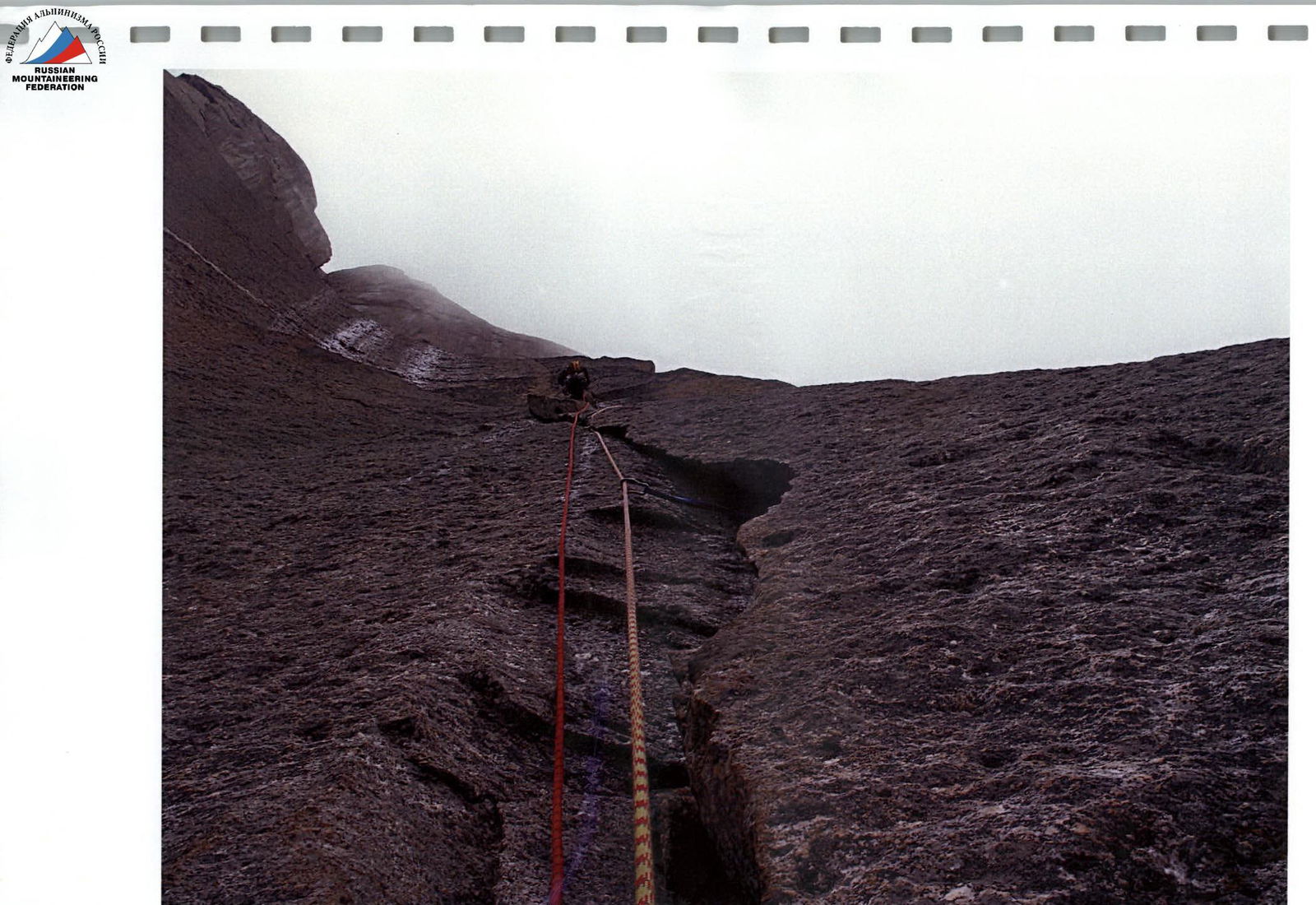
Section R21–R22
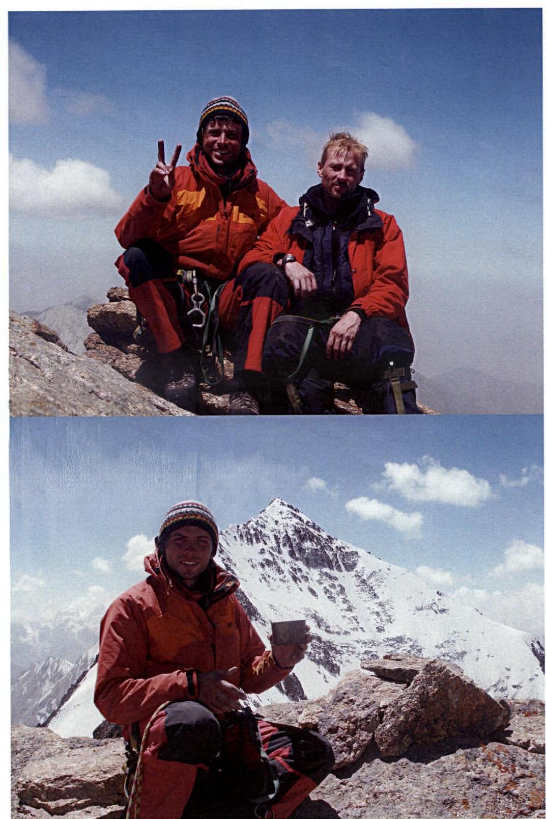
Team on the summit of Akksu North, Akksu Main in the background