Ascent Report
Irkutsk Team
Ascent of Admiralteets peak 5090 m via North Face.
August 9, 2012
Approximate difficulty category: 5B
Irkutsk, 2012
Ascent Details
- Pamir-Alay, Turkestan Range, Laylyak valley.
Section number according to the classification table: 5.4.2.
- Peak Admiralteets 5090 m (peak coordinates: 39°34′16.68″ N, 70°02′17.18″ E), via North Face
- Difficulty category: proposed 5B, first ascent
- Route type: ice and snow
- Route elevation gain: 790 m (4300 m — 5090 m)
Route length: 1090 m (15 ropes)
Section lengths:
- V difficulty category: 120 m
- VI difficulty category: 45 m
Average steepness:
- Wall section: −70°
- Total route: 65°
- Equipment left on the route: rope loop on the ridge for rappel organization.
Equipment used on the route: 49 ice screws, 6 (0) rock protection
- Team's total climbing time: 8 h 45 min ascent, 4 h 30 min descent, 20 h 30 min travel between camps. No overnight stays.
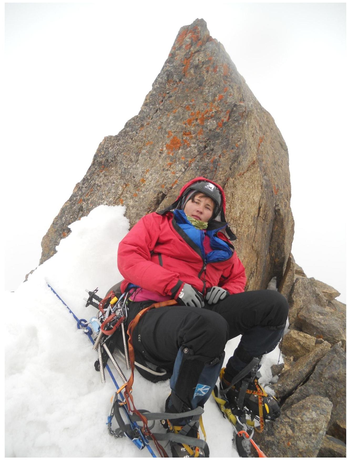
- Team leader: Glazunov Evgeny Vladimirovich (Candidate for Master of Sports)
Team members: Glazunova Ekaterina Georgievna (Candidate for Master of Sports), Tyulyupo Alexey Vitalievich (1st class)
- Coach: Glazunov Evgeny Vladimirovich (Candidate for Master of Sports)
- Departure from Base Camp: 5:00, 9.08.2012. Summit reached: 15:50, 9.08.2012. Return to Base Camp: 0:30, 10.08.2012.
Tactical Actions and Sportive Characteristics of the Route
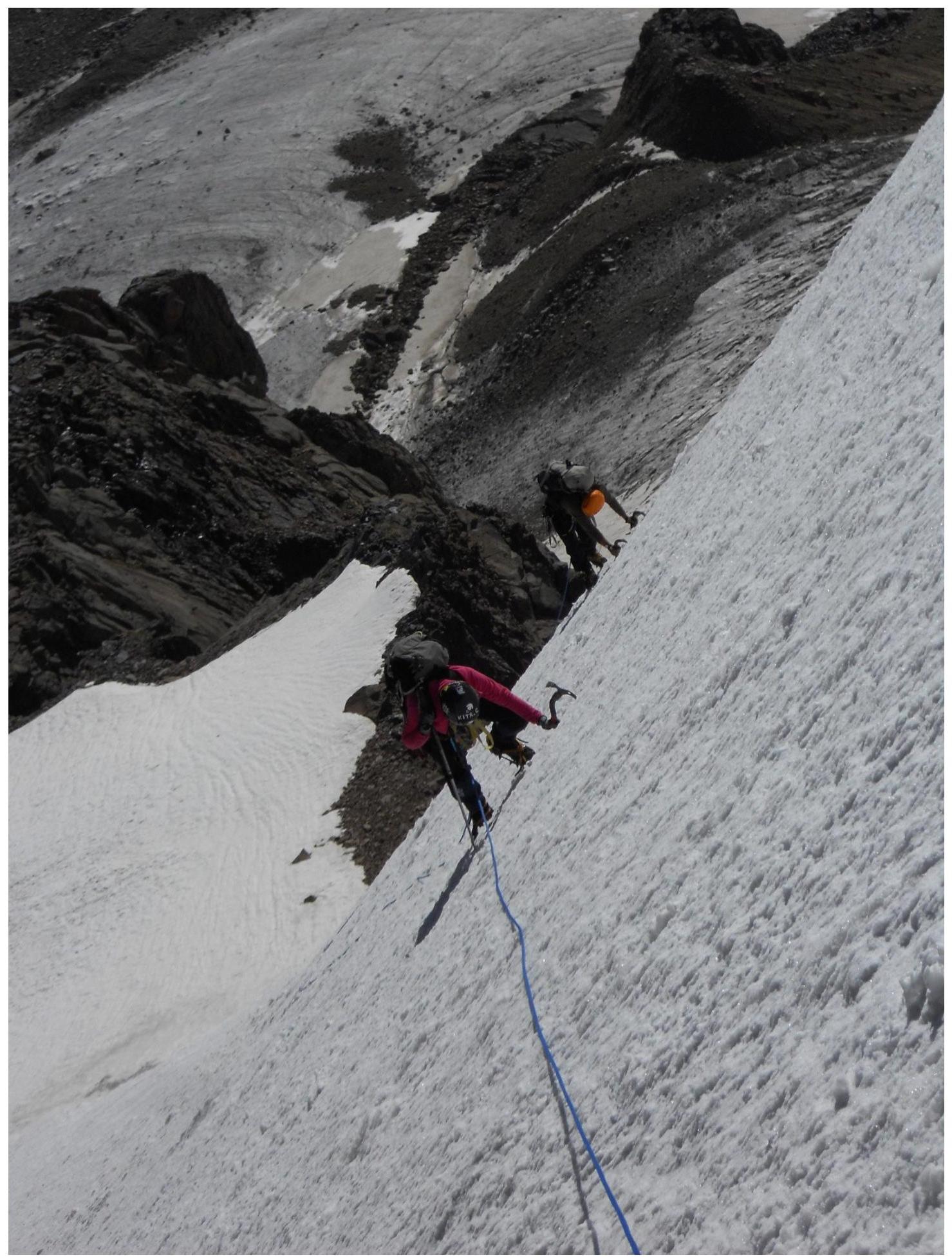
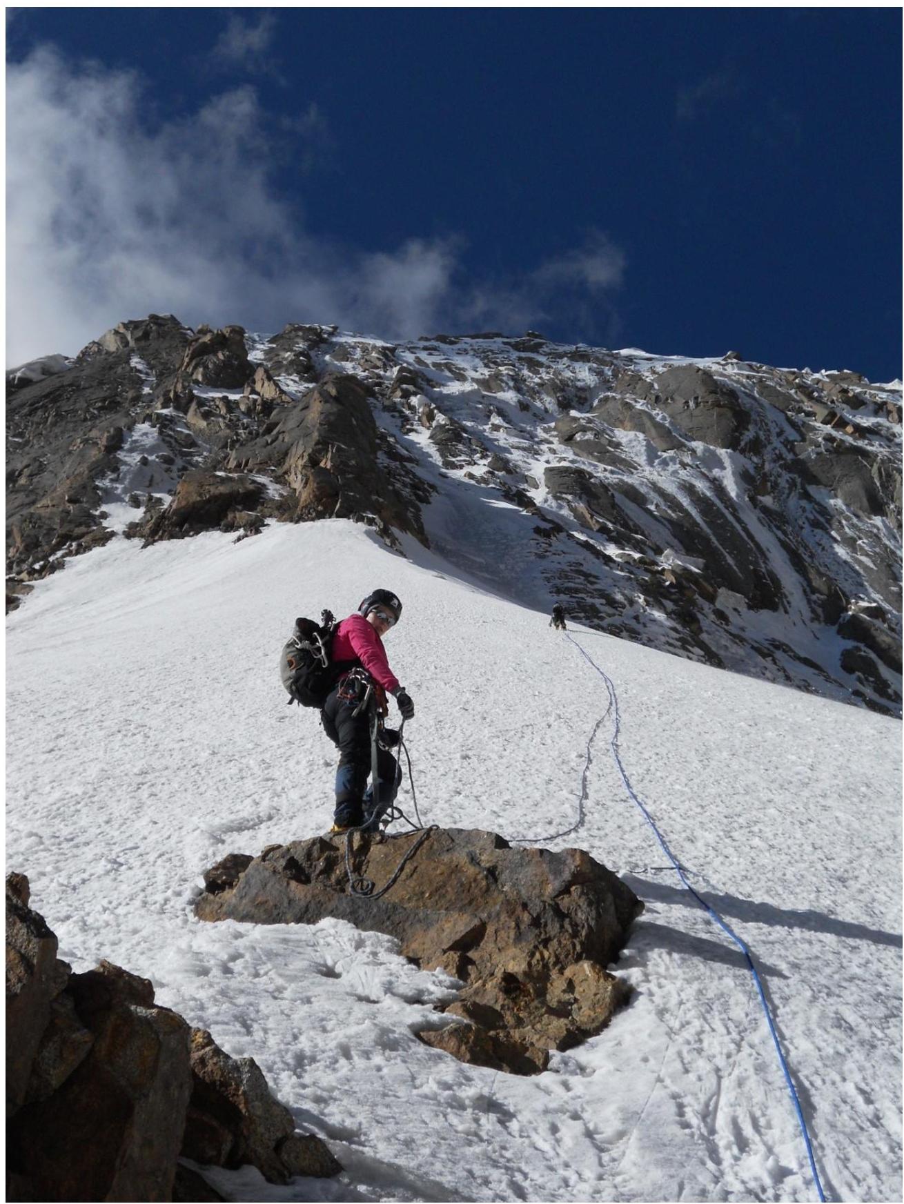
The route we ascended goes via the North Face of Admiralteets peak, through a system of ice couloirs and gullies. Most of the day, these are in shadow, making the route safer. During the ascent, there were virtually no rockfall or icefall incidents.
The team departed for the ascent at 5:00 from the Ak-Su glacier (3670 m), planning to complete the route and descend within a day. By 8:00, they reached the "cushion" below Petrogradets (4240 m). The ascent began at 9:30, and the team reached the summit at 15:50. They descended via the ascent route (15 rappels to the glacier), arriving back at the camp under the Ak-Su wall at 00:30.
The team used 60-meter ropes, so the section descriptions are based on this length.
The first and second climbers ascended without protection, while the third climber was secured with fixed ropes — this scheme allowed for a relatively fast pace.
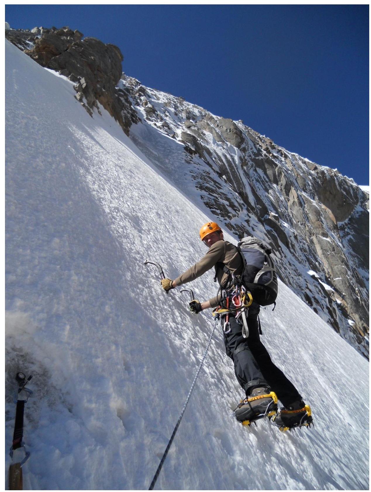
The lower and upper parts of the route were climbed by the first climber with the use of hammer and pitons.
The key middle section with mixed terrain was traversed using ice screws.
The team estimates that this route, in terms of technical difficulties, corresponds to similar routes of 5B category. Considering the adopted classification in the area and the absolute height of the peak, the team assesses this route as 5B category.
Ascent
graph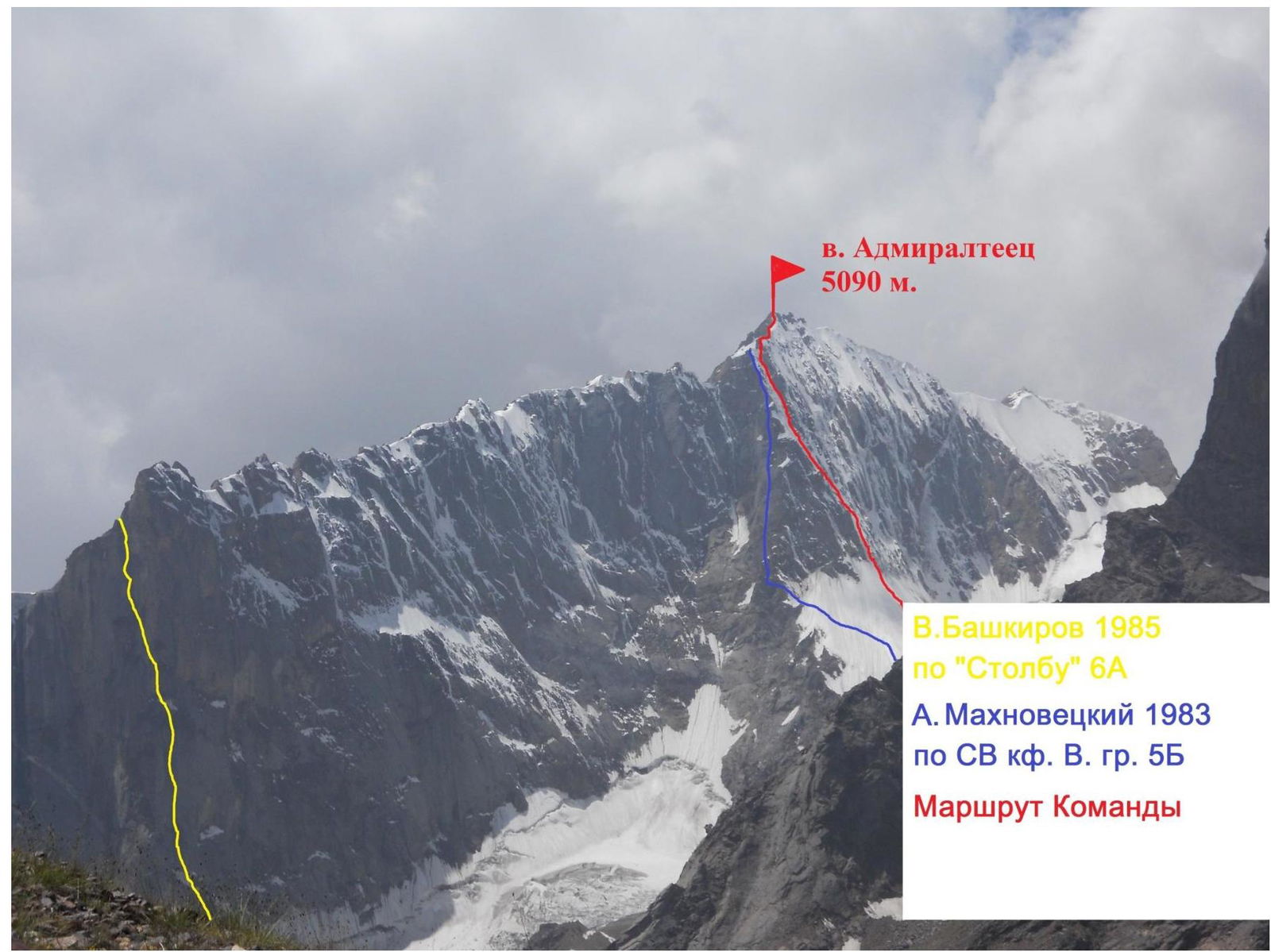
General view of
Admiralteets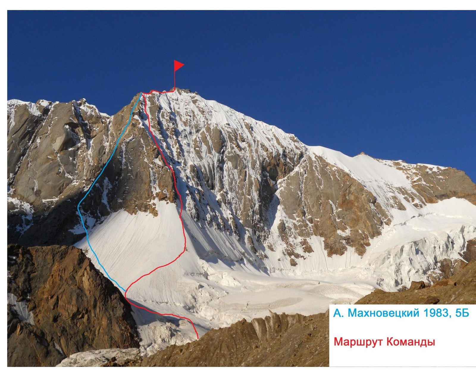 A.
Makhovetsky, 1983, 5B
A.
Makhovetsky, 1983, 5B
Team's route
General view of North Face of
Admiralteets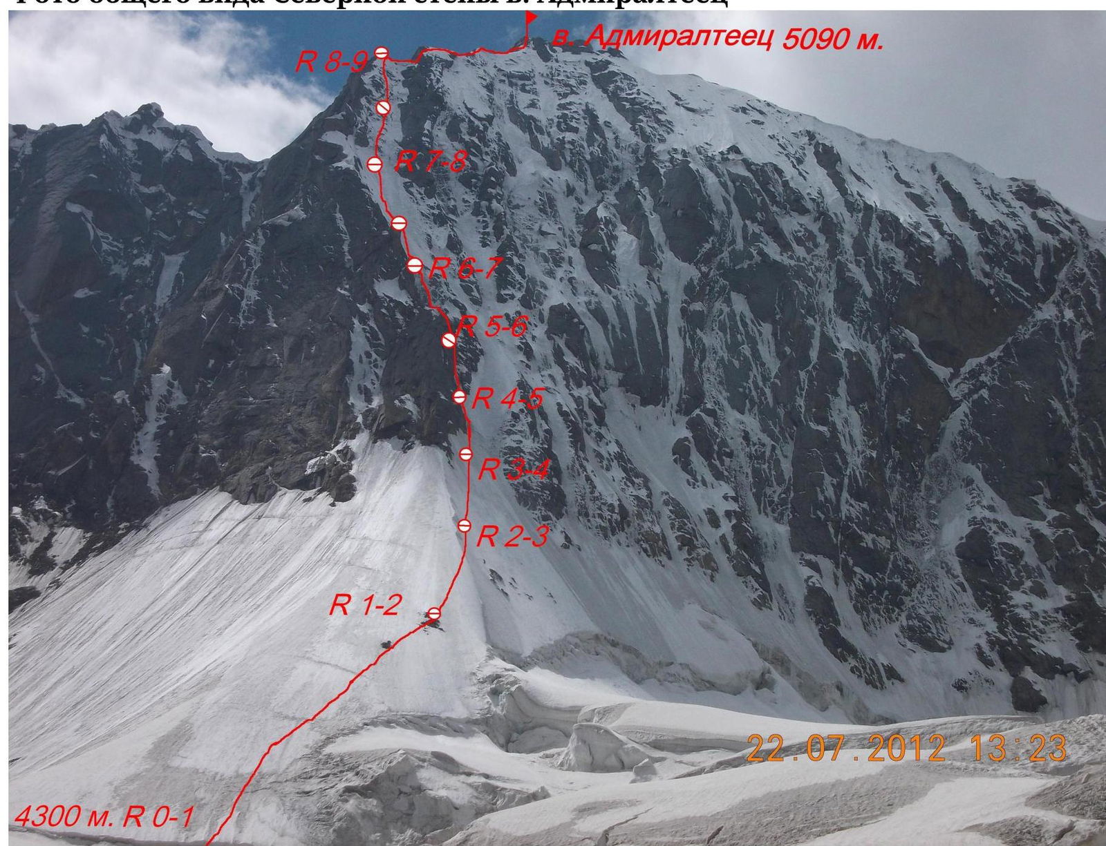
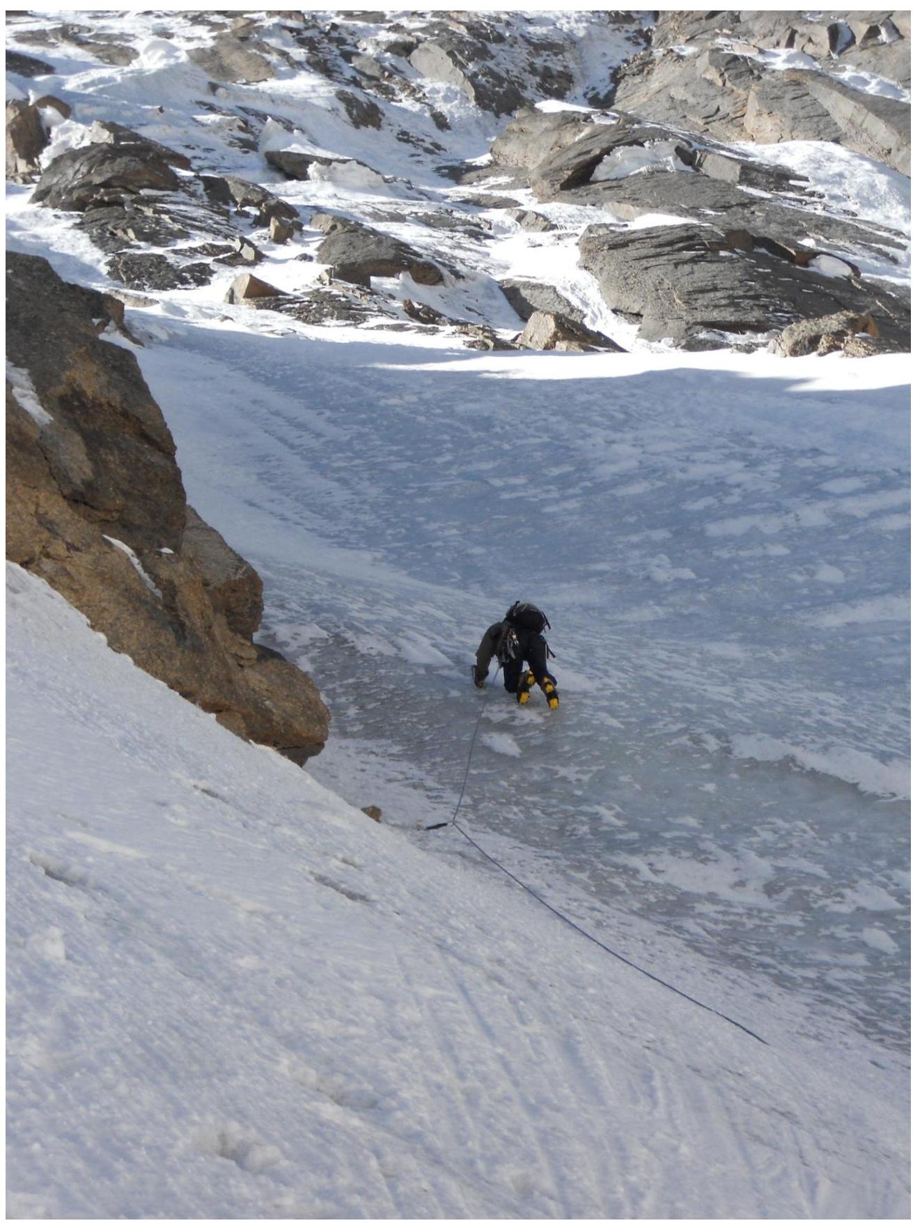
Route photos by sections
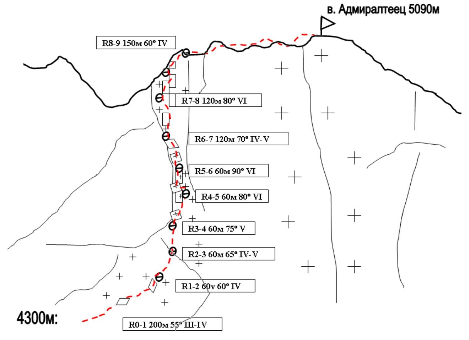
Route Description by Sections
The approach to the route starts from "Korean Camps" via the right (in the direction of travel) part of the Ak-Su glacier and talus slopes of Iskander peak. We reach the "cushion" of the glacier, then cross the glacier towards Admiralteets peak. We move towards a characteristic gap in the glacier, under a small ice ridge, which marks the beginning of the route.
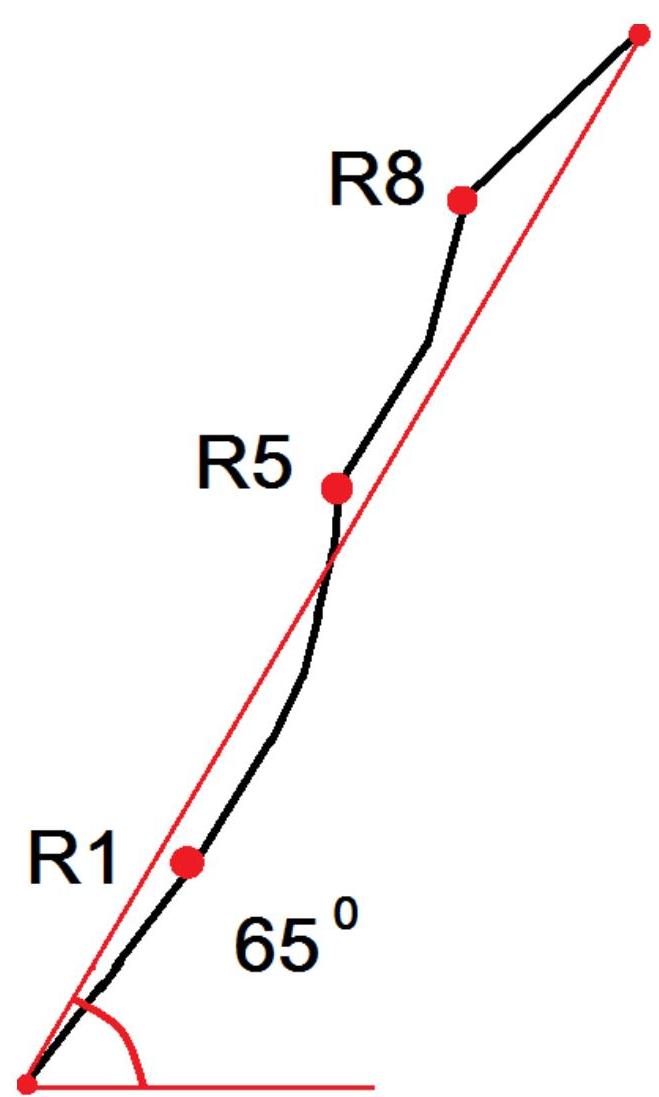
Section R0–R1. Snow and ice slope; we move towards rocky outcrops in the middle of the slope. Simultaneous movement. Station on a rocky outcrop (250 m. 45–55°. III–IV).
Section R1–R2:
- Move towards the snowy ridge.
- Then, it's necessary to traverse over the ice ridge to its right side.
- Section length is two ropes. Slope steepness gradually increases. (120 m. 60°. IV)
Section 2–3. Direction of movement is to the right, bypassing the rock counterfort, exit onto "monolithic" ice. (60 m. 65° IV–V).
Section R3–R4. Move up the monolithic steep ice, along the characteristic counterfort. On the walls of the counterfort, there are huge firn "mushrooms" weighing several tons, so stations on this section and further are made in protected areas from potential falls. (60 m. 70–80° V)
Section R4–R5
Move up through ice cascades with three vertical steps and sections of ice-covered rocks. Station in a safe location. (60 m. 80–85° VI)
Section R5–R6
First key section: a vertical ice-covered rock wall. Traverse from left to right. Station on a small ledge at the exit into a couloir. (60 m. 90°. VI)
Section 6–7. Move up the ice couloir towards vertical rocks; section length is two ropes. (120 m. 65–70° IV–V) Section 7–8. Second key section — move towards the ridge via a system of gullies and steep ice-covered rock walls. In the middle of the section — station on ice screws. Exit onto the ridge from right to left. Deep snow on rocks at the exit to the ridge significantly hinders movement. (120 m. 80° VI)
Section 8–9. Move along the ridge through a series of walls and ridges towards the summit; the summit cornice is traversed head-on. (240 m. 50° IV)
Descent follows the ascent route — return along the ridge to R8, then 15 rappels to the glacier.
UIAA Scheme.
 Hand-drawn
route profile
Hand-drawn
route profile
Section 0–1
Section 1–2
Section 2–3
Section
3–4
18 Section
4–5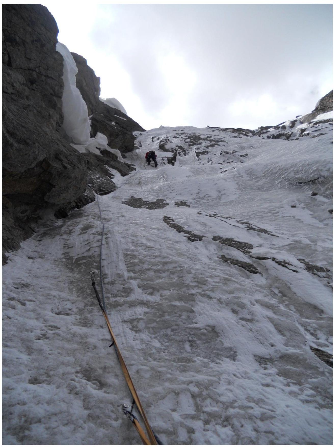
Section
5–6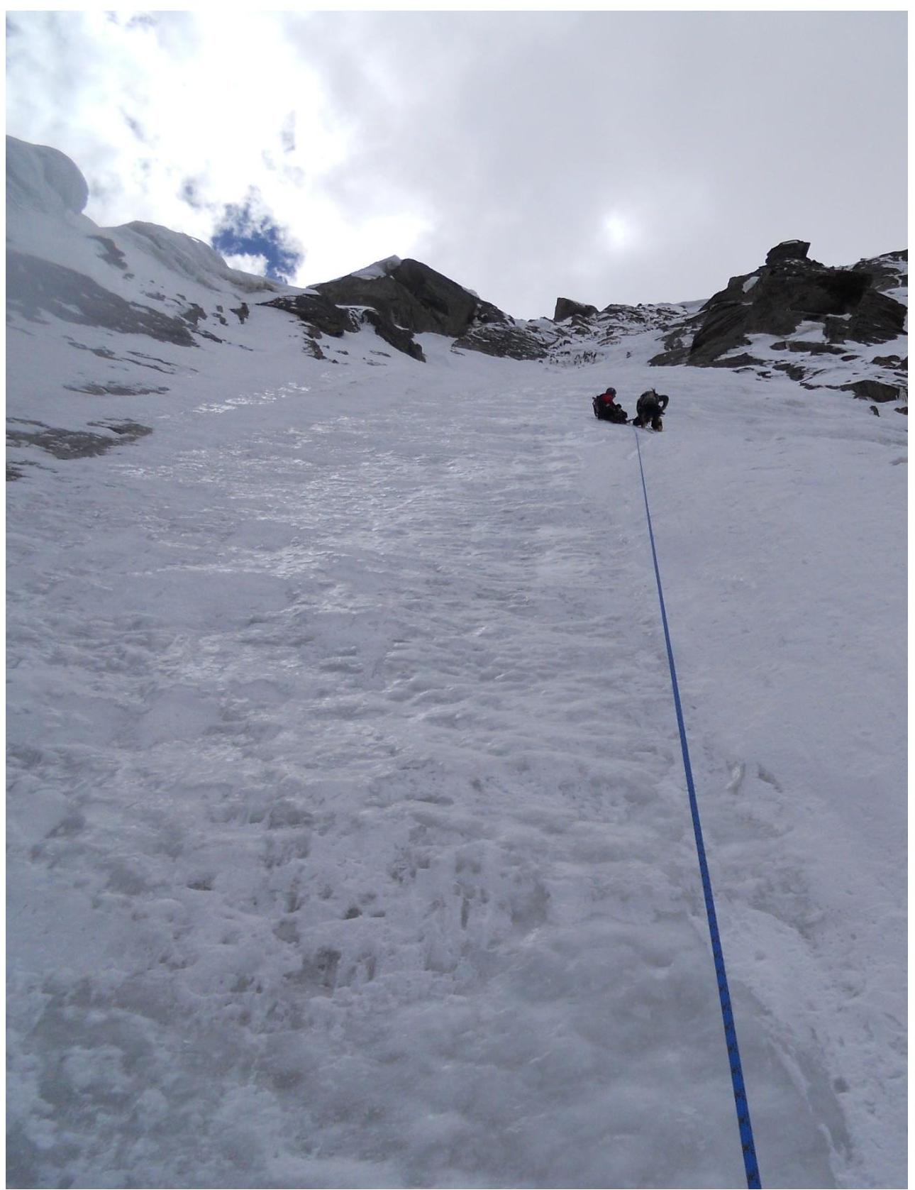
Section
6–7
Section 7–8
Summit