
Russian Mountaineering Federation
Team Report
MAGNITOGORSK MOUNTAINEERING CLUB FIRST ASCENT ON PIK MAGNITKA, APPROX. 5A CAT.
Ascent Passport
-
Ascent area – 5.3.3 Pamiro-Alai;
-
Object of ascent – Pik Magnitka, via SW ridge, 4477 m;
-
Category of difficulty 5A;
-
Route type – rock;
-
Route characteristics:
height difference – 957 m; route length – 1558 m; length of 5th-6th sections – 283 m; including 6th – 60 m; average steepness of the entire route – 47.15°, incl.;
-
Protection used on the route:
rock pitons – 50; bolt pitons – 0; chocks and friends – 78; pitons left on the route – 0;
-
Total climbing time 10:10;
climbing days – 1;
-
No overnight stops during the ascent;
-
Team leader – Agata Mavrinskaya, Candidate Master of Sports;
Team members:
- Sergei Telitsyn, 1st sports category;
- Konstantin Kalmykov, 1st sports category;
- Vadim Tyudin, 1st sports category;
- Timur Dzhabraev, 1st sports category.
Team coach – Sergei Soldatov;
-
Route approach – August 25, 2015;
Route reconnaissance August 25 from 17:00 to 19:30; Departure – August 26 at 6:00; Summit – August 26 at 13:40; Return to Archa Plateau camp – at 20:30 on August 26, 2015;
-
Descent from the summit via the Western ridge;
-
Organization: Magnitogorsk Mountaineering Club;
-
Report responsible – Agata Mavrinskaya, bestewhole@gmail.com, ph. 8 904 973-41-72.
Brief Overview of the Ascent Area
The area is located in the spurs of the Zeravshan Range, on the right slopes of the Yaghnob River valley. On the road from Anzob settlement towards Zeraffshan settlement, around the eighth kilometer, a trail starts on the right side up the slope, leading to the Archa Plateau and the climbing area. Trail:
- begins with a gentle ascent to the right along a scree slope;
- leads to slightly inclined rocks;
- in difficult-to-pass sections, the trail is cut into the rocks;
- is suitable for pack donkeys to reach the upper summer pastures;
- does not pose difficulties for loaded climbers.
Currently, the trail:
- retains its terrain and signal cairns;
- in some places, it gets lost on scree slopes eroded by streams.
Route:
- after 1.5–2 hours of steep ascent, the trail leads over a ridge to a green Archa plateau;
- the plateau is surrounded by grandiose rock massifs over 4000 m high;
- everywhere there are huge thickets of juniper filling the entire cirque.
Further:
- after another half hour, you reach the summer camp area;
- the camp is comfortably located near a spring;
- in hot weather, water is only available here;
- there is enough firewood for a camp kitchen.
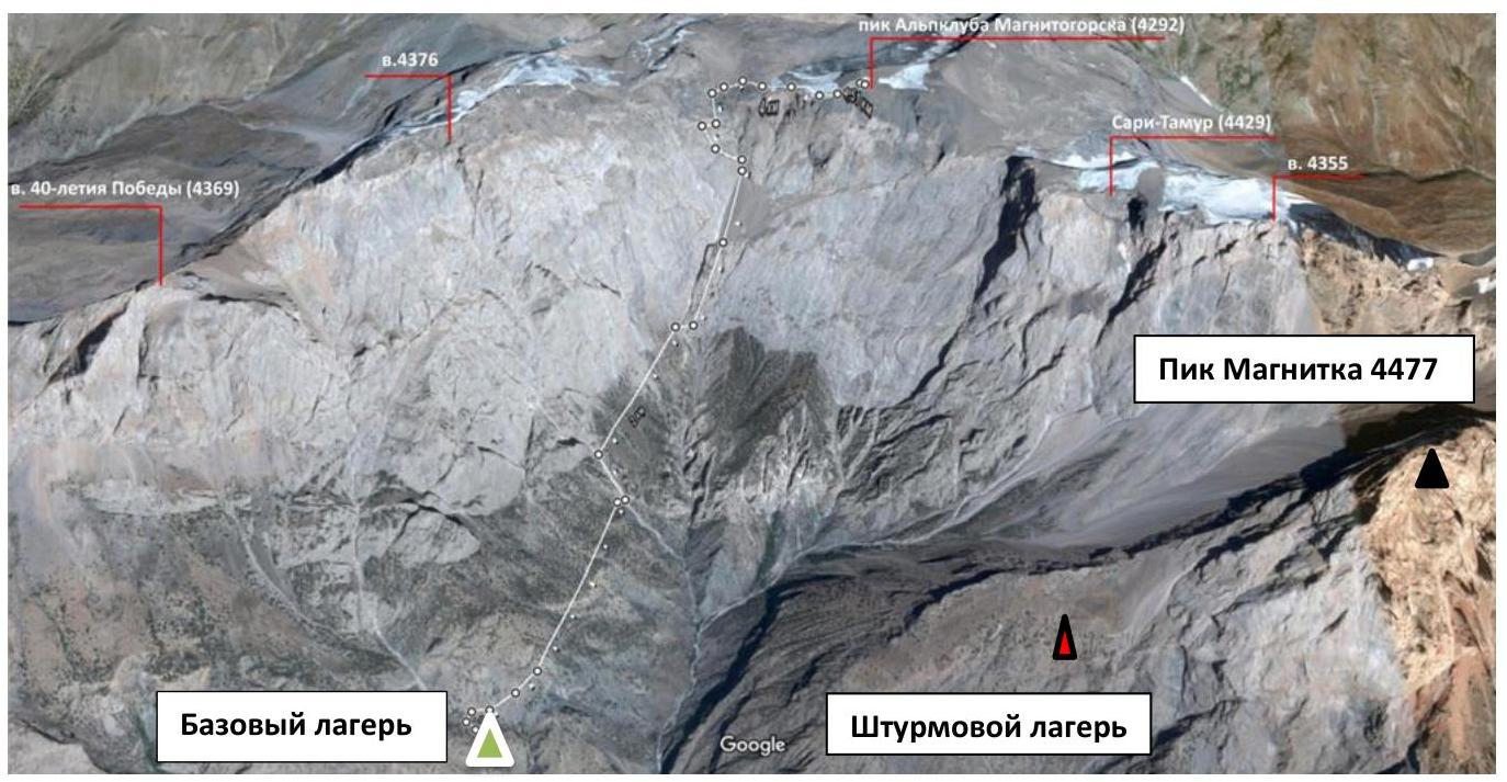
The base camp is traditionally set up near the camp, close to the peak of 40th Anniversary of Victory.
From the base camp to the assault camp, it takes about 2.5–3 hours walking east along a fairly good trail. Midway, there's a so-called "birch grove" with firewood and, most valuably, spring water. Water is only available here, under the wall, and there's none along the rest of the route. If desired, the assault camp can be set up here, though some effort is needed to level the tent site. From here to the start of the route is about 2 hours.
Team Tactical Actions
The tactical plan was to complete the route in one day with one day of reconnaissance.
The group was mobile, having had good acclimatization through several ascents of 3B–5B category.
On the first day, August 25, was the reconnaissance day. Three ropes were fixed (up to R4) that day. On August 26, the team started the route around 6:00 and reached the summit by 13:40. Throughout the route, Konstantin Kalmykov led. The descent began at 14:00. Around 18:00, the team arrived at the assault camp and, after a brief stay, headed to the base camp, arriving at 20:30.
On the route, the first climber worked on a double rope, and the second and subsequent climbers ascended on fixed ropes with top-rope protection. All types of protection were effective on the wall, with anchor pitons mainly used for organizing belay stations.
The team only carried a tarp for bivouac gear. The team had five 1.5-liter water bottles.
The weather was favorable and hot throughout the route.
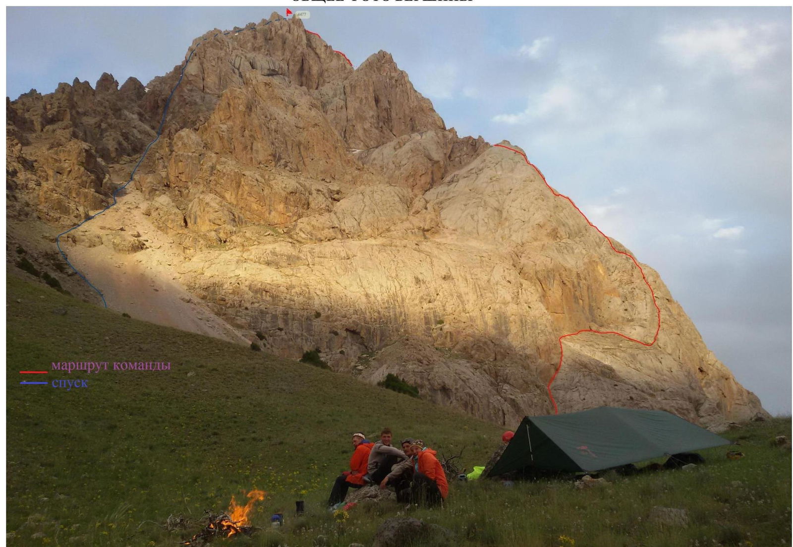
The descent from the summit was via the Western ridge, exiting onto the SW couloir and then down the scree to the assault camp.
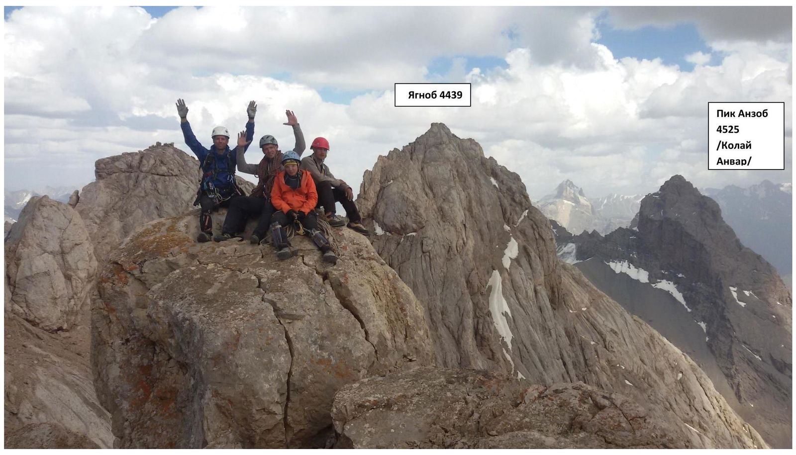
GENERAL PHOTO OF THE SUMMIT!
UIAA Symbol Route Diagram
| Rock Pitons | Chocks/Friends | Bolts | UIAA | R | Length | Difficulty | Steepness | Remarks (time) |
|---|---|---|---|---|---|---|---|---|
| 0 | 0 | - | R28 | 100 m | II | 30° | ||
| 1 | 2 | - | R27 | 80 m | IV | 60° | ||
| 3 | 4 | - | R26 | 50 m | IV | 70° | ||
| 4 | 6 | - | R25 | 60 m | VI | 90° | ||
| 2 | 4 | - | R24 | 50 m | IV | 70° | ||
| 0 | 3 | - | R23 | 50 m | II | 20° | ||
| 4 | 3 | - | R22 | 70 m | V | 80° | ||
| 0 | 2 | - | R21 | 60 m | II | 35° | ||
| 1 | 3 | - | R20 | 50 m | III | 40° | ||
| 0 | 1 | - | R19 | 3 m | V | 80° | ||
| 3 | 2 | - | R18 | 30 m | III | 45° | ||
| 0 | 2 | - | R17 | 5 m | IV | 60° | ||
| 1 | 2 | - | R16 | 30 m | III | 30° | ||
| 2 | 1 | - | R15 | 80 m | II | 20° | ||
| 2 | 4 | - | R14 | 70 m | III | 45° | ||
| 1 | 2 | - | R13 | 50 m | II | 20° | ||
| 4 | 5 | - | R12 | 100 m | III | 45° | ||
| 2 | 1 | - | R11 | 50 m | II | 35° | ||
| Rock Pitons | Chocks/Friends | Bolts | UIAA | R | Length | Difficulty | Steepness | Remarks (time) |
| :---------- | :------------- | :---- | :------------------------------------------------------------------------------------------------------------------------------------------------------ | :--- | :------------ | :--------- | :---------- | :----------------- |
| 2 | 3 | - |  | R10 | 50 m | IV | 60° | |
| 3 | 3 | - | R9 | 40 m | III | 40° | ||
| 1 | 2 | - | R8 | 50 m | II | 45° | ||
| 2 | 1 | - | R7 | 30 m | III | 40° | ||
| 2 | 2 | - | R6 | 50 m | III | 45° | ||
| 3 | 4 | - | R5 | 80 m | III | 40° | big rock | |
| 2 | 3 | - | R4 | 50 m | III–IV | 45°–50° | ||
| 3 | 2 | - | R3 | 50 m | V | 70° | ||
| 0 | 3 | - | R2 | 70 m | III | 25° | ||
| 0 | 5 | - | R1 | 50 m | V | 65° | ||
| 2 | 3 | - | R0 | 50 m | V | 65° |
Route Timeline
| Time | Date | ||
|---|---|---|---|
| August 25 | August 26 | ||
| 21:00 | 21:00 | ||
| 20:00 | 19:30 | 20:00 | |
| 19:00 | 19:00 | ||
| 18:00 | 18:00 | ||
| 17:00 | 17:00 | 17:00 | |
| 16:00 | 16:00 | ||
| 15:00 | 15:00 | ||
| 14:00 | 13:40 | 14:00 | |
| 13:00 | 13:00 | ||
| 12:00 | 12:00 | ||
| 11:00 | 11:00 | ||
| 10:00 | 10:00 | ||
| 9:00 | 9:00 | ||
| 8:00 | 8:00 | ||
| 7:00 | 7:00 | ||
| 6:00 | 6:00 | 6:00 | |
| Total climbing time | 2:30 | 7:40 | 10:10 |
Route Description by Sections
R0–R1 – Up an internal corner 50 m via a good crack running through the center. The section is easy to climb. Station on anchors. Semi-suspended positions for stations. For protection, average-sized cams and large stoppers work well.
R1–R2 – The route turns right after the first rope and transitions into another internal corner. Also, easy to climb via a wide crack in the center of the corner. For protection, average-sized cams and large stoppers work well.
R2–R3 – Oblique traverse along a 60-meter oblique ledge. Done in one pitch. In dry weather, it's relatively easy to climb smooth inclined slabs here, but the section requires good coordination. In wet weather, it's safer to fix ropes for protection. After the ledge, the route transitions to a ridge right of an overhanging smoothed wall, 10 m. Convenient protection spot.
R3–R4 – First, right up a chimney ending in a plug, which is bypassed on the right, then straight up the wall. 70°, 5th category. The protection spot is not very convenient.
R4–R5 – Straight up the wall, then along a series of ledges to the right, then slightly left to a big dark rock. Easy to climb. The difficulty and steepness of the section gradually increase.
From here, the route turns right along a ridge, then exits onto a crest.
R5–R6 – Right along the ridge 80 m, 3rd category.
R6–R7 – Along a series of small ledges, approach an internal corner. Steepness gradually increases. 50 m, 3rd category.
R7–R8 – Up the internal corner to the right to a ledge. Here, the first control cairn is built. 30 m, 3rd category.
R8–R9 – From the cairn, move left 50 m, 2nd category.
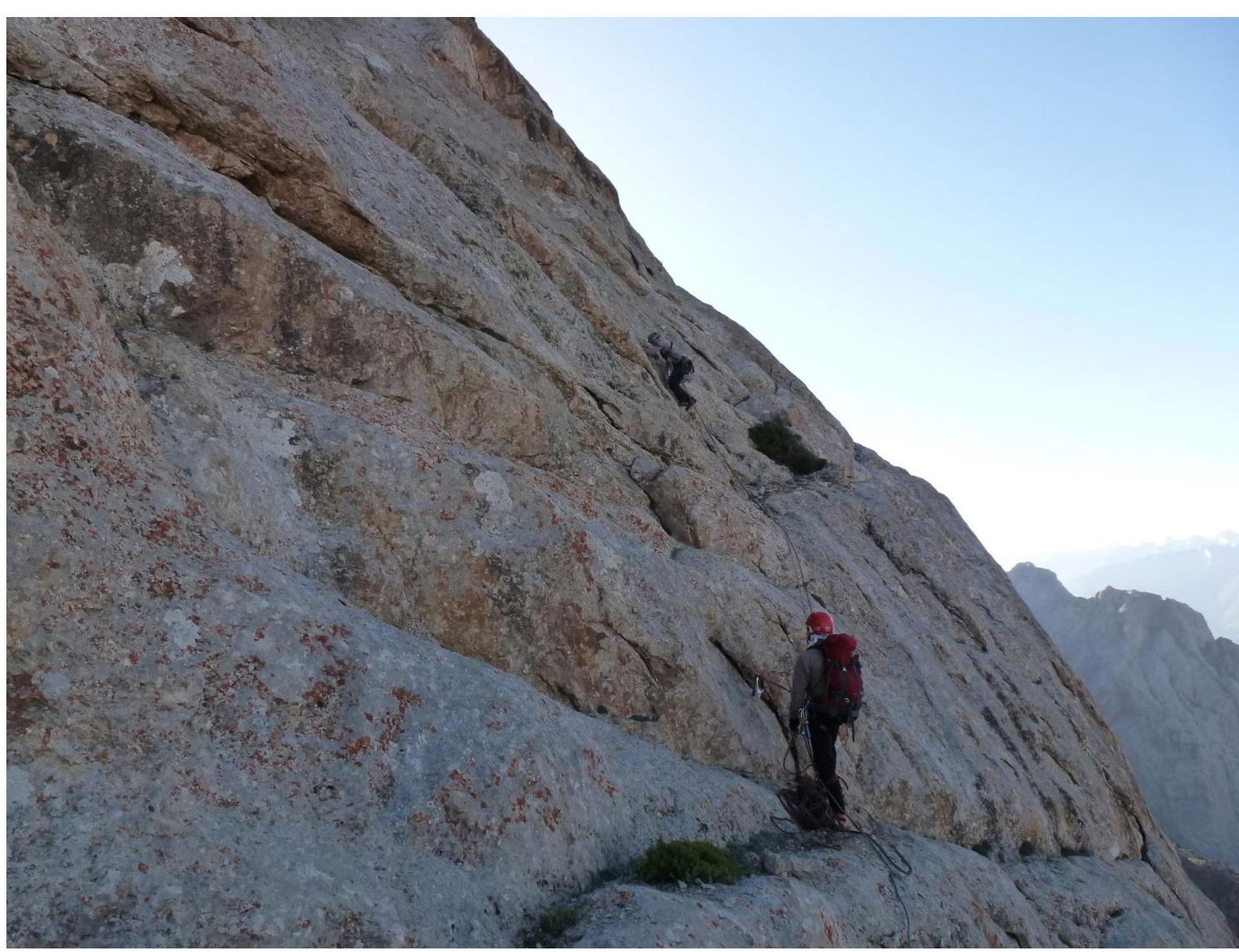
R9–R10 – Up 40 m along the wall, 3rd category.
R10–R11 – Left along the wall 60°, 4th category.
R11–R12 – Along a crack, first left, then right 50 m, 2nd category, 35°.
R12–R13 – 100 m straight up, 3rd category, 45°.
R13–R14 – Traverse left 50 m, 2nd category.
R14–R15 – Up the wall to reach a pinnacle. 70 m, 45°.
R15–R16 – Along the ridge 80 m, 2nd category.
R16–R17 – 30 m left along a ledge, 3rd category.
R17–R18 – Five-meter wall, 4th category, 60°.
R18–R19 – A large pinnacle is bypassed on the left. 30 m, 3rd category.
R19–R20 – Difficult traverse left 3 m, 5th category.
R20–R21 – 50 m along a ridge to the right, exiting onto a crest, 3rd category.
R21–R22 – Left down a scree-filled couloir 60 m.
R22–R23 — Vertical chimney ending in a destroyed plug, bypassed on the left. Rockfall hazard. 70 m, 5th category.
R23–R24 – Traverse right 50 m. Done in one pitch.
R24–R25 – From a ledge, up an internal corner 50 m. To the right of the internal corner is a scree-filled couloir; do not ascend it as it leads to overhanging smoothed "ram's foreheads". From the internal corner, ascend to a very convenient ledge where, if needed, two people can comfortably bivouac. Here, the second control cairn is built.
R25–R26 – This is the key rope on the route. From the ledge, up a crack gradually turning into a chimney, 50 m, 90°, 6th category.
R26–R27 – Up an internal corner to the left 50 m, 4th category, to reach the base of the pre-summit ridge.
R27–R28 – Up inclined smoothed slabs 80 m. The section is done on friction. There are practically no protection spots. In unfavorable weather, movement on this section will be significantly hindered.
R28–R29 – Along the ridge 100 m to reach the summit.
Area photo
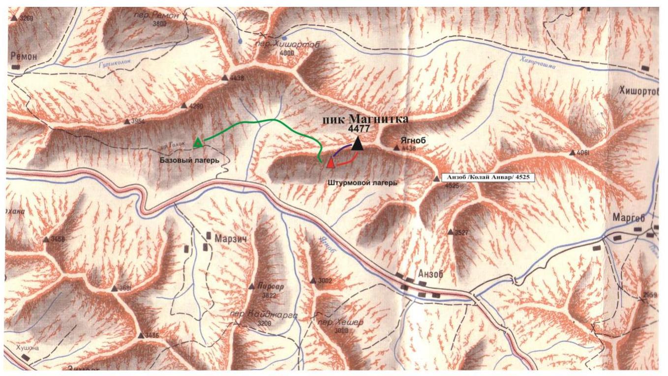
Area Diagram
- Approach route
- Ascent route
- Descent route
ROUTE PROFILE
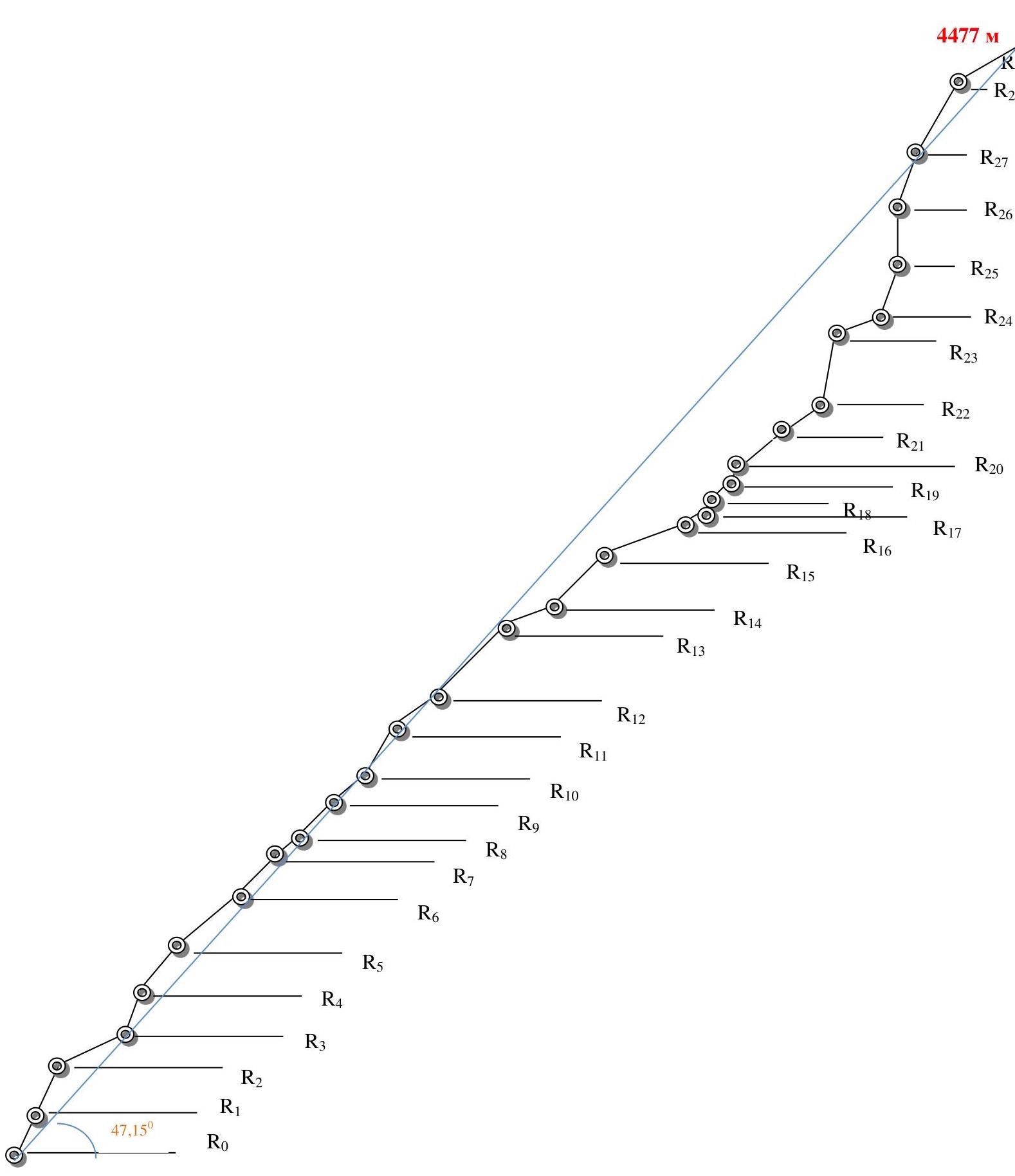
PHOTO ILLUSTRATIONS FOR PIK MAGNITKA REPORT
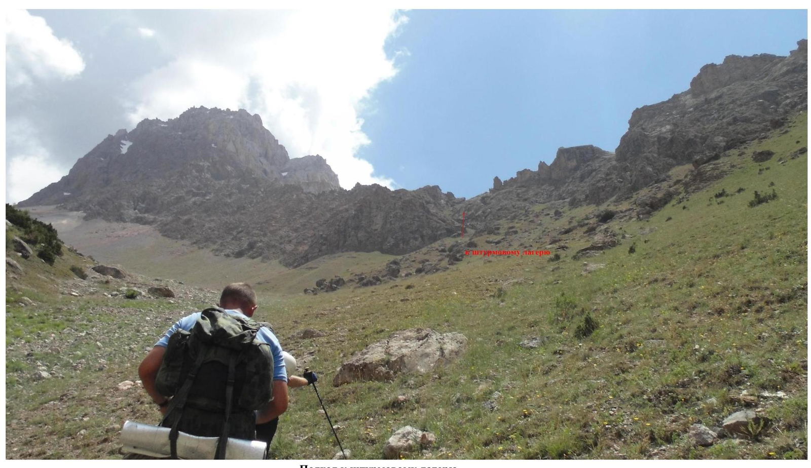
Approach to the assault camp
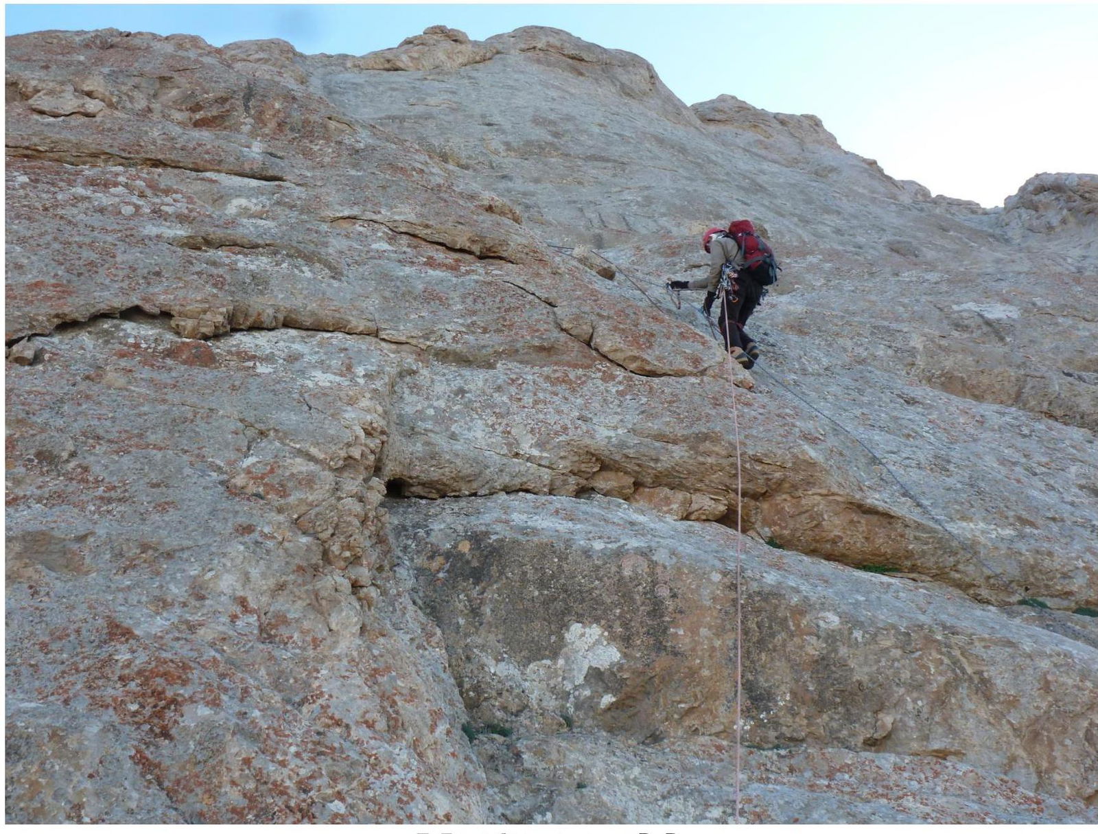
Mavrinskaya A., Dzhabraev T., Tyudin V. On section R0–R1
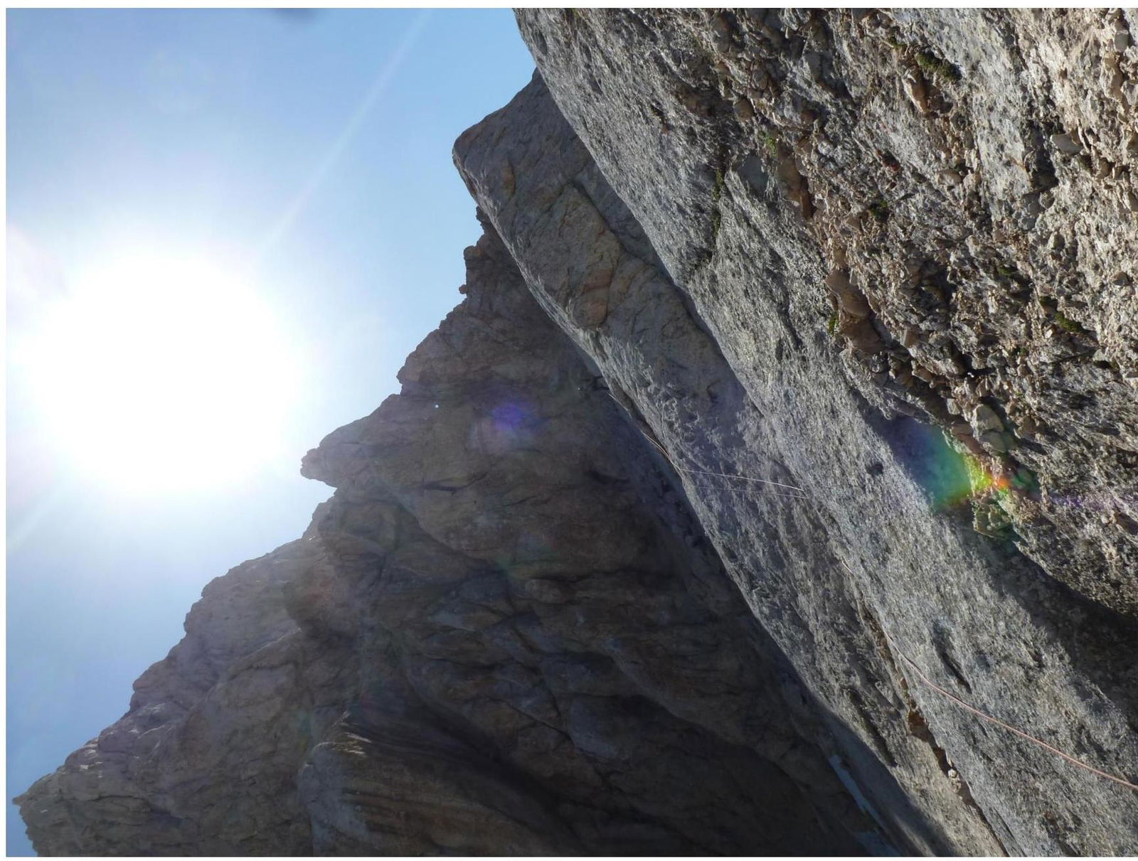
Section R3–R4
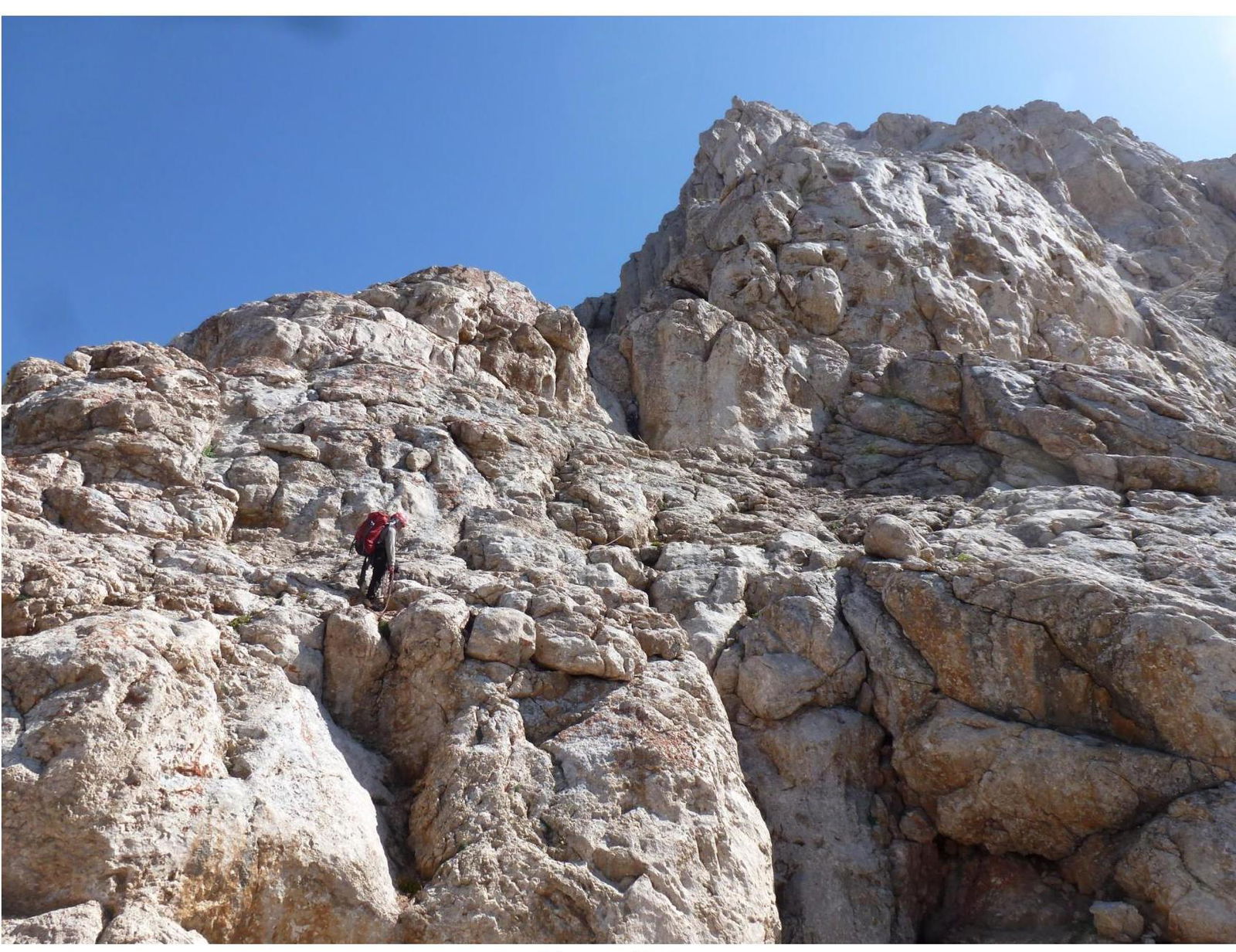
T. Dzhabraev on section R4–R5
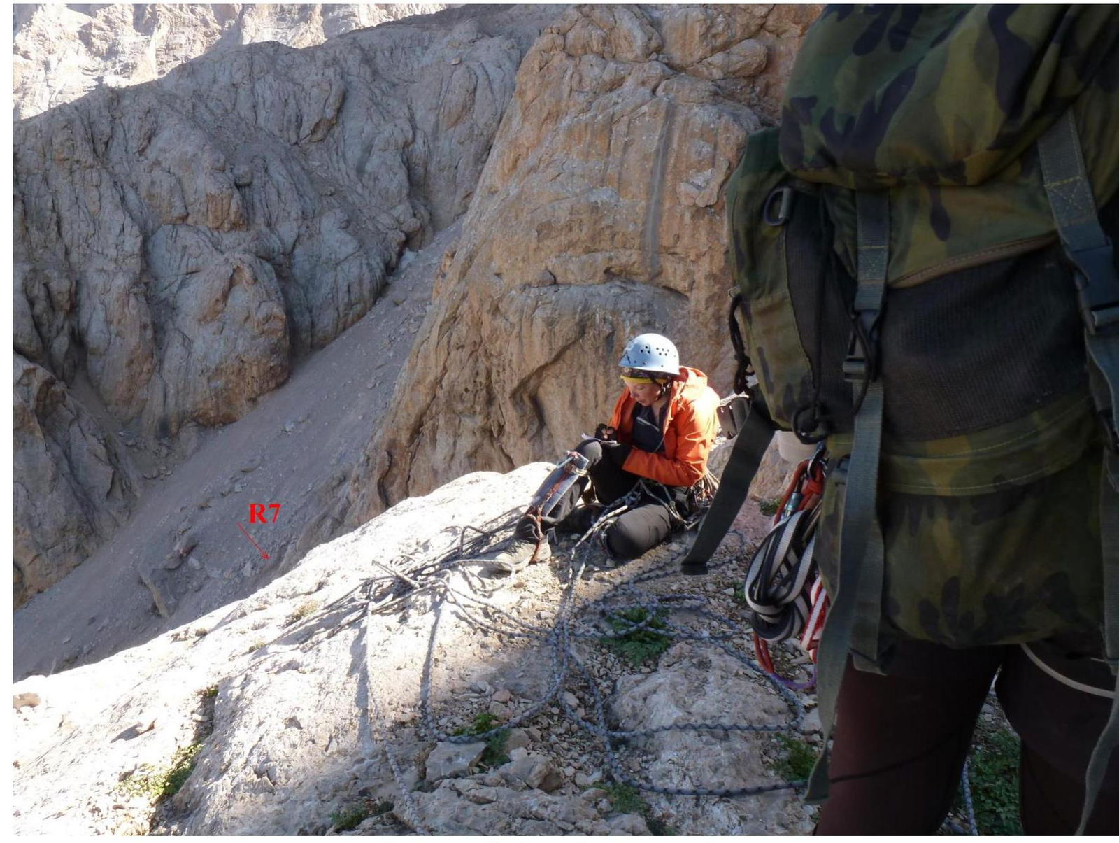
On section R8. First control cairn
Section R8–R9
Section R9–R10
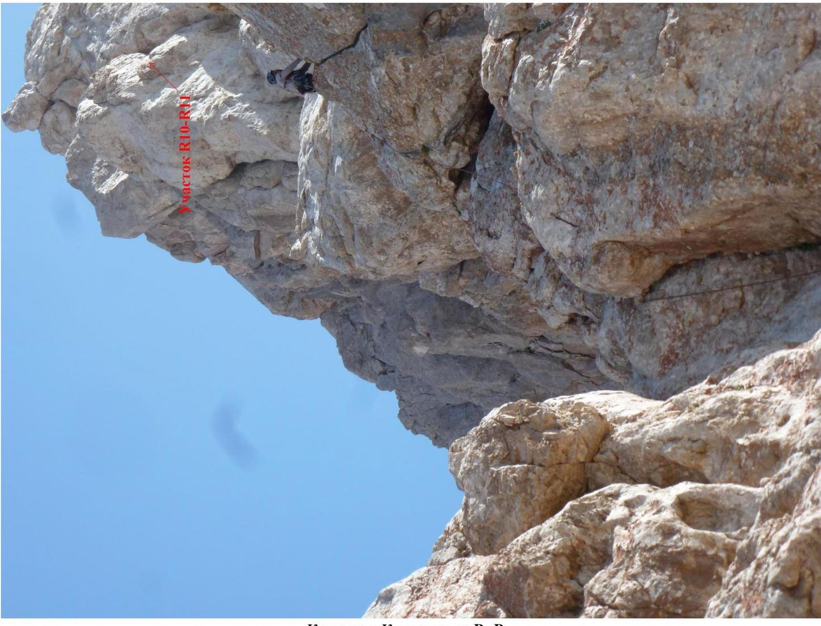
K. Kalmykov on section R9–R10
Section R12–R13
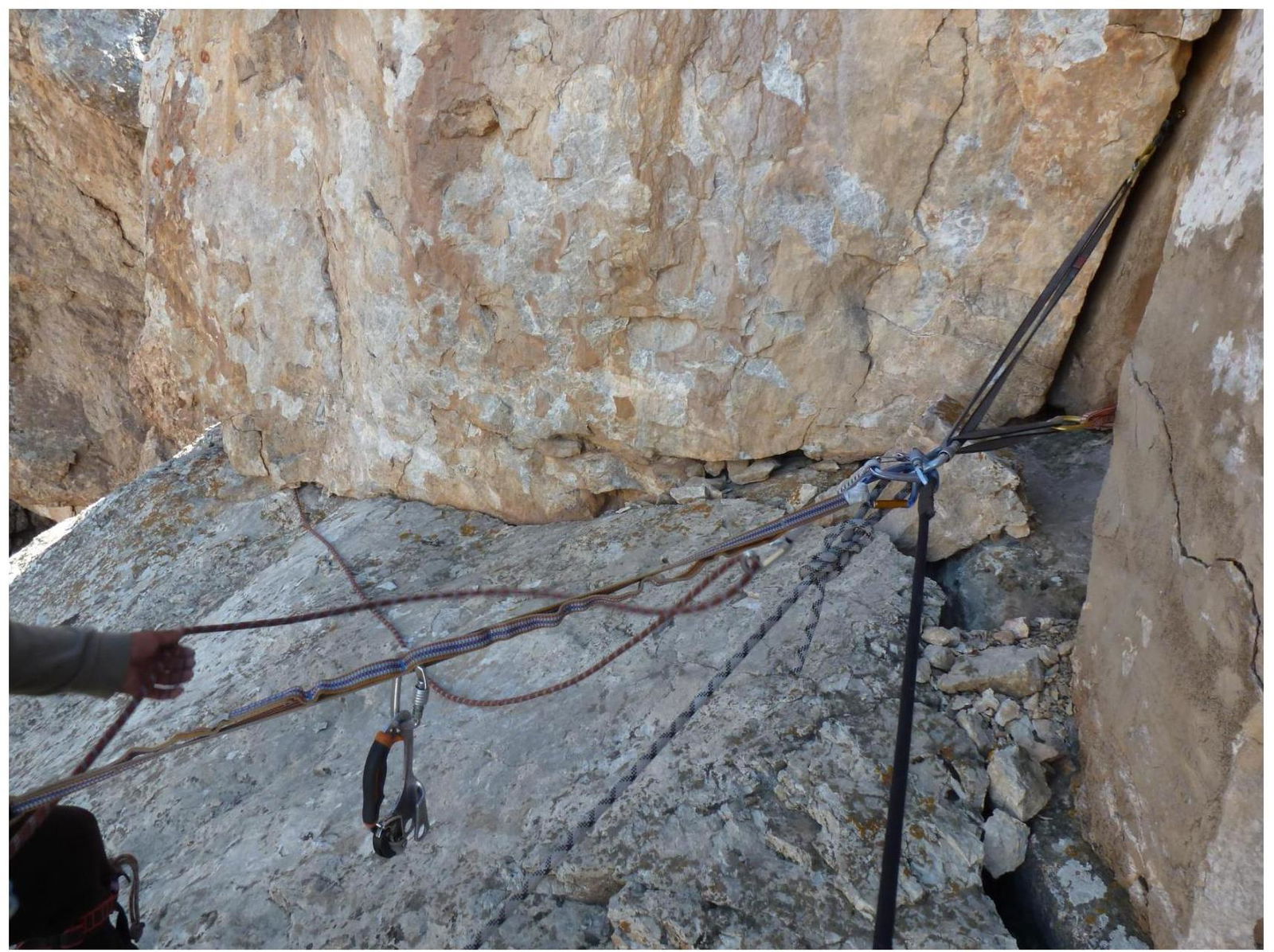
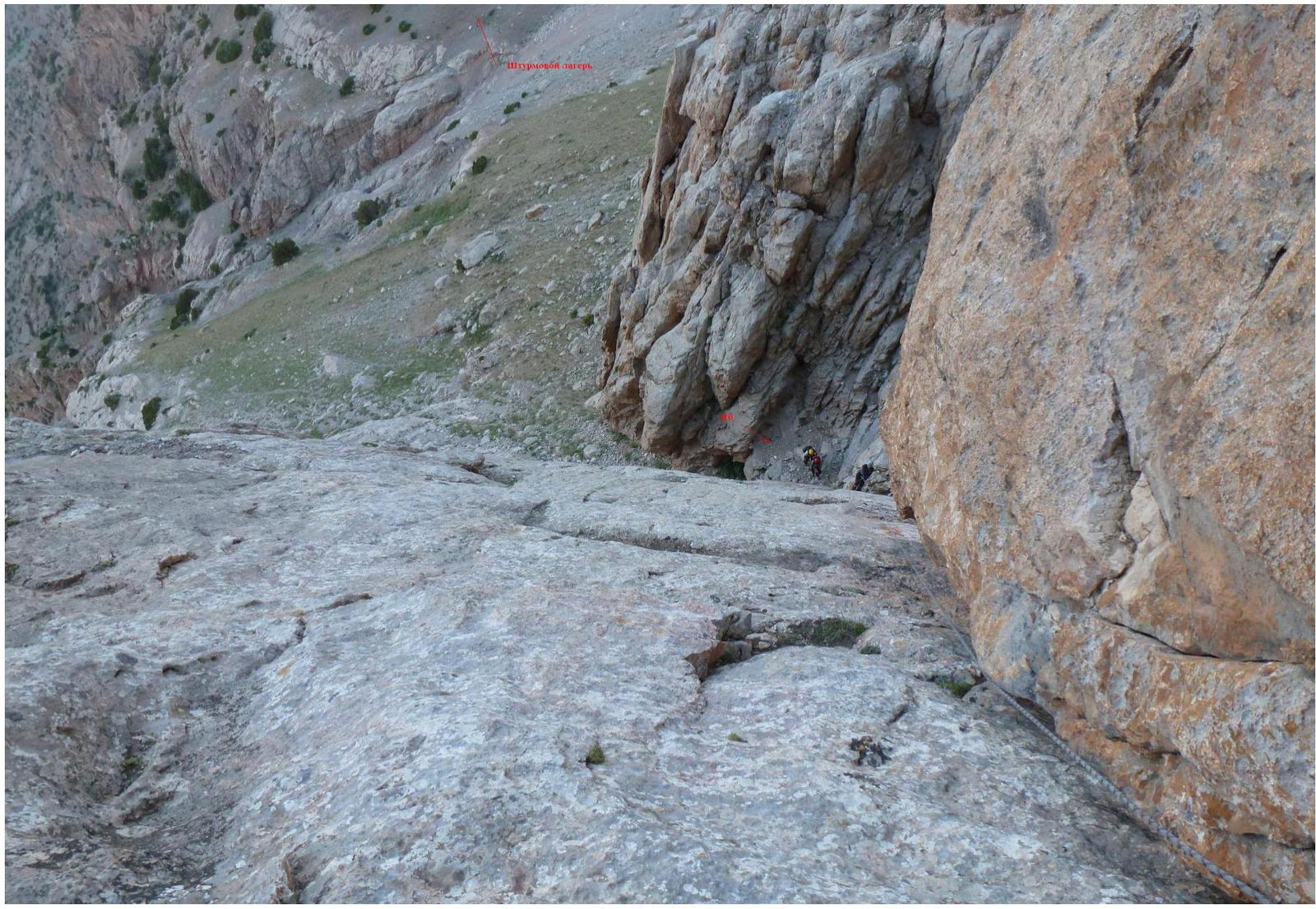
Station on section R22
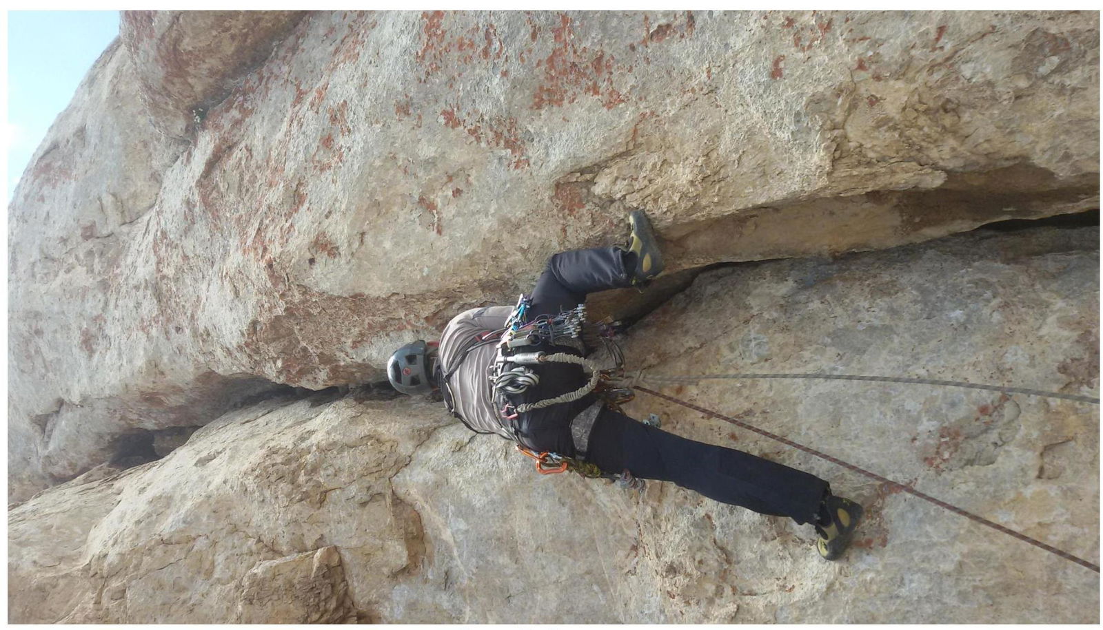
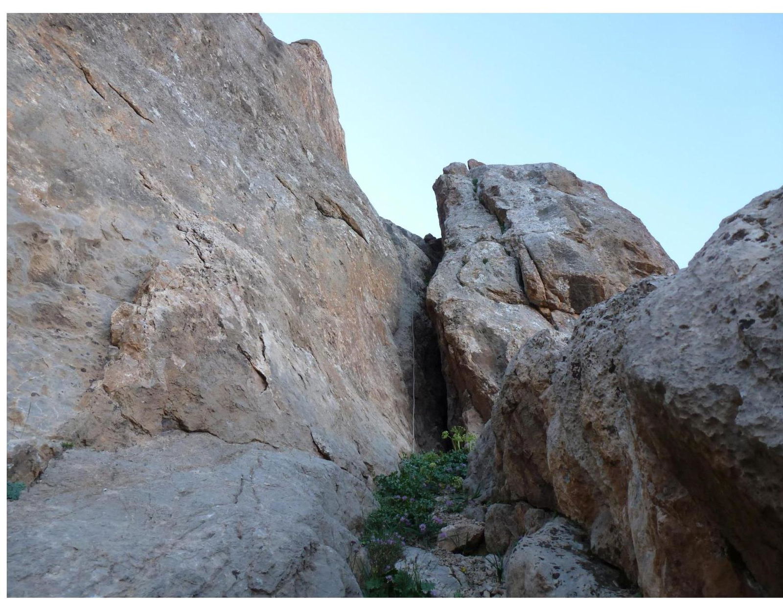
Section R25–R26
The Summit!