PASSPORT
- Rock class
- Pamir-Alai. Fann Mountains. Imat valley
- "Stupenka" peak
- Proposed 2B cat. first ascent
- Height difference 250 m. Length of sections 3 cat. - 45 m 2 cat. - 250 m
- 4 pitons driven, 10 chocks placed.
- Duration - 2.5 hours
- Team: Baykovsky Yu. V. MS Gupalov A. II
- Coach: Baykovsky Yu. V. MS 1st category
- Ascent made on September 2, 1994.
- Organization: State Sports Committee of the Republic of Tajikistan. Association of Alpinism, Rock Climbing and Travel of Tajikistan.
PHOTO OF "STUPENKA" PEAK (4200 m)
Photo taken from Patrush peak from the north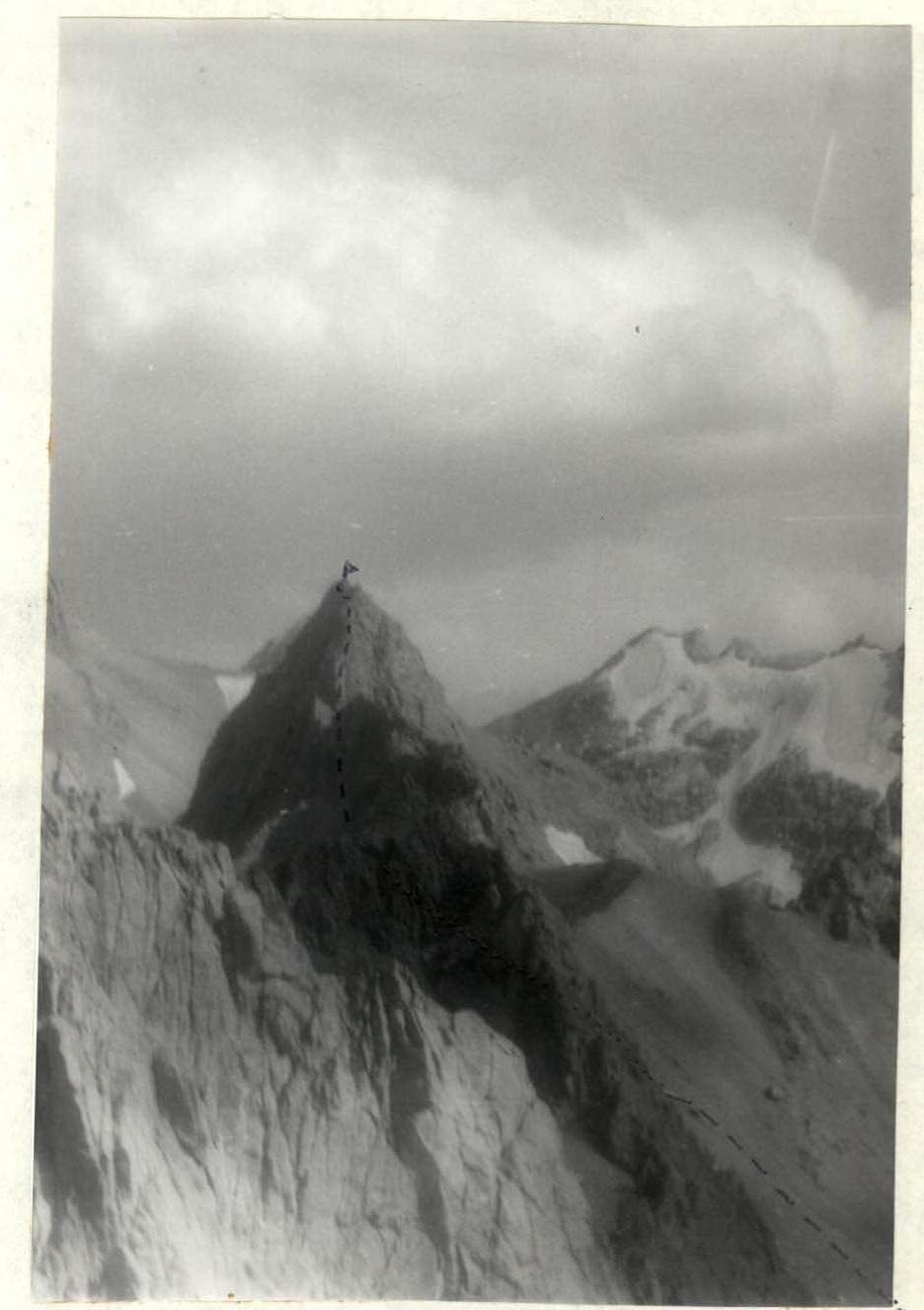
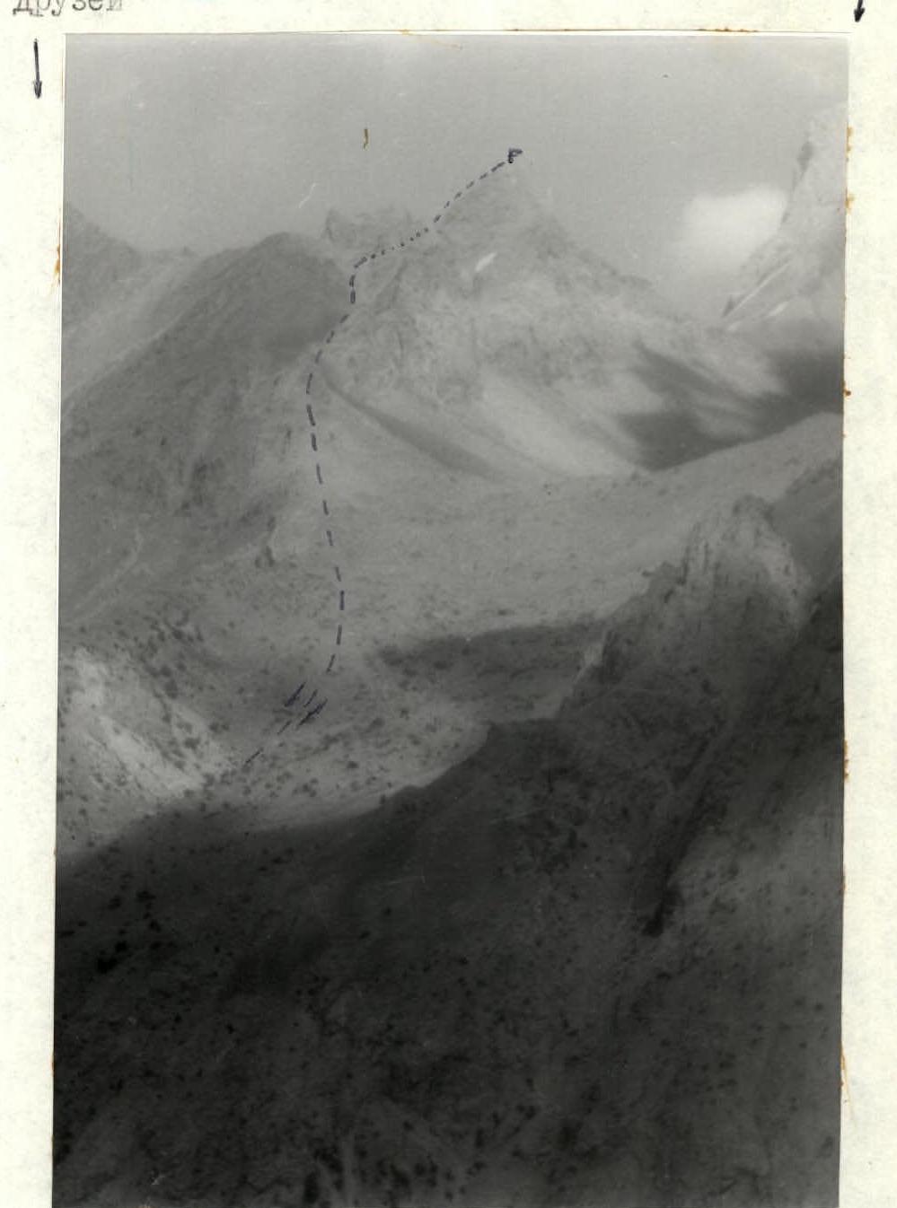
PHOTO OF "STUPENKA" PEAK 4200 m
Photo taken from the cirque of Bolshaya Ganiza peak.
v. Pamyati Druzei
v. Sarof
ROUTE SCHEME IN UIAA SYMBOLS
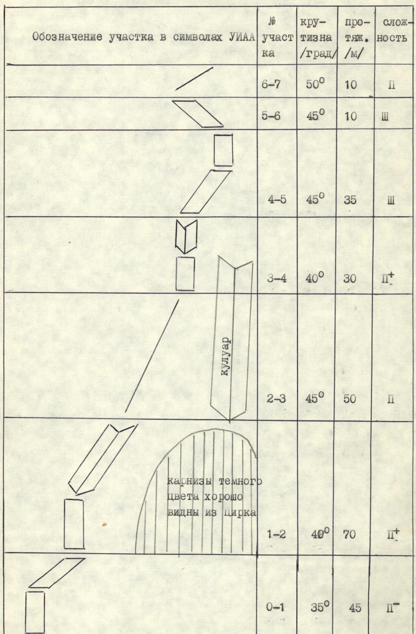
| Section designation in UIAA symbols | Section # | Steepness (°/grad) | Length (m) | Difficulty |
|---|---|---|---|---|
| R6–R7 | 6–7 | 50° | 10 | 2 |
| R5–R6 | 5–6 | 45° | 10 | 3 |
| R4–R5 | 4–5 | 45° | 35 | 3 |
| R3–R4 | 3–4 | 40° | 30 | 2+ |
| R2–R3 | 2–3 | 45° | 50 | 2 |
| R1–R2 | 1–2 | 40° | 70 | 2+ |
| R0–R1 | 0–1 | 35° | 45 | 2- |
Couloir. Dark-colored cornices are clearly visible from the cirque.
Route description by sections
The approach from the shepherd's summer camps takes 2-2.5 hours. Move up the couloir to the saddle between "Pamyati Druzei" peak and "Stupenka" peak. Having reached the powerful gendarme located on the saddle, bypass it on the right. Reach the scree saddle between the gendarme and "Stupenka" peak. The route starts from here. It is well visible, except for the middle part, which is hidden by a rock bastion. The route runs to the left of a clearly defined couloir, separating it from the counterfort ridge. A 2B category route has been ascended on the counterfort.
The route is rock, ridge, logical, and safe. Section R0–R1. From the saddle, 30 m up the rocky scree to a rock wall. Up and to the right 45 m.
Section R1–R2. Up the wall and further to the right along the inner corner, right-upwards, bypassing the dark cornices. Reach the ridge.
Section R2–R3. 50 m up the ridge.
Section R3–R4. The ridge leads to the pre-summit massif. 30 m up the wall and inner corners.
Section R4–R5. The key section of the route. A series of ledges and steep walls. The rocks are more monolithic than on the previous sections. Move 35 m up and to the right under the summit. Reach a ledge.
Section R5–R6. Along the ledge to the left, bypassing the vertical wall. Bypass the rock summit bastion (10 m) and reach the ridge.
Section R6–R7. The sharp ridge leads to the summit. There is no space on the summit for the whole group, so the group gathers and takes a summit tour on the ledge (section R5–R6).
Descent from the summit is via the ascent route. The ascent takes 2.5 hours.