REPORT
on the ascent to the Zamok peak via the northwestern edge (G. Venckovsky's route, 68), category 5A, from August 1, 2019, to August 2, 2019.
I. Ascent Passport
| № | 1. General Information | |
|---|---|---|
| 1.1 | Full name, sports rank of the leader | Merkurieva V.A. — Master of Sports |
| 1.2 | Full name, sports rank of the participants | Zhdanov I.M. — 2nd sports rank |
| 1.3 | Full name of the coach | |
| 1.4 | Organization | |
| 2. | Characteristics of the ascent object | |
| 2.1 | Region | GISSARO-ALAY, Fann Mountains — northern part |
| 2.2 | Valley | Alaudin |
| 2.3 | Section number according to the 2013 classification table | 5.3.1 |
| 2.4 | Name and height of the peak | Zamok, 5070 m |
| 2.5 | Geographical coordinates of the peak (latitude, longitude), GPS coordinates | |
| 3. | Characteristics of the route | |
| 3.1 | Route name | via the northwestern edge (G. Venckovsky's route, 68) |
| 3.2 | Proposed category of complexity | 5A |
| 3.3 | Degree of route exploration | - |
| 3.4 | Relief characteristics of the route | Rocky (with some combined sections — flowstone ice) |
| 3.5 | Elevation gain of the route (altimeter or GPS data) | 1445 m, 910 m (wall section) |
| 3.6 | Route length (in meters) | 2600 m, 1000 m (wall section) |
| 3.7 | Technical elements of the route (total length of sections of various complexity categories with indication of relief characteristics (ice-snow, rocky)) | Category I rocky — 1410 m, Category II rocky — 160 m, Category III rocky — 325 m, Category IV rocky — 103 m, Category V rocky — 173 m, Category V rocky + ice — 15 m, Category VI rocky + ice — 3 m. |
| 3.8 | Average slope of the route, (°) | 35° |
| 3.9 | Average slope of the main part of the route, (°) | 65° |
| 3.8 | Descent from the peak | Descent via route 2A from the saddle between Zamok and Paykhamber peaks |
| 3.9 | Additional route characteristics | Water is present on the route |
| 4. | Characteristics of the team's actions | |
| 4.1 | Travel time (team's travel hours, in hours and days) | 20.5 hours (2 days), 16.5 hours (wall section) |
| 4.2 | Overnights | 1 bivouac (ledge) |
| 4.3 | Route preparation time | - |
| 4.4 | Start of the route | 04:30, July 31, 2019 |
| 4.5 | Ascent to the peak | 11:25, August 1, 2019 |
| 4.6 | Return to the base camp | 13:20, August 1, 2019 |
| 5. | Person responsible for the report | |
| 5.1 | Full name, e-mail | Zhdanov Ilya Mikhailovich, snb.flex@gmail.com |
II. Ascent Description
1. Characteristics of the Ascent Object
The Zamok peak (5070 m) is located in the eastern spur of the Zeravshan ridge in the Fann Mountains of the Pamir-Alay mountain system, within Tajikistan. Orographically, it is in the basin of the Pasrud River, in its upper reaches. The approach to the peak is possible from the MATC "Vertikal-Alaudin" and ATB "Artuch".
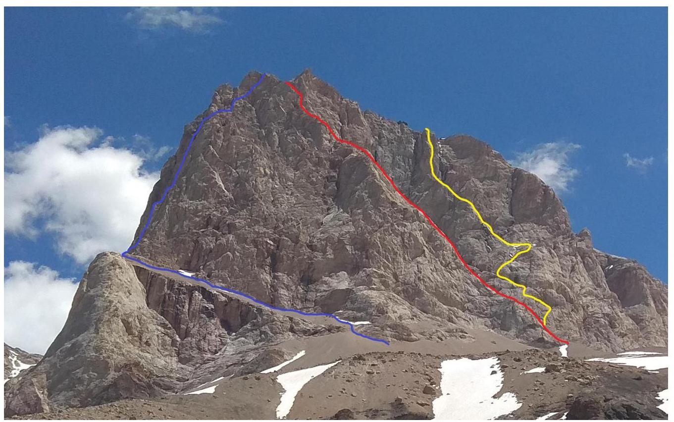
Zamok peak. Photo of the western wall from the "Fagitor" bivouac near the Mutnye Lakes. August 27, 2019.
- Blue line — 5A via the NW edge (G. Venckovsky, 68) — the route taken
- Red line — 5A via the W wall (L. Kapkov, 70)
- Yellow line — 5A via the central part of the W wall (E. Oshe, 1976)

Route profile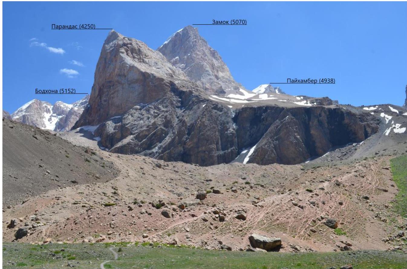
Panorama of the area. Photo taken from the trail to the Mutnye Lakes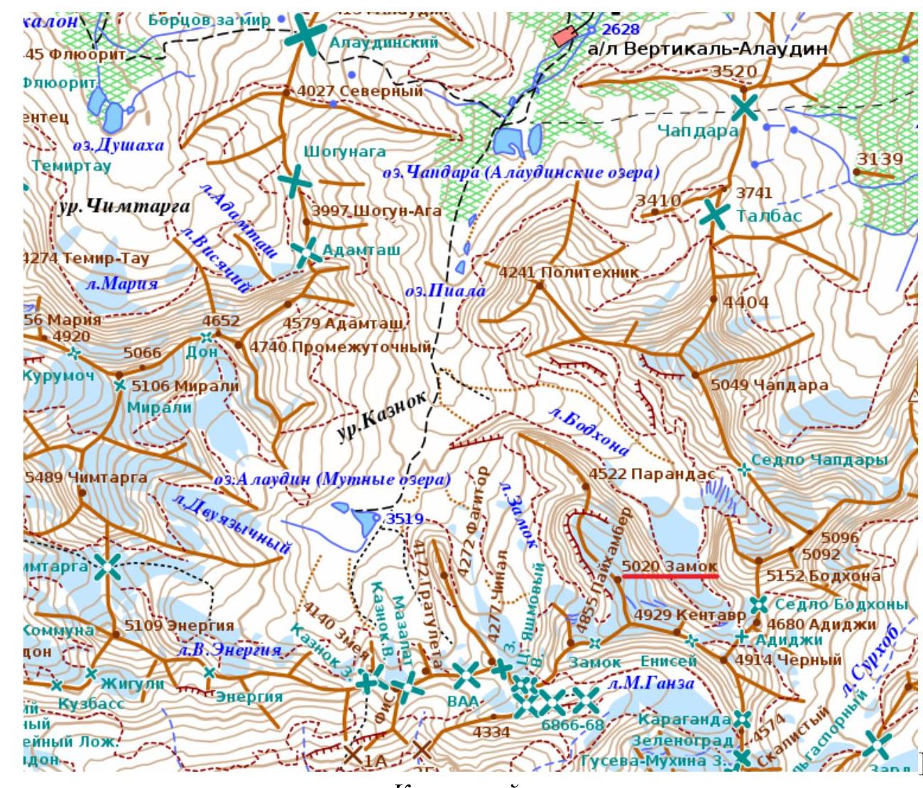
The approach from AL "Vertikal-Alaudin" takes about 6 hours. We exit the camp along the trail to the Mutnye Lakes. The trail is good and marked on the map with a black dotted line.
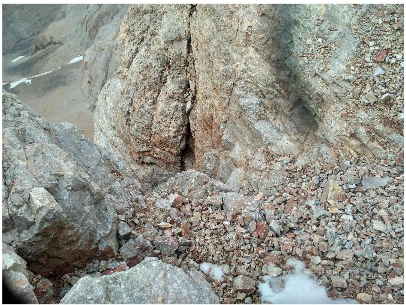
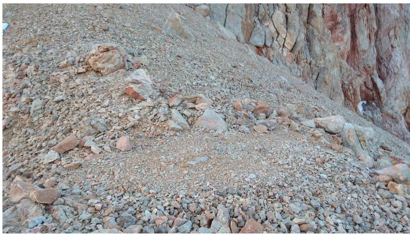
We pass by the Chapdara and Piala Lakes. A little before reaching the Mutnye Lakes, we turn left towards the Fagitor peak. From here, a faint trail begins along the scree.
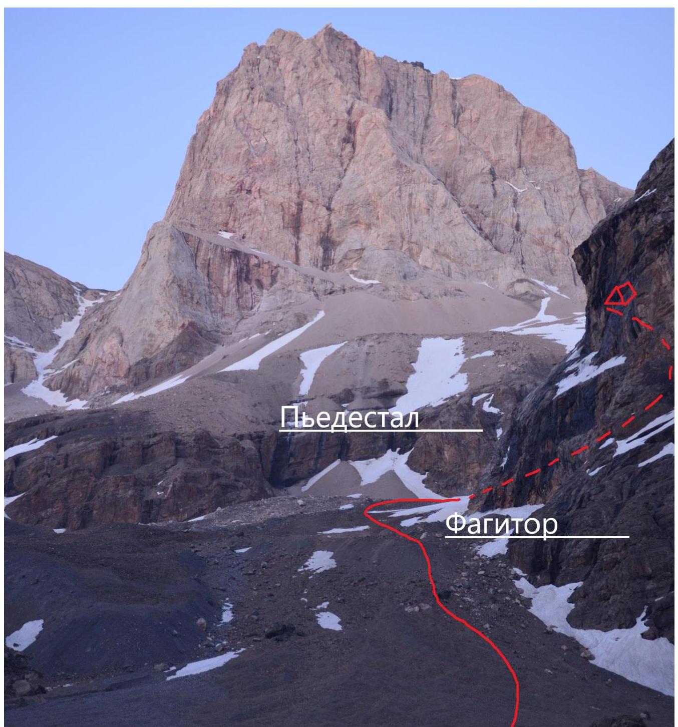
Approximate approach path. Photo taken from the Mutnye Lakes. The rocky pedestal in front of the western wall of Zamok is bypassed on the right (orographically). There are cairns. Then we move up along the scree slopes and snowfields towards the leftmost (orographically) rocky outcrop on the scree slopes. Above the outcrop, and to the left of it, there are platforms suitable for a tent. There is a snowfield. During the day, it melts, and water can be collected.
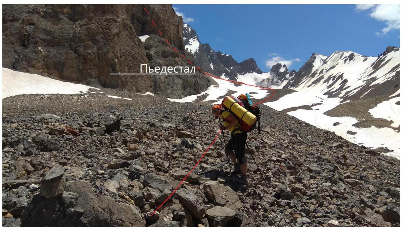
Bypassing the pedestal

Bivouac to the left of the rocky outcrop. In the background, the beginning of the Kapkov and Oshe routes.
2. Route Characteristics
 Technical characteristics of the route sections
| Section № | UIAA Symbol Line | Complexity Category | Length, m | Steepness, ° |
|---|---|---|---|---|
| R19–R20 | I | 800 | 10 | |
| R18–R19 | II | 80 | 30 | |
| R17–R18 | III–III+ | 60 | 45 | |
| R16–R17 | V–V+ | 50 | 70 | |
| R15–R16 | I–II / V / II–III | 60 (20 / 15 / 25) | 30 / 70 / 45 | |
| R14–R15 | IV | 20 | 60 | |
| R13–R14 | III | 70 | 45 | |
| R12–R13 | III | 20 | 70 | |
| R11–R12 | III | 80 | 45 | |
| R10–R11 | V+ (IV) VI (V) | 26 (10 / 3 / 3 / 10) | 80 / 60 / 90 / 70 | |
| R9–R10 | IV (III) | 25 (10 / 15) | 85 / 50 | |
| R8–R9 | V+ | 40 | 60 | |
| R7–R8 | V+ | 30 | 75 | |
| R6–R7 | III+ / IV | 40 | 50 | |
| R5–R6 | V+ / III+ | 35 (25 / 10) | 75 / 60 | |
| R4–R5 | V+ / IV | 28 (8 / 20) | 80 / 60 | |
| R3–R4 | IV | 15 | 60 | |
| R2–R3 | III | 20 | 45 | |
| R1–R2 | III / IV+ | 30 (15 / 15) | 50 / 75 | |
| R0–R1 | II | 60 | 45 | |
| R00–R0 | I | 1000 | 25 |
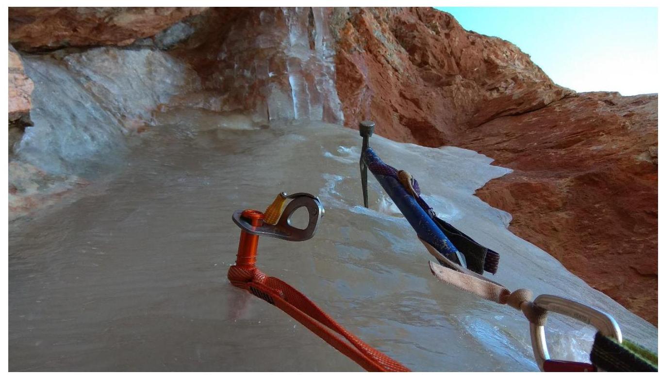
No count of protection elements was made. On most sections, protection was provided by cams and friends (we used 2 sets of cams and friends from № 0.5 to № 2 and one cam № 3). On many sections and belays, anchor pitons were used. Small and medium-sized chocks were used rarely. On section R15–R16 and the belay at the end of section R16–R17, ice screws were used. On the second crux, a large eccentric would be beneficial.
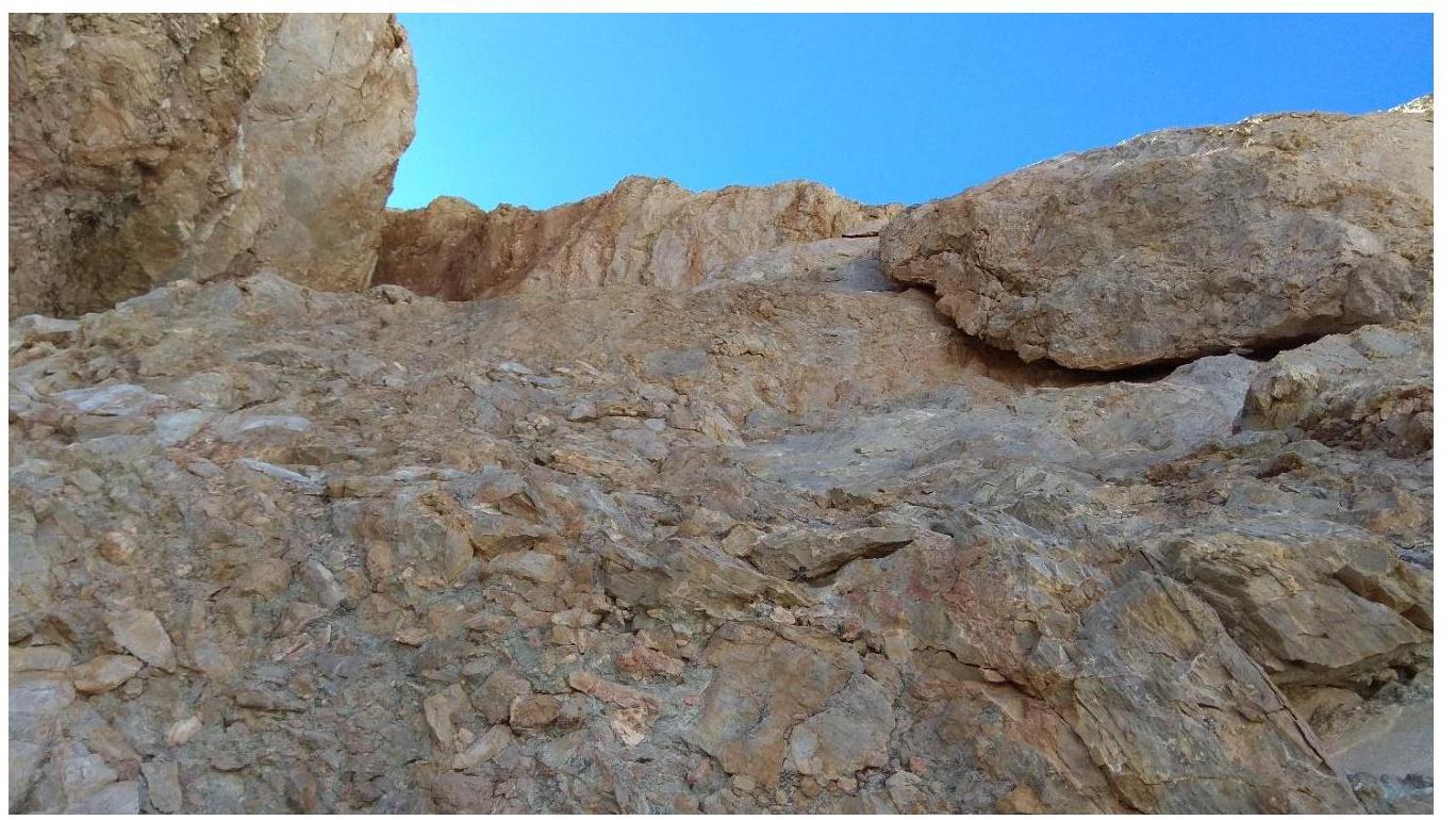
R00–R0 — a tiring traverse along a wide ledge with small, steep, and "moving" scree. It was more convenient and safer to stick to the rocks in the second half of the path. We move to the upper part of the white nose. There is a place for an overnight stay. 1000 m, I.
R0–R1 — from the top of the white nose, along simple, crumbling rocks and scree. 60 m, II, 45° (simultaneous).

Start of section R0–R1. Photo from the ledge on the "white nose".
R1–R2 — straight up, slightly veering left along crumbling rocks and an internal angle with good holds. 15 m, III, 50° (alternating); 15 m, IV+, 75° (alternating). R2–R3 — left and up to a large, vertical crack. 20 m, III, 45° (simultaneous). R3–R4 — up the crack (stemming, with ice in the crack, and problems with protection). Exit to a ledge under a narrow chimney. 15 m, IV, 60° (alternating). R4–R5 — a narrow chimney; the backpack has to be left behind and pulled up separately. Then, along crumbling rocks to a saddle. Belay on a ledge. 8 m, V+, 80° (alternating); 20 m, IV, 60° (alternating). R5–R6 — difficult climbing with problems in organizing protection. From the saddle, slightly right and up the wall. Then, the rocks become less steep, and an internal angle leads right to a ledge. Belay on a ledge. 25 m, V+, 75–80° (alternating); 10 m, III+, 60° (alternating).
Section R5–R6 (easing of the rocks after the difficult part).
Internal angle at the end of section R5–R6. R6–R7 — along simple, crumbling rocks up, slightly right, to a convenient large ledge under a chimney (possible overnight stay). III+ / IV — 40 m, 50° (simultaneous).
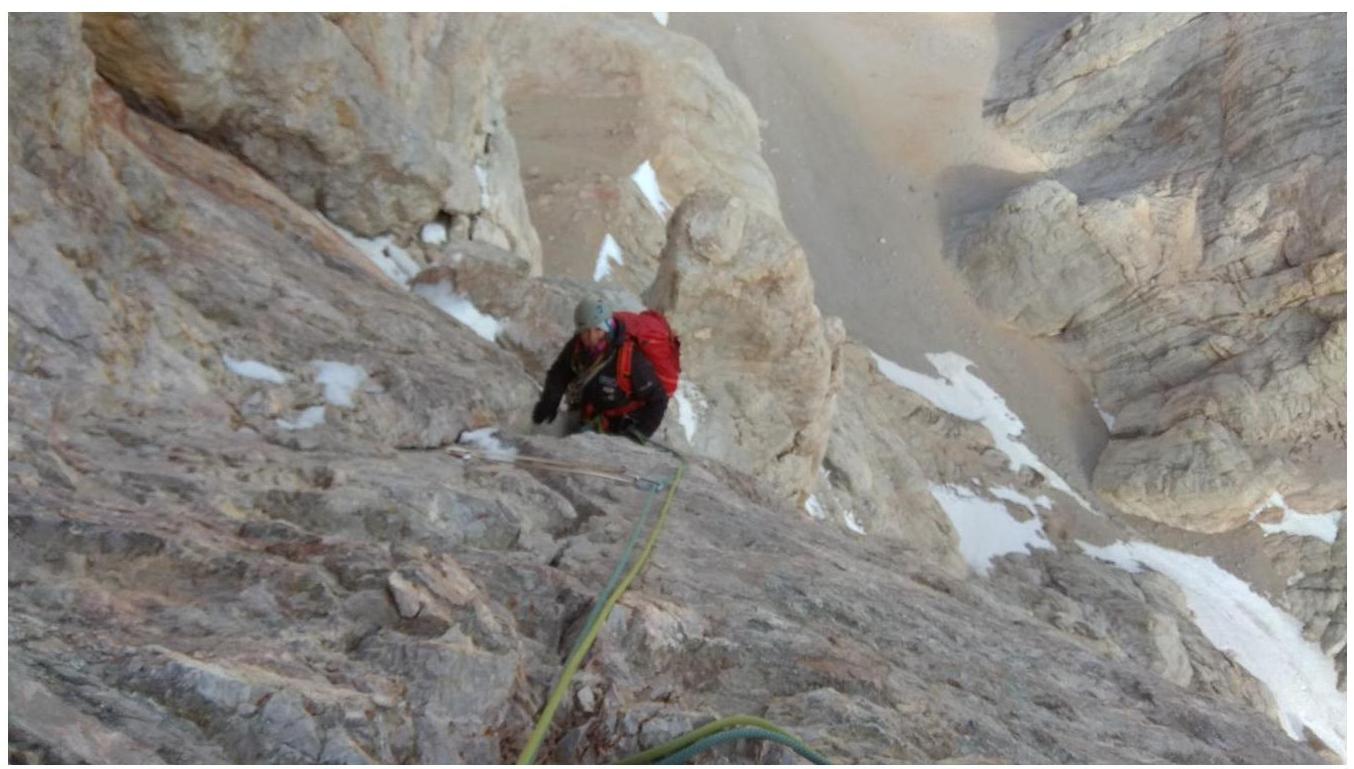
R7–R8 — the first crux. Chimney. Impossible to place protection for the first 10 m. Very large cams or Big Bros are necessary. For climbing in the narrow chimney, it's better to remove all gear from the back pockets. First, climb outside, then enter the chimney and move to the first constriction. Here, a loop can be hung on the constriction. Then, the chimney widens, and after a triple constriction, exit right to a ledge convenient for belaying. The backpack had to be pulled up, as climbing with it in the chimney is impossible even in a suspended state. Belay slightly to the right on a local piton and an anchor with a cam. 30 m, V+, 70–75° (alternating).

Chimney on section R7–R8. First crux. Photo from the ledge under the chimney.
Belay at the end of section R7–R8. R8–R9 — along cracks and inclined slabs, ascend right and up to a sharp, thin, vertical edge. Bypass the edge and reach a ledge suitable for an overnight stay. Belay on anchors. 40 m, V+, 60° (alternating). R9–R10 — traverse the ledge, approaching a vertical, slightly overhanging crack with good holds. Problems with organizing protection. There is an old piton. Then, along simple rocks, right, first slightly up, then slightly down to a wall with an old piton with a white loop. Belay on a ledge. Sometimes, small icicles and stones fall from above. 10 m, IV, 85° (alternating); 15 m, III, 50° (alternating).

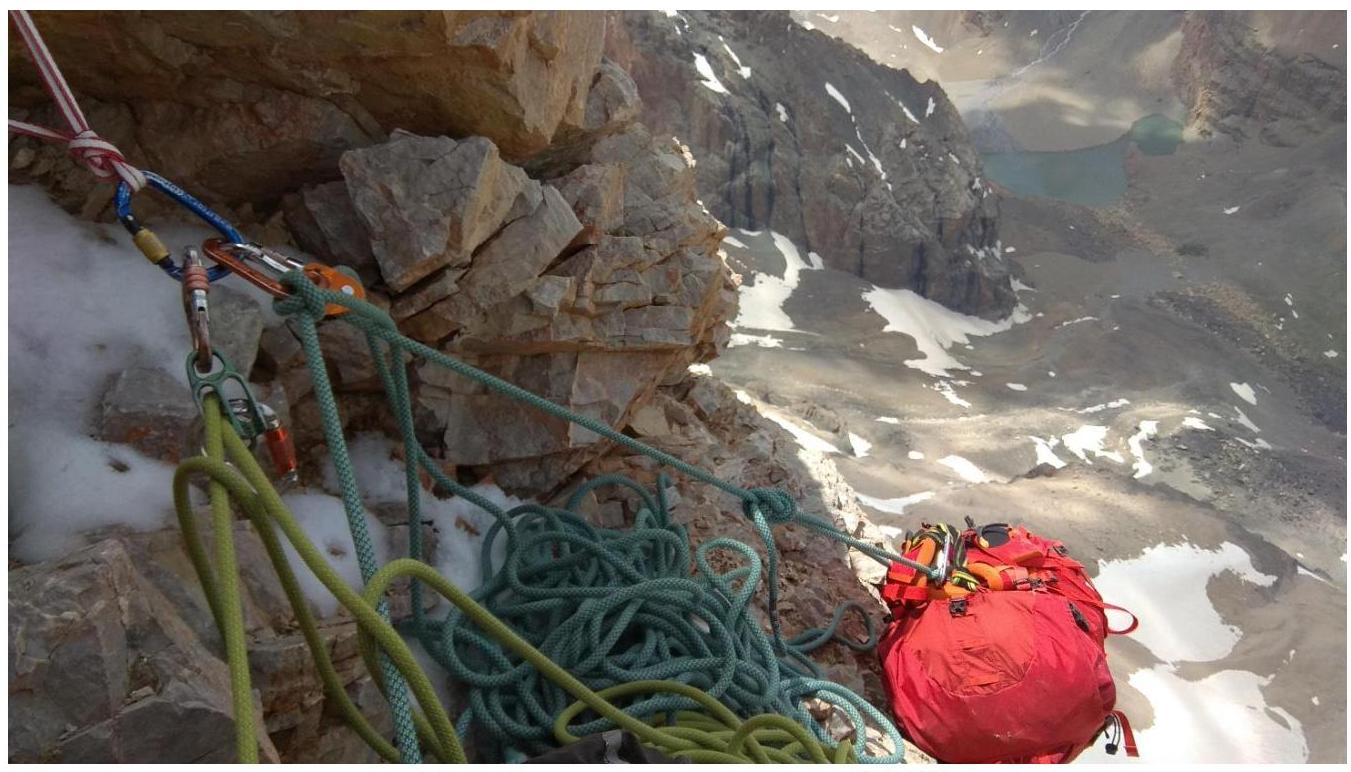
Crack on section R9–R10. R10–R11 — the second crux. First, difficult climbing on a monolithic wall, right and up from the old piton. Then, along a flowstone-covered internal angle, overhanging at the end (with water flowing on the left part). Then, up the wall to a scree ledge. Had to climb with a rock hammer on the right foot and a crampon on the left boot. Had to dig and melt ice with hands for a cam № 3. There is an old piton in the angle and 2 cut bolting after exiting the angle. Protection is problematic. A large eccentric would be beneficial. Climbing is difficult and tense. 10 m, V+, 80° (alternating); 3 m, IV, 60° (alternating); 3 m, VI, 90° (alternating); 10 m, V, 70° (alternating).
Scree ledge at the end of section R10–R11. R11–R12 — along simple, crumbling rocks, left and up to a scree-filled couloir ending in a red overhang. 80 m, III, 45° (simultaneous). R12–R13 — traverse along a ledge right to vertical, simple rocks with water flowing on them. 20 m, III, 70° (simultaneous). R13–R14 — left and up along simple rocks to a scree-filled couloir. 70 m, III, 45° (simultaneous).
R14–R15 — right and up along a flowstone-covered internal angle with good holds. Exit to scree ledges; belay on a ledge under overhanging columns (walls). 20 m, IV, 60° (alternating). Overnight stay on a platform that had to be cleared of large stones and leveled. There was also a ready-made place for a sitting bivouac nearby.
R15–R16 — traverse right along a ledge to an old loop on a ledge (white, slightly below). Simultaneous. Then, right and up along an internal angle covered with flowstone (old piton) to a shallower section and a small ledge. Traverse right along the ledge under a scree-filled couloir with an internal angle on the right, turning into a chimney higher. 20 m, I–II, 30° (simultaneous); 15 m, V, 60–70° (alternating); 25 m, II–III, 45° (simultaneous).
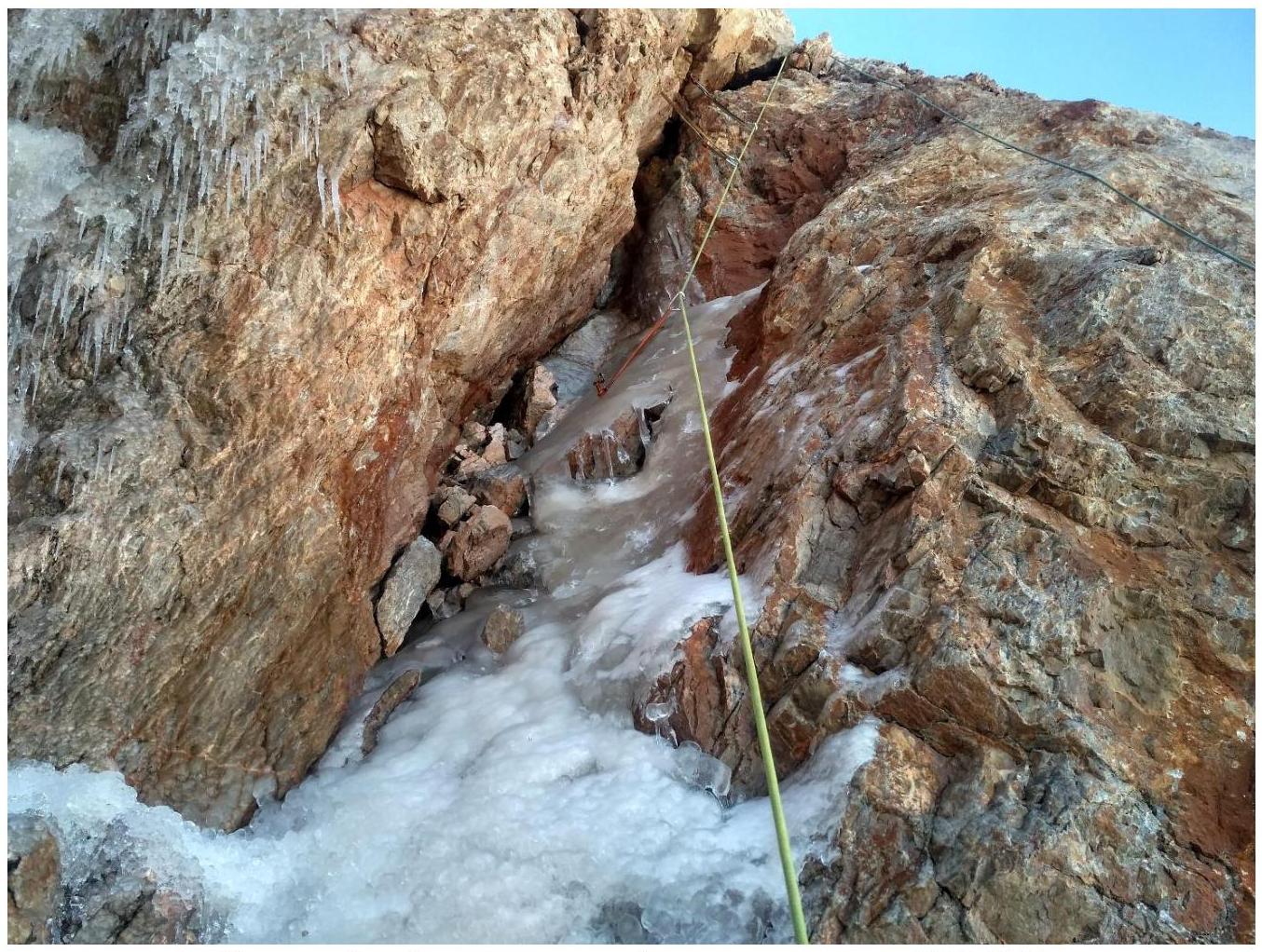
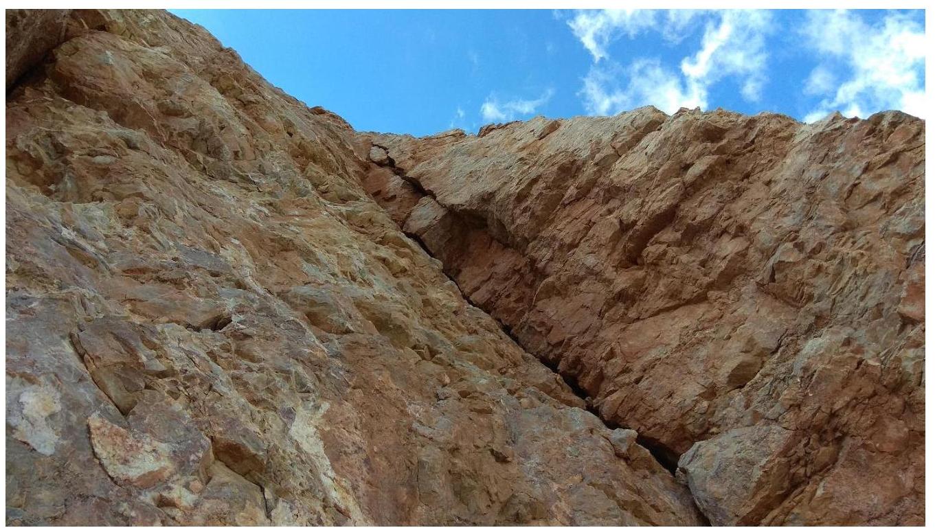
Flowstone-covered internal angle on section R15–R16. R16–R17 — the third crux. Right and up along an internal angle that becomes shallower, forming a ledge, and then becomes steep again, turning into a chimney. Good protection; stemming is required. After exiting the chimney, traverse right and up along inclined slabs. Belay on pitons and a bollard. 50 m, V–V+, 70° (alternating).
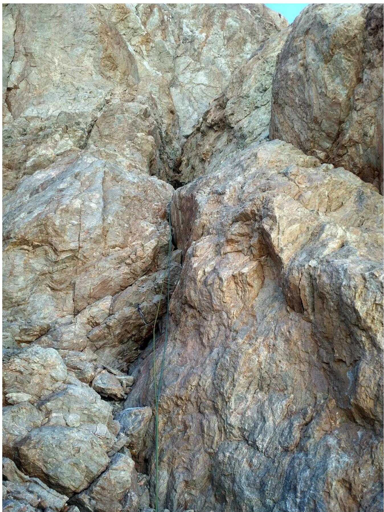
Internal angle turning into a ledge at the start of section R16–R17.
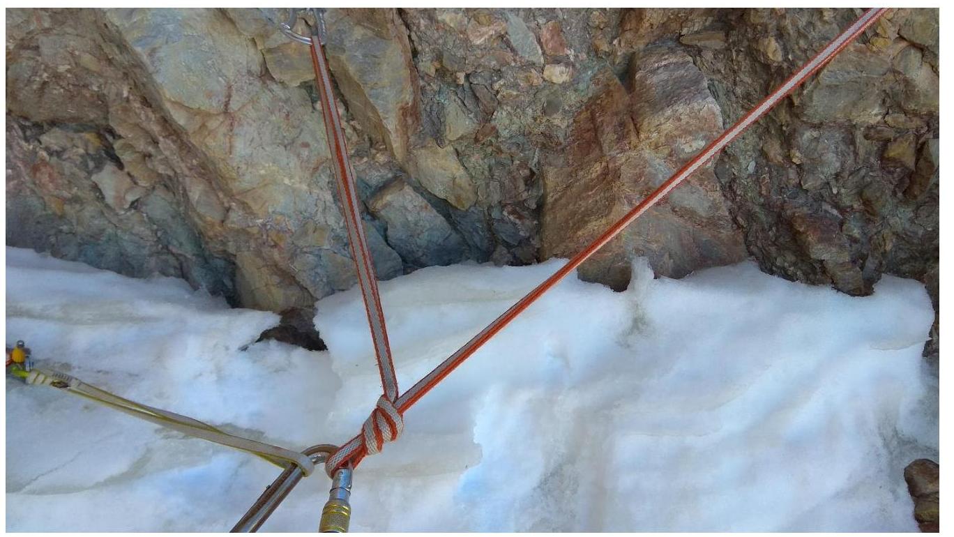
Belay on 2 anchors and a bollard at the end of section R16–R17. R17–R18 — along simple, crumbling rocks and slabs up, slightly right, to the ridge. Then, turn left onto the ridge and move along it to the pre-summit ridge. The wall section is over; the rest is a walk. 60 m, III–III+, 40–50° (alternating).
Start of section R17–R18. Photo from the belay. R18–R19 — ascend right and up along a snow-ice ridge. 80 m, II, 30° (in a team). R19–R20 — move along a wide, scree-covered ridge to the peak. 400 m, I, 10° (in a team).
Descent
Descent via route 2A from the saddle between Zamok and Paykhamber peaks (Zamok Pass).
From the peak, descend forward (orographically) along the ridge, bypassing a red gendarme on the right (traversing). There is ice in some places; teams uncertain on ice may need protection.
Then, directly along the ridge towards the Paykhamber Glacier. Exit onto the glacier (do not turn right into a scree-filled couloir earlier) and cross it down and left. After crossing the bergschrund on the left part of the glacier, descend right and down to exit onto a gentle slope below the icefall. Then: right onto scree; down along the scree alongside the southern wall of Zamok to the bivouac sites.
The descent takes 1.5–2 hours.
3. Characteristics of the Team's Actions
Before this route, the duo Zhdanov-Merkurieva completed an acclimatization hike to the Chimtarga Pass (4700 m) from July 22 to July 28.
Training ascents:
- to Severnaia peak (2B, 3A)
- to Alaudin (4A)
- to Zamok peak via the western wall (L. Kapkov, 5A).
Ascent Tactics
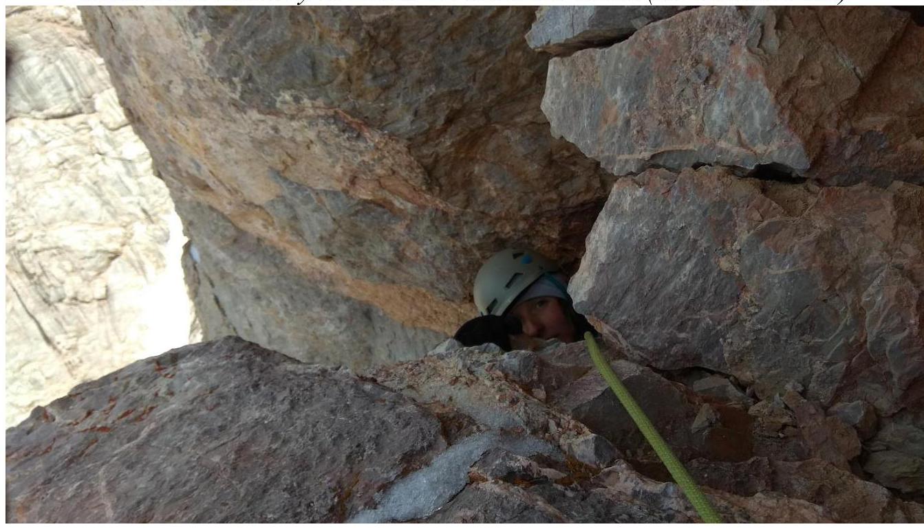
Zhdanov led on the route. The leader climbed with a small, light backpack, while the second participant carried a full backpack. On some sections, the backpack had to be pulled up. A Petzl Micro Traxion block was used.
Initially, we planned to climb in rock shoes, but it was very cold on the route until noon, so we had to wear boots occasionally. Crampons were also needed on two sections with flowstone ice.
An ice axe, taken for protection during the descent on the glacier and for removing pitons by the second climber, proved useful for climbing.
Ice screws were used in two places.
Protection was provided by two identical dynamic ropes. Leader protection was through an "eight" device, and second protection was through an autoblocking device. The entire route was climbed free by both participants.
Regular radio communication was maintained throughout the ascent. A backup satellite phone was also available.
Initially, we planned to complete the route in one day. This assessment was based on the relatively easy passage of the Kapkov route (5A) on Zamok's western wall in 14 travel hours. At 19:00, we decided to set up a bivouac, as the last crux was ahead, and we wouldn't have made it down the wall section in time.
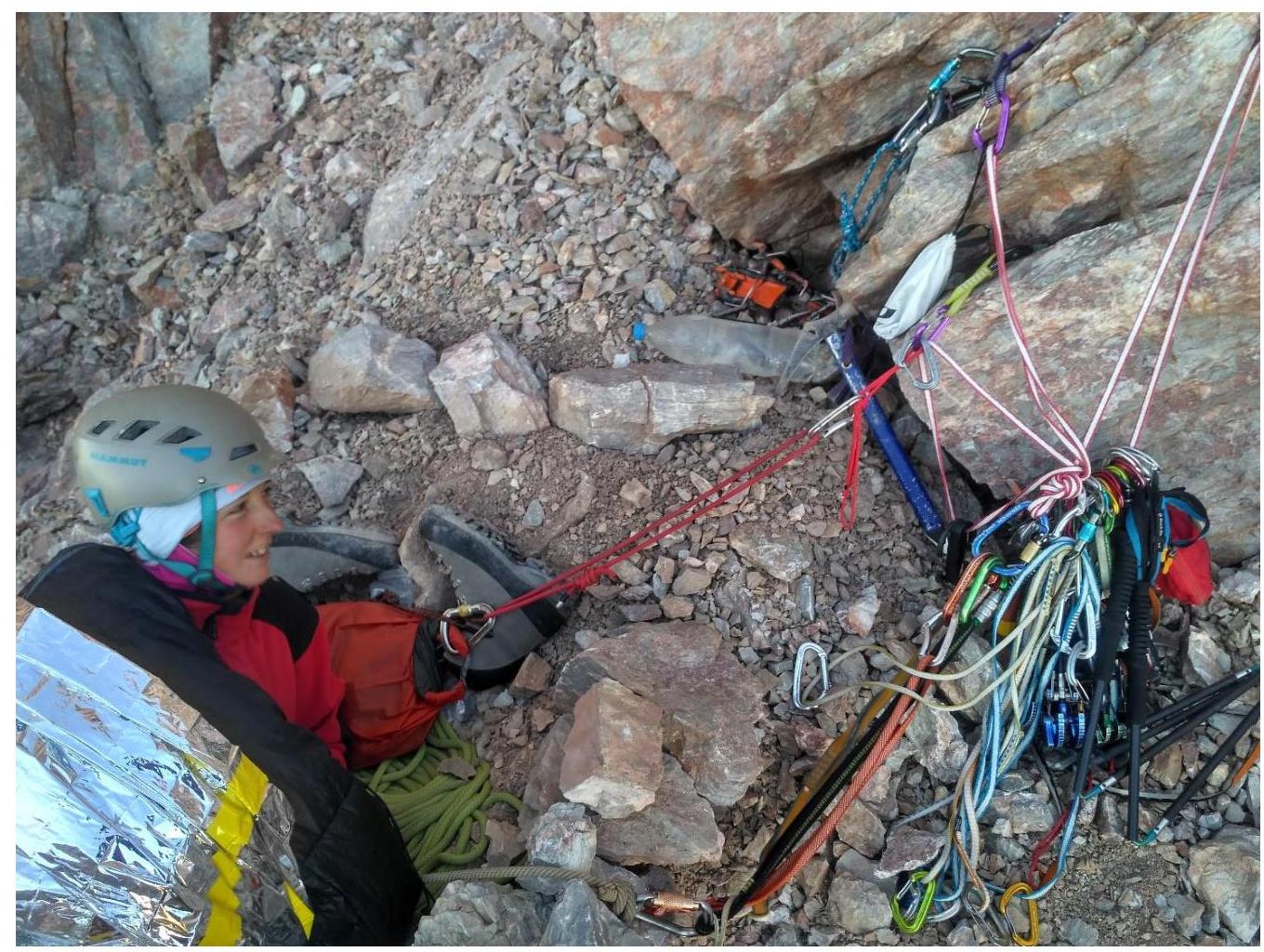
For the bivouac, we brought a 2-person sleeping bag-blanket Red Fox "Big Wall Team" and a thermal blanket-bag Silver Track from Splav. The dense thermal blanket-bag performed well on the bivouac; it was warm and comfortable.
On August 1, at 07:30, we resumed the ascent, finished the wall section at 10:50, and reached the peak at 11:25. We descended to the bivouac sites at 13:20, rested, ate, dismantled the bivouac, and descended to the BSL "Vertikal-Alaudin".
On the peak, we found our own note from the Kapkov route. Previously, we had retrieved a note from the "Belarusian Alpine Federation" dated July 28, 2019, with leader Sidorchuk V.L.
According to the participants, this route is significantly more challenging than the popular Kapkov route (5A) on Zamok's western wall. The route is cold due to its northwestern orientation, receiving very limited sunlight. There are sections with flowstone ice. In several places, organizing protection is problematic. The first 10 m of the first crux lack protection entirely. The route is often plagued by falling stones, requiring careful movement. Orientation, especially in the second half of the route, is non-trivial. In terms of climbing difficulty and the number of sections with challenging climbing, this route surpasses the Kapkov route. The average steepness is also higher — 64°. Compared to rocky routes of category 5A in Ala-Archa, this route is also more challenging.
We recommend this route for teams prepared for category 5B ascents. We believe the route is more suited to category 5B (as assessed by the first ascensionists). Although it lacks sections of VI climbing (only 3 m), it has many sections of V+ climbing, sometimes with problematic protection. There are also complex combined sections.
The description used by the Moscow team led by Altman O.I. (also found in the RISK guidebook) did not entirely match our route, so we decided to write a detailed report.
Team timeline:
- July 31:
- 04:30 — departure from the campsite
- 06:00 — began work on the route
- 09:00 — working on section R5–R6
- 12:00 — leader completed the first crux (R7–R8)
- 15:00 — first climber reached the middle of the second crux (R10–R11)
- 19:00 — set up a bivouac at the end of section R14–R15
- August 1:
- 07:30 — resumed work on the route
- 10:50 — finished the wall section
- 11:25 — reached the peak
- 13:20 — descended to the bivouac sites
- 19:30 — returned to BSL "Vertikal-Alaudin"
Supplement to the Route Photo Illustration
Bivouac site under the start of the wall section (on the "white nose").
Exit from the chimney at the end of the first crux.
Bivouac.
Flowstone-covered internal angle.
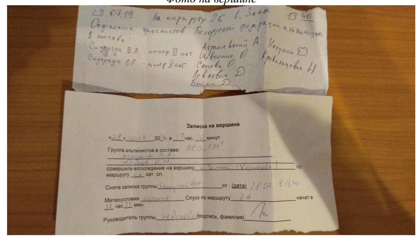
Photo on the peak.
Notes on the peak:
July 28, 2019. Via route 2B to v. Zamok 13:40. Members of the Belarusian Alpine Federation: AtraShevsky A., Katunin D., Sidorchuk V.L. (leader, II category), Shevchenko G., Krivaltsevich N., Somova O., Levkovich D., Boiko D.
Note on the peak: "28" July 2013 at 17:10. A group of climbers consisting of: Merkurieva V.A., Zhdanov I.M. DSO Luch completed an ascent to Zamok peak (Kapkov's route I) category 5A. Retrieved a note from a group (...) dated (date) July 28, 2019, 13:40. Weather conditions are good. Descent via route 2A started at 17:25. Team leader Zhdanov (signature, surname).