Description of the First Ascent to the Festivalnaya Peak via the North Face
The Festivlnaya peak is located in the upper reaches of the Mama River, in the southern spur of the Hissar Range - south of the Proni Siam and South Siam peaks. This spur stretches from north to south and sharply turns east near the Festivlnaya peak.
There are two Festivlnaya peaks:
- Eastern
- Western (main, height 4350 m),
which are elevations on a massive ridge stretching in a latitudinal direction.
A route along the ridge from east to west was previously traversed and is rated as a 4A category route.
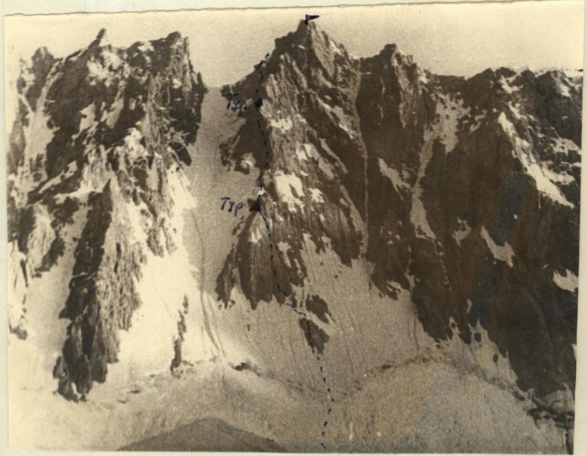
The northern slopes of the peak are steep, with snow-covered rocks and steep snow and ice couloirs in many places. A significant snow and ice couloir descends from the saddle between the Eastern and Western peaks.
The rocks on the left (in the direction of travel) bank of the couloir are heavily destroyed, and stones are constantly falling from there. To the right of the couloir, there are two counterforts separated by a snowy slope, and ascent routes to the peak are possible via both.
The group chose a path along the rocks bordering the couloir.
Route Description
From the base camp, located on the Siama River under the slopes of the Medvezhiy Zamok peak, we go downstream along the river on its orographic right bank and, rounding the slopes separating the cirques of the Siama and Festivlnaya glaciers, we first go along the left orographic bank of the Festivlnaya River, then along
 snowfields. Overnight stay on the left lateral moraine of the Festivlnaya glacier.
From the overnight stay, we approach the bergschrund encircling the entire northern slope of the Festivlnaya peak ridge via snowfields. The bergschrund is wide but clogged with snow in some places. The bergschrund is crossed at its lowest point on the slope, passing over a snow bridge slightly to the right of the wall and directly under well-defined rock islands. Under no circumstances should the bergschrund be crossed to the left of the specified location, as stones and small avalanches fall almost continuously down the ice and snow couloir to the left of the wall. After crossing the bergschrund, we ascend to a rock island via a steep firn and ice slope (steepness around 50°), which turns into serac ice near the rocks. The length of this section from the beginning of the bergschrund to the start of the rock island is 90 m. Belay via ice screws and a rock piton at the beginning of the rock island.
The rock island (its length is approximately 35 m) consists of steep slabs covered with serac ice in many places. It is traversed in its middle part via a crack. Belay via pitons.
At the top of the rock island, on a ledge two meters from the crack, to the left of it, the first control cairn is built.
Note: traversing this entire section via ice, bypassing the rock islands, is less time-efficient and more dangerous.
After the first rock island, we move directly upwards: along steep firn and ice to a second rock outcrop located approximately 10 meters from the first. The second rock island is a steep, narrow ridge composed of black rocks. Belay on the rocks is via pitons.
Then we traverse a steep snow and ice slope to the left, in the direction of the main rocks of the wall. Near the rocks, we cross an ice gully about three meters wide. Belay via an ice screw.
Then we emerge onto the rocks. The first 20 m are rocks of medium difficulty and difficult, covered with serac ice. Then we go 90 m along a rock gully with a width of 0.5 m to 2 m and a steepness of 65–70°. To the left of the gully are steep slabs, and to the right is a slope with serac ice. The gully is blocked by plugs in two places. The first plug is climbed via a narrow crack on the left. In the upper part, the gully narrows and turns into a crack. After the first 50 m, there is a good belay spot: a platform with a выступ. In between, belay is via pitons. The exit from the gully is a snow plug 3 m high. This plug is bypassed on the right along smooth rocks covered with serac ice. This section is traversed without backpacks. Above the plug, there is a good platform for the belayer and a выступ.
To the right of the platform are slabs and a wall. The next 35 m of the route are traversed initially along a steep slab (we go along its right side, where there is a crack), then along smooth, difficult rocks ending in a sharp ridge. Holding onto the ridge, we move to the left and descend onto a small depression - a ledge, where belay is organized via pitons. The ledge is narrow, and no more than two people can fit on it simultaneously. Here, in a niche, slightly below the belay spot, to the right in the direction of travel, the second control cairn is built.
Then we traverse a snow saddle. The first 10 m of the saddle are a sharp ridge of dense firn, which we traverse sitting astride. An additional point of support is the pick of an ice axe. The remaining 20 m - steep snow (around 60°) - are traversed in three pitches. The snow saddle is traversed very cautiously, with thorough piton belay: on both sides of the saddle are snow and ice couloirs with protruding rocks.
Having traversed the snow saddle, we come up against a wall, which is bypassed on the left along indistinct inclined ledges. Belay is via pitons. The general direction of movement is along the rocks, along the boundary between the rocks and the snow and ice couloir on the left in the direction of travel. It is not possible to go along the couloir:
- the couloir is almost continuously shelled with stones from the rocks on its left bank;
- the couloir is very steep, with almost vertical walls in places.
Immediately after the snow saddle, we move 90–100 m along ledges, traversing the wall to the left. The rocks are difficult. The rocks are fragile, with many loose stones, so belay via protrusions is almost impossible. Belay is via pitons and wedges. At the end of this hundred-meter section, there is a выступ for belay. The выступ is not very convenient:
- it is difficult to pull the rope through;
- the spot is inconvenient for belay: no more than two people can be here simultaneously;
- one of them is not standing on full feet;
- it is difficult to pass each other.
Then we continue moving along the left side of the rocks, traversing the wall. The length of the traverse is 40 m. On this section, there are two places with overhanging rocks that throw off those passing. The rocks are difficult, belay is via pitons.
Note: from the выступ, two paths are visible.
- The first path, chosen by the group, is a traverse of the wall to the left.
- The second is to the right along a slab (via a crack on the slab), then upwards along a wide and very smooth corner.
At the beginning of the next section (30 m long), about three meters of overhanging rocks are traversed using ladders. From the ladders, we emerge onto a ledge, along which we move slightly to the right, then to the left along wide ledges covered with small debris. Many loose stones. Belay is via pitons.
The next 30 m are an internal corner with good handholds. Belay is via pitons.
After the corner, we continue moving along similar inclined ledges, always going to the left. We traverse 50 m of rocks of medium difficulty but very dangerous due to loose stones. At the end of this section, on a wide inclined ledge covered with small debris, three meters to the left of the route under the wall, the third control cairn is built. To the right of the route, 10 m away, is a spot for an overnight stay (one tent).
Then 20 m of rocks of medium difficulty lead us to a wall, which is traversed on the left via a traverse. The traverse is 30 m. Belay is via pitons.
We continue moving along the left side of the wall, along inclined ledges. To the left is a couloir, and to the right are sheer red rocks with characteristic black spots. Belay is via pitons. Having traversed 60 m, we approach a gray slab. On the slab (about 18–20 m high), in its right part, there are good handholds. We ascend the slab initially upwards, then traverse to the left.
The gray slab leads us to a snow cornice located under the ridge. We traverse the snow cornice (its height is 10 m) and emerge onto the main ridge of the Festivlnaya peak - about 60 meters to the right of the saddle between the Eastern and Western peaks. Here, there are spots for tents.
The path along the ridge to the Main (Western) peak initially goes along porous rocks with good protrusions for belay. The peak is reached via a sharp rocky ridge (20 m long).
The descent from the peak along the ridge is to the west. Initially, we go along rocks, then along snow. Three sharp gendarmes are bypassed on the left, re-emerging onto the ridge. Further descent along the snow is dangerous (due to cornices), so we bypass the snowfield on the left along rocks, descending downwards and re-emerging onto the ridge. Further descent along snow and scree leads us to the Razvedchik pass. From the Razvedchik pass, we descend directly into the base camp on the Siama.
Note: it is also possible to recommend a descent from the saddle directly southwards, along scree and then along snow, and return to the camp via the cirque of the Studencheskaya peak. This descent is easier but longer.
Information about the Group
The first ascent of the north face of Festivlnaya was made on August 6-8, 1964, by a group of instructors from the Varzob alpine camp in the following composition:
Leader: Georgiy Stepanovich Bukharov - Master of Sports (Kharkov). Members:
- Aleksey Ivanovich Korzhavin - 1st sports category (Dushanbe).
- Valeriy Ivanovich Lavrushin - 1st sports category (Dushanbe).
- Ernst Suleymanovich Abdulaev - 1st sports category (Dushanbe).
- Svetlana Yevgenyevna Kolenkina - 1st sports category (Dushanbe).
- Vera Alekseyevna Matveyenko - II category (Moscow).
The group was well-trained and technically prepared for the first ascent. Preliminary to this, the group made ascents to peaks of 3rd and 4th categories of difficulty.
The first ascent was made in warm, sunny weather.
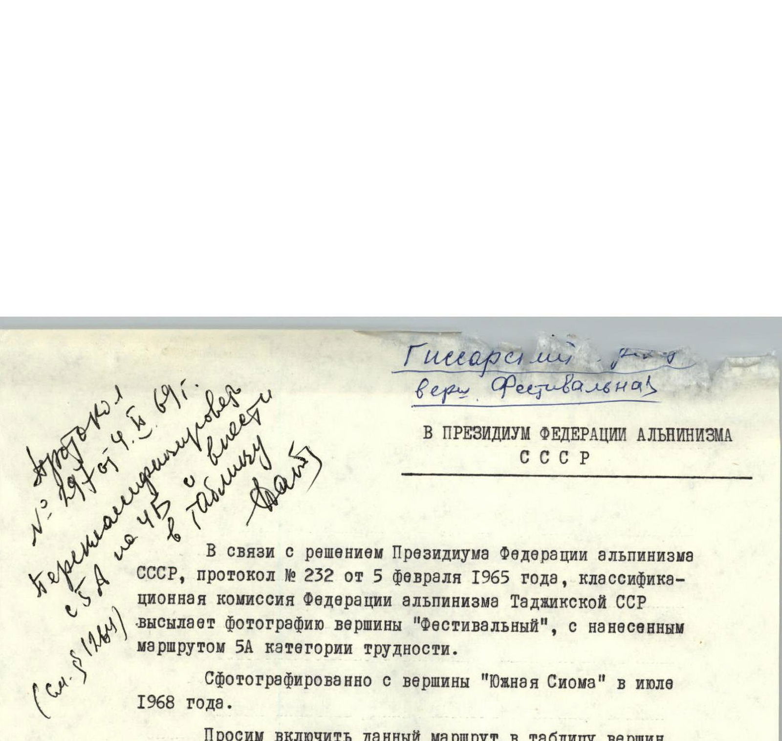
To the Presidium of the USSR Alpine Federation
In connection with the decision of the Presidium of the USSR Alpine Federation, protocol No. 232 dated February 5, 1965, the Classification Commission of the Alpine Federation of the Tajik SSR sends a photograph of the "Festivalny" peak with the route of 5A category marked on it. Photographed from the "South Sioma" peak in July 1968. We request that this route be included in the table of peaks of the USSR.
Chairman of the Classification Commission of the Alpine Federation of the Tajik SSR: V. Lavrushin
January 3, 1969