5.15. 16 23
Ascent Log
Ascent type: rock Ascent area: Pamir-Alay range, Kichik-Alay ridge
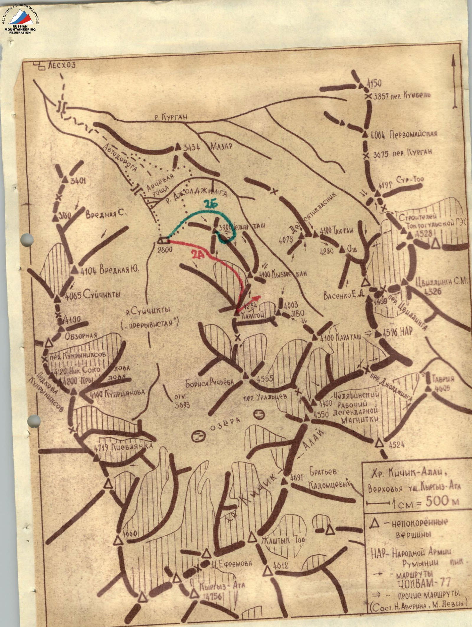
Peak: Karagoy Height: 4234 m Ascent route: from Suychikty valley via NE ridge Suggested difficulty category: 2A
Route Characteristics
Elevation gain: 1350 m Section length: 5–6 km Average slope: 35°
Pitons used:
| For belaying | For creating belay stations | |
|---|---|---|
| Rock | — | — |
| Ice | — | — |
| Bolt | — | — |
Climbing time: 5.3 hours Number of bivouacs and their characteristics: —
Team Leader, Members, and their Qualifications
- Lukoyanov A. A. — team leader, II sports category
- Eroshena R. I. — II sports category
- Samokotin Yu. T. — II sports category
- Chernokun S. P. — II sports category
Team Coach
MS Levin M. S.
Date of departure and return
August 28, 1977 g.
Karagoy
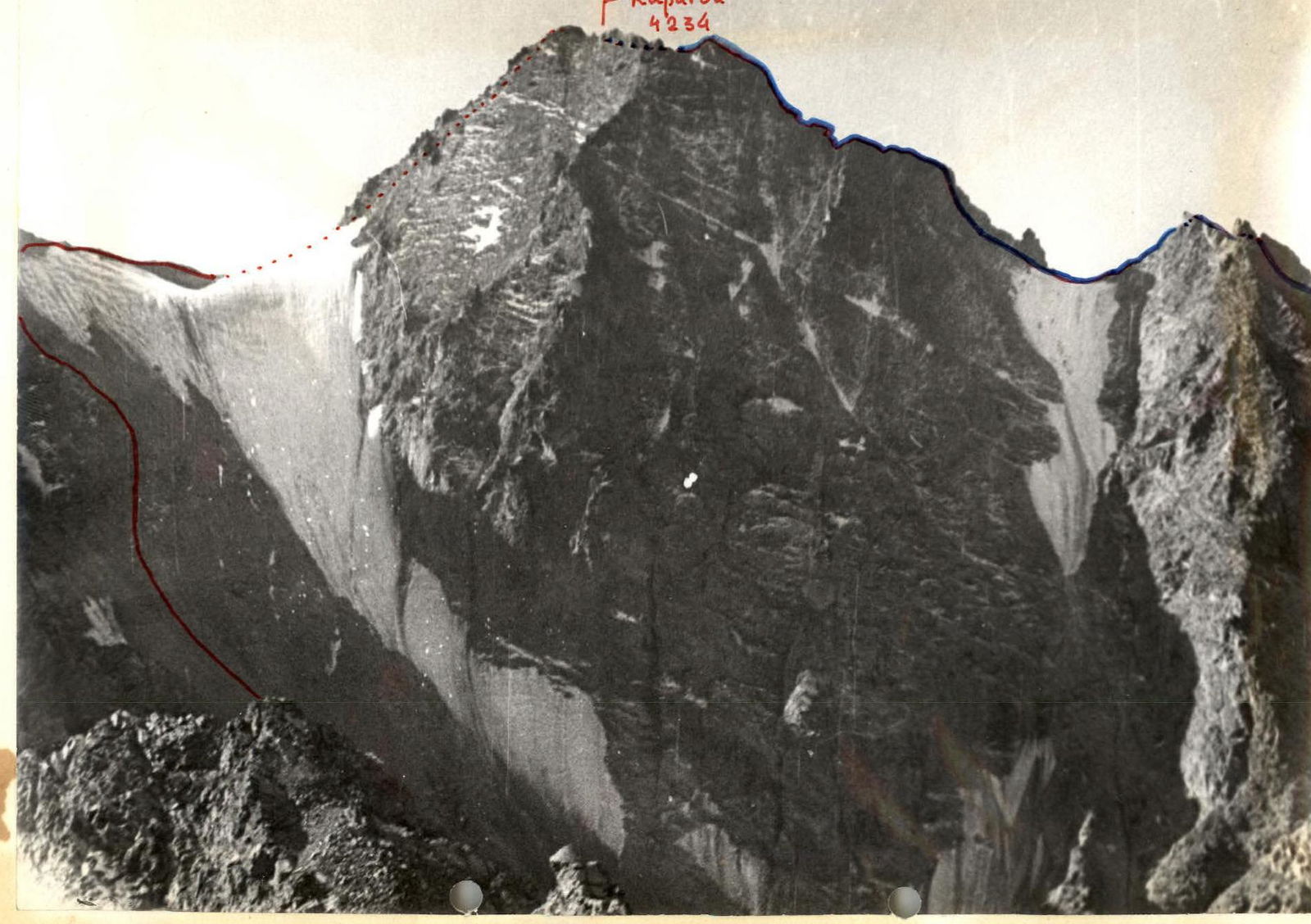

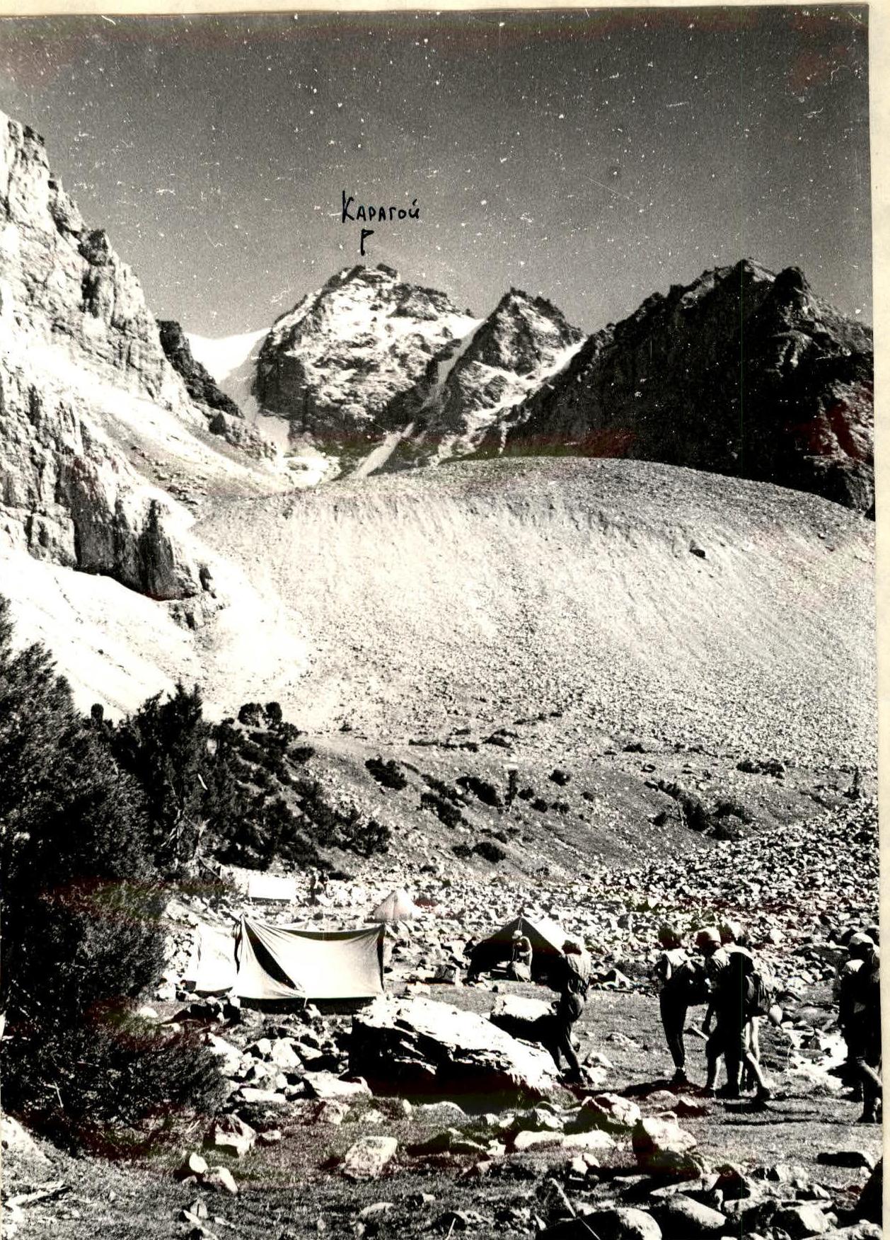 View from base camp "2800"
Detailed Route Description
August 28, 1977: approach to the start of the route from base camp "2800" in Suychikty valley — 0.2 hours
| Time | Designation | Average slope | Length | Terrain characteristics | Difficulty | Weather conditions | Belaying | Passage |
|---|---|---|---|---|---|---|---|---|
| 6:15–8:45 | R0–R1 | 15° | 1500 m | Moraine ascents | 1 | Excellent weather | — | Walking |
| 9:00–11:00 | R1–R2 | 50° | 800 m | Rocky slope, ledges covered with loose rocks. Bypassing rocky outcrops. | 1–3 | — | Simultaneous on the entire rope | Walking, free climbing |
| 11:15–11:35 | R2–R3 | 15° | 200 m | Rocky ridge with a snow patch | 1 | Movement along the edge | — | Walking |
| 11:35–12:05 | R3–R4 | 40° | 300 m | Scree slope. Destroyed rocky outcrops, loose rocks. | 2 | — | — | Walking, free climbing |
Descent via the couloir to the south, into Joljilga valley, and return to base camp "2800" from the summit — 3 hours 48 minutes.
Approaches
Osh — Iskinaukat — Karakoy forestry — bridge over the Kuragan river behind the forestry. Then by any vehicle up the right (or.) bank of the Suychikty river to the lower boundary of the juniper forest on the western slopes of g. Mazar. The route is visible after the 1st ascent behind the bridge over the Kuragan river. Cross the forest in the direction of the moraine ridge. Total with a load to the start of the route from the bridge — no more than 2.5 hours.
Classification Proposals
The route is very beautiful and logical. When bypassing the snow-ice field, do not go far to the left — it may be snowy there. This — and overall too — the route reminded the group of "Sportivnaya" in "Talgar". The group requests to include the route they completed in KTMGV as:
Karagoy 4234, 2A, rock, from Suychikty valley via NE ridge.