I. Climbing Passport
- Climbing category: technical.
- Climbing area: Pamir-Alay, Kisik-Alay ridge.
- Brothers Kadomtsev peak via the central buttress of the NW wall.
- Estimated difficulty category: 5B category, combined.
- Route characteristics:
- height difference: 620 m sections of 5–6 category difficulty: 420 m, average steepness: 68°
- Number of pitons hammered, protection placed:
- for belaying: rock pitons: 60, protection: 40, slings: 20
- for creating ITO (Intermediate Technical Obstacles). rock pitons: 6, protection: 15, slings: 8
- Number of climbing hours: 29
- Number of nights on the route: 1.
- Surname, name, patronymic of participants and their qualification: Bashmakov M.I. — Candidate Master of Sports — leader, Basenko A.I. — Candidate Master of Sports, Tulaev I.I. — Candidate Master of Sports, Koren A.V. — 1st sports category
- Team coach — Troshchinenko L.A., Master of Sports of the USSR.
- Date of departure for the route — March 7, 1982.
2. Area Map.
 From the Forest Experimental Station, located in the upper reaches of the Karagoy River (24 km from the regional center Naukat, Osh region), along the road up to the confluence of the Kurgan and Suychikty rivers (30 min). Then across the bridge, along the trail in the Suychikty River gorge to the cirque of Kievyanka peak (the highest peak in the area) (4 hours). Then turn into the cirque of Brothers Kadomtsev peaks — traverse along a large scree through a small saddle leading to the cirque (2 hours). Under the peak itself — a good place for a bivouac.

- NW wall buttress
4. Table of Main Climbing Route Characteristics.

5. Brief Explanation for the Table of Main Climbing Route Characteristics.
R0–R1. Steep snow slope (scree in summer) leading to a couloir. R1–R2. Smooth rocks with ice accretion, partially overhanging. Piton and protection belays. R2–R3. Steep snow couloir, ice underneath the snow. Ends with a narrow "throat". Climb up the left wall. Ice accretion. Piton belays. R3–R4. Snow couloir ending in a steep ice pitch, flanked by smooth sheer rocks. Climbed in crampons. Piton belays on rocks, possible ice screw belays. R4–R5. Widening couloir, snow and ice, increasing steepness. Couloir "locked" by a rock outcrop with cornices, rocks are crumbling, difficult to place piton protection. R5–R6. Exit to the ridge along heavily dissected vertical terrain with overhanging rock wall. On the ridge — a suitable platform for an overnight bivouac. Control cairn here.
Sections R1–R6 are rockfall-prone.
R6–R7. Steep ridge, piton belays, ending in a sharp gendarme.
R7–R8. Bypass gendarme on the left along a narrow ledge, piton belays, followed by steep slabs with limited handholds leading to the ridge beyond the gendarme.
R8–R9. Ridge consisting of a series of walls and ledges with ice accretion. Ridge leads to a steep rock pitch.
R9–R10. Traverse right along an inclined slab. Ice accretion. Piton belays.
R10–R11. Inclined slab with sufficient handholds but covered in ice accretion. Slab ends in cornices. Ladder and "hook-legs" necessary. Piton and protection belays. Unable to bypass this rock pitch.
R11–R12. Rather steep sharp ridge leading to the next rock pitch. Control cairn before it.
R12–R13. Narrow rock pitch with overhang, followed by a visible saddle on the summit ridge. Climbed "from ladder to ladder" beyond the cornice, very sharp and steep ridge — "KNIFE". "KNIFE" ends in a vertical wall descending to the saddle on the summit ridge. Good spot for an overnight bivouac here.
R13–R14. Pre-summit ridge:
- Steep snow and ice pitch.
- Climbed in crampons.
- Belays on rock outcrops.
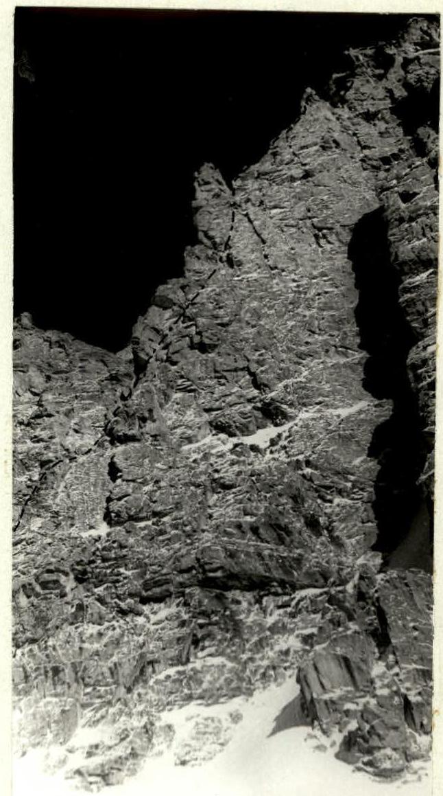
Fig. 2. Route profile.
- invisible part
- visible part
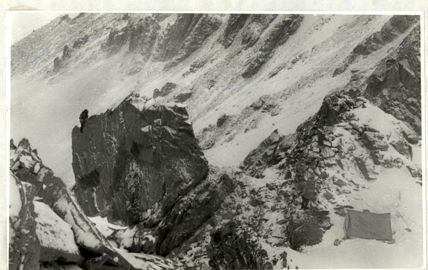
Fig. 5. Section R12–R13. Overnight bivouac on the pre-summit ridge. (Photographed from section R13–R14)
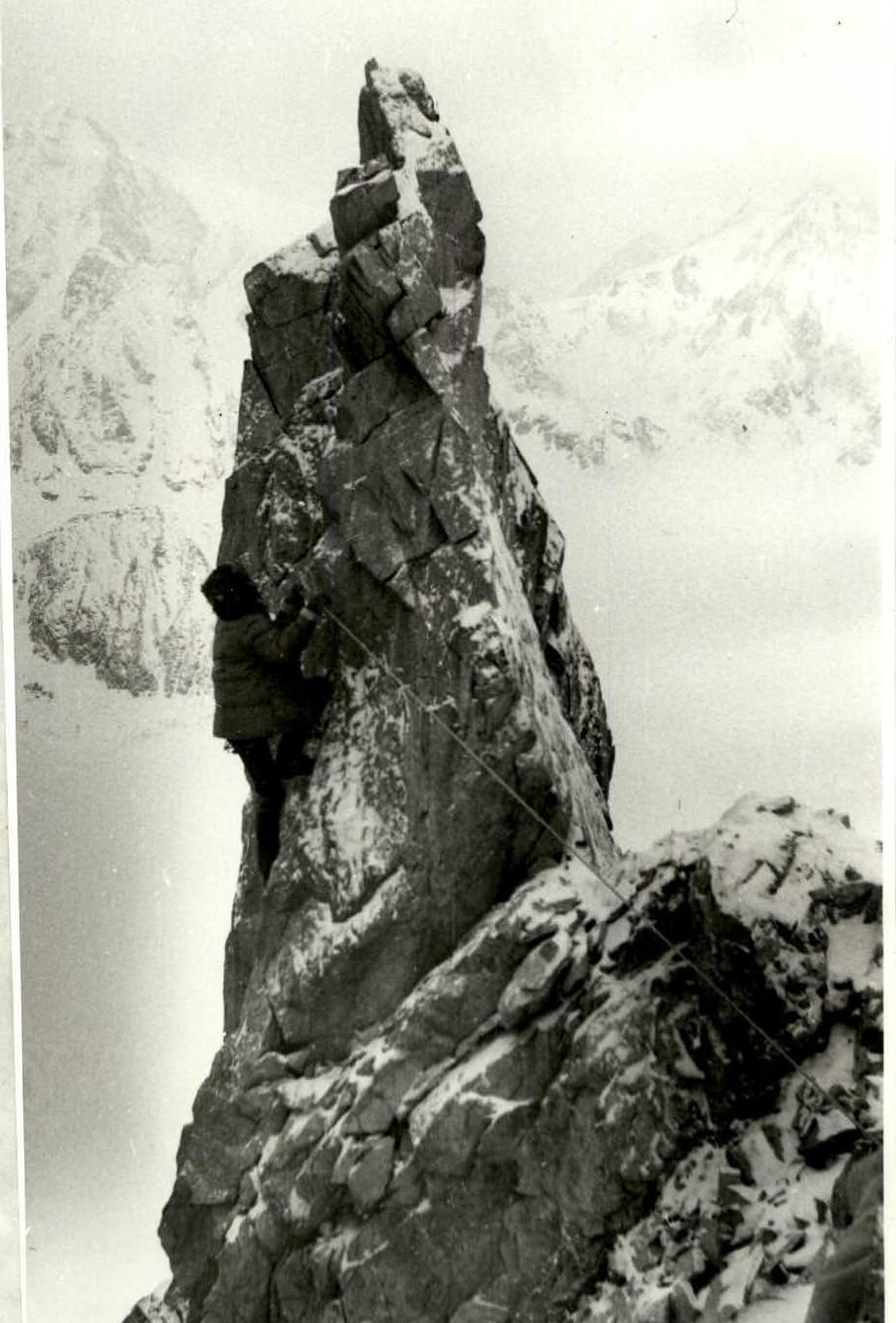
Fig. 6. Section R12–R13 (descent to the saddle)