Report on the First Ascent
Teams from the Republic of Buryatia to p. Sauk-Djaylau 4866 m via the Bastions of the Northern Ridge. July 19, 2015. Approximately 5B–6A category of difficulty. Ulan-Ude, 2015.
Climbing Passport
- Pamir-Alay, Alay Ridge, Archekanysh (Surmetash) gorge. Section number according to the classification table 5.1.1
- Peak: Sauk-Djaylau 4866 m (peak coordinates: 39°46′0.47″ N 71°56′4.48″ E, height and coordinates determined by GPS), via the Bastions of the Northern Ridge.
- Category of difficulty: proposed 5B–6A, first ascent, second ascent overall.
- Route type: Combined.
- Route elevation gain: 916 m (3950 m–4866 m).
Route length: 1100 m.
Section lengths:
- V category of difficulty – 360 m
- VI category of difficulty – 85 m. Average steepness: 72°.
- Number of pitons left on the route: 1 anchor (4 bolts for rappel, off the main line). Number used on the route: anchors: 37, ice screws: 9, stoppers 42/1, 8 points of artificial aids on fifi hooks.
- Team's total climbing hours: 13 h 00 min. Overnight stay: 1 on a ledge in a tent, lying down.
- Leader: Evgeny Vladimirovich Glazunov (Master of Sports).
Participants:
- Sergey Vladimirovich Glazunov (Candidate for Master of Sports)
- Alexey Vitalyevich Tyulyupo (1st sports category)
- Coach: Evgeny Vladimirovich Glazunov (Master of Sports).
- Departure from Base Camp to the route: 6:00, July 18, 2015. Arrival at the summit — 15:30, July 19, 2015. Return to Base Camp — 13:00, July 20, 2015.
- Alpinism Federation of the Republic of Buryatia.
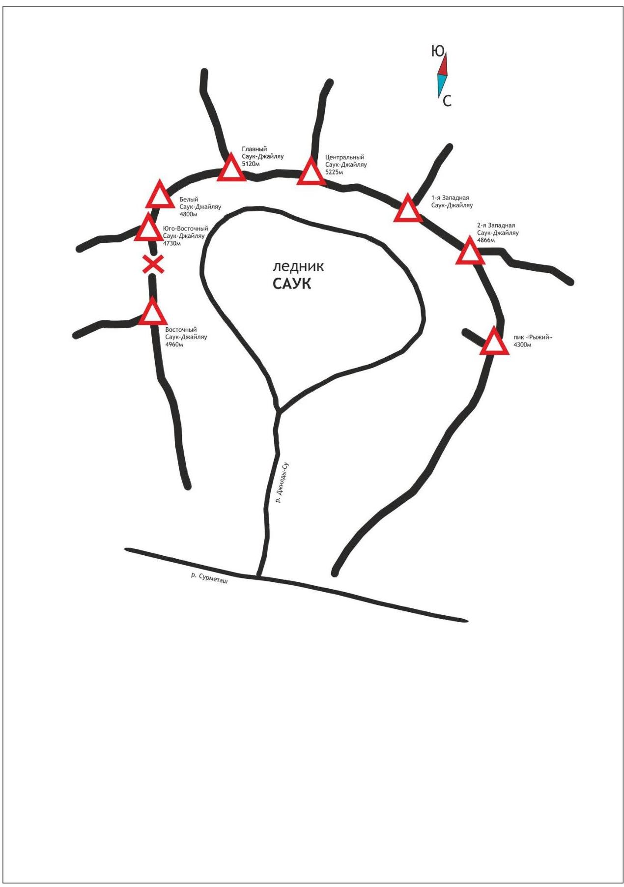
Schematic Map of the Sauk-Djaylau Massif
Tactical Actions of the Team, Sporting Characteristics of the Route
The Sauk-Djaylau massif is located in the upper reaches of the Surmetash River and is an isolated cirque with extensive glaciation. Peak heights reach up to 5300 m. The approach to the massif begins from the city of Kyzyl-Kiya, Osh region of Kyrgyzstan, from the village of Uch-Karghon. Move up the gorge to Chaykhona, then by vehicle up the Surmetash River until the end of the road, where a section was washed away by a mudflow. Here, a base camp is set up at an altitude of 2600 m. The gorge has not been visited by climbers since the mid-90s, which caused significant difficulties for the team. Climbing activities in Archekanysh are currently expeditionary in nature. Trails in the area have overgrown, and bridges have become unusable. Also, during our stay in the area, the "Magistralny" bridge over Surmetash was washed away, and crossing the river over the remains of the bridge became a serious problem. We had to organize 3 suspension crossings over the river, which required a lot of time and effort. After the team left the gorge and removed the ropes, passing through the river canyon with the water level as it was during our stay is not possible! It's worth noting that a week after we left, a Polish tourist drowned in Surmetash.
The team began the ascent after conducting a reconnaissance sortie and acclimatization climb to 4A category of difficulty.
This route was chosen by us due to its relative safety regarding rockfall. This season, due to the warm summer, several routes and options for first ascents in this massif were exposed to rockfall, posing an objective danger. The first ascent route is safe in this regard because:
- It passes through the most monolithic section of the wall
- It leads to the Bastions of the Northern Ridge
From the summit, we retrieved a note dated August 15, 1977; judging by the content, we are the second group to have reached it.
It's worth noting that:
- The heights of some peaks in old reports are significantly underestimated and require correction.
- We used a GPS navigator to determine peak heights and route elevation gains.
The team had 60 m ropes, so the description of sections is based on this length. The tactical plan was made assuming 2 days for the ascent and 3 days for the descent.
For the overnight stay, we took:
- a tent fly from a Fox Explorer by Redfox, without the inner part, weighing about 1.5 kg
- 2 sleeping bags
- a jetboil
- a first-aid kit
- minimal bivouac gear and food
Communication was maintained with an observer in the Base Camp daily. The route was climbed with free climbing on 99%, except for the wet slab on section R11–R12, where we used 9 points of artificial aids.
Work on the route was done in shifts: on the first day (July 18), Evgeny Glazunov worked, covering sections R0–R15 and organizing an overnight stay on a ledge on the ridge. The weather on the first day was good, but by evening, it started raining, catching us on sections R11–R15.
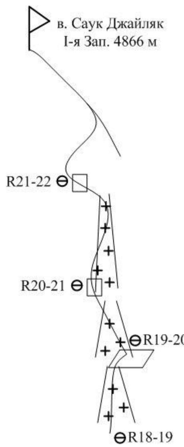
The rain continued until 12:00 (July 19); after waiting it out, the team started the final push, passed sections R15–R22, and reached the summit. Alexey Tyulyupo led first, then we descended to the overnight stay location for the next night.
On July 20, we descended to the glacier via the ascent route. On the route, we left one anchor piton for rappel and 4 bolts off the main line, as rappels were done directly. Other descents were organized using terrain features and ice climbing techniques to keep the route as clean as possible after our passage.
Based on our reconnaissance and observations, we can conclude that this area has great potential for mixed first ascents. However, the difficulty of accessing the assault camp and the lack of bridges in the gorge complicate their execution. The best time for ascents, in our opinion, is:
- the off-season
- early June
In summer, there is a high risk of rockfall and ice avalanches.
Panorama of the Sauk-Djaylau massif
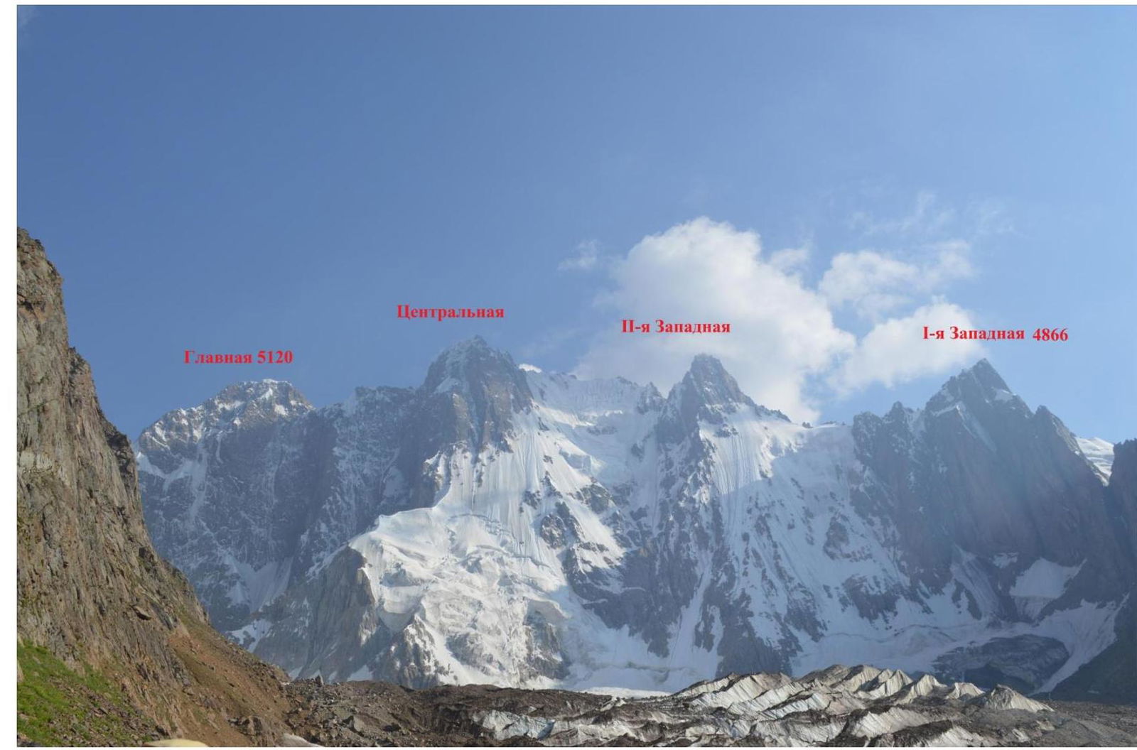
Sauk-Djaylau I-western 4866 m


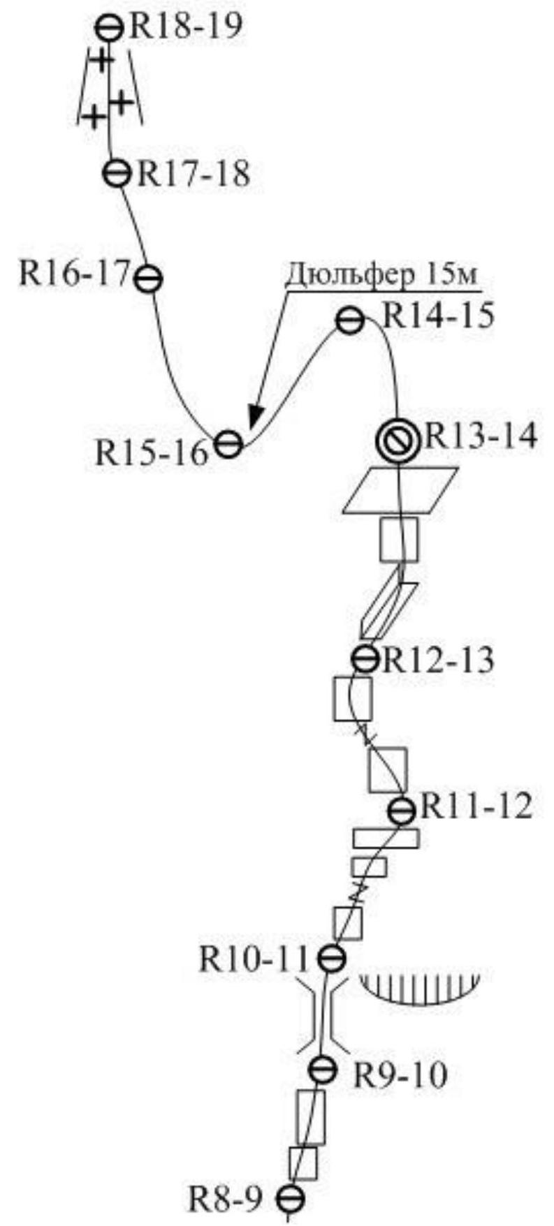
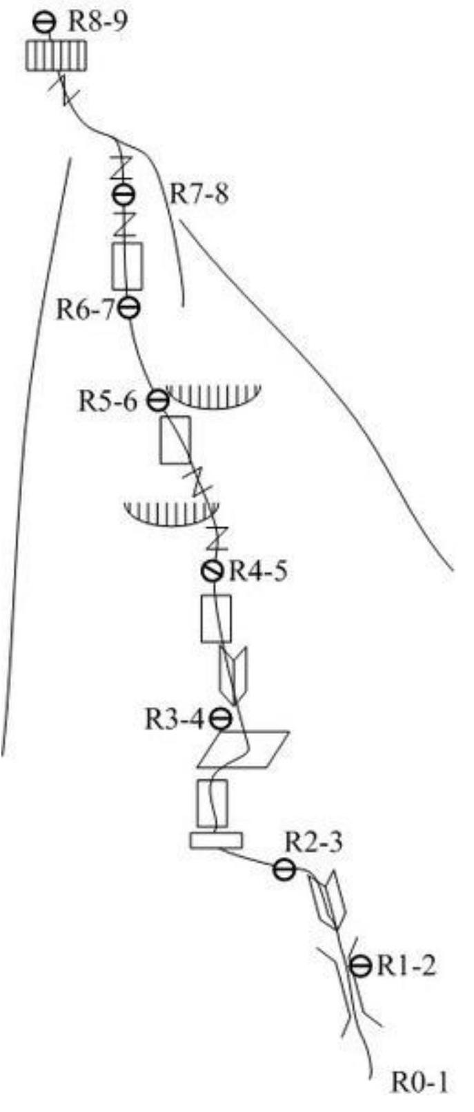
Route Description by Sections
Approach to the route via the glacier and snow slope. The slope is exposed to rockfall from two couloirs, so caution and attentiveness are required during the ascent.
| R0–R1 | Destroyed chimney, many loose rocks, careful climbing. 55 m, 75°, 4. |
| R1–R2 | Movement through the chimney towards a large black cornice. The upper part of the rock is destroyed, many loose rocks, careful climbing. 40 m, 75°, 4. |
| R2–R3 | Traverse under the cornice to the left, then move to a vertical wall, and climb it to a ledge. Challenging climbing in the middle and end of the section. 55 m, 75°, 5–6. |
| R3–R4 | From the ledge, move right into an internal corner, climb it to a slab. Then traverse the slab to the right. Challenging climbing to a small ledge under a vertical crack. 55 m, 85°, 6. |
| R4–R5 | Climb the crack until it becomes impossible to continue, then pass a half-meter cornice with careful climbing; cams #2–3 fit well. Move into an internal corner with a wide crack, which ends with a characteristic bridge. From the bridge, downclimb and move up a "mirror" slab. Challenging climbing on thin cracks and small holds. Requires careful protection with anchors from climbing, demanding attentiveness and caution. 60 m, 90°, 5–6. |
| R5–R6 | Climb a ridge towards rock slabs before reaching the Bastions of the N. Ridge. Then, through a series of walls, reach a ledge. Station on the ledge. 55 m, 75°, 4–5. |
| R6–R7 | Internal corner, followed by a slab. Climb the slab, then a crack from left to right. Climbing the crack with good protection on cams. Pass the crack and a small cornice to a ledge. 60 m, 85°, 6. |
| R7–R8 | From the station, a monolithic wall, followed by a slight easing leading to a ridge. Climb a wet crack with a series of cornices to a ledge. 55 m, 75°, 5–6. |
| R8–R9 | Climb walls and a series of ledges towards a chimney. Station at the base of the chimney. 60 m, 70°, 4–5. |
| R9–R10 | Climb the chimney with extremely careful climbing. The chimney walls have many loose rocks resembling scales. Protection on cams. Exit the chimney through its left part. Many loose rocks at the exit. The chimney is the most rockfall-prone section of our route. 40 m, 75°, 5. |
| R10–R11 | Move right through a series of walls and ledges to a large ledge at the base of a vertical slab. Overnight stay possible on the ledge. 45 m, 75°, 4. |
| R11–R12 | Vertical slab, deep cracks. Climb on fifi hooks until a flake; wet rocks (drizzle), then free climb left to the ridge through a series of walls and ledges. 50 m, 85°, 6 A1. |
| R12–R13 | Climb a vertical crack towards the summit of the bastion on the ridge. Protection on cams. Wet rocks. 60 m, 75°, 5. |
| R13–R14 | Climb rocks of medium difficulty. Reach a ledge. Overnight stay; the tent does not fit entirely. 45 m, 60°, 4. |
| R14–R15 | Climb to the summit of the Bastion via simple rocks, then downclimb along the ridge. From the ridge, 15 m rappel to a saddle. 40 m, 55°, 4. |
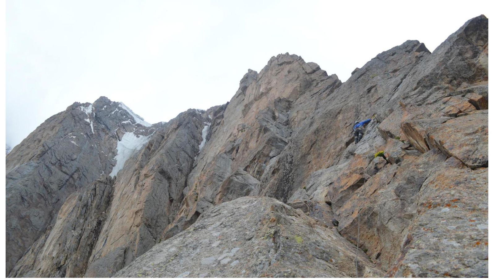
| R15–R16 | Climb large-block rocks of medium difficulty from left to right. 60 m, 75°, 5. |
| R16–R17 | Move towards a saddle in the ridge. 45 m, 55°, 4. |
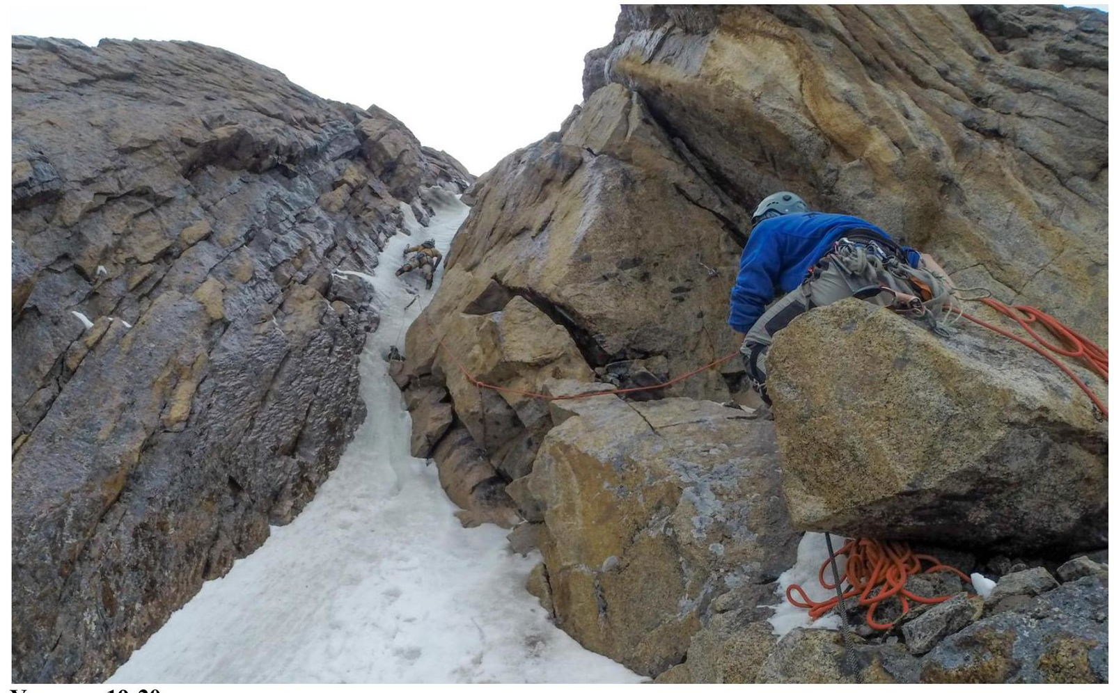
| R17–R18 | Snow and ice couloir, leading to the base of an ice chute. 60 m, 55°, 4. |
| R18–R19 | First rope of the ice chute. Ice of medium steepness; exit to a convenient ledge on the right. Station on the ledge. 50 m, 70°, 5. |
| R19–R20 | Rope on steep ice; exit to a ledge on the left. Station on the ledge. 55 m, 85°, 6. |
| R20–R21 | Climb the ice chute until it becomes less steep. Then exit to a ledge at the base of the ridge. 50 m, 75°, 5. |
| R21–R22 | Climb rocks to the ridge, then along the ridge to the summit. 45 m, 55°, 4. |
UIAA Scheme
R16–R17, R15–R16
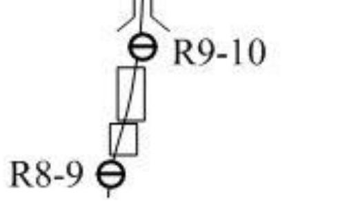
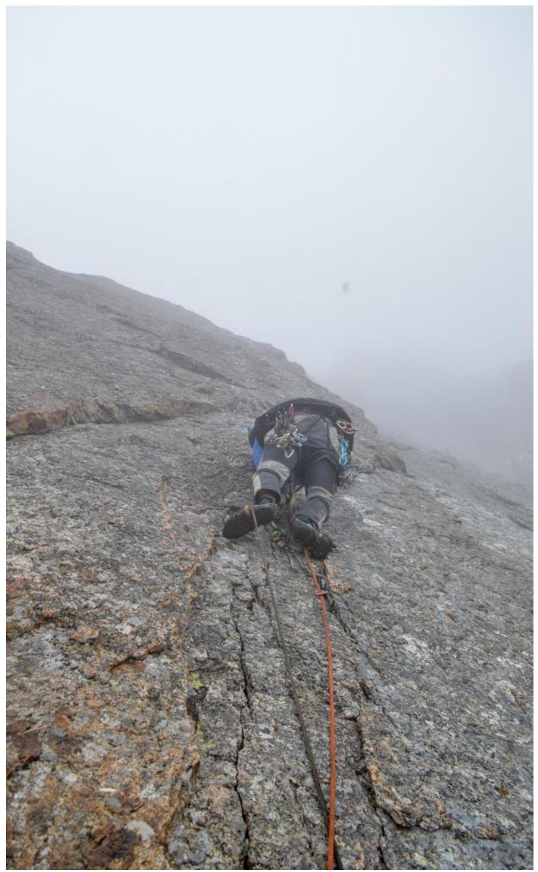
R8–R9
Photo Illustrations
Attention! Some photos from the route were taken with a GoPro camera with a built-in "Fish Eye" lens, which distorts the image.

Suspension crossing over Surmetash
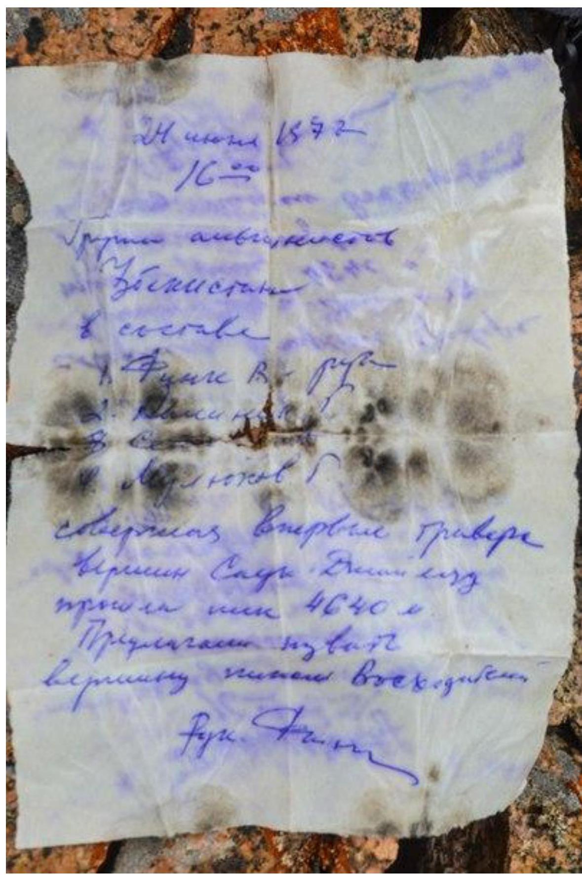
Note from the Summit, 1977
Section R3–R4 internal corner

Section R4–R5:
- lower part, passing the cornice with free climbing

Section R4–R5 upper part, exit from the "mirror" to the station
Station on section R5–R6
Section R6–R7
Section R7–R8
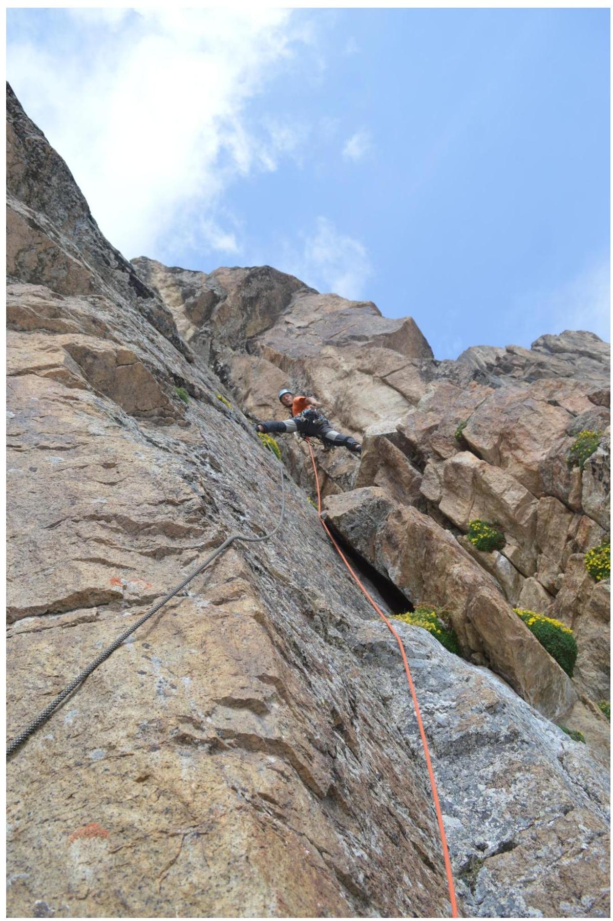
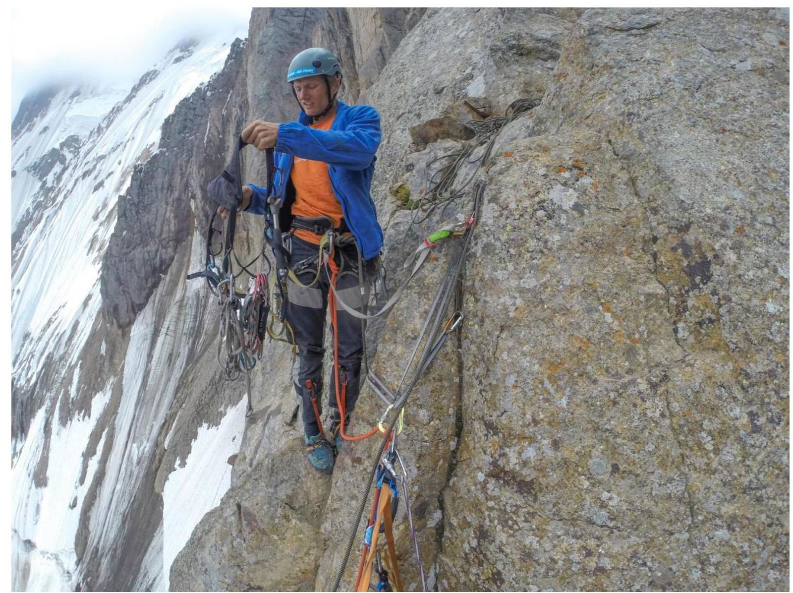
Section R11–R12, passing the wet slab on artificial aids

Overnight stay, section R13–R14
Section R19–R20

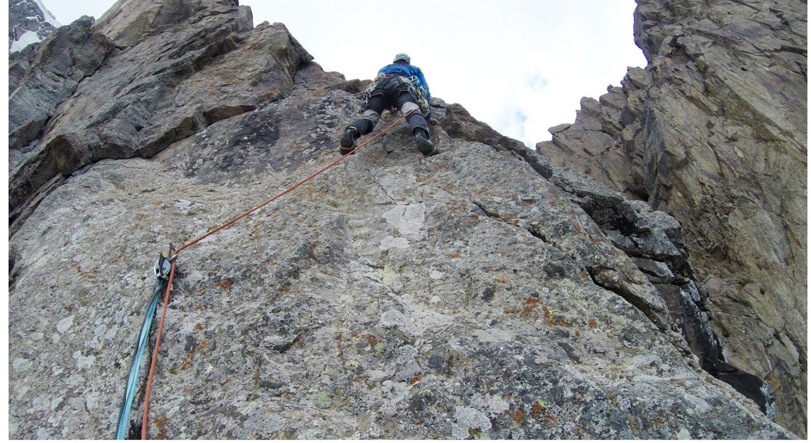
Section R21–R22, exit to the pre-summit ridge
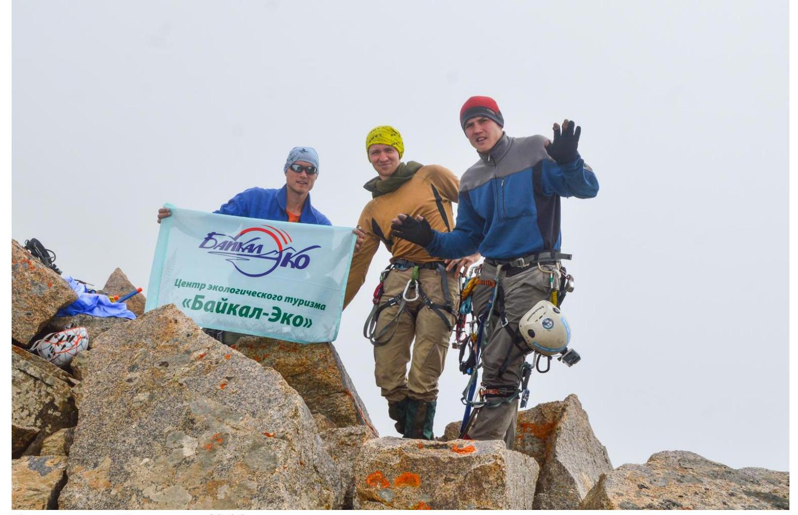
Team on the Summit 4866 m.