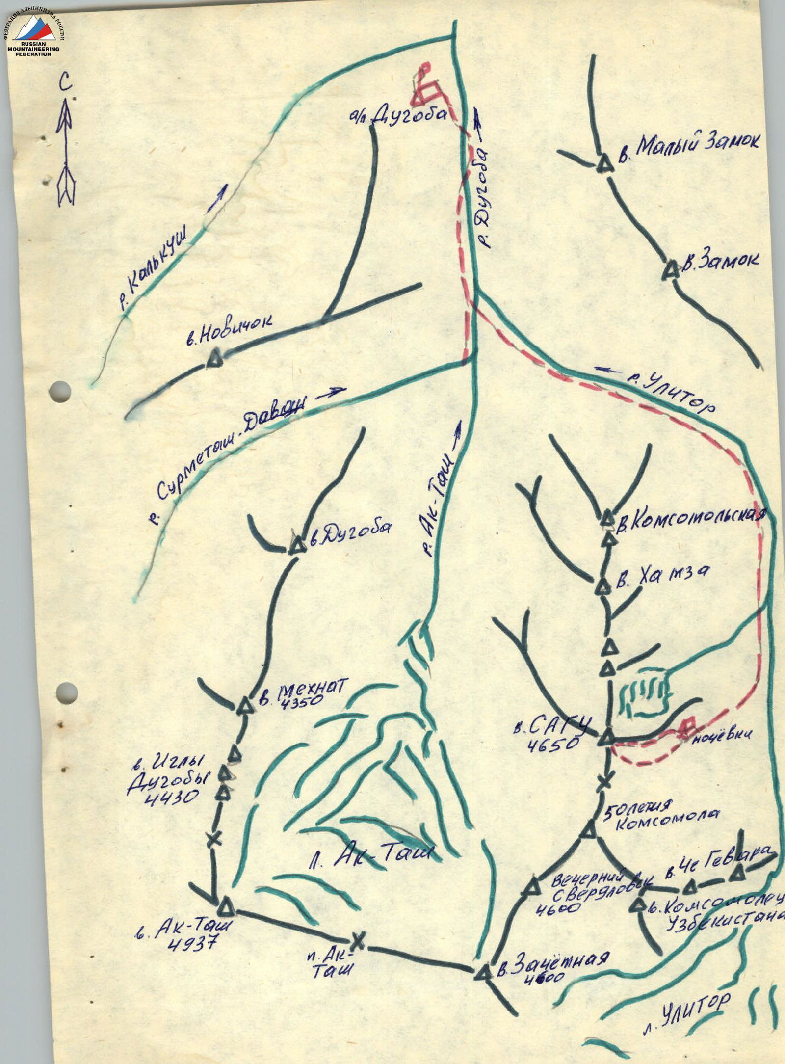
Brief description of the route approach
From Dugoba a/l, follow the trail to the confluence of the Ak-tash and Ulitor rivers, then continue along the Ulitor river trail to the moraine campsite. Then, follow the trail through two moraine ascents to the campsite under the high rocky ridge. From the campsite, ascend the scree gully to the destroyed black rocks and then rightwards along the scree to the rocky slabs. This is the starting point of the route.
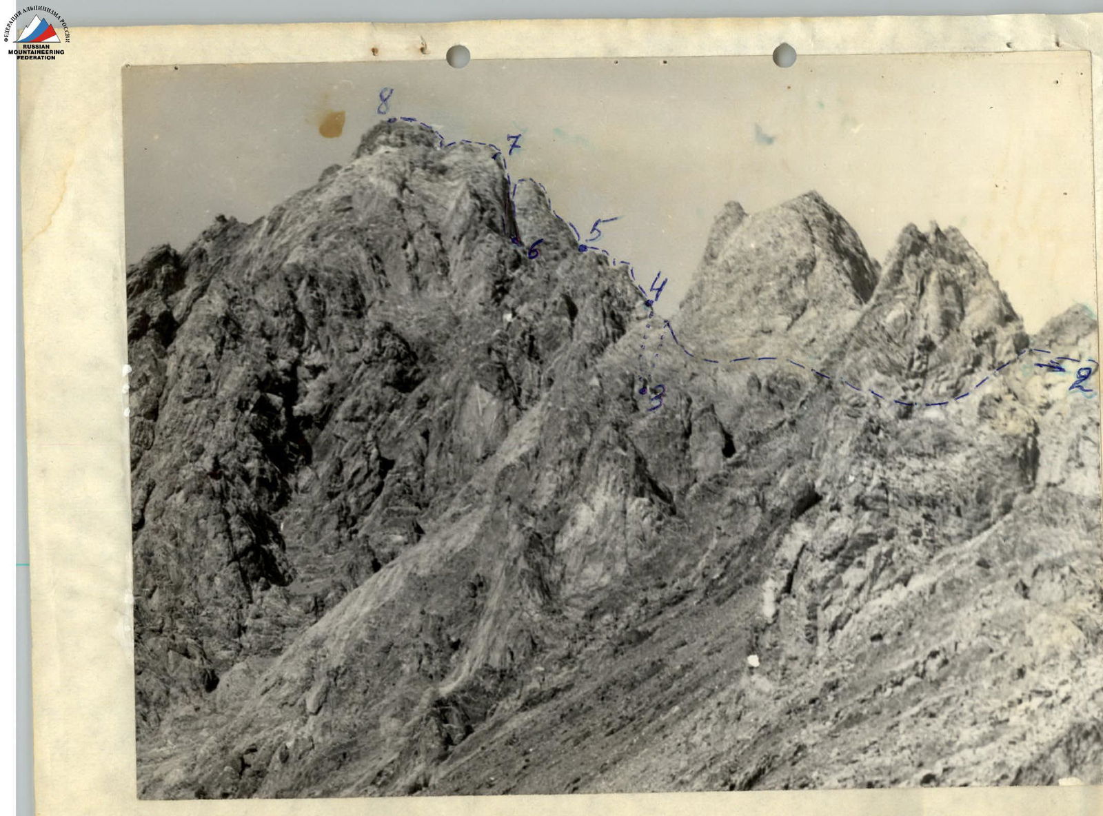
MAIN ROUTE CHARACTERISTICS TABLE
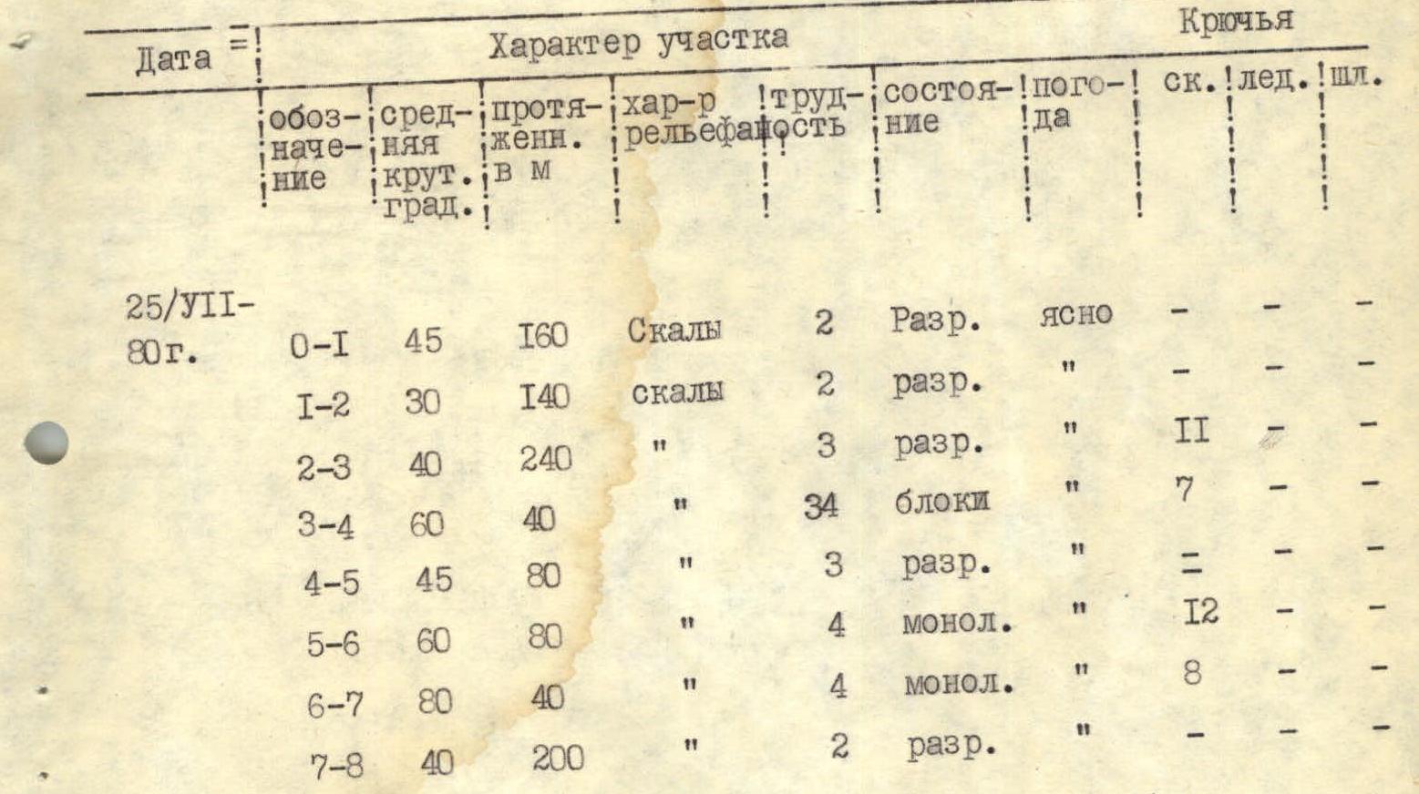
| Date | Section | Avg. steepness, deg. | Length, m | Terrain type | Difficulty | Condition | Weather | Rop. | Ice | Pit. |
|---|---|---|---|---|---|---|---|---|---|---|
| 25/VII–80 г. | R0–R1 | 45 | 160 | Rocks | 2 | Broken | Clear | — | — | — |
| R1–R2 | 30 | 140 | Rocks | 2 | Broken | — | — | — | — | |
| R2–R3 | 40 | 240 | — | 3 | Broken | — | II | — | — | |
| R3–R4 | 60 | 40 | — | 4 | — | Blocks | 7 | — | — | |
| R4–R5 | 45 | 80 | — | 3 | Broken | — | — | — | — | |
| R5–R6 | 60 | 80 | — | 4 | Monol. | — | 12 | — | — | |
| R6–R7 | 80 | 40 | — | 4 | Monol. | — | 8 | — | — | |
| R7–R8 | 40 | 200 | — | 2 | Broken | — | — | — | — |
Brief explanation of the table
| Section | Explanation |
|---|---|
| R0–R1 | Slabs, partly covered with small scree. |
| R1–R2 | Ridge. The first buttress is climbed "head-on" for 5 m. |
| R2–R3 | Ridge. The 2nd, 3rd, 4th, 5th buttresses are bypassed on the left. Descent to the right into a gap. |
| R3–R4 | Ridge. |
| R4–R5 | Ridge. |
| R5–R6 | Ridge. In the upper part of the first rope, there is a 10 m wall with a steepness of 90°. Then, ascend to the buttress "head-on" and descend into a gap. |
| R6–R7 | In the lower part, there is a 20 m wall with a steepness of 80° and then a ridge. |
| R7–R8 | In the lower part, there is a slab (first rope) and then a ridge. |