
Report
On the First Ascent of Kremen Peak (4351 m)
via the Western Ridge, Category 4A
1. Climbing Passport
- Climbing Area: Jamantau Ridge, Inner Tien Shan
- Peak Name: Kremen (4351 m, N 40°54.604′, E 74°39.295′ (WGS 84))
- Route Name: via the Western Ridge
- Category of Difficulty: proposed 4A
- Route Type: rock climbing
- Route Elevation Gain: 540 m (GPS reading). Route Length: 700 m. Average Steepness: 51°. Climbing difficulty mainly III–IV, crux at the 2nd rope VI–/VI (UIAA)
- Equipment Used on the Route: tricams: 4, small sizes; hexes: 3; chocks: 13 pieces; friends: 6+1 Black Diamond camalot (No. 4) — needed for the crux rope. Hooks used on the route: rock — 0, ice — 0, including ITO — 0. Drill-in hooks (stationary, removable) were not used. 2 slings left on the route.
- Departure to the Route: 6:00 AM, July 9, 2007. Summit Reached: 12:00 PM, July 9, 2007. Return to Camp: 7:00 PM, July 9, 2007
- Team Climbing Hours: 13 hours
- Team Leader: Dmitry Martynenko, 2nd sports category (alpinism)
- Participants: Dmitry Shapovalov, 1st sports category (sports tourism), Ekaterina Ananyeva, 2nd sports category (sports tourism)
- Coach: Nikolai Goryunov (Kiev), Master of Sports (alpinism)
- Route Features: Descent via the ascent route. Partially rappelling, partially climbing, descent time — ascent time
The ascent was made without prior route processing.
2. Area Description
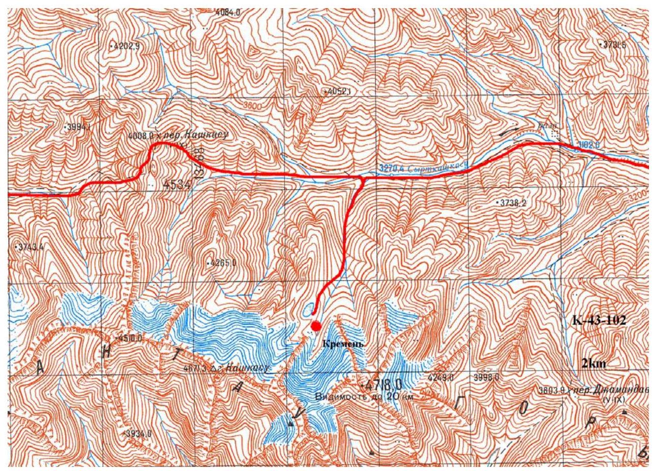
Kremen Peak is located in the northern spur of the Jamantau Ridge, Inner Tien Shan, in the upper reaches of the right tributary of the Syrtkashkasu River. The Jamantau Ridge is oriented in a latitudinal direction and is bounded to the west by the canyon of the Alabuga (Arpa) River, to the north by the Alabuga River valley, to the east by the Karasu River valley, and to the south by the Arpa depression. The ridge peaks reach 4700 m, while the surrounding valleys are about 3000 m high, and the technical part of the routes usually begins above 3600 m. The ridge is composed of strong Paleozoic sedimentary rocks with a very rough surface. Along with the potential for rock climbing, the northern slopes of Jamantau have noticeable glaciation, and ice slopes with steepness up to 75° allow reaching the summits from the northern side via routes of moderate complexity. There are practically no glaciers to the south, only rocks and endless scree fields crossing the valleys from bank to bank.
The climate of the area is pleasant and not very hot. It is determined by the ridge's orientation and the prevailing direction of air masses. The moist air from the Fergana Valley moves from west to east, is delayed by the mountains of the Fergana Ridge, and falls out with abundant precipitation on its western slopes. The Arpa depression does not receive precipitation, and its climate is very dry. This is a typical high-mountain desert with a sharply continental climate. Air masses fly over it without stopping, grouping as they approach the slopes of the Jamantau and At-Bashi ridges. Due to these residual clouds, precipitation is observed on the slopes of Jamantau in mid-summer on approximately 30% of days. At Kremen Peak, noticeably less precipitation is observed, as the peak is protected from it to the south, west, and east by the main ridge and its spurs, which in places exceed the peak's height by 300 m.
You can approach the Jamantau Ridge from both Naryn and Osh (Osh — Jalalabad — Kal damo Pass — Kazarman). To the north, along the Alabuga valley, through the villages of Jergetal and Dürbeljin, there is a good asphalt road from Kazarman to Naryn. From this road, you can reach the Kashkasu River via dirt roads and from there approach any peak of West Jamantau within a day, including the Kamas and Chontash peaks. You can also approach the ridge from the east, from the Naryn — Torugart Pass (Chinese border) highway. A dirt road, accessible to Niva and other 4x4 vehicles, branches off this highway and goes through the Turasu Pass to the confluence of the Turasu and Jamandavan rivers. From this road, you can approach any peak of East Jamantau within half a day to a day, including the Kremen and Ak-Jaman peaks. From the Naryn — Torugart Pass highway, you can also get into the Arpa valley. All these paths are used by the Kyrgyz to reach the pastures surrounding Jamantau. Their yurts are not uncommon in the lower parts of the ridge during the summer season.
The Jamantau Ridge has no climbing history. The first photographs of the ridge were taken during water trips along the Alabuga River. The first trip and the first ascents were made by a group of climbers and sports tourists from Kiev led by D.S. Shapovalov in the summer of 2007. Jamantau has a noticeable potential for rock and ice climbing.
The name Jamantau ("Bad Mountains") comes from the actual impossibility of crossing the ridge despite its apparent ease. Wide valleys at the mouth lead to wide saddle passes. But in the middle of the valley, they typically narrow, becoming narrow canyons, and bypassing them is often very difficult. This happens on both sides of the ridge. To date, there is only one non-category pass through the ridge — Jamandavan.
3. Area Map
4. Technical and Tactical Actions of the Team
On July 8, 2007, a sports group on a trip through Inner Tien Shan (July 3–29, 2007) noticed a rock peak of a regular pyramidal shape on the right side while descending along the Syrtkashkasu River. Leaving a cache near the Syrtkashkasu River, the group moved lightly towards Kremen Peak.
The weather the day before the ascent was unstable. On the day of the ascent, it was clear, and the mountain had time to dry. It was planned to complete the ascent within one daylight period. Based on this, the camp was set up directly under the western ridge of the mountain. The following equipment was available:
- an expanded set of chocks
- a set of friends
- a pair of camalots
- a set of tricams
- a pair of hexes
This set was sufficient for routes of the fourth category.
On the morning of July 9, 2007, the group started the ascent. The same evening, the team returned to base.
The key sections of the route were done using free climbing. The lead changed every rope on the route. The leaders were:
- Dmitry Martynenko
- Dmitry Shapovalov
The leader climbed with two 8.1 mm dynamic ropes.
Due to the remoteness of the area, there was no contact with the outside world.
5. Route and Summit Photographs

- View from the north. Taken on July 8, 2007. The western ridge is on the right.

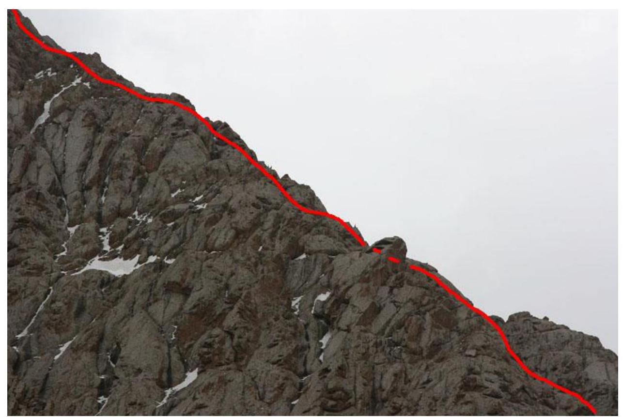
- Lower part. Taken on July 8, 2007.
- Middle part. Taken on July 8, 2007.
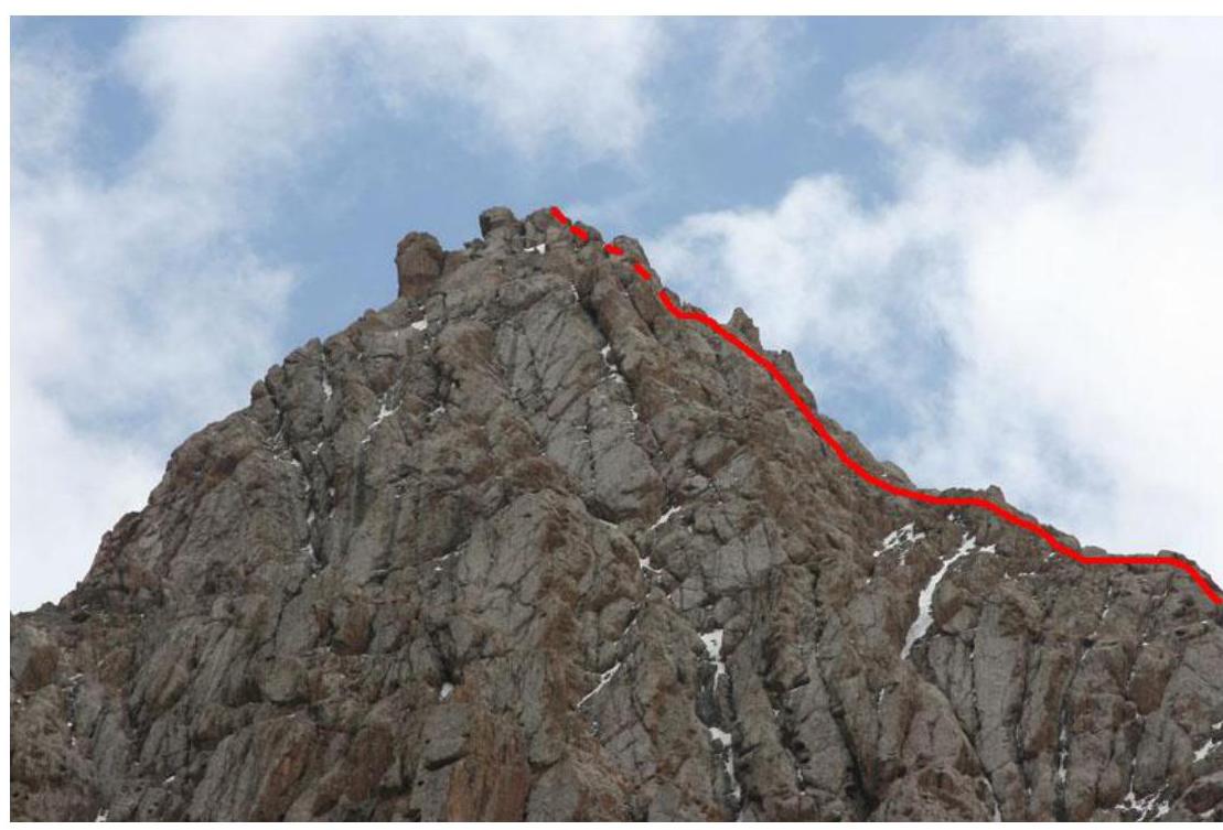
- Pre-summit part. Taken on July 8, 2007.
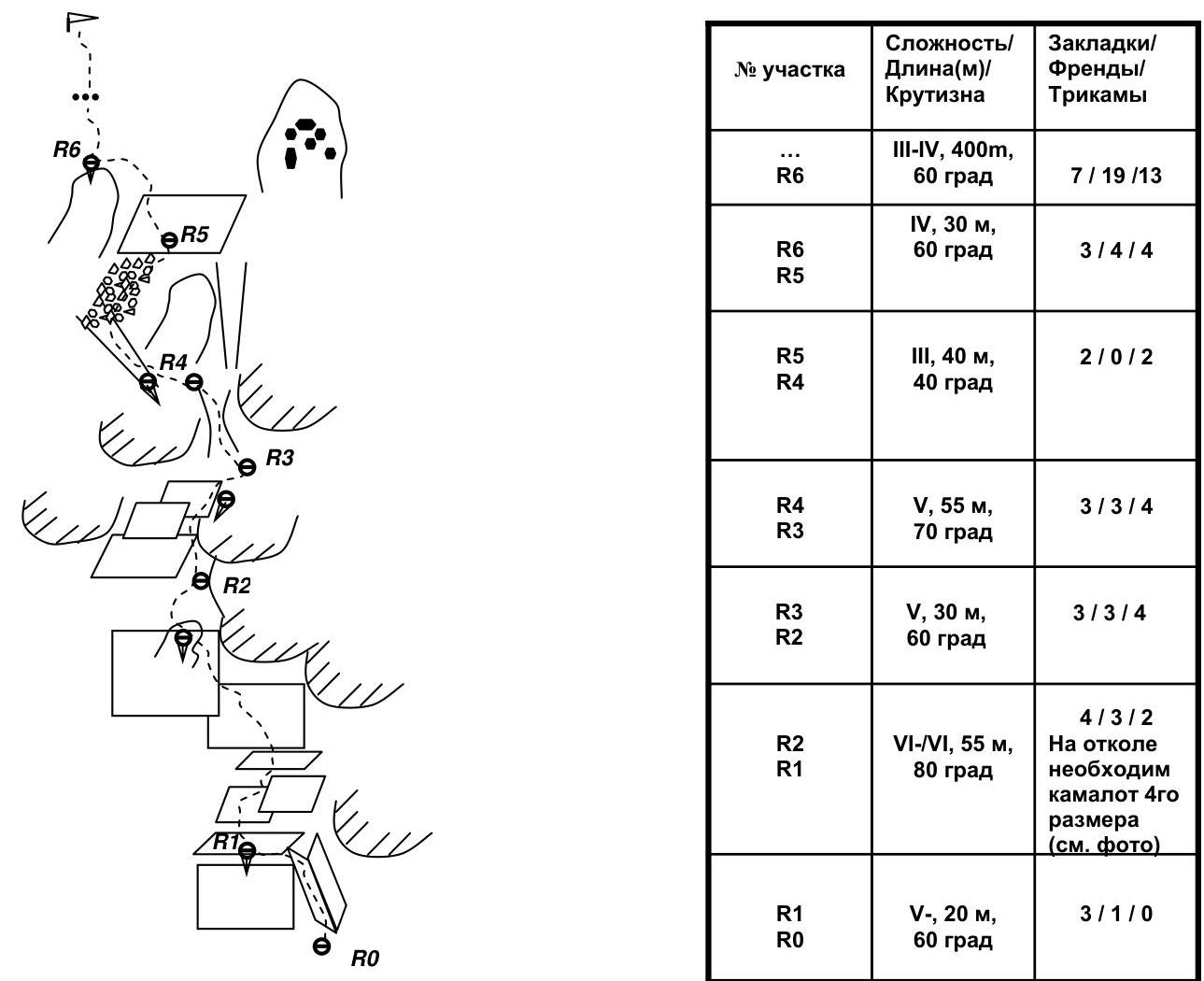
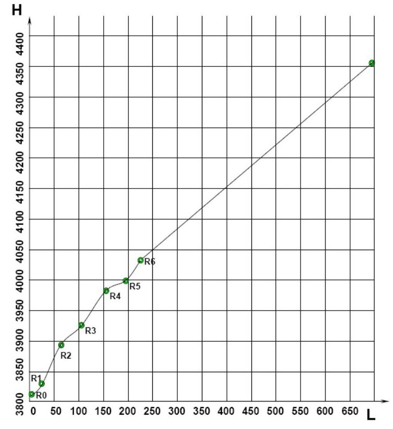
6. UIAA Scheme. First 6 Key Ropes
| Section No. | Difficulty/Length/Steepness | Chocks/Friends/Tricams |
|---|---|---|
| R6 | III–IV, 400 m, 60° | 7/19/13 |
| R5–R6 | IV, 30 m, 60° | 3/4/4 |
| R4–R5 | III, 40 m, 40° | 2/0/2 |
| R3–R4 | V, 55 m, 70° | 3/3/4 |
| R2–R3 | V, 30 m, 60° | 3/3/4 |
| R1–R2 | VI–/VI, 55 m, 80° | 4/3/2 Camalot No. 4 required for the crux (see photo) |
| R0–R1 | V–, 20 m, 60° | 3/1/0 |
7. Drawn Route Profile
8. Photo Illustrations
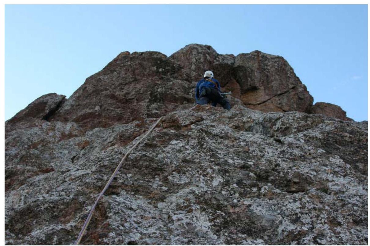
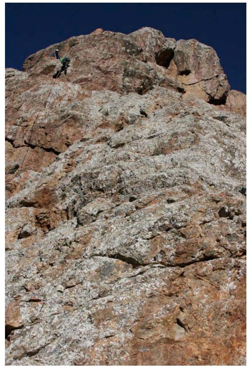
- Key section of the route. To the left is a flake under No. 4 camalot, station R2 is behind the flake. Taken on July 9, 2007.
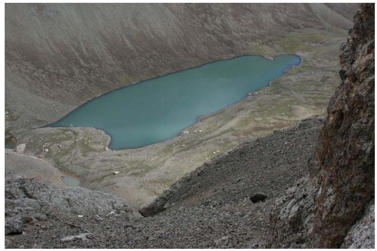
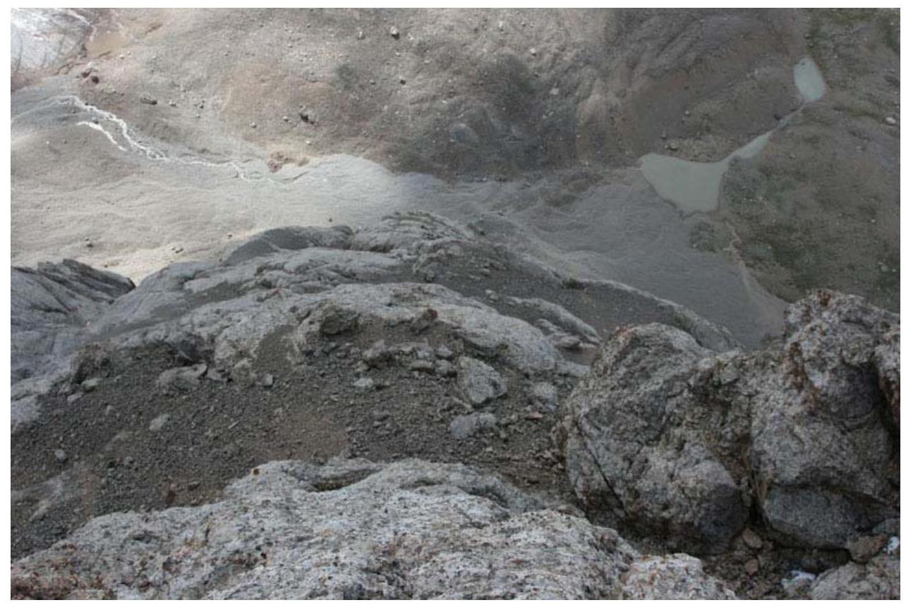
- View of the campsites from the lower third of the route. Tents were set up near a small lake. Taken on July 9, 2007.
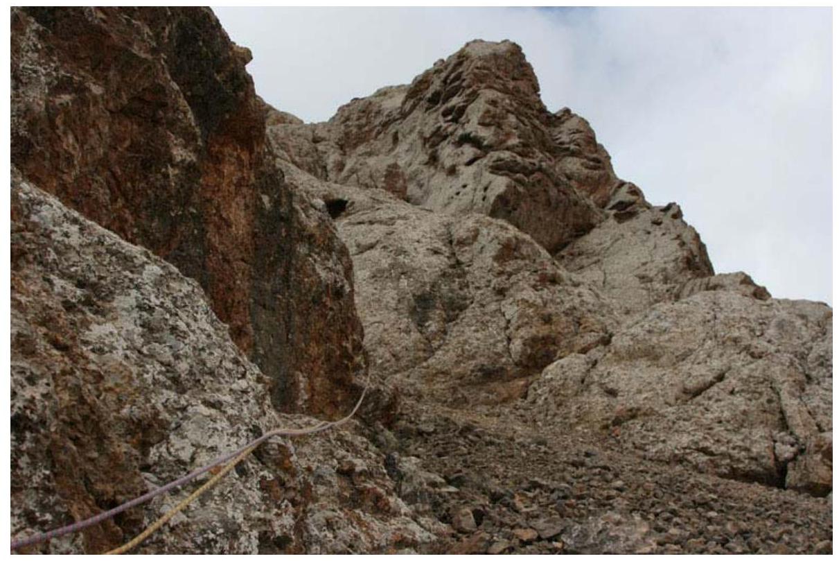
- Section after the 4th rope. Further on rocks of medium difficulty, sticking to the ridge. To the right in the direction of movement is a counterfort with characteristic holes-washouts. The couloir between the counterfort and the main ridge is rockfall-prone. Taken on July 9, 2007.
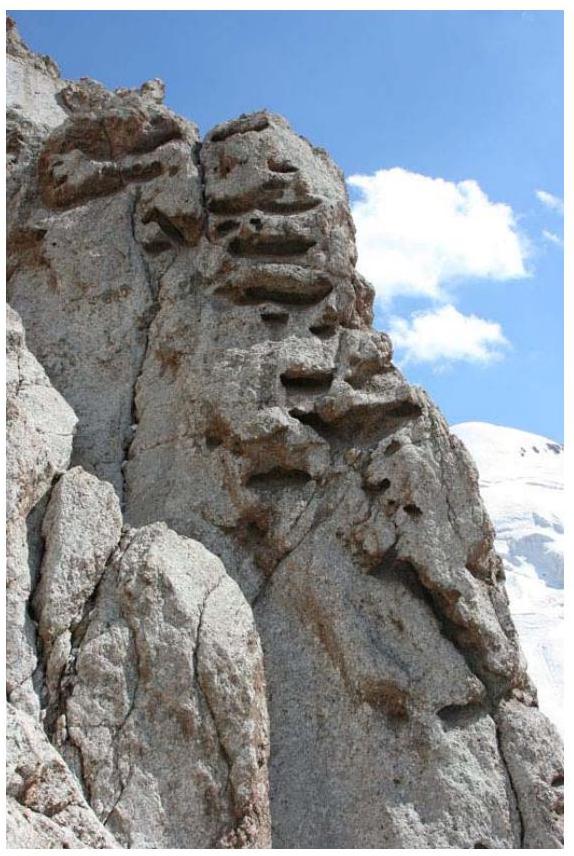
- The counterfort is a good landmark when passing the lower part of the route. The route goes along the ridge to the left in the direction of movement from the counterfort. Taken on July 9, 2007.
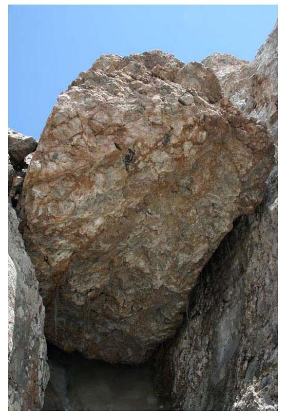
- In the pre-summit part of the route, there is a huge stone plug. Taken on July 9, 2007.
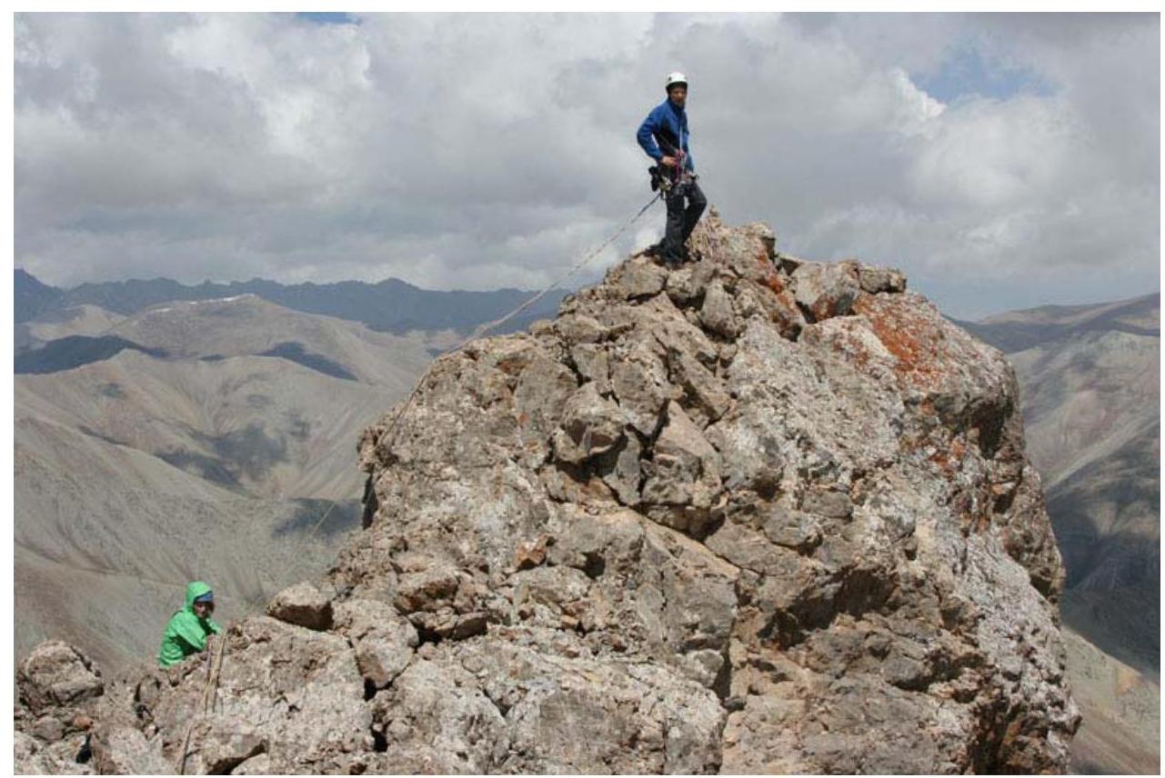
- Summit. Taken on July 9, 2007.
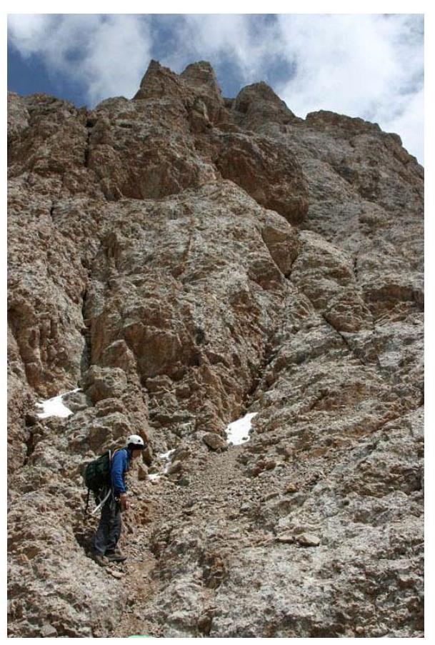
- In the middle and upper parts, technically difficult sections alternate with scree shelves. Taken on July 9, 2007.

- Descent. Rappelling in the upper part of the route. Taken on July 9, 2007.
- Lower part of the route from above. Descent along a scree shelf to the left. Taken on July 9, 2007.

- Rappelling on the R4–R3 section. Taken on July 9, 2007.
- Rappelling from the flake on the key section R1–R2. Taken on July 9, 2007.
10. Links
Report on this trip, passports of the passes and peaks completed:
Ascents in neighboring Torugart-Too and At-Bashi ridges
Risk Onsite, No. 32. Article by D. Shapovalov.
The report was compiled by D. Martynenko, photographs were taken by D. Shapovalov.
Comments
Sign in to leave a comment