Ascent Log
-
Climbing category: rock
-
Ascent area: Western Tian-Shan, Sayram-Su gorge (base camp 1700 m)
-
Peak, route: Peak 20 years of Assembly of the People of Kazakhstan 3552 m (20 years of APK), via the southeastern ridge.
-
Estimated category of difficulty: 1B category, rock, first ascent
-
Altitude difference according to altimeter: 852 m
- total route length: approximately – 3000 m;
- length of the wall section – none;
- steepness: on difficult sections up to 40°;
- average steepness of the wall section – none;
- average steepness of the route – 35°.
-
Number of pitons hammered: rock 0, chocks 0.
-
Number of travel hours/days: 15 h/2 days
-
Travel hours to the summit (not counting approaches and rests) – 5 h 15 min (one day, August 1, 2015)
Approaches from Base Camp 1700 m along the Sazan-Ata gorge: from 15:00 to 19:00 on July 31, 2015.
Departure from bivouac 2700 m from the Silbili valley to the gorge between Peak Iglа and 20 years of APK: at 7:00 on August 1, 2015. Start of the route: at 7:00. Reaching the summit: at 12:15. Descent from the summit: from 13:00 to 15:30 to the northeast to the bivouac. Return to Base Camp 1700 m at 19:50.
-
Leader: Vorobyova Viktoriya Nikolaevna – (III sporting category) Diploma ZhB-II 0090822 Kaz.IFK. List of participants:
- Rafikov Shamil – (instructor)
- Urazalin Erbol – (instructor)
- Rafikova Liliana
- Sarsenbaeva Gaukhar
- Marcichuk Iosif
- Unyaev Egor
- Shcherbanov Dmitriy
- Zaripov Marat
- Koshabaev Anvar
- Kim Evgeniy
- Askarov Nursultan
- Rudenko Nikolay
- Mirkamilov Mirjamal
- Kamalov Marcel
- Asanbekova Gulya
- Zhuravlev Georgiy
- Mirzadavletov Aidar
- Generalov Saveliy
- Chernykh Aleksandr
- Rafikova Natalya
- Sansyzbaev Ruslan
- Zharkikh Igor
- Zharkikh Stanislav
- Protsenko Sergey
- Markovskiy Vitaliy
- Khasanov Giyos
- Eleubekov Talgat
- Shemuratov Vladimir
- Rakhmatulaev Usen
- Sansyzbaev M.
-
Coach: Vorobyova V.N. (Diploma ZhB-II 0090822 Kaz.IFK).
-
Start of the route: at 7:00.
Reaching the summit: at 12:15 for the first participant, by 13:20 for all.
Descent from the summit: from 14:00 to 14:30 to the northeast to the bivouac.
Return to Base Camp 1700 m at 19:50.
Event Organizers:
- Akimat of South Kazakhstan Region,
- Assembly of the People of Kazakhstan,
- Akimat of Tolebi District,
- Sayram-Ugam State National Nature Park,
- Public Council for the Development of Sports and Ecological Tourism and Environmental Education under the Akimat of South Kazakhstan Region.
Person responsible for the Report: Vorobyova V.N. (Viktoriya Vorobyova, e-mail: viktoriya594@gmail.com, Diploma ZhB-II 0090822 Kaz.IFK, phone: 7 701 435 19 95, Page 3–12).
PHOTO #1: View of the Ugam Range in Western Tian-Shan on July 31, 2015. The peaks of the eastern part of the range are marked.
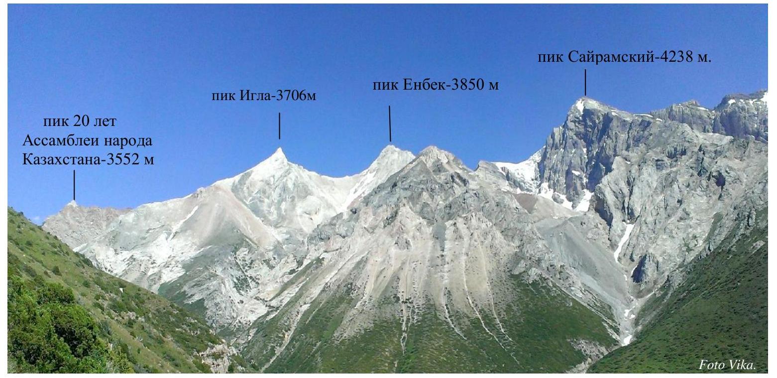
PHOTO #2: Peak 20 years of Assembly of the People of Kazakhstan – 3552 m.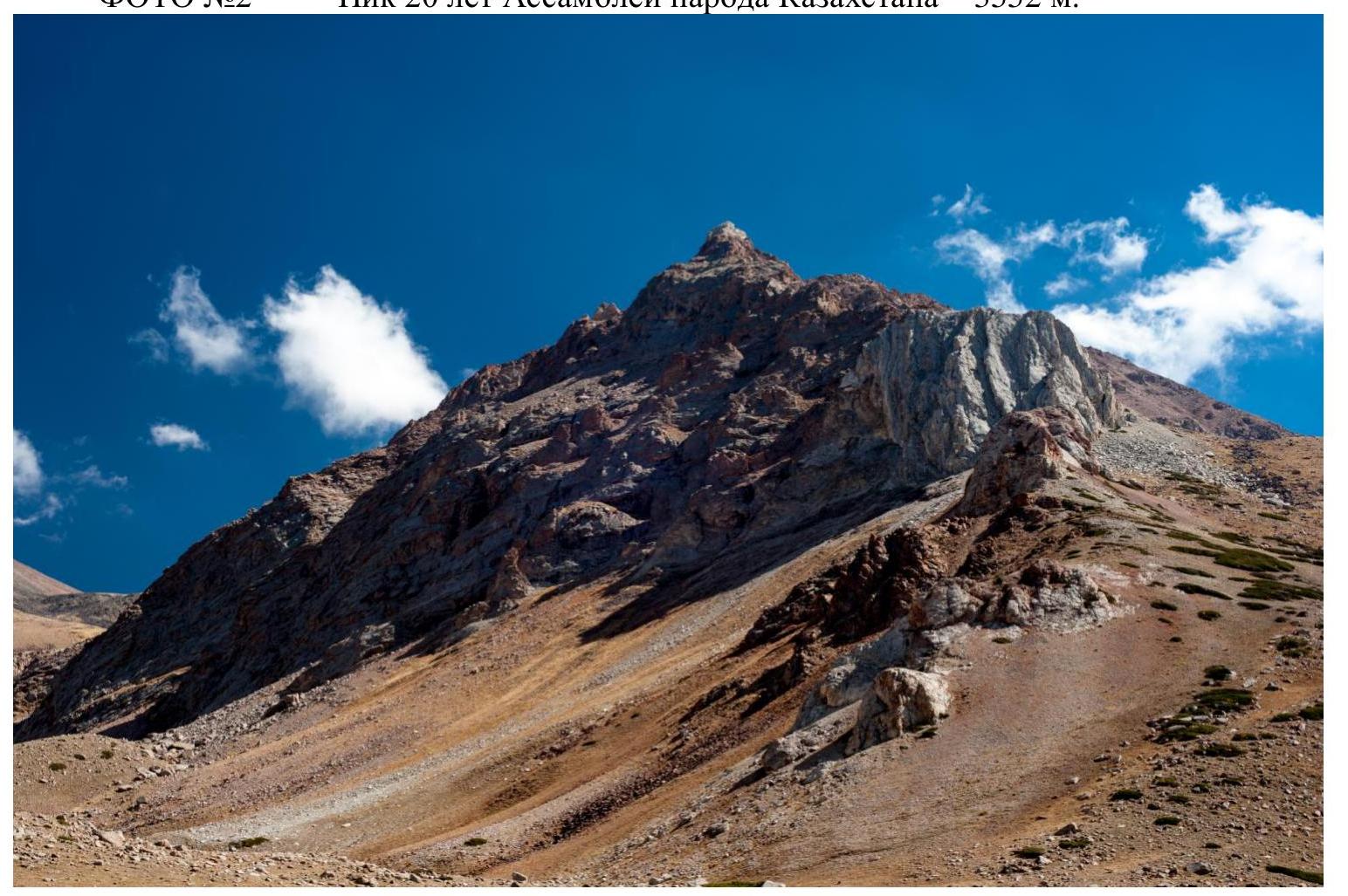 Page 4–12. Map of the area of the first ascent.
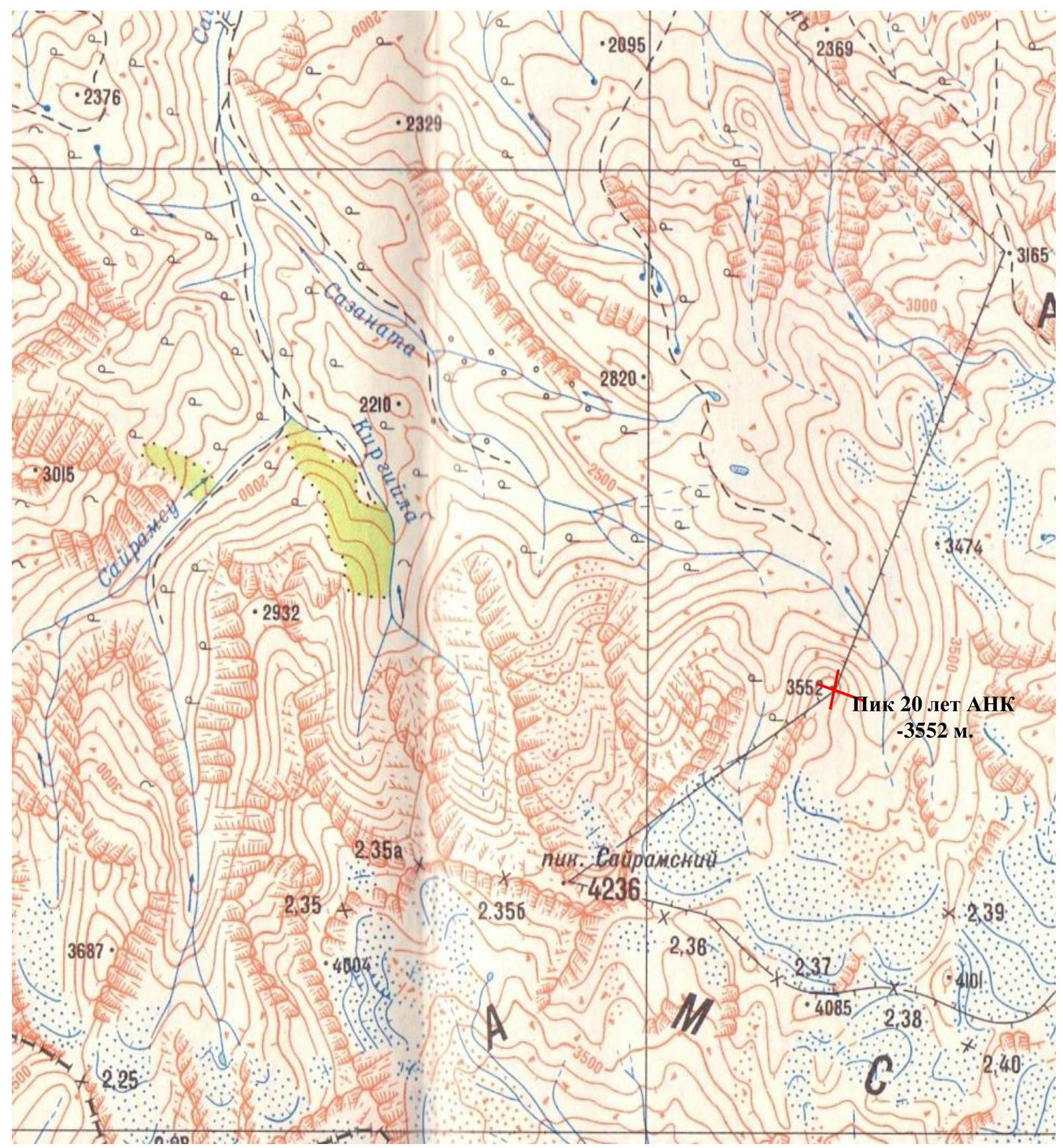 Page 5–12. 3-D scheme of the route.
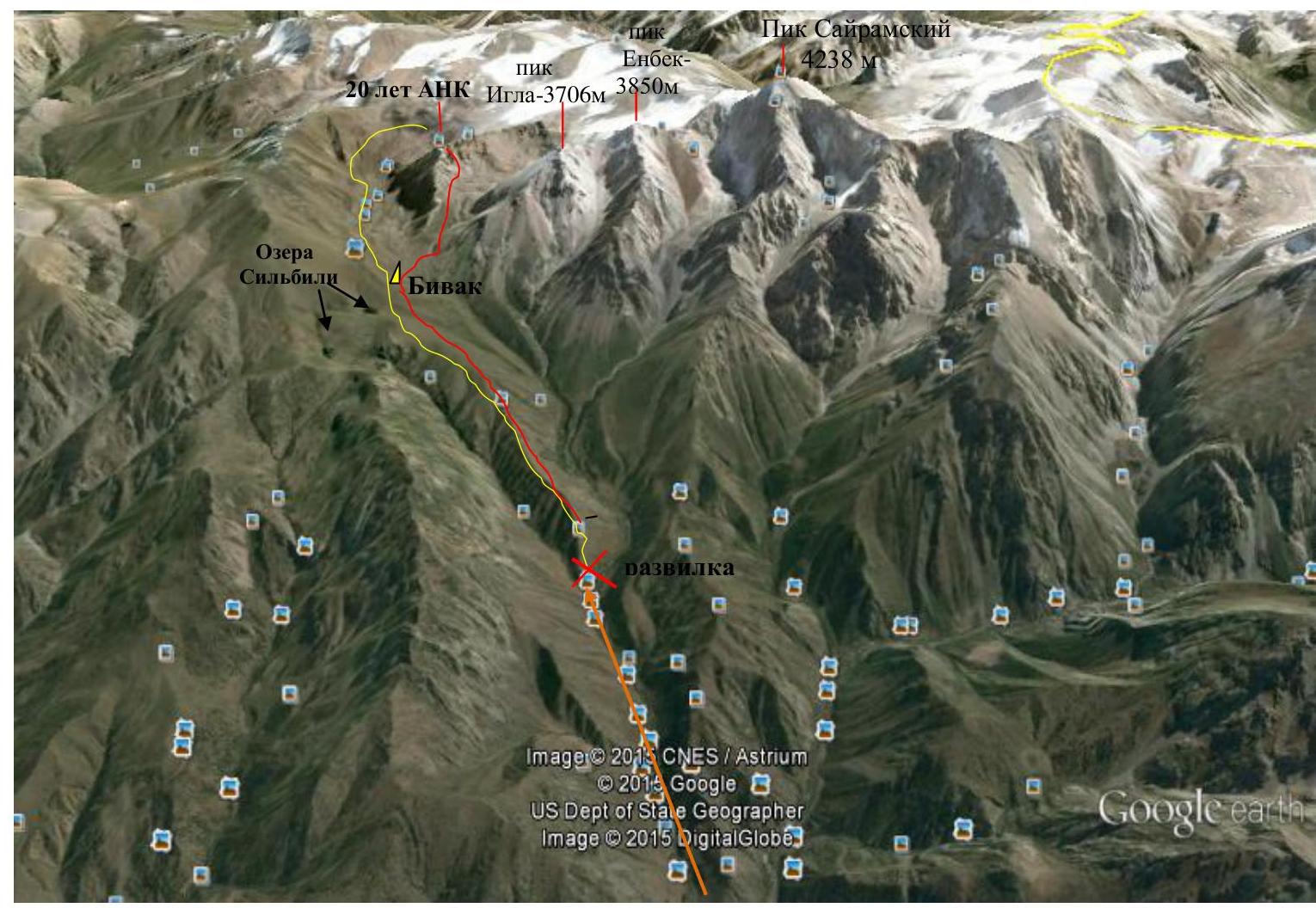
NOTES on PHOTOS: Sazan-Ata gorge – ascent line □, descent line ×, fork △, bivouac. Page 6–12. Brief description of the route via the southeastern ridge: Peak 20 years of Assembly of the People of Kazakhstan – 3552 m.
The base camp is located in the Sayram-Su gorge at an altitude of 1700 m above sea level. The approach to the route begins along the Sazan-Ata gorge along a good road, along fruit gardens and the Sazan-Ata river to the ridge, you pass through a stream – 1 h. Then straight up along the ridge to the Silbili Valley – 2700 m above sea level, it takes 3 h to walk. The valley is large, to the left are two Silbili lakes (water is not potable). The bivouac site is to the right, towards the stream. Overnight stay.
On August 1, 2015, departure from the Silbili valley to the mountain. The summit is located to the left of Peak Iglа (3706 m above sea level). From the Silbili valley, it is necessary to cross to the right side through the river ford (the river is not very turbulent and not deep).
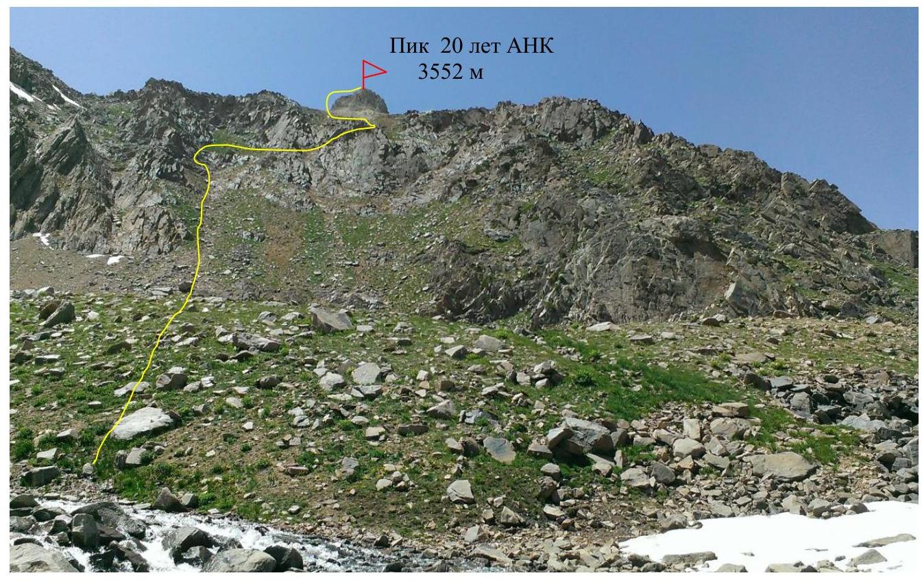
The ascent begins along the gorge between:
- Peak 20 years of APK – 3552 m,
- Peak Iglа – 3706 m.
Route:
- Upstream along the creek – a good trail to a green meadow – 1 h.
- Then we move to the left along the rocky ridge along the large moraine – 1 h.
- Then move to the right along the moraine and scree to the main ridge – 1 h.
- Average steepness of the ascent – 35°.
- Along the main ridge to the left 100 m along the large moraine to the saddle under the white tower.
The route to the summit passes along the white tower. There are no technical difficulties. Rockfall hazard is present.
Passing the summit:
- From the saddle to the right, eastward, bypass the tower, then up two ropes of 50 m each to the summit.
- The rocks are destroyed, with small scree in places.
- Insurance is provided by rock outcrops.
- Climbing in rope teams.
The summit:
- Sharp, rocky.
- Can accommodate 5 people at a time.
- On the summit, insurance is required in the form of a loop, as there are rocky drops of 150 m from the summit.
- A cairn is built, clearly visible.
Descent:
- From the summit along the ascent path to the saddle.
- Then to the northeast along small and medium scree into the valley.
The route is educational, allowing work on scree and grassy slopes, with a rope on the rocky ridge. The significant length and varied relief allow comparing the described route with routes such as Peak Enbek – 1B category, where the group, after passing a long slope, reaches a rocky ridge with sections of 1B category.
Page 7–12. PHOTO #3. Ascent to the summit.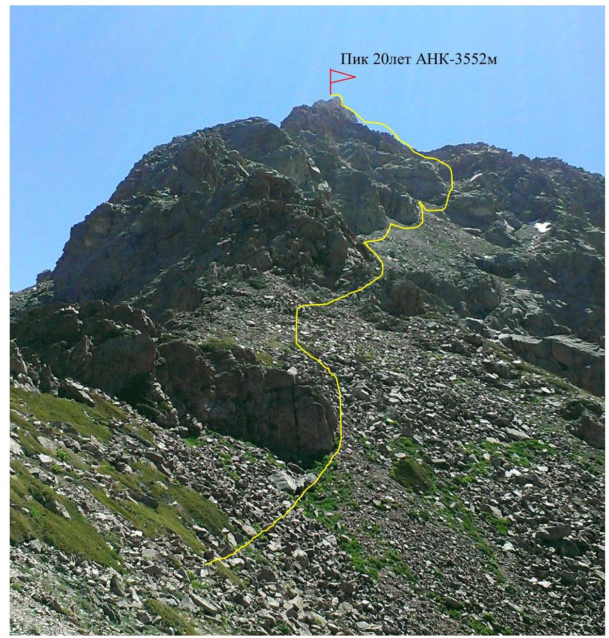 Page 8–12. PHOTO #4. Bivouac. Departure to the mountain – August 1, 2015.
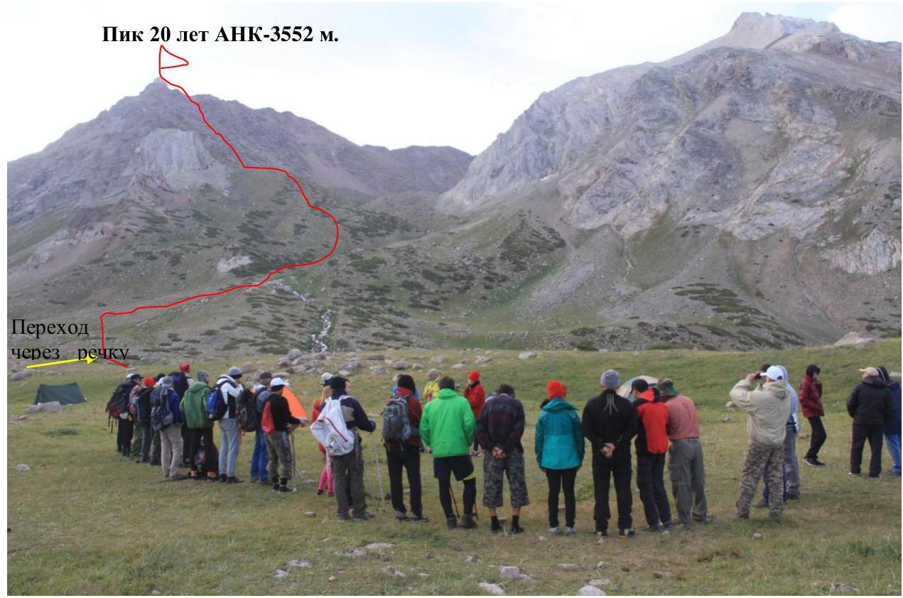 Departure to the mountain – August 1, 2015.
PHOTO #5. ROUTE TO THE SUMMIT.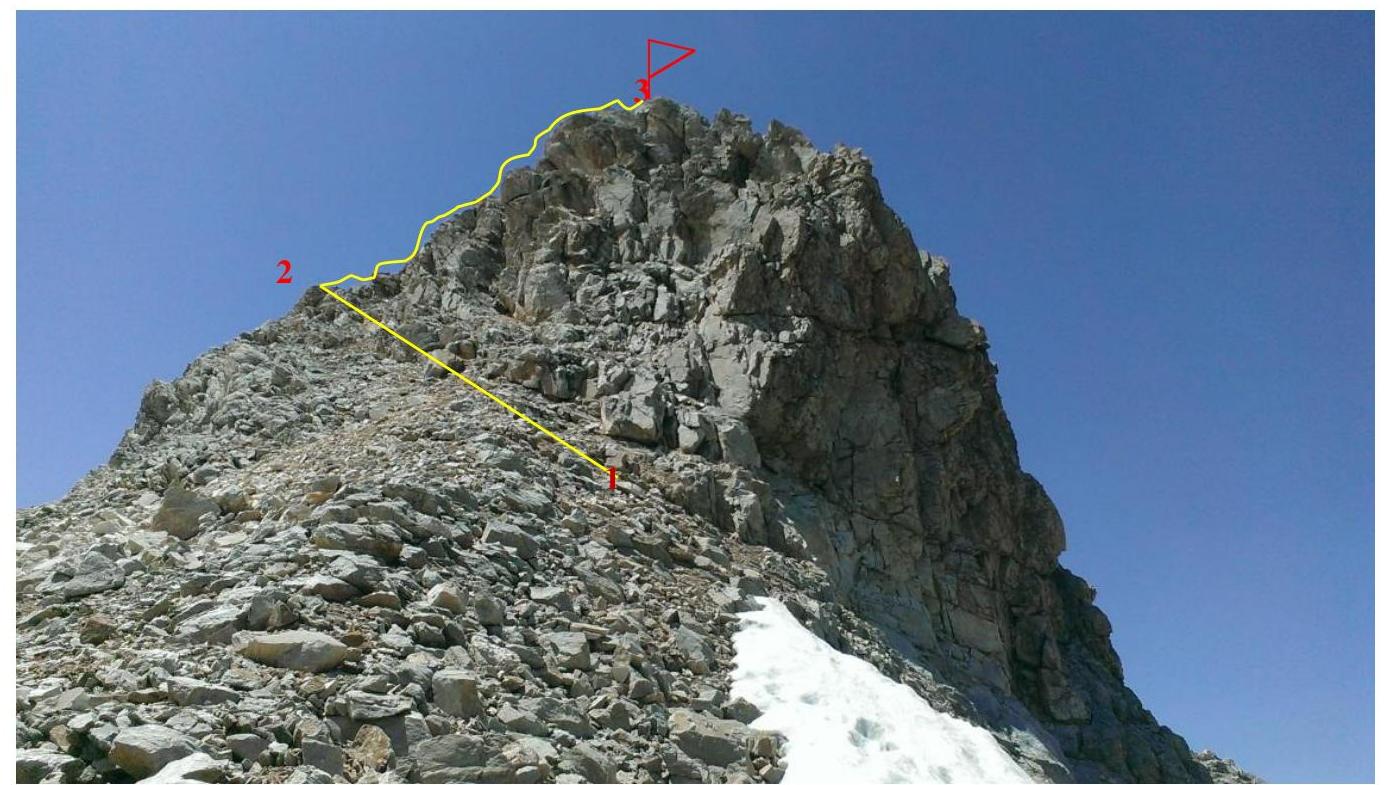 Page 9–12. PHOTO #6. Ascent to the mountain. Reaching the main ridge.
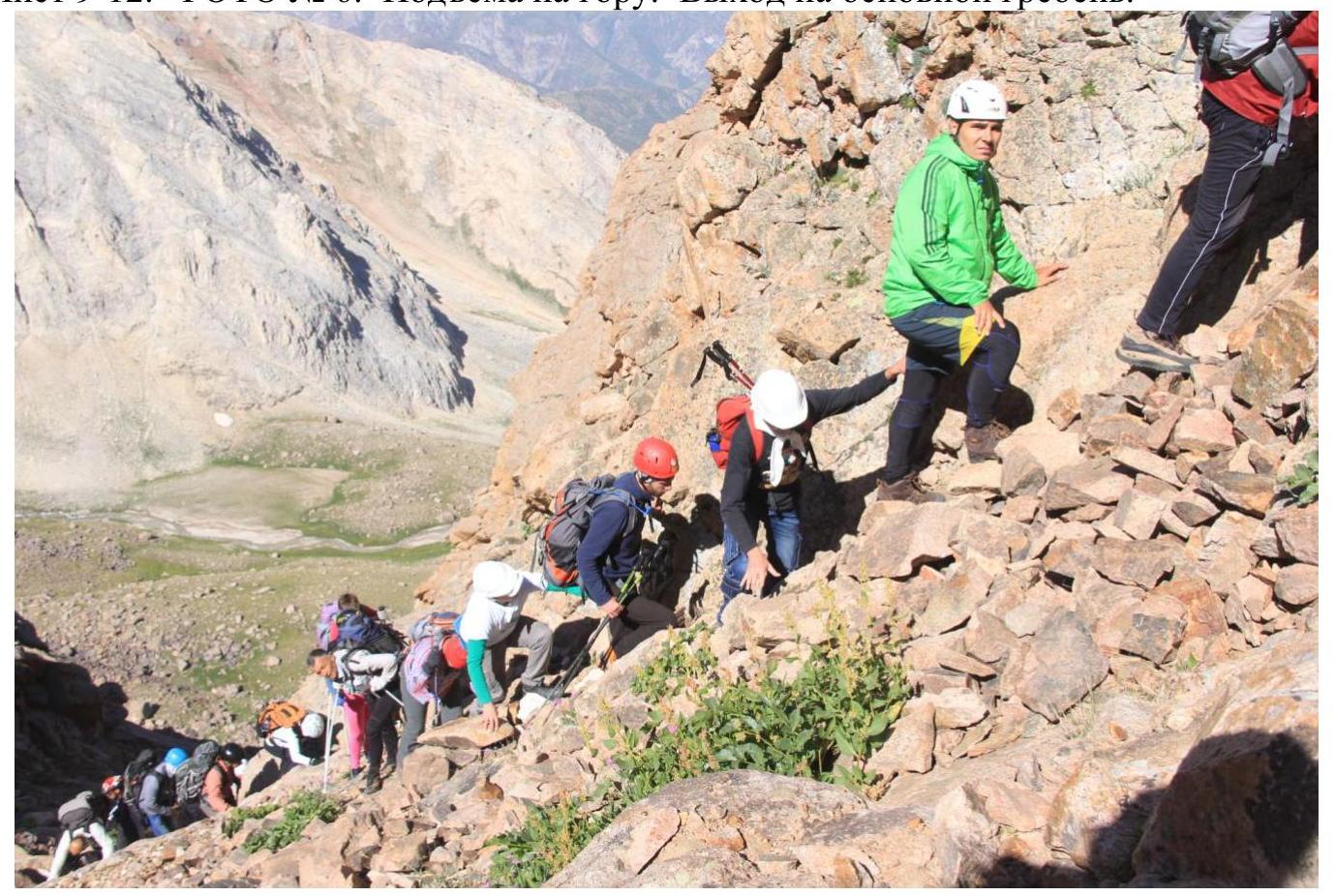 Page 10–12. PHOTO #7. Approaching the summit.
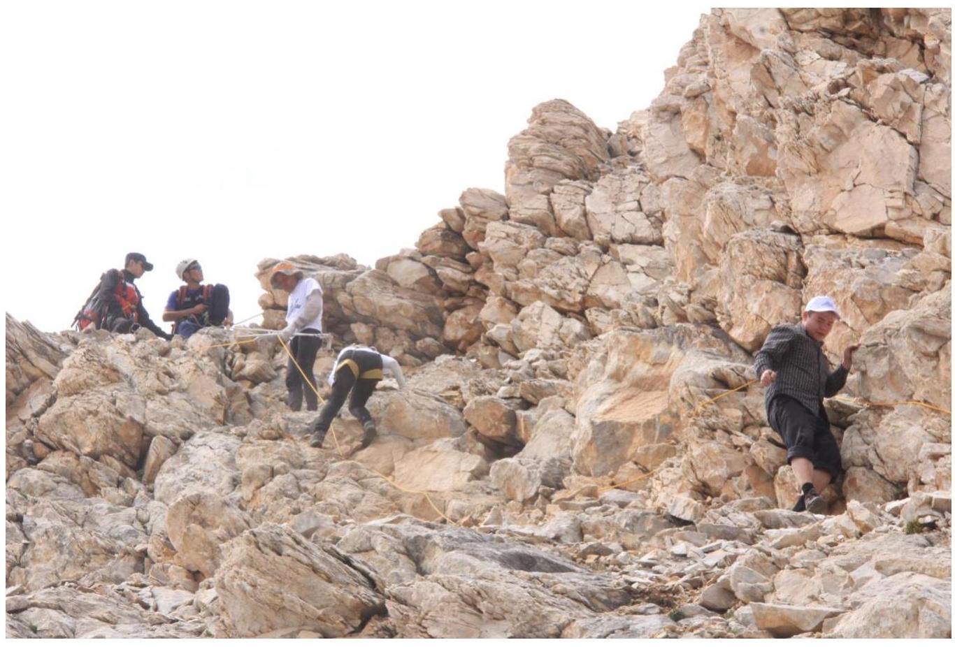
PHOTO #8.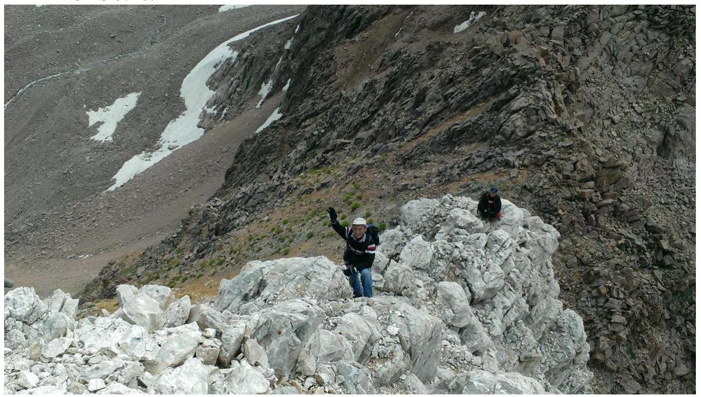 Page 11–12. PHOTO #9. On the summit, a cairn is built. Writing a note.
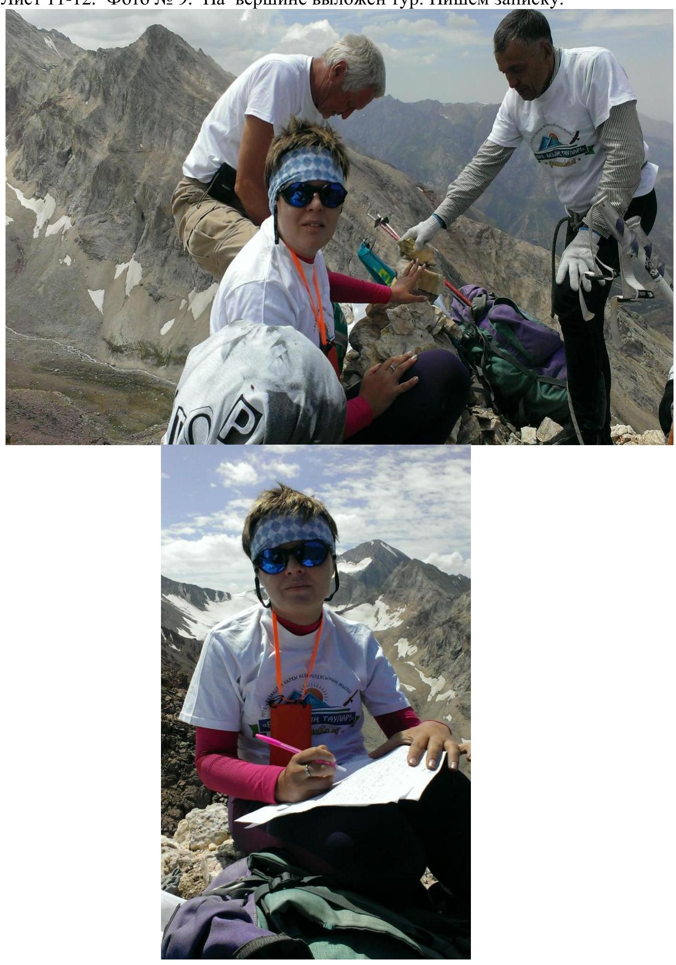 Page 12–12. GROUP PHOTO.
DESCENT FROM THE SUMMIT along the ascent path to the saddle to the northeast.