
Ascent Log
- p. Karbysheva is located in the Terskey-Alatoo range to the north of p. Karakolsky, between p. Blyukhera and p. Dyuklo. The route's ordinal number is 69, section 7.10 of the classification table.
- Name — Pik Karbysheva. Route name — via the South Ridge.
- Proposed category of difficulty is 4B.
- Route type — combined.
- Height difference — 630 m.
- Length — 870 m.
Length of sections with category 5 complexity — 105 m. Average steepness of the route — 47°. Steepness of the main part of the route — 53°.
- Number of pitons left on the route — 0 pcs.
- No ITO was used; no drill-in anchors were used.
- Total climbing time: 18 h 5 min
- Leader: Soldatov Alexander Anatolyevich, 2nd sports category.
Team members:
- Shapovalenko I.N. — Candidate for Master of Sports
- Isaev A.V. — 2nd sports category
- Kechinov A.M. — 2nd sports category
- Coach: Shapovalenko I.N.
- Departure to the route: 4:00 AM, August 22, 2003.
Reached the summit: 6:00 PM, August 22, 2003.
Photo 1. Overall photo of Pik Karbysheva summit

Routes:
- via South Ridge, led by Soldatov A., 4B, June 22, 2003
- through the center of the East Face, A. Korolenko, 1977, 5A category
- via East Ridge, I. Serdyukov, 1978, 3A category
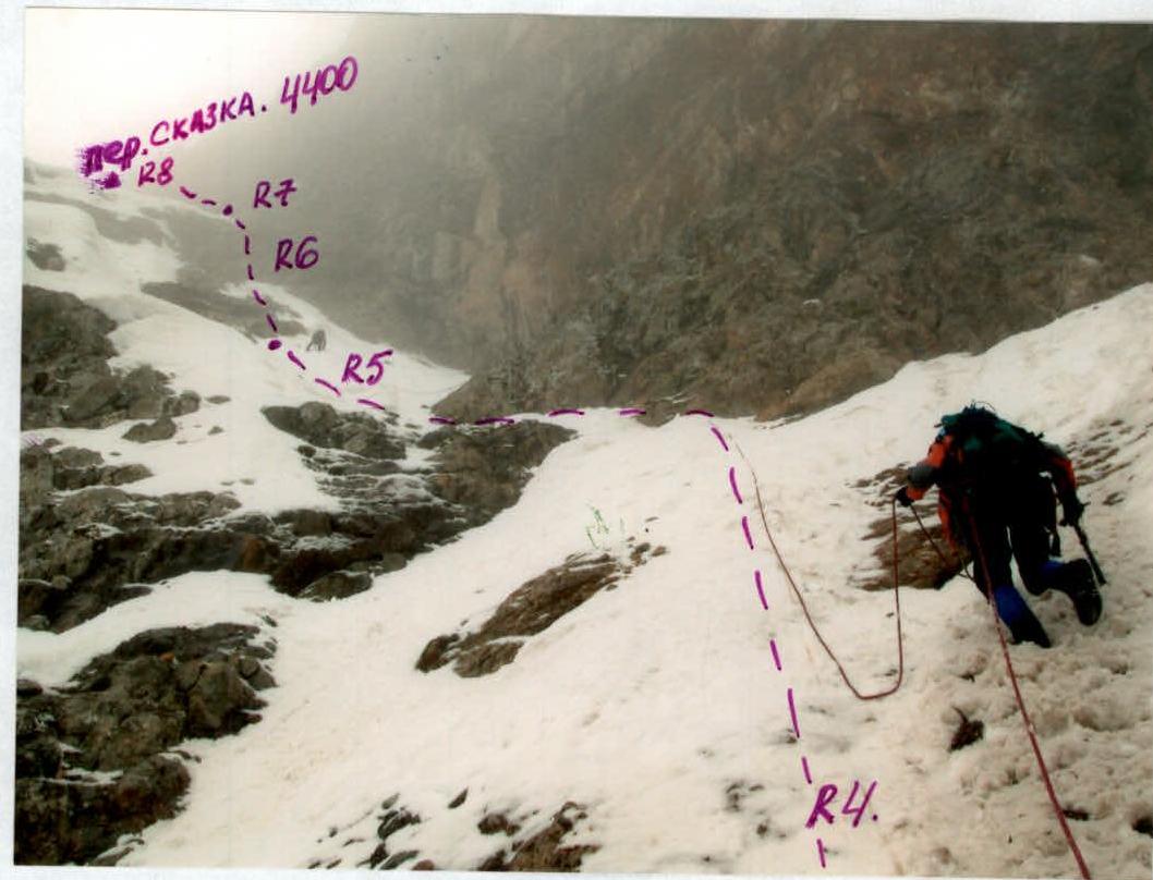
The survey was conducted on June 23, 2003, from the Karakolsky Glacier. Approach to the route Departure at 4:00 AM. From the base camp, along the valley to the beginning of the Karakolsky Glacier, exiting to the right side of the valley onto a lateral moraine, across talus, then through "ram's foreheads" above the waterfall, and onto the glacier below Pik Karbysheva — 2 hours. Crossing the Karbysheva Glacier to the route — another 1.5 hours. The approach was complicated by a significant amount of snow on the glacier. The route begins with movement up an avalanche cone with a height gain of approximately 70 m. After that, the group started moving up a couloir with a steepness of 45°, where a stream flows, and snow lies on top of accreted ice. The couloir leads to a chimney with plugs filled with snow, ice, and broken rocks (section R3–R4). After passing the chimney, the character of the route changes — rock slabs with an average slope of 50–60°, with areas of more broken rocks, and places more suitable for organizing intermediate belays and stations. A very challenging section for climbing was R6 — steep, broken rocks 20 m long, covered with a layer of snow. 2:00 PM. Section R7 — exit onto the pass saddle (pass Skazka — 3A category). On the pass saddle, there are 2 rappel loops and a cairn where we found a note from a group of tourists. Section R8 — traversing along the ridge with small gendarmes; movement became more complicated — it started snowing. Even relatively simple climbing sections became challenging — very slippery, increasing the risk of falls. Logically, the route continues along a steep rock ridge — with sections of difficult but beautiful climbing on steep granite rocks. We had to abandon this plan — given the condition of the rocks and the weather, it seemed too risky. The group had to traverse onto rock slabs with a steepness of 50–60°, covered with snow, under which there was ice, with rock outcrops. This situation allowed the group to use rock pitons, stoppers, and occasionally screw in ice screws where the ice was thick enough (sections R9–R11). The use of ice screws was limited — they typically went in halfway. A very challenging climbing section was at the beginning of R12 — exiting from snow onto a steep rock wall completely covered in ice. The length of this challenging section was not great — 10–12 m, but it provided many "joyful" moments for the belayer while I. Shapovalenko was climbing this section! After passing the wall, we again encountered "normal" snow-covered slabs, making it possible to climb in crampons. We changed leaders again — Soldatov A. became the second lead climber of the day. The exit from the chimney R13 was also not simple — for the same reasons. Before exiting onto the rocks, we had to dig down to the ice again to organize a belay. The rocks themselves were quite acceptable for climbing in crampons; the relief allowed the use of stoppers, but one had to be mindful of placing friends between ice-cemented rocks. The section ended with a rock bastion, on the offsets of which our station was conveniently located. The final section, R14, involved climbing a snowy slope with a steepness of up to 60° around the bastion on the left, exiting onto a steep ridge with snowdrifts on the south side. To the summit along the ridge was 25 m. Movement along the ridge was on the north side, using an ice axe for belay. SUMMIT! 6:00 PM. At the summit, there was a metal plaque. Unfortunately, we did not find any notes, although according to I. Khanin, it is usually left in the gap between the rock and the plaque. The weather was very unpleasant — blowing snow, snowfall, cold. Visibility — 30 m. We quickly began our descent in an easterly direction down a steep snowy slope alongside cornices. Commands to adjust the rope length were not audible; the partner in the rope team was hard to see. Within 2 hours, by the time of our next communication session, the group had descended onto the Djuklo Glacier, finding a narrow snowy couloir. It took another 2.5 hours of deep snow on the glacier to reach the camp, as well as:
- large talus slopes,
- "ram's foreheads"...
On the glacier, it was raining... Sheet 4, page 8
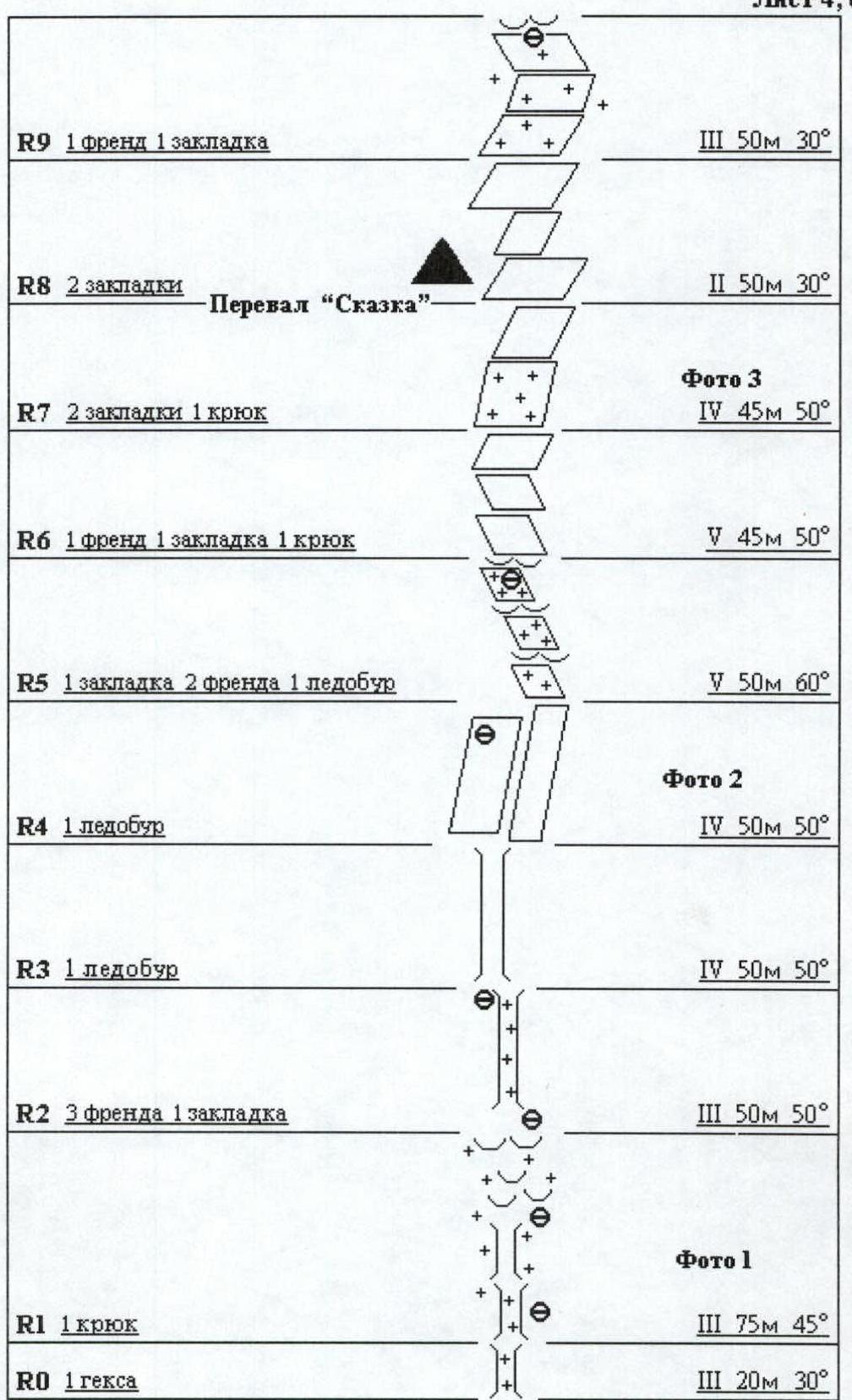
Sheet 4, page 8a
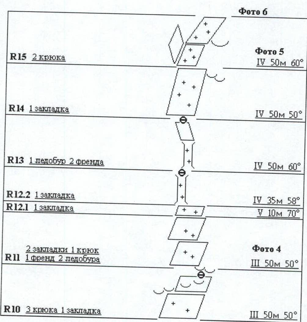
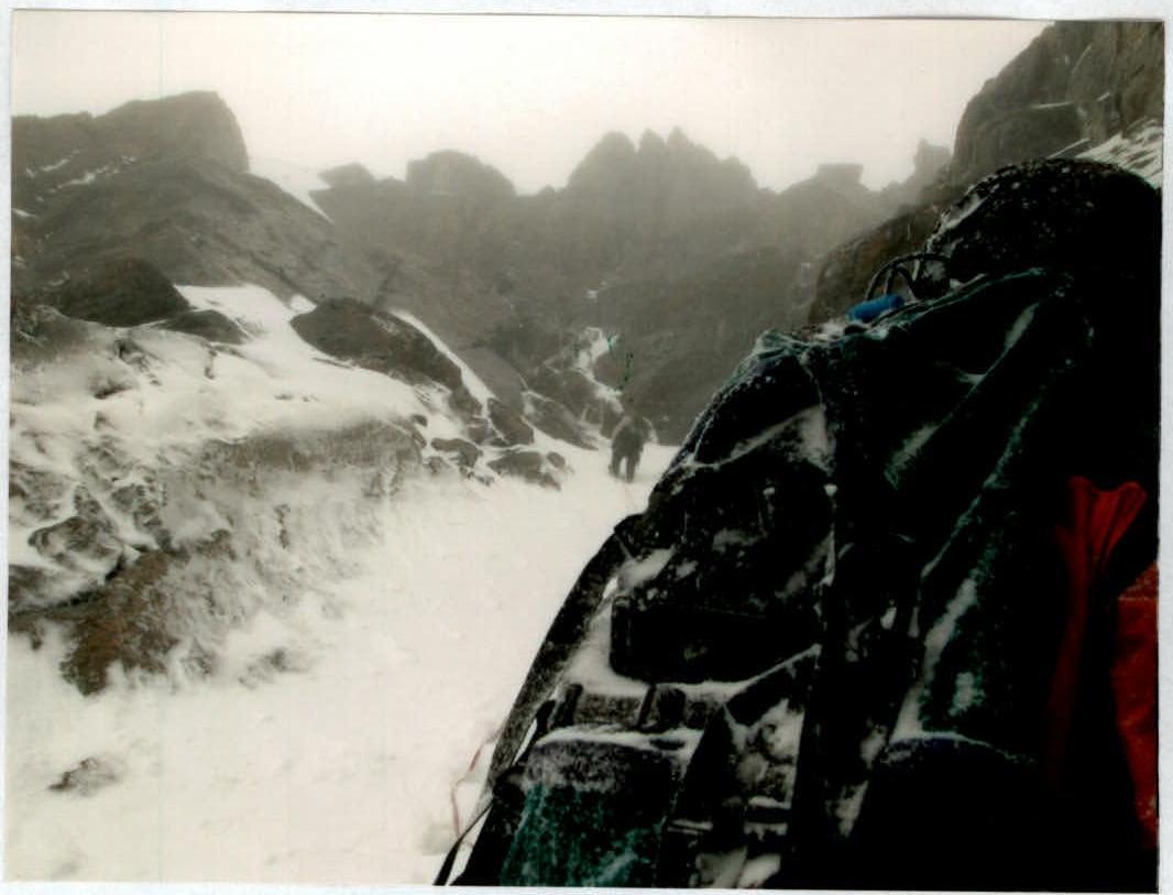
Technical photograph of the route
Photograph of the plaque at the summit of Pik Karbysheva
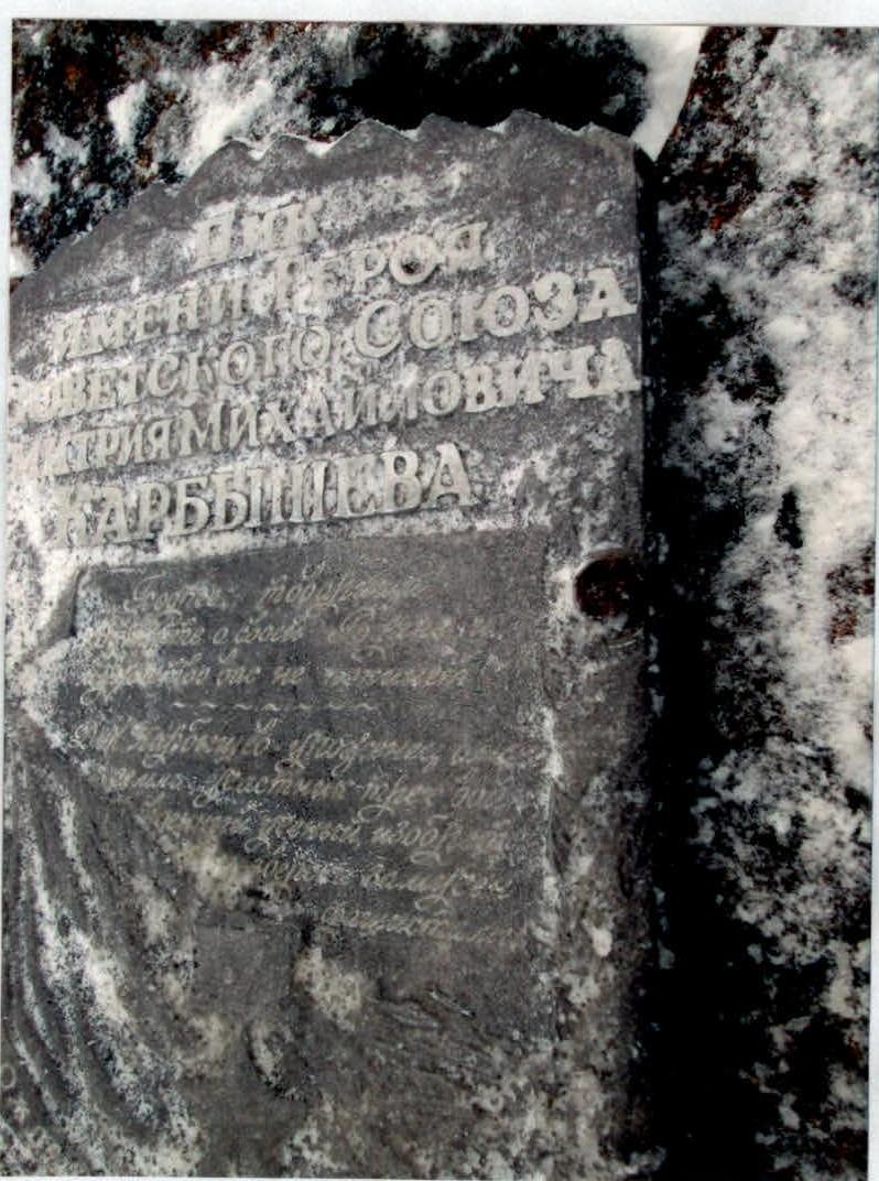
The original note was not found, either due to the large amount of snow or because it was not there, as nothing was found in the recommended location (under the plaque).
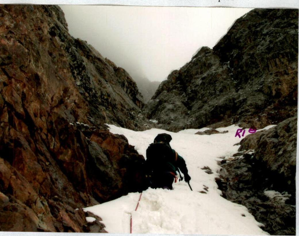
Photo 6.1. Passage of section R1. Movement along the snowy stream bed towards the "ram's foreheads" — the location of the station.
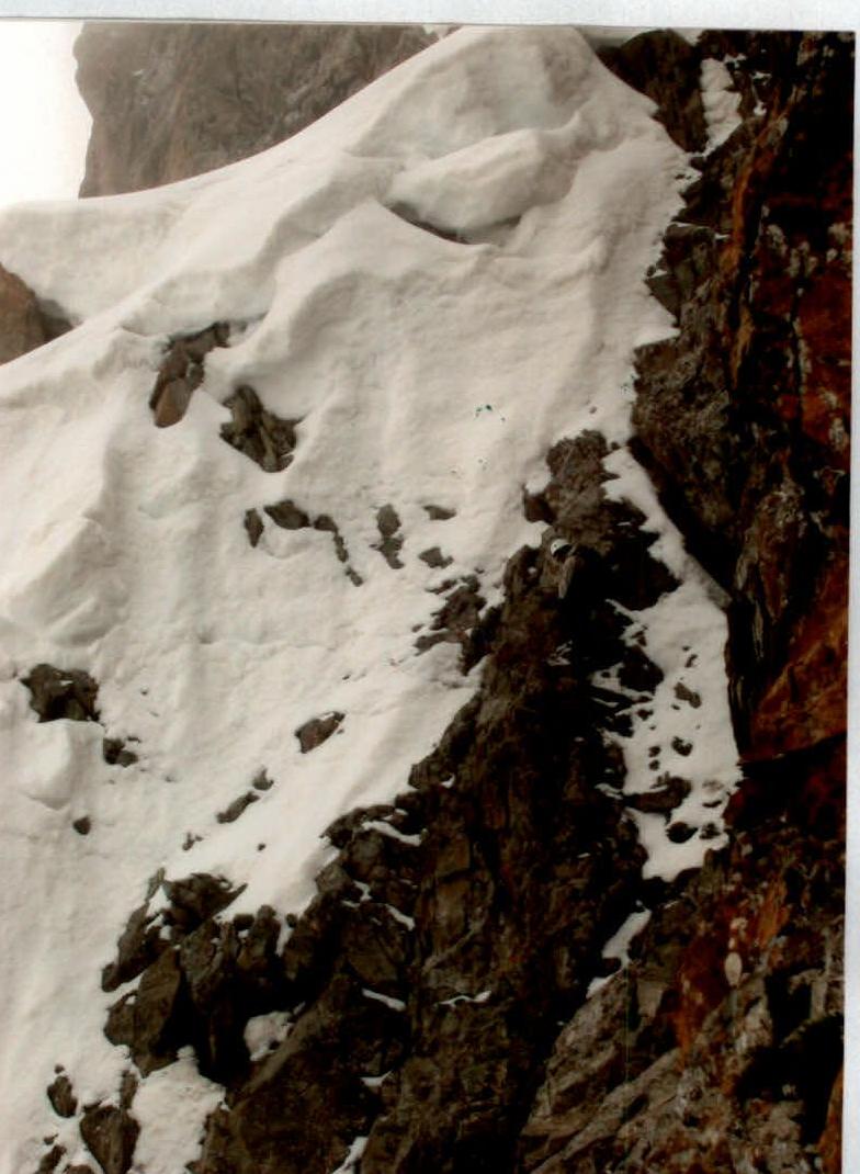
Photo 6.2. Shapovalenko climbing the steep, broken rocks of section R6.
Comments
Sign in to leave a comment