
Climbing Report for Khan-Tengri Peak, 6995 m
via the NE ridge of Chapayev Peak's shoulder, B. Solomatov's route, 5A category
CSKA team named after Demchenko: Bryk R.A. — team leader, Volkov A.E., Dikovsky K.
Route Passport
- Category — high-altitude and technical
- TIAN-SHAN, 7.9. Tengri-Tag ridge
- Khan-Tengri peak, 6995 m, NE ridge of Chapayev Peak's shoulder, (B. Solomatov's route, 1974)
- 5A category of difficulty
- Route type — combined
- Route characteristics:
- Elevation gain — 2,900 m;
- Wall section — 40–50 m;
- Route length — 3,500 m;
- Wall section length — 40–50 m;
- Length of 5th category sections — 50 m, including 6th category — 0 m.
- Average steepness of the entire route — 40°, main section — 40°.
- Team's travel time — 10 days including acclimatization.
- Departure date — July 39, 2017, 14:00, Summit date — August 8, 2017, 16:00
- Team members: Bryk Roman (Candidate for Master of Sports), Volkov Andrey (Master of Sports), Dikovsky K. (2nd sports category) Coach: Kuznetsova E.V. (Candidate for Master of Sports)
Route photos:

The team had 3 camps:
- Camp 1 (4600 m)
- Camp 2 (5500 m)
- Camp 3 — saddle (5850 m)
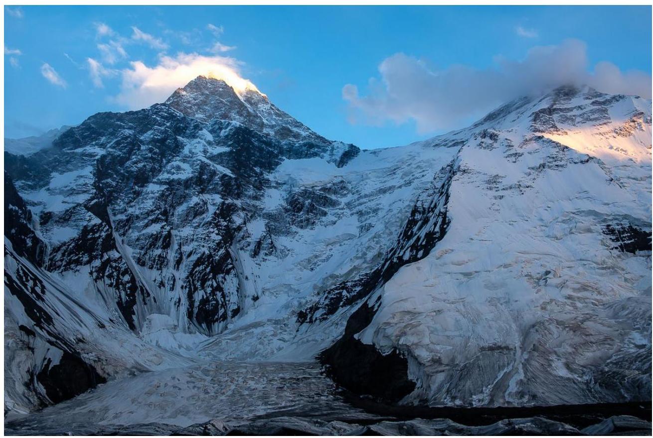
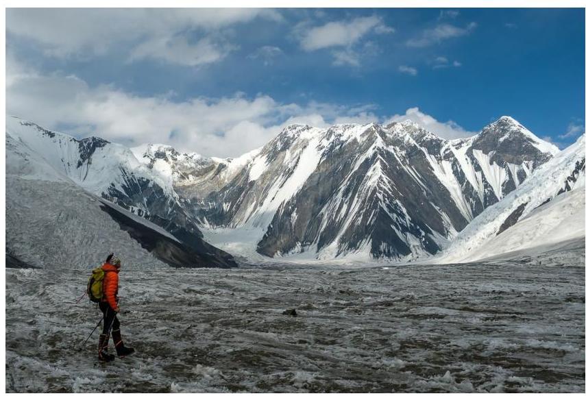
NE ridge and Chapayev Peak
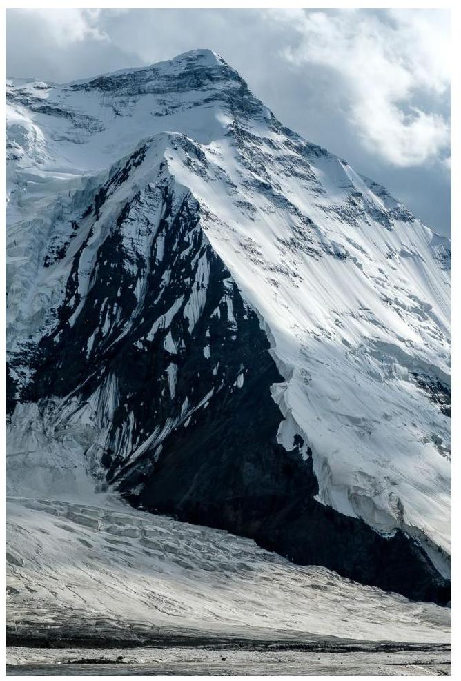
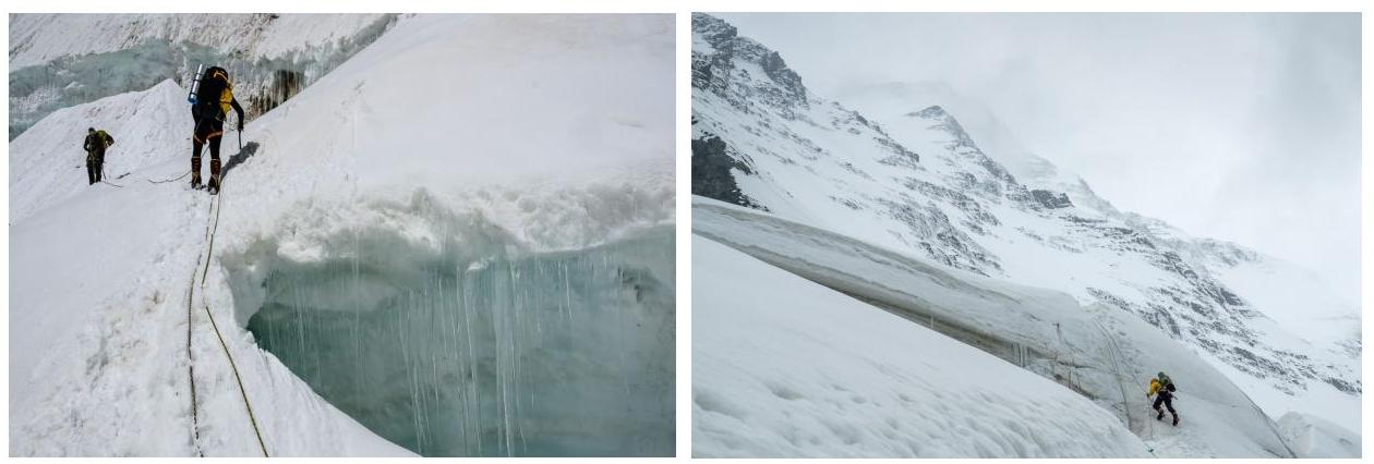
Upper part of the route
Logistics
Flight: Moscow — Almaty (Kazakhstan). Transfer: Almaty (+ food shopping) — Karakara camp (around 2,000 m)* (2–3 hours). Karakara camp — walking to Kyrgyzstan territory via a bridge (15 min) — Aксай-travel camp.
Helicopter: Aксай-travel camp — North Inylchek glacier Base Camp (4,000 m), (45 min).
*We spent several days in Karakara camp (Kazakhstan) waiting for the helicopter and made an acclimatization trip to 3,600 m.
Route Description and Team's Work
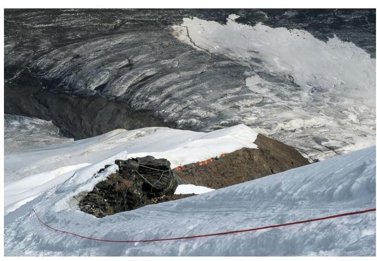
The team arrived at the North Inylchek glacier on July 29. We made an exit towards the Marble Wall.
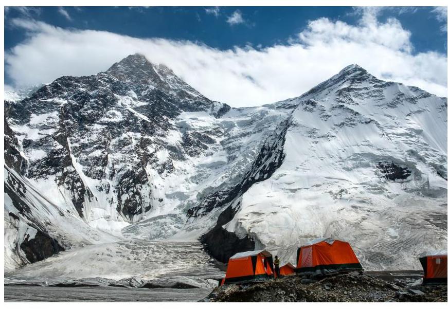
View of the route from Base Camp on North Inylchek
Marble Wall
July 30
Crossing the flat glacier and starting the ascent to Camp 1 at 4,500 m. Acclimatization night. 500 m elevation gain on a snow-ice slope at 40°. From 4,300 m, fixed ropes start and continue almost to the summit. The ascent gradually moves left onto the distinct NE ridge, becoming steeper with vertical sections 5–7 m. "Caution," the lower part of the route can be avalanche-prone during certain times. In our case, there was practically no snow.
Ascent to Camp 1
July 31, 2025
Night spent on a safe shoulder of the NE ridge at 4,500 m. About 150 m higher, there's another potential campsite. After the night in Camp 1, we descended back down via the ascent route.
Camp 1
August 1, 2025
Rest day
August 2, 2025
Departure from Base Camp (4,000 m) to Camp 2 at 5,500 m, bypassing Camp 1. A long and challenging transition. Almost the entire time, we ascended using the front points of our crampons. Encountered vertical sections, rocky gendarmes, and ice walls. Average steepness 45°. Navigation is not complicated: we moved along the ridge and followed the fixed ropes. Ropes were mainly thin lines and sometimes old static ropes. A snowstorm began in the evening. Cold.
Ascent to Camp 2 and view of Camp 1 from above
August 3, 1953
Night spent on a wide plateau. The weather was good in the morning, and we headed towards Chapayev Peak at 5,800 m for acclimatization.
August 4 and 5
Descent to camp, rest
August 6
Ascent to Camp 2 during a snowstorm.
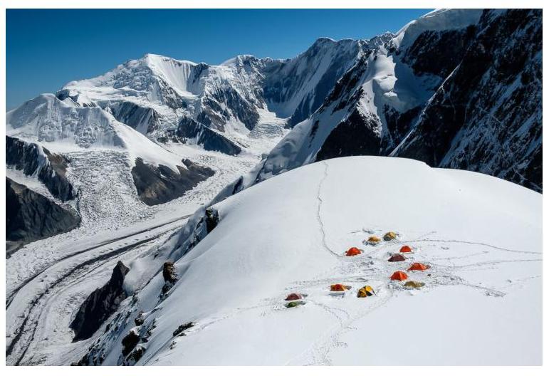
Camp 2, photo taken during acclimatization
August 7
Ascent to Chapayev Peak and descent to the right onto the Khan-Tengri col. In the middle part of the ascent, the steepness of the rocks with ice reaches 60–70°. Sections are 10–20 m. Old, frayed ropes require careful selection. After ascending Chapayev Peak (6,100–6,200 m):
- Ropes end;
- A closed glacier begins;
- A rope is needed for traversing the closed glacier.
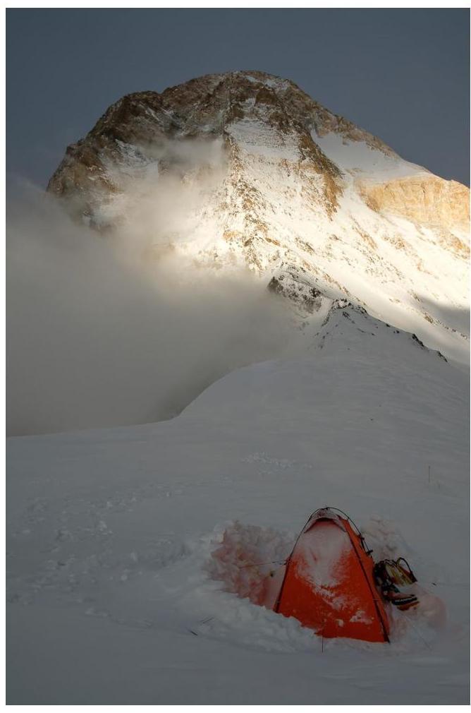
Below, the slope is cut by a large bergschrund with ropes and a ladder. We moved in a snowstorm with zero visibility. In the evening, we established a campsite on the col (5,800–5,900 m), digging a deep pit and setting up our tent. Strong wind.
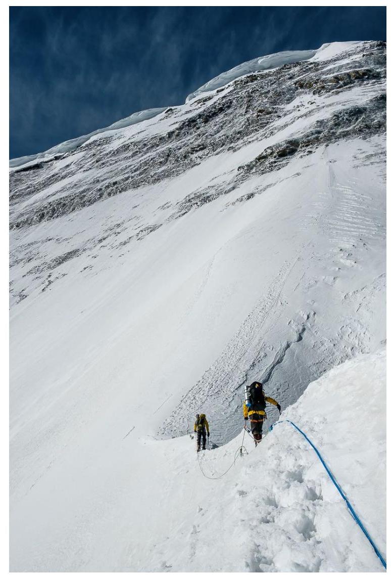
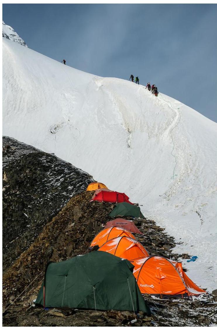
Start of the ascent to Camp 3, under Chapayev Peak
Descent from Chapayev Peak to the col. The camp is visible from the south, but we're not heading there; we need to go higher and a bit further to the left. "Caution": in bad weather, it's easy to take a wrong turn towards the southern slopes.
View of the ridge from 5,800–5,900 m from the col
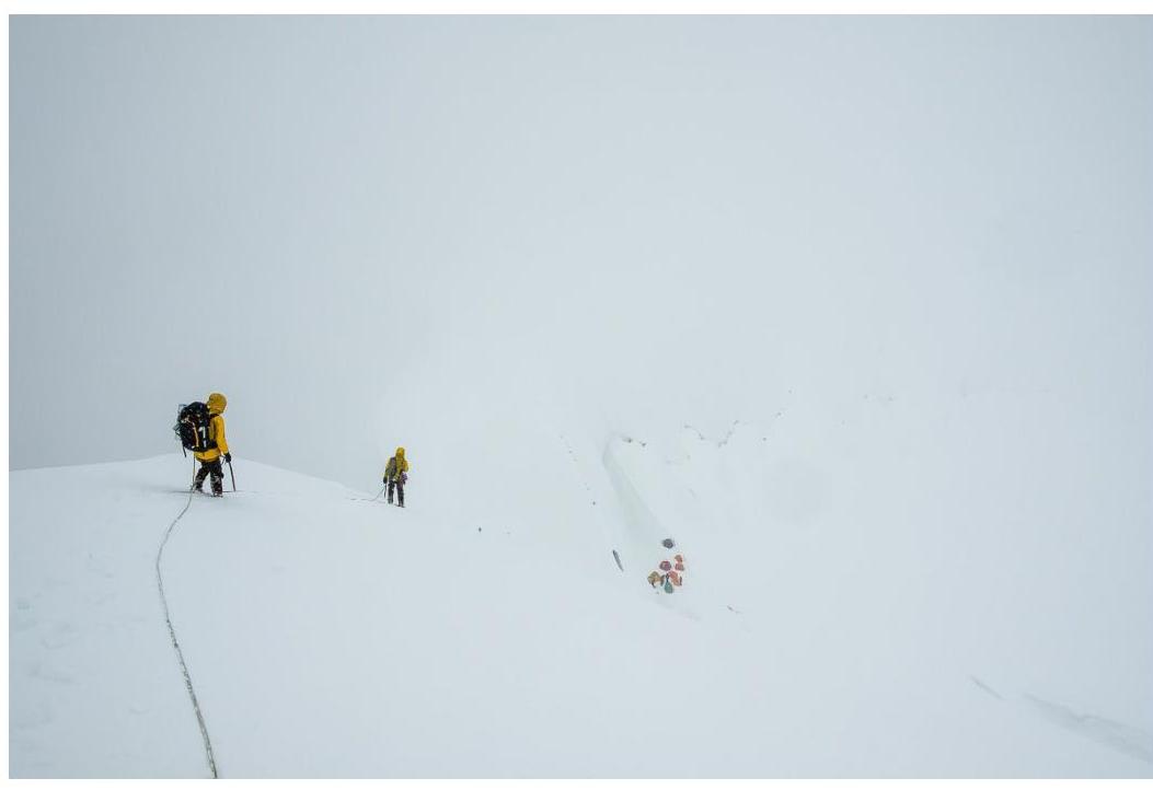
Camp 3 at 5,850 m
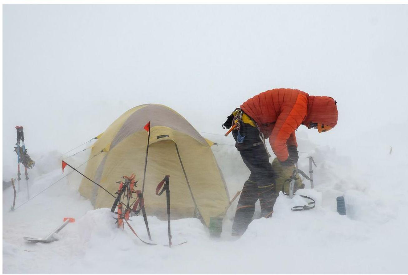
August 8, 1953
Strong wind, snowstorm. We waited for dawn and visibility. The storm subsided, but the wind remained incredibly strong. We managed to start the ascent at 6:30. The ascent follows a distinct ridge, and from this point, the route coincides with the route from the south. On this day, only one team was ascending from the south. From the north, there were three of us and two Swiss climbers plus one Slovenian.
The ridge is not very steep, but there are vertical sections. At 6,400 m, there's a potential site for one tent. Around 6,600 m, the route turns right: from the ridge into a wide couloir. The couloir starts with a 15 m wall. Further, there's a steep snow slope at 45°, which can be avalanche-prone. The slope leads to the right side of Khan-Tengri's pyramid. From this point, the slope becomes gentler.
A few hundred meters of snow slope (20–30°) with occasional gendarmes, and we took turns reaching the summit (the first at 16:00). Descent followed the ascent route. The first team member reached the col and the tent at 19:00. The others followed later.
"Caution," old ropes are used; be extremely cautious when selecting a rope.
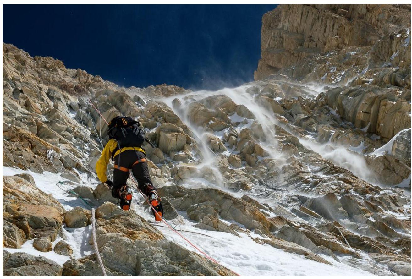
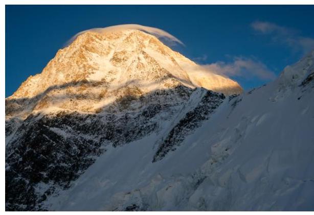
Ascent to the summit, rock wall before the snow couloir
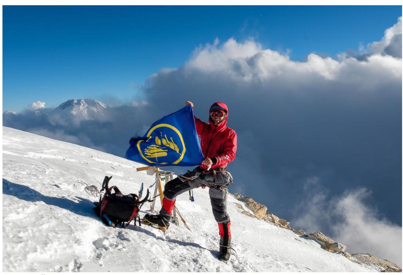
Dikovsky on the summit
August 9, 2025
At night, one team member felt unwell. Suspected pre-edema. We decided to descend to the south as returning to Chapayev Peak was not feasible due to health concerns. One rappel from the col, and we began our descent on foot, roped together, towards the southern side.
Near Camp 2, the first team member fell into a crevasse and managed to climb out. Further descent led to the South Inylchek glacier. The Aксай-travel camp team came out to meet us with a doctor — huge thanks to them!
August 12, 2025
We flew out from the South Inylchek Base Camp to Karakara camp, stopping at the North side to pick up our left-behind gear.
General Conclusions and Recommendations
Main hazards: the lower part of the route can be avalanche-prone, ropes are often old with torn sheathing throughout the route.
A rope is needed for the section: Chapayev Peak — Khan-Tengri saddle. Reverse descent is significantly complicated: we used a descender and UIAA knot during the descent. It can be very windy and cold on the ridge, especially in the morning. Bring warm clothing.
A beautiful, logical, interesting, and not the easiest route to the summit. It rather corresponds to 5B category of difficulty, but due to the presence of fixed ropes, assessing the complexity is challenging. Subjectively, it seems more interesting and safer than the route from the south.
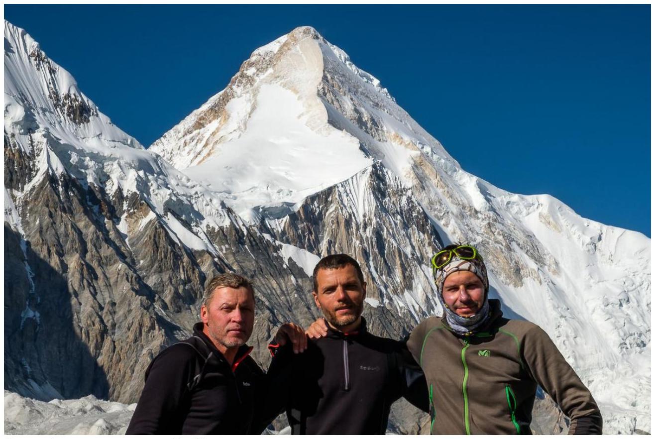
Team after descent, view from the south