PASSPORT
- Altitude-technical class
- Central Tian-Shan, Tengri-Tag range
- Peak Khan-Tengri, via south-west slope, 6995 m
- 2A cat. diff.
- Height difference — 2795 m
- Pitons driven: rock 0+8ˣ ice 1+2ˣ
- Climbing time — 12.5 hours, days — 2
- Overnight stays: in a snow cave
- Participants: Nagovitsyna Elena Yulyevna, CMS Rogozhnikov Viktor Nikolayevich, 1st sports category
- Coach — Sokolov Sergey Alexandrovich, MS
- Departure for the route — August 8, 1998 Summit — August 9, 1998 Return — August 10, 1998
- Organisation — Chelyabinsk City Federation of Alpinism and Rock Climbing.
Route of ascent via south-west slope to peak Khan-Tengri.
Tactical actions of the team
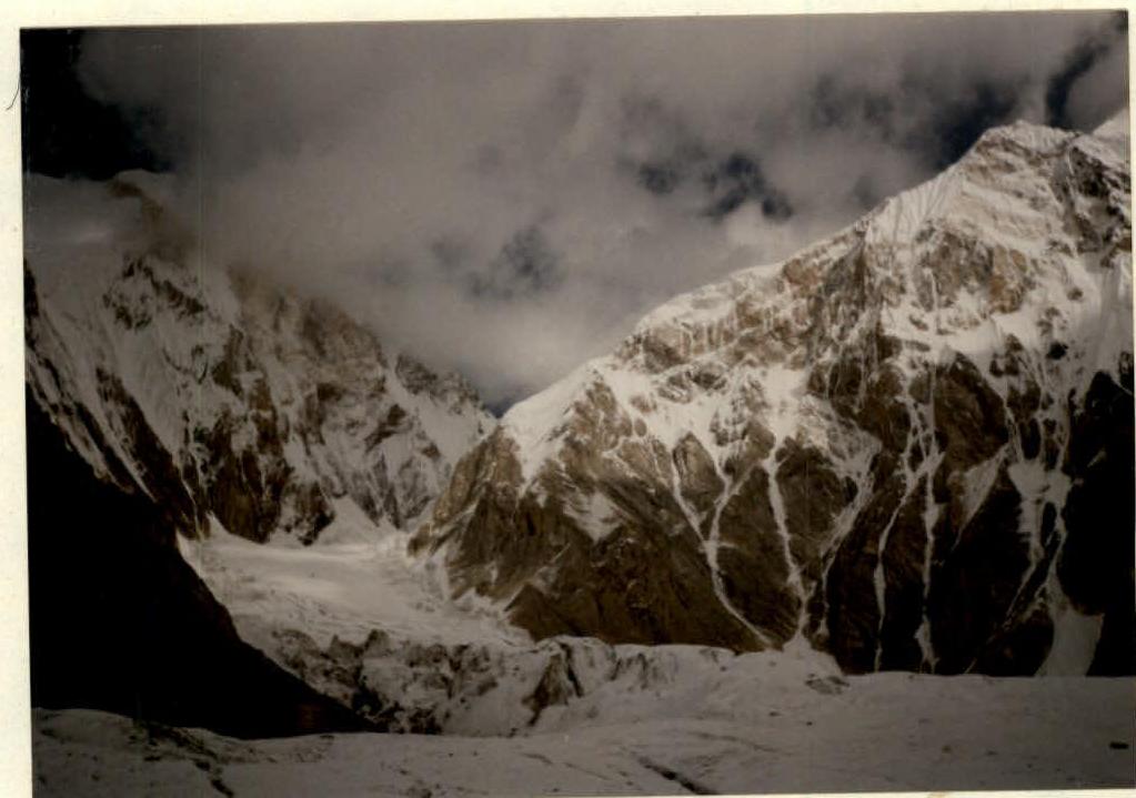
The ascent was made on August 8–9, 1998. On August 8 at 4:00, the pair left the "Maц Tian-Shan" camp and at 5:30 approached the Semenovsky glacier (4200 m), where the route to peak Khan-Tengri begins. (Photo #1, 2) On the section of the route leading to the saddle (4200–5800 m), the most hazardous area is the traverse of the Semenovsky glacier under the slopes of peak Chapayev (bottle) before reaching the upper part of the icefall (5200 m). The danger lies not only in crevasses hidden under snow, but also in snow avalanches descending from the slopes of peak Chapayev. The pair traversed this hazardous section early in the morning, before the sun hit the slopes of peak Chapayev. The rope team moved simultaneously. At 9:00, they reached the upper part of the icefall (5200 m). Up to 5000 m, there was fog, with visibility of several meters. Above, the sun was shining brightly (photo #3). At 11:30, they ascended to 5800 m and, together with a pair from Kazan, dug a snow cave.
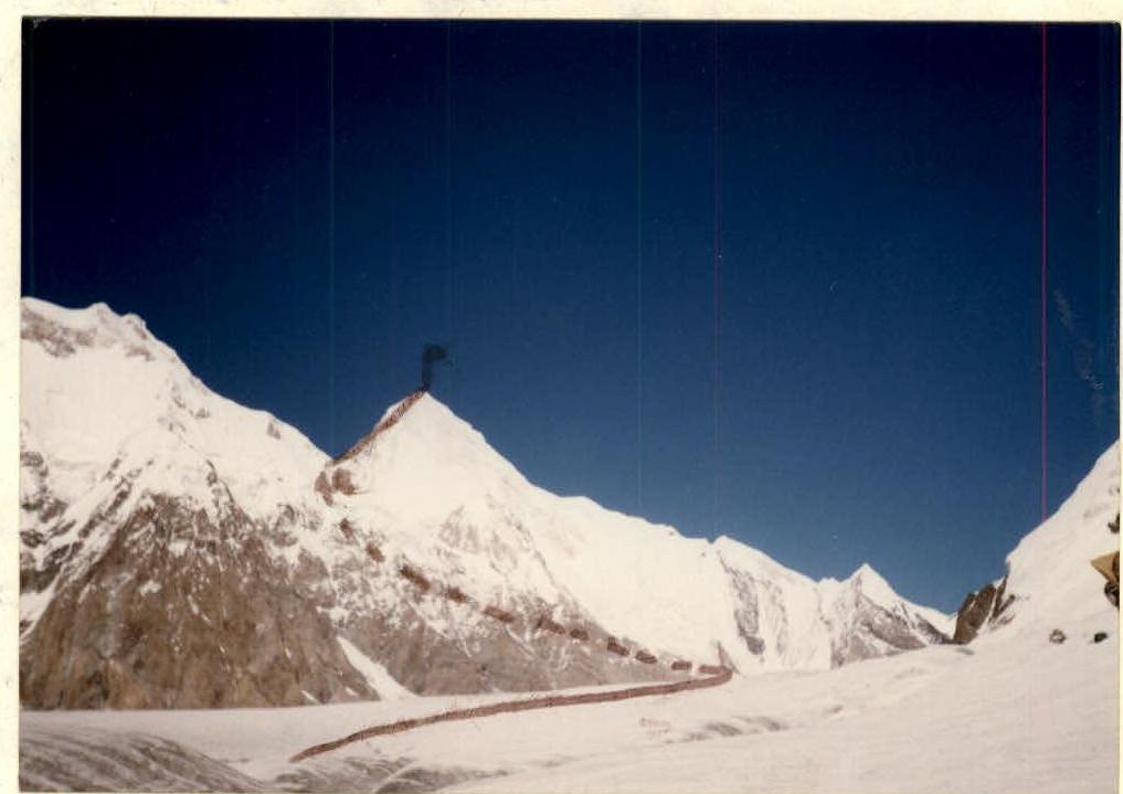
On August 9, departure was at 6:00. The sky was variably cloudy, with strong winds. The ascent to the saddle via steep firn was done in turns, with protection through ice screws, and further up to 6300 m, the rope team moved simultaneously. From 6300 m, a rocky section of the ridge began. The rope team moved in turns or simultaneously, with protection through pitons, and some elements of rocky terrain. On complex rocky sections, there were numerous remnants of old fixed ropes, but their condition was poor, with the ropes being heavily worn out. The section between 6600–6700 m featured a steep snow-ice couloir, with the rope team moving in turns, and protection through pitons and ice screws. At 11:30, they reached the snow-ice dome below the summit, moving simultaneously, with deep snow and strong winds. At 12:30, they reached the summit, leaving a token on a pennant under a tripod. The descent from the summit followed the ascent route, with an overnight stay in a snow cave at 5800 m. On August 10, they descended to the base camp. There were no significant deviations from the tactical plan. Communication with the base camp was carried out according to schedule. There were no falls or injuries during the ascent or descent.
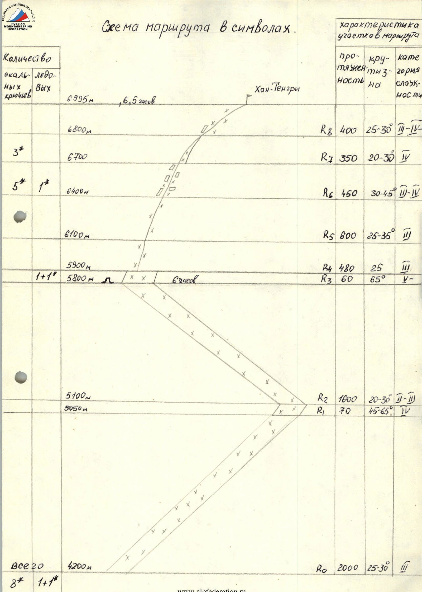
Route diagram in symbols
The ascent route took 6.5 hours.
| Section | Height, m | Length, m | Steepness, ° | Category of difficulty | Number of pitons (rock/ice) |
|---|---|---|---|---|---|
| 6995 (peak Khan-Tengri) | |||||
| R8 | 6800 | 400 | 25–30 | 3–4 | |
| R7 | 6700 | 350 | 20–30 | 4 | 3 rock |
| R6 | 6400 | 450 | 30–45 | 3–4 | 5 rock, 1 ice |
| R5 | 6100 | 600 | 25–35 | 3 | |
| R4 | 5900 | 480 | 25 | 5 | |
| R3 | 5800 | 60 | 65 | 5 | 1 rock, 1 ice |
| R2 | 5100 | 1600 | 20–30 | 3–2 | |
| R1 | 5050 | 70 | 45–65 | 4 | |
| R0 | 4200 | 2000 | 25–30 | 3 | |
| Total: | (total 20) | 8 rock, 1+1 ice |
Photographs
Photo #1. Start of the route.
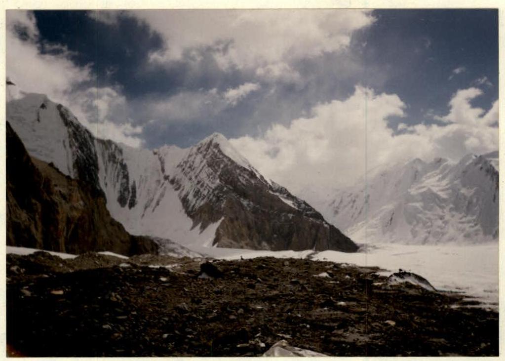
Photo #2. Semenovsky glacier.