Description
Ascent Route
TO THE PEAK "30 YEARS OF ALPINISM IN KAZAKHSTAN" 4000 m above sea level Taldy River valley in the eastern part of Kungey Alatau Alma-Ata 1960.
The peak "30 years of alpinism in Kazakhstan" is located in the eastern part of the Kungey Alatau ridge, in the Razdelny spur, which extends from the main ridge in a northerly direction from the peak Tashtau (3933 m) and separates the main source of the Taldy River from the Lednikovy stream.
The ridge of the peak "30 years of alpinism in Kazakhstan" is stretched from south to north. The northern and southern peaks rise above it (the southern peak is higher). The peak "30 years of alpinism in Kazakhstan" is a rocky peak without glaciation.
The eastern slope, descending into the circus of the Lednikova lateral valley, is of great steepness, cut by several steep couloirs. On the western side, there is a cirque, and at the end of the spur, there are steep slabs.
The hanging Lednikova valley consists of several chambers.
There is a glacier on the slopes of the peaks Muztau and Teristik.
The stream flowing from the Lednikova valley is the right source of the Taldy River.
The base camp of the Kazakhstan Climbing Club expedition was located on the right (orographic) bank of the Taldy River, 7-8 hours' walk from its mouth (20 km) and 1.5 km from the mouth of the Lednikovy stream.
On August 10, 1960, while at the base camp, the group was engaged in selecting products. Products were selected for 4 days, and equipment was prepared:
-
- Main rope - 2 × 40 m.
-
- Auxiliary rope - 1 × 60 m.
-
- Rock pitons - 15 pcs.
-
- Crampons - 2 pairs.
-
- Rock hammers - 2 pcs.
-
- Carabiners - 10 pcs.

- Carabiners - 10 pcs.
Photo #1. General view of the Lednikovogo stream valley.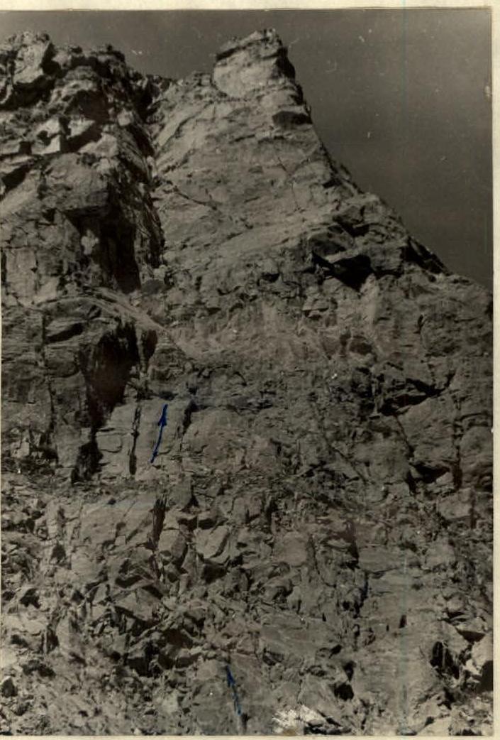
Photo #2. Inner corner on the eastern slope.
-
- Ice pitons - 4 pcs.
-
- Primus stove - 2 pcs.
-
- Gasoline - 2 l.
-
- First-aid kit - 1 pc.
-
- Slippers - 2 pairs.
-
- Set of rockets with a flare gun - 1 pc.
-
- "Pamirka" tent - 1 pc.
When the products and equipment were selected, the group climbed to the opposite slope of the Taldy valley - from the peak - and examined the ridge of the Nameless peak through binoculars. After that, the issue of assault tactics was decided. The route was planned for 2 days, without prior recon.
The climbers were distributed into rope teams:
- First rope team: Bashlykov, Kireev
- Second rope team: Kulemin, Vakulin, Skuratovich
The weight of backpacks with personal and group gear was approximately 12-13 kg.
On August 11, the group left the base camp along the right bank (orographic) of the Taldy River. Having reached the fork of the Taldy River and crossing the Lednikovy stream over rocks, we began the ascent towards the counterfort. About an hour later, we approached the counterfort leading to the ridge. Previously, the ascent route was planned to be along this counterfort to the slope ridge. The exit to the ridge is difficult due to having to overcome a 40-meter wall, with a steepness of about 80°, and being heavily destroyed.
The ascent was made along the inner corner (photo 2) - as the safest option. 4 rock pitons were hammered into the wall for belaying (more could not be hammered due to the wall's high friability).
Having passed the inner corner, the group reached the main ridge along rocks of medium difficulty. The ridge is heavily destroyed and studded with "gendarmeries." The height of the "gendarmeries" is over 12-15 m. The rocks of the ridge are red. Most of the "gendarmeries" are composed of separate blocks (photo 3) of the same color.
Bypassing the "gendarmeries" is often impossible due to steepness and friability. We managed to bypass only the 3rd and 4th "gendarmeries." The bypass goes along the left (in the direction of travel) side - along rocks of medium difficulty.
There are 8 "gendarmeries" in total. The rest were taken "head-on."
When passing this section, careful belaying should be observed, and rock pitons should be widely used, as there are precipices on both sides of the ridge, and the rock is heavily destroyed.
Overcoming the "gendarmeries" took 7 hours; 10 pitons were hammered.
Having overcome the "gendarmeries," we approached a 70-meter wall, completely sheer, with a limited number of holds. We approached this wall at 18:00. We decided to organize an overnight stay under the wall on a relatively comfortable site.
While some set up the tent, others chose the route for the next day.
Climbing along the heavily destroyed ridge through numerous "gendarmeries" tires the group both physically and morally.
On the first day, the group worked for 11 hours, with a height gain of 600 m.
Second Day
On August 25, at 6:00, we left the overnight stay. The wall turned out to be too difficult; we decided to bypass it by descending from the ridge to the left and down by 50-60 m.
The descent passes along heavily destroyed rocks with a steepness of 45-60°. From the rocks, we exit onto a snowy slope with a steepness of 60°.
In the upper right part, this snowy slope abuts a rocky wall, and it is impossible to exit onto the ridge along it. We decided to continue along a steep snowy gully (photo 4).
The snowy slope to the entrance to the gully is overcome with step-cutting and piton belaying.
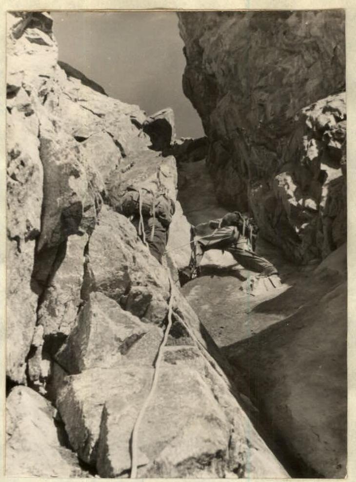
Photo #5. Ascent along a steep couloir.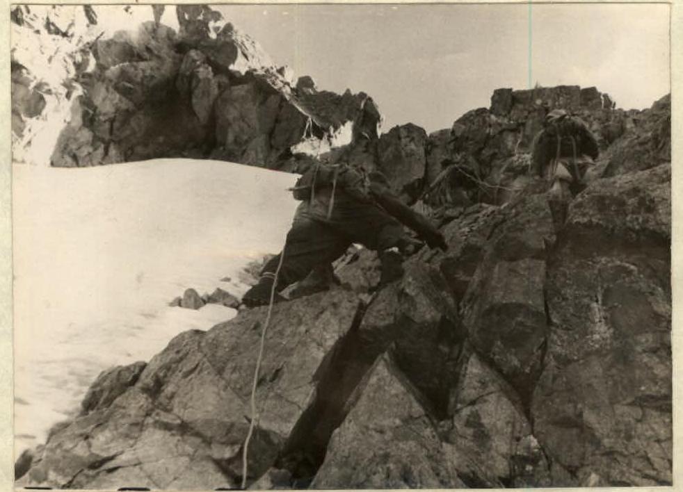
Photo #6. Exit from the couloir.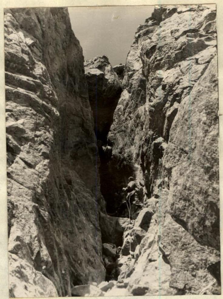
Photo #7. Overcoming the chimney.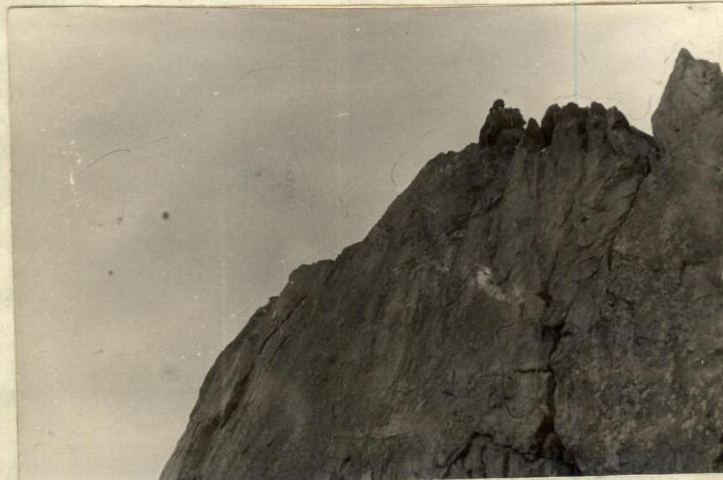
Photo #8. Section of the ridge "knife." The length of the section is approximately 40 m (4 ice pitons were hammered). The snowy gully is not fully visible; only its lower part is visible. Having entered the gully's mouth, we became convinced that, despite its steepness, the gully is passable. Movement along the gully occurs along its left side - near the rock. Pitons for belaying can be hammered into the rocks (photo #6). Crossing the snowy slope and moving along the gully took 3 hours (9 rock pitons were hammered in the gully). After the gully - along easy, rounded rocks, moving to the right and up, we exit onto the ridge (photo 5). Further, a practically horizontal ridge stretches, dropping off to the left - with rocky and snowy walls, and to the right - with heavily smoothed slabs.
Along the ridge, we approach a "gendarmerie" made of gray granite. Bypassing the "gendarmerie" is very complicated and dangerous. The "gendarmerie" has a chimney, the upper part of which is closed by a huge "plug" (photo 7). We decided to go through the chimney as the most convenient and safe route.
- The length of the chimney is 20-25 m.
- The chimney is passed along its left side.
- The middle part - on wedges, under the "plug."
- The exit to the "plug" is made along the left side.
- After the "plug," the chimney turns into a steep slab, the length of this section is about 20 m.
- Rubber slippers helped to overcome it.
- Belaying in the chimney and on the wall - only through pitons (4 pitons were hammered).
After the wall, a very sharp, but not steep, rocky ridge stretches (photo 8), which is overcome by the "ridge walking" method. The narrow ridge leads to the summit (photo 9).
On August 12, at 17:00, the group was on the summit. The journey from the overnight stay to the summit took 11 hours. 20 rock and ice pitons were hammered; the height gain was 400 m.
The group considers the most challenging sections to be:
-
- Snowy slope with a gully
-
- Chimney and wall
-
- Exit to the summit along the sharp ridge.
On the same day, we descended from the summit to the southwest by 100-120 m and exited into a couloir, the bottom of which is filled with ice and soft scree in the upper part, and medium scree in the lower part. Along the scree, we reached an ancient moraine, and then to the fork of the Taldy River. The descent is straightforward, except for the couloir. The descent took 4 hours.
The group of first ascensionists to the peak "30 years of alpinism in Kazakhstan" consisted of climbers:
- Bashlykov D.A. - leader
- Skuratovich E.I. - participant
- Kireev G.P. - participant
- Vakulin V.G. - participant
- Kulemin M.S. - participant
The route taken by our group is very interesting and can be recommended to sports groups. The route took 26 hours. 34 rock and ice pitons were hammered. The group believes that the route corresponds to category 3B.
Description compiled by D. Bashlykov True: Zinev Club January 1, 1962