I. Climbing category - combined 2. Climbing region - Tian Shan, Kunghey Ala-Too 3. Peak PARUS, height 4130 m, route via N ridge, combined 4. Estimated difficulty category - 2A 5. Route characteristics:
- height difference - 550 m
- average slope - 20°
- sections of 5th difficulty category - none
- Pitons hammered in:
- for belaying - 10 chocks, for creating artificial anchors - none
- Number of travel hours - 10 h
- Overnights on the route - none
- Group composition:
- Ganyalin V. A., Candidate Master of Sports
- Maidanuk V. I., 2nd category climber
- Team coach: Ganyalin V. A. II. Departure and ascent date - August 20, 1981
TABLE OF MAIN ROUTE CHARACTERISTICS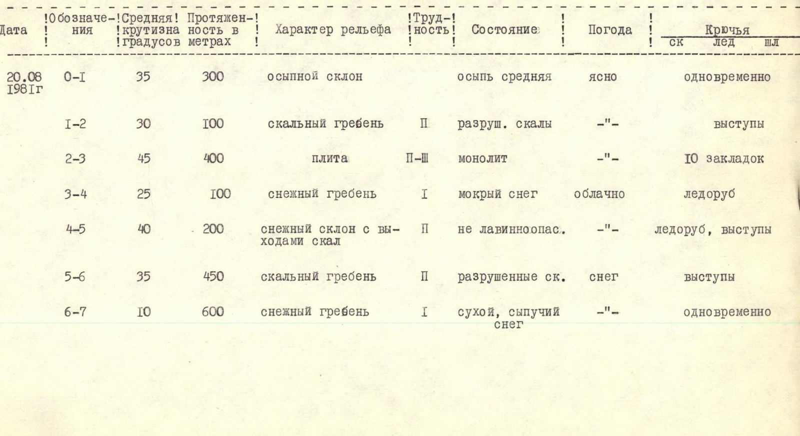
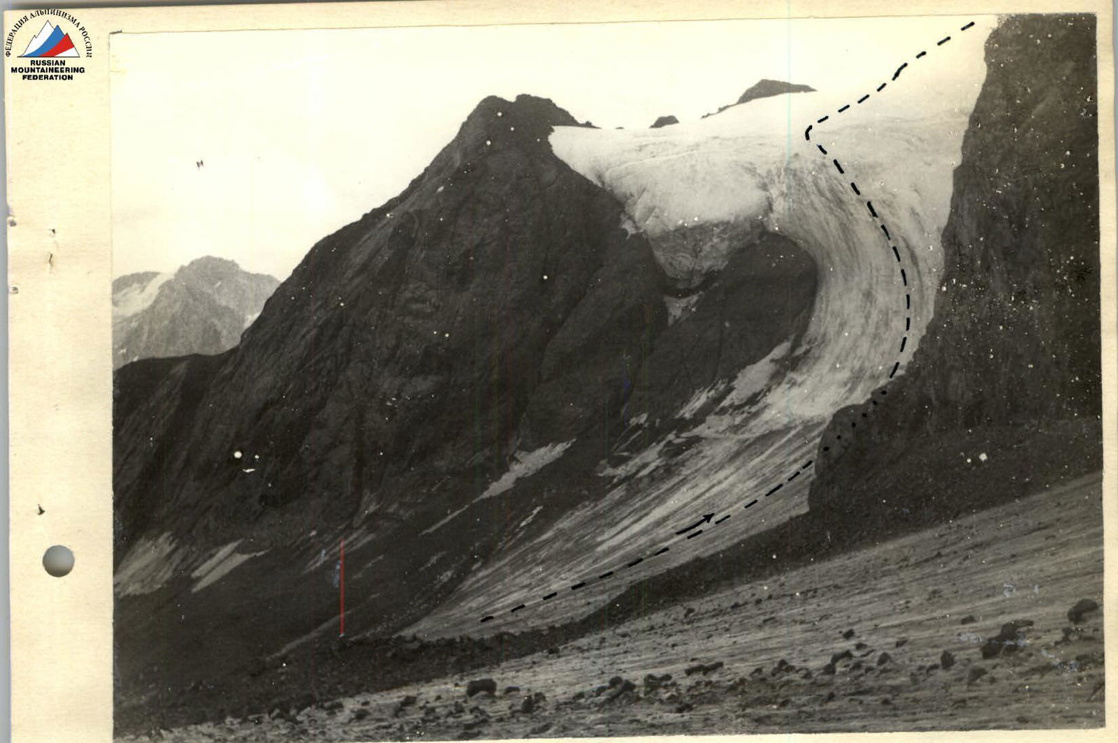
Description of the approach to routes on peaks PARUS and SNEGURochKA
From the base camp at the fork of the Chon-Uryukty river (height 2780 m) go down the trail to the bridge, then up the trail to the left, steeply to the west to the moraine of the Parus glacier. Here the trail disappears and the path continues to the west across the moraine ridges to the glacier.
At the tongue of the left branch of the glacier (Snegurochka glacier) is the starting point of the 2A category route to the peak Snegurochka. Approach time is 3-3.5 hours.
The approach to routes on peak Parus via the open ice of the glacier takes 1.5 hours.
 Start of the route to peak Snegurochka
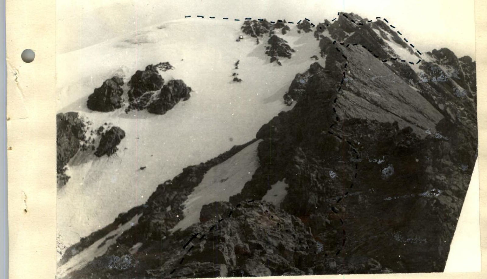 Route via the North ridge to peak Parus
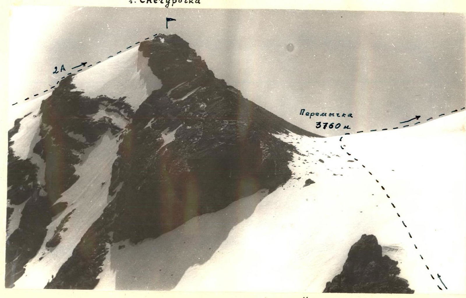
Peak Snegurochka. Saddle 3760 m.
 Start of the route via the E ridge to peak Parus