Ascent Passport
- Ascent class — combined
- Ascent area — Tian Shan, Kungay Ala-Too ridge
- Peak — AELITA, height 3910 m, route via the Eastern wall — combined.
- Estimated difficulty category — 4B
- Route characteristics:
- height difference — 400 m
- average steepness — 65°
- sections of 5th difficulty category — 120 m
- Pitons driven:
- for belay — 28, for creating I.T.O. — 2
- rock — 24, ice — 4, chocks — 3
- Overnight stays on the route — none
- Number of travel hours — 14 hours
- Group composition:
- Ganyalin V.A. CMS, leader
- Budyko D.I. 1st sports category, participant
- Zabara Yu.M. 1st sports category — same —
- Litvinov A.V. 1st sports category — same —
- Team coach — Ganyalin V.A.
- Date of departure on the route and ascent — July 22, 1981
Description of the approach to the start of routes in the Western cirque
(to the peaks Suvenir, Chernomor, Aelita, Sadko, Demon and to peak Lyudmila in the Karakia cirque.)
From the base camp at the fork of the Chon-Uryukty river (height 2780 m) go west along the trail to the terrace, then along the stream and climb to the first ascent of the Western cirque glacier moraine (1.5–2.0 hours). From here, left, steeply up 1.5–2.0 hours of walking on loose moraine and then along the glacier along the northern rocky ridge of peak Suvenir to the foot of a deep saddle located to the right of the sheer 300 m tower of the peak.
The path to the start of other routes to the second ascent of the moraine is 30 minutes. From here, to the right along the talus slope, and then on ice. To the start of the route to peak Demon via the eastern wall is 1 hour. Slightly left along the moraine outcrops along the exposed ice of the steeply sloping glacier (25°) — to the upper terrace of the glacier under the rocky walls of the cirque (1–1.5 hours).
Here are the starting points for the routes:
- via the eastern edge to Chernomor II,
- via the eastern wall to peak Aelita,
- to peak Sadko,
- to Ikar.
From here through the saddle between peaks Sadko and Ikar, the path goes west, and then along the Karakia glacier along a short ridge running in a NW direction from peak Ikar, 3 hours of walking to the start of the route to peak Lyudmila. Here on the lateral moraine of the Karakia glacier there are places for overnight stays.
The approach to the start of the route to peak Lyudmila from the base camp takes 6 hours.
Table of main characteristics of the ascent route
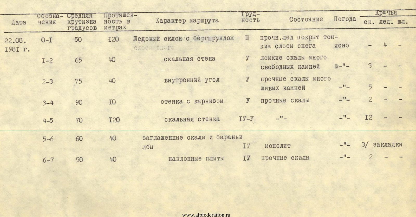
| Date | Designations | Average steepness, ° | Length, m | Route character | Difficulty | Condition | Weather | Pitons (rock / ice / chock) |
|---|---|---|---|---|---|---|---|---|
| 22.08.1981 | R0–R1 | 50 | 120 | Ice slope with bergschrund | III | firm ice covered with a thin layer of snow | clear | 4 / — / — |
| R1–R2 | 65 | 40 | rocky wall | V | fragile rocks, many loose stones | — " — | 3 / — / — | |
| R2–R3 | 75 | 40 | inner corner | V | firm rocks, many loose stones | — " — | 5 / — / — | |
| R3–R4 | 90 | 10 | wall with an overhang | V | firm rocks | — " — | 2 / — / — | |
| R4–R5 | 70 | 120 | rocky wall | IV–V | — " — | — " — | 12 / — / — | |
| R5–R6 | 60 | 40 | smoothed rocks and rocky outcrops | IV | monolith | — " — | 3 chocks | |
| R6–R7 | 50 | 40 | inclined slabs | IV | firm rocks | — " — | 2 / — / — |
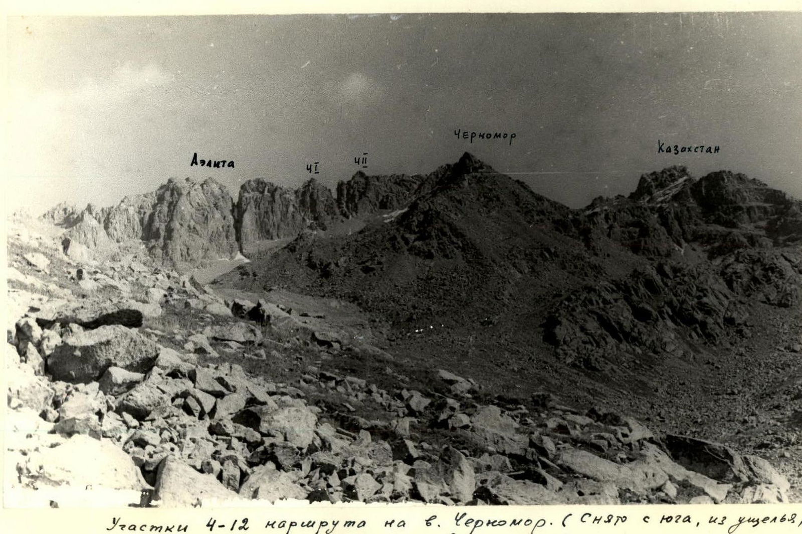
Sections R4–R12 of the route to peak Chernomor. (Taken from the south, from the gorge leading to Issyk-Kul)

Profile of the lower part of the route to peak Aelita.
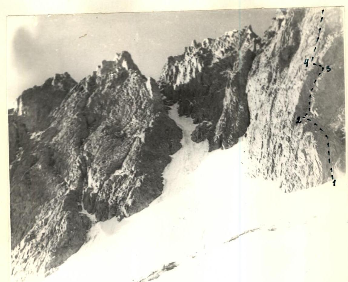
Lower part of the route to peak Aelita
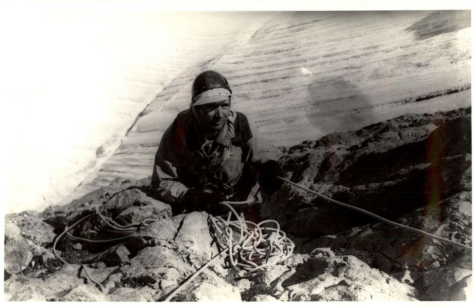
On the section R2–R3 (Aelita, 45)