Ascent Passport
- Region: Western Kakshaal Too Range. Jangart River valley.
- Name of the peak: 4911 m. Proposed name — Pik Aleksey. Route: via the north-west wall
- Proposed category of difficulty: 4B, first ascent. Note: the participants of the ascent gave the following category of difficulty: class IV, WI4, rock max 3. Explanation: IV — a full day of technical climbing. WI4 — prolonged sections of 80°, sufficiently long sections of 90° with occasional places to rest.
- Character of the route: combined
- Height difference of the route: 757 m (according to GPS readings).
Length of sections: 4 km — length of the couloir — 600 m
Steepness: the main part of the route up to 80 degrees.
- Team's walking hours: 16 hours.
Descent from the summit — descent via a different route along the western ridge and the northern slope.
- Leader: Van Berkel Michael Robert
Participants:
- Van de Gevel Caspar Bernardus Maria
Chargois Frank
- Departure from the assault camp: 4:30 AM on September 18, 2019.
Reached the summit: 3:00 PM on September 18, 2019. Return to base camp: 8:30 PM on September 18, 2019.
- Team of climbers — Netherlands.
Person responsible for the report — Van Berkel Michael Robert
Dutch Expedition — Jangart, 2019
First ascent of Pik 4911 m, «Pik Aleksey», Dutch Couloir IV, 4.3a, 600 m, August 18, 2018.
After viewing some photographs of the Dutch mountaineering expedition in the Jangart region of Kyrgyzstan in 2018, I was captivated. Not just by the beautiful mountains, but especially by the quality of the ice. In recent years, the Alps have suffered from heat.
In the summer in Peru, there's just vertical powder snow, and in the Himalayas, you never know what to expect. Combine this with limited altitude, easy access, limited expedition time — and the decision was made, tickets were booked.
On September 6, Cas van de Gevel, Frank Chargois, and Mike van Berkel boarded a plane and headed to Bishkek, the capital of Kyrgyzstan.
After a one-day delay in the hunters' camp due to bad weather, we loaded the horses and headed into the Jangart gorge, to our base camp at an altitude of 3070 m.
Eager to make our first outing, we set off towards our target the next day, but the weather was too unstable to climb. We spent one night at 3750 m, left some climbing gear, and headed back to base camp. However, we received route information for our intended mountain. We were not disappointed; the impressive leading couloir to the ridge with a rocky summit — what more could you ask for.
In base camp, we were treated by a cook named Aleksey. He spoiled us with dishes for the next three days. After three days, the weather forecast finally promised us a day without snow.
On Tuesday, September 17, we approached glacier N1 to set up the assault camp. Of course, snowfall started as soon as we pitched our tent, but the evening was clear and beautiful.
The next morning, we:
- woke up at 3:00 AM,
- departed from the assault camp at 4:30 AM.
It was quite cold, -20°C, and we were ready to start. After 1.5–2 hours of walking on the glacier, we put on our crampons and began to break through to the start of the couloir.
The ascent in the couloir was simply perfect! Good placements on soft ice, with black ice underneath to insert ice screws. After three pitches of wonderful climbing, up to 80°, the terrain became less steep and snow returned. Two pitches of walking led us to the snow ridge, which characterizes the upper part of the route. Located in a stunning location, on the ridge there was a lot of snow, but surprisingly, ice for belays continued.
Around 1:00 PM, we reached the ridge. The weather was perfect, and a completely remarkable view opened up. Countless mountains, some of which towered above us, and our first glimpse of China. Being the only people in this area, it felt much more remote to us than the Himalayas. From the assault camp, the summit looked quite easy. As we all know, appearances can be deceiving, and this time was no exception. A 10 m rock slab with 50 cm of powder snow blocked our path. Fortunately, we spotted a weak spot on the south-west ridge just below and thus managed to access the rocky summit. A few steps of simultaneous climbing up to the third degree, quite loose rock, and we reached the summit at 3:00 PM. The weather was perfect, and we enjoyed stunning views.
The descent involved:
- 5 rappels
- numerous descents down steep slopes
- powder snow, sometimes waist-deep
After a 16-hour ascent and descent, we reached the assault camp tent at 8:30 PM. The next day, we were all smiling as we walked back to base camp, aware that we had made such a beautiful climb in such a stunning location. After two days of rest in our base camp, time was up, the horsemen arrived, and we began our journey home.
We ascended Pik 4911 m on September 18, 2019, from glacier N1 (see map). Our Garmin Inreach gave these coordinates and altitude of the summit: 41.662873 N, 78.961810 E, 4947 m.
We believe this to be the first ascent of this mountain.
The route — Dutch Couloir:
- length: 600 m
- class: IV
- WI4
- rock max 3
We propose the name Pik Aleksey for the mountain, in honor of our excellent cook (guide).
In Kyrgyzstan, we used the services of Tien Shan Travel. We can highly recommend this company — all the services they provided were excellent.
We would like to thank:
- NKBV for financial support
- Kurt Hagens for sharing all information from last year's expedition
Mike van Berkel, October 6, 2019
 □
□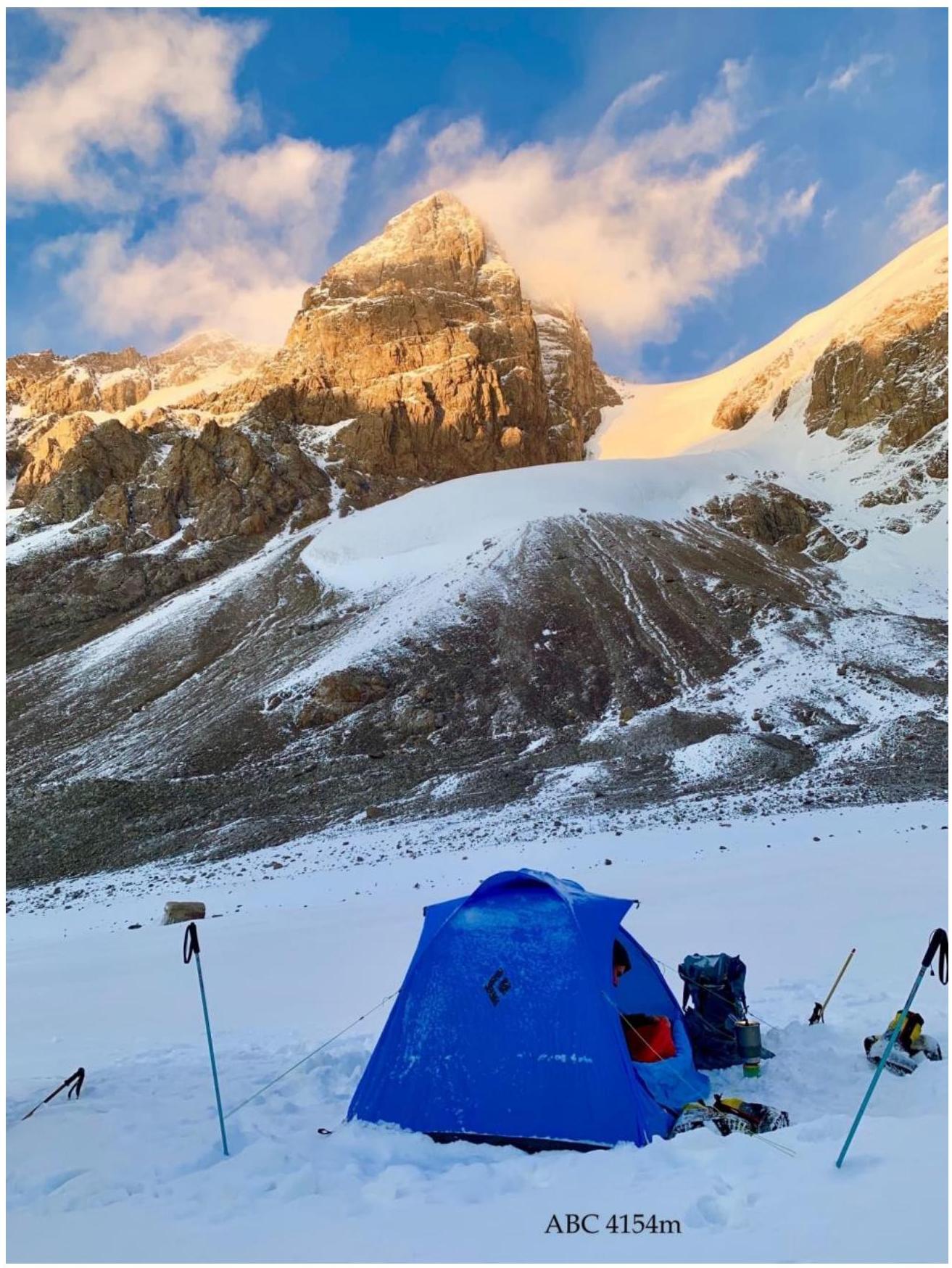 ABC
4154
м
ABC
4154
м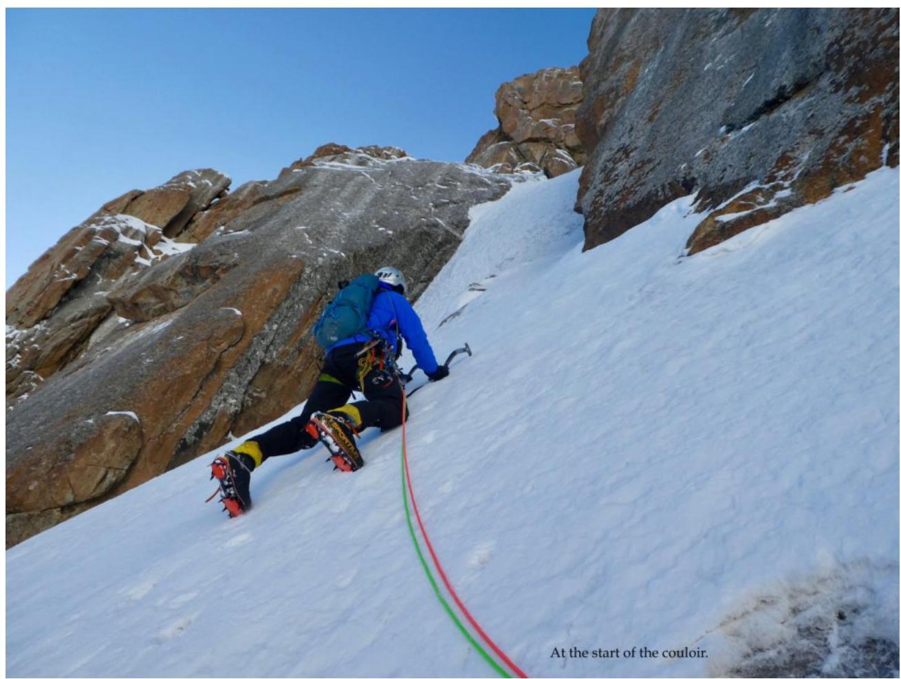
At the start of the
couloir.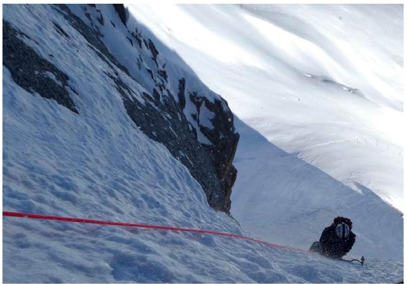
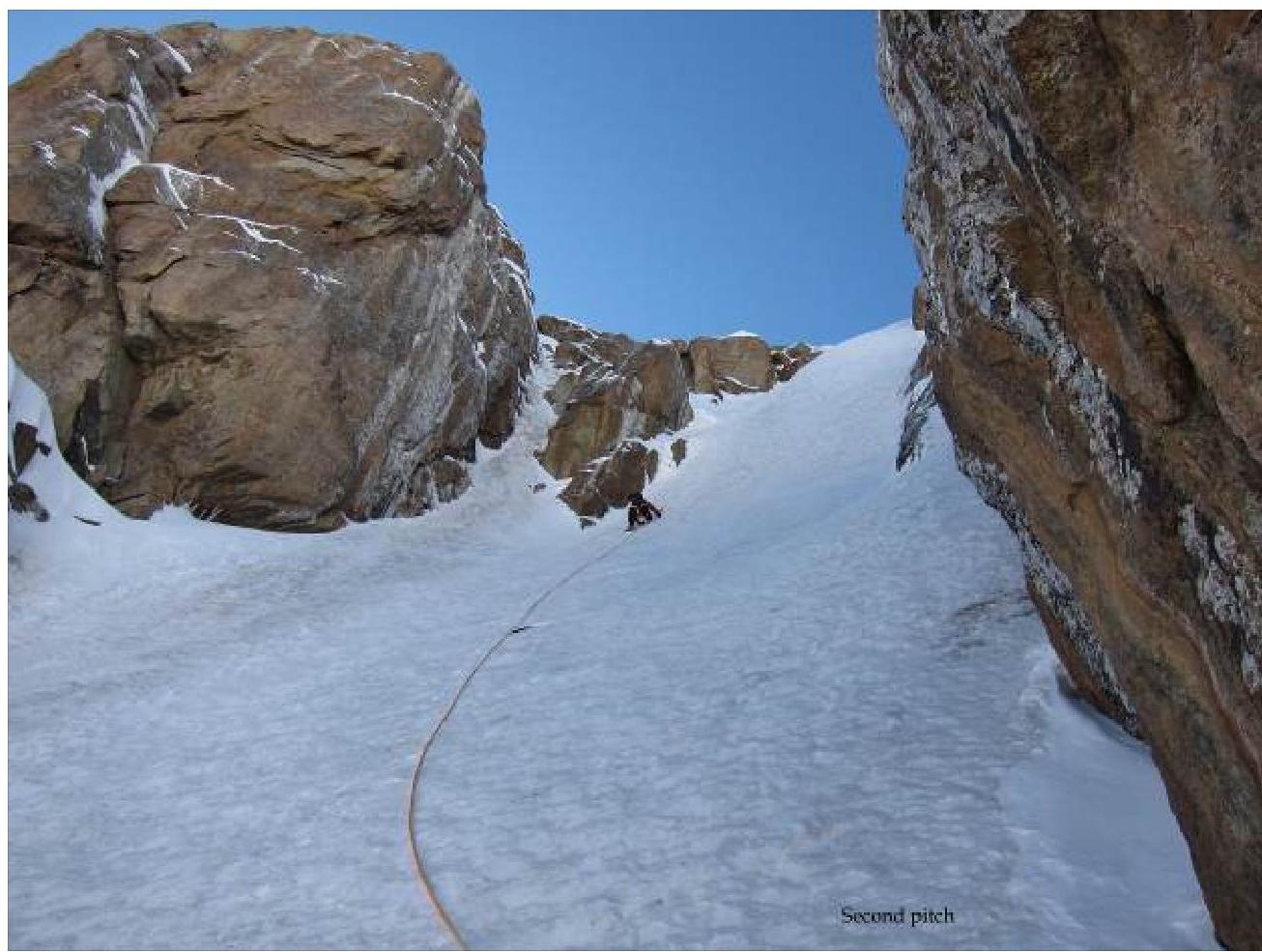
Second
pitch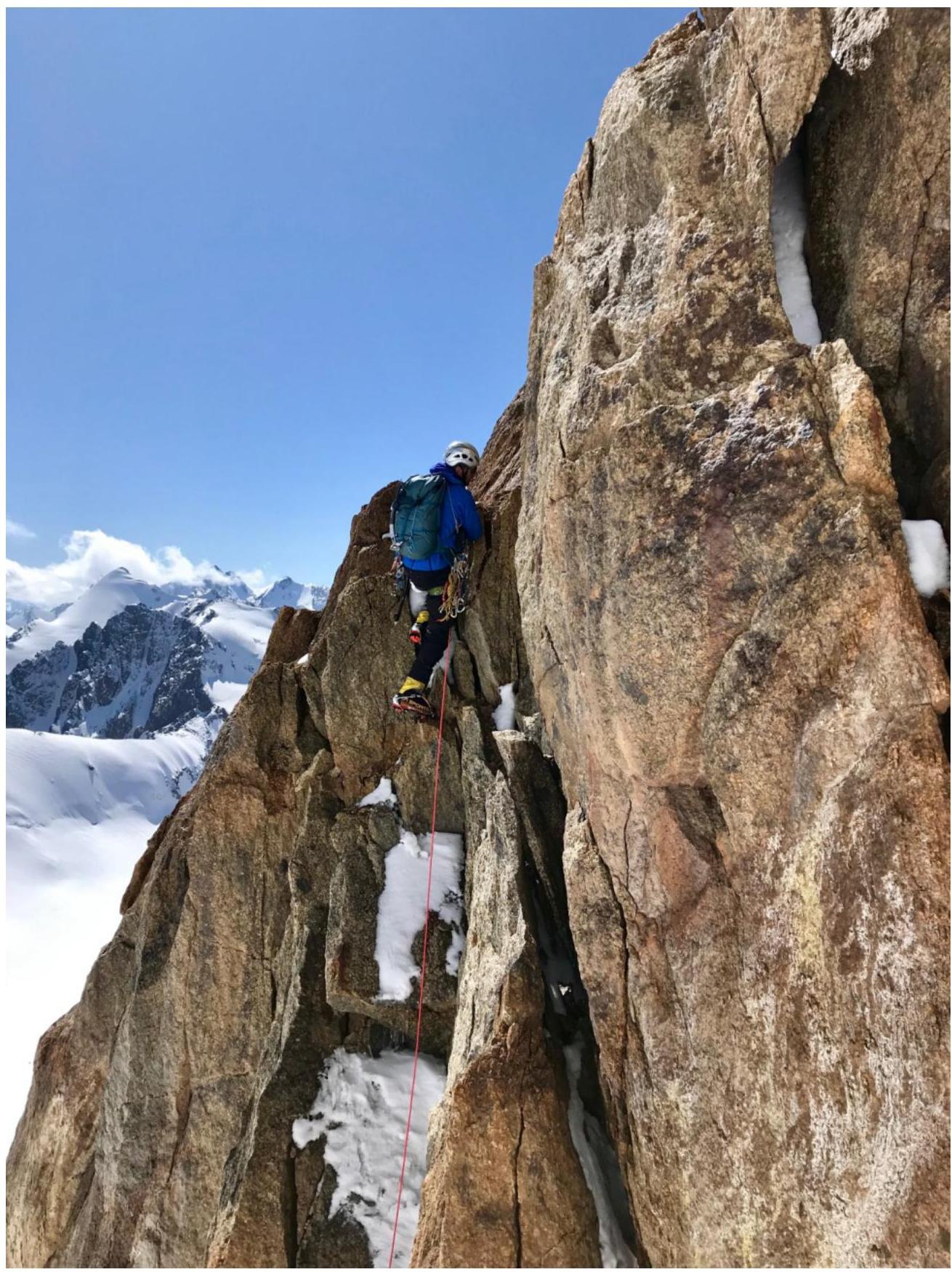
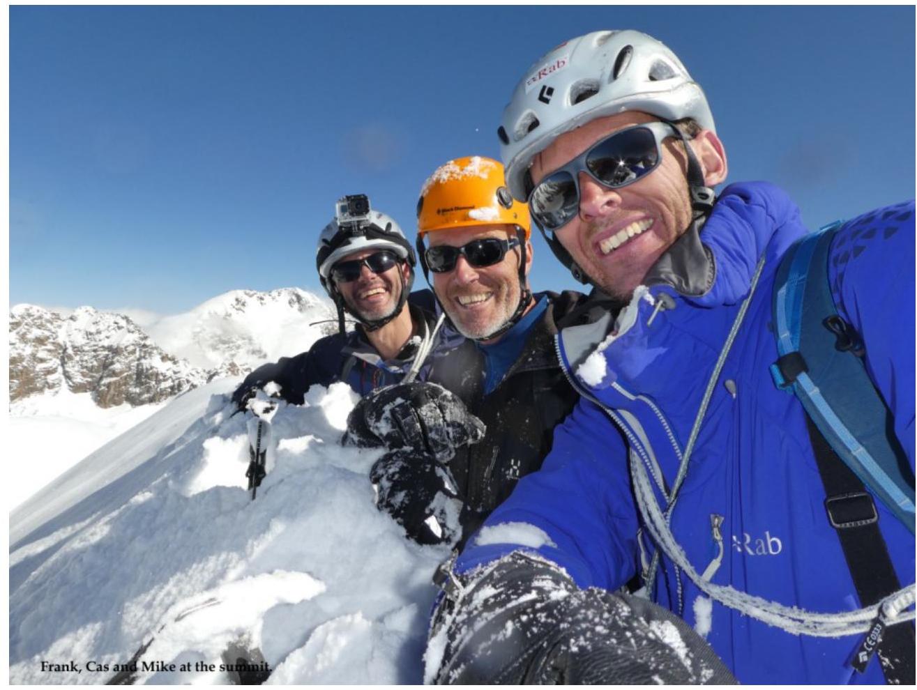
Frank, Cas and Mike at the
sunrise.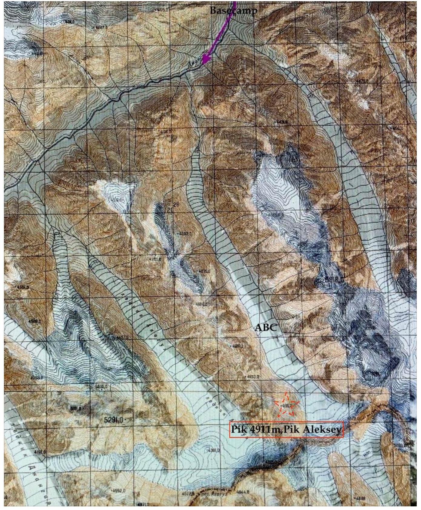
Pik 4911 m (Pik
Aleksey)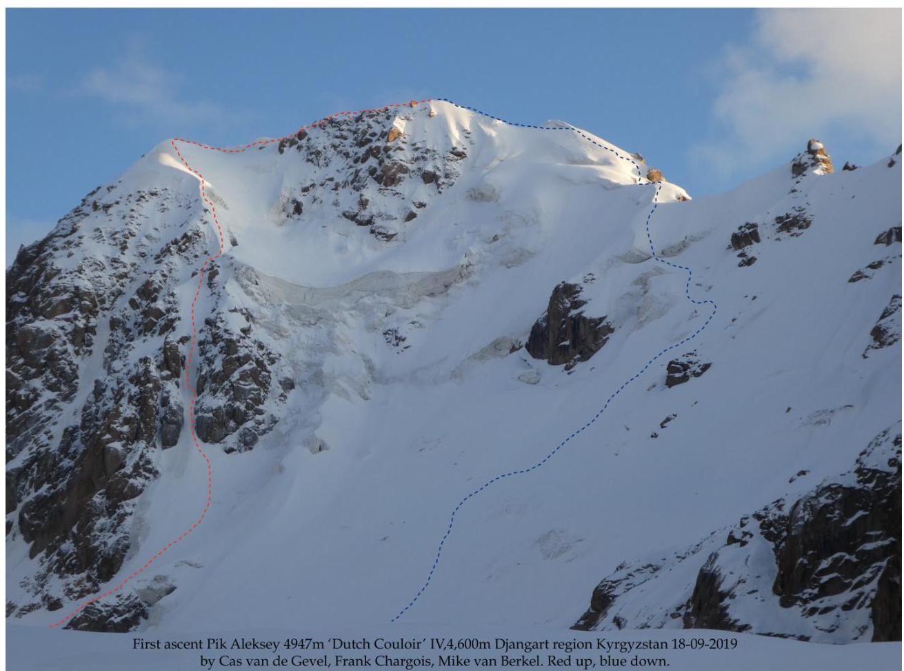
First ascent Pik Aleksey 4947 m «Dutch Couloir» IV, 4, 600 m Djangart region Kyrgyzstan September 18, 2019 by Cas van de Gevel, Frank Chargois, Mike van Berkel. Red up, blue down.