406
Ascent Passport
-
Region — Central Tien Shan, № 7.5.
-
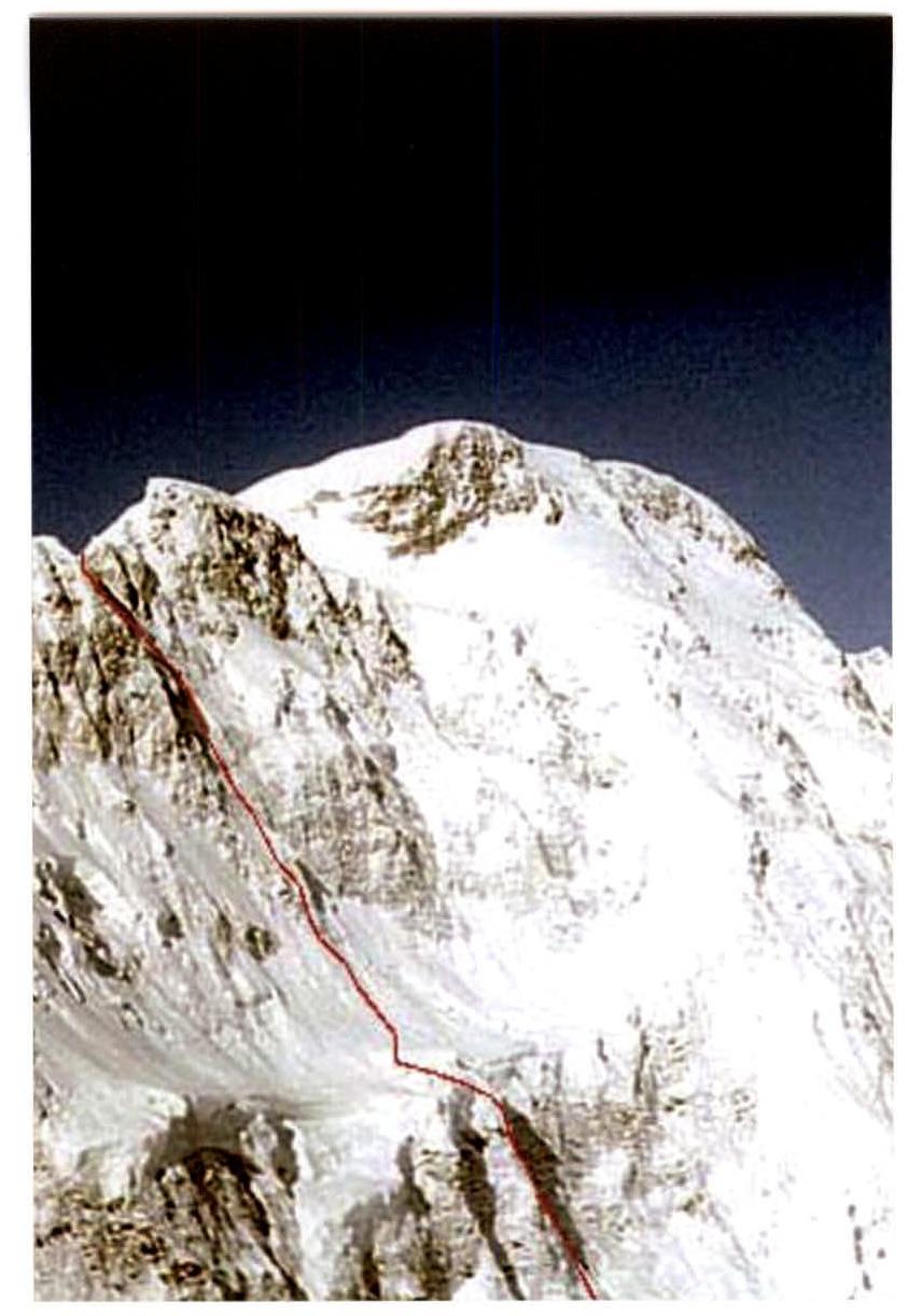
Peak — Pobeda 7439 m, via the right bastion of the ice balcony on the north face.
-
Proposed route — 6B category of difficulty, first ascent.
-
Route characteristics — combined.
-
Route description:
elevation gain — 2639 m, wall section elevation gain — 1850 m, route length — 4000 m, sections of 6th category of difficulty — 350 m, 5th category of difficulty — 1500 m, average steepness of the wall section — 60°.
-
Equipment left on the route: pitons — 10; including screw pitons — 0.
Pitons used on the route:
- stationary screw pitons — 0;
- removable screw pitons — 0. Total artificial aids used — 5.
-
Total climbing hours — 134, days — 13, including acclimatization.
-
Team leader — Gleb Sokolov, Master of Sports
Team members:
- Pyotr Kuznetsov, Master of Sports of International Class
- Oleg Khvostenko, Master of Sports
- Vladimir Arkhipov, Master of Sports
- Evgeny Bakaleinikov, Master of Sports
- Sergey Cherezov, Master of Sports
- Sergey Filatov, Master of Sports
- Alexander Mikhalitsin, Candidate for Master of Sports
-
Team coaches: Yuri Baykovsky, Master of Sports, Honored Coach of Tajikistan.
Nikolai Zakharov, Master of Sports of International Class, Honored Coach
-
Departure date: onto the route — August 8, 2003, at 11:00;
to the summit — August 19, 2003, at 12:00; return — August 20, 2003, at 20:00.
-
Organization: International Mountaineering Club
Address: Moscow, Luzhnetskaya nab. 8, Russian Olympic Committee, office 330. tel./fax (095) 725-45-28, www.clubalp.ru↗, E-mail: mak@clubalp.ru
Route profile on the left
| № |  |  | Characteristics | |
|---|---|---|---|---|
| 10 | 6 | 8 | 50 m, 65°, VI | |
| 9 | 16 | 200 m, 55°, IV | ||
| 8 | 20 | 140 m, 60°, VI | ||
| 7 | 8 | 12/5 | 40 m, 75°, VI, A1 | |
| 6 | 2 | 2 | 60 m, 55°, IV | |
| 5 | 4 | 8 | 50 m, 75°, VI | |
| 4 | 7 | 6 | 100 m, 60°, VI | |
| 3 | 4 | 2 | 80 m, 65°, V | |
| 2 | 8 | 12 | 80 m, 75°, VI | |
| 1 | 16 | 250 m, 60°, V |
Ascent graph
| № | Total | Ice screws | Pitons | Characteristics |
|---|---|---|---|---|
| 167 | 66/5 | |||
| 17 | 700 m, II | |||
| 16 | 10 | 250 m, 55°, IV | ||
| 15 | 12 | 300 m, 55°, IV | ||
| 14 | 24 | 500 m, 60°, V | ||
| 13 | 4 | 10 | 50 m, 60°, VI | |
| 12 | 12 | 200 m, 55°, V | ||
| 11 | 14 | 6 | 300 m, 55°, V |
Route Description by Sections
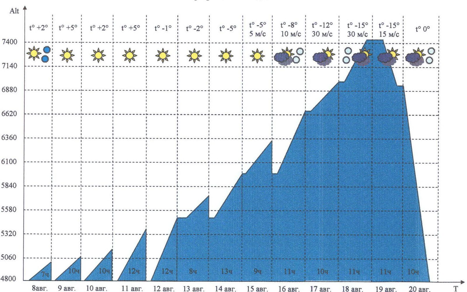
Section 1. From Zvezdochka glacier, up a snow-ice slope through a bergschrund, then towards a rocky counterfort, 250 m.
Section 2. Icy rocks, 80 m. General direction is up and to the right. Section 3. Inclined ice ledge, 80 m. General direction is up and to the left. Section 4. Snow-ice slope with rock outcrops, 100 m. Section 5. Icy "ram's foreheads", 50 m. Section 6. Snow-covered inner corner, 60 m. Section 7. Icy inner corner, 40 m. Direction is up and to the left. Exit to a snow ledge at the foot of the icefall.
Section 8. Icefall, 140 m. The first rope is 80° steep, then it gradually becomes less steep. Exit to a "balcony". The "balcony" has enough space for comfortable overnight stays.
Section 9. Up a snow-ice slope through a bergschrund, then towards a protruding rocky ridge, 200 m.
Section 10. Icy "ram's foreheads", 50 m.
Section 11. Snow-ice couloir with rock outcrops, 300 m. General direction is towards the protruding ridge. On the ridge, a platform for two tents was carved out.
Section 12. Snow-ice couloir, 200 m. Section 13. Icy "ram's foreheads", 50 m. Direction is up and to the right. Section 14. Snow-ice couloir, 500 m. Direction is up and to the right, bypassing rocks, then up and to the left until reaching the ridge. The ridge has many convenient places for bivouac.
Section 15. Up a snow-ice counterfort to the summit of Peak Armenia, 300 m. From the summit of Peak Armenia, descend in a southeast direction towards the slopes of the main summit of Peak Pobeda.
Section 16. Up a snow-ice slope, bypassing a hanging icefall on the left, 250 m, until reaching the ridge.
Section 17. Easy ridge, 700 m, to the summit of Peak Pobeda.
Descent via the classic route through Peak Vazha-Pshavela.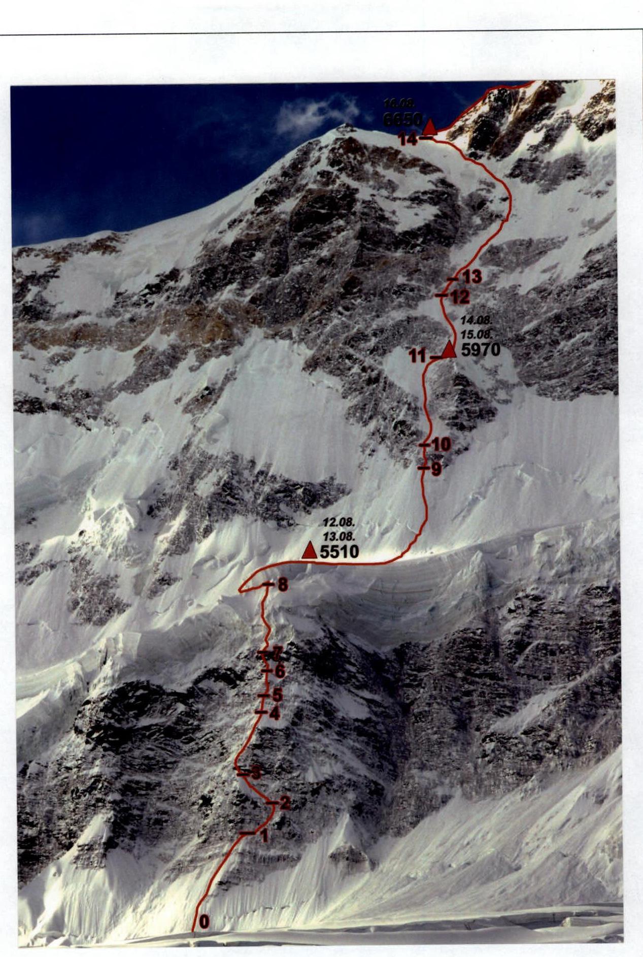
Technical photo
of the route
Section 2
Section 3
Section 4
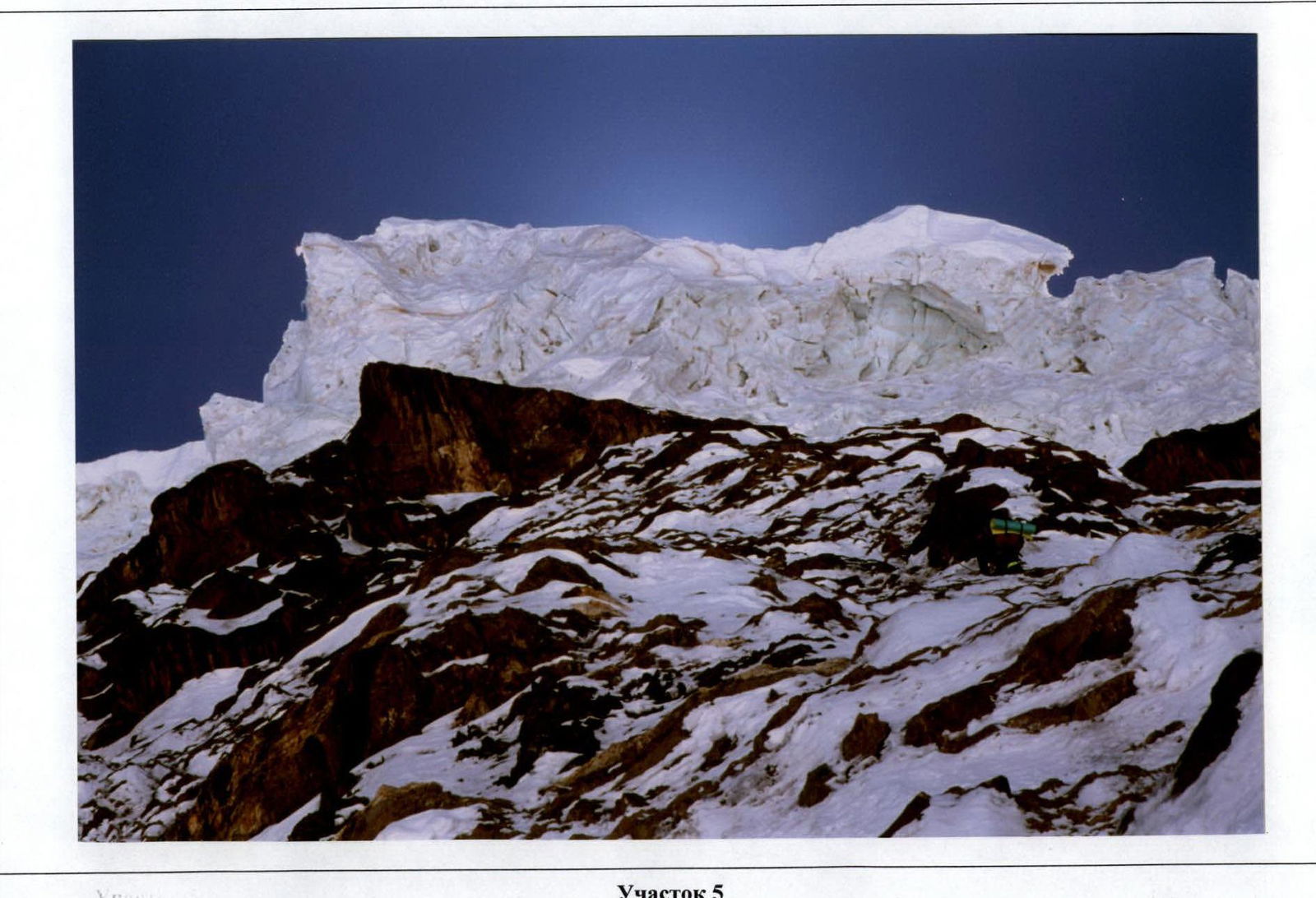
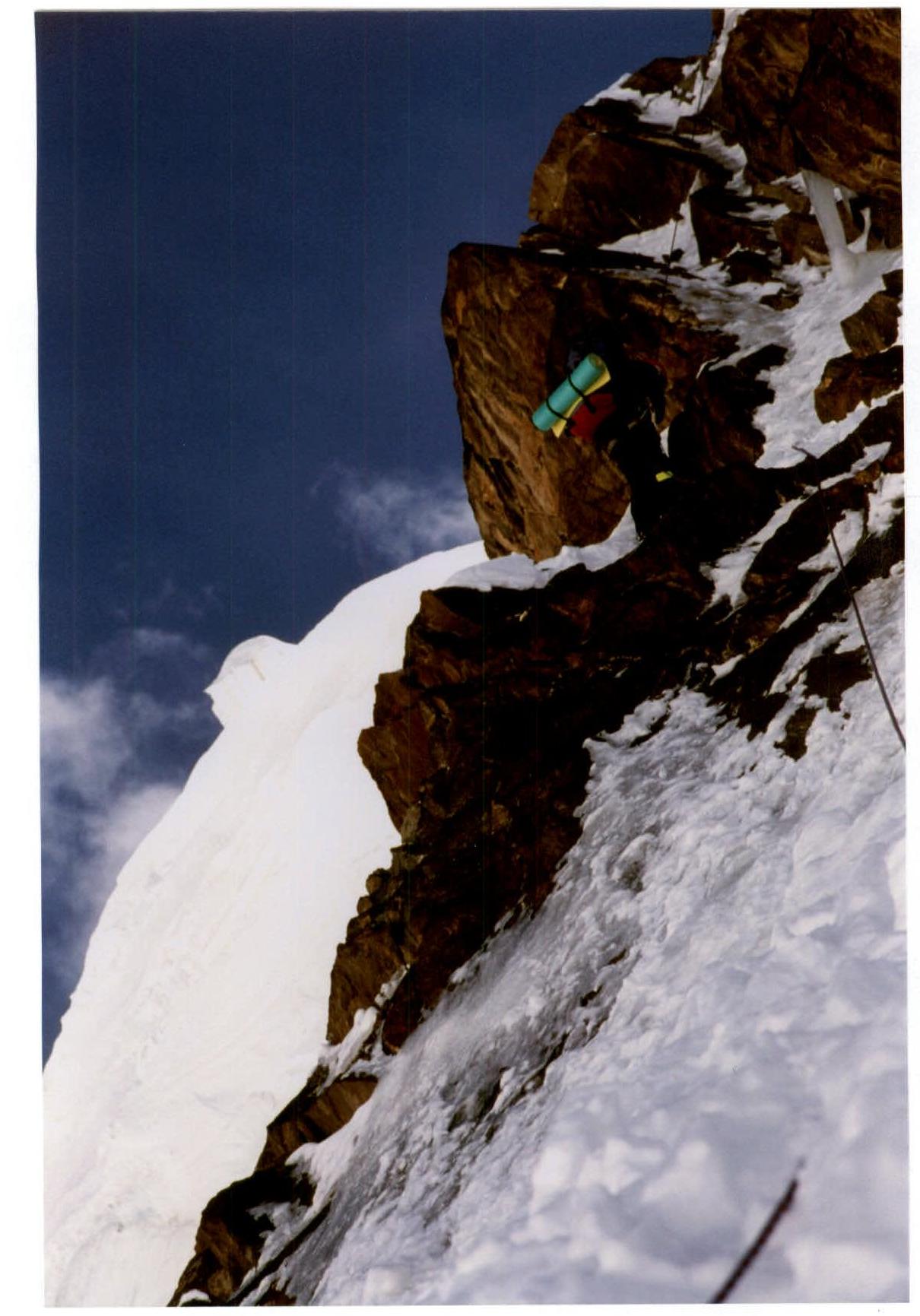
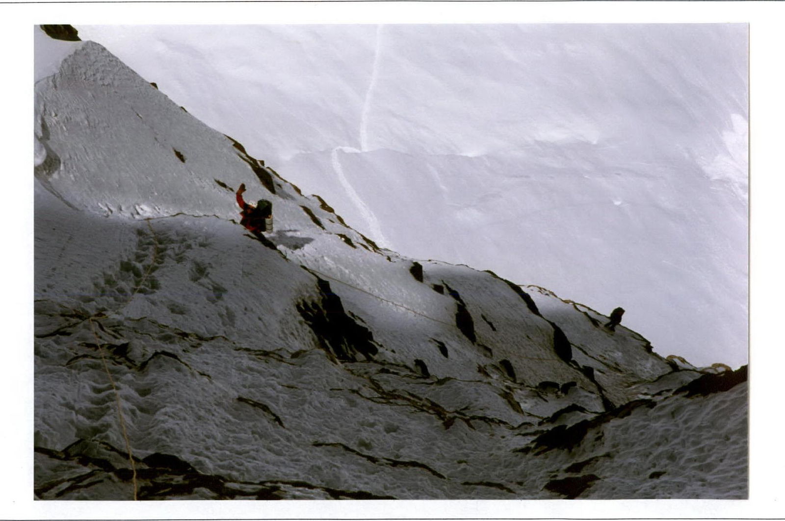
Section 7
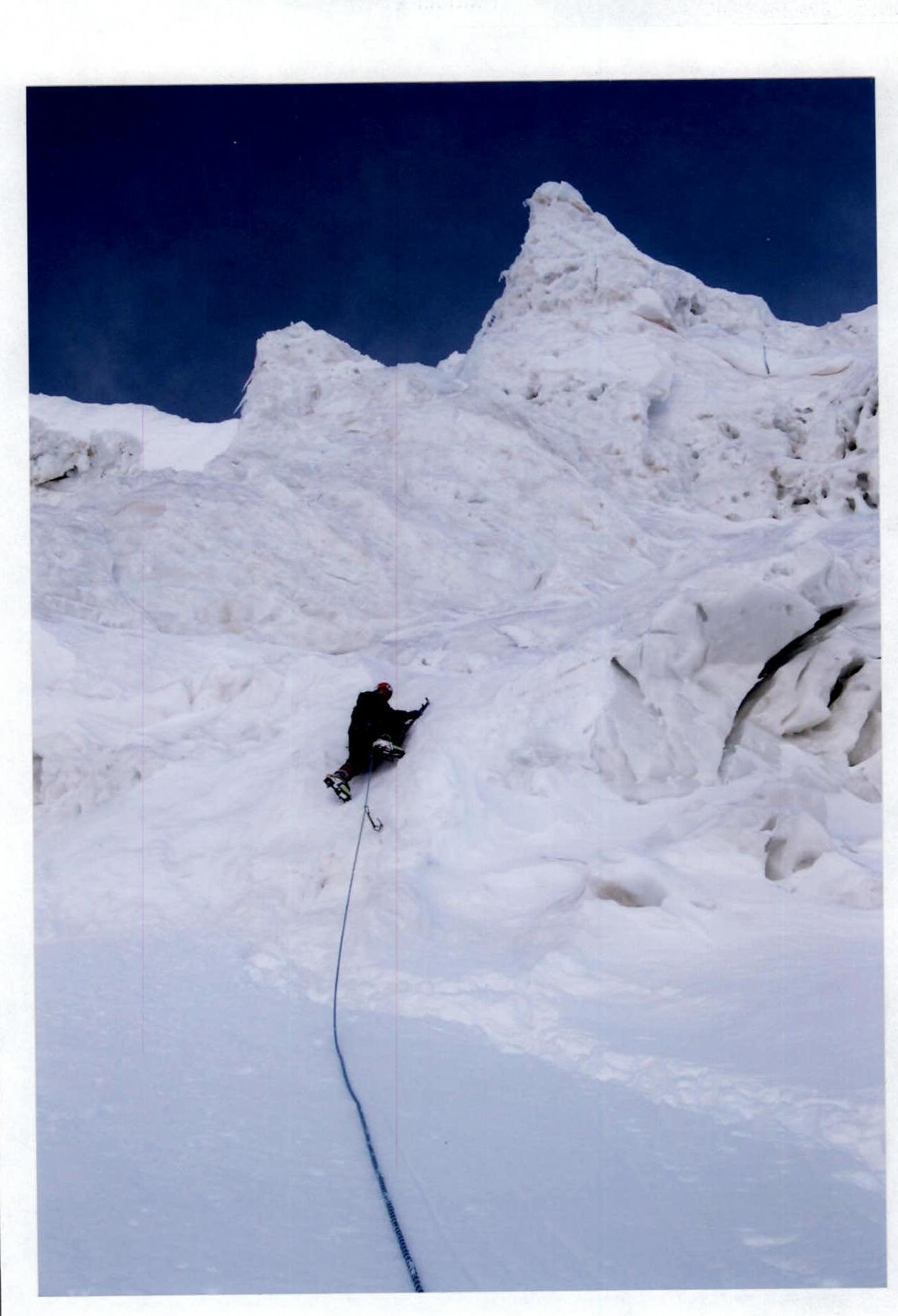
Section 8. V. Arkhipov, passing the icefall.
Sections 9–10
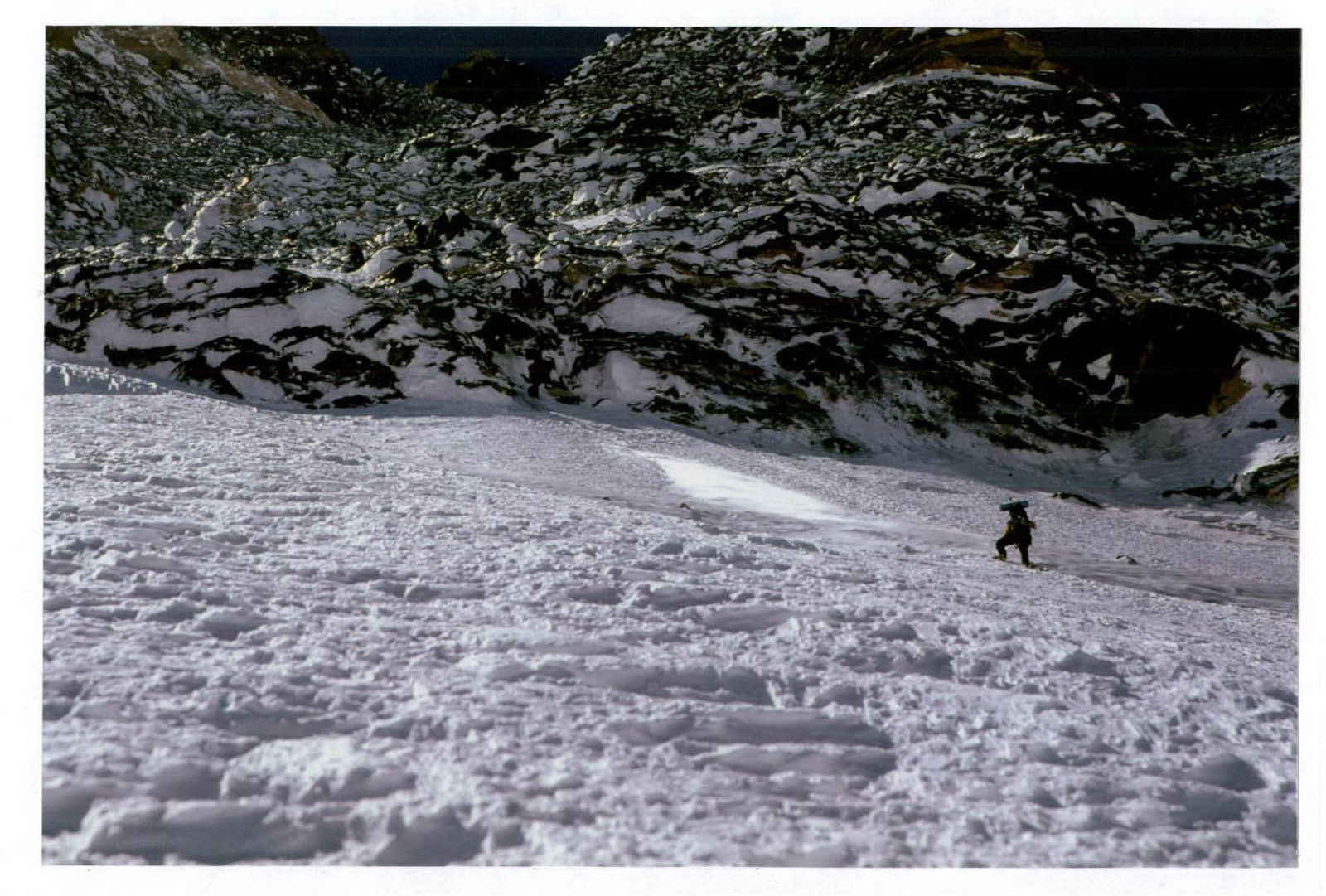
Section 12. Tents of Camp 2 are visible.
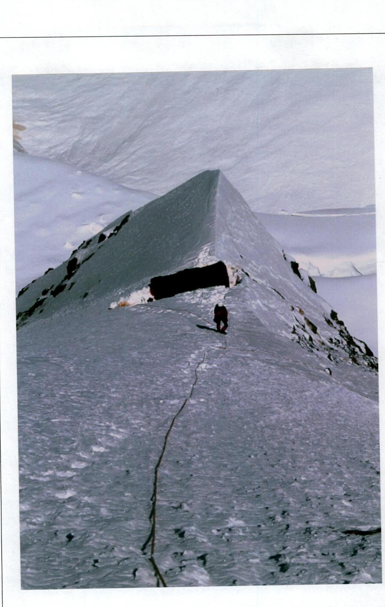
Section 14. Before reaching
the ridge.
 www.alpfederation.ru↗
Comparative Characteristics of the Route on Peak Pobeda
via the right bastion of the ice balcony on the north face (first ascent)
Opinion of Gleb Sokolov — team captain
The route climbed on Peak Pobeda is significantly more complex than the route to Lhotse Shar, which is of the 6th category of difficulty. The problems include:
- mixed terrain sections;
- destroyed rocks where it is very difficult to organize protection.
The snow-ice part of the route on Peak Pobeda is similar to the traverse of Peaks Gorky and Khan-Tengri. There is a similar variability in snow density and thickness. However, it is significantly different due to the presence of very hard ice, on which it is impossible to organize protection.
The route is technically more complex than the route on Peak Kommunizma (Bezubkin). The differences are:
- colder conditions;
- longer route.
In my opinion, the route climbed by the team on Peak Pobeda corresponds to the 6B category of difficulty.
Opinion of Pyotr Kuznetsov — team member
The R1–R7 section of the route is comparable in difficulty to the "death zone" on Cho Oyu at a height of almost 8000 m, climbed by me and Sergey Timofeev during the 1991 expedition as part of the 1st Russian expedition. The same icy and heavily destroyed rocks, where it is impossible to hammer in a piton or place a camming device.
The only difference is the length:
- On Pobeda, this section is 3.5 times longer.
In my assessment, the complexity of this section is 6A–6B category of technical difficulty.
The R7–R8 section of the route is very similar to the section of the Russian route in 1991 on Cho Oyu at a height of 6500–7000 m. In the lower part, there is very hard ice, and at the top, there are delicate lace-like structures, passing which is unpleasant and not safe. The complexity is 6A.
The R9–R14 section of the route is an alternation of steep rocky outcrops and ice, sometimes covered with snow. Perhaps the closest comparison is the rocky belt during the first ascent on Everest by the Krasnoyarsk team in 1996. The only difference is that the route on Pobeda has more ice sections. The complexity is 5B–6A.
In my opinion, the route climbed by the team on Peak Pobeda corresponds to the 6B category of difficulty.
High-altitude Climbing Experience of Team Members
All team members have experience in high-altitude climbing. Seven are Masters of Sports in mountaineering, one is a Candidate for Master of Sports.
Gleb Sokolov — ascents in the Himalayas: Makalu, Lhotse Gl., Lhotse Shar, Lhotse Middle (first ascent), Khan-Tengri — 19 times, Peak Pobeda — 3 times. Champion of Russia.
Pyotr Kuznetsov — ascents in the Himalayas: Dhaulagiri, Cho Oyu up to 8000 m, Everest, Lhotse Middle (first ascent). Peak Lenin — 5 times, Peak Kommunizma — 2 times, Peak Korzhenevskaya — 2 times, Khan-Tengri — 2 times, Peak Pobeda — 2 times. Multiple champion of the USSR and Russia in the rock, technical, high-altitude, and winter classes.
Evgeny Bakaleinikov — Everest up to 8600 m, Khan-Tengri — 3 times, Peak Pobeda, Peak Lenin. Champion of the USSR.
Oleg Khvostenko — Khan-Tengri — 2 times, three-time champion of Russia in different classes. Ranked number one in the Russian national mountaineering team rating in 2003.
Vladimir Arkhipov — Khan-Tengri — 3 times, Peak Lenin. Champion of the USSR and Russia in different classes.
Sergey Cherezov — Khan-Tengri — 2 times. Two-time champion of Russia. Alexander Mikhalitsin — Khan-Tengri — 2 times. Sergey Filatov — Peak Lenin, Peak Kommunizma, Peak Korzhenevskaya, Peak Pobeda.
Summary of the Ascent Analysis
- The wall section of the route consists of 46 ropes. The average steepness is 60°.
- The greatest technical difficulty is presented by the lower part of the wall up to the exit to the icefall (bastion). The main danger here is the hanging icefall above. Several icefalls were observed to the right and left of the ascent line. The steepness of individual sections reaches 80°. The terrain is mixed (micst) — rocks, icy and covered with snow. Ice screws and rock pitons were used for protection. Some sections were climbed using artificial aids. The bastion was processed from below from the camp. Over 4 days, 13 fixed ropes were placed.
- On August 12, the team in full strength started on the route and, after passing the processed part of the wall, reached the icefall. The length of the icefall is 3 ropes (140 m). We managed to find the simplest route through the icefall. The greatest difficulty was presented by the first rope — ice steepness of 85°. Further, it becomes less steep. After exiting the icefall, the danger of icefall collapse disappeared. Thus, the lower part of the wall was climbed in 5 days, its length was 16 ropes. Camp 1 was established on the balcony of the north face at a height of 5500 m.
- The second part of the wall up to the exit to the ridge has a length of 30 ropes, with an average steepness of 55°. The route mainly passes through snow-ice couloirs, intersected in two places by rocky belts. The main potential danger is a possible avalanche in case of snowfall. Fortunately, the weather was stable during the ascent. The main difficulty was the lack of good overnight stays in the upper part of the wall.
- On August 14, Camp 2 was established at a height of 6000 m. On a small snowy ridge, a platform for two tents was cleared. On August 16, the team reached the ridge of Peak Pobeda and established Camp 3 at a height of 6650 m.
- The ridge of Pobeda is quite sharp. In some places, the snow steepness reaches 70°. Up to the summit of Peak Armenia, 7 more fixed ropes were placed. Camp 4 was established at a height of 7000 m.
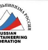
- On August 18, the team started the summit push. Along the ascent route, 3 more fixed ropes were placed. Further, a relatively easy ridge followed, but visibility sharply worsened, and a strong west wind blew. In difficult weather conditions, at 16:00, the team reached the summit of Peak Pobeda. Then the team continued moving west along the summit ridge. Camp 5 was established at a height of 7430 m on the summit ridge of Peak Pobeda.
- On August 19, at 12:00, the team reached the cairn in the western part of the summit. The descent via the classic route from the west presented certain difficulties, especially considering the state of fatigue of all participants. Several fixed ropes were placed during the descent. At 17:00, the team reached the Obelisk and continued towards Vazha-Pshavela. Suddenly, the weather sharply worsened, a strong headwind blew, and visibility disappeared. The team reached Peak Vazha-Pshavela in complete darkness, where Camp 6 was established at a height of 6950 m.
- On August 20, the team descended to Zvezdochka glacier in full strength.
- The entire ascent took 13 days, including processing and descent to the camp. The weather was generally favorable during the ascent, except for August 18 and the evening of August 19. The success of the ascent was due to the excellent physical fitness and acclimatization of all participants, as well as the well-planned tactical plan prepared by the team captain. There were no emergency situations during the ascent, and all participants remained practically healthy and moved independently. Radio communication with the base camp was maintained regularly three times a day. Observers from the team were constantly present on Zvezdochka glacier.
August 22. South Inylchek glacier.