MOSCOW ALPINISM AND ROCK CLIMBING FEDERATION
Report
On the ascent of the CSKA team named after Demchenko
To the peak Novy (Novey) 4798 m. Central Tien Shan, Western Kokshaal-Too (41° 5′43.84″ N, 77°31′32.83″ E)
via the northern ridge "Masterpiece" First ascent Presumably 2B category of complexity
Grigoryev D.R. + 6
Participants of the ascent
- Team leader – Grigoryev Dmitry Rurikovich, 1st sports category. Coach: Kuznetsova E.V. Address: 115193, Moscow, 6-y Kozhukhovskaya st., 18, bld. 1, apt. 19. rurikovichd@gmail.com, +7 903 145 88 61
- Golovchenko Dmitry Nikolaevich, Candidate Master of Sports. Coach: Kuznetsova E.V.
- Nilov Sergey Alekseevich, Master of Sports. Coach: Kuznetsova E.V.
- Andreev Nikolay Valerievich, no sports category
- Rachinskaya Ekaterina Yurievna, no sports category
- Galimzyanov Timur Ravilievich, 2nd sports category
- Nikitin Vladimir Valerievich, 2nd sports category
Route 2B to the peak Novy via the northern ridge
Ascent passport
- Central Tien Shan, Western Kokshaal-Too range, Sarychat gorge, classifier section: 7.5.
- Peak Novy 4798 m (41° 5′43.84″ N, 77°31′32.83″ E) via the northern ridge
- Proposed category of complexity — 2B, first ascent
- Route type: combined
- Route elevation gain: 1290 m
Route length: 7020 m. Average slope:
- main part of the route — 30°;
- entire route — 11°.
-
Number of pitons left on the route: total — 0; including bolted pitons — 0.
-
Team's total climbing hours: 12 hours, 1 day
-
Team leader: Grigoryev D.R., 1st sports category, instructor № 1110 Team members: Golovchenko D.N., Candidate Master of Sports Nilov S.A., Master of Sports Andreev N.V., no sports category Rachinskaya E.Yu., no sports category Galimzyanov T.R., 2nd sports category Nikitin V.V., 2nd sports category
-
Coach: Kuznetsova E.V.
-
Departure from Base Camp: 7:00, August 13, 2015.
Route started: 7:00, August 13, 2015. Summit reached: 15:00, August 13, 2015. Return to Base Camp: 19:00, August 13, 2015. Descent from the summit: via the ascent route, through the scree southern slope of the canyon.
-
Organization: Moscow Alpinism and Rock Climbing Federation, CSKA named after Demchenko
-
Person responsible for the report: Grigoryev Dmitry Rurikovich. rurikovichd@gmail.com, +7 903 145 88 61
General photo of the summit
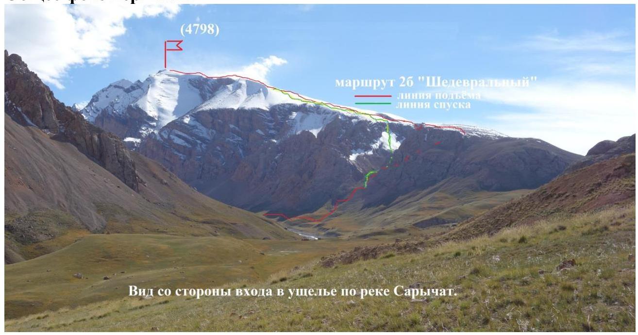
Figure 1. View from the entrance to the Sarychat gorge
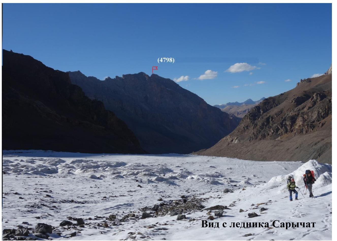
Figure 2. View from the Sarychat glacier
Photos of the route profile from the right and left
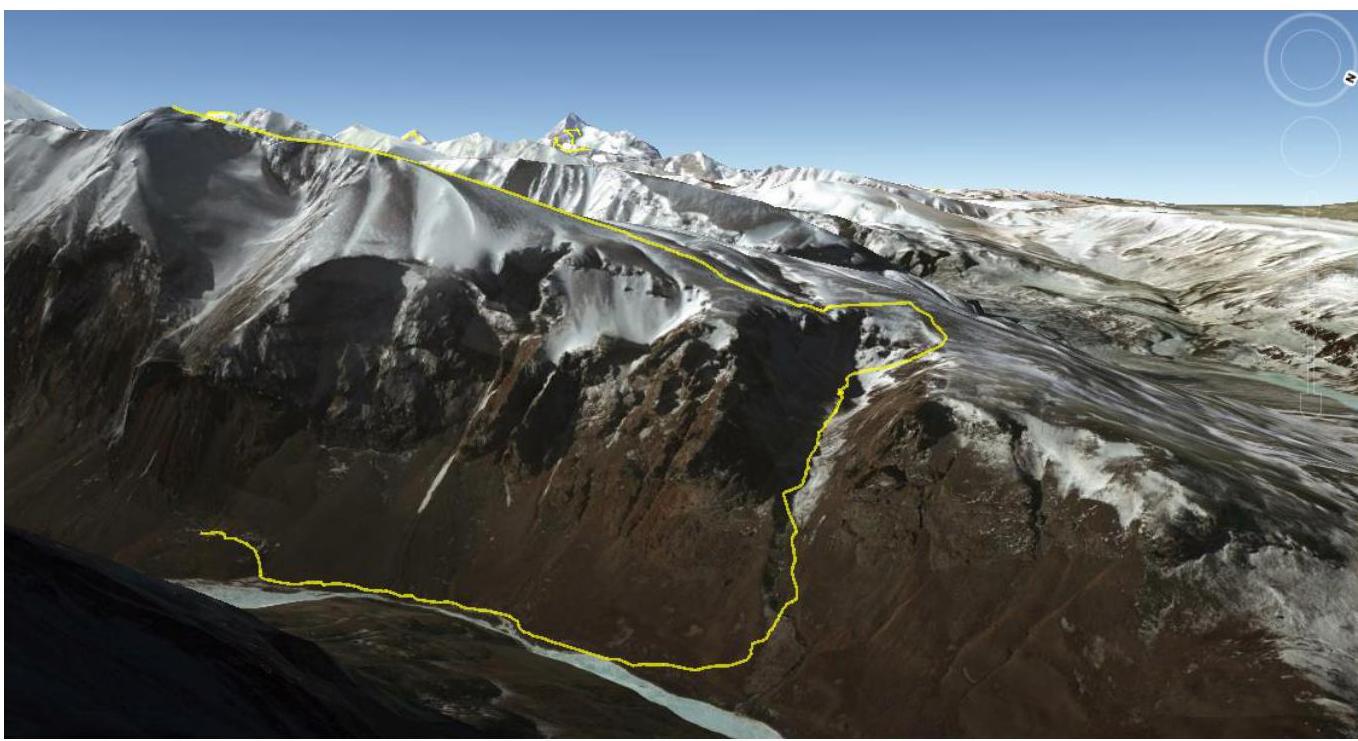
Figure 3. Route profile view from the east (GOOGLE EARTH)

Figure 4. Route profile view from the west (GOOGLE EARTH)
Photopanorama of the area
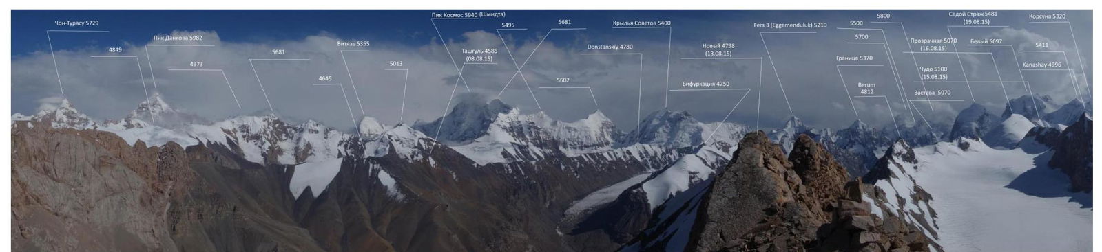
Figure 5. Photopanorama taken from the summit Novy in the direction south.
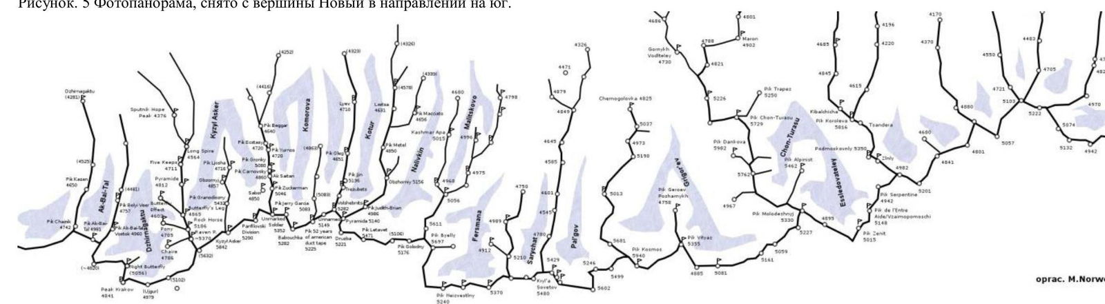
Figure 6. Map of the area.
Central Tien Shan, Western Kokshaal-Too range, area of peak Beliy (5486 m)
Brief description of the area
Western Kokshaal-Too is the southernmost range in Kyrgyzstan. This range is located in the Central Tien Shan between Lake Issyk-Kul and the Takla-Makan desert, on the border with China. To the north, the Kokshaal-Too range borders the Uzengy-Kuush and Myudyryum rivers, to the south — the Kokshaal River.
In this area, there are many peaks with elevations around 6000 m. The most interesting among them are: peak Kyzyl-Asker (5842 m), peak Krylya Sovetov (5800 m), peak Shmidta (5954 m, not climbed), peak Dankova (5982 m), peak Chon-Turasu or Joldash (5729 m), peak Alpinist (5641 m), peak Sergey Korolev (5816 m). This area is characterized by a combination of typically Alpine forms (many vertical rock walls with an elevation gain of about 1.5–2 km) with extensive glaciation, second only to the area around peak Pobeda in the Tien Shan. The entire area, including the lowlands, is a permafrost zone. Marshy areas are often found up to elevations of 4000 m.
The snow line is at an elevation of around 4000–4500 m above sea level. River valleys have high absolute elevations of around 3000–3500 m above sea level. The climate in the valley is harsh. The average monthly temperature in summer is around 5–8 °C, with unstable weather.
Approach
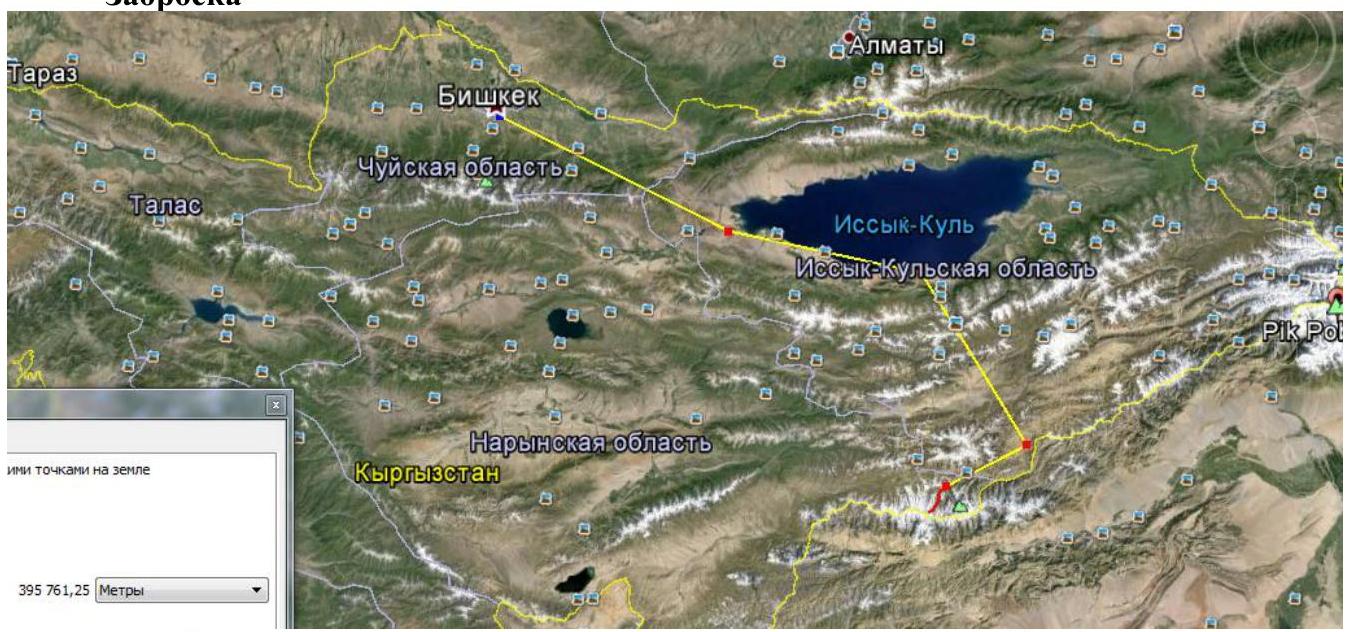
Figure 7. Route map from Bishkek to the base camp in the Sarychat gorge.
Approach from Bishkek by car:
- Along the southern shore of Issyk-Kul on the A363 highway to the village of Barskoon.
- Then on the A364 road.
- After 20 km, the asphalt ends, and a dirt road begins, leading to a gold mining settlement through a pass to the village of Kara-Say.
- The A364 road to the gold mines turns north.
- First border checkpoint.
- Cross the wide Naryn River, then the road is almost non-existent.
- Continue through passes and rivers to the checkpoint.
- After the checkpoint, follow the Uzengeguush River south to the Bulat-M hunting lodge.
- From the hunting lodge, the road is very dangerous, sometimes requiring clearing of debris.
- The journey to the hunting lodge takes around 20 hours.
From the hunting lodge on foot:
- Follow the left bank of the Uzengeguush River (crossing the remains of a bridge from the hunting lodge).
- Reach the Autali River (fording or crossing by stones upstream or downstream depending on the weather).
- Continue along the Sarychat River to the last grassy areas on the slope, about 1 hour before the melted glacier tongue.
Base camp:
- Set up high above the river in a flat basin, protected from the wind.
- In front of the basin, there is a 100 m stream flowing through the grass.
- In the basin, water is found in crevices between large rocks, often drying up and stagnant.
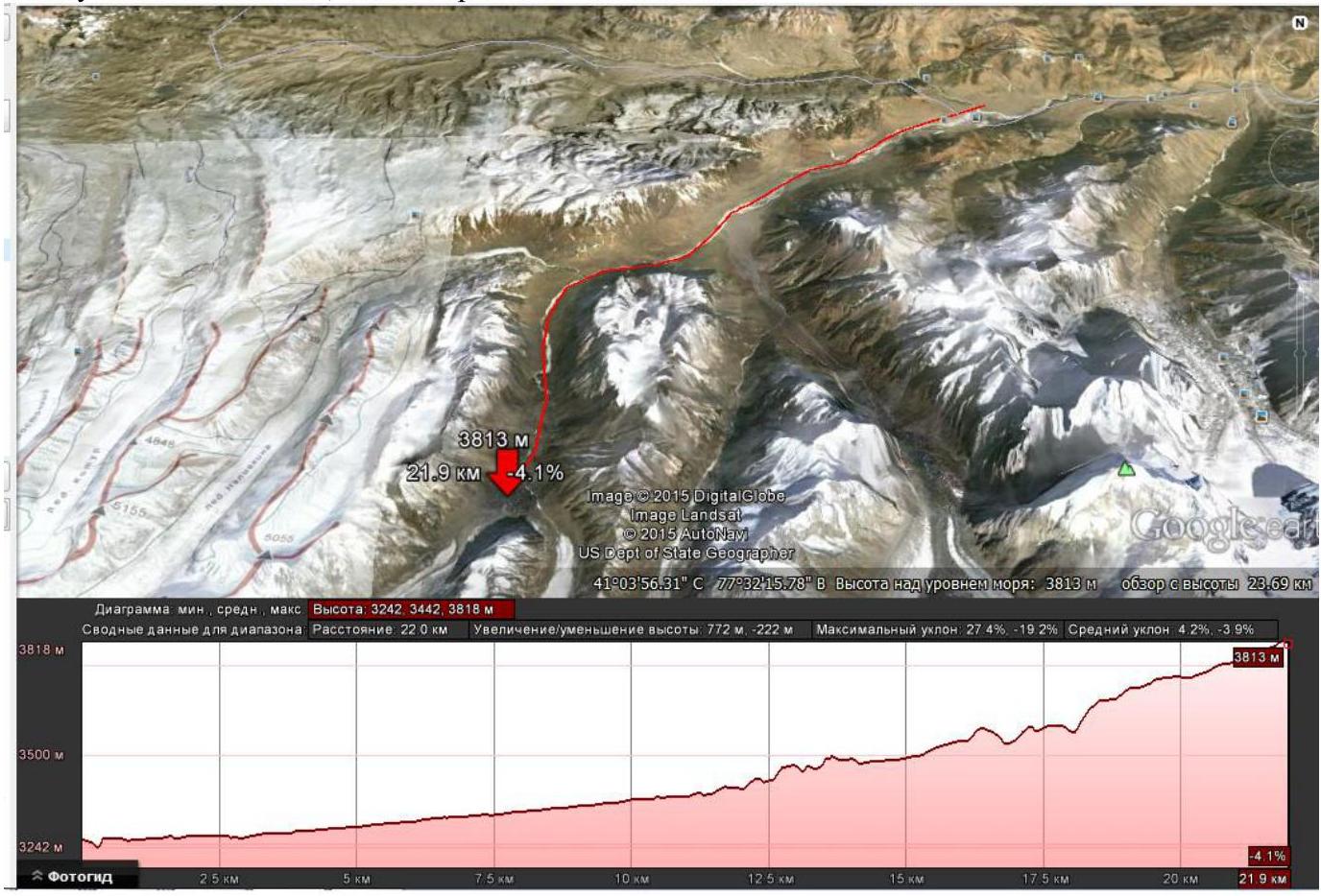
Figure 8. Route map from the hunting lodge to the base camp in the Sarychat gorge.
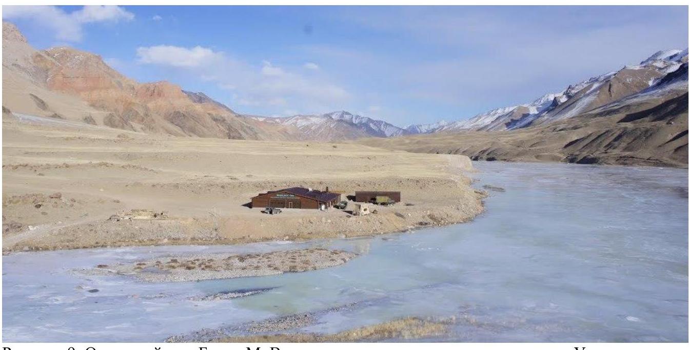
Figure 9. Bulat-M hunting lodge. View from the southeast downstream along the Uzengeguush River

Figure 12. Ascent route to the peak.

Figure 13. Map with peaks climbed during the Moscow team expedition in 2015.
Ascent schedule
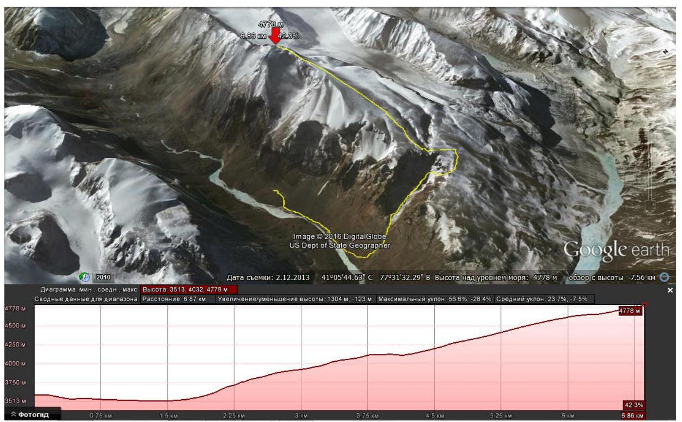
Figure 14. Route from the base camp to the summit (GOOGLE EARTH). The elevation profile is shown below.
| Section № | Elevation | Length | Transition | Elevation Gain | Slope | Terrain Type | Category of Complexity | |
|---|---|---|---|---|---|---|---|---|
| 0 | 3500 | |||||||
| 1 | from camp to canyon entrance | 3500 | 1900 | 1900 | 0 | 0 | grass | 1 |
| 2 | entrance – exit Big Canyon | 4020 | 3350 | 1450 | 520 | 21 | grass, rocks | 1 |
| 3 | Canyon bypass | 4120 | 4000 | 650 | 100 | 9 | rocks | 1 |
| 4 | entrance – exit small canyon | 4140 | 4250 | 250 | 20 | 5 | rocks, stones | 1 |
| 5 | ascent along the slope to the pre-summit rocky ridge | 4650 | 6250 | 2000 | 510 | 15 | stones | 1 |
| 6 | Ascent to the rocky ridge along the rocky slope | 4680 | 6300 | 50 | 30 | 39 | rocks | 3 |
| 7 | Passage along the rocky ridge | 4750 | 6500 | 200 | 70 | 21 | rocks | 2 |
| 8 | Passage along the snow-ice ridge, summit | 4786 | 6800 | 300 | 36 | 7 | ice, snow | 2 |
Route description
Departure from the base camp. Descend along the grassy slopes to the canyon entrance. Cross the stream flowing from the canyon and ascend along the steep grassy slope via a winding trail into the canyon.
Walk along the canyon floor — red rocks on the right, a gentle scree slope with rock outcrops at the top on the left. Inspect the left scree slope, determine the descent point, and note the rock outcrops at the top as a landmark for the descent! Continue to the end of the canyon (waterfall over 50 m in the left part), turn right along the rocks, exit onto a stony slope, and ascend along the scree slope to the southern edge of the canyon. Bypass the canyon in a circle from the south to the north along wide stony fields resembling "Japanese rock gardens." Approach the small canyon formed by a stream creating a waterfall visible in the large canyon. Descend along the steep scree (several descents with "ram's foreheads" and without; find the suitable one) to the bottom of the small canyon, with tubs and small waterfalls on the right. Ascend to the opposite edge of the canyon along simple rocks and exit onto the broad northern slope of peak Novy. The summit is obscured by a small glacier. Move towards the glacier along small stones containing:
- iron ore rocks
- fossilized shells
- PPP!!
Crampons can be worn to traverse the glacier. The glacier leads directly to the summit along the rocky ridge before the summit. It is simpler to bypass the glacier on the right, descending slightly along the slope to choose an optimal trajectory based on the slope angle. After 500 m along the slope, a cairn is observed. From the cairn, the pre-summit rocky ridge is visible. Approach the rocky ridge, ascend 30 m along simple rocks to the rocky ridge (protection — rock pitons, loops). Traverse the narrow rocky ridge — the glacier on the left, the rocky slope on the right — ascending towards the summit. Before the summit, the rocky ridge is interrupted by a glacier. Ascend to the summit in crampons. The summit is rocky, wide, and flat.
Descent follows the ascent route. From the foot of the pre-summit rocky ridge, descend either along the stony slope or the gentle glacier directly along the watercourse. Then, along the broad stony slope to the southern edge of the canyon. Find a passage down between the rocks on the southern edge of the canyon to the broad scree slope. Passages are narrow; descend one by one, pressing against the edges of the couloirs to avoid being hit by stones dislodged by the upper climbers. On the broad slope, it is possible to move closer together, warning about descending stones, or at a safe distance from each other. The slope is not steep enough to accelerate stones over long distances. Descend along the slope (lifts) to the canyon floor and return to camp. Alternatively, bypass the canyon in a circle via the ascent route.
The route is safe with a very beautiful and diverse terrain. Broad slope and glacier. Safe technical rocky ridge. Gentle ice slope before the summit. In bad weather, it is possible to get lost on the broad slope, but in any case, it is possible to descend to the stream flowing into the small canyon or to the southern edge of the large canyon.
Route length 8.2 km, elevation gain 970 m.
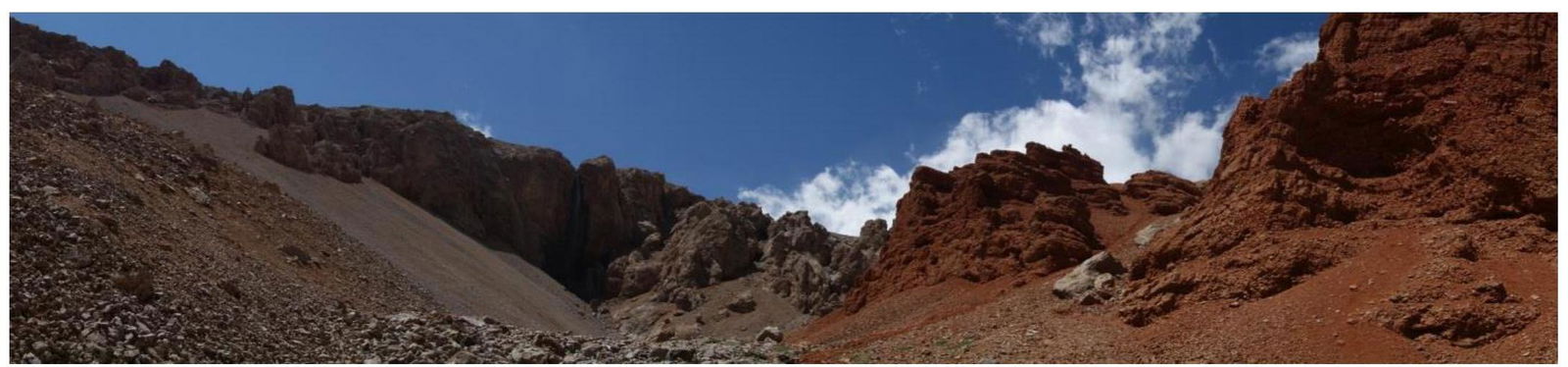
Figure 15. In the large canyon. On the left is the descent slope, on the right are red rocks, and in front is a waterfall.
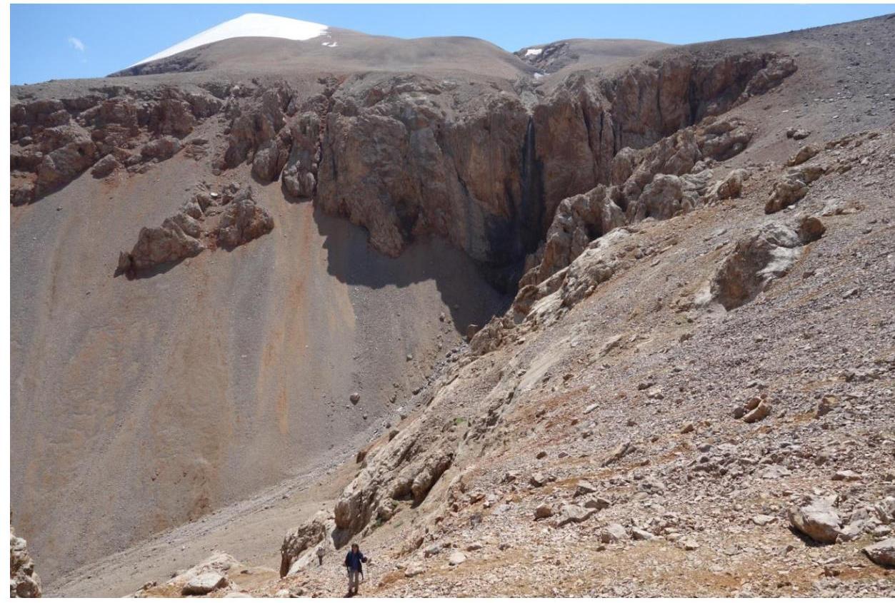
Figure 16. Exit from the large canyon. On the horizon is the icy slope of peak Novy; in the center is the descent slope and waterfall with a small canyon. Bypass to the right along the top through the "rock gardens" to the small canyon.
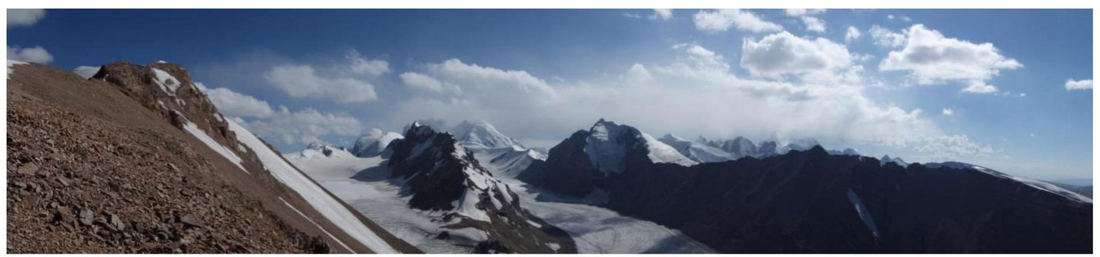
Figure 17. Panorama from the ascent slope. On the left are pre-summit rocks and ridge; below is the Malitskov glacier.

Figure 18. Pre-summit rocks and ridge.
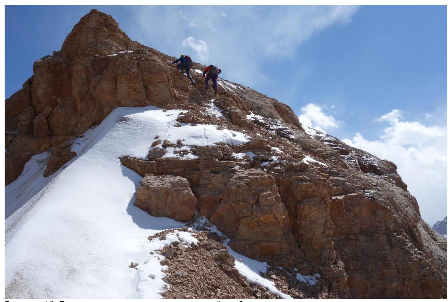
Figure 19. Ascent along rocks to the pre-summit ridge.
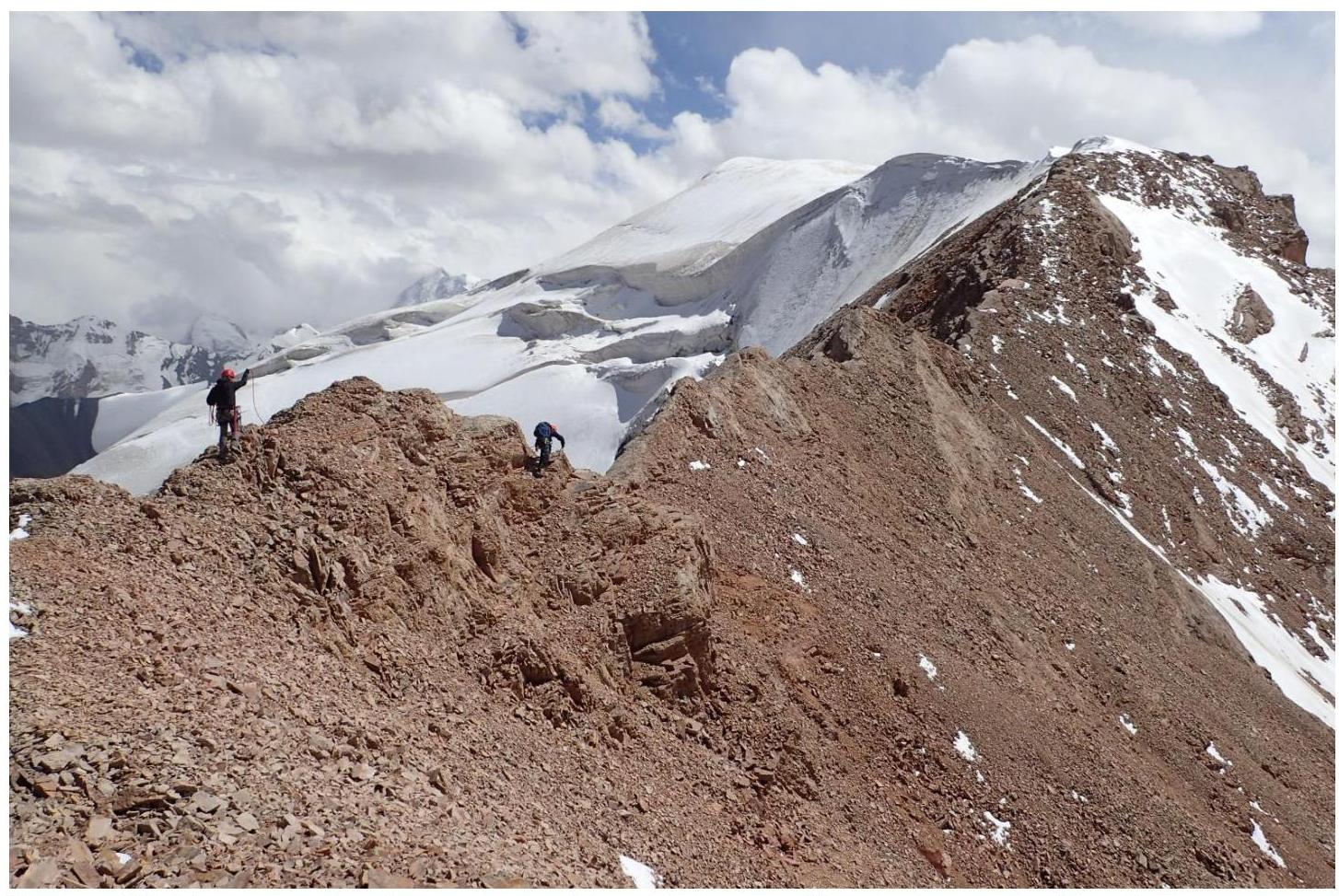
Figure 20. Pre-summit rocky ridge turning into a snow-ice ridge.
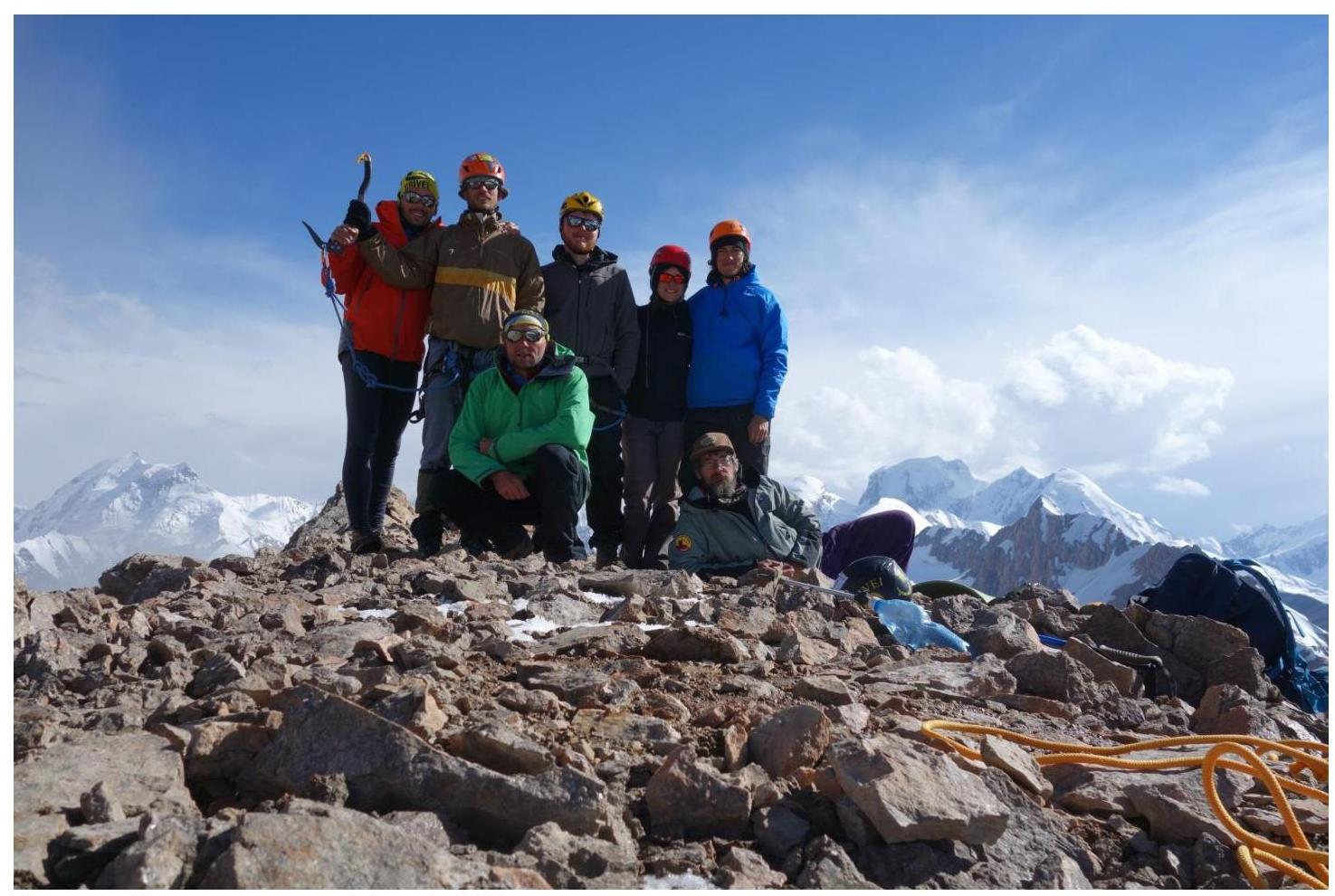
Figure 21. Summit peak Novy 4798 m.

Figure 22. Descent slope to the large canyon.
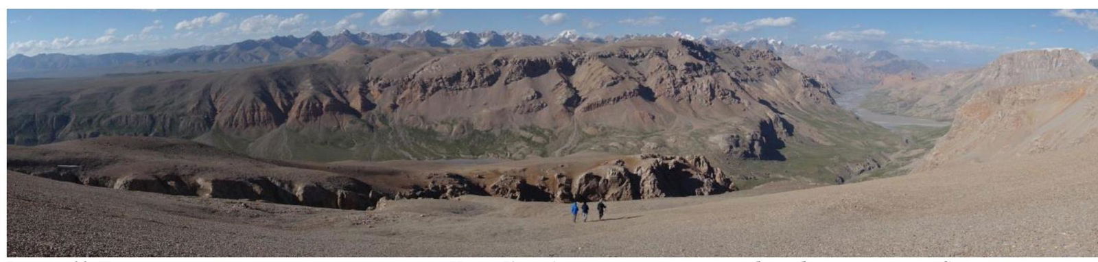
Figure 23. Panorama of the descent slope to the south — beyond the mountains is Issyk-Kul. Climbers near the southern edge of the large canyon. On the right is the wide valley of the Uzengeguush River.
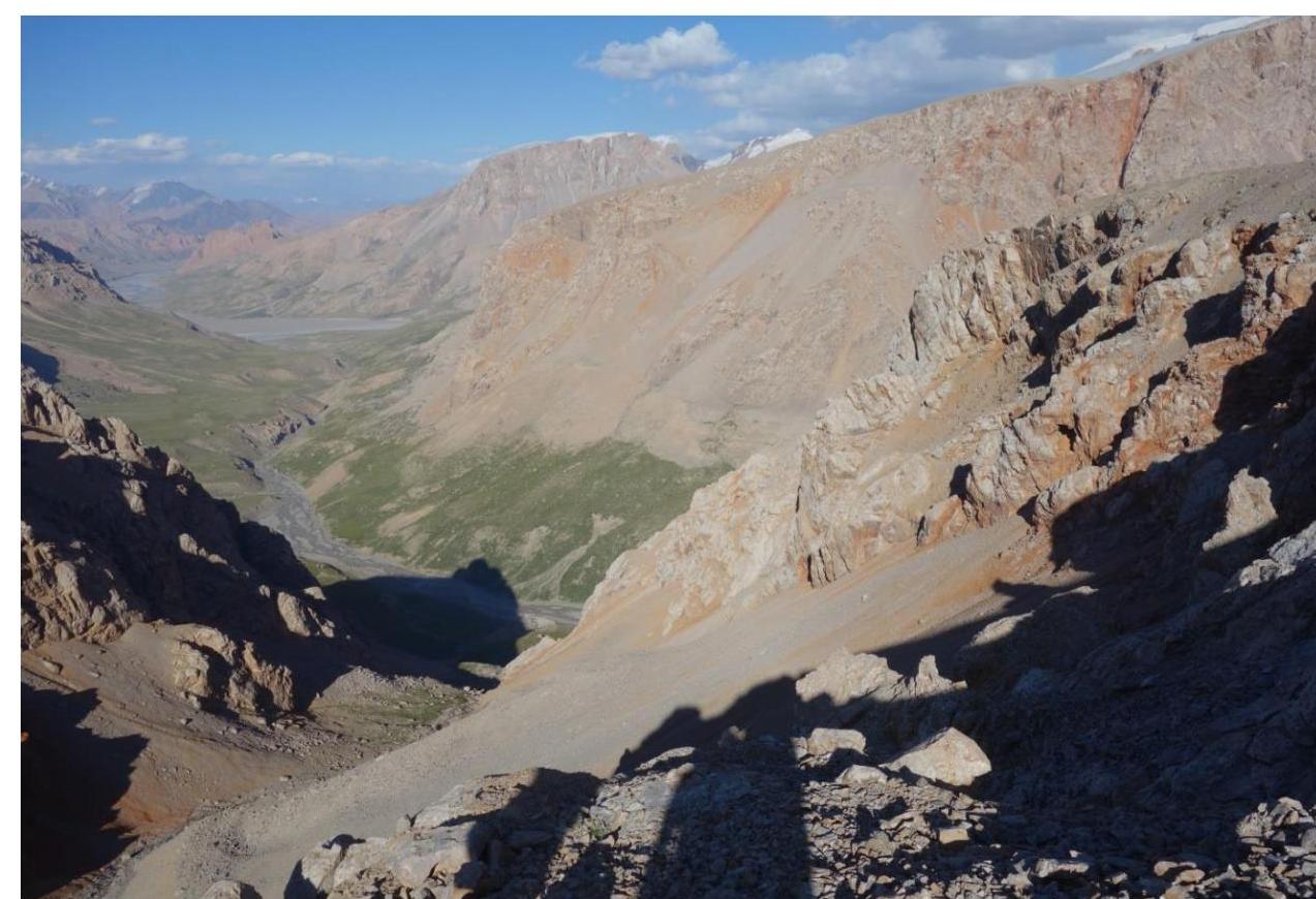
Figure 24. Passage between rocks on the southern edge of the large canyon to the descent slope into the canyon.
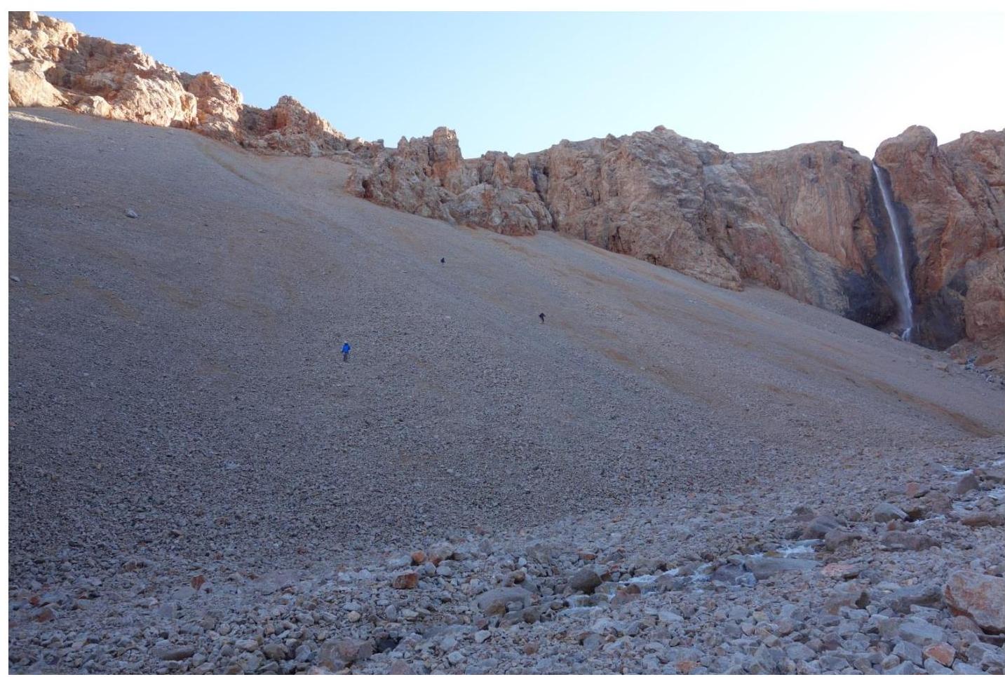
Figure 25. On the descent slope to the bottom of the large canyon.
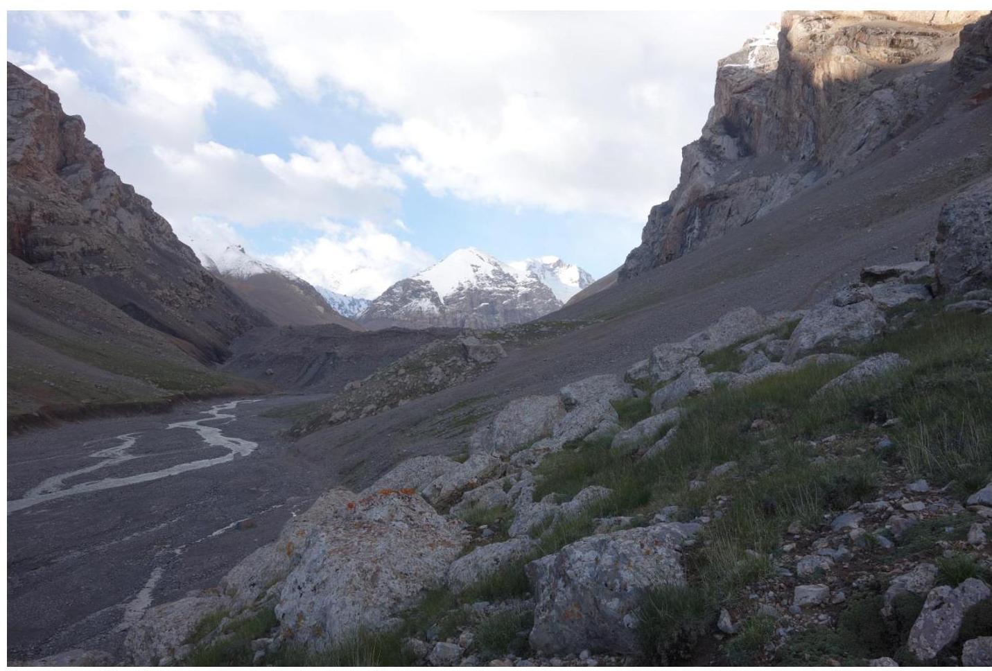
Figure 26. On the descent slope from the large canyon to the Sarychat River. In the center of the photo, behind the grassy-stony slope, is the base camp. To the right above the camp are the eastern walls of peak Novy 4798 m.