
Report
On the ascent of Ratzek Peak via the western ridge by the sports section of the "Polytechnic" Alpine Club on August 8, 2023.
I. Ascent Passport
| № | 1. General Information | |
|---|---|---|
| 1.1 | Full name, sports rank of the leader | Sozinov K.I., 2nd sports rank |
| 1.2 | Full name, sports rank of the participants | Khlopin D.M., 2nd sports rank, Mesh M.V., 2nd sports rank |
| 1.3 | Full name of the coach | Molodozhen V.A., Master of Sports |
| 1.4 | Organization | "Polytechnic" Alpine Club |
| 2. Characteristics of the Ascent Object | ||
| 2.1 | Region | Tian Shan, Kyrgyz Range |
| 2.2 | Valley | Ala-Archa |
| 2.3 | Number of the section according to the 2020 classification table | 7.4 |
| 2.4 | Name and height of the peak | Ratzek, 3972 m |
| 2.5 | Geographical coordinates of the peak (latitude/longitude), GPS coordinates | N42.52258, E74.53960 |
| 3. Characteristics of the Route | ||
| 3.1 | Name of the route | Via the western ridge |
| 3.2 | Proposed category of difficulty | 3A |
| 3.3 | Degree of route development | Well-developed |
| 3.4 | Nature of the route terrain | Rock |
| 3.5 | Height difference of the route (data from altimeter or GPS) | 180 m |
| 3.6 | Length of the route (in meters) | 260 m |
| 3.7 | Technical elements of the route (total length of sections of varying difficulty with indication of terrain type: ice-snow, rock) | II–III cat. diff. rocks — 50 m, III cat. diff. rocks — 110 m, IV, IV+ cat. diff. rocks — 100 m |
| 3.10 | Descent from the peak | To the south to the saddle (route 2A cat. diff.) |
| 3.11 | Additional characteristics of the route | - |
| 4. Characteristics of the Team's Actions | ||
| 4.1 | Time of movement (team's walking hours, in hours and days) | 5.5 hours |
| 4.2 | Overnight stays | - |
| 4.3 | Time of route development | - |
| 4.4 | Start of the route | 06:00 on August 8, 2023 |
| 4.5 | Reach the peak | 11:30 on August 8, 2023 |
| 4.6 | Return to the base camp | 13:30 on August 8, 2023 |
| 5. Person responsible for the report | ||
| 5.1 | Full name, e-mail | Mesh M.V. maxmesh@gmail.com |
II. Description of the Ascent
1. Characteristics of the Ascent Object
1.1. General Photo of the Peak
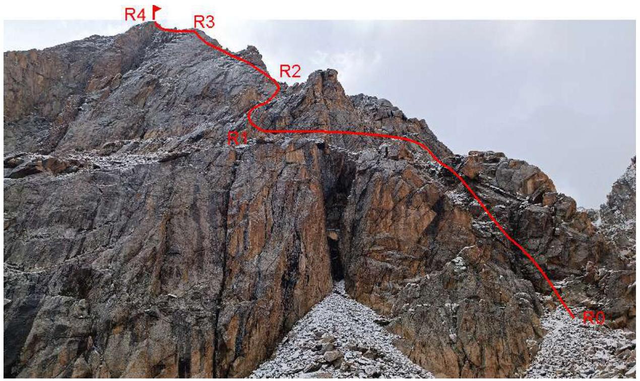
Photo 1. Ratzek Peak from the west. The team's route is marked in red. The photo was taken in August 2023 from the Teketorsky overnight stays.
1.2. General Description
Ratzek Peak is located in the lower part of the Ak-Sai glacier, near the "Ratzek Hut" base camp. Its proximity to the alpine camp and rocky terrain make it a convenient object for rock climbing and ascents. Routes to the peak have been laid out from different sides: 1B via the northwestern ridge, 2B via the northern ridge, 2A via the south. The route via the western ridge is technically more challenging than the northern one; it is rated 3A by V. Akimov and other climbers (with the comment that the route is very short for a "normal" 3A).
1.3. Map of the Area
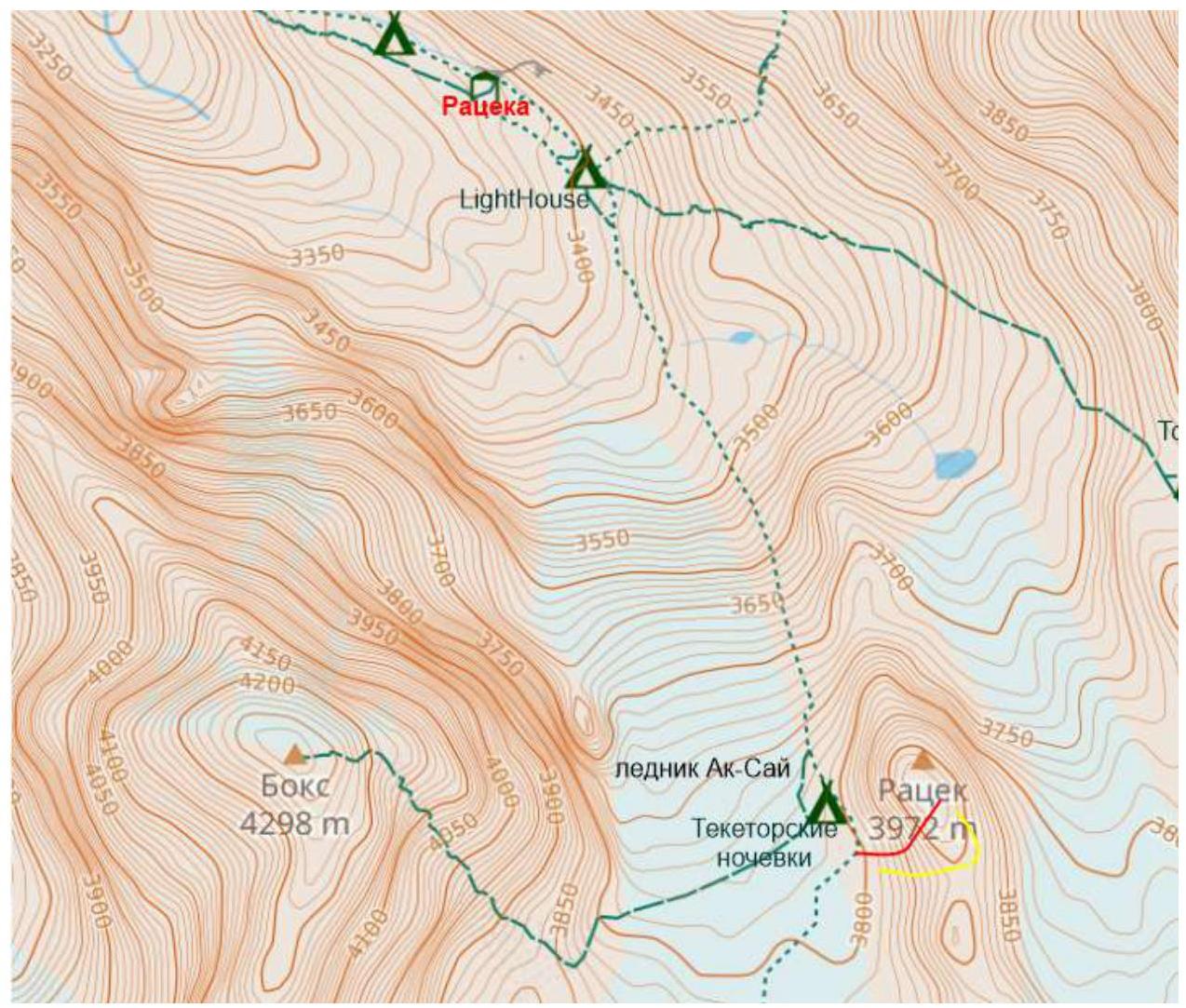
Map of the area (taken from openstreetmap.org). The path from the alpine camp is marked in green, the descent path in yellow, and the route in red.
The path from the base camp goes along the "Crocodile" moraine under the slopes of Ratzek Peak. In the lower part, the trail goes along a conglomerate slope, and the trail's location changes from year to year. Throughout its length, the trail is marked with cairns. One should follow the trail to the Teketorsky overnight stays (the journey takes 1.5–2 hours). From the overnight stays, it's about another 50 m to the scree saddle between Ratzek Peak and the next peak in the Corona ridge (known as the IFMGA peak). The start of the route is from the rocks at the edge of the saddle (photo 2).
2. Characteristics of the Route
2.1. Scheme of the Route in UIAA Symbols and Characteristics of Sections
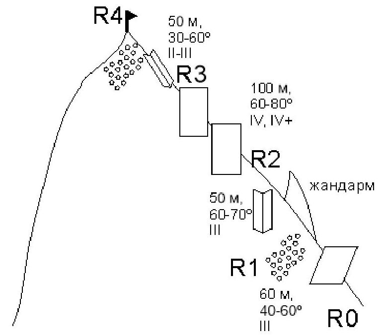
Figure 1. Scheme of the route in UIAA symbols and characteristics of sections
3. Characteristics of the Team's Actions
3.1. Brief Description of the Route Passage
The team started the ascent from the base camp at 04:30, began moving along the route at 06:00. The ascent took place in snowfall conditions; the team reached the peak at 11:30. The return to the base camp was at 13:30.
| Section № | Characteristics of the Section | Description | Photo № |
|---|---|---|---|
| R0–R1 | Rocky, 60 m, 40–60° III | The route begins from the scree saddle between Ratzek Peak and the nameless pinnacle in the Corona ridge. From the saddle, move along the broken rocks towards the pinnacle on the western ridge of Ratzek Peak and then left, bypassing the pinnacle. | 2,3 |
| R1–R2 | Rocky, 50 m, 60–70° III | Continuing to bypass the pinnacle, return to the western ridge | 4 |
| R2–R3 | Rocky, 100 m, 60–80° IV, IV+ | Movement along the ridge, along the ridge itself or a few meters to the left. Belaying on friends, stoppers; "local" anchors are encountered. | 5–8 |
| R3–R4 | Rocky, 50 m, 30–60° II–III | Move to the right side of the ridge, then climb to the peak along the broken rocks on the right side. Movement is simultaneous. | 9,10,11 |
Descent from the route: from the peak, head south towards the scree saddle along the line of route 2A, or to the right — to the drilled rappel stations (up to the scree, 2 rappels of 30 m and 40 m). Then, walk down the scree towards the Teketorsky overnight stays. The total descent time to the overnight stays is within 1 hour.
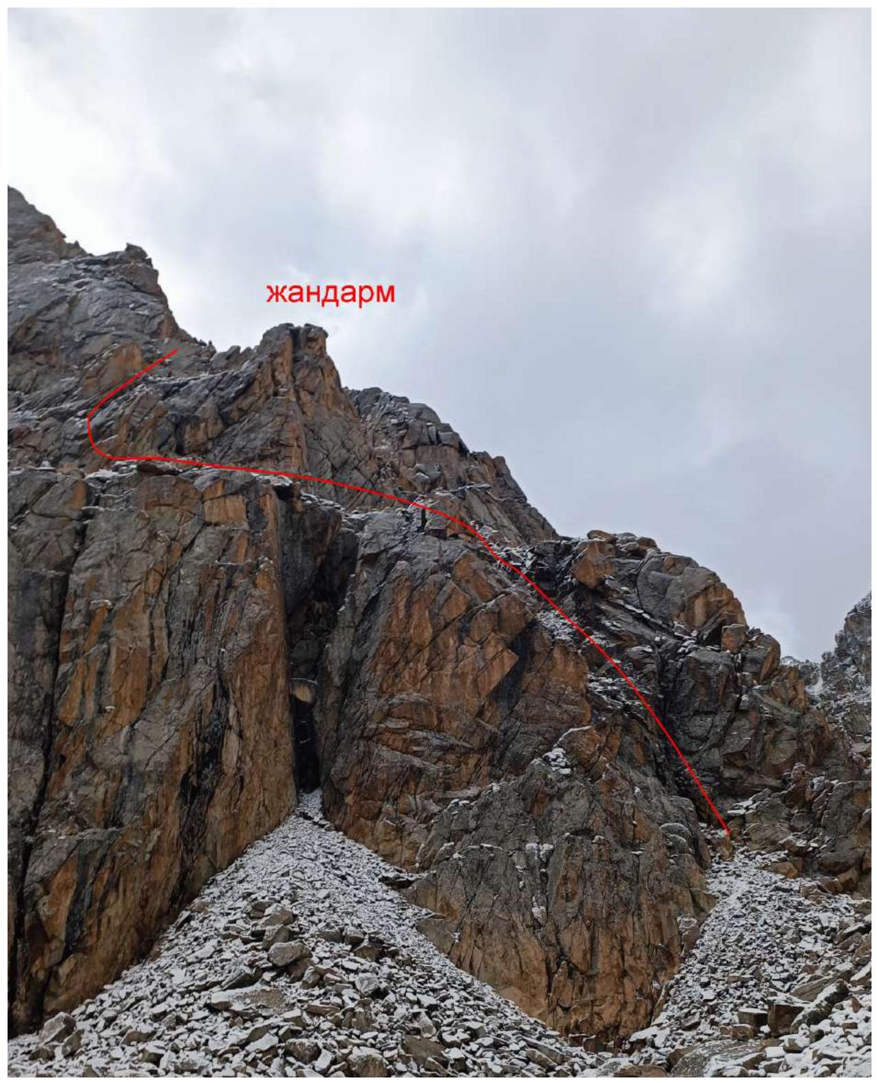
Photo 2. Start of the route, the team's path is marked in red.
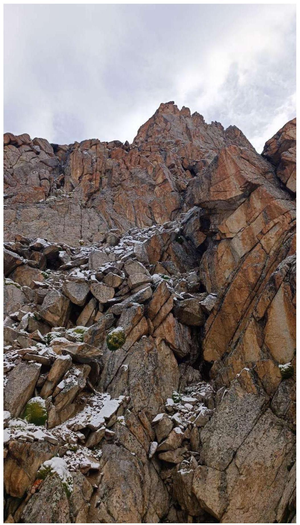
Photo 3. Section R0–R1
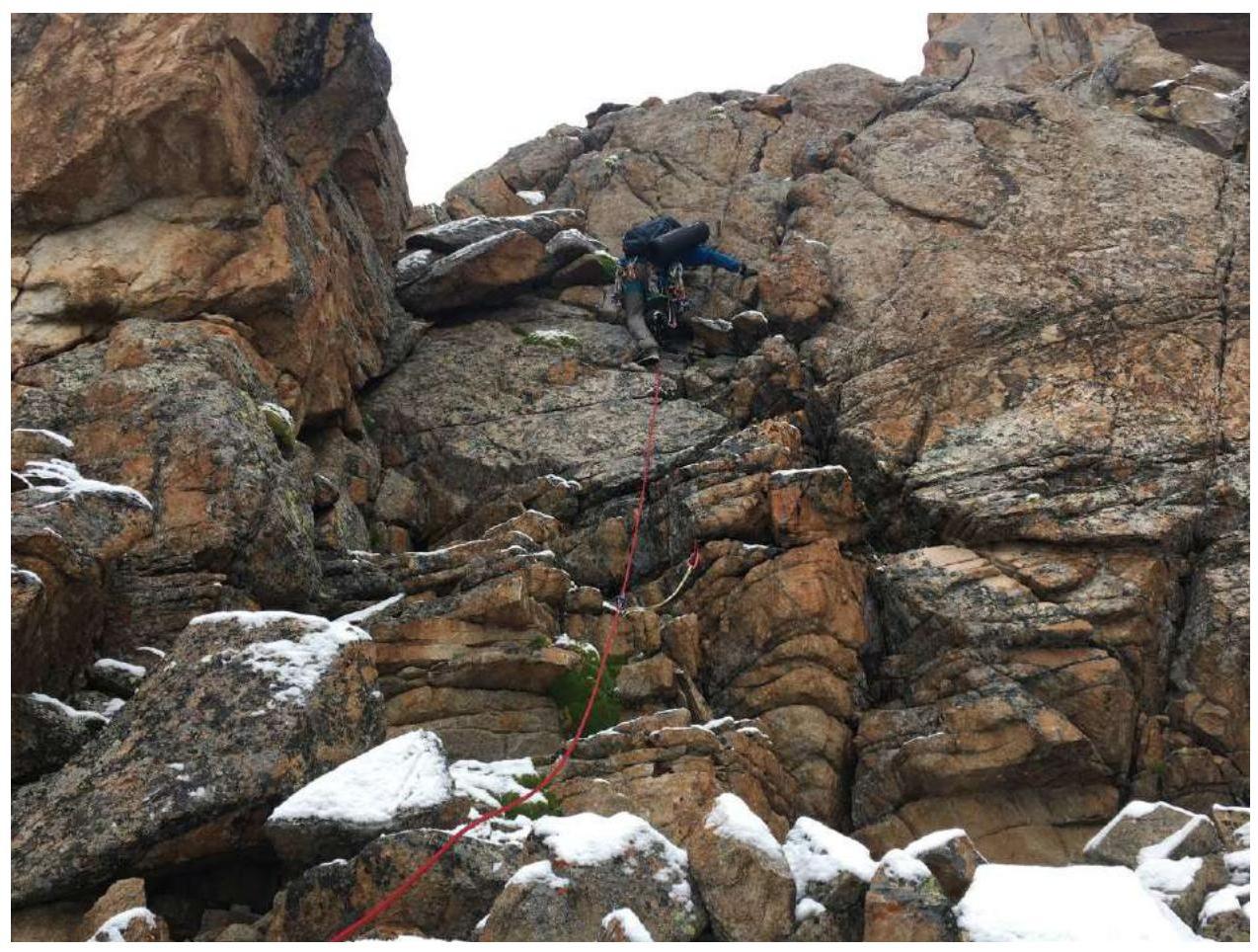
Photo 4. Section R1–R2
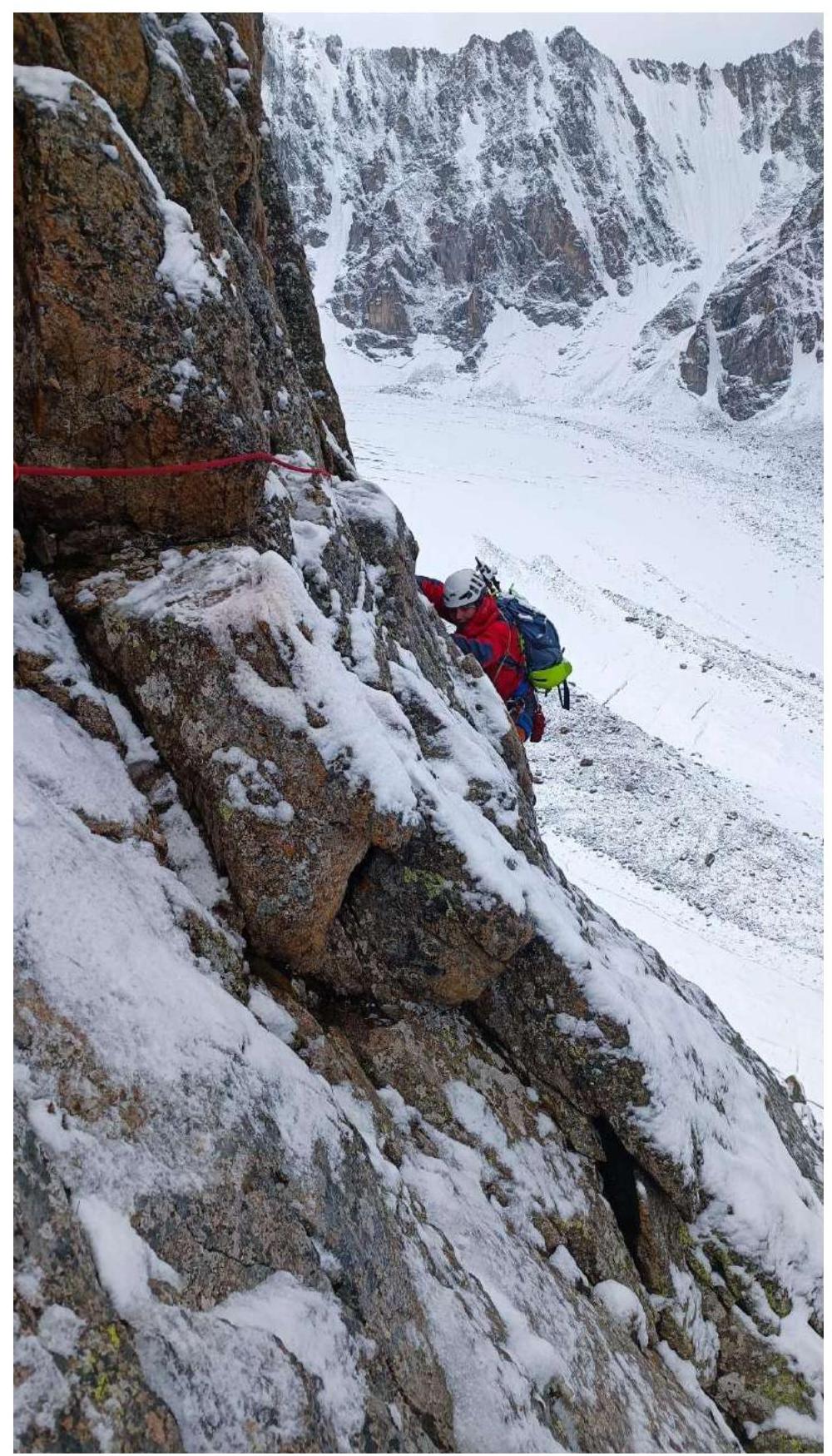
Photo 5. Section R2–R3

Photo 6. Section R2–R3
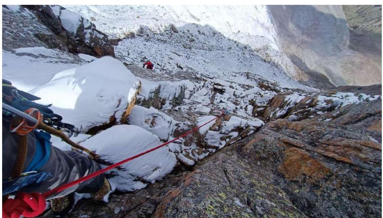
Photo 7. Section R2–R3
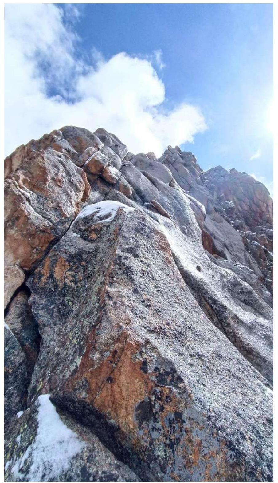
Photo 8. Section R2–R3, upper part
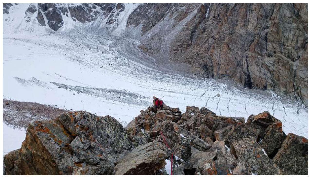
Photo 9. Section R3–R4, view towards R3
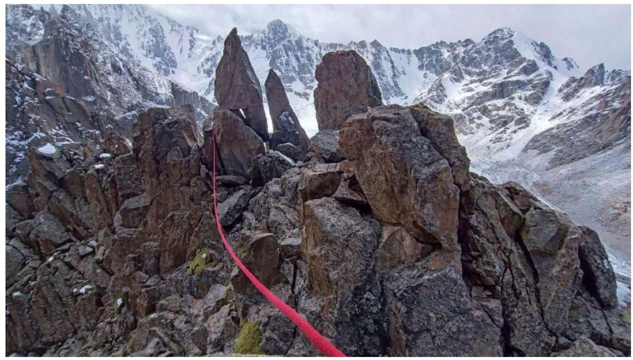
Photo 10. Section R3–R4. View from the peak
3.2. Photo of the Team on the Peak
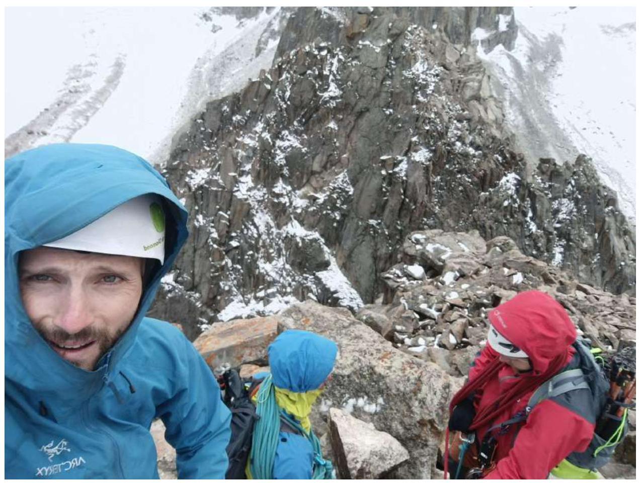
Photo 11. Team on the peak of Ratzek Peak
3.3. Overall Assessment of the Route
The route is logical and safe. Despite its short length, the number and complexity of technical sections fully correspond to the declared category of difficulty 3A.
For belaying, it is recommended to have a set of friends and a set of stoppers. "Local" anchors are encountered on the route in particularly difficult places, but it is recommended to have a few of your own. It is highly recommended to have about 5 extension slings 80–150 cm long, as there are many bends and turns on the route, and without them, there will be significant friction at intermediate belay points.
Comments
Sign in to leave a comment