
Report
On the ascent of Peak Box via the center of the eastern wall by the sports section of the "Polytechnic" alpine club on July 31, 2023
I. Climbing Report Details
| № | 1. General Information | |
|---|---|---|
| 1.1 | Full name, sports rank of the leader | Khlopin D.M., 2nd sports rank |
| 1.2 | Full name, sports rank of the participants | Mesh M.V., 2nd sports rank |
| 1.3 | Full name of the coach | Molodozhen V.A., Master of Sports |
| 1.4 | Organization | "Polytechnic" alpine club |
| № | 2. Characteristics of the Climbing Object | |
|---|---|---|
| 2.1 | Region | Tian Shan, Kyrgyz Ridge |
| 2.2 | Valley | Ala-Archa |
| 2.3 | Classification category according to 2020 table | 7.4 |
| 2.4 | Name and height of the peak | Box, 4240 m |
| 2.5 | Geographical coordinates of the peak (latitude/longitude) | N42.5227, E74.52407 |
| № | 3. Characteristics of the Route | |
|---|---|---|
| 3.1 | Name of the route | Via the center of the E wall |
| 3.2 | Proposed category of difficulty | 4A |
| 3.3 | Degree of route exploration | The route is well explored |
| 3.4 | Nature of the route terrain | Rocky terrain |
| 3.5 | Height difference of the route (altimeter or GPS data) | 520 m |
| 3.6 | Length of the route (in meters) | 880 m |
| 3.7 | Technical elements of the route (total length of sections of varying difficulty) | II cat. rock - 480 m, III cat. rock - 210 m, IV, IV+, V- cat. rock - 190 m |
| :-- | :-- | :-- |
| 3.10 | Descent from the summit | Via scree slope to the SE (Route 1B category) |
| 3.11 | Additional characteristics of the route | - |
| № | 4. Characteristics of the Team's Actions | |
|---|---|---|
| 4.1 | Time of movement (team's walking hours, in hours and days) | 9 hours |
| 4.2 | Overnights | - |
| 4.3 | Time spent on route preparation | - |
| 4.4 | Start of the route | 05:30 on July 31, 2023 |
| 4.5 | Reaching the summit | 14:30 on July 31, 2023 |
| 4.6 | Return to the base camp | 16:30 on July 31, 2023 |
| № | 5. Person Responsible for the Report | |
|---|---|---|
| 5.1 | Full name, e-mail | Mesh M.V., maxmesh@gmail.com |
II. Description of the Ascent
1. Characteristics of the Climbing Object
1.1. General Photo of the Peak
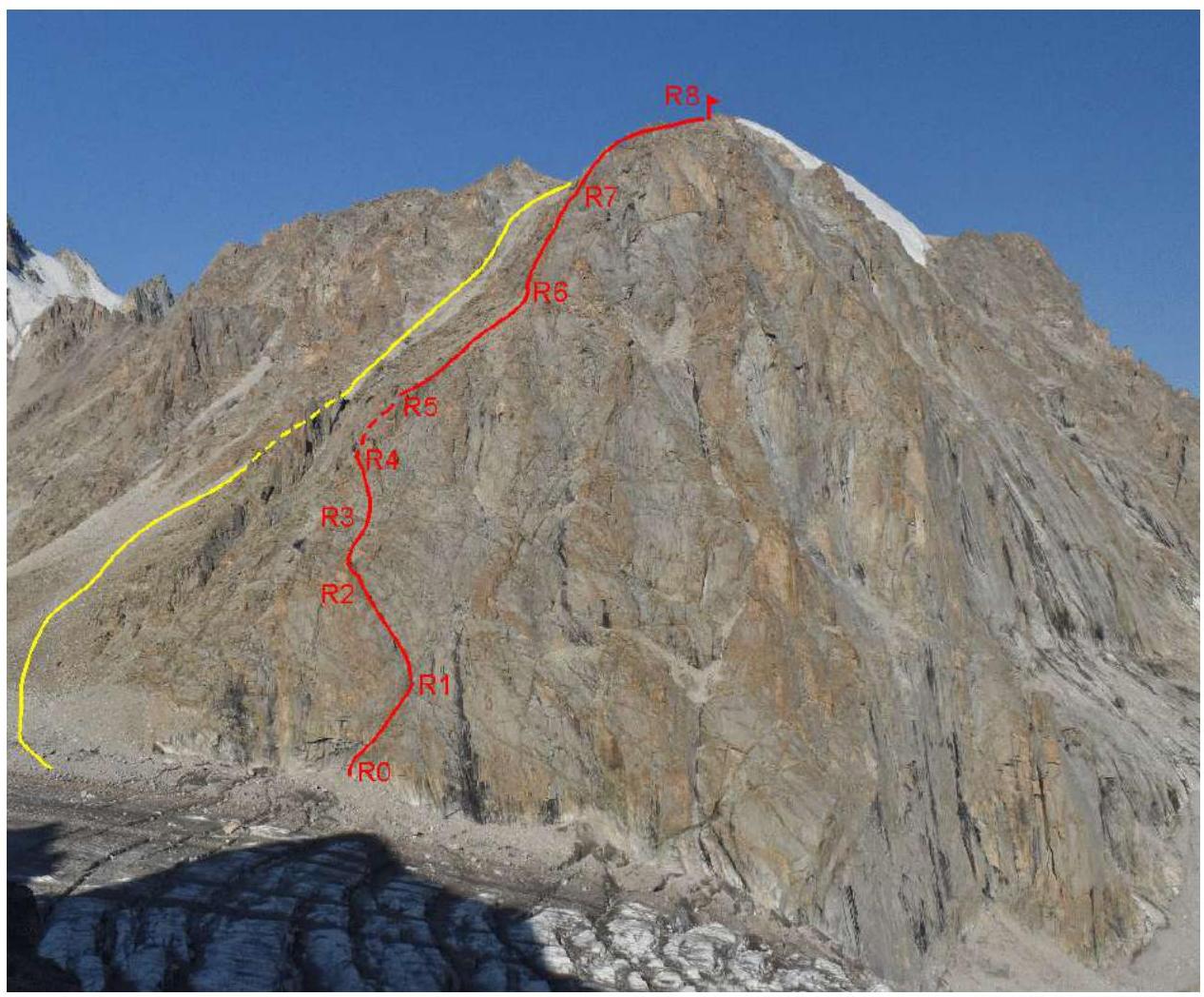
Photo 1. Peak Box from the east. The team's route is marked in red, the descent path is marked in yellow. The photo was taken in July 2023 from Peak Ratsek.
1.2. General Description
Peak Box is located in the lower part of the Ak-Sai glacier, virtually above the "Ratsek Hut" base camp. Its proximity to the alpine camp and rocky terrain make it a convenient object for climbing. There are 11 classified routes on the peak, but some of them, such as those on the northern wall, are very prone to rockfall in summer and are not frequently climbed.
Routes on the eastern wall: — are purely rocky; — are relatively safe since rocks from the upper part of the route predominantly fall onto the northern side.
On the eastern wall, 2 routes are classified — 3B and 4B categories. The route climbed by the team was pioneered by Alexey Pototsky, a guide from the alpine camp. The team followed the route as drawn by him.
1.3. Map of the Area
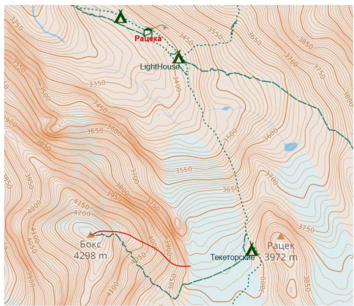
Map of the area (taken from openstreetmap.org). The path from the alpine camp and the descent path are marked in green, the route is marked in red.
The path from the base camp goes along the "Crocodile" moraine under the slopes of Peak Ratsek. In the lower part, the trail goes along a conglomerate slope, and the trail's location changes from year to year. Throughout its length, the trail is marked with cairns. One should follow the trail to the Teketor overnight stays (the journey takes 1.5–2 hours), slightly above which there is a convenient exit onto the glacier. Along the flat part of the glacier (the glacier is open in summer, crampons are not required), approach the eastern wall of Peak Box. The start of the route is located between two noticeable landmarks: — to the left — cornices; — to the right — a large black streak (Photo 1).
2. Characteristics of the Route
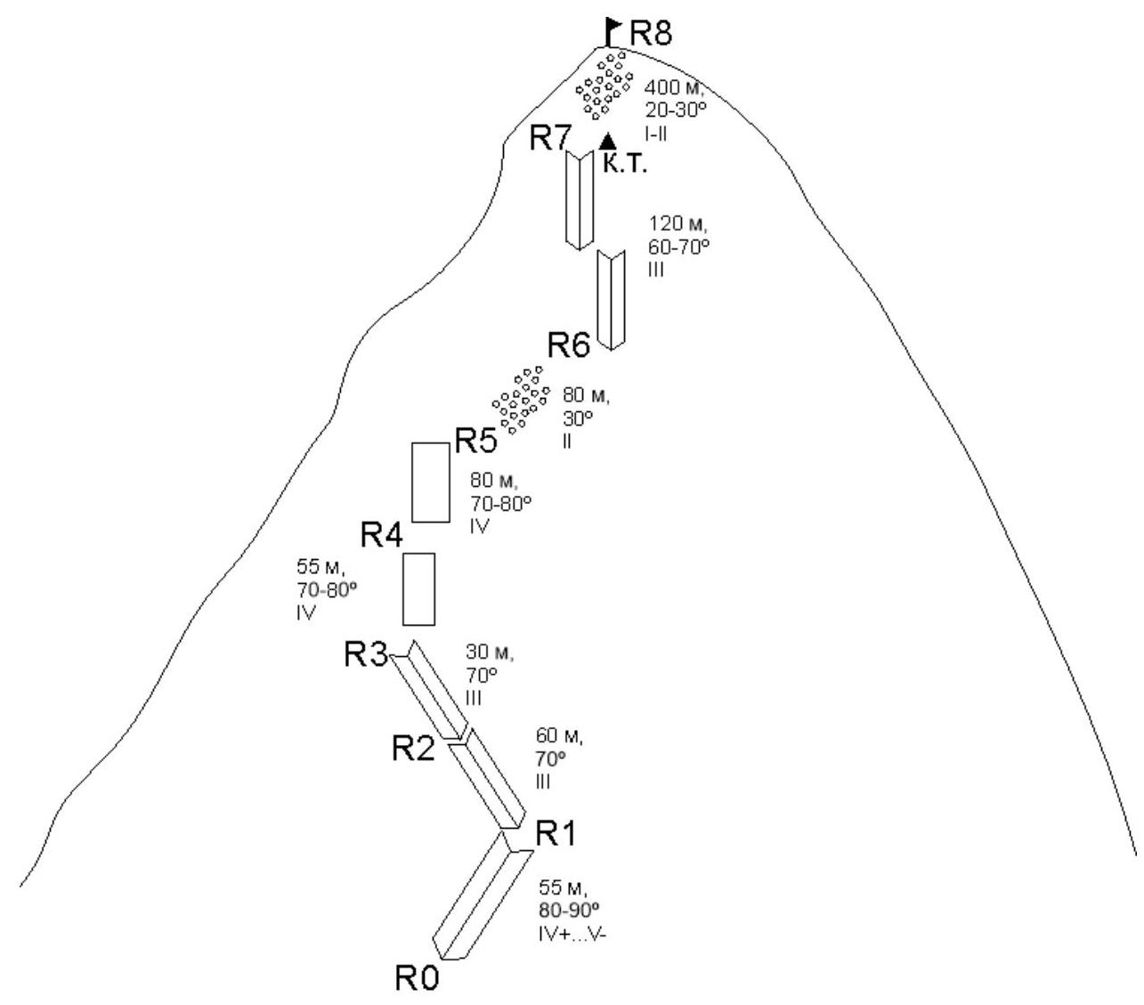
2.1. Scheme of the Route in UIAA Symbols and Characteristics of Sections
3. Characteristics of the Team's Actions
3.1. Brief Description of the Route Passage
The team started the ascent from the base camp at 03:30, picked up the cached gear under Peak Ratsek at 05:00, crossed the glacier (crampons not required), and began moving along the route at 05:40. The team reached the final cairn at 13:30 and the summit at 14:30. They returned to the base camp at 16:30.
| Section № | Section Characteristics | Description | Photo № |
|---|---|---|---|
| R0–R1 | Rocky, 55 m, 80–90°, IV+…V− | The start of the route is between two noticeable landmarks: to the left — cornices, to the right — a large black streak. At the start, there are 2 old hooks with reflective ribbons. The section goes along a weakly expressed inner corner to a bolt. The lower key (5 m), climbing is approximately IV+…V− category. Station on a bolt and own points (recommended to have 1–2 anchors). Coordinates of the route start: N42.52366 E74.53152 | 1,2 |
| R1–R2 | Rocky, 60 m, 70°, III | From the station, move left and up into another inner corner. Climbing is straightforward, but there are many loose rocks. The next station is on a ledge to the left of the direction of travel. Almost 60 m to the station. | 3 |
| R2–R3 | Rocky, 30 m, 70°, III | Climb the inner corner (Photo 4) to a wide couloir (Photo 5), move up along it next to the right wall. The length of the section is 30 m due to significant friction on the bends. | 4,5 |
| R3–R4 | Rocky, 55 m, 70–80°, IV | Cross the couloir upwards and to the left towards the lower of the two pinnacles on the counterfort. Insurance on friends and stoppers, as there are many opening cracks. Station on a convenient ledge under the pinnacle. | 5,6 |
| R4–R5 | Rocky, 80 m, 70–80°, IV | From the station, cross the counterfort and move along its left side to a large scree ledge. Do not descend into the couloir to the left of the counterfort! | - |
| R5–R6 | Rocky, 80 m, 30°, II | Approach the base of a large inner corner along the ledge. Movement is simultaneous. | 7 |
| R6–R7 | Rocky, 120 m, 60–70°, III | Move up the system of inner corners. Be cautious — many loose rocks. Climb the inner corner to the counterfort. On the reverse side of the counterfort, there is a control cairn. Coordinates of the control cairn: N42.52233 E74.52801 | 7,8,9 |
| R7–R8 | Rocky, 400 m, 20–30° I–II | From the control cairn, move along a straightforward scree slope to the summit. | 10 |
Descent from the route: down the scree from the summit to the east towards the scree slope (a wide couloir), then down the slope to the glacier. The descent to the glacier takes about 1 hour.
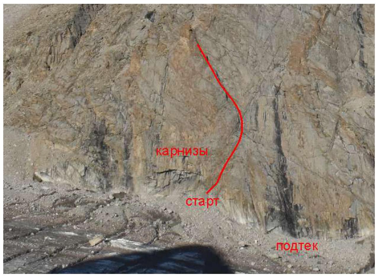
Photo 1. Start of the route. The first two sections of the route are marked with a red line.
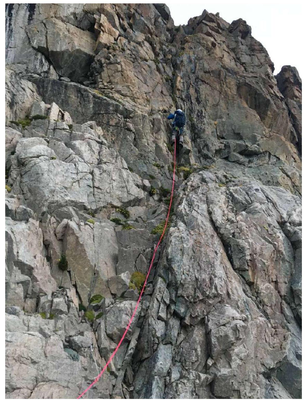
Photo 2. Section R0–R1, leader on the key.
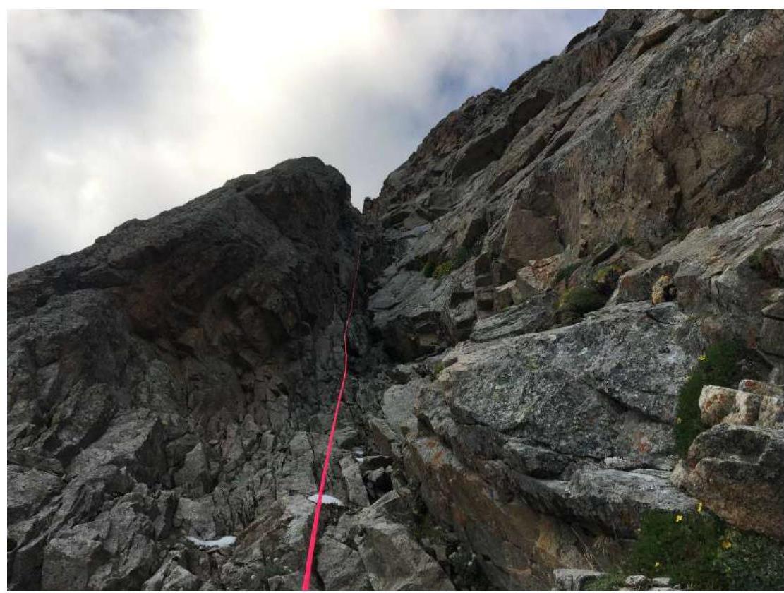
Photo 3. Section R1–R2, view from station R1.
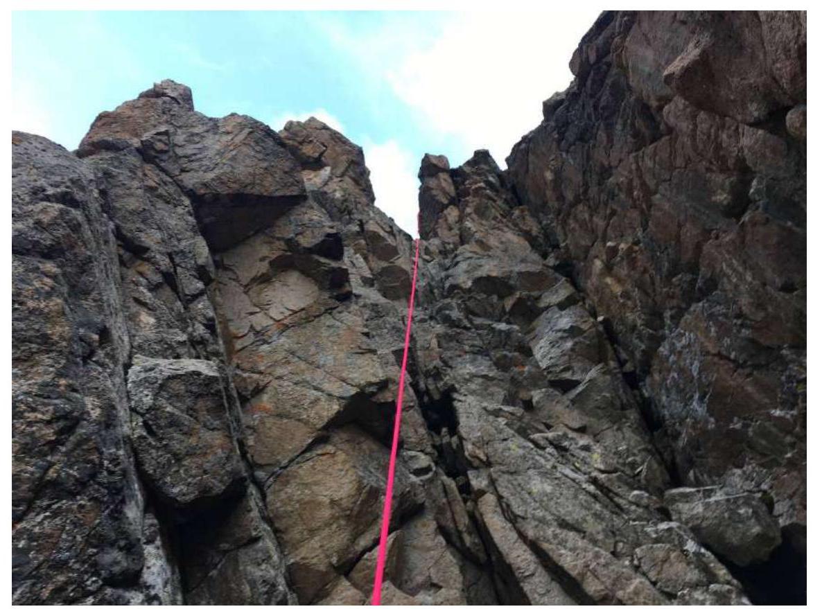
Photo 4. Section R2–R3, photo taken from point R2.
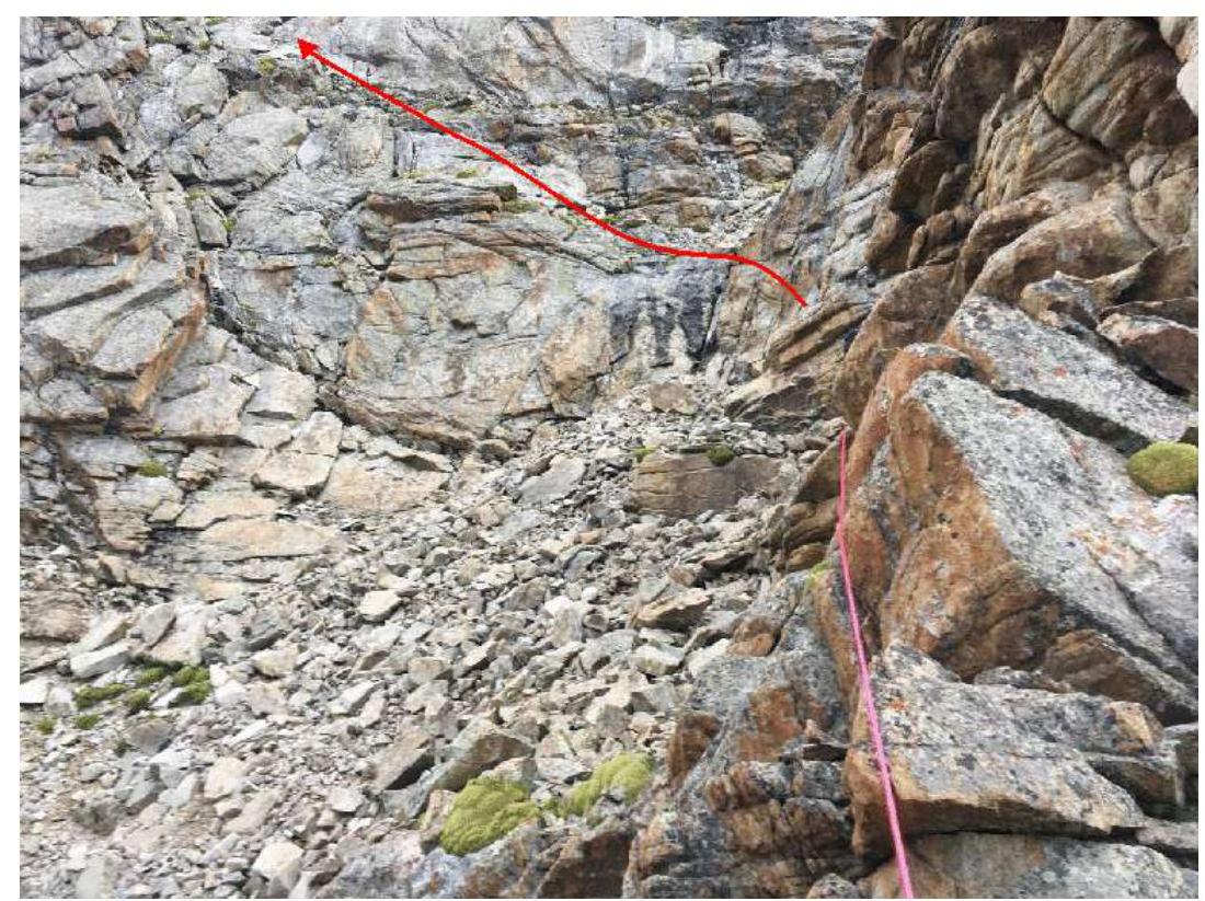
Photo 5. Section R2–R3, upper part, and R3–R4 (path marked with a red line).
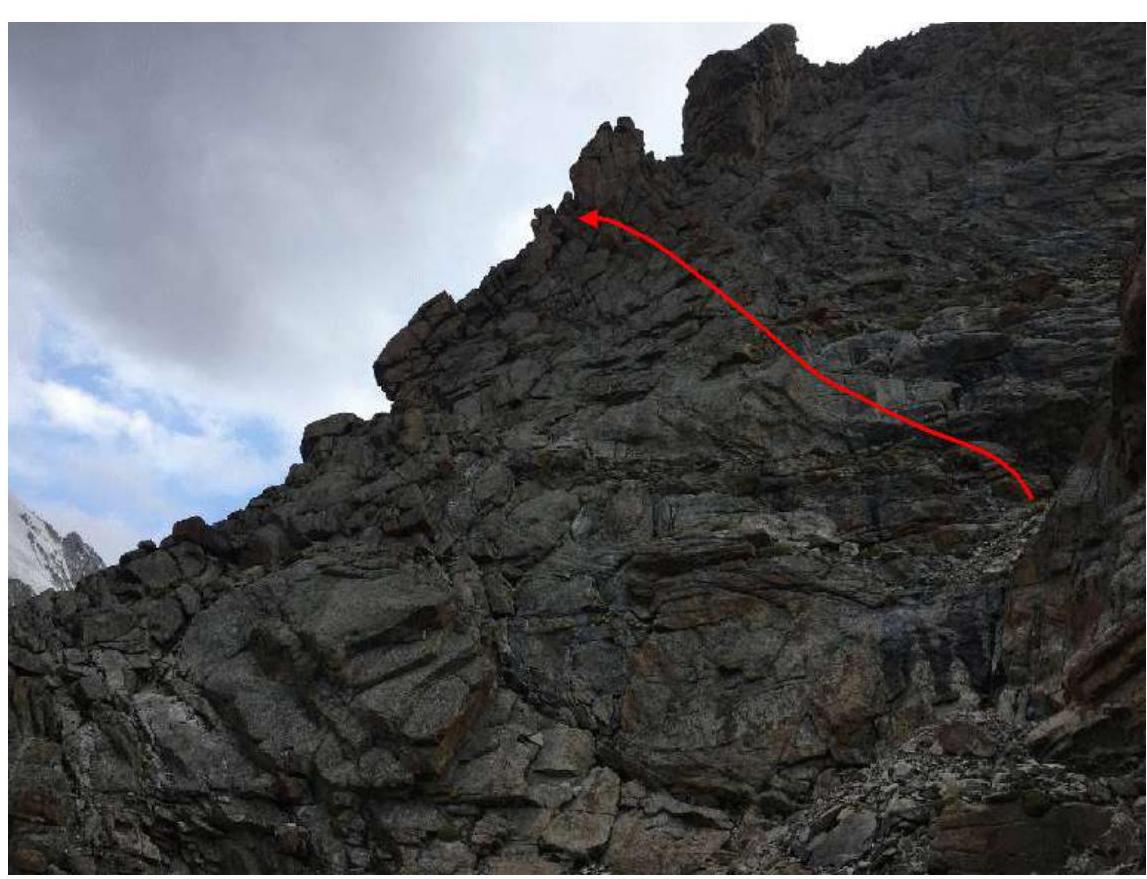
Photo 6. Section R3–R4. Approximate path marked with a red line (variations are possible).
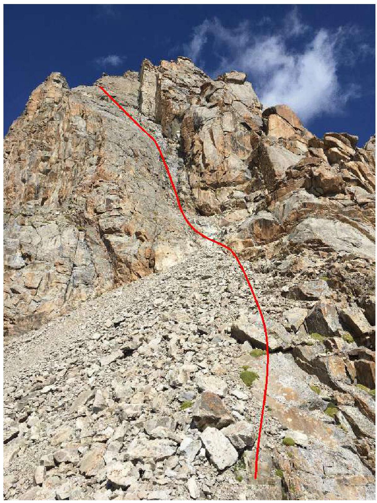
Photo 7. Sections R5–R6 — scree ledge and R6–R7 — inner corner.
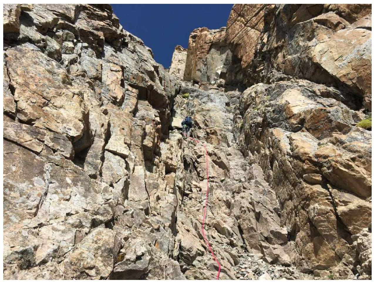
Photo 8. Section R6–R7, upper part.
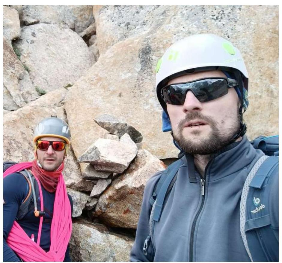
Photo 9. Team at the control cairn.
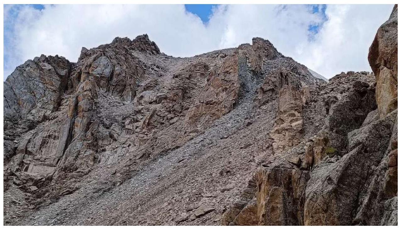
Photo 10. Section R7–R8 — scree slope.
3.3. Overall Assessment of the Route
Throughout its length, the route is logical and follows the simplest path, facilitating orientation. In couloirs and inner corners, there are many loose rocks; caution is required during movement, and an alternating movement scheme is recommended.
For insurance on the route, rocky terrain gear is necessary: a set of friends, a set of stoppers. It is recommended to have a set of cams for insurance in opening cracks. Convenient placement of belay stations is ensured by using a 60 m or longer rope.
In terms of difficulty and length of technical sections, the route corresponds to category 4A.
Comments
Sign in to leave a comment