
REPORT
ON THE ASCENT OF PIK BOKS VIA THE LEFT PART OF THE EASTERN WALL ROUTE, CATEGORY 3B DIFFICULTY, BY THE POLITEKHNIK-6 TEAM FROM JULY 27 TO JULY 27, 2023
I. Ascent Passport
| № | 1. General Information | |
|---|---|---|
| 1.1 | Full name, sports rank of the leader | Imanbaev Renat Talgatovich, 2nd sports rank |
| 1.2 | Full name, sports rank of the participants | Breer Artur Andreevich, 2nd sports rank, Ibragimova Elena Valeryevna, 1st sports rank |
| 1.3 | Full name of the coach | Baranov Dmitry Andreevich |
| 1.4 | Organization | UTC FA SPb |
| 2. Characteristics of the Ascent Object | ||
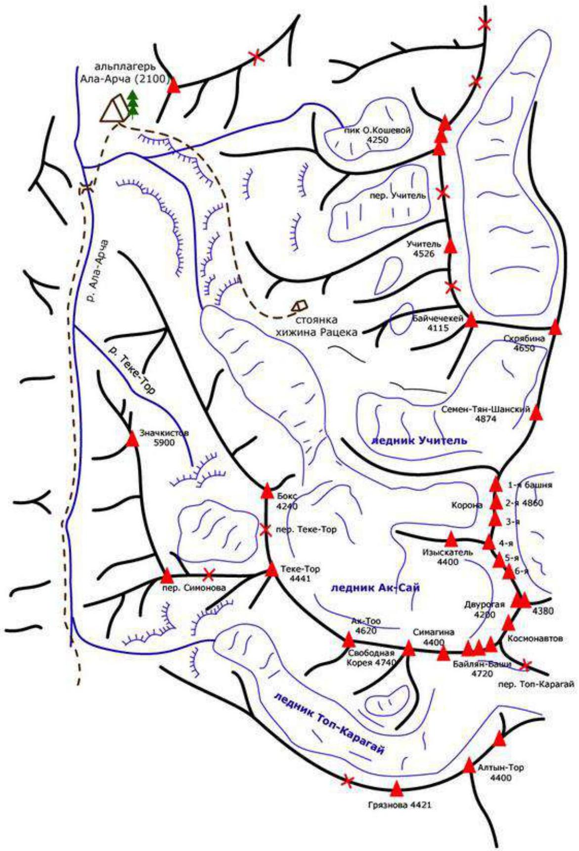
| 2.1 | Region | Kyrgyz Ala-Too range (Ala-Archa) |
| 2.2 | Valley | Aksai |
| 2.3 | Section number according to the 2013 classification table | 7.4 |
| 2.4 | Name and height of the summit | Pik Boks, 4240 m |
| 2.5 | Geographical coordinates of the summit (latitude/longitude), GPS coordinates *(1) | |
| 3. Characteristics of the Route | ||
| 3.1 | Route name | Left part of the E. Wall |
| 3.2 | Proposed difficulty category | 3B |
| 3.3 | Route exploration level | |
| 3.4 | Route terrain type | Rocky - (select) |
| 3.5 | Route elevation gain (altimeter or GPS data) | 700 m |
| 3.6 | Route length (in meters) | 865 m |
| 3.7 | Technical elements of the route (total length of sections with different difficulty categories, specifying terrain type: ice-snow, rocky) | Category I rocky - 675 m. Category II rocky - 75 m. Category III rocky - 55 m. Category IV rocky - 60 m. |
| 3.8 | Descent from the summit | Category 1B |
| 3.9 | Additional route characteristics | Water present |
| 4. Characteristics of the Team's Actions | ||
| 4.1 | Movement time (team's walking hours, in hours and days) | 7 hours |
| 4.2 | Overnight stays | Not planned |
| 4.3 | Route start | 5:30 July 27, 2023 |
| 4.4 | Summit ascent | 12:30 July 27, 2023 |
| 4.5 | Return to base camp | 16:00 July 27, 2023 |
| 5. Person Responsible for the Report | ||
| 5.1 | Full name, e-mail | Imanbaev Renat Talgatovich, ren.spb@gmail.com |
DESCRIPTION OF THE ASCENT
1. Characteristics of the Ascent Object
Map of the area:
 General photo of the summit:
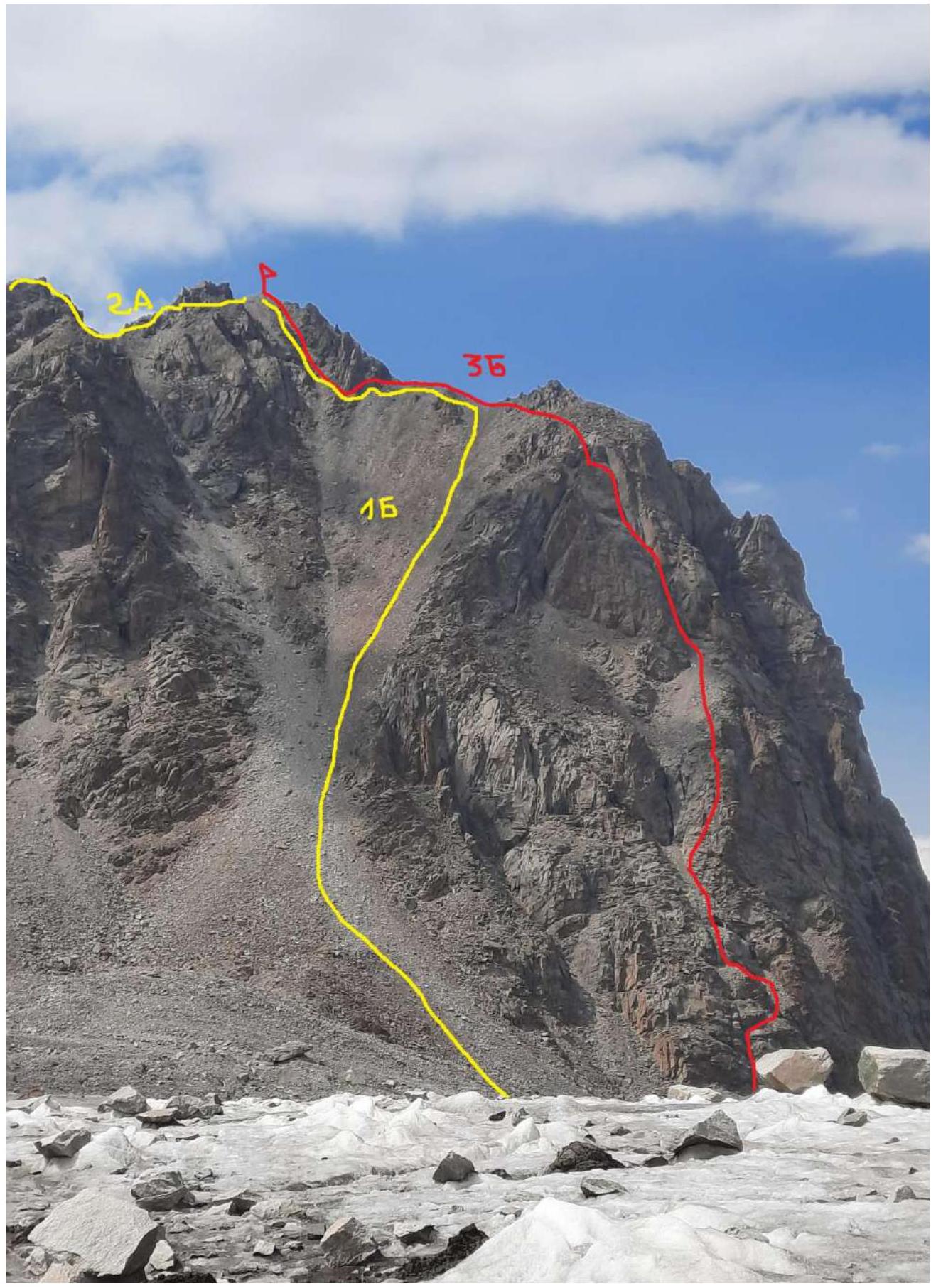
Photo from the Ak-Sai glacier (July 29, 2023)
2. Characteristics of the Route
Technical characteristics of the route sections
| Section № | Terrain type | Difficulty category | Length, m | Type and number of anchors |
|---|---|---|---|---|
| R0–R1 | Inner corner | III–III+ | 40 m | 4 friends |
| R1–R2 | Scree slope | I–II | 70 m | 0 |
| R2–R3 | Rocky wall | III | 15 m | 2 friends |
| R3–R4 | Scree slope | I–II | 40 m | 0 |
| R4–R5 | Rocky wall | III+–IV | 60 m | 4 anchors, 5 friends |
| R5–R6 | Scree slope | I–II | 40 m | 0 |
| R6–R7 | Inner corner/rocky wall | III | 70 m | 5 friends, 1 anchor |
| R7–R8 | Scree | I | 600 m | 0 |
3. Characteristics of the Team's Actions
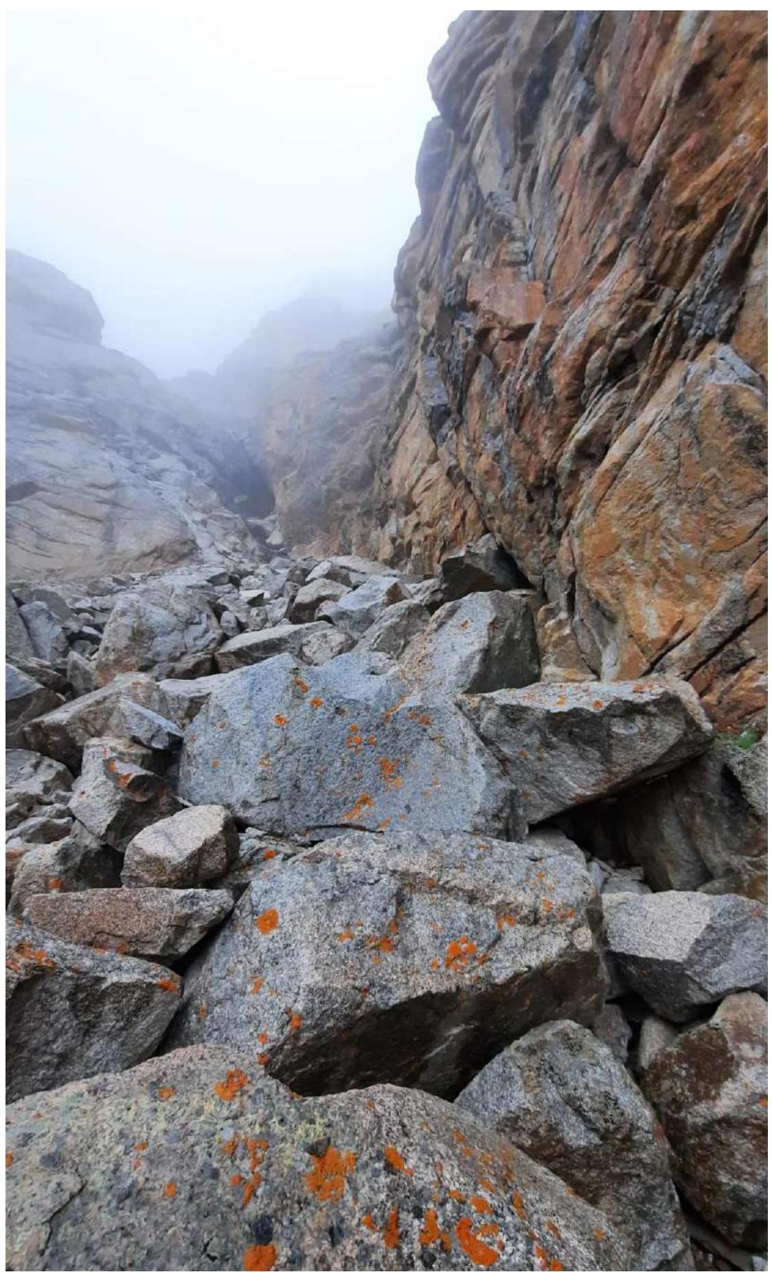
On July 27, 2023, at 4:00, we left the base camp located at the Ratsek hut. We ascended to the Teketorsky overnight stays and crossed the Ak-Sai glacier. At 5:30, we were under the route.
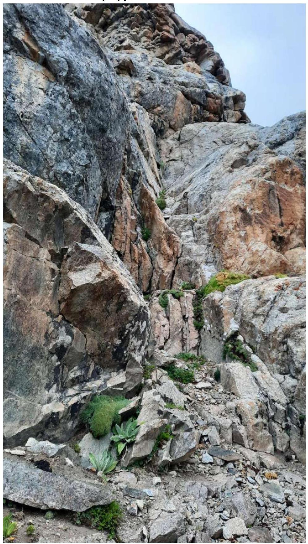
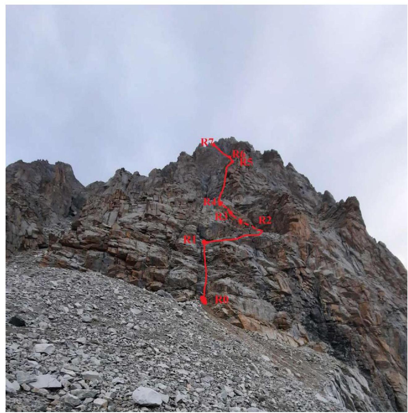
Section R0–R1 is an inner corner that becomes steeper at the top. In wet weather, it becomes quite slippery. The section ends with a large ledge. There are several "natural" pitons on the route.
Section R1–R2: the ledge goes to the right and turns into a scree gully. The gully goes up and to the left. 10–20 meters before the inner corner that ends the gully, you need to move left under the rocky slabs. At the base of the slab, there is a "natural" cam.
Section R2–R3: a small wall with a difficulty of 3, ending in a scree gully.
Section R3–R4: a scree gully ending in an inner corner with black streaks.
Section R4–R5: 20–30 meters before the black streaks, the route goes up to the right along the rocky wall. Climb up under the ridge, without going out onto the edge, sticking to the left side of the ridge.
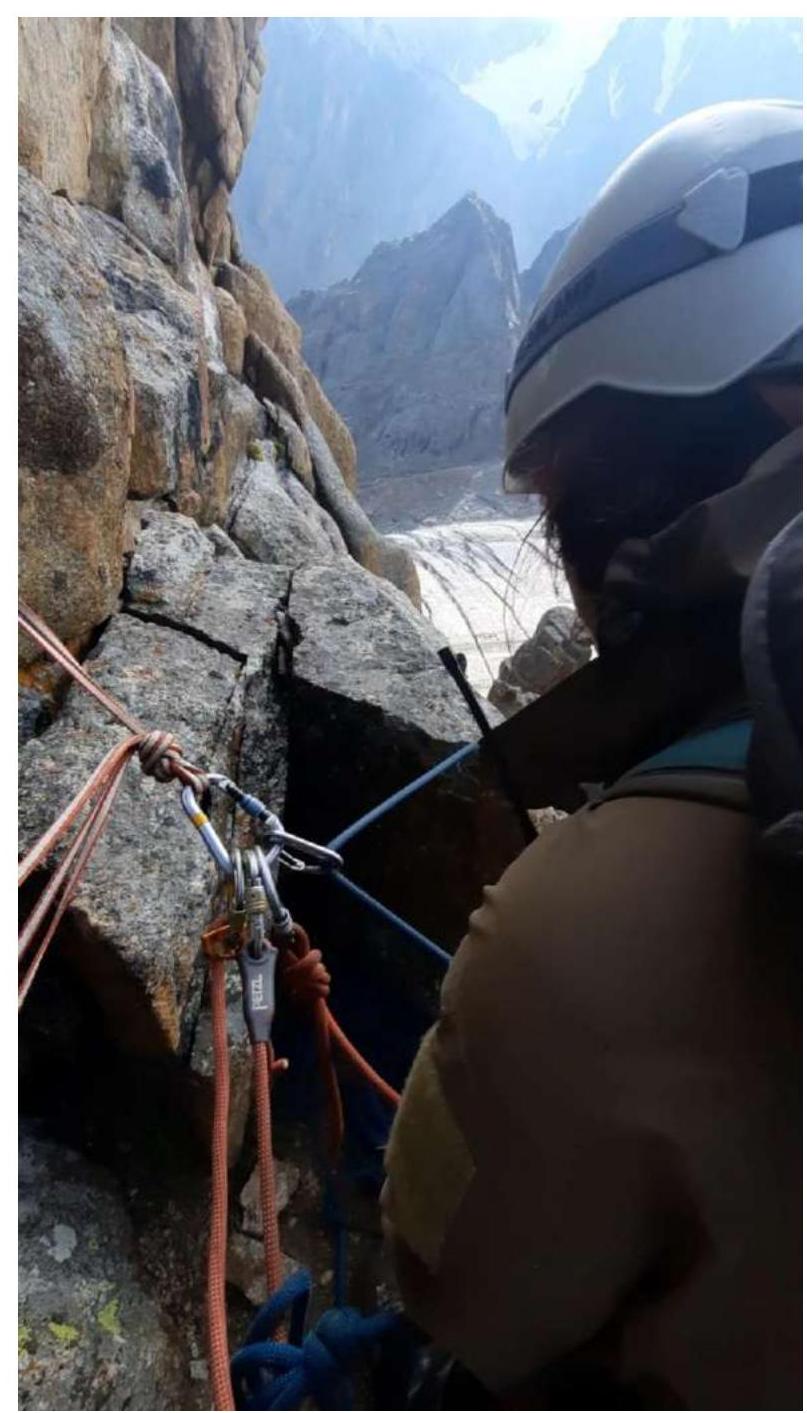
View from the station at the top of section R4–R5
View from the station into the gully (start of section R4–R5)
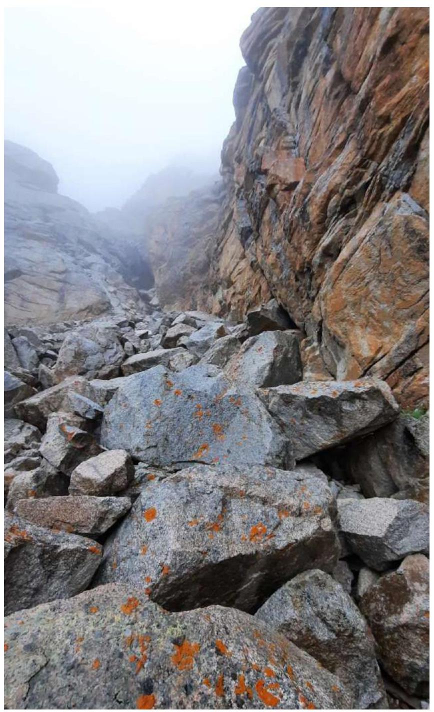
Section R5–R6: the rocky wall ends with an exit into a scree gully. Along it, 40–50 meters to the inner corner.
Section R5–R6–R7 (inner corner - in the center, rocky wall - on the left)
Section R6–R7: you can climb along the inner corner or along the left wall. The inner corner looks unsafe with a lot of "live" stones. The rocky wall is a system of small ledges. We climb up to the exit onto the ridge and cross over it. There are few places for belays on the wall. You need to climb carefully.
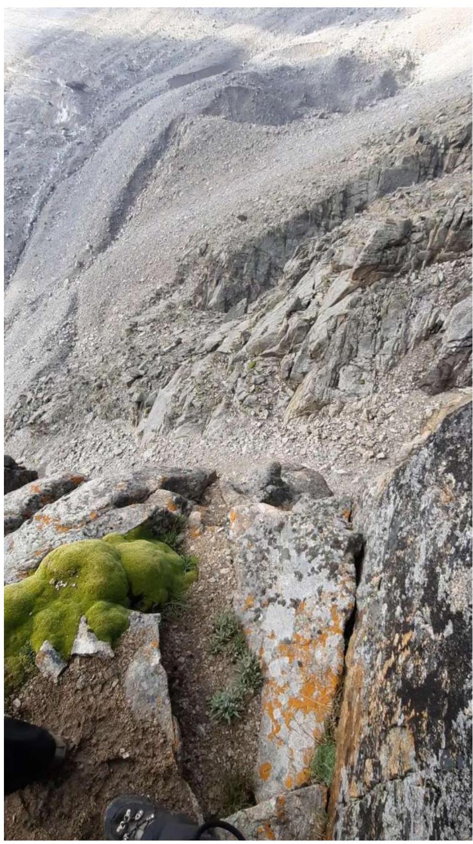
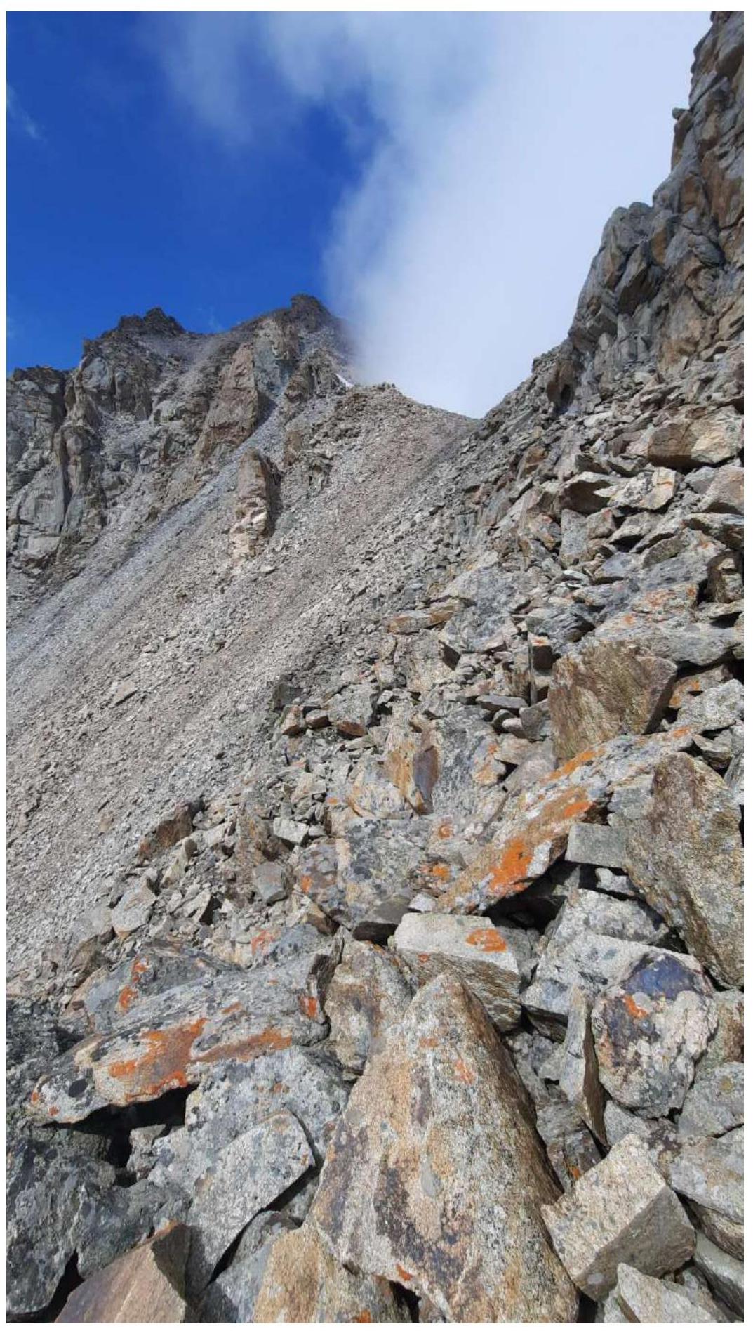
Section R7–R8: behind the ridge, there's a desire to go down a bit into the gully and climb up to the saddle along it, but it's more convenient to go along the left part of the ridge to the saddle. In this part of the route, "tourists" are stacked.
From the saddle to the summit, it's a 15–20 minute ascent along the scree. We reached the summit at 12:30.
Section R7–R8
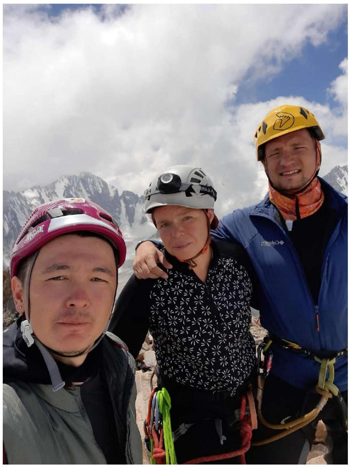
Summit of Pik Boks
Overall, the route is quite safe. The route is recommended by Pavlenko D. as a good 3B.
Descent from the summit via category 1B.
In the upper part of the route (start of R6 or start of R7), you can go into the gully on the left and from it exit into the main descent gully.
Comments
Sign in to leave a comment