
Report on the First Ascent of the Route to Peak Uchitel via the Eastern Ridge.
Climbing Passport
- Tian-Shan, Kyrgyz Ala-Too range, Ala-Archa gorge.
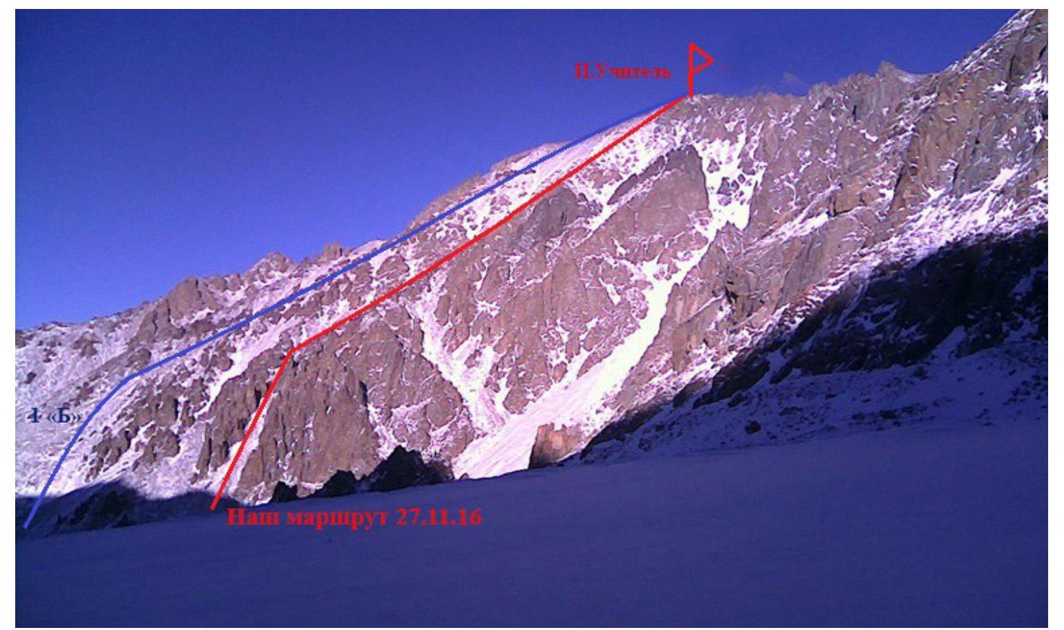
Peak Uchitel 4550 m. Presumed 2A category of difficulty, first ascent.
Route character — ridge.
Route height difference — 700 m.
Route length — 1700 m.
- Section lengths: I — 1550 m, II — 150 m,
- Average steepness: main part of the route — 30°.
- Pitons left on the route: total — 0;
- Total used on the route: ice screws — 0, rock pitons — 0, chocks — 0.
- Total artificial protection points (APs) used — 0 pcs.
- Team's total climbing hours: 6 hours, 1 day (excluding overnight stays)
- Team:
Klevtsova Anastasia (leader).
Seliverstov Sergey
Usatykh Alexey.
- Senior coach: Popov Fedor Efimovich
- Departure to the route: 8:00, November 27, 2016.
Reached the summit: 14:30, November 27, 2016.
Returned to Base Camp: 16:00, November 27, 2016.
General view of the summit
Route Description
| Departure from Ratshek campsite (Base Camp) | 8-00 |
|---|---|
| Approached the route | 9-30 |
| Reached the summit | 14-00 |
| Descent to Base Camp | 16-00 |
We start moving towards Uchitel Glacier. After the first ascent (20 minutes walk), we look for a logical couloir on the left above, bounded by steep rock walls. We turn in its direction. At the entrance to the couloir, we set up a large cairn.
Further:
- To the very top of the couloir, which ends in a rock cirque.
- We put on harnesses, helmets, and rope up.
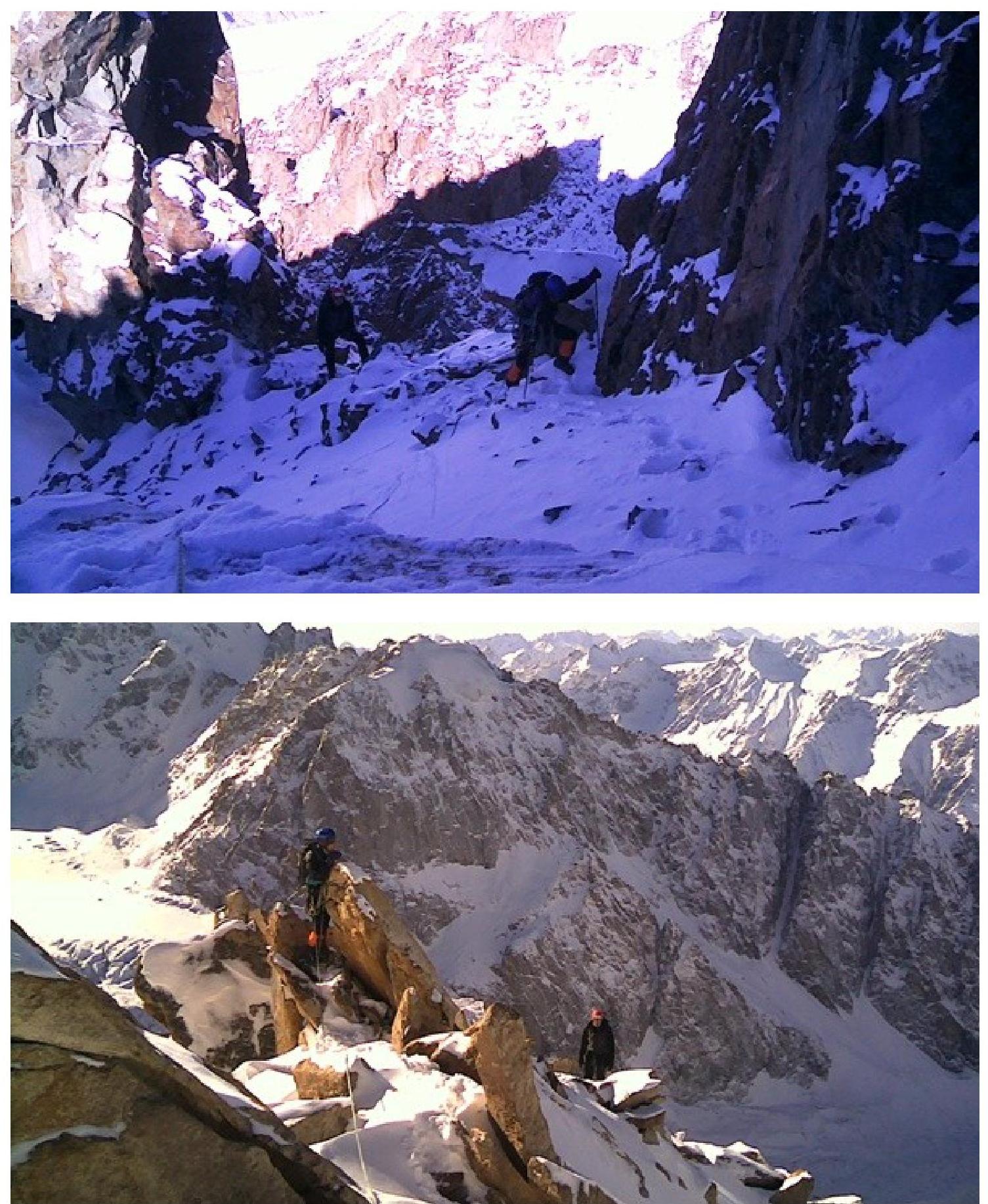
- We start along a logical inner corner (20 m, 45°, II).
- Further on foot along the scree-filled couloir towards the ridge.
- Through a small wall, we exit onto the ridge (2 m, 60°, III).
- Further to the very summit — a long ridge, sometimes small walls, sometimes heavily destroyed (1600 m, 30°, I–II).
- Before the summit — a snow-ice ridge. Crampons may be needed.
A good long 2 "A".
Couloir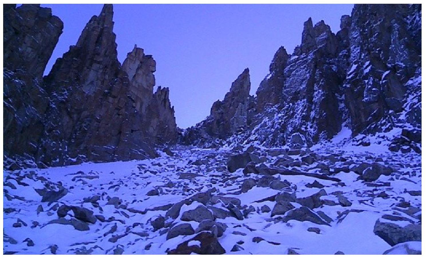 Start of
the route
Start of
the route
Exit to the
ridge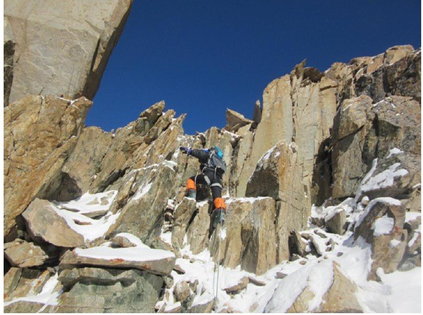
Ridge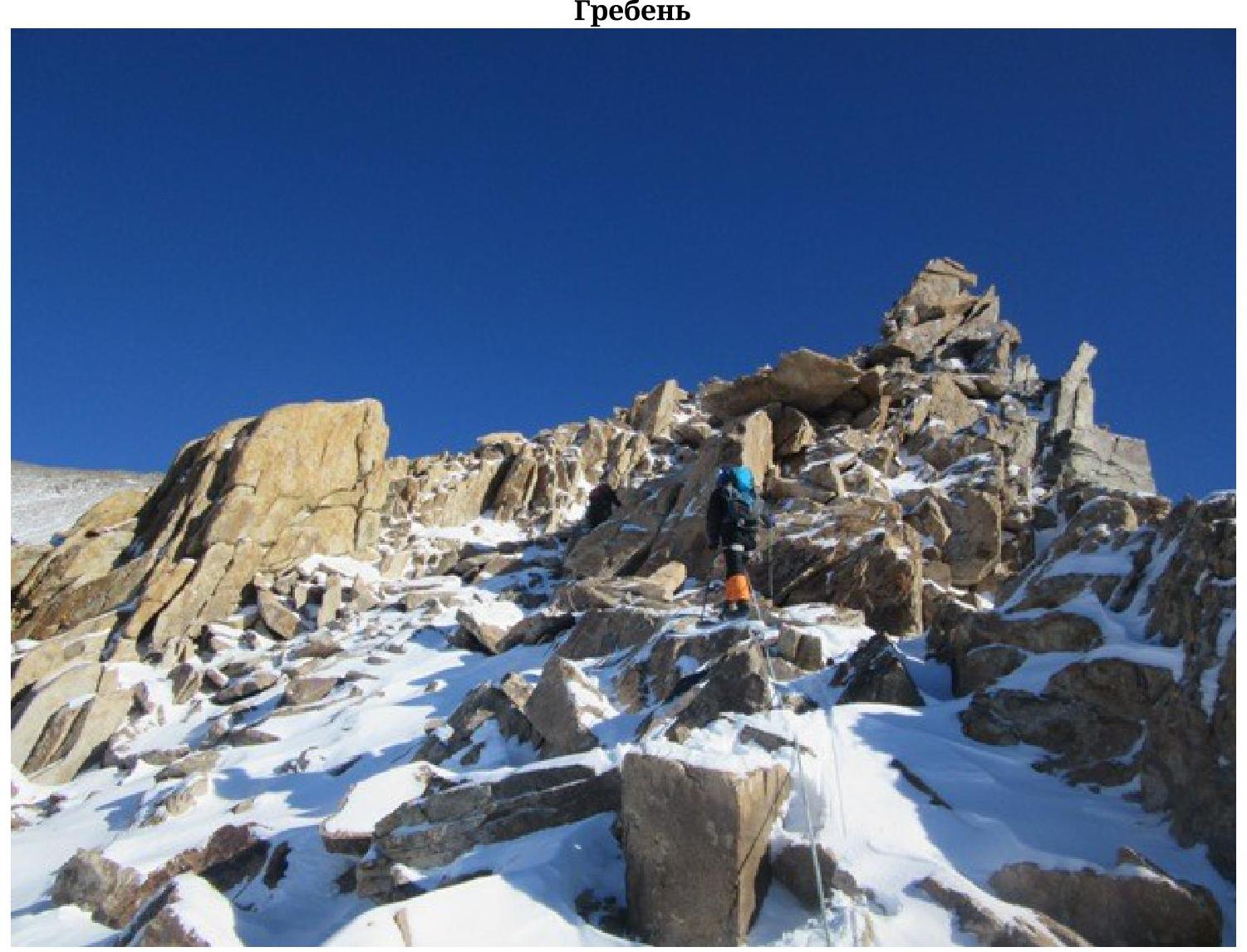
Before reaching the
summit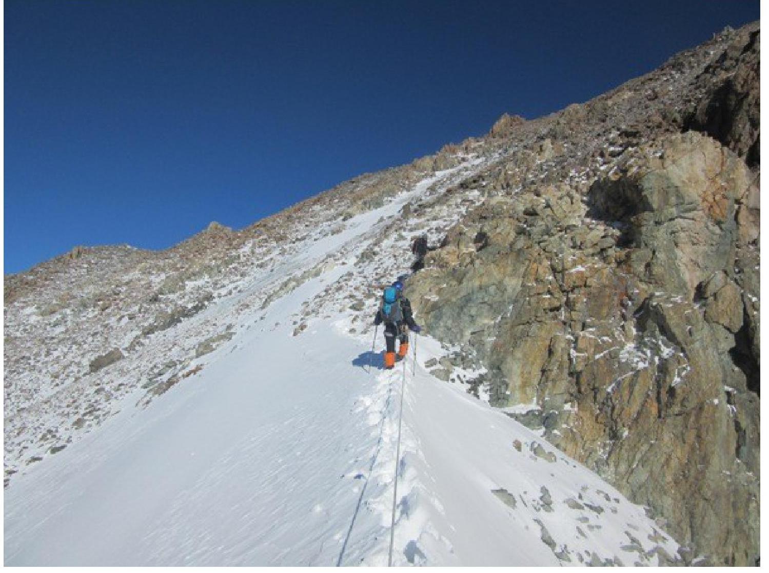
Summit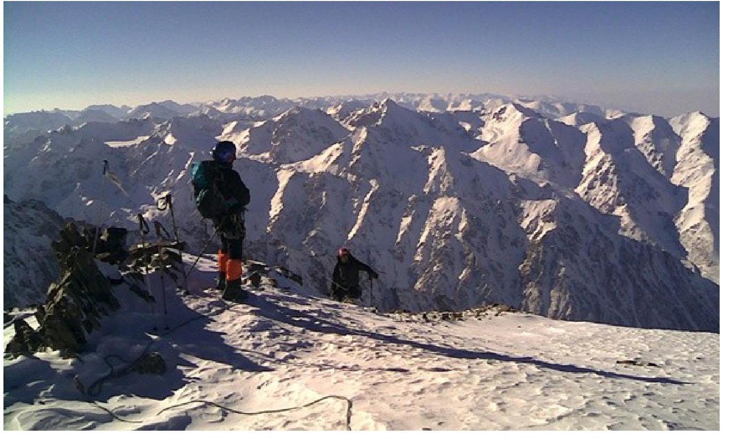

This is us schematized from the
summit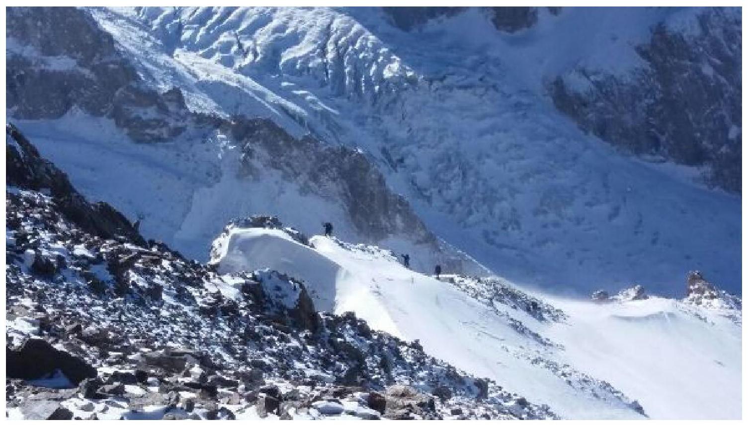
Comments
Sign in to leave a comment