Ascent Passport
- Region — Tian-Shan, Kyrgyz Range, Ak-Sai gorge
- Peak — Trident 4500 m, right couloir, N face, 5A
- Proposed — 5A category of difficulty, first ascent.
- Route type — combined
- Route characteristics:
elevation gain — 560 m. route length — 820 m. length of 5th category sections — 470 m. average steepness — 55°, main part — 65°
- Left on the route: total 2 rappel rings.
Used stationary pitons — 0, removable pitons — 0. Total usage of ITD — 0
- Total climbing hours — 14 h 30 min, days — 1
- Team leader: Prokofiev Denis Evgenievich MS
Team members: Popova Marina Evgenievna 1st sports category
9. Team coaches:
Balezin Valery Viktorovich MSMK, Zakharov Nikolay Nikolaevich MSMK, ZTR
On the route — at 6:30 AM on August 4, 2013, on the summit — at 5:30 PM on August 4, 2013, return to base camp — at 11:00 PM on August 4, 2013.
- Ascent organized by — Ministry of Sports, Tourism and Youth Policy of Krasnoyarsk Krai.
2013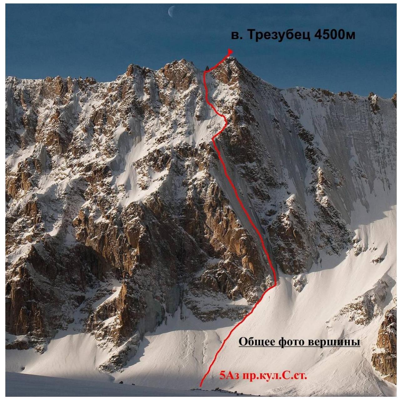 в.
Trident 4500 m
№7
в.
Trident 4500 m
№7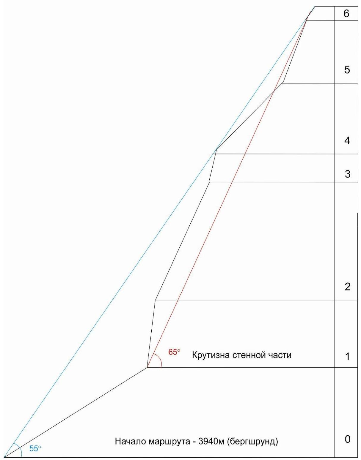
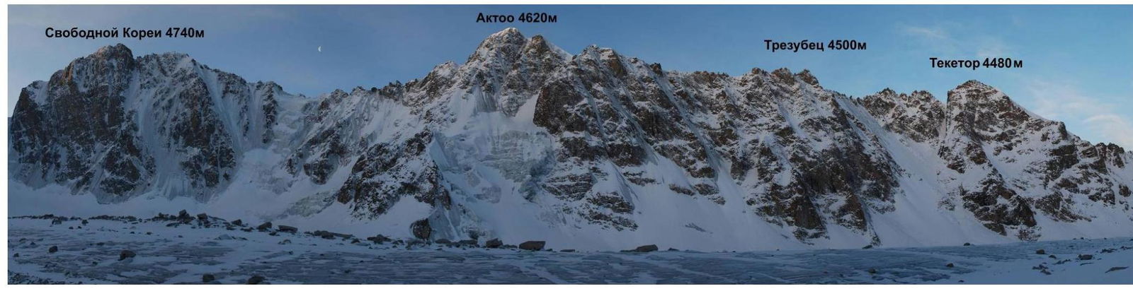
Area photopanorama
Brief overview and tactical actions of the team
The Trident peak is located between the Aktoo and Teketor peaks, and there is a fairly simple approach to it along the Ak-Sai glacier from the Koronskie overnight camps. A logical first ascent was planned — via the icy couloir of the northern wall to the right tooth.
The team Prokofiev D., Popova M. left the Koronskaya hut at 6:30 AM, and by 9:00 AM they approached the icy part of the route. By 2:00 PM they reached the rocky section, and due to the large amount of snow, they passed it by 4:00 PM, then again entered the icy section. By 5:00 PM they were on the saddle between the teeth. At 5:30 PM they reached the summit.
Since the situation was avalanche-prone, and there was little daylight left, a decision was made:
- to descend via the ascent route,
- to use 60 m ropes.
By 9:00 PM the team descended to the beginning of the icy section. At 10:00 PM they descended through the snow to the Ak-Sai glacier. At 11:00 PM the team returned to the Koronskaya hut.
| № | total | ||
|---|---|---|---|
| 15 | 40 | ||
| 6-7 |  |  | 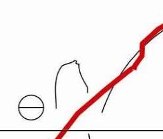 |
| 4 | III +30 м 60^{\circ} | ||
| 5-6 | 12 | 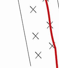 | |
| 4-5 | 7 |  | |
| 3-4 | 6 | 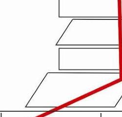 | |
| 2-3 | 11 |  | |
| 1-2 | 6 |  | |
| 0-1 | 4 | 5 |  |
UIAA route scheme
Route description by sections
The approach from the Koronskaya hut takes approximately 1–1.5 hours along the Ak-Sai glacier. It is necessary to move in a connected team, as the glacier is partially covered. Then the ascent begins under the bergschrund, and movement is also in a connected team, avalanche-prone.
Section R0–R1 — approximately 200 m long. Beginning of the route. We approach the bergschrund, then move along the snow to the rocks. Movement is along the rocks to the right and upwards, towards the icy couloir. Belaying is done using rocks (medium-sized chocks), and at the end, using ice screws. The ice is fragile in some places. It is necessary to move carefully — avalanche-prone.
Section R1–R2 — approximately 80 m long. Movement is on ice, the ice is not very strong:
- At the beginning of the pitch, it is necessary to clean the ice from "bubbly ice" for safety.
- After 30 meters, the ice becomes stronger.
- The steepness of the ice is approximately 75°.
The section is complex.
Section R2–R3 — movement is on ice, approximately 170 m. The ice becomes less steep, around 60°.
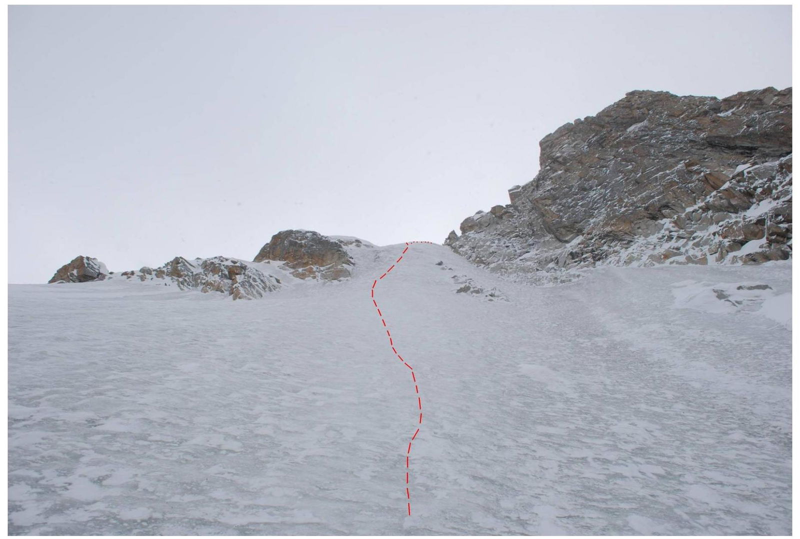
Section R3–R4 — the ice becomes steeper, the couloir leads to a steep "face", approximately 75°. This section is the most complex and is the key section of the route.
Section R4–R5 — ascent on ice to the rocks, approximately 120 m. The rocks are not very steep, around 40°, the orientation is the continuation of the icy couloir. It is necessary to move carefully (due to the large amount of snow — avalanche-prone). Belaying is done along the rocks using stoppers and medium-sized chocks. The station is on a large ledge. Then again, we move onto the ice.
Section R5–R6 — 180 m long, movement is on ice:
- The ice is steep, 65°–70°.
- Near the top, the ice starts to break off in lenses.
Ascent to the saddle between the teeth.
Section R6–R7 — 30 m long. Movement from the saddle to the right, ascent up a 60° wall, climbing is not complex. A control cairn is built, and a note is left.
Descent: descending via the ascent route is the most logical:
- First, 3 rappels to the rocky section.
- Then 2 rappels along the rocks (a loop is left).
- Then along the icy couloir for approximately 500 m.
In total, there were 11 rappels, and by 9:00 PM the team was already at the beginning of the R0–R1 section.
Supplement to the route:
The equipment used on the route was mainly ice screws, and for the rocky section R4–R5, it is necessary to bring:
- a set of stoppers
- a friend
At the beginning of the route and on the rocky section R4–R5, it is necessary to be cautious due to the possibility of avalanches.
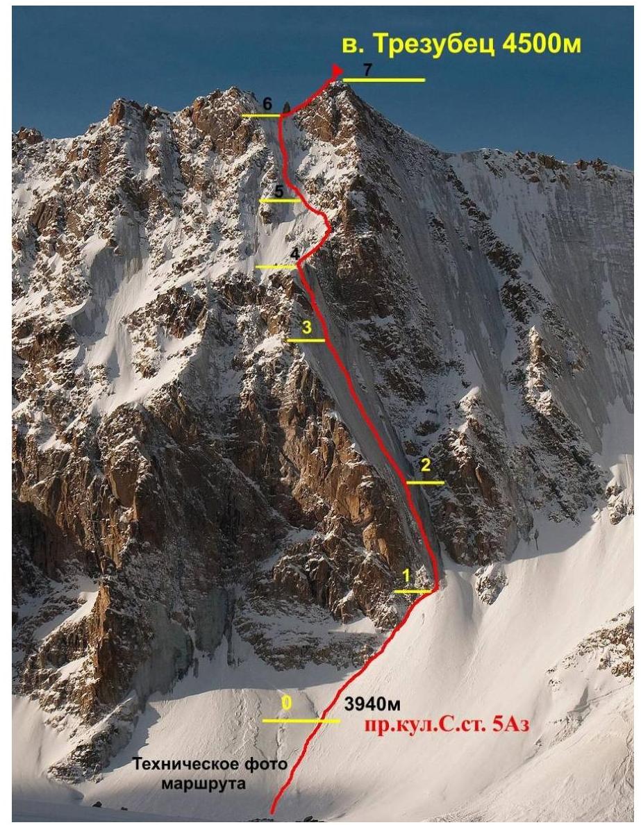 3940
м right couloir N face
5A
3940
м right couloir N face
5A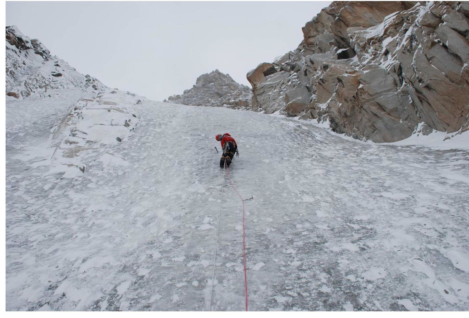
Passing section R1–R2. Denis Prokofiev. R1–R2. Approach to section R2–R3
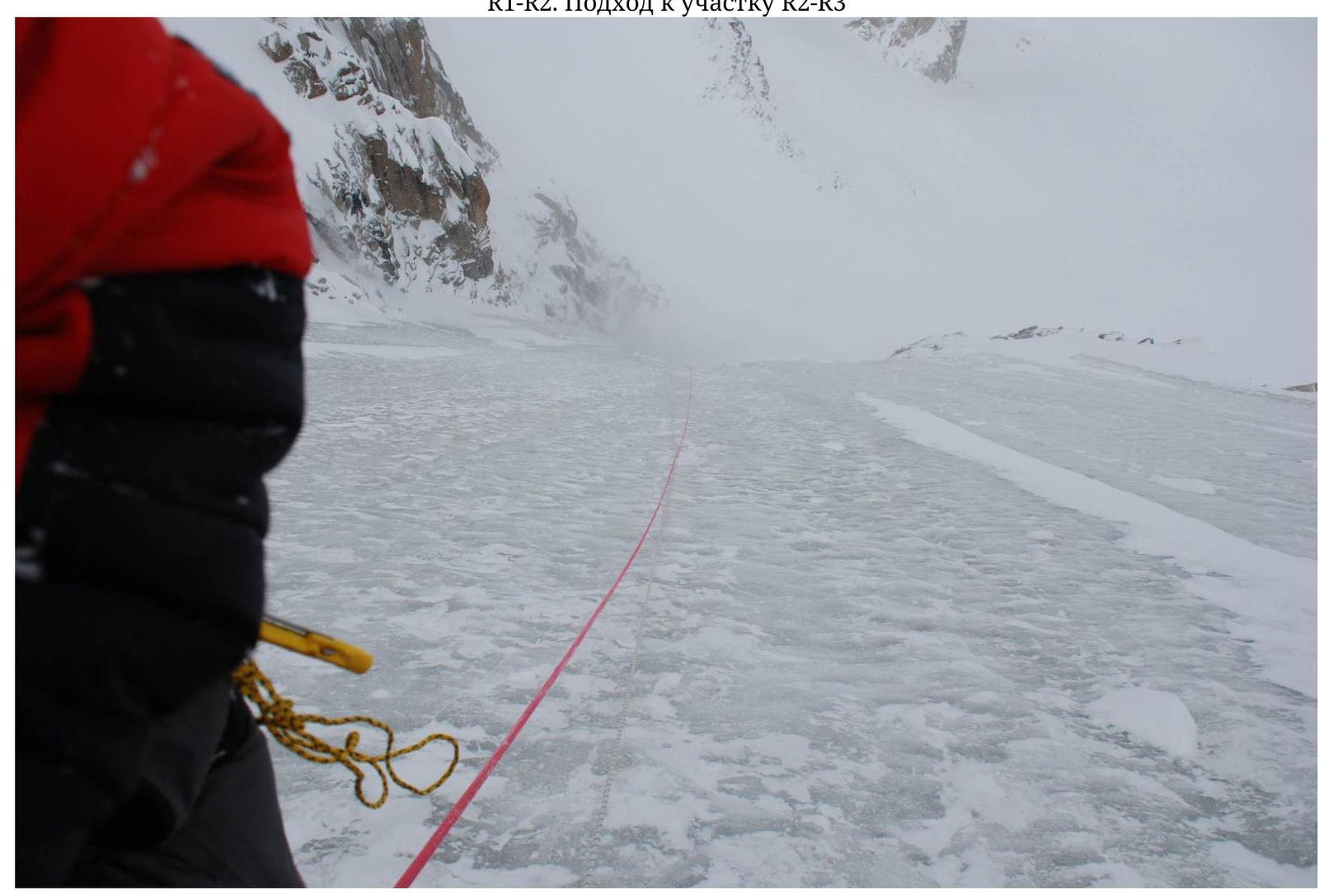
Taken from the station on section R2–R3. The photo shows the beginning of section R2–R3
Section R3–R4. Taken from station R3.