Passport
- Winter category.
- Tian-Shan. Kyrgyzsky ridge. Ak-Sai gorge.
- Peak Svobodnaia Korea, 4740 m, via the north wall.
- 6A category difficulty (S. Semiletkin, 1988) 9th ascent.
- Elevation gain 820 m, route length — 1125 m.
Length of sections with 5th category difficulty is 390 m, 6th category — 310 m. Average steepness of the route is 60°.
- Pitons used
| Rock | Bolt | Nuts | Ice screws |
|---|---|---|---|
| 30+2* | 8 | 210 | 38 |
| 26+4* | 5+4* | 190+2* | 0 |
* — re-use of previously hammered pitons.
Left on the route: rock pitons — 1, nuts — 0, bolts — 0.
- Team's climbing hours — 45 hours and 4 days.
- Overnights: all lying down, on a platform.
- Leader: Evgeny L. Novoseltsev, Candidate Master of Sports, home address 620100, Ekaterinburg, Tveritin str., 13-26. Participants: Vitaly Akimov, Candidate Master of Sports.
- Coach: Valery N. Pershin, Master of Sports of International Class, Honored Master of Sports, home address 620144, Ekaterinburg, Frunze str., 78-32.
- Approach to the route on January 20, 2001.
Summit on January 23, 2001. Return on January 24, 2001. 12. Organization: Ural Climbers Club, Ekaterinburg, 620014, Ekaterinburg, Moskovskaya str., 28b.
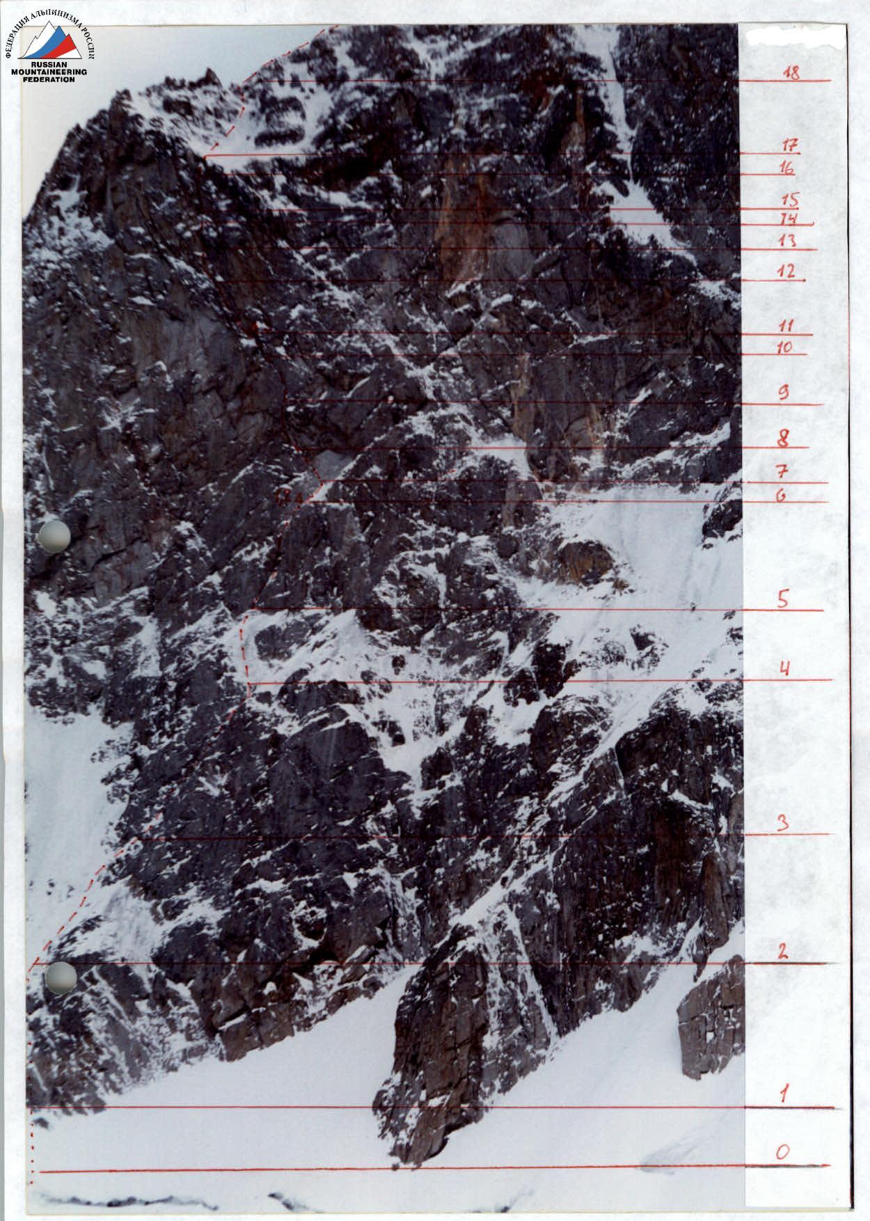
Technical photo of the route.
Team's Tactical Actions
The Ala-Archa area, being well-explored, is one of the most interesting regions for winter technical mountaineering in the CIS. Moreover, it offers quick and relatively easy access and is financially affordable. Peak Svobodnaia Korea drops from the north with a nearly sheer wall featuring several routes of 6B category difficulty. The experience of winter ascents via this wall and its technical complexity predetermined our choice. Continuous year-round rock and technical training, free climbing level up to 7c+, careful selection of equipment and clothing — all this enabled us to complete the planned route quickly and without accidents.
As part of the preparation for this ascent, at the end of December, we completed:
- M. Mikhailov's route on v. Boks, 5B category difficulty (3rd ascent);
- ascent on v. Baychechekey, 5A category difficulty.
Rest and good acclimatization also contributed to our rapid progress.
On the route, the team used new equipment samples:
- Hilti drill as a punch;
- shortened 8 mm bolt pitons of original design by Alvo-Titanium;
- mini-cams from 10 mm also by Alvo-Titanium;
- shortened drill bits.
For bivouac organization, we used:
- a platform of our own design;
- warm sleeping bags with new, separate-fraction synthetic insulation.
Our pair's movement was organized in Big Wall style (capsule style) due to the heavy load:
- the first climber ascended on a double rope, without a backpack, and set up a belay station;
- the UIAA rope was used as a fixed rope;
- with the help of a second rope, the leader pulled up the load through a block-roller;
- the second climber ascended on the fixed (belay) rope, removing belay points and controlling the load with a self-belay.
Using the belay rope to pull up the load was complicated by the large number of belay points and the resulting additional friction.
For belay station organization, we used:
- at least two drill bits (ice);
- 3–5 rock elements.
Proper organization of the belay chain ensured the safety during two working falls of 1.6 m and 6 m (stopper and cams). The nutrition regimen was classic — hot meals in the morning and evening, snacks during the day. We had a modern first-aid kit, including vasodilators, Promedol, and other necessary medications and supplies, but did not use it. At Ratsek camp, there was a potential rescue team with the right to ascend routes of 6th category difficulty. We brought our trash down and tried to leave as few of our belay points as possible. The combination of these tactical
Route Diagram in UIAA Symbols
M 1:2000 (sections over 100 m are not to scale)
| Section # | Climbing hours date | Route | Photo # | Category of difficulty | Section length | Steepness (degrees) |
|---|---|---|---|---|---|---|
| 1 | 2 | 3 | 4 | 5 | 6 | 7 |
| 5 | Photo #3 | VI A1 | 65 of which 15 | 80° | ||
| V+ | 50 | 65° | ||||
| 4 | IV | 75 | 60° | |||
| 3 | Photo #2 | V+ | 40 | 60° | ||
| 2 | Photo #1 | III | 40 | 55° | ||
| 1 | V | 70 | 70° | |||
| 0 | II | 110 | 50° | |||
| :--: | :--: | :--: | :--: | :--: | :--: | :--: |
| 18 | January 23 / 10 h | III | 180 | 40° | ||
| 17 | V | 230 | 50° | |||
| 16 | Photo #10 | VI A3 | 20 | 85° | ||
| 15 | Photo #8 | VI A2 | 40 | 85° | ||
| 14 | Photo #8 | VI A2 | 15 | 80° | ||
| 13 | 2nd control pitch | Photo #8, #9 | VI A3e | 25 | 95° | |
| 12 | Photo #8 | VI A2e | 30 | 90° | ||
| 11 | January 22 / 11 h | Overnight 3 | Photo #7a | VI A3+ | 50 | 90° |
| 10 | Photo #7 | VI A2 | 15 | 90° | ||
| 9 | Photo #7 | VI A3 | 30 | 80° | ||
| 8 | 1st control pitch | Photo #6 | VI A3+ | 30 | 110° | |
| 7 | Photo #5 | VI A2+ | 40 | 85° | ||
| 6 | January 21 / 11 h, | Processing, overnight 2, overnight 1 | Photo #4 | IV | 20 | 60° |
| January 20 / 13 h |
Route Description by Sections
| Section R0 | Steep snow slope ending in a bergschrund |
|---|---|
| Section R1 | Steep ice slope with rock outcrops |
| Section R2 | Steep ice slope with a strong deviation to the right |
| Section R3 | Not clearly defined inner corner, the right edge forms a steep ledge, iced in the lower part. |
| Section R4 | Steep ice slope leading to the start of the main route part. |
| Section R5 | Inner corner with a section in the upper part passed on artificial aids (ITO). |
| Section R6 | Oblique snow-ice ledge («TV»). |
| Section R7 | Series of oblique (right to left) not clearly defined cracks, area of relatively "fresh" rock breakage, many loose blocks, careful climbing on ITO. |
| Section R8 | Overhanging section turning into a "cornice" passed "in screw" from left to right, then from right to left, difficult climbing on ITO, mainly on pitons (control pitch knocked off). |
| Section R9 | Slab with a general direction of micro-cracks from right to left, monolithic, blind cracks, passage complicated by snow and ice, ITO. |
| Section R10 | Vertical inner corner, in the upper part resembling a "chimney", climbing upwards, ITO. |
| Section R11 | Subjectively considered the key section of the route, extremely difficult ITO, the right part of the slab overhangs, juts out, strong deviation from the vertical to the left to bypass two small "cornices". The entire range of ITO is used, including bolts. |
| Section R12 | Climbing up a slab bypassing a small cornice, the right part of the slab overhangs, difficult climbing on ITO. |
| Section R13 | Steep inner corner, partly overhanging, in the middle part — 2nd control pitch, difficult climbing on ITO. |
| Section R14 | Rocks resembling "ram's foreheads", covered in snow, difficult climbing on ITO. |
| Section R15 | Large inner corner with a convenient crack, cams and hexes go well, ITO. |
| Section R16 | Vertical wall bypassing a small cornice, climbing via the right part of vertical cracks, difficult climbing on ITO. |
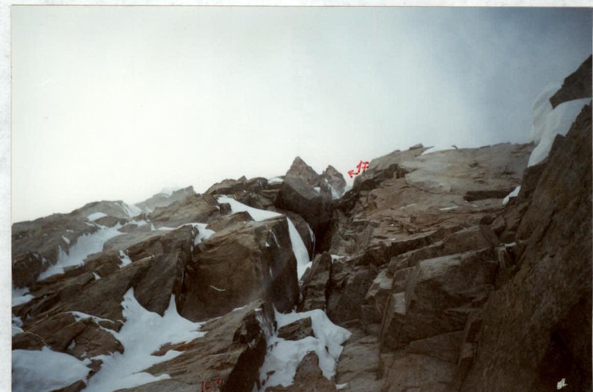
| Section R17 | Ice gullies leading to the ridge. |
| Section R18 | Easy ridge of 2–3 category difficulty leading to the summit. Descent via M. Mikhailov's route 1999, 6A category. |
Photo #1. Section #2 from above.
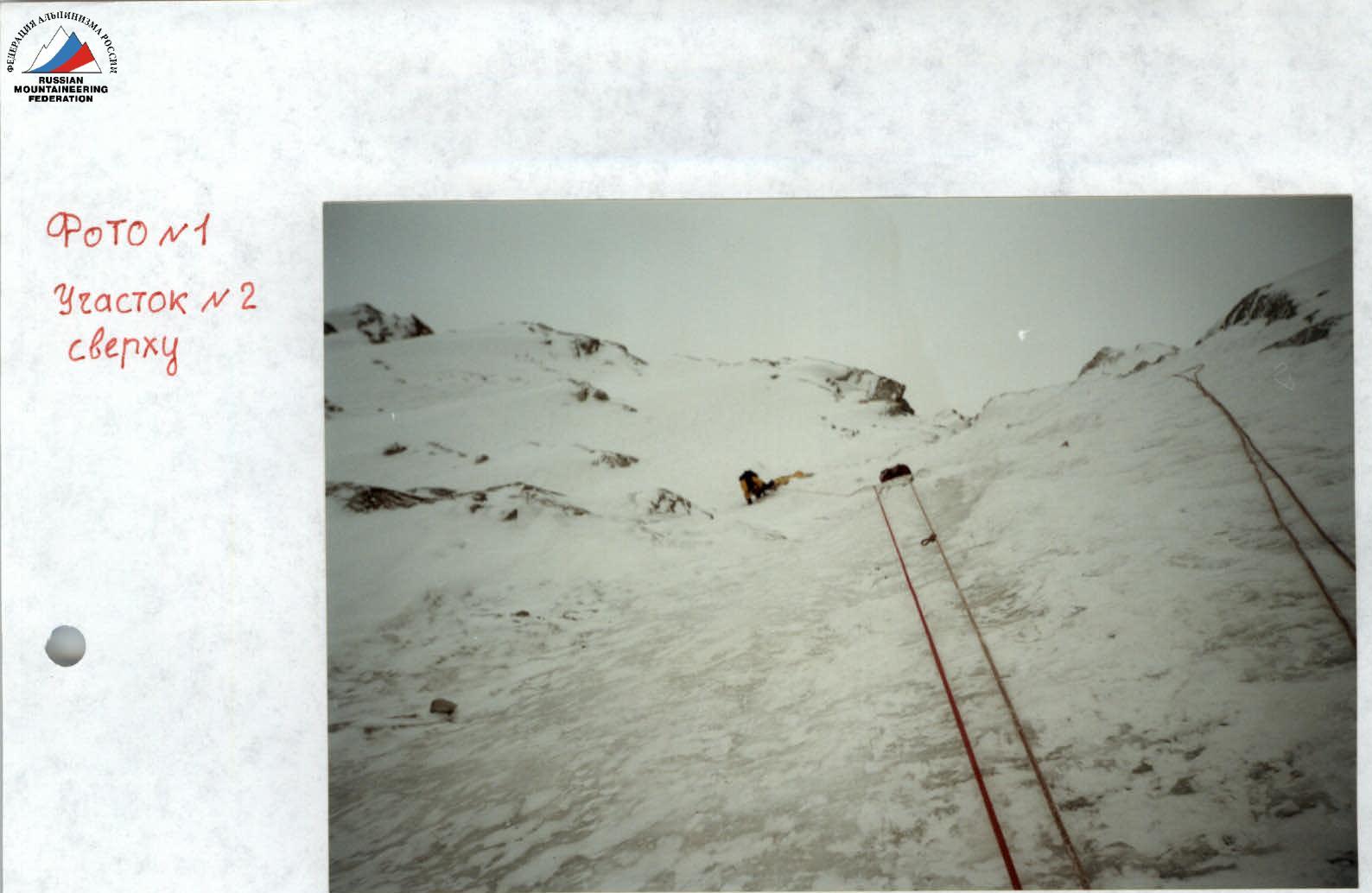
Photo #2. Section #3.
Photo #3. Section #5.
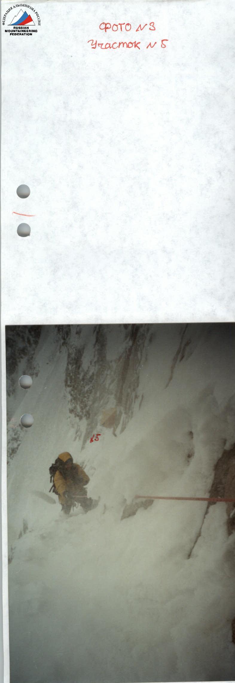
Photo #4. Section R6. Overnights #1, 2.
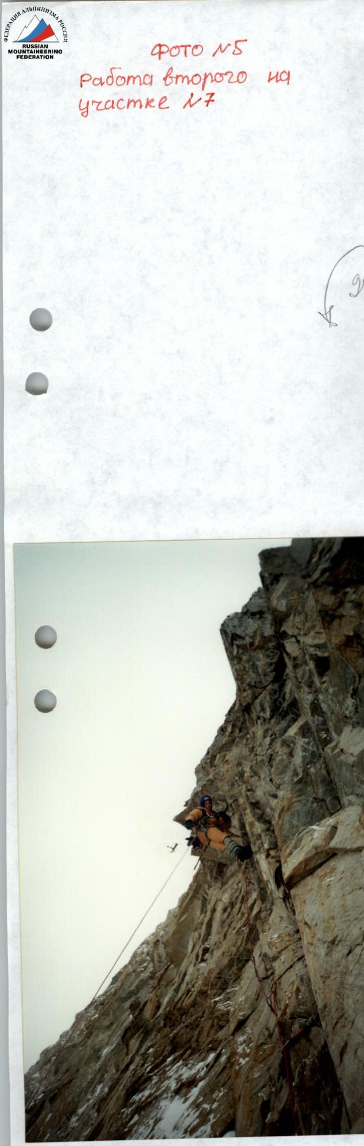
Photo #5. Second climber on section R7.
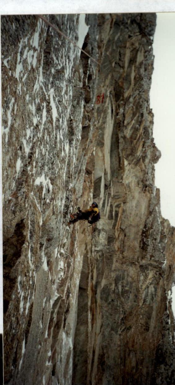
Photo #6. First climber on section R8.
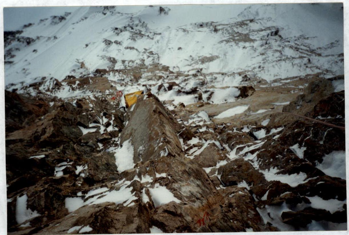
Photo #7a. Overnight #3. Section R11, view from above.
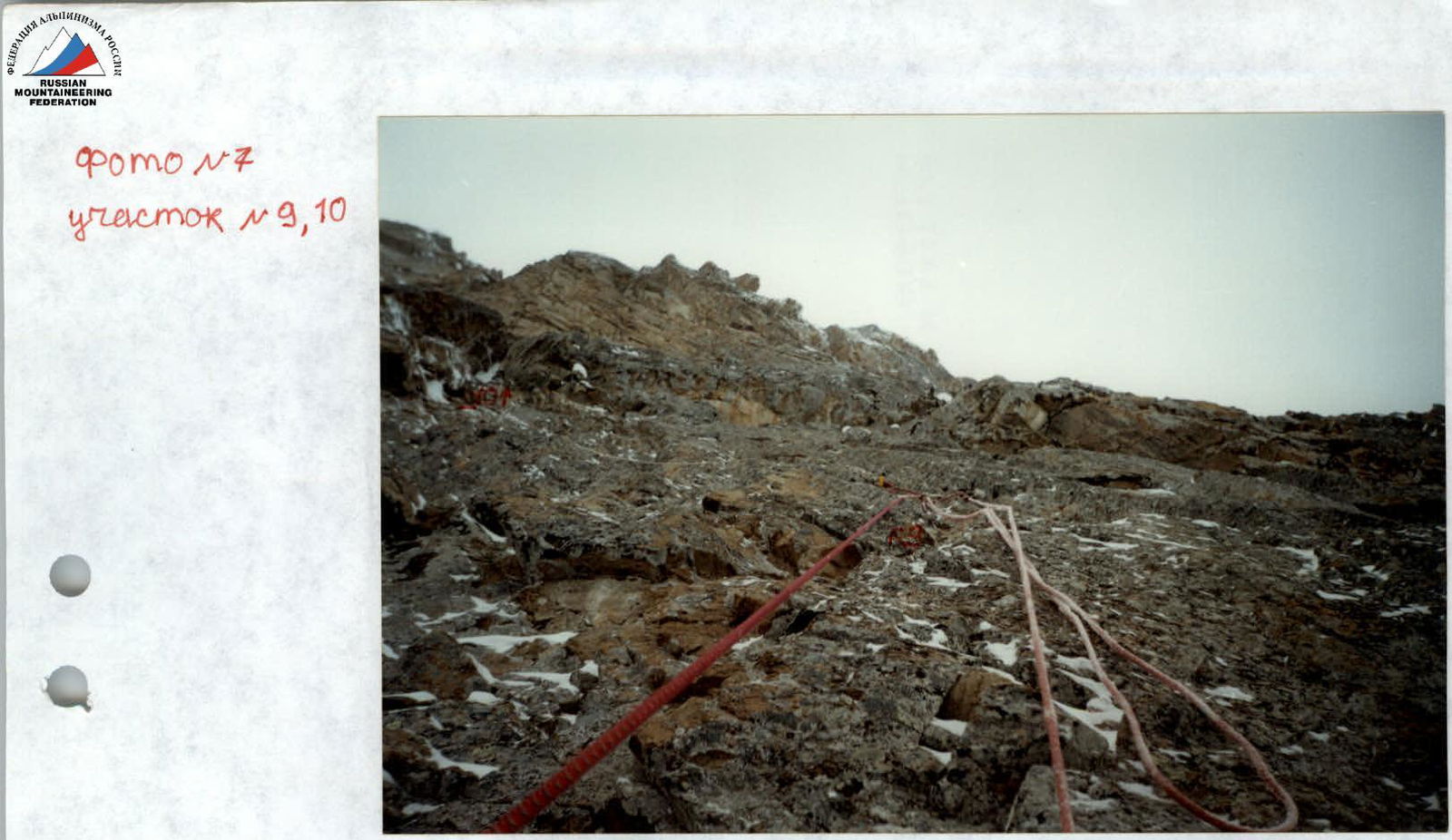
Photo #7. Sections R9, R10.
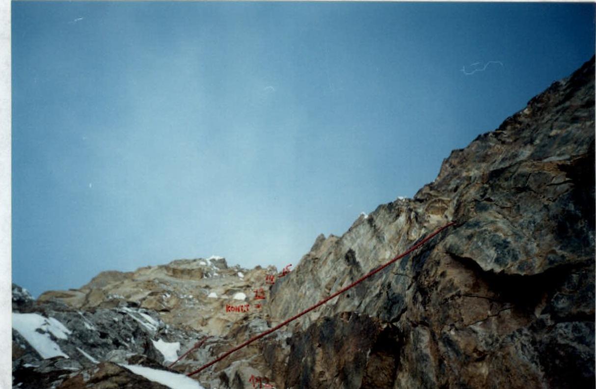
Photo #8. Sections R12, R13, R14, R15.
Photo #9. Overnight #4 (on descent via the route).
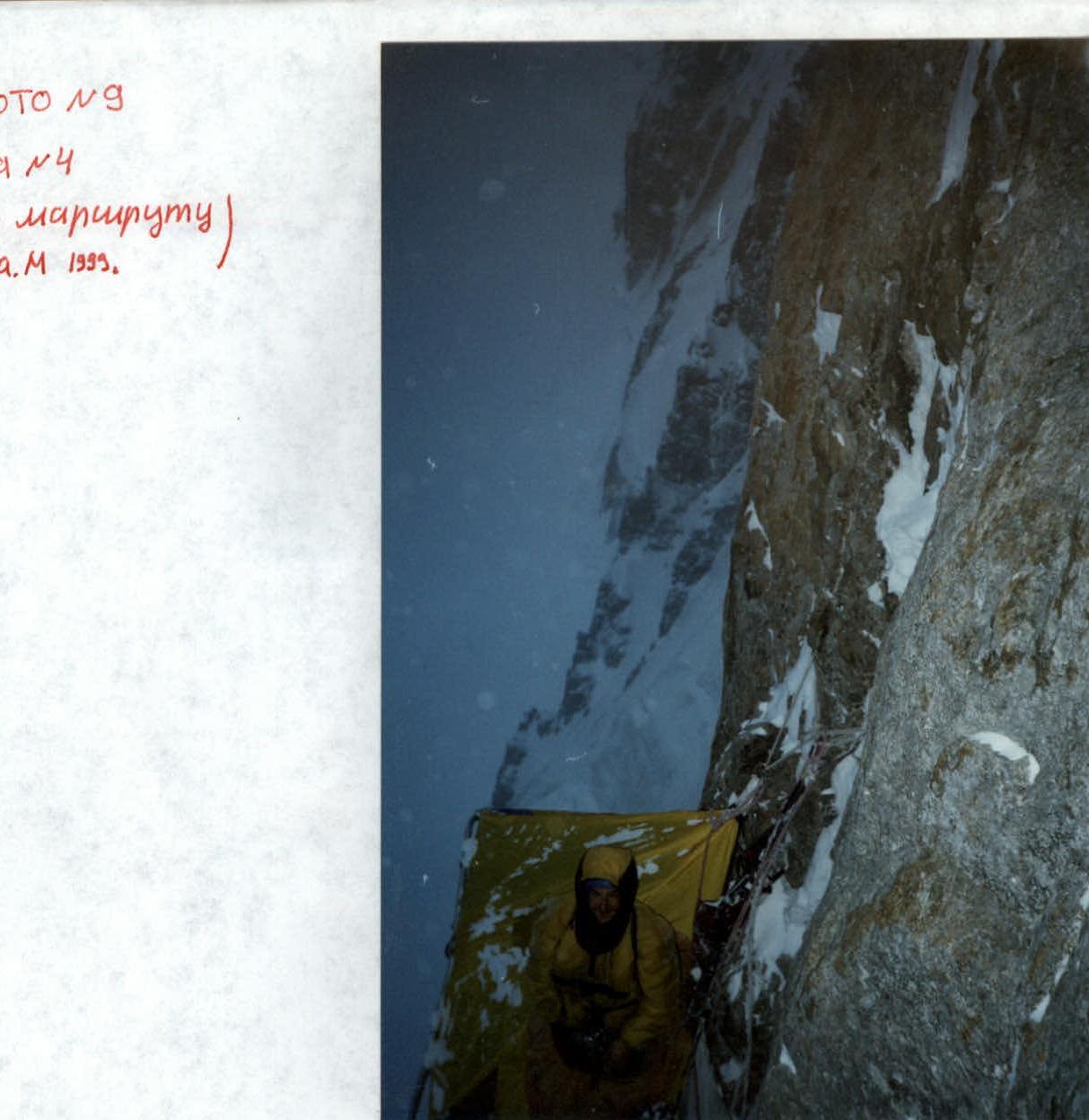
Photo #10. Section R16.