PASS
I. Technical category 2. Kirghizskiy Ala-Too, Ak-Sai valley 3. Peak Svobodnaya Korea via the ice couloir on the North face, 4740 m 4. Proposed 5B cat. of diff. first ascent 5. Height difference 820 m, length 1580 m
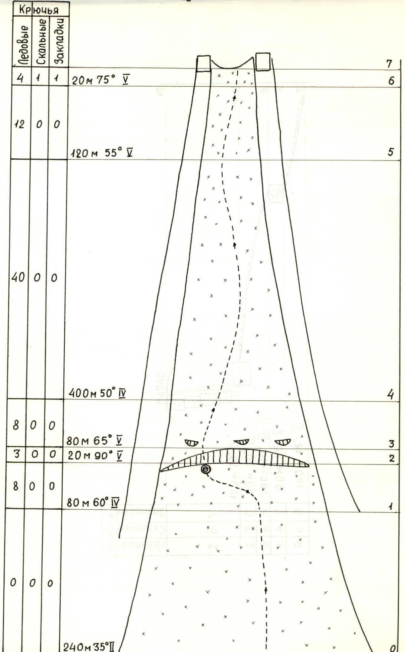
Length of sections with 5 cat. of diff. is 280 m. Average steepness of the main part of the route is 50° (4100–4600), no sections of 6 cat. of diff. 6. Pitons driven: rock 20, bolt hangers 11, ice 80 7. Team's total climbing time 24 hours, days 2 8. Bivouacs: 1,2 on a snow platform 9. Team leader: Bashmakov Mark Ivanovich
Team members:
- Larionov Sergey Anatolyevich CMS
- Koren Alexey Vladimirovich MS
- Golubtsov Sergey Genrikhovich CMS
- Konovalov Yury Viktorovich 1st sports category
- Moroz Vladislav Pavlovich CMS
- Mozhaev Mikhail Vasilyevich CMS
- Coach: Troshchinenko Leonid Andreyevich HMS
- Start of the route — February 5, 1984
Summit — February 6, 1984
Return — February 6, 1984
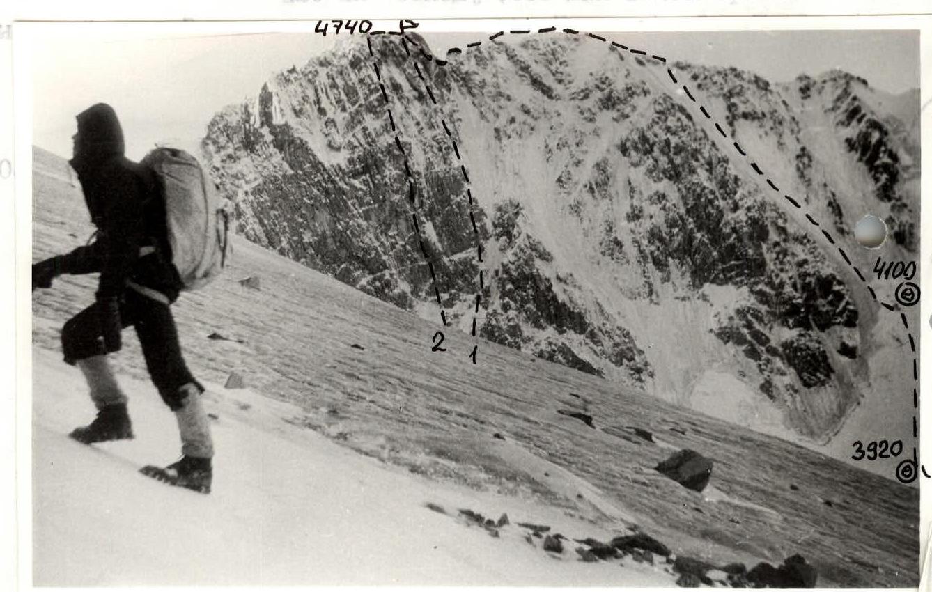
R0 — team's route R1 — Myshlyaev's route 5B R2 — Bezzubkin's route 6
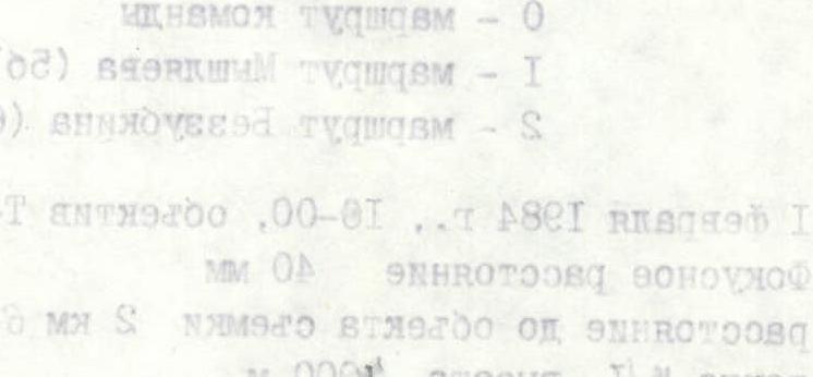
February 1, 1984, 10:00, lens Т-43, 4/40 – LOMO Focal distance 40 mm Distance to the subject 2 km 600 m Point # 4, altitude 4000 m
Route description by sections
R0–R1
Steep dense firn on this section allowed simultaneous movement. Climbers moved without a rope and without crampons. The first climber cut steps.
R1–R2
Two rope lengths before the bergschrund, the firn slope turns into an ice wall. The ice is loose, not refrozen.
- The first climber moves in crampons, with an "Shakal" ice axe and an ice hammer.
- No more complex technical equipment is required.
- Belay via ice screws.
- The rest of the team moves on fixed ropes.
R2–R3
Passing the bergschrund required the use of ice hooks. The ice is vertical and very hard. Belay via ice screws.
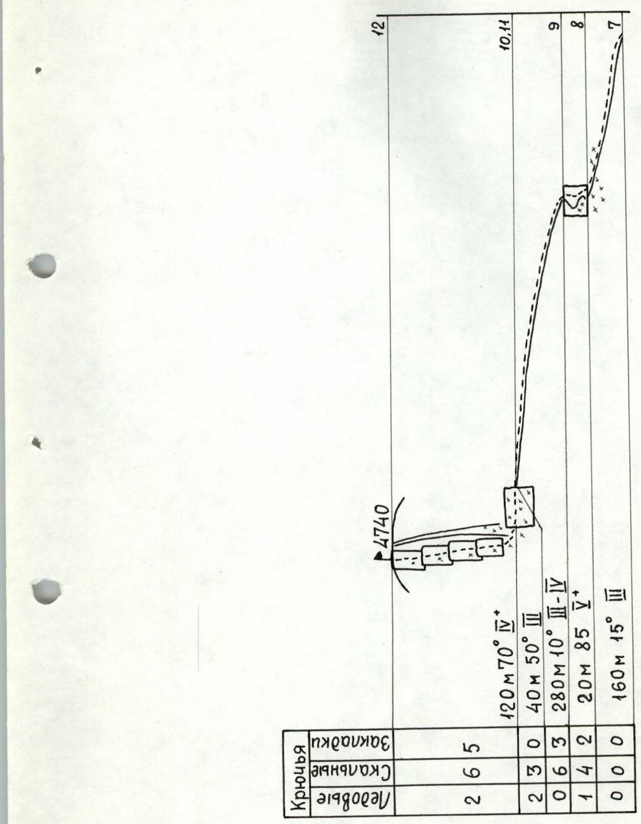
R3–R7
The ice couloir, which is the main part of the route, has an average steepness of over 50°. Steep at the beginning, more gentle in the middle, it becomes steeper again before reaching the ridge. The exit to the ridge is a 20 m 70° ice wall. The ice along the entire length of the couloir is clean, without lying snow. The ice is winter, refrozen. Ice hooks are used throughout the ascent. However, unlike summer plastic ice, they only penetrate one to two centimeters, sometimes dislodging lenses of ice. When moving with ice hooks, utmost caution and concentration are required. Belay via pitons. At the end of each rope length, two pitons are placed for fixed ropes. After passing the next rope length, one of the pitons (not used for securing the fixed ropes) is replaced with a rappel anchor. Pitons are difficult to place in winter ice. Special tools were used to place pitons and rappel anchors. On descent, the last climber descends on an ice anchor tested by the second-to-last climber, with belay via an ice screw.
R7–R8
Movement along the ridge by independent rope teams. Belay via:
- rock outcrops
- ridge bends.
R8–R9
Ascent to a gendarme directly up a wall with a crack. Belay via pitons and chock stones. After the first rope team passes, the rope is left for the following teams. Descent is via rappel.
R9–R10
Movement along the ridge by independent rope teams. Belay via:
- pitons
- rock outcrops
- ridge bends.
R10–R12
Summit tower. From a notch in the ridge, traverse one rope length to the left. Then three rope lengths to the summit. Belay via pitons and chock stones. Movement on fixed ropes. Descent is via two rappels.

Technical photograph of the route. February 5, 1984, 11:00. Lens Т-43, 4/40-LOMO, F = 40 mm Taken from the start of the route, point # 5, altitude 3900 m
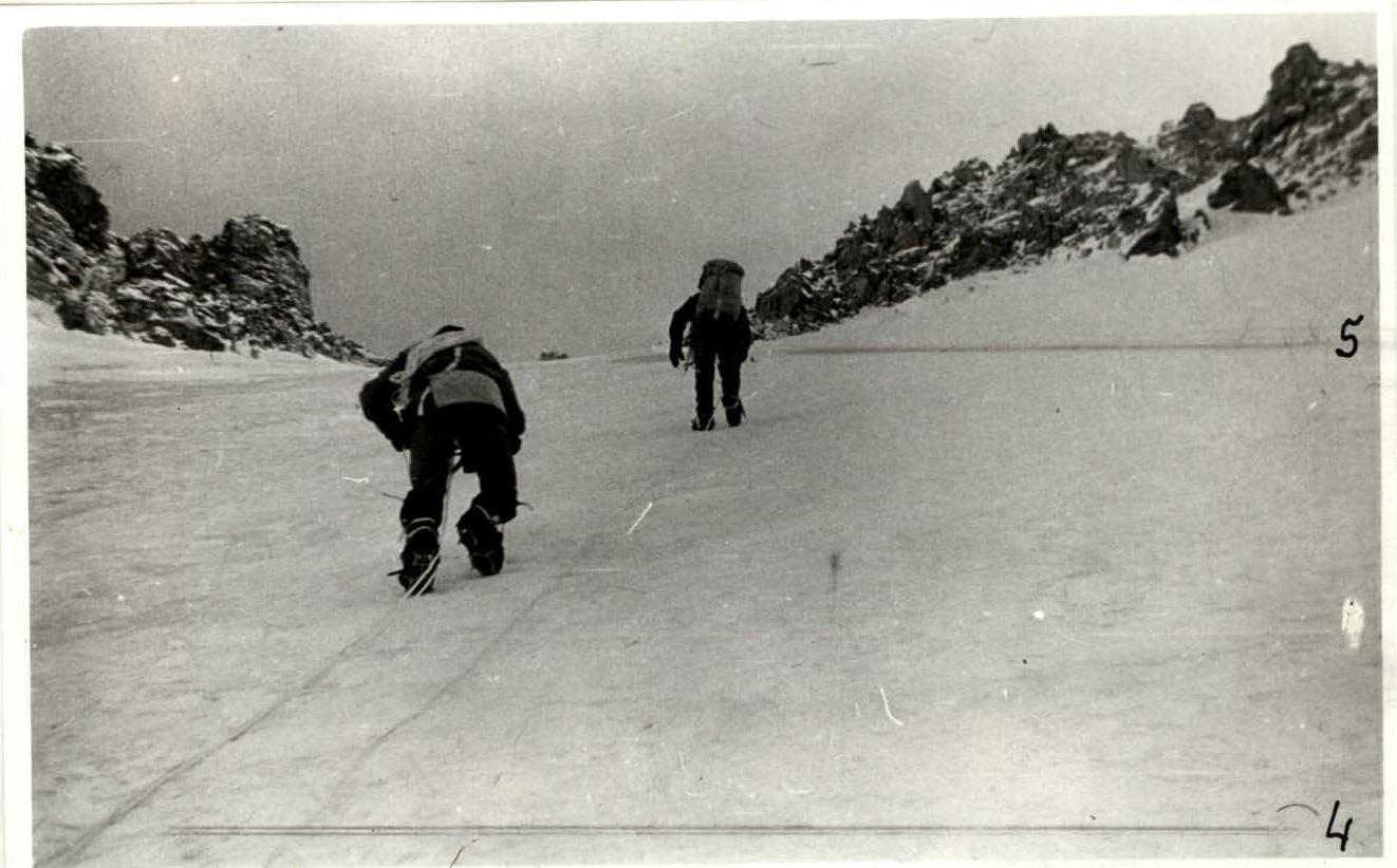
Photo 1
Work on section R4–R5. Moving on fixed ropes. February 6, 1984, 9:00; lens Т-43, 4/40-LOMO, focal distance 40 mm.


