Ascent report for the first ascent of the route to Pik Korona 1st Tower via the north face (ice gully).
Ascent Details
- Tian Shan, Kyrgyz Ala-Too range, Ala-Archa valley.
Pik Korona 1st Tower, 4810 m, via the ice gully on the north face. Proposed category: 5A, first ascent.
Route type: ice.
Elevation gain: 800 m.
Route length: 1050 m.
- Section lengths: I — 400 m, II — 100 m, III — 350 m, IV — 100 m, V — 100 m,
- Average slope: main part of the route — 55°
Total route — 45°
- Number of "pitches" left on the route: total — 0;
- Total equipment used on the route: ice screws — 55, rock pitons — 0, chockstones — 0.
- Total number of artificial points of support (AFS) used — 0 pcs.
- Team's total climbing time: 12 hours, 1 day (no overnight stay)
- Team members:
Sergey Seliverstov (team leader), Pavel Vyazovetsky (Moscow State University).
- Coach — Fyodor Popov
- Departure to the route: 6:00, January 3, 2013.
Reached the summit: 15:00, January 3, 2013. Returned to Base Camp: 18:00, January 3, 2013.
General View of the Summit
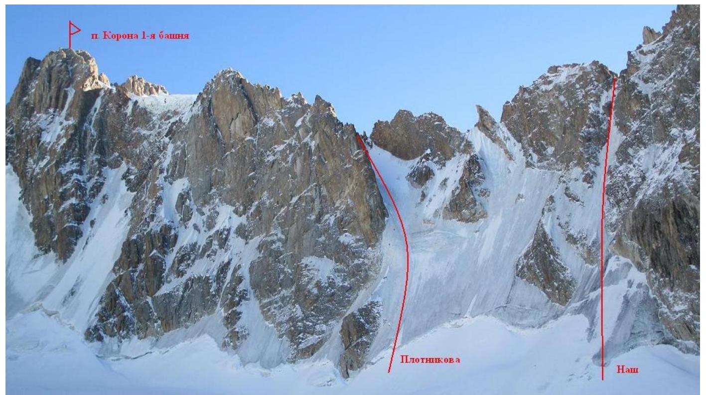
Route
diagram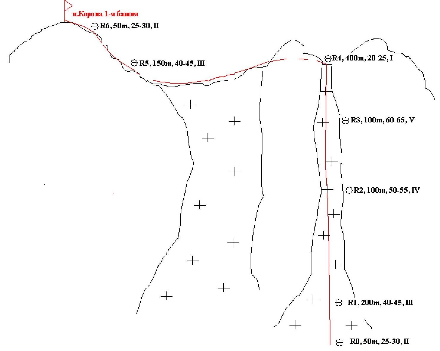
Route
profile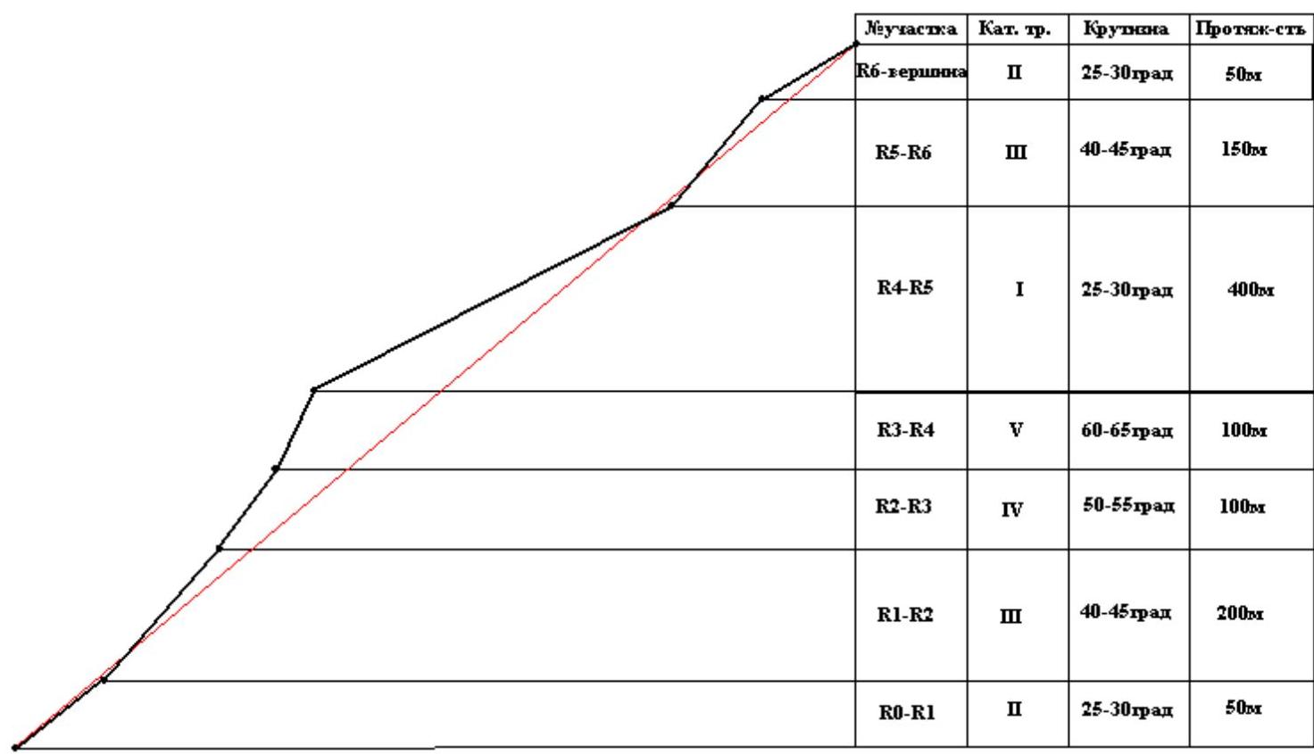
Route Description
Departure from "Ratsek" campsite — 6 hours. Approach to the route — 8 hours. Ascent to the summit — 15 hours. Descent to "Ratsek" campsite — 18 hours. Approach via moraines past the "Nauka" hut, through the "Uchitel" glacier. Approaching the bergschrund took 2 hours.
- R0–R1. Crossing a small bergschrund and traversing simple ice, 25–30°, 50 m., II.
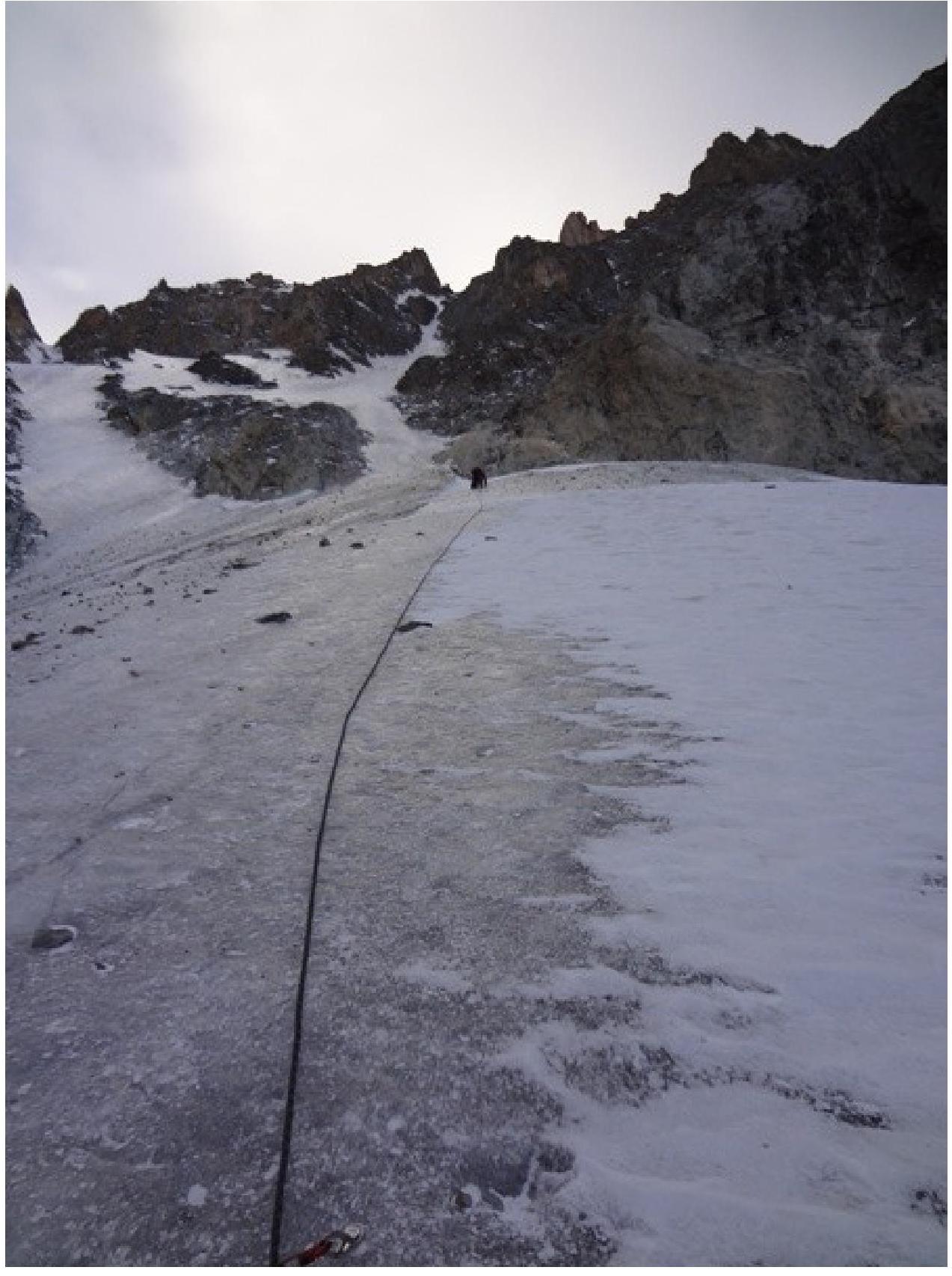
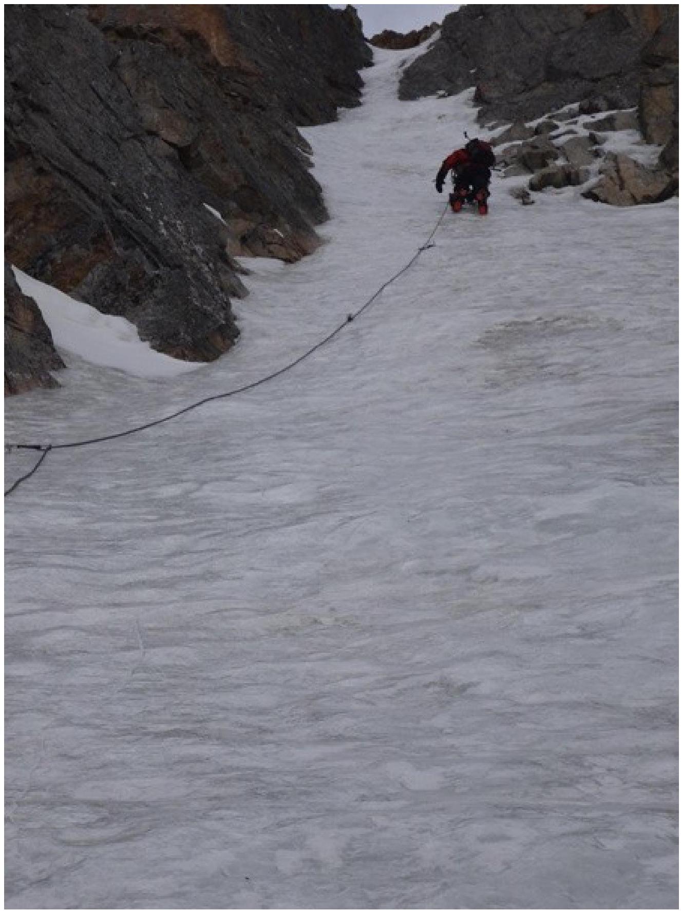
- R1–R2. Uncomplicated ice, 40–45°, 200 m., III.
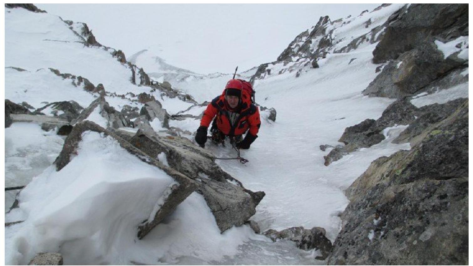
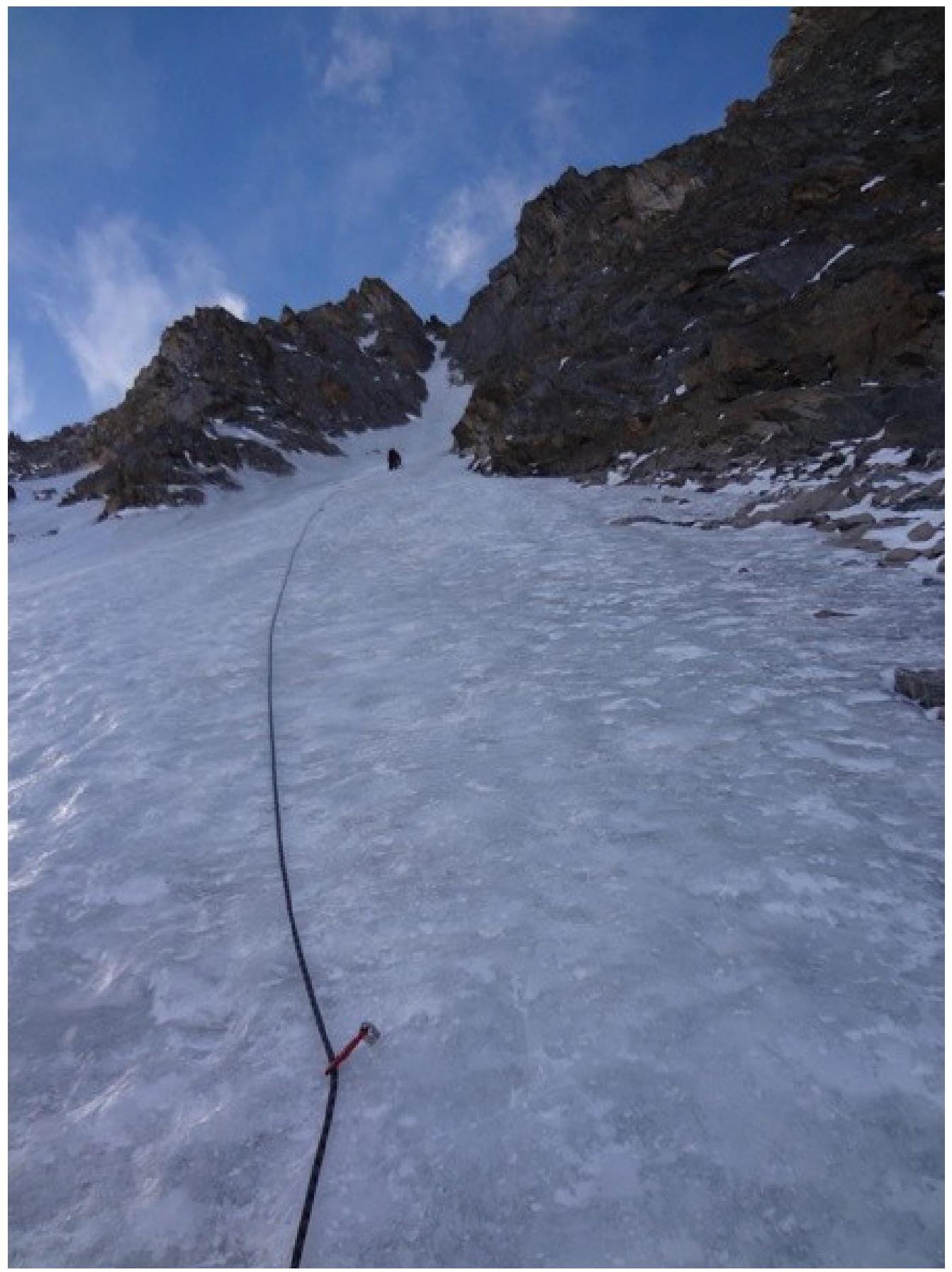
- R2–R3. Steep, wide ice gully, 50–55°, 100 m., IV.
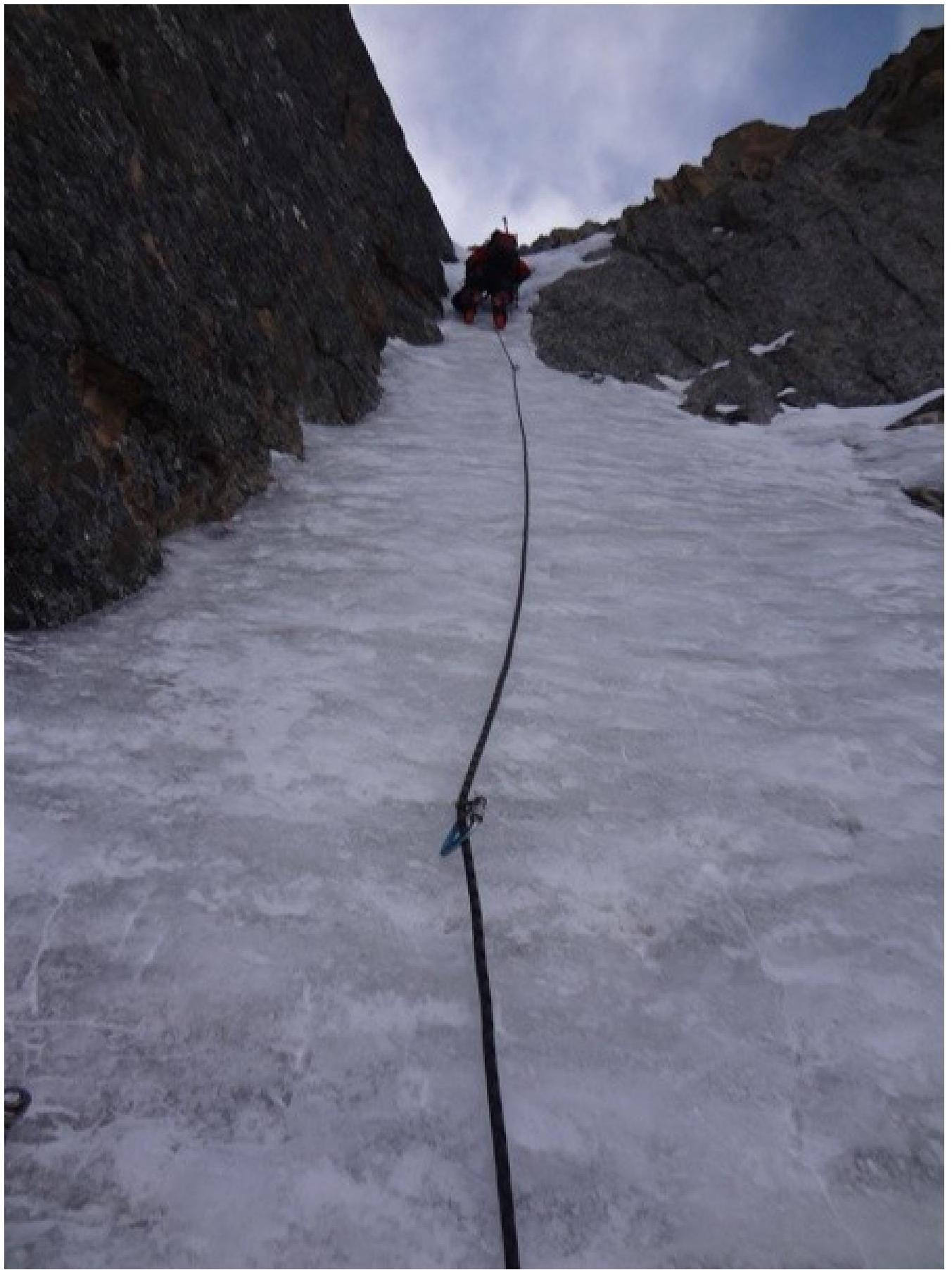
- R3–R4. The gully becomes steep and narrow, местами less than a meter wide. At the exit, some rock outcrops need to be gripped, and ice rivulets need to be traversed. 60–65°, 100 m., V.
- R4–R5. Exit onto a snowy slope, and ascend towards the first tower.
- R5–R6. Ice gully typically used for descending from the first tower, 40–45°, 150 m., III. Reach a scree saddle to the left of the first tower.
- R6–R7. Traverse right on несложным скалам to the summit. 25–30°, 50 m., II.
Descent from the tower via the ascent route. On the first rappel, be cautious of the ice — loose rocks above can be dislodged by the rope. Stay close to the left wall. There are rappel anchors throughout. Descend to the glacier and proceed to "Ratsek" campsite.
Section
R1–R2
Section
R2–R3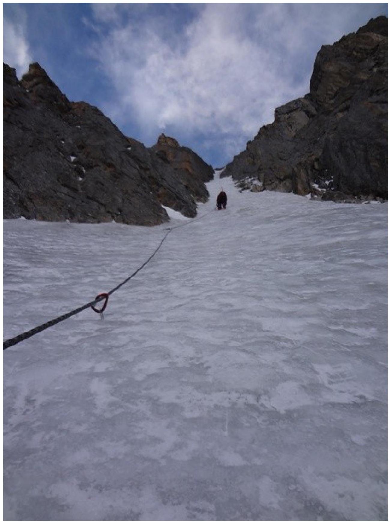
Section R3–R4
Digitized by Google
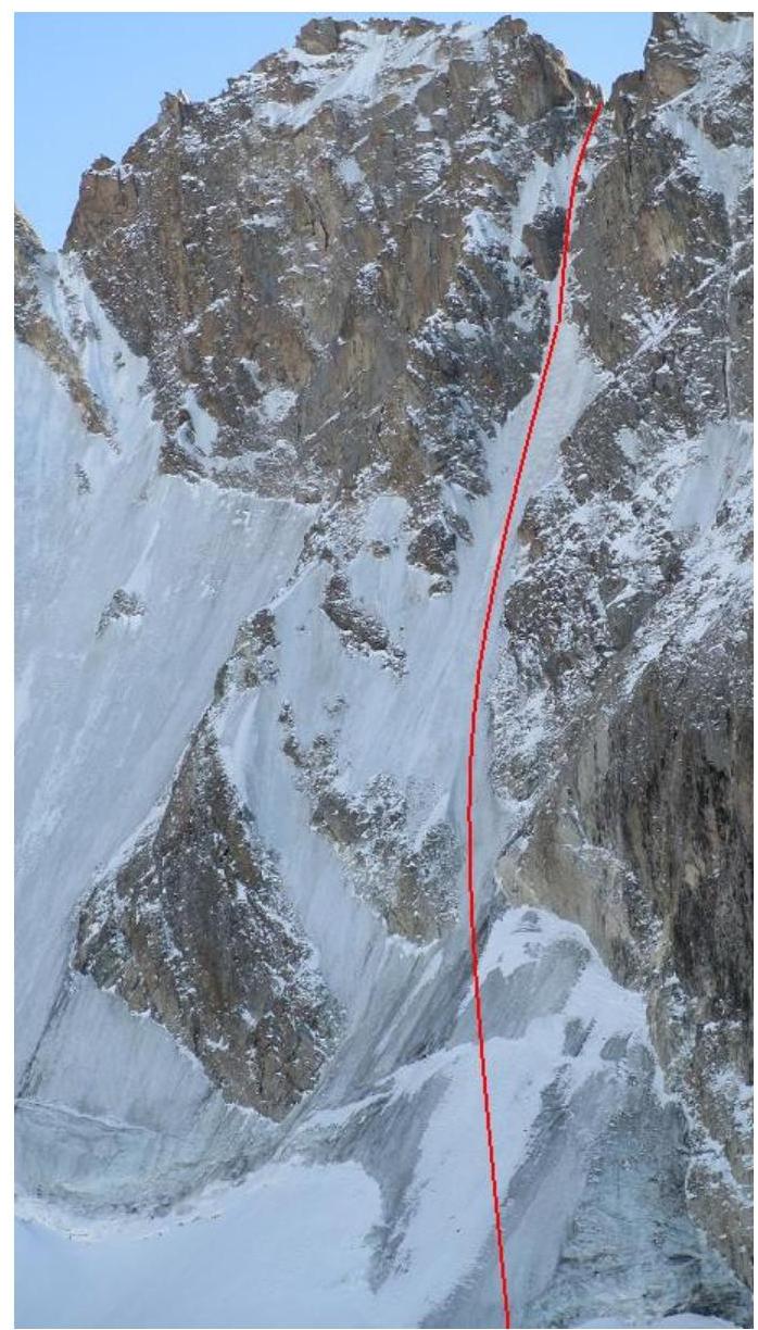
View from above, from the exit off the face