Report
On the ascent of peak "Kirgizstan" via the North face (claimed for the USSR Championship in the technically challenging category).
And on the traverse of peak "Kirgizstan" with ascent via the North face (claimed for the Central Council Championship of the "Spartak" Volunteer Sports Society).
Alma-Ata, 1963
I. Introduction
The combined team of the Kazakh Republican Council of the "Spartak" Volunteer Sports Society on July 5-8, 1963, completed the ascent of peak "Kirgizstan" via the North face, claimed for the USSR Championship in the technically challenging category, and on July 1-3, they completed a traverse of the peak with ascent via the North face.
Peak "Kirgizstan" is located in the upper reaches of the Salyk glacier in the Alamedin gorge, in the central part of the Kyrgyz Ala-Too range (see the Kyrgyz Ala-Too map) in the area of the Alamedin walls, very popular among climbers of Kyrgyzstan and Kazakhstan. The absolute height of the peak is 4840 m. It is the highest point of the latitudinal part of the Alamedin spur.
Four ridges radiate from the peak: Northwest, Southwest, Southeast, and Northeast.
- The Northwest ridge is a combined ice-snow-rock ridge, sharp, of average difficulty to overcome.
- The Southwest and Southeast ridges were not studied in detail by us (they are only visible from the Pastukhov glacier). The visible sections of the ridges are of average difficulty, sharp ice-rock-snow.
- The Northeast ridge is the most difficult to traverse, sharp, steep, icy with rare outcrops of difficult and average rocks. The ascent via this ridge by Leningrad climbers (Kheysin’s group) is considered an ascent of the highest category of complexity.
From peak "Kirgizstan":
- to the south descends the Pastukhov glacier;
- to the east — the South Protsenko glacier;
- to the west — a small Nameless glacier;
- to the north — the large Salyk-Western glacier.
To the north, towards the Salyk-Western glacier, peak "Kirgizstan" drops off with an almost sheer, over a kilometer high ice-rock wall, which was the dream of our team (and not just ours) for several years. The relative height of the wall above the upper reaches of the glacier is 1100 m.
This area has only recently begun to attract climbers, when alpinism techniques have significantly advanced, making possible ascents that were only dreamed of a few years ago.
Kazakhstan climbers started doing technically very complex ascents relatively recently. By 1960, we had completed all the complex routes in the Trans-Ili Alatau, done earlier by strong teams from Moscow, Leningrad, etc., and we began preparing to tackle "our own" routes. By 1961, the "Spartak" team, which formed the backbone of the Kazakhstan national team, had strengthened enough to tackle the North face of peak Svobodnaya Koreya, and the West face of peak Bai-Ian-Bashi.
In 1962, the team did not conduct an independent event due to the illness of its captain. However, some team members completed remarkable ascents (to peak Khan-Tengri, West face of peak Mayakovsky, West faces of peak Talgar, etc.). By 1963, many complex wall routes (North face of peak Svobodnaya Koreya, Korona, Bai-Ian-Bashi, etc.) and traverses (Aksai horseshoe, Traverse of the Alamedin walls, etc.) had been completed in the Kyrgyz Ala-Too, which were long considered "out of reach" even for very strong teams. In 1963, it was time to tackle the almost sheer, cold, and imposing North face of peak "Kirgizstan".
Preparation for the Ascent
Preparation for such a serious ascent began in 1961, and by the summer season of 1962, the team was ready to head to the area. Our application was approved. But a series of unfortunate circumstances forced us to postpone the assault on the wall for a whole year.
From the autumn of 1962, the team began seriously preparing lightweight, reliable, and convenient equipment. We started with metal equipment: by the summer season, we had two lightweight (0.4 kg) anchors that had passed the most rigorous tests; we manufactured small (from 1.5 m to 5 m) well-jointed ladders and two 30-meter ladders, piton hooks made of steel and duralumin with good technical characteristics, petal and regular titanium hooks, channel, anchor, and corkscrew ice hooks made of steel and light alloys; we obtained "eternal" piton hooks, hook-catchers, etc. This metal equipment allowed us to confidently tackle the wall. Only the "eternal" piton hooks released by the All-Union Central Council of Trade Unions failed to justify themselves — they have a very small wedge.
Other equipment was already available to the team, except for six sleeping bags, which were received by the team on the day of departure.
We also seriously approached the issue of food on the wall. This task was entrusted to a group led by G. Petraško (see below). As a result, the team on the wall was provided with high-calorie, suitable for high altitudes, tasty, and lightweight products.
The core team trains year-round as part of the Kazakhstan national team. Special training in rock and ice techniques began in March of this year, when nearby rocks became snow-free.
By the start of the season, all team members were confidently overcoming smooth steep slopes and overhangs, using and testing all our equipment. Steep ice walls (up to 10 m) are available 15-17 km from Alma-Ata until mid-April. This allows for full-fledged training without leaving production.
On the approach
Conditions for the Ascent of peak "Kirgizstan"
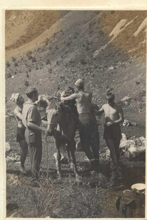
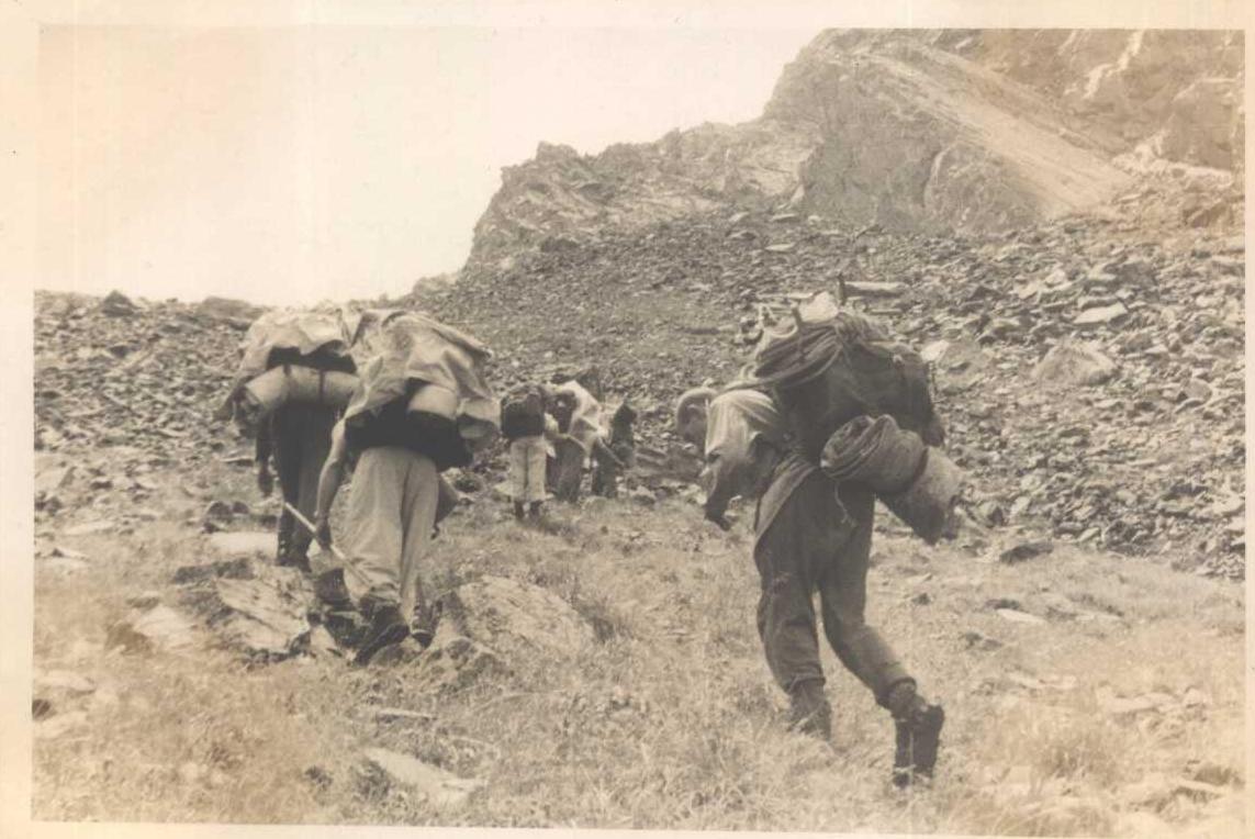
Peak "Kirgizstan" is located 50 km from the capital of the Kyrgyz SSR, Frunze — 30 km by car, 15 km on horseback, and 5 km on foot.
To the village of Tash-Moinok, there is a good road, and buses run daily. Further (orographically) along the right bank of the Alamedinka river, along a satisfactory pack trail to the Salyk river (11 km) and then along the right bank of the Salyk river (4 km) to the terminal moraine, one can easily reach with the help of pack transport. Another 5 km on foot along the terminal and lateral moraines of the Salyk river, and you are at the foot of peak "Kirgizstan".
In the village of Tash-Moinok — the last settlement — there are some communications (telephone, telegraph). In the neighboring gorge to the west is the "Ala-Archa" alpine camp. Despite good accessibility, the upper reaches of the Salyk glacier are still poorly explored by climbers.
In 1952, a group led by Marechek first ascended peak "Kirgizstan" from the Pastukhov glacier area.
In 1961, an expedition led by A. Romanov completed an ascent of 4B category of complexity to peak "XXII Party Congress". In 1962, a group from Leningrad "Trud" (led by Kheysin) completed a traverse of peaks "Kirgizstan" – "XX Party Congress", claimed for the USSR Championship (2nd place).
Several ascents via easy routes were made to the peaks of the Salyk glacier cirque from neighboring gorges. This concludes the list of known ascents.
Weather conditions in the Salyk glacier area are typical for the entire Northern and Western Tian Shan. During the team's stay in the area, there were 6 days without precipitation, one thunderstorm with sleet, and several light snowfalls. Typically, after 3-4 pm, fog sets in. At night and in the morning, the weather is usually excellent.
Reconnaissance of the Route
For the preliminary selection of the ascent object, in 1961, a group was sent consisting of:
- Master of Sports V.P. Fedchenko;
- First-class climber E.I. Skuratovich
to the upper reaches of the Salyk glacier. The group reconnoitered the approaches and recommended route options. In the autumn of 1961, the ascent object was approved at a team meeting.
Over three days (June 28-30, 1963), the team leadership thoroughly studied the North face, noting hazardous and difficult sections. To clarify some questions, a traverse of peak "Kirgizstan" was completed with ascent via a weakly expressed counterfort (see diagram). This ascent was claimed for the Central Council Championship of the "Spartak" Volunteer Sports Society and was completed in 3 days (42 hours of continuous work) by a group consisting of:
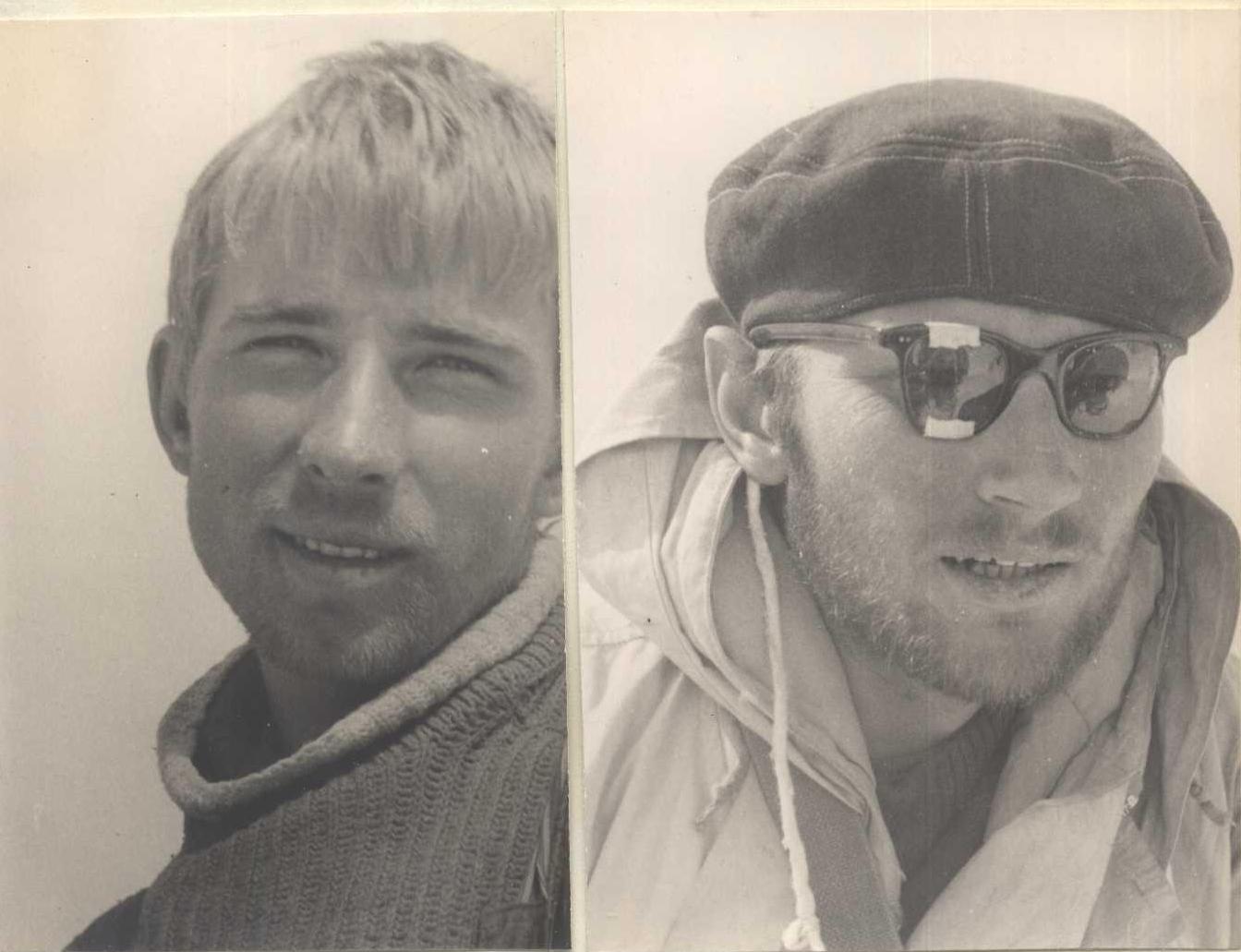
- B.A. Studenin — Master of Sports — leader;
- I.G. Domianidi — Master of Sports;
- G.A. Petraško — 1st sports category;
- V.P. Reznik — 1st sports category.
Organization and Tactics of the Ascent
The All-Union Federation accepted our application for the ascent via the North face of peak "Kirgizstan" by a team consisting of:
- B.A. Studenin — leader;
- I.G. Domianidi;
- G.I. Fedotov;
- G.A. Petraško;
- V.P. Reznik;
- E.I. Skuratovich;
- M.S. Kulemin (reserve).
To complete the ascent, a group of 12 people headed to the Salyk glacier area:
- Masters of Sports — Studenin, Domianidi, Fedotov, Kulemin;
- 1st sports category — Petraško G.A., Reznik V.P., Savin, Garshin, Ermilova;
- 2nd sports category — Sverdlina;
- 3rd sports category — Sagimbekov (doctor) and Povoroznyuk.
According to the plan:
- a foursome of climbers — Studenin, Domianidi, Petraško, Reznik — was to complete the main ascent;
- a foursome of climbers — Kulemin, Fedotov, Savin, Garshin — was the insurance group;
- a foursome — Ermilova, Sverdlina, Sagimbekov, and Povoroznyuk — was the auxiliary group, providing observation of the climbers and reliable communication with the USSR Federation, Central Council of the "Spartak" Volunteer Sports Society, etc.
The route sheet and calendar plan were approved by authorized representatives of the USSR Alpinism Federation, D.I. Gushchin, and other team materials were agreed upon.
After a thorough reconnaissance of the route, we planned the following wall ascent:
- early on July 5, the assault foursome would start the route, aiming to reach safe rocks by 11:00 (start of rockfall and avalanches);
- movement in two equal teams with three backpacks (the first team member always goes without a backpack);
- particularly complex sections were planned to be overcome with the help of 30-meter ladders;
- the route was planned to be completed with three bivouacs on the wall;
- food and fuel were taken for 6 days, considering possible bad weather;
- backpacks were planned to be pulled up using an auxiliary rope;
- to ensure the safety of the ascent, the number of participants was reduced to four.
No significant adjustments were made to these plans during the ascent.
The 30-meter lightweight nylon-duralumin ladders, petal hooks, and hammers with reinforced "beaks" fully justified themselves during the ascent.
The entire team on the wall worked in harmony and at a good pace. The good physical and technical preparation of the participants allowed them to maintain the pace throughout the ascent.
Medical Support
Team members are under constant supervision of the Republican Sports Medicine Dispensary. Every 6 months, all participants undergo a full medical commission, and before each ascent, a medical examination is conducted. Before departing for the Kyrgyz Ala-Too, the team underwent a medical commission. In the base camp, a doctor, U. Sagimbekov, was constantly present, conducting medical examinations, and providing consultations before ascents, monitoring the quality of food, its composition, calorie content, and vitamin saturation.
Throughout the stay in the mountains, there were no cases of injury or colds.
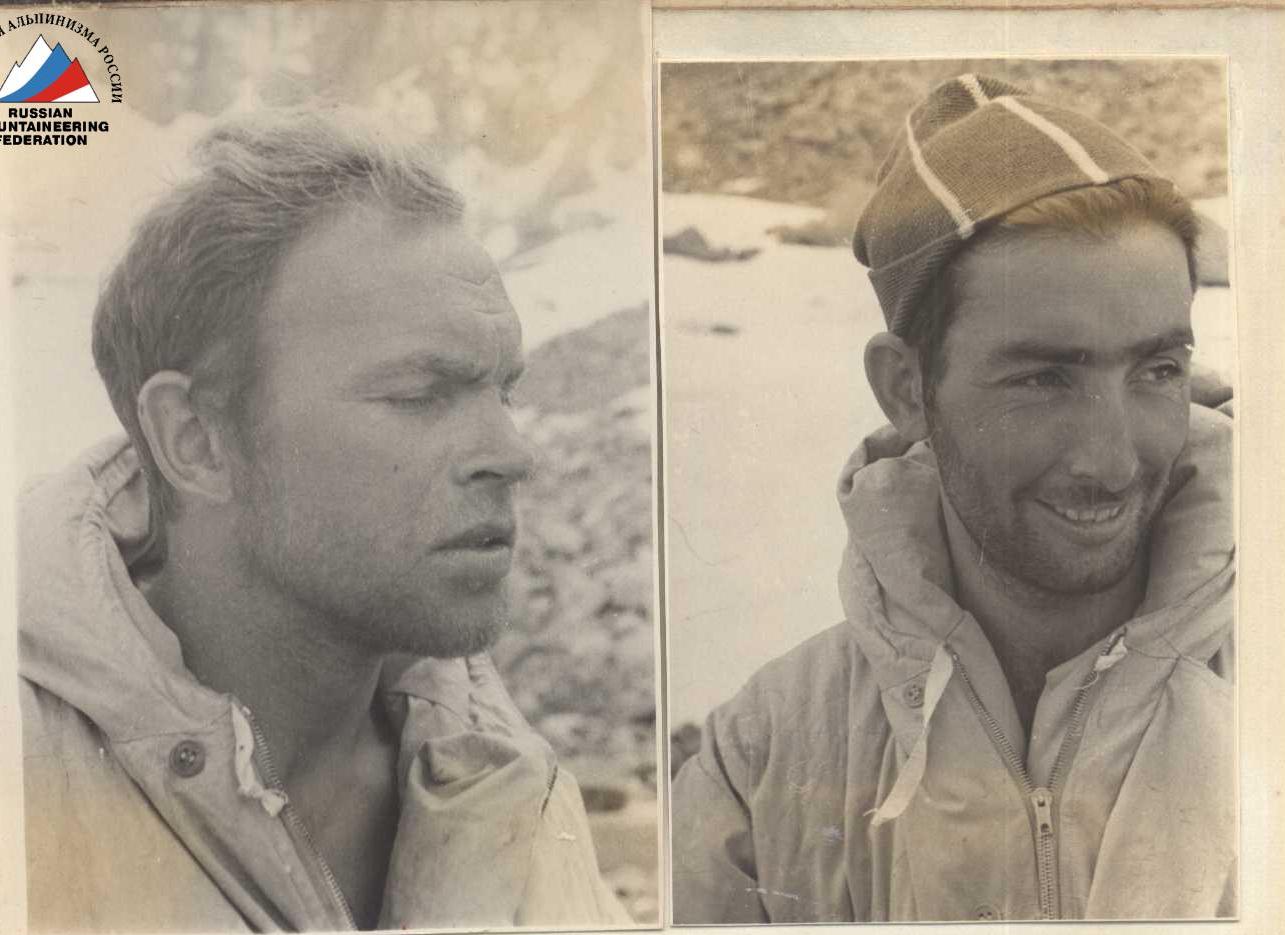
B.A. Studenin, G.A. Petraško, I.G. Domianidi, V.P. Reznik
Guests of the Ascent
Description # 1
Traverse of peak "Kirgizstan" from west to north with ascent via the North face.
1st day. Departure at 3:00 (exit at 3:30). From the base camp on the left moraine of the Salyk glacier, we move southward to the base of the counterfort of the Central Alamedin wall; then, bypassing the crevasses of the icefall, we move southeast, ascending towards the Bergschrund under the West counterfort of the North face of Kirgizstan. The journey from the camp to the start of the ascent takes 1 hour 30 minutes.
Section R1
We ascend the avalanche cone to the Bergschrund, slope 45°–50°; hard-packed snow, steps are well-defined, insurance via ice axe; length — 70 m.
Section R2
We overcome the Bergschrund via a snow bridge formed by avalanches. The slope steepness increases to 60°. The snow slope turns into an ice slope, requiring step-cutting. The length of the slope from the Bergschrund to the rocky outcrops is 40 m, with 3 ice hooks driven.
Section R3
The section is a rocky outcrop 80 m long, with an overall steepness of 50°–45°. The rocks are smoothed, tile-like, of average difficulty, requiring piton insurance. 6 hooks were driven, and outcrops were used.
Section R4
From the upper part of the rocky outcrop, with careful piton insurance, we traverse westward across the ice couloir separating the outcrop from the main wall. The couloir is 15 m wide, the ice is polished by descending avalanches, hard, steps are cut with difficulty.
Standard ice hooks do not enter well, but channel titanium wedges 20–25 cm long enter and hold well. 2 rock and 1 ice hook (wedge) were driven.
Section R5
After crossing to the rocks, we traverse rightward 10 m across difficult rocks, driving 2 hooks. Then, we ascend 30 m up difficult rocks with a steepness of 75°–80°. 4 titanium hooks and 1 wedge were driven. The character of the rocks: smooth, licked rocks with few handholds, few cracks.
Section R6
The wall gradually turns into a poorly expressed internal angle with a steepness of 60°. The rocks are of average difficulty, character — smoothed, indistinct steps. The length of the section is 70 m.
In the upper part, the internal angle turns into a sheer chimney 5 m long, overhanging at the top; 7 hooks were driven on the section.
After the chimney, we emerge onto a small saddle on the counterfort; to the left, the counterfort rises with steep rocky walls, and to the right, it drops off with a sharp, knife-like ridge. Here, the first control cairn is built.
Section R7
From the cairn, the path goes right of the main counterfort upward along the "chicken breast"; on the left, it is separated from the counterfort by an ice couloir 3 m wide, and on the right, it is bounded by a snow-ice slope. The length of the rocky section is 50 m, the slope is 60–70°. The rocks are very smooth with few handholds, and some sections have formed ice. 8 hooks were driven.
Section R8
From the end of the "chicken breast", we ascend the snow-covered ice slope 10 m long with a steepness of 55°. Upward to the right, towards the base of the rocky wall, which is cut by a chimney filled with formed ice. Steps are cut into the ice, insurance via hooks — 1 ice and 2 rock hooks.
Section R9
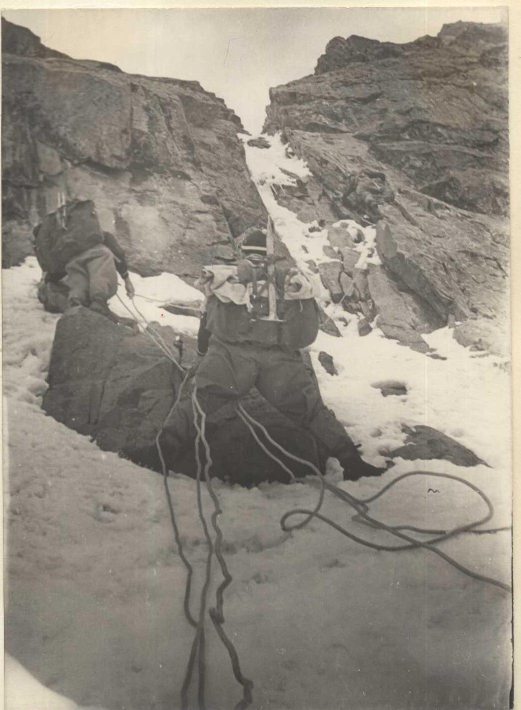
The key point of the route — a shallow chimney. It cuts through the entire wall almost to its upper part; the rocks are heavily destroyed, with many loose stones. The chimney is filled with snow and formed ice, and water seeps through it. On the right and left of the chimney are sheer rocky walls. Its width is 1.5–2.4 m. The ascent is made along the right wall of the chimney, with a steepness of about 90°, and some overhanging sections.
After the first rope length, there is a small inclined shelf with a convenient выступ for organizing insurance; here, participants are taken in, and backpacks are pulled up.
On this 35-meter section:
- 2 overhanging sections, each 4–5 m long;
- overcoming is done with the help of ladders;
- sometimes hooks were driven to create artificial footholds.
A total of 17 hooks were driven:
- 5 petal hooks;
- 3 titanium wedges;
- 2 wooden wedges;
- 7 regular hooks.
After the shelf, the path continues along the chimney, whose steepness does not decrease, but the rocks become more monolithic and convenient for climbing. Here, 9 hooks were driven on a 40-meter section.
Section 6. In the chimney
After overcoming the chimney at 19:00, we stop for the night. We sit in pairs in tents on small inclined ledges, organizing piton insurance. Towards evening, the weather worsens, and it snows lightly at night. In the morning, with the sunrise, we rise, prepare breakfast, and continue movement at 7:00.
Section R10
The path goes along a stepped rocky wall with a steepness of about 80°. The structure is partly tile-like; from afar, it seems несложной, but the smoothness of the handholds makes it very complex. We ascend directly upward 120 m, then move rightward and upward 10 m, where there is a small shelf with good outcrops. On this section, exclusive piton insurance is used, with 15 hooks driven.
Section R11
From the shelf, we ascend directly upward along smoothed rocks, then along a smooth slab 15 m long with rare handholds. On the right, another smooth slab hangs over it, and on the left, the second slab forms a sharp edge with it. In the upper part, the slab curves slightly to the right, and the right slab overhangs so much that it forms a narrow slit, making it difficult to squeeze through with backpacks. The steepness of the section is 85°. 5 hooks were driven.
Section R12
Again, a stepped wall similar to section R10, with a steepness of 80° and a length of 50 m. 6 hooks were driven. Here, two counterforts converge: the left one, along which the route goes, and the right one, initially 100 m away from the left counterfort at the start of the route.
 www.alpfederation.ru↗
 www.alpfederation.ru↗
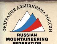
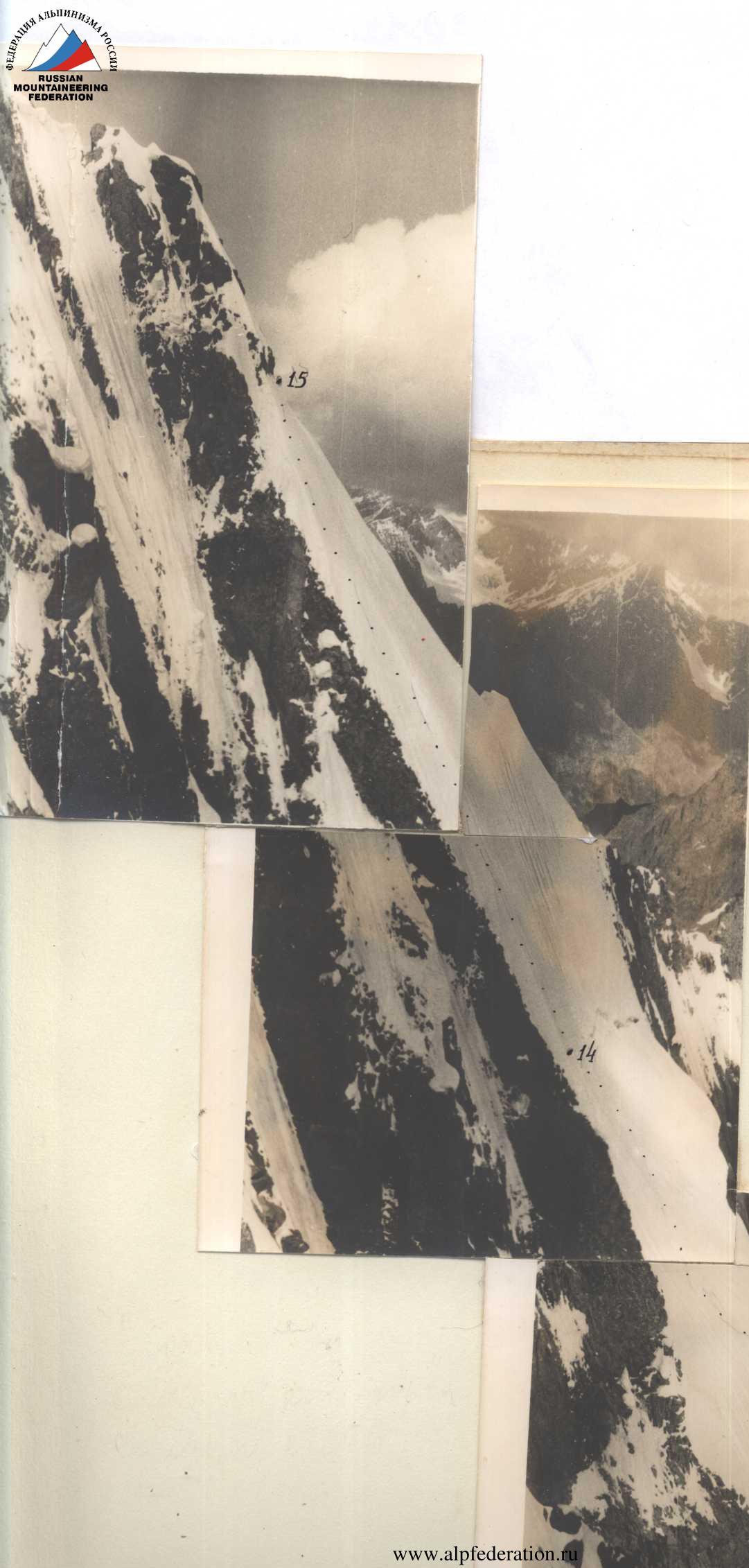
Section R13
From the convergence point of the counterforts, a rocky-snowy ridge extends leftward and upward with a steepness of 20° and a length of 60 m. The rocks of the ridge overhang to the left, forming a 200–250 m high sheer wall down to the glacier, creating a kind of rocky cornice, and above the rocks, a snowy cornice overhangs, forming a narrow slit, a shelf, along which one must move almost crawling. Insurance is through outcrops; 2 hooks were driven at the exit to the cornice and in the middle of the ridge.
Section R14
From the rocky cornice, we exit onto a snowy cushion with a steepness of 10–20° and approach the left edge of the Bergschrund. On the cushion, if necessary, a good bivouac can be organized.
Section R15
We bypass the Bergschrund on the left and exit onto a weakly expressed snowy ridge, to the left of which lies a rather difficult and dangerous ridge composed of heavily weathered rocks. In the upper part, the steepness of the ridge increases to 70° and turns into an ice slope, lightly dusted with snow. Here, steps must be cut. 6 ice hooks were driven.
Upon reaching the watershed ridge, the weather began to deteriorate. We had to organize a bivouac in a snowy drift. The cave turned out not to be very convenient but warm, despite the storm raging just a meter above us. The whole night was marked by a strong blizzard. In the morning, the wind subsided a bit, but snowy "flags" still hung over the ridges for a long time. In the rocks, just below three well-visible teeth, our third control cairn was left.
Section R16
Further, we move along a snow-rock-ice ridge with numerous "gendarmeries" and snowy cornices that are relatively easy to bypass.
From section R16 onwards, our route coincides exactly with the route of the Leningrad "Trud" group, so we do not provide a description of this part of the route.
The descent from the saddle between peaks Usechanka and Kirgizstan along the ice and ice-snow slope was made using a 100-meter auxiliary rope. The descent was carried out very quickly and reliably, leaving several hooks in the rare rocky outcrops of the upper part of the slope. The entire route was completed with lightweight backpacks (without sleeping bags) in 42 hours of work, with about 20 rock hooks and eleven ice hooks driven (including the descent). Category of complexity — 5B.
Table of Main Route Characteristics
Ascent route — North face of peak Kirgizstan Height difference of the route 1100 m Including the most complex sections 560 m Steepness of the route 75° Including the most complex sections 85°
| Section # | Steepness on the section in degrees | Section height in meters | Relief character | Technical difficulty | Insurance method | Weather conditions | Exit time | Stop for bivouac | Walking hours | Rock hooks driven | Ice hooks driven | Piton hooks driven | Rucksack pull (m) | Ladders (m) | Bivouac conditions | Daily ration weight (kg) |
|---|---|---|---|---|---|---|---|---|---|---|---|---|---|---|---|---|
| 1 | 50 | 70 | Packed snow | Average | Through ice axe | Good | 5:00 | 3 | 30 м | |||||||
| 2 | 85 | 10 | Snow, ice | Difficult | Ice axe, ice hooks | Good | 5 | Ladder | ||||||||
| 3 | 60 | 170 | Snow, ice | Difficult | Ice axe, ice hooks | Good | 5 | |||||||||
| 4 | 70 | 120 | Rocks | Difficult | Piton insurance | Good | 21 | |||||||||
| 5 | 60 | 45 | Snow, ice | Difficult | Ice hooks, rock hooks | Good | 2 | 6 | ||||||||
| 6 | 80 | 100 | Rocks with formed ice | Very difficult | Rock and ice hooks | Good | 26 | 2 | 60 м | Ladder 30 м x 2 | 1.2 kg | |||||
| 7 | 20 | 20 | Rocks | Average | Piton insurance | Good | 21 | 16 | 4 | Tent | ||||||
| 8 | 0 | 0 | Rocks | Average | Piton insurance | Good | 8:30 | 2 | ||||||||
| 9 | 80 | 30 | Rocks | Difficult | Piton insurance | Good | 7 | 30 м | 30 м | |||||||
| 10 | 85 | 35 | Rocks | Very difficult | Piton insurance | Good | 13 | 35 м | 30 м | 2x6 | 1.2 kg | |||||
| 11 | 70 | 30 | Rocks | Difficult | Piton insurance | Good | 19:30 | 11 | 9 | Tent | ||||||
| 12 | 85 | 10 | Rocks | Very difficult | Piton insurance | Good | 7 | 5 | 12 м | Ladder 30 м x 2 | 2x3 | |||||
| 13 | 50 | 40 | Rocks | Difficult | Piton insurance | Good | 7 | 40 | ||||||||
| 14 | 80 | 25 | Rocks | Difficult | Piton insurance | Good | 8 | Ladder 30 м x 2 | 2x2 | |||||||
| 15 | 60 | 10 | Ice, rocks | Difficult | Rock and ice hooks | Good | 2 | 2 | ||||||||
| 16 | 70 | 40 | Rocks | Difficult | Piton insurance | Good | 7 | |||||||||
| 17 | 75 | 15 | Icy chimney | Difficult | Piton insurance | Good | 6 | |||||||||
| 18 | 85 | 10 | Icy groove | Very difficult | Rock hooks | Good | 5 | |||||||||
| 19 | 75 | 15 | Rocks | Difficult | Piton insurance | Good | 4 | 25 м | ||||||||
| 20 | 85 | 30 | Rocks | Very difficult | Piton insurance | Good | 13 | 30 м | Ladder 30 м x 2 | 2x3 | ||||||
| 21 | 80 | 20 | Rocks | Difficult | Piton insurance | Good | 5 | |||||||||
| 22 | 65 | 20 | Rocks | Difficult | Piton insurance | Good | 3 | |||||||||
| 23 | 70 | 40 | Rocks | Difficult | Piton insurance | Good | 6 | |||||||||
| 24 | 10 | 10 | Rocks | Difficult | Piton insurance | Good | 20 | 13 | 3 | 1.2 kg | ||||||
| 25 | 50 | 40 | Rocks | Difficult | Piton insurance | Good | 7 | 5 | 20 м | |||||||
| 26 | 45 | 70 | Snow, rocks | Difficult | Piton insurance | Satisfactory | 9 | |||||||||
| 27 | 75 | 25 | Rocks | Difficult | Piton insurance | Thunderstorm | 6 | |||||||||
| 28 | 50 | 30 | Rocks | Difficult | Piton insurance | Snow | 8 | |||||||||
| 29 | 80 | 40 | Rocks | Difficult | Piton insurance | Snow | 12 | |||||||||
| 30 | 45 | 20 | Snow, rocks | Average | Piton insurance, outcrops | Snow | 23 | 16 | 2 | 1.2 kg | ||||||
| 42 | 86 | 11 | In base camp | 1100 |
Description of the Ascent via the North face of peak Kirgizstan
On July 5, 1963, at 3:30, after eating a delicious home-cooked meal for the last time, the assault group shouldered three backpacks and headed towards the foot of peak "Kirgizstan" along the familiar path. Looking back, we see our comrades remaining in the camp. They watch us for a long time, then, shivering, climb into their tents. In 1 hour 20 minutes, we reach the beginning of the difficult part of the route — the steep snow slope leading to the Bergschrund. A short rest, and at 5:00, after checking our readiness once more, we move forward.
Section R1
We ascend directly upward to the Bergschrund via the compacted snow cone formed by avalanches. The steepness of the snow slope is 40°. Steps are well-defined with 2-3 blows of the boot. Insurance is through an ice axe, difficulty is average.
Section R2
The powerful Bergschrund, 8 m high (almost sheer), is overcome at a point where avalanche snow has formed a kind of ramp from the lower edge to the upper. After organizing careful insurance through an ice axe, the first team member ascends with the help of ladders attached to anchor hooks. At the top, an ice hook is driven, a 30-meter ladder is hung, and participants ascend with backpacks. The section is difficult, with 1 ice and 4 anchor hooks driven.
Section R3
A long and quite steep — 200 m, 60° — ice slope, partially covered with dense, not deep snow. Tamping steps does not provide sufficient reliability; they need to be cut with an ice axe. Insurance is through an ice axe, partly through ice hooks. 4 standard ice hooks and 1 channel titanium wedge were driven.

Section R4
We exit onto the rocks of the first wall to the right of the ice-filled, not deep chimney. Near the rocks, the ice is exposed, making the exit very difficult. The wall consists of diorite tiles with a steepness of 70°. The tiles are smoothed, with very few dubious handholds and a small number of sufficiently wide cracks. Insurance is exclusively piton, as there are no good outcrops on the tiles, and the wall is uniform from bottom to top. If desired, one can easily pull up backpacks here over a distance of up to 60-80 m. The length of the wall is approximately 150 m. 21 hooks were driven, including 9 petal titanium hooks and 2 titanium wedges.
Section R5
After ascending the right part of the wall, we exit onto an ice-snow slope with individual rock outcrops, separating the first wall from the second. To the left lies an ice ridge, followed by another ice-snow slope leading to simpler rocks of the second wall, in our opinion. However, this slope is dotted with stone tracks and is heavily exposed to rockfall. Therefore, we decide to go to the right of the ice ridge. The section is traversed with step-cutting and careful piton insurance. The length of the section is 60 m, the slope is 60°, with 2 rock, 4 standard ice hooks


