
Irkutsk Regional Public Organization "Club of Active Leisure and Alpinism"
Gory Baikal
Report on the First Ascent
To the summit of Baychechekey 4515 m. Via the center of the West Wall, approximately 5B category of difficulty.
Ascent Passport
-
Tian-Shan, Kyrgyz Range, Ak-Sai gorge. Section number according to the classification table 7.4.
-
Baychechekey summit 4515 m (summit coordinates: 42°31′45.76″ N 74°33′23.32″ E), via the center of the West Wall.
-
Category of difficulty: proposed 5B, first ascent.
-
Route character: rock.
-
Route elevation gain: 535 m (3980–4515).
Route length: 735 m. Length of sections:
- V category of difficulty: 250 m.
- VI category of difficulty: 180 m. Average steepness of the wall section: 78°. Average steepness of the entire route: 60°.
- Number of pitons left on the route: 0.
- Team's total climbing time: 12 hours 10 minutes.
No bivouacs.
- Leader: Glazunov Evgeny Vladimirovich (Master of Sports). Participants: Glazunov Sergey Vladimirovich (Candidate for Master of Sports).
- Coach: Glazunov Evgeny Vladimirovich (Master of Sports).
- Departure from Base Camp to the route: 05:00, January 31, 2016. Start of work on the route: 07:00, January 31, 2016. Reached the summit: 19:10, January 31, 2016. Return to Base Camp: 22:30, January 31, 2016.
Tactical Actions of the Team, Sports Characteristics of the Route
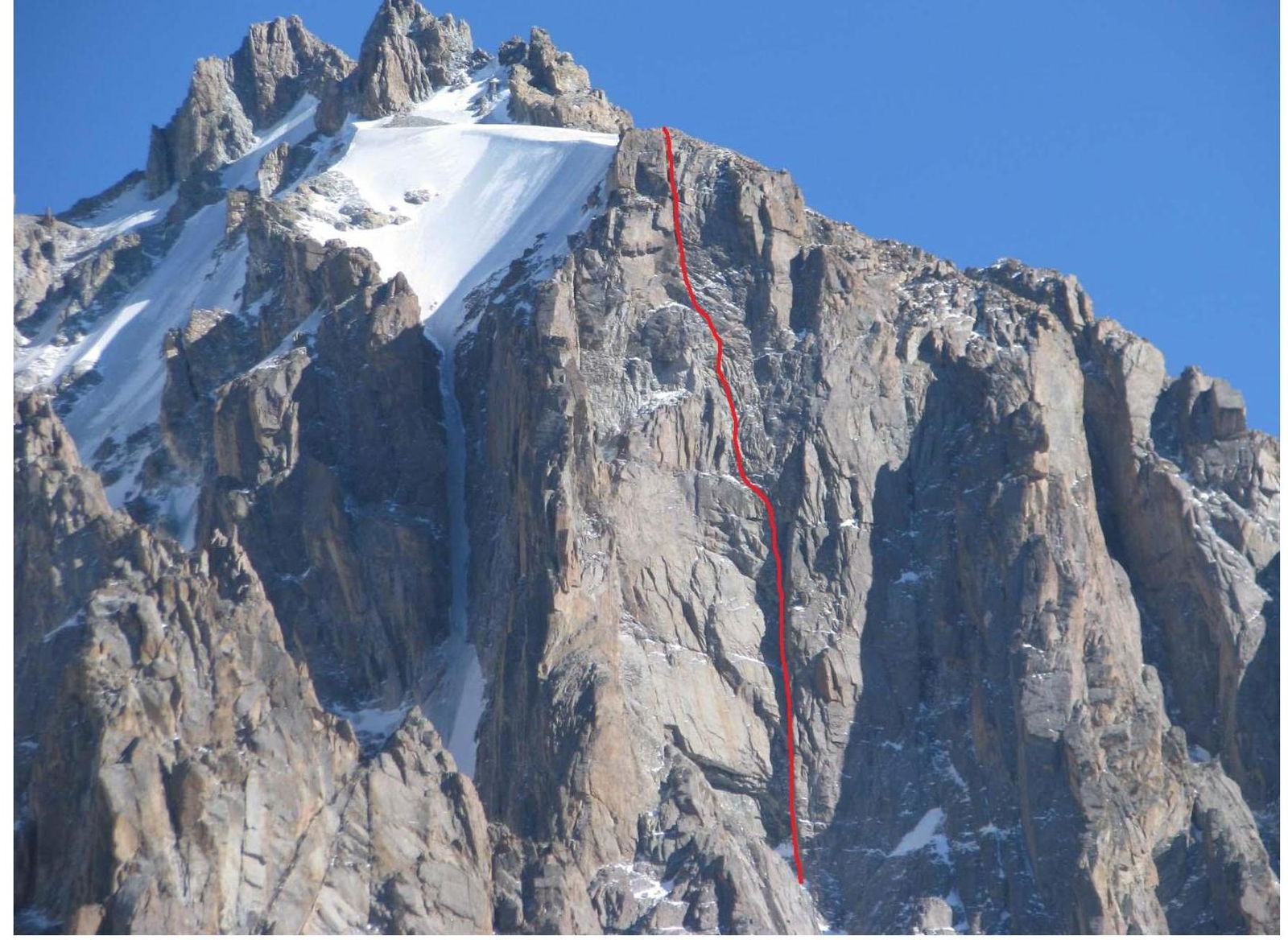
The route goes through the center of Baychechekey's West Wall, it is clearly tied to the relief and is visible from the base camp from start to finish. This section of the Wall remained unclimbed, despite the presence of many classified routes in the vicinity.
A few days before us, a team from Krasnoyarsk attempted to climb the route, completing three pitches. However, they descended due to various reasons, leaving behind anchors and a control tour on the section. We had observed this route back in 2013, as it is very logical and beautiful.
The route demands good technical skills in Artificial Technical Climbing (ITC) and psychological preparation, as it features sections of loose rock, cornices, flakes, sharp rock formations, etc. throughout. Destruction of these formations and falls can lead to injuries and serious consequences. There are no bolted anchors on the entire route, so a significant amount of time is spent on organizing protection. We climbed the route in poor, cloudy weather, finishing in darkness with hurricane-force winds, which, combined with the challenging climbing and ITC, required additional effort from us. According to the team's assessment, this route fully corresponds to the 5B category of difficulty based on the set of technical challenges. We recommend it for experienced and prepared climbers who are proficient in ITC techniques and have experience with several winter 5B climbs.
For example, we completed the Sadovsky route on the 5th Tower of the Corona in 4.5 hours, while this route took us 12.1 hours.
To climb this route, one needs: an expanded set of anchor pitons, rock friends, ITC equipment, and 1 skyhook for a 6 mm hole. There are no suitable bivouac sites on the lower part of the route. Above R6, a bivouac is possible.
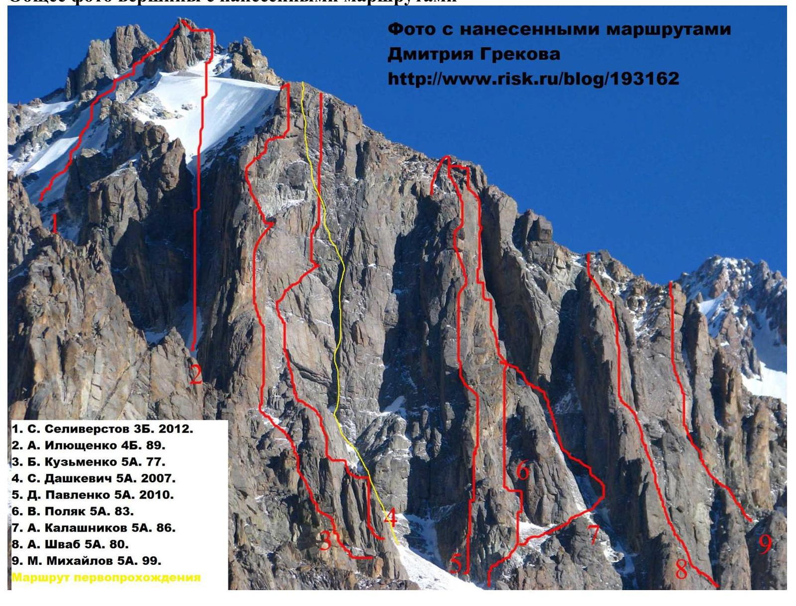
General Photo of the Summit with Routes Marked
Photo with routes marked by Dmitry Grekov: http://www.risk.ru/blog/193162 ↗
- S. Seliverstov 3B, 2012
- A. Ilyushchenko 4B, 1989
- B. Kuzmenko 5A, 1977
- S. Dashkevich 5A, 2007
- D. Pavlenko 5A, 2010
- V. Polyak 5A, 1983
- A. Kalashnikov 5A, 1986
- A. Schwab 5A, 1980
- M. Mikhailov 5A, 1999 First ascent route
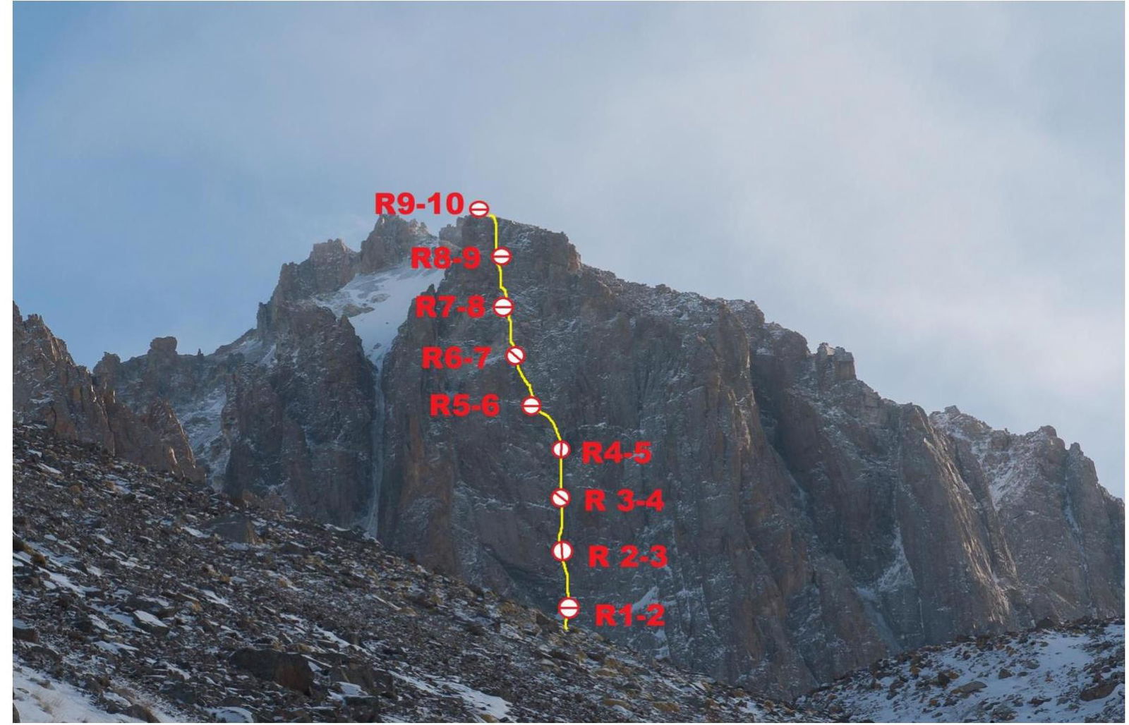
Photos of the Route by Sections
Description of the Route by Sections
R0–R1. Start of the route, move towards a characteristic large cornice in the left part of the West Wall through a system of corners and couloirs filled with snow. Some small walls are encountered. Station on the right under the cornice on anchor pitons, 100 m, 55° (III).
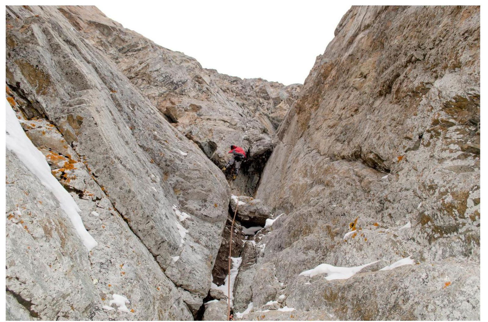
R1–R2. Overhanging, destroyed internal corner. To the right of the corner is a vertical slab. ITC via a crack under the cornice, from under the cornice - transition to the right (there is a hole for a 6 mm skyhook from the previous attempt) - into a giant internal corner, along which we continue. Hanging station in the corner on anchors and nuts, 50 m, 90° (VI, A2).
R2–R3. Up the corner, exit to a flattening, then the corner widens into a chimney, through which we exit to a ledge where a station was organized. 50 m, 85° (VI, A2).
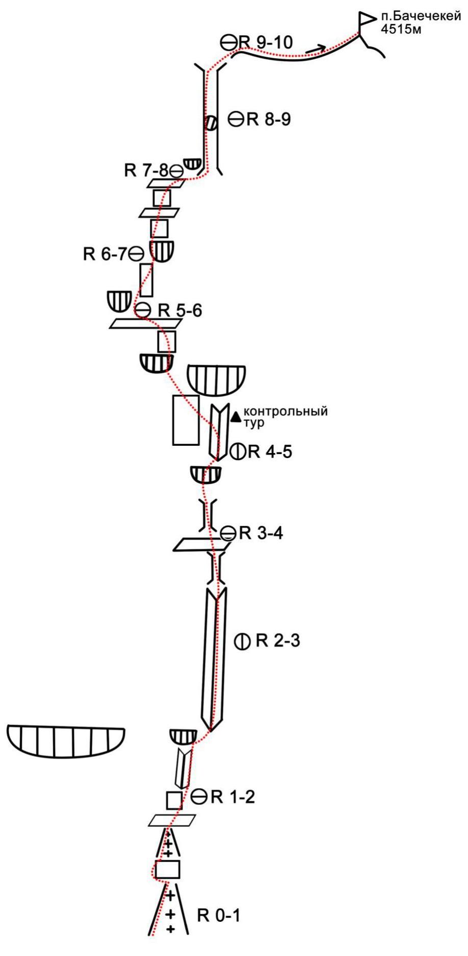
R3–R4. Up the corner under a large cornice. Pass the cornice on the left part, crack between rock formations, tense ITC, destroyed unreliable terrain. Behind the cornice, transition to the right into a corner, hanging station in the corner on anchors. (Photo 2–3). 50 m, 95° (VI, A2–A3).
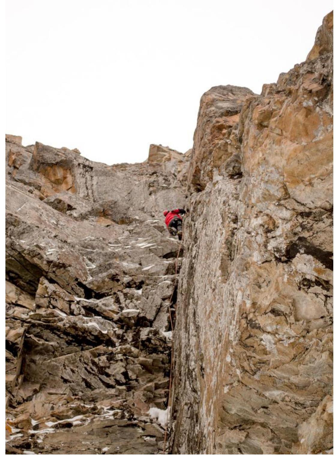
R4–R5. Up the corner to the control tour, the corner ends with a huge overhanging belt (we chose to pass the overhanging belt via the left option, a right option is also possible). From the tour, transition to the left along a slab to overhanging destroyed terrain, along which we move left to a cornice. On this section, protection is poor, with unreliable live blocks - be cautious! Then, through the cornice, left and up to a ledge with a station on anchor pitons. Key section of the route. 50 m, 95° (VI, A2–A3).
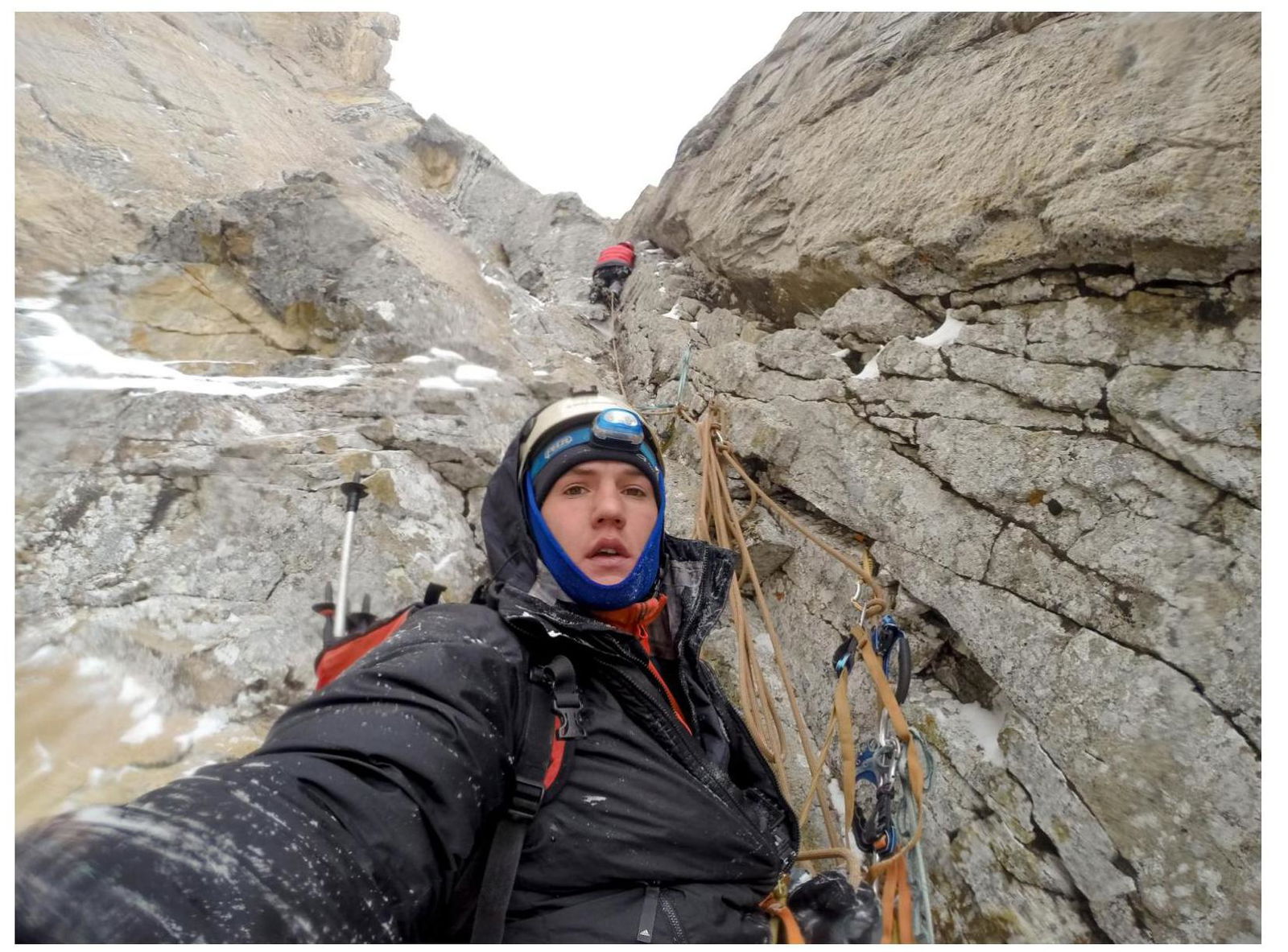
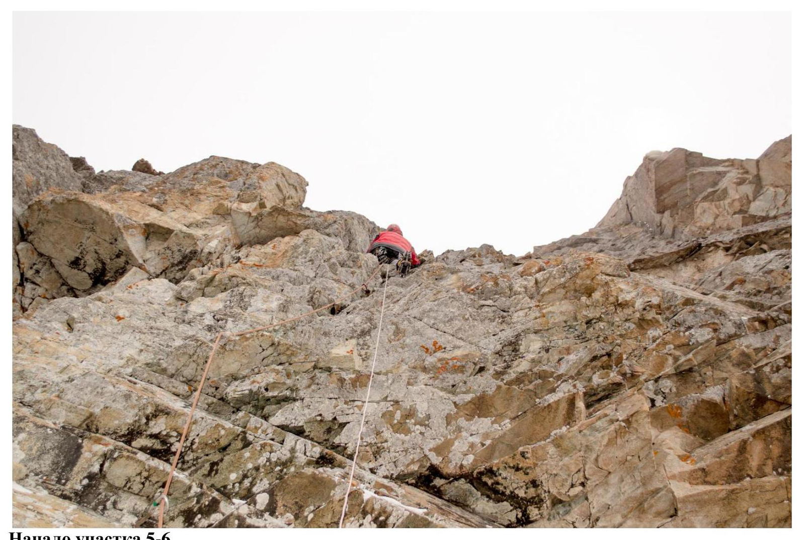
R5–R6. From the ledge, move along a crack to the right via free climbing under a cornice, then climbing through corners, walls, and ledges towards a large chimney. In the middle of the section, a belt of white rock is heavily destroyed, requiring careful passage. Station on a sloping ledge at the base of a vertical wall. 45 m, 80° (VI, A1).
R6–R7. From the station, along the wall with a small cornice and further into an internal corner, move to a ledge. The terrain is destroyed, requiring careful passage. Station on anchors. 50 m, 80° (VI, A1).
R7–R8. From the ledge, slightly to the right over a ridge, along gentle terrain, approach the base of a destroyed chimney. Entry into the chimney through 2 cornices, tense ITC through destroyed terrain. Then climbing up the chimney. Station on a ledge in the middle of the chimney. 50 m, 90° (VI, A2).
R8–R9. Climbing up the chimney until it ends. Then exit slightly to the right along slabs - exit to Baychechekey's shoulder. 40 m, 80° (VI).
R9–R10. Walk along the plateau to the summit. 200 m, 30° (II).
UIAA Scheme
Section R1–R2
Section R2–R3
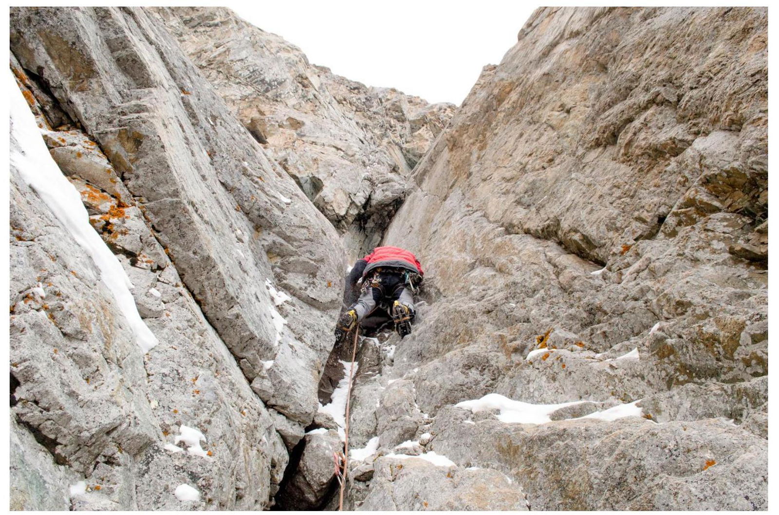
Start of section R3–R4
Passing the large cornice on section R3–R4
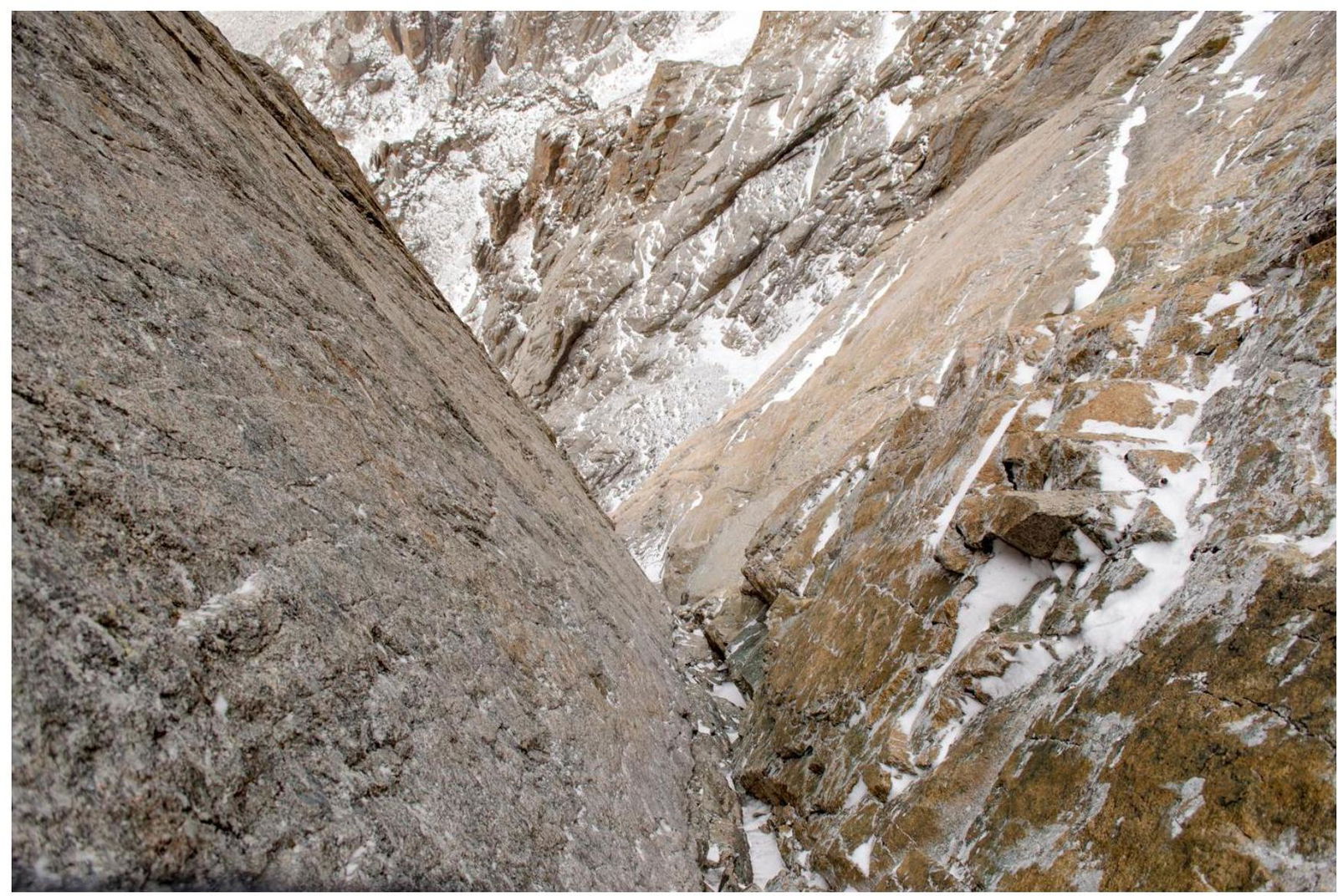
View down from station R4
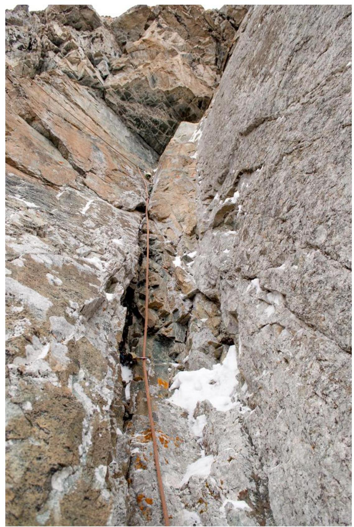
Start of section R4–R5 (control tour and traverse to the left under the cornice)

Overhanging destroyed terrain after the traverse on section R4–R5
Start of section R5–R6
Comments
Sign in to leave a comment