Kirov Region Mountaineering and Climbing Federation
Ascent Report
Kirov team ascent of Aktoo peak (4620 m) via the right-hand part of the North wall. January 9, 2013. Approximately category 5A complexity.
Kirov, 2013
Ascent Details
-
Tian-Shan, Kyrgyz range, Ak-Sai gorge. Section number according to the classification table: 7.4.
-
Aktoo peak (4620 m) (peak coordinates: 42°30′05.82″ N, 74°31′59.13″ E), right-hand part of the North wall.
-
Category: proposed 5A winter, first ascent.
-
Route type: ice and snow.
-
Route elevation gain: 720 m (3900 m — 4620 m).
Route length: 900 m.
Section lengths:
- V category — 120 m
- VI category — 45 m
Average steepness:
- wall section — 72°
- entire route — 60°
- Pitons left on the route: 0.
Equipment used on the route: ice screws — 38, protection — 3 (0).
The route was completed entirely with free climbing.
- Team's total climbing time: 7 hours 00 minutes.
No overnight stays.
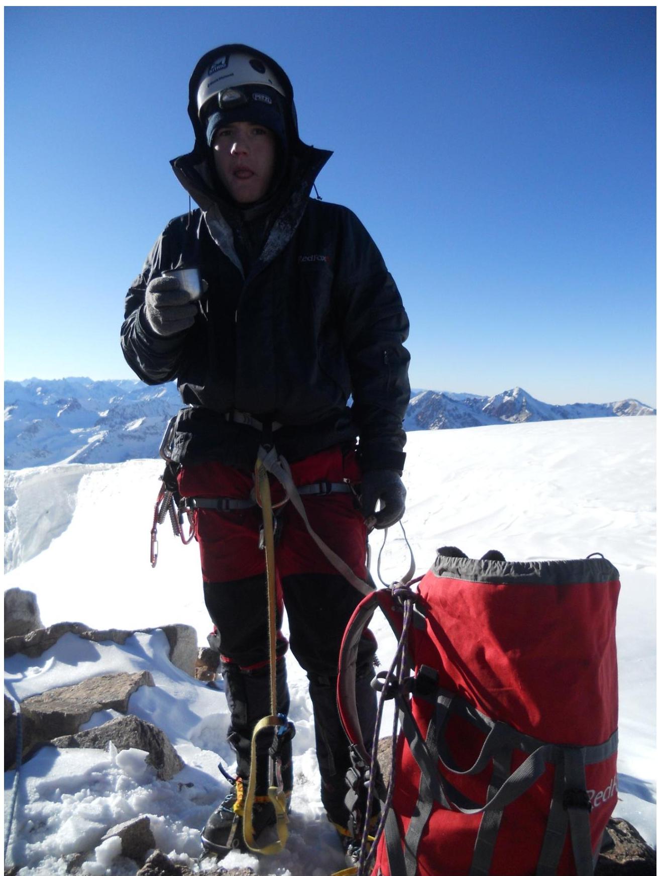
- Team leader: Glazunov Evgeny Vladimirovich (Candidate for Master of Sports).
Team member: Glazunov Sergey Vladimirovich (2nd sports category).
-
Coach: Glazunov Evgeny Vladimirovich (Candidate for Master of Sports).
Exit from Base Camp: 5:00, January 9, 2013. Summit: 15:50, January 9, 2013. Return to Base Camp: 20:30, January 9, 2013.
Tactical Actions and Sportive Characteristics of the Route.
The route goes through the right-hand part of Aktoo peak's North wall, via an unclimbed system of ice couloirs and walls, intersected by two rock bands: upper and lower.
- The upper band of ice-crusted rocks continues for one and a half to two rope lengths and is the key section.
- The route is exclusively winter!, as the wall is exposed to rockfall in summer.
- The route is significantly harder, with a higher average steepness and more technical climbing than the neighboring route via the couloir (Tarasov, 4B), which the team used for descent.
- The Kyrgyz Republic Mountaineering Federation has also assessed our route as category 5A, which the team requests be considered by the respected members of the Classification Commission of the Russian Mountaineering Federation.
The team started the ascent at 5:00 from the Ratsek campsite, aiming to complete the route and descend within a day.
At 9:00, they approached the route and began the ascent.
They reached the summit at 15:50.
They descended via the Tarasov route (10 rappels to the glacier).
They returned to camp at 20:30.
The team used 60 m ropes, so the section descriptions are based on this length. The first and second climbers moved with free climbing, except for 4 rope lengths before the ridge, where the second climber followed on top-rope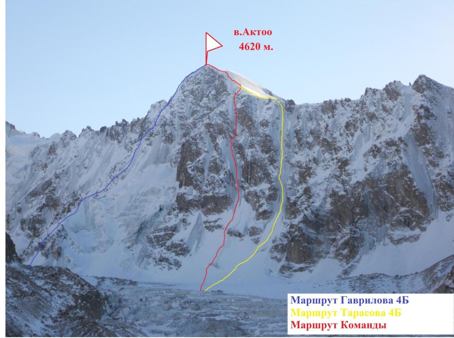
Gavrilov's 4B route, Tarasov's 4B route, and the team's route. General view of Aktoo peak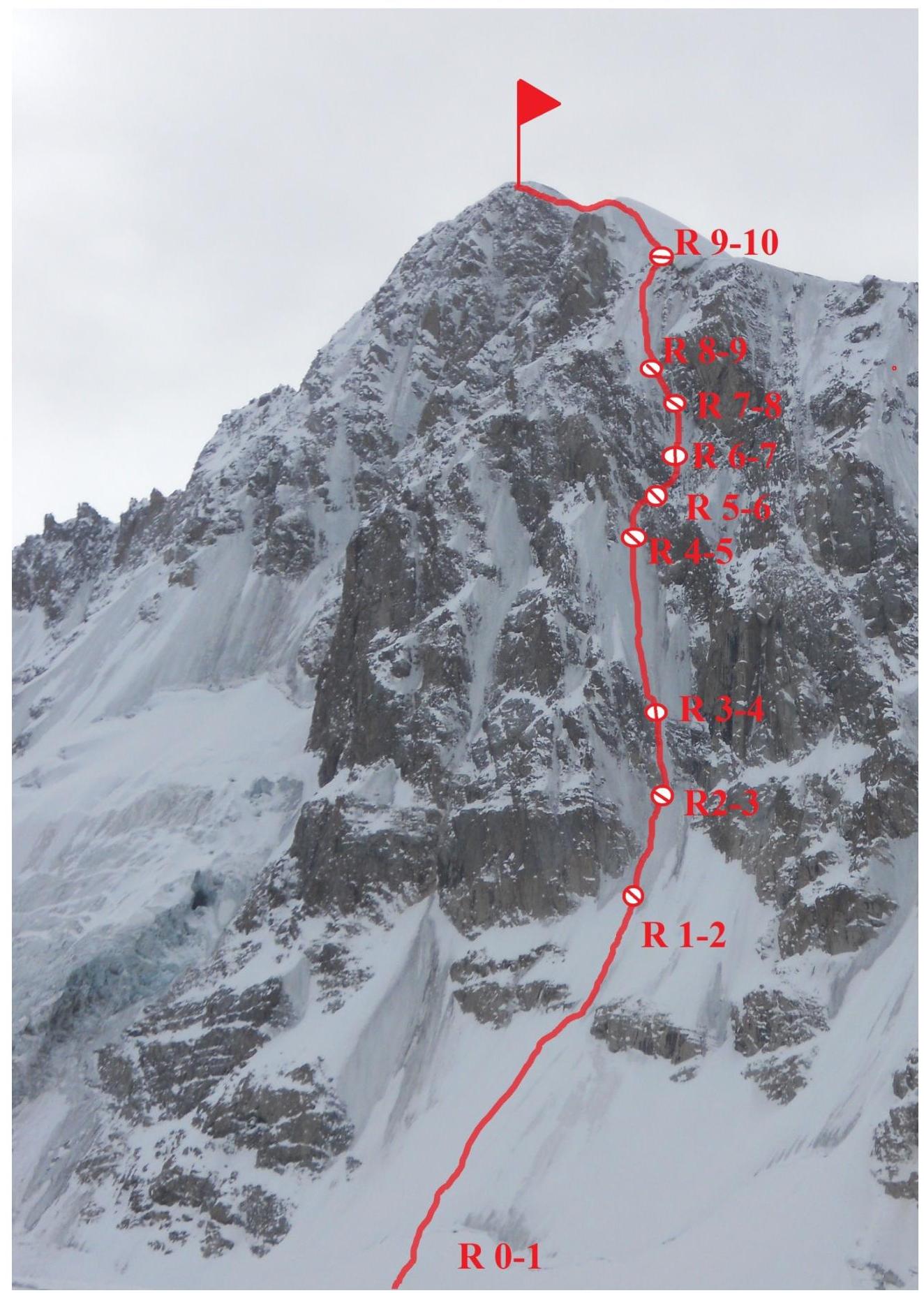
Route Photos by Section
Route Description by Section
0–R1 The route begins from the glacier, moving towards a characteristic gap in the lower rock band. Climbing on a snow, then snow-ice slope with increasing steepness. In the middle and upper parts of the section, one has to dig trenches in loose snow to reach the ice. Climbing is simultaneous. Belay station on monolithic ice, 200 m, 55° (III).
R1–R2 Approach on ice to the first rock band. Belay station under the vertical part (60 m, 55–60° IV).
2–3. Passing the first rock band via an ice couloir on a vertical wall — the first key section (photo 1) (60 m, 85° VI).
3–4. Up the ice slope to the base of the second rock band. Belay station under the rocks. Section length is two rope lengths. Photos 2–3. (120 m, 70° IV–V).
4–5. Traverse right on an ice-covered rock ledge. (50 m, 70° V).
5–6. Climb the rock wall (photo 4) — key section. To the left, there is unreliable ice crust on the rocks. Good placements for protection in the rocks. Hanging belay station at the exit to monolithic ice (photo 5) (30 m, 90° VI).
6–7. From the belay station, climb vertical ice with some rock sections, exactly one rope length to the base of a small inner corner. (60 m, 85° VI).
7–8. Climb the ice-filled corner (photo 6) to the ice slope leading to the ridge (60 m, 80° V).
8–9. On the ice slope, bypass a huge corniche from left to right, and exit onto the ridge (60 m, 75° IV).
9–10. On the ridge, climb simultaneously-alternately, and then through a small ice wall to the summit (200 m, 55° IV–V).
Descent: return to R9 by the ascent route, then descend the ridge to reach the couloir (Tarasov's route), and make 10 rappels of 60 m to the glacier.
UIAA Scheme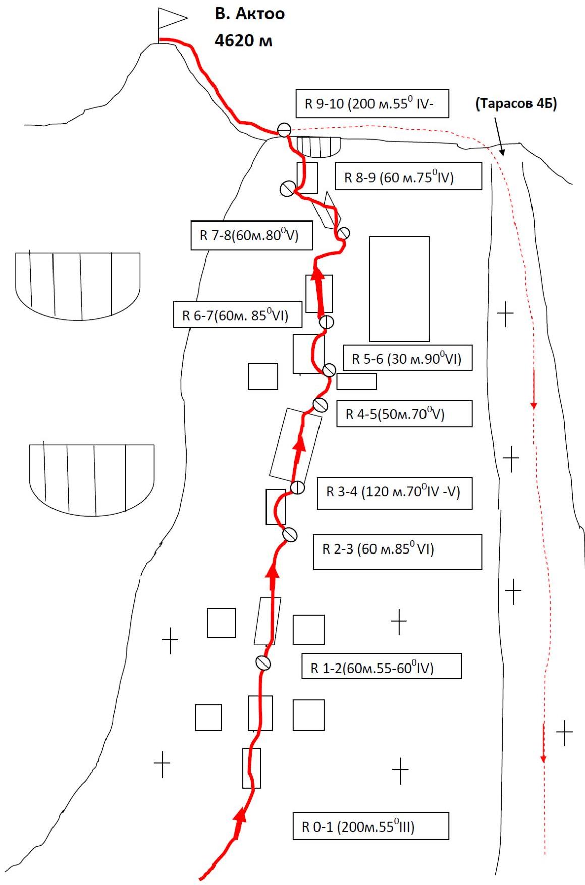
SLOPE PROFILES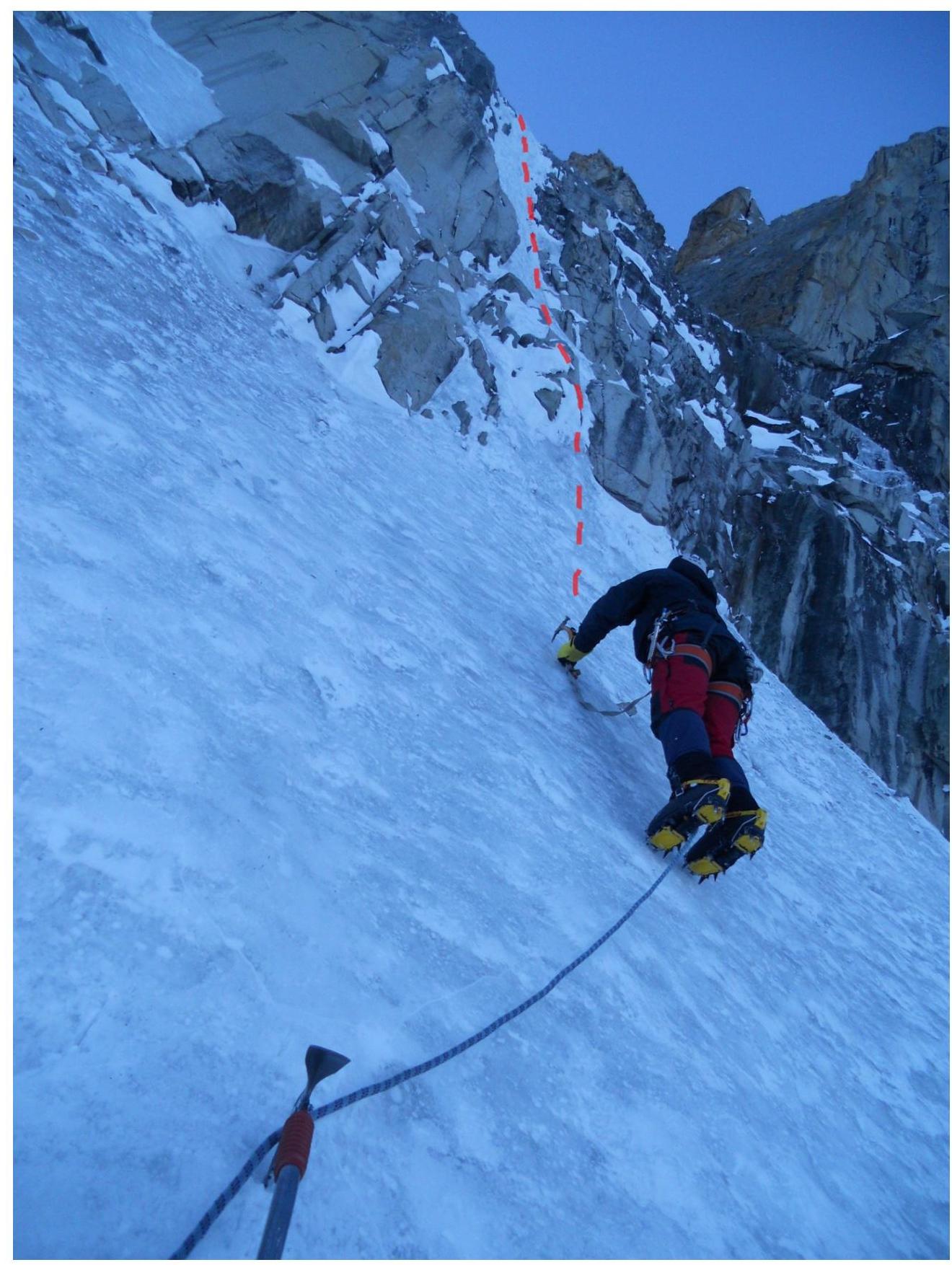
Photo 1. Section 2–3 (passing the first rock band via a vertical ice couloir)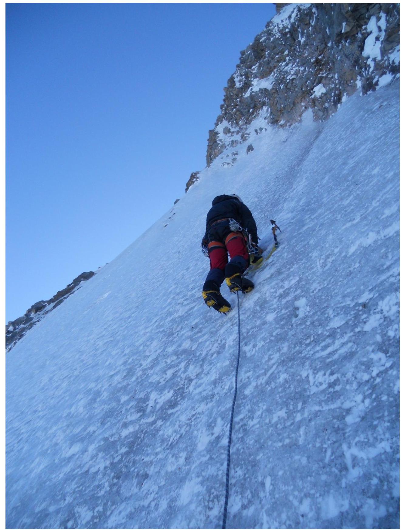
Photo 2. Section 3–4, middle part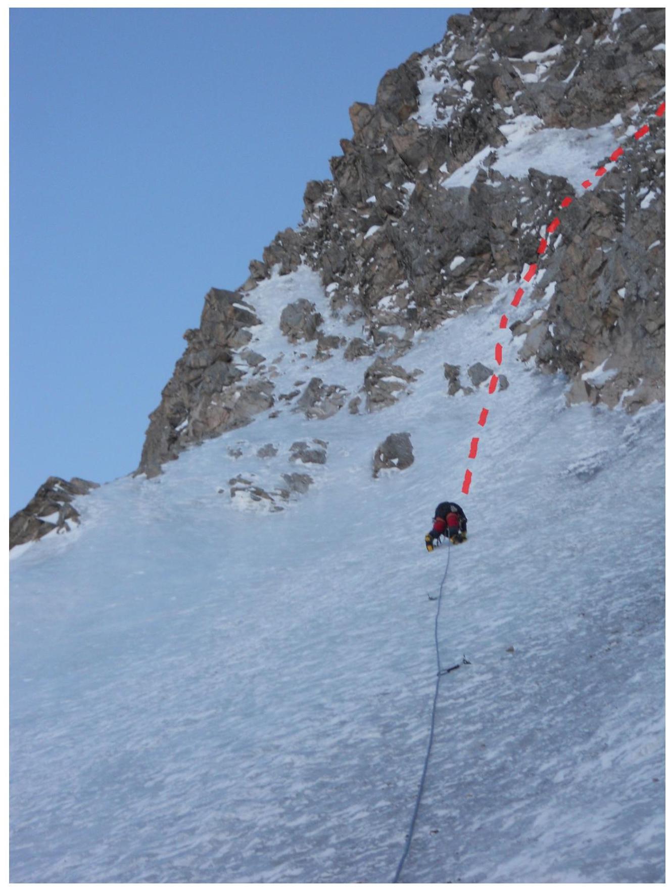
Photo 3. Section 3–4, upper part (exit from the ice slope to the second rock band).
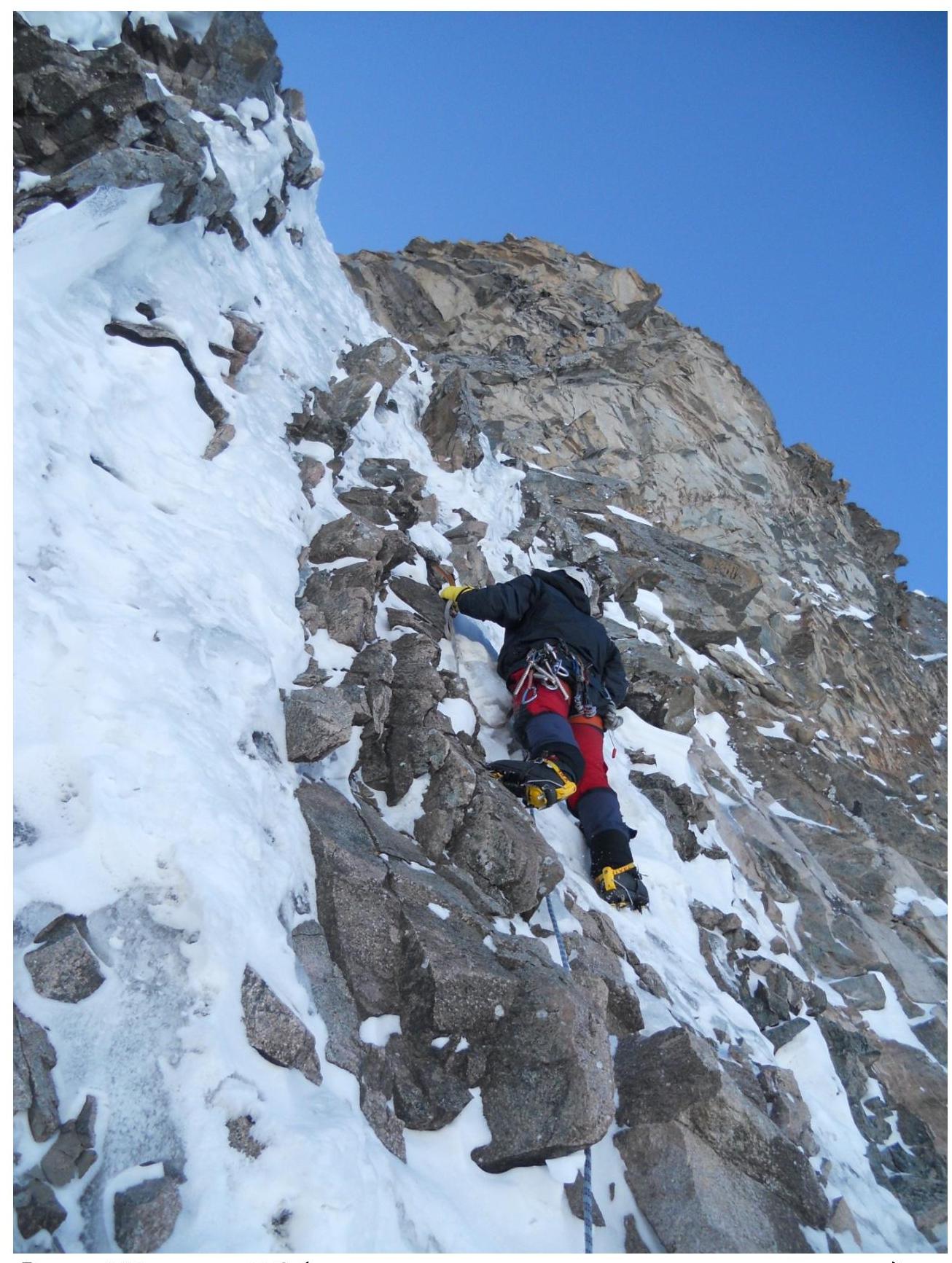
Photo 4. Section 5–6 (key rope length on the upper rock band).
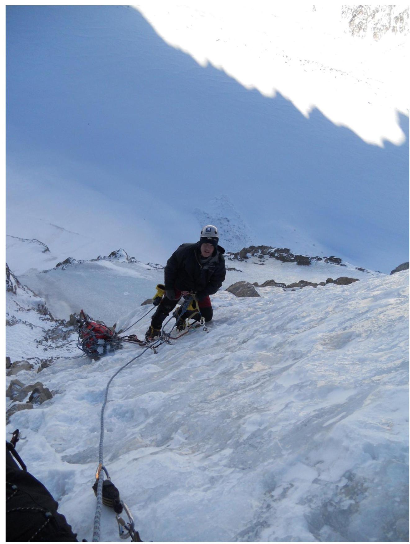
Photo 5. Start of section 6–7.
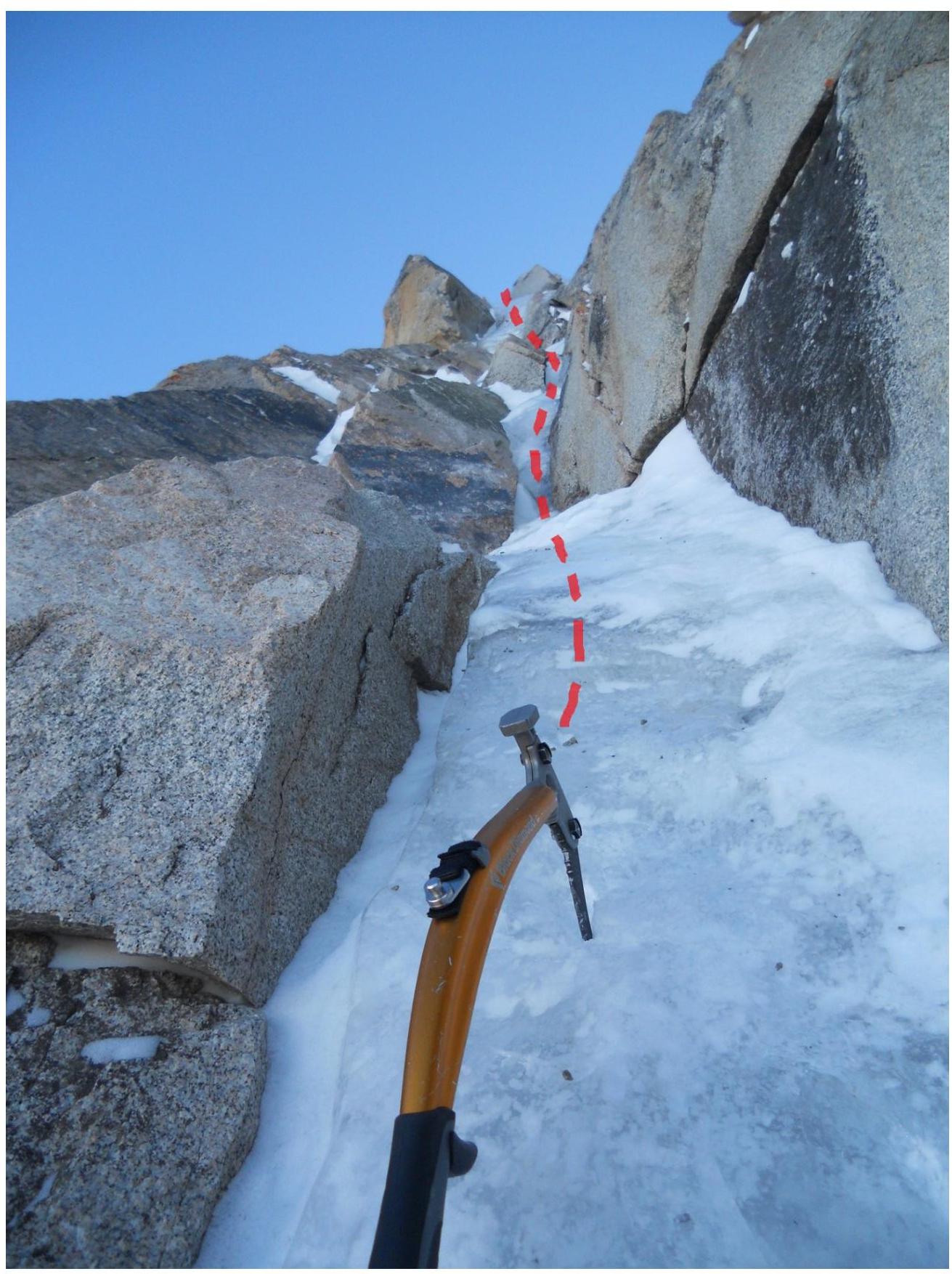
Photo 6. Section 7–8