
Ascent Passport
-
Ascent class — rock climbing
-
Ascent area — Tian-Shan, Trans-Ili Alatau ridge.
-
Peak — Chkalov Peak, height — 3892 m, route — along the northern ridge.
-
Expected difficulty category — 2B
-
Route characteristics:
- Height difference — 700 m.
- Average steepness — 45°.
- Sections of 5th category of difficulty are absent
-
Pitons driven:
- for belaying — II, for creating belay anchors — none
- rock — II
- ice — none
- bolted — none
-
Number of climbing hours — 7
-
Number of nights on the route — none
-
Ascent participants:
- Cherepinsky Yuri Davydovich — Master of Sports, leader
- Koshcheev Evgeny Vasilyevich — 1st sports category, participant
- Guryev Sergey Anatolyevich — 1st sports category — same
- Zhurakovsky Evgeny Nikolaevich — 2nd sports category — same
-
Team coach: Cherepinsky Yu.D.
-
Date of departure on the route and ascent — August 15, 1980.
Map of the Ascent Area
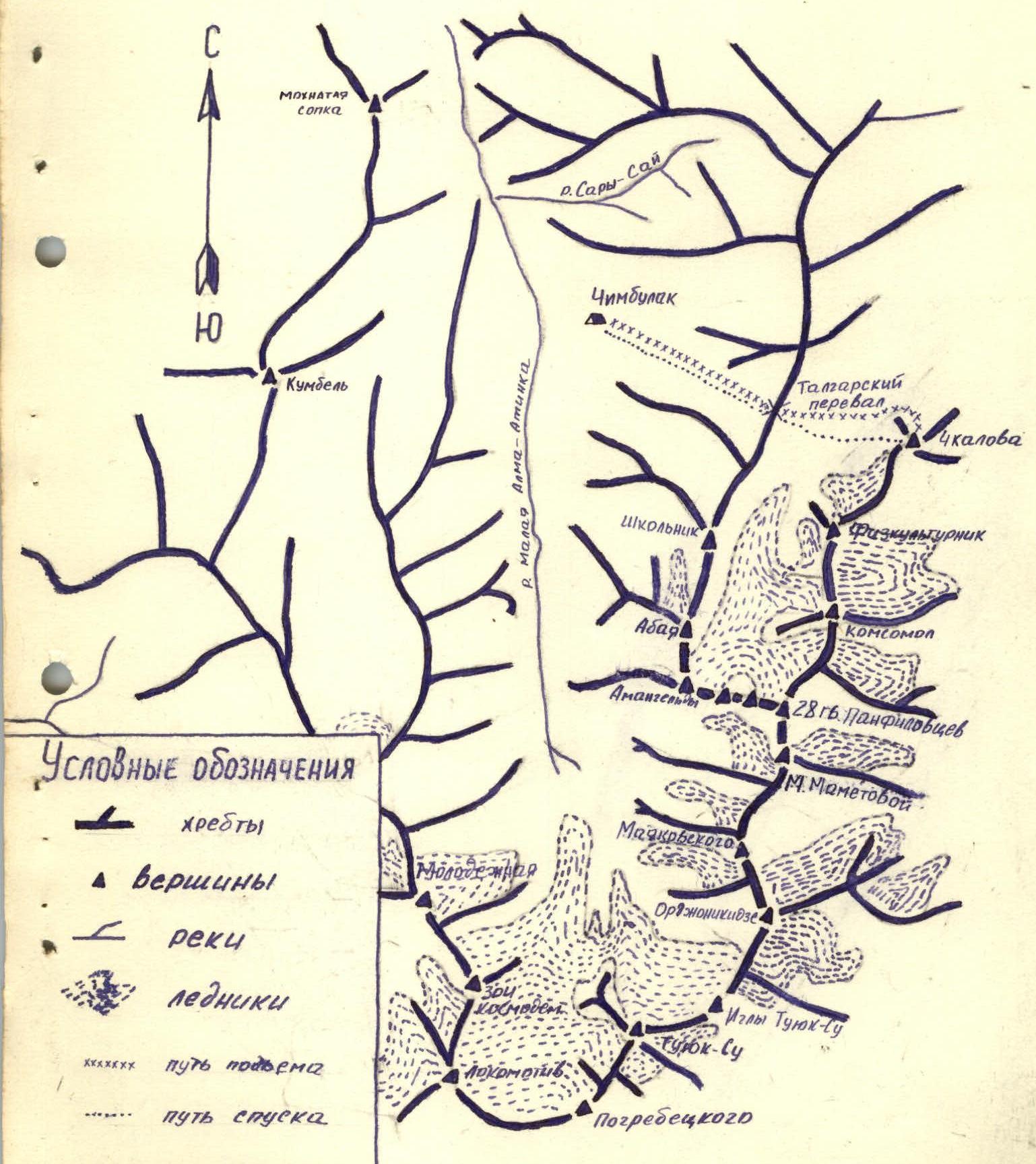
Brief Description of the Approach to the Route
From Chimbulak along the trail along the support of the suspension road to the Talgar Pass, the journey takes 2 hours.
From the pass to the east, descend with a loss of height of 200–250 m to the moraine of the Bogdanovich Glacier.
Moving in the same direction, cross the moraine of the glacier to the left edge of the Chkalov Peak massif. In this part of the massif, a wide talus couloir is clearly visible.
The path to the foot of the couloir, where the route begins, takes 1.5–2 hours.
Brief Explanation for the Table
You should ascend the couloir, staying close to the rock ridge on the left.
The upper part of the couloir is very steep, and its passage must be accompanied by belaying.
The couloir leads to a ridge, where the rocky part of the route begins.
Table of Main Characteristics of the Ascent Route
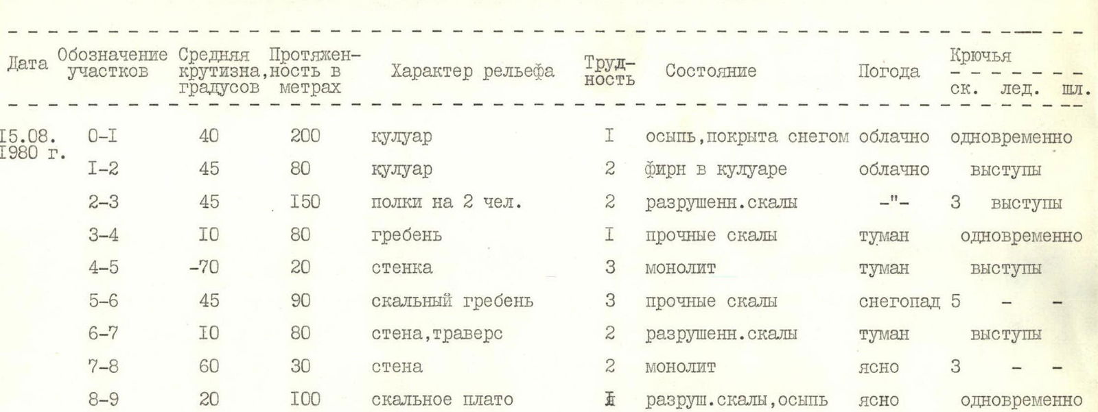
| Date | Designation of sections | Average steepness, ° | Length, m | Terrain characteristics | Difficulty | Condition | Weather | Pitons (rock) | Pitons (ice) | Pitons (bolted) |
|---|---|---|---|---|---|---|---|---|---|---|
| 15.08.1980 г. | R0–R1 | 40 | 200 | couloir | 1 | talus, covered with snow | cloudy | simultaneously | ||
| R1–R2 | 45 | 80 | couloir | 2 | firn in the couloir | cloudy | ledges | |||
| R2–R3 | 45 | 150 | shelves for 2 people | 2 | destroyed rocks | — " — | ledges | |||
| R3–R4 | 10 | 80 | ridge | 1 | strong rocks | fog | simultaneously | |||
| R4–R5 | –70 | 20 | wall | 3 | monolith | fog | ledges | |||
| R5–R6 | 45 | 90 | rocky ridge | 3 | strong rocks | snowfall | 5 | |||
| R6–R7 | 10 | 80 | wall, traverse | 2 | destroyed rocks | fog | ledges | |||
| R7–R8 | 60 | 30 | wall | 2 | monolith | clear | 3 | |||
| R8–R9 | 20 | 100 | rocky plateau | 2 | destroyed rocks, talus | clear | simultaneously |
Comments
Sign in to leave a comment