Ascent Passport
I. Ascent Class
- rock
- Ascent Area
- Trans-Ili Alatau
- Summit
- B. Khmelnitskogo, 4150 m; Eastern Ridge.
- Estimated Difficulty Category
- 1B
- Route Characteristics:
- height difference — 300 m;
- length of sections with II–III difficulty category 5–60 m;
- route type — combined
-
Pitons hammered in for belay — 6 rock;
-
Number of walking hours — 4 h
-
Number of overnight stays
- none
- Surname, name, patronymic of the leader and participants:
- Monaenkov E.I. MS — leader
- Belyakov V.D. CMS — participant
- Statsenko S.N. CMS — participant
- Kulakov V.P. 1st category — participant
- Team Coach — Stolyarsky, MS USSR
II. Date of departure and return — June 25, 1986
- Organization — Center for Alpine Training Kaz RS "Dynamo"
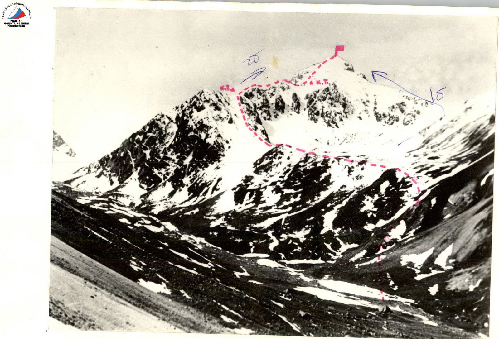
Fig. I. Peak Bogdan Khmelnitsky. Eastern Ridge. Ascent route.
P. B. Khmelnitskogo 4150 m
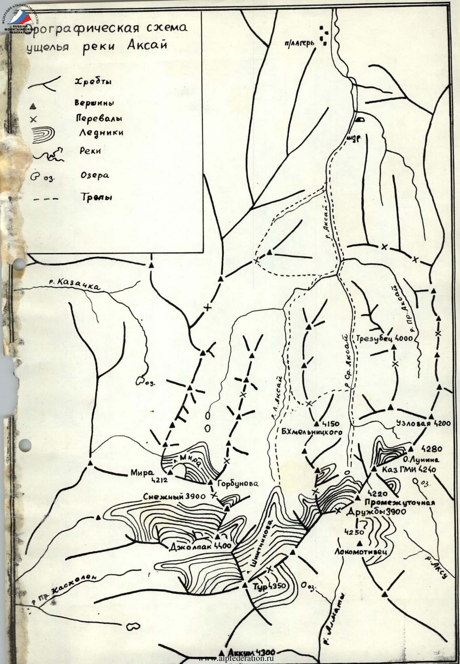
Brief description of the approach to the route
From the city of Alma-Ata to the "Leninets" pioneer camp, travel by car on the highway. Then, on the right (orographically) side of the gorge, walk to the confluence of three rivers:
- Left Aksay
- Middle Aksay
- Right Aksay
From the pioneer camp — 4 hours walking.
Further path along the valley of the Middle Aksay River, on the right (orographically) side leads to a large boulder (large stone) lying in the river floodplain — 2 hours walking from the confluence of the rivers. Here is the initial bivouac.
Above the camp at the Big Stone, cross the Aksay River and begin ascending along the grassy slope towards the scree. Reaching the level of the scree, ascend along the right edge of the scree, along the grassy slope, partially along the rocky outcrops of the slope, ascend to the green shoulder, from which the route begins to the left.
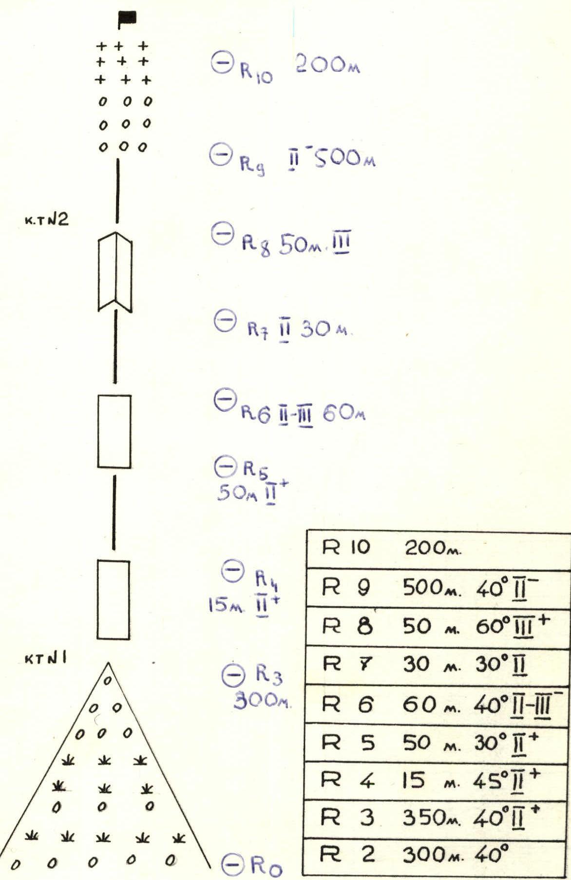
Description of the Eastern Ridge route to Peak Bogdan Khmelnitsky
R1 Ascend from the river along the grassy slope to the green shoulder.
R2 From the shoulder, 300 m to the left upwards along the steep scree slope, the rocky outcrop is bypassed on the left, on the ridge is a control cairn.
R3 Further along the ridge in the direction of the summit 300–380 m.
R4 "Gendarme" 15 m, which is climbed "head-on", descent 5 m, then along the ridge 50 m.
R5 Wall 60–70 m, 30–40°, II difficulty category. Belay through ledges and pitons.
R6 Ridge. 20 m. Wall — 5 m, then bypass on the left along the ledges to the inner corner 5 m, 50°, III difficulty category.
R7 Further along the ridge to the left to the "gendarme" "head-on".
R8 Along the ridge, which is partially bypassed on the left.
R9 After the ridge, exit to the scree slope, at this place is a control cairn.
R10 Further along the scree slope in the direction of the summit, before the summit — scree slope, which is traversed with alternating belay. Descent via the 1B category route.
Footnotes
-
A. Akkum 4300 m ↩