Ascent Passport
- Ascent class: technical
- Ascent region: North Tian-Shan, Trans-Ili Alatau, Maloe Alma-Atinskoe gorge
- Peak, route: Ordzhonikidze Peak (4410 m), via S slope, first ascent.
- Presumed category of difficulty: 4B, combined
- Height difference: 600 m
total route length — 840 m, wall section length — 720 m, of which 5th category of difficulty — no, 6th category of difficulty — no, average steepness of wall section — 60°, average steepness of route — 50°
- Pitons driven (figures in denominator — for ITI):
rock — 6/0, ice — 47/0, chocks — 0, bolt pitons — 0
- Number of climbing hours/days: 8 hours/1 day
- Overnight stays: no
- Leader — Pivtsov Vasily Talgatovich, 1st sports category
Team members — Molgachev Damir Sergeyevich, 1st sports category; Rudakov Alexander Yuryevich, 1st sports category; Skopin Artem Alekseyevich, 1st sports category
- Coach: Ilyinsky Ervand Tikhonovich, Honored Coach of the USSR
- Departure for the route: January 29, 2000, 6:30 AM
Summit: January 29, 2000, 2:30 PM; Return: January 29, 2000, 6:00 PM;
Map-scheme
of the area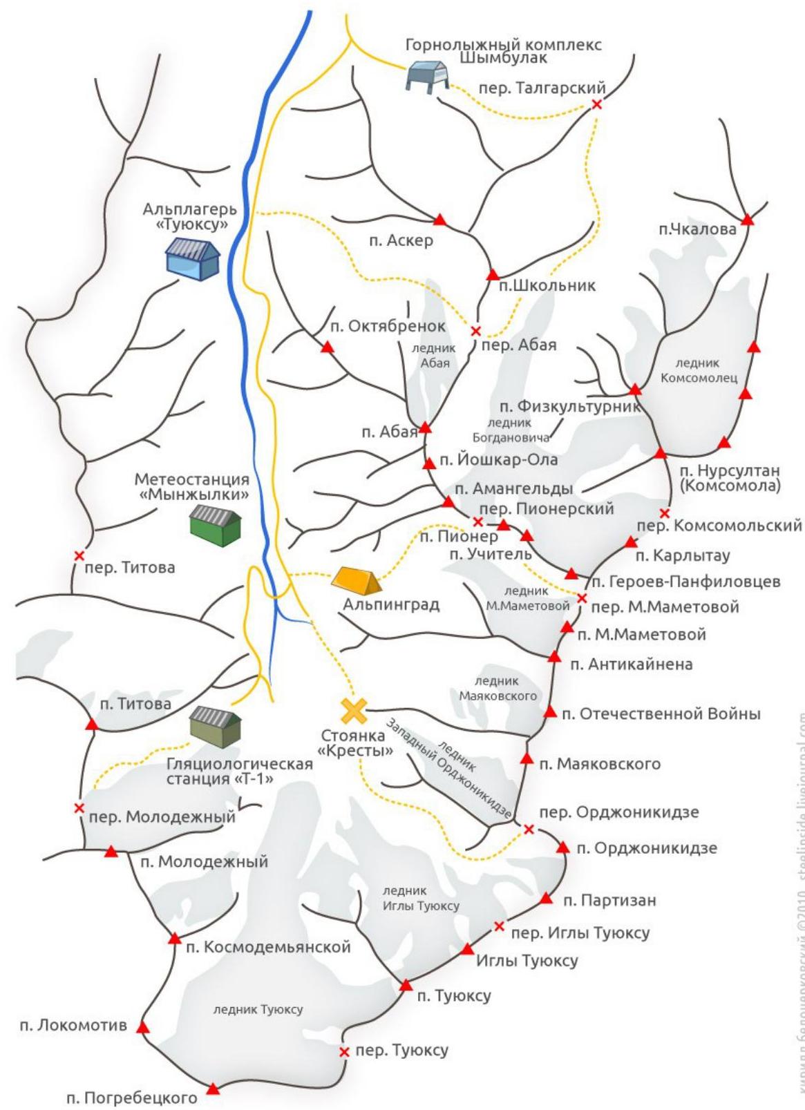 n.
Pogrebetsky
n.
Pogrebetsky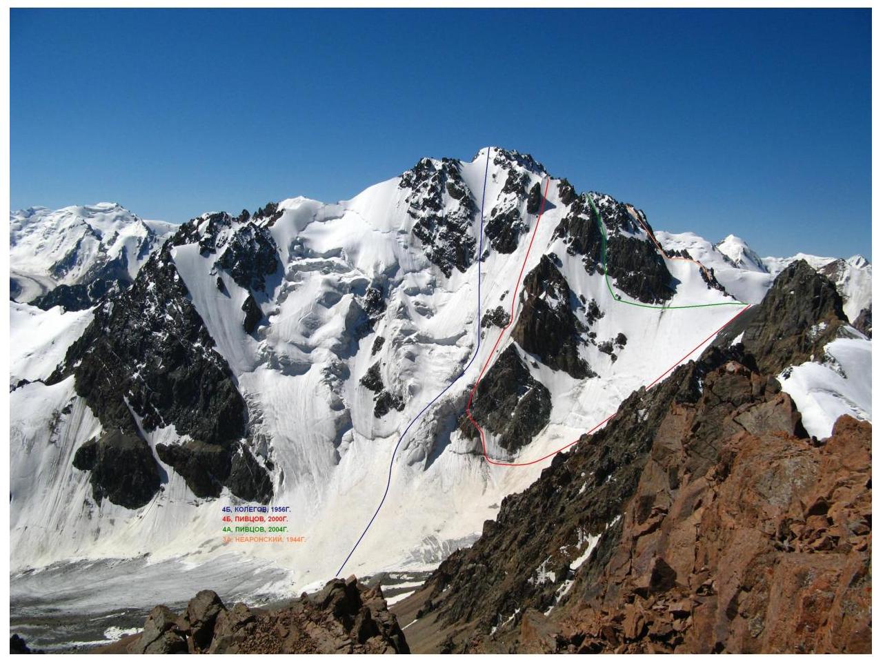
Route Description
Descending from Ordzhonikidze Pass, it is necessary to bypass the rock counterfort descending to the East Ordzhonikidze Glacier. The route begins from the bergschrund, located between the counterfort (right) and the rock triangle (left). Movement to the bergschrund is with simultaneous belay.
From the bergschrund, hugging the rock triangle, two ropes, with steepness up to 60°, lead to the ice ridge under the icefall. Further along the ridge with steepness 45° and length 45 m, approach under the triangular rock, under which a belay station is organized.
The next rope, with steepness up to 65°, passes along a narrow ice couloir between the counterfort and the rock island. It leads to a snow field with steepness up to 50° and length 140 m.
Further, rounding the rock island to the right, follow the direttissima. From the rock island, the route begins to wind and in the upper part reaches 65°. The wall ends at a ridge, along which, after 150 m, the summit is reached.
In summer, the route may be prone to rockfall.
Belaying is carried out:
- through ice screws,
- due to the proximity of rocks — it is possible to use pitons, chocks, and other protective gear.