Northern Tian-Shan, Trans-Ili Alatau
Peak Manshuk Mametova via the North Face
25 category of difficulty
Ascent Passport
- Region, gorge, section number according to the classification table of 20__ year — Northern Tian-Shan, Trans-Ili Alatau, Maloye Almatinskoye gorge.
- Name of the peak, its height, name of the route: Peak Manshuk Mametova via the north face.
- Proposed: 2B cat. diff.
- Character of the route: combined
- Height difference of the route: 350 m
Length of the route: 500 m. Length of sections:
- V cat. diff. — 0 m
- VI cat. diff. — 0 m. Average steepness:
- main part of the route — 55°
- whole route — 40°
- Hooks left on the route:
total 0; including bolted — 0
- Team's walking hours: no information
- Leader: Aleksey Raspopov, Candidate Master of Sports
Participants: no information
- Coach:
- Exit to the route from the Base Camp:
Route started
Exit to the summit
Return to the Base Camp
Descent from the summit: via 1B cat. difficulty route;
-
Organization:
-
Responsible for the report K. Belotserovskiy
Email and phone: k.belotserovskiy@gmail.com, +7 701 736 1887
General photo
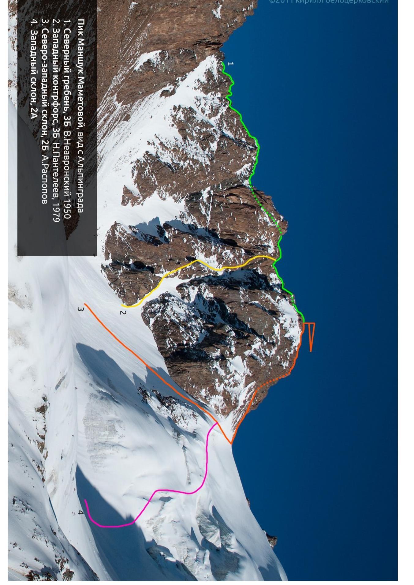
Peak Manshuk Mametova, view from Alpingrid
- North ridge, 35, V. Neverovskiy, 1950
- West cogort, 35°, N. Svideleyev, 1970
- North-west slope, 45°, A. Rastopav
- West slope, 54°.
Route Diagram
Peak Manshuk Mametova via the North-West slope,
2B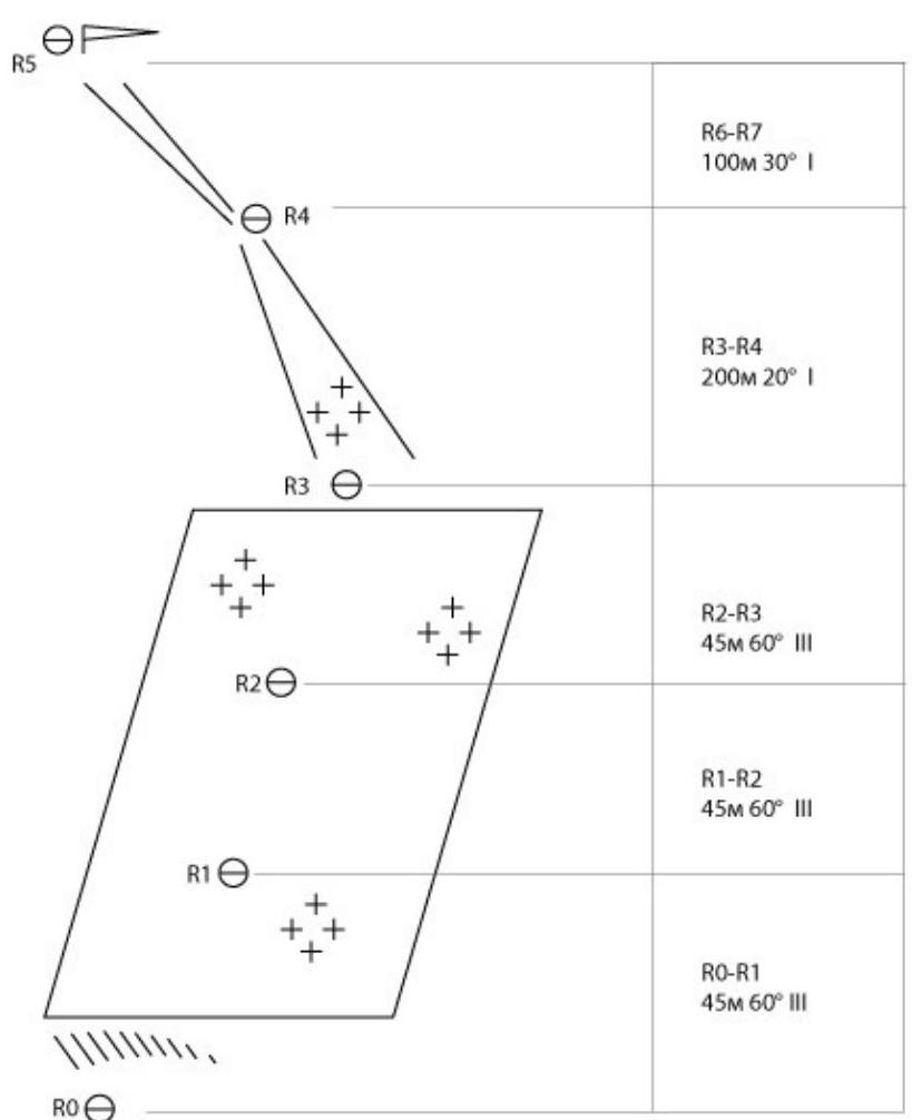
Description
R0–R1
Start from the bergschrund. Move up the moderately steep ice.
R1–R2
Movement on ice. The ice contains inclusions of small pebbles (blown from the pass), so tools and ice screws quickly become dull.
R2–R3
The ice becomes a bit steeper. Exit to the snow patch.
R3–R4
Ascend the gentle snow couloir to the saddle.
R4–R5
From the saddle, via the scree couloir and then along the ridge, reach the summit. Descent via route 2A to the Manshuk Mametova glacier, or via route 1B to the Otechestvennoy Voyny cirque.

