Siberian Federal District Climbing Championship
high-altitude technical class
2022
Report
on the ascent to the Zvezdny peak, 2265 m via the right part of the South wall angles, 4B–5A cat. diff., first ascent by the Krasnoyarsk team from August 12, 2022.
I. Ascent Passport
| 1. General Information | ||
|---|---|---|
| 1.1 | Full name, sports rank of the team leader | Prokofiev D.E. (MS) |
| 1.2 | Full name, sports rank of the participants | Mekhov A.A. (2nd sports rank) Akhpasheva M.O. (2nd sports rank) Zaripov R.R. (2nd sports rank) |
| 1.3 | Full name of the coach | Prokofiev D.E. (MS) |
| 1.4 | Organization | Krasnoyarsk Regional Climbing Federation |
| 2. Characteristics of the Ascent Object | ||
| 2.1 | Region | Western Sayan |
| 2.2 | Valley | Ergaki valley |
| 2.3 | Section number according to the 2013 Classification Table | 6.6.2 |
| 2.4 | Name and height of the peak | Zvezdny, 2265 m |
| 2.5 | Geographical coordinates of the peak (latitude/longitude), GPS coordinates | 35°20′18″N 76°27′23″E |
| 3. Route Characteristics | ||
| 3.1 | Route name | right part of the South wall |
| 3.2 | Proposed category of difficulty | 4B–5A |
| 3.3 | Route exploration level | first ascent |
| 3.4 | Route terrain character | rock climbing |
| 3.5 | Route height difference (altimeter or GPS data) | 350 m |
| 3.6 | Route length (in meters) | 465 m |
| 3.7 | Technical elements of the route (total length of sections with varying difficulty, indicating terrain character (ice-snow, rock)) | 2 cat. diff. rocks – 50 m 3 cat. diff. rocks – 200 m 4 cat. diff. rocks – 35 m 5 cat. diff. rocks – 170 m 6 cat. diff. rocks – 10 m Rocks VI, A3 – M |
| 3.8 | Average route steepness, (°) | 73° |
| 3.9 | Average steepness of the main route section, (°) | 52° |
| 3.10 | Descent from the peak | SW edge |
| 3.11 | Additional route characteristics | Main route section is on anchors and small friends |
| 4. Team Actions Characteristics | ||
| 4.1 | Time in motion (team's working hours, in hours and days) | 6 h 00 min, 1 day |
| :--: | :--: | :--: |
| 4.2 | Overnights | - |
| 4.3 | Route processing time | 0 h, 0 days |
| 4.4 | Route start | 9:00 August 12, 2022 |
| 4.5 | Reach the peak | 15:00 August 12, 2022 |
| 4.6 | Return to base camp | 19:00 August 12, 2022 |
| 5. Weather Conditions Characteristics | ||
| 5.1 | Temperature, °C | 10–18°C |
| 5.2 | Wind speed, m/s | 2 m/s |
| 5.3 | Precipitation | none |
| 5.4 | Visibility, m | full |
| 6. Report Responsible | ||
| 6.1 | Full name, e-mail | Prokofiev D.E. desprok@gmail.com |
II. Ascent Description
1. Characteristics of the Ascent Object
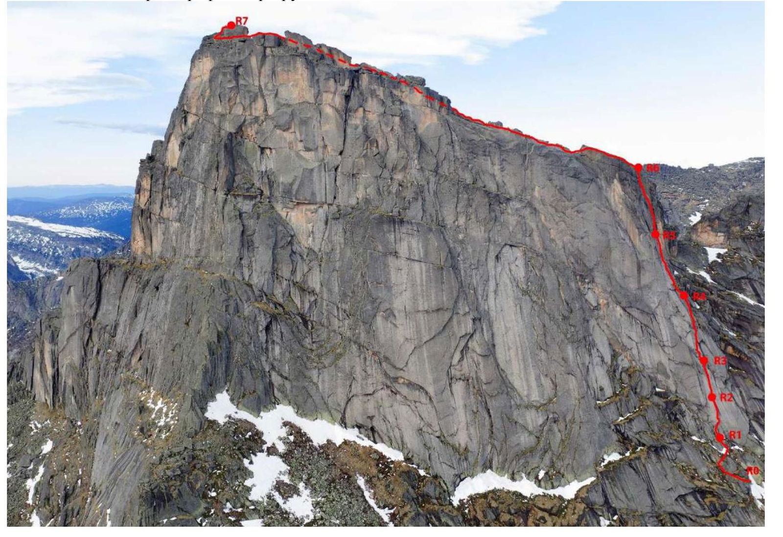
1.1. General photo of the peak
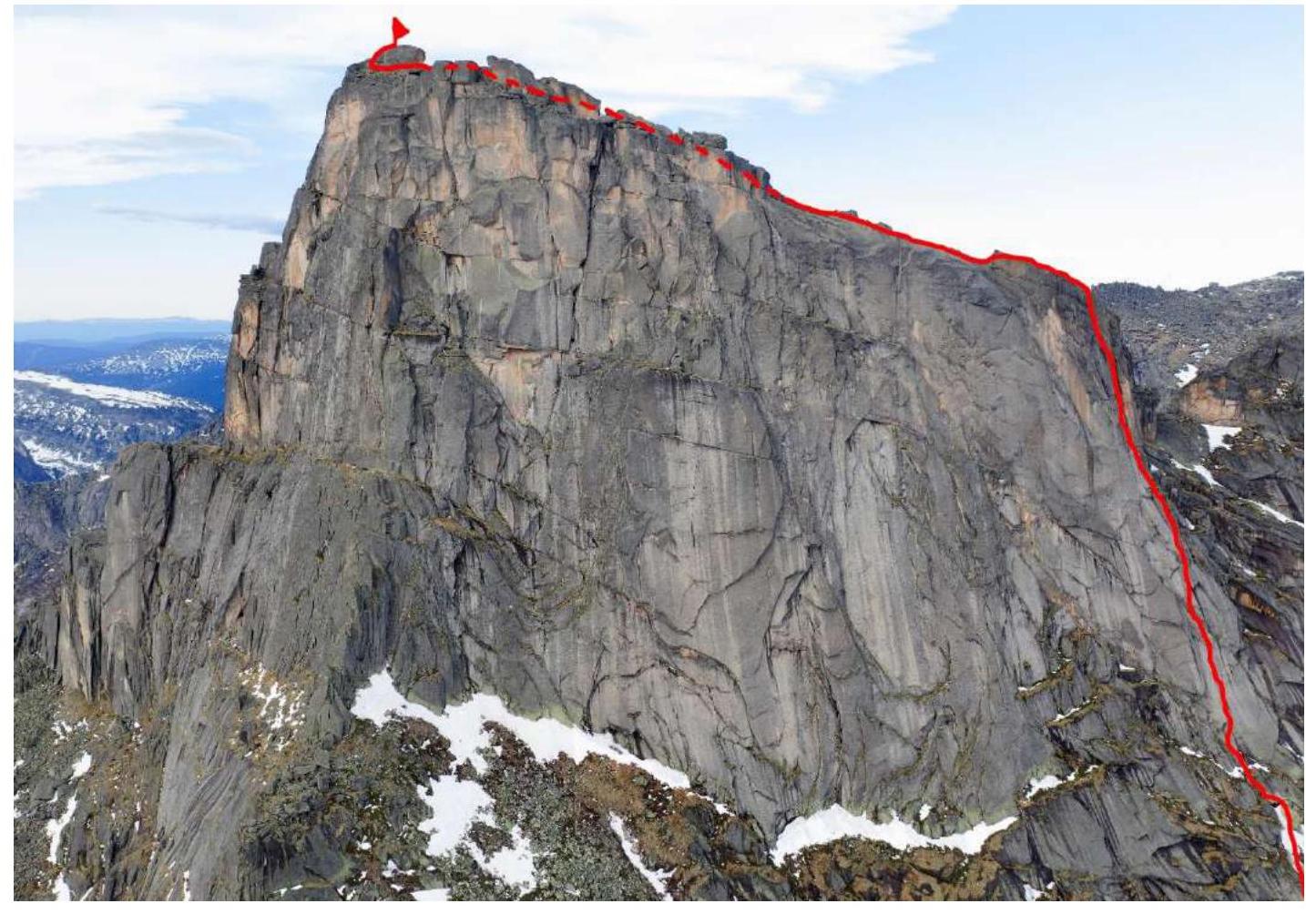
Route taken by the team
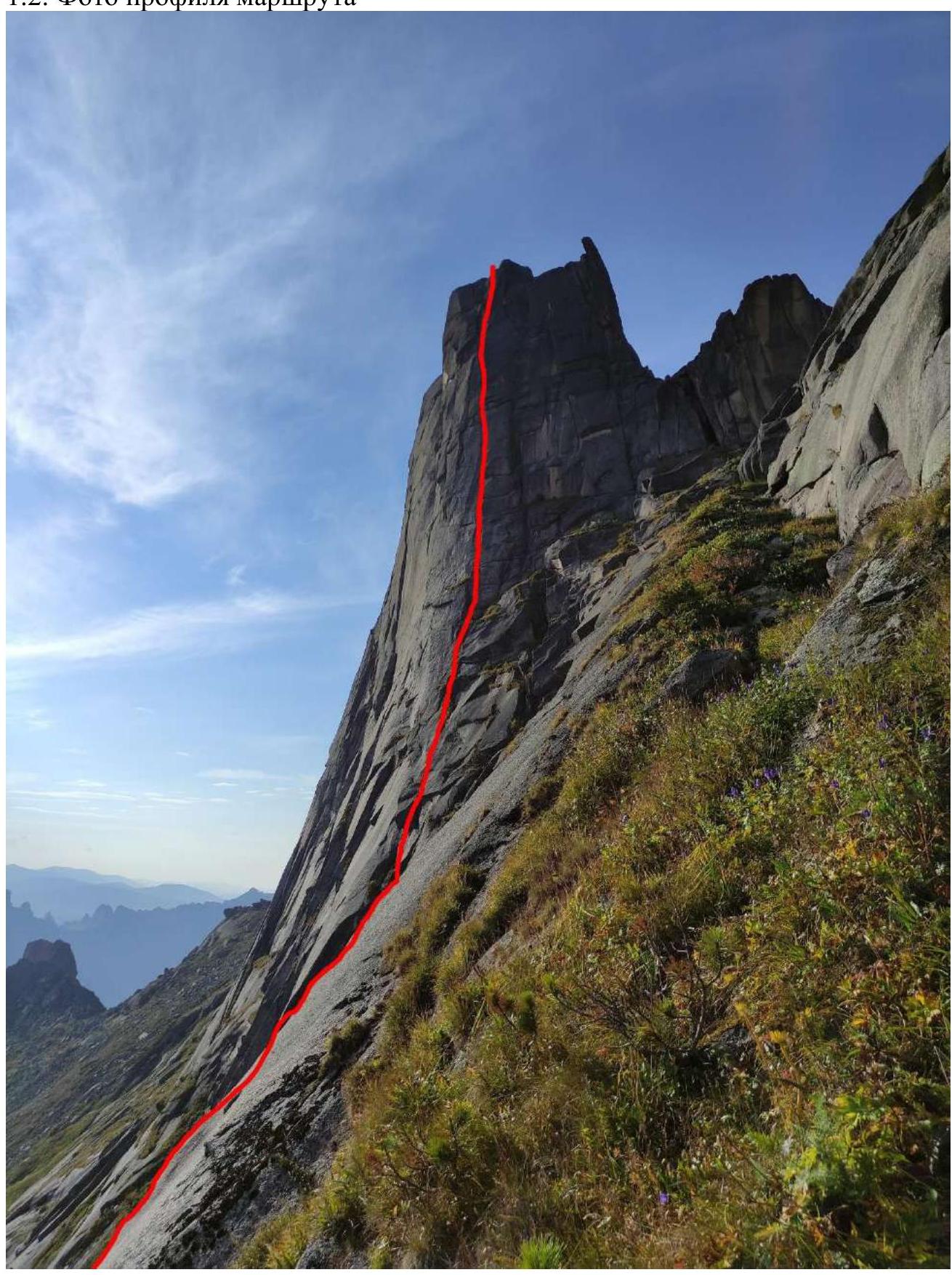
1.2. Route profile photo
1.3. Hand-drawn route profile
Peak 2265 m

1915 m — Route start
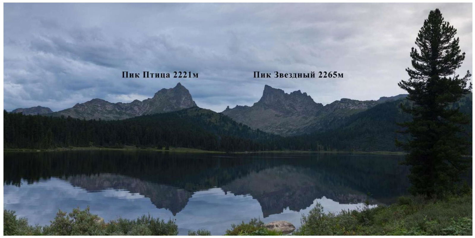
1.4. Photo panorama of the area
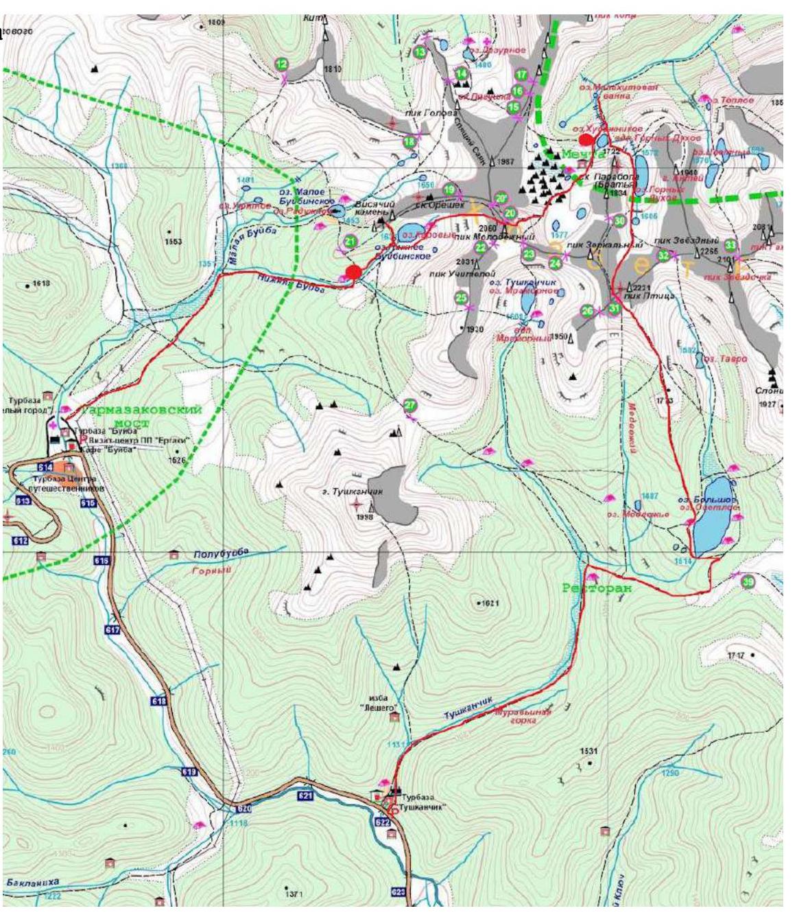
1.5. Area map
2. Route Characteristics
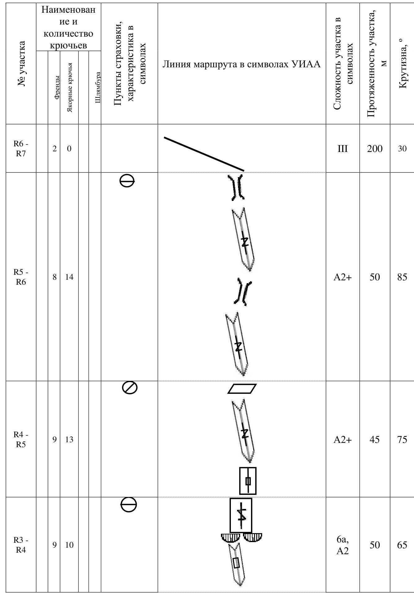
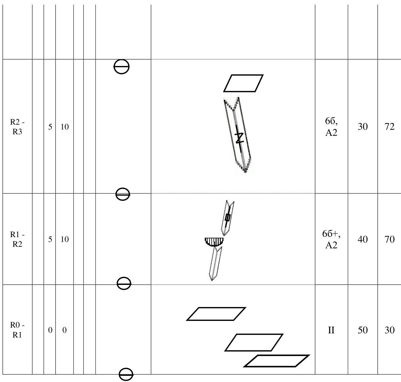
2.1. Technical photo of the route
2.3. UIAA symbol route diagram
3. Team Actions Characteristics
The Ergaki area is a familiar region. The chosen line is logical, running close to the 3B Shalyakin route along the Eastern ridge without intersecting it.
The route is entirely independent and has high technical complexity, passing through a series of internal corners and cornices. The route combines both free climbing (middle section) and ITO techniques. The route is comparable in difficulty to other 5A routes in the Ergaki area. The route is a vivid representative of Ergaki routes and is close in complexity to the 5A category route. Recommended for those planning to tackle technically complex routes in this area.
3.1. Brief description of the route passage
The approach to the route involves traversing left from the main trail leading to the classic 3B Shalyakin route, along grassy ledges for 150 m. The route begins by traversing a series of grassy ledges R0–R1.
The main landmark for the route start is a pronounced internal corner with a small cornice at the bottom.
The R1–R2 section involves climbing an internal corner. Protection: small friends and anchors. Many will need hook-nuts here. 40 m — and you're on a comfortable grassy ledge.
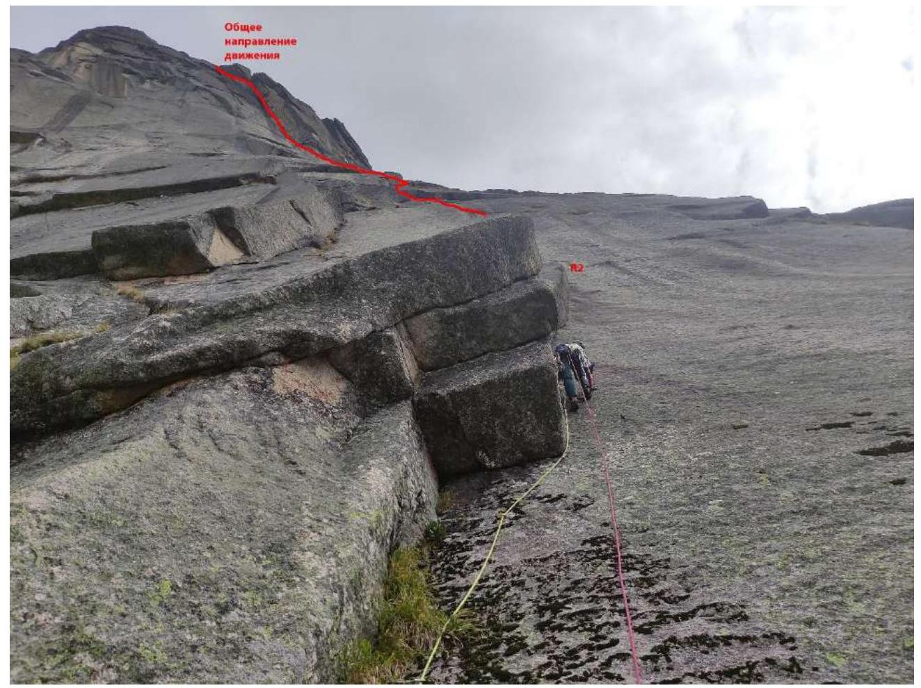
Fig. 1. Route start. Movement along the internal corner with a cornice.
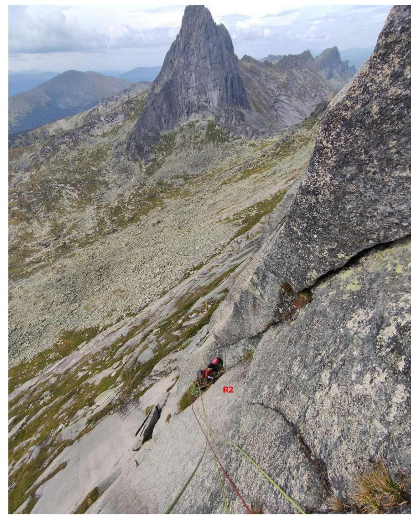
Fig. 2. R2 station. The internal corner continues, and the cracks become slightly better, with fingers fitting into them. Exit to a grassy ledge.
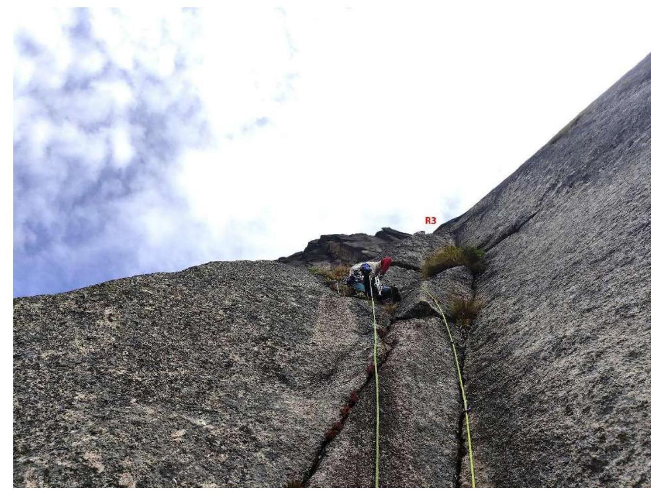
Fig. 3. R2–R3 section.
Next, climb the internal corner towards the cornices shaped like the letter M. We called them "Eyebrows." Under the cornice:
- traverse right 3 m,
- then up the crack.
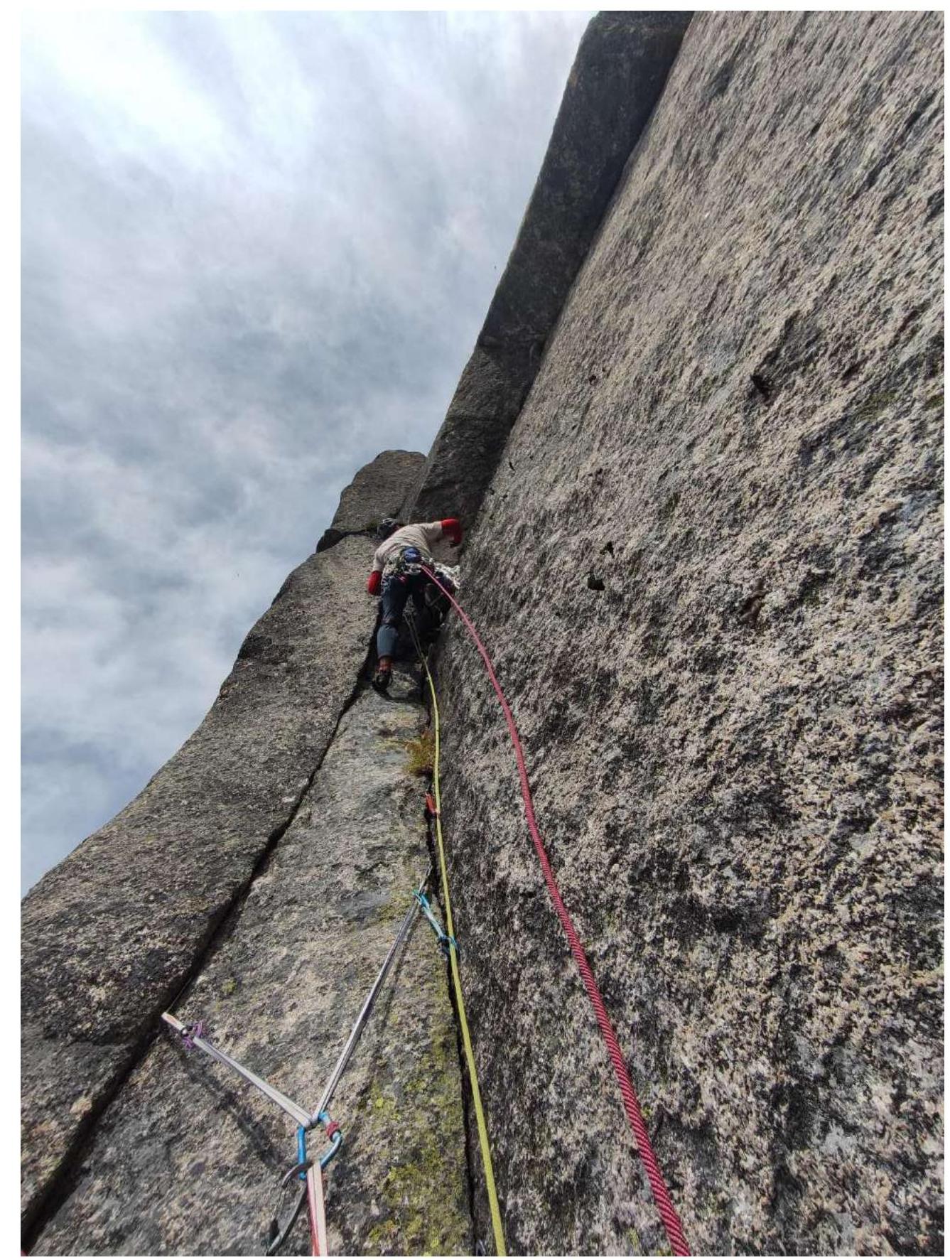
Fig. 4. R3–R4, movement along the corner and cornices. Difficulty gradually increases.
Exit from the cornices — difficulty drops to 6A level. Free climbing, moving left, exit to the R4 ledge.
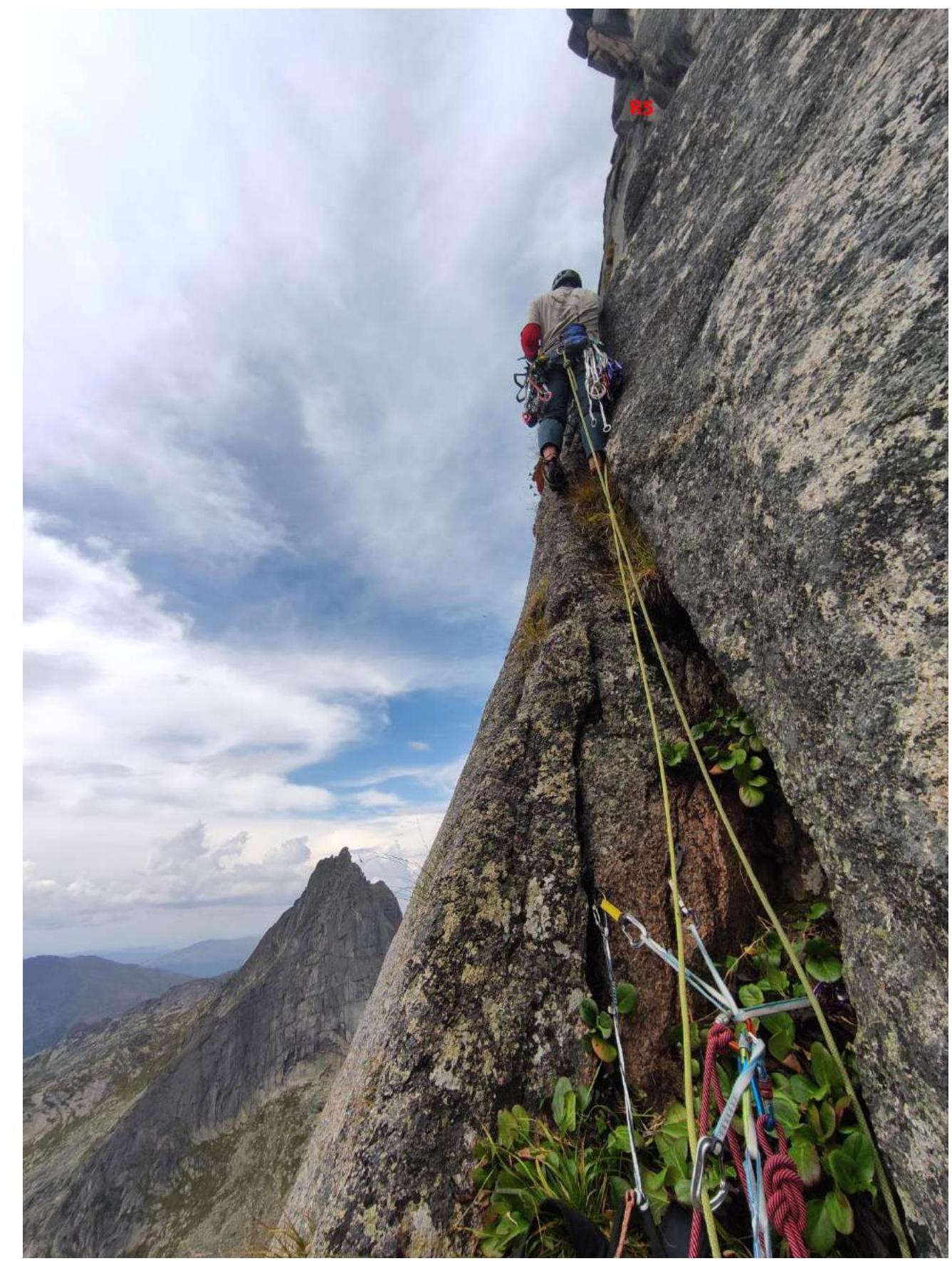
Fig. 4. R4 station.
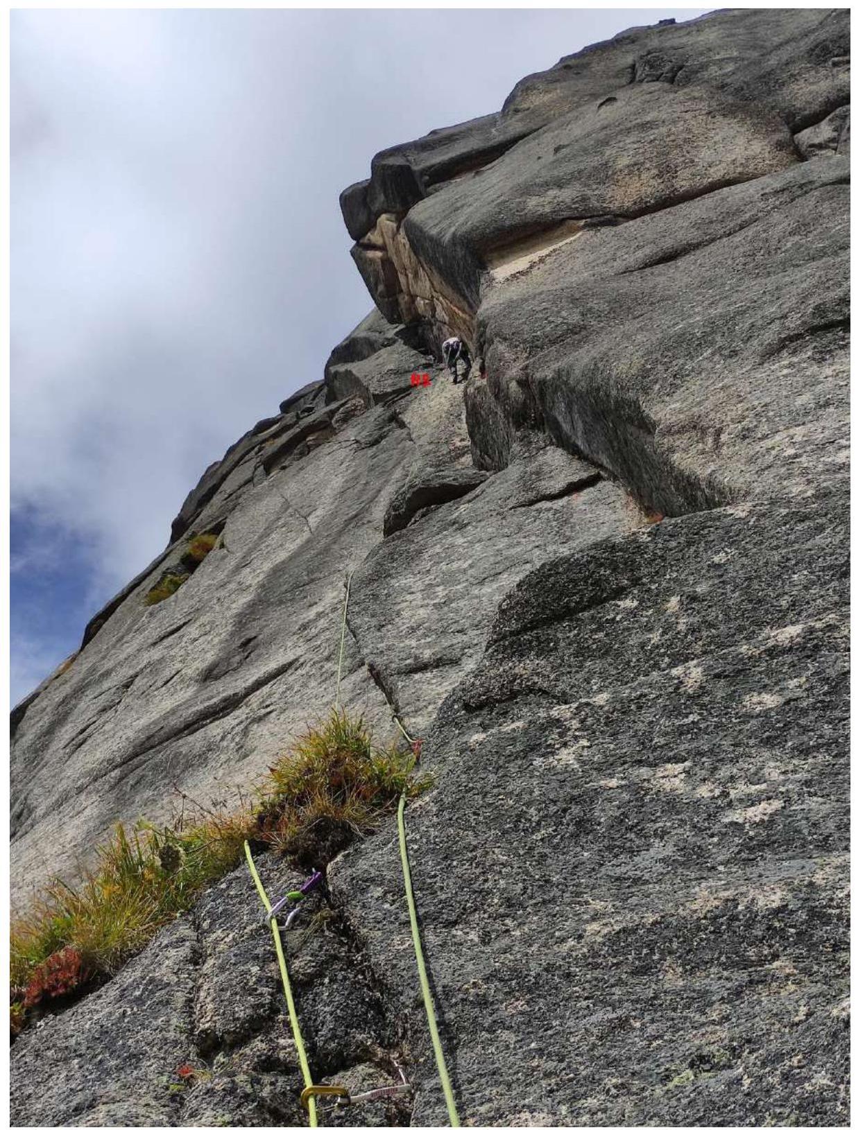
Fig. 5. R4–R5. Through a vertical wall, complex climbing, first exit to a ledge. Then enter a global internal corner leading to the summit ridge. ITO technique is required here. Station is hanging on a small uncomfortable ledge.
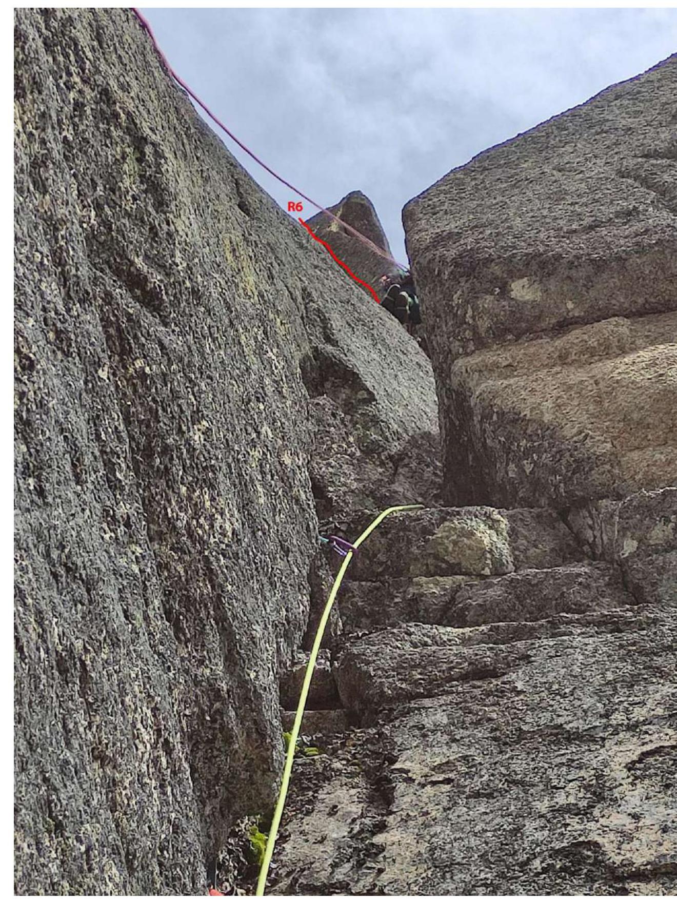
Fig. 6. Next, along the internal corner, enter a chimney, then free climb in the chimney towards the second part of the internal corner. Protection with large friends up to #4 (camalot).
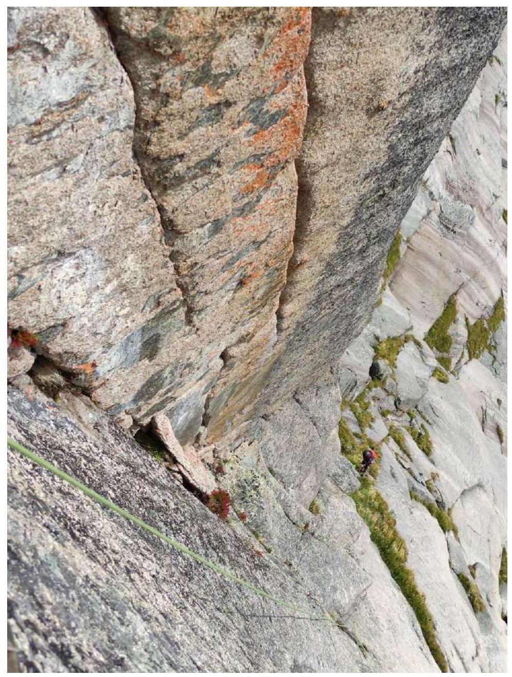
Fig. 7. Part of the internal corner R4–R6
R5–R6. Up the internal corner. Steepness increases up to 85°. Protection on anchors and small friends. Approach the off-width chimney leading to the summit ridge. Protection with large camalots up to #5. If you lack large camalots, there's an option to bypass the off-width by traversing right.
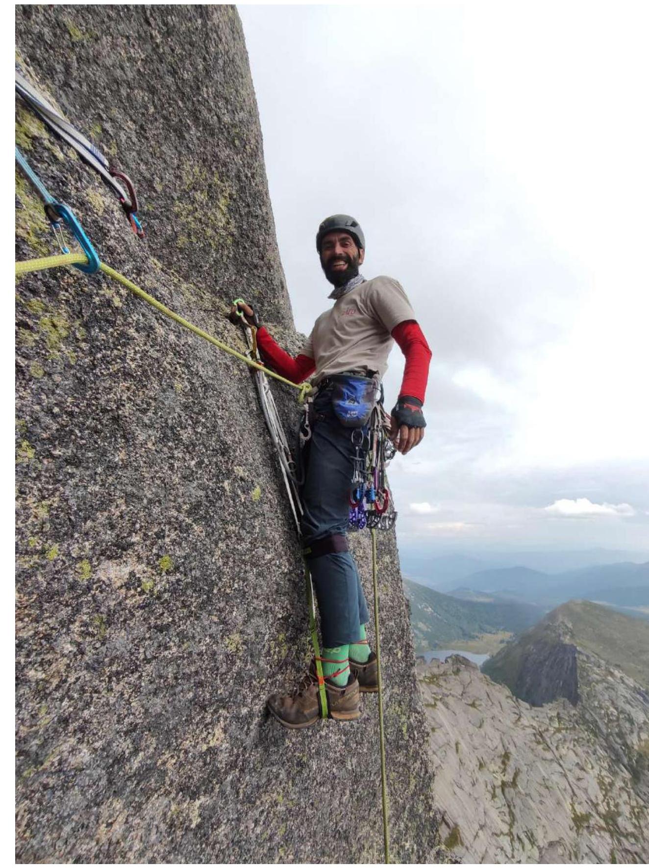
Fig. 8. Finish of the R6 section by traversing right
Fig. 9. R6, team reached the ridge. The route then merges with the upper part of the 3B Shalyakin route. Along the ridge, 200 m northeast, easy climbing leads to the summit.
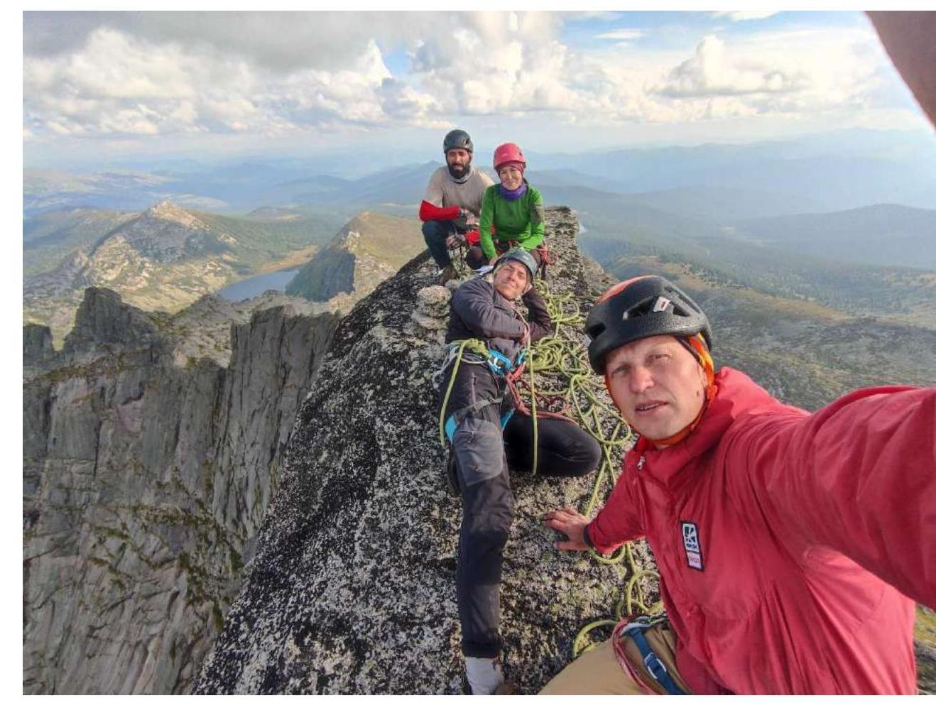
Fig. 10. R7, team on the summit. Route description by sections
| Section # | Description | Photo # |
|---|---|---|
| R0–R1 | System of ledges, internal corners, and cracks 50 m, 30° | |
| R1–R2 | System of internal corners and cracks 40 m, 70° | 1, 2 |
| R2–R3 | System of internal corners and cracks 30 m, 72° | 3 |
| R3–R4 | Up through the cornice, then free climbing, moving left onto a ledge. 15 m, 70°, 35 m, 65° | 4 |
| R4–R5 | Up the wall, enter the internal corner leading to the ridge. 45 m, 75° | 5 |
| R5–R6 | Up the internal corner into a chimney. Then along the internal corner to the ridge 50 m, 80–85° | 6, 7, 8 |
| R6–R7 | Along the ridge, easy climbing to the summit. | 9, 10 |