
Russian Championship in Alpinism
High-Technical Class 2021
Report on the Ascent to Ptitsa Peak, 2221 meters.
Via the center of the North wall, 5B category of complexity. First ascent by the Krasnoyarsk team on July 23, 2021.
| I. Passport of the Ascent 1. General Information | ||
|---|---|---|
| 1.1 | Full name, sports rank of the leader | Kozlova A.P. (MS) |
| 1.2 | Full name, sports rank of participants | Seryupova D.R. (MS) |
| 1.3 | Full name of coach | Prokofiev D.E. (MS), Zakharov N.N. (MSMK), Balezin V.V. (MSMK) |
| 1.4 | Organization | Krasnoyarsk Regional Federation of Alpinism |
| 2. Characteristics of the Object of Ascent | ||
| 2.1 | Region | Western Sayan |
| 2.2 | Valley | Ergaki valley |
| 2.3 | Number of section according to the classification table of 2013 | 6.6.2 |
| 2.4 | Name and height of the peak | Ptitsa 2221 m |
| 2.5 | Geographical coordinates of the peak (latitude/longitude), GPS coordinates | 52°49′32″N 93°24′6″E |
| 3. Characteristics of the Route | ||
| 3.1 | Name of the route | Via the center of the North wall |
| 3.2 | Proposed category of complexity | 5B |
| 3.3 | Degree of route development | first ascent |
| 3.4 | Nature of the route relief | rock |
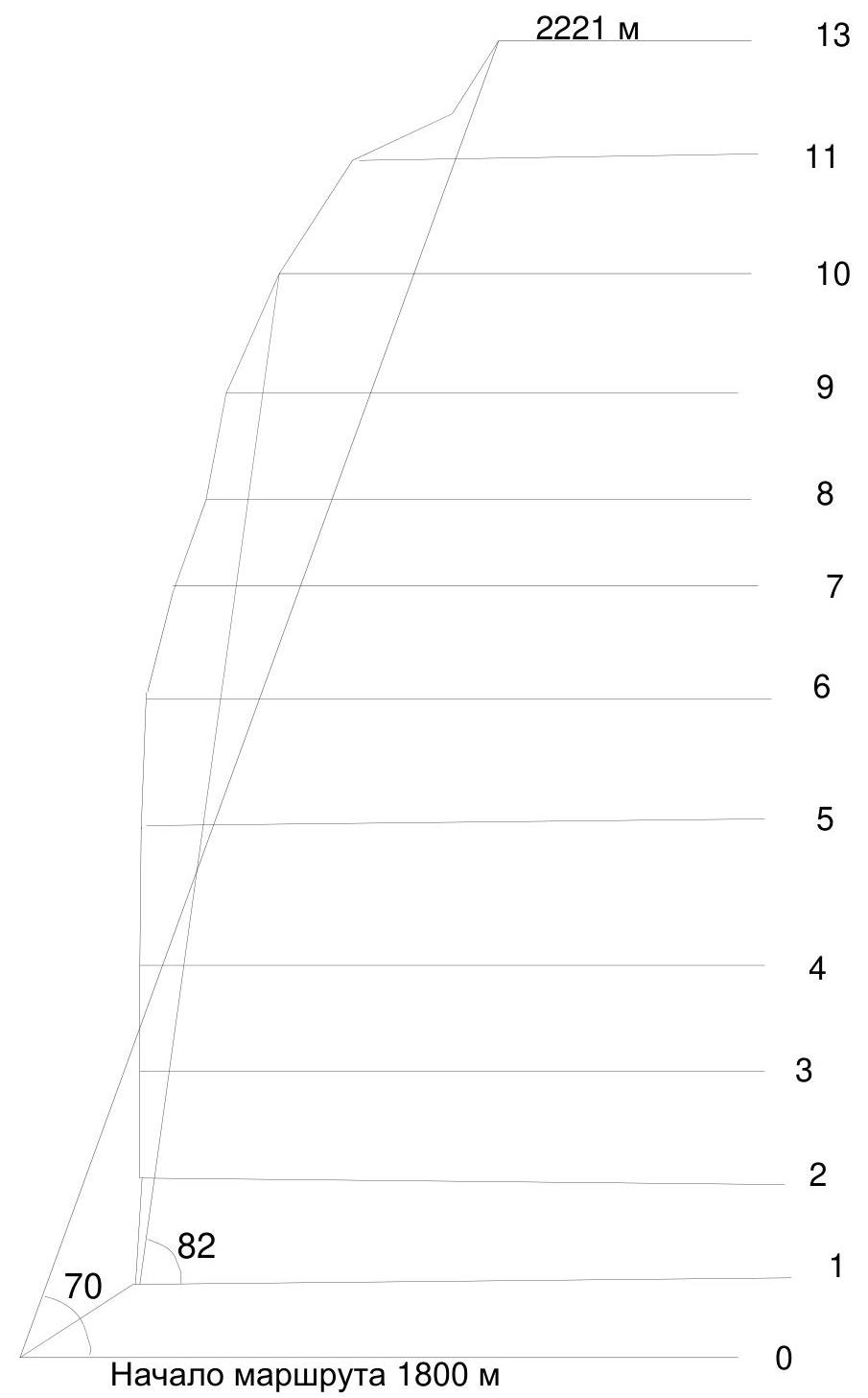
| 3.5 | Height difference of the route (altimeter or GPS data) | 420 m |
| 3.6 | Length of the route (in meters) | 680 m |
| 3.7 | Technical elements of the route (total length of sections of varying complexity with indication of relief nature (ice-snow, rock)) | II cat. rock 50 m. III cat. rock – 30 m. IV cat. rock – 30 m. V cat. rock – 60 m. VI cat. rock – 70 m. Rock VI, A2, A3 – 430 m |
| 3.8 | Average steepness of the route, (°)*(2) | 70 degrees |
| 3.9 | Average steepness of the main part of the route, (°)*(2) | 82 degrees |
| 3.10 | Descent from the peak | SW ridge, from the south by |
| route 2A Boyarskoy | ||
| 3.11 | Additional characteristics of the route | The main part of the route is almost always wet, so AIT on anchors and friends is used |
| 4. Characteristics of the Team's Actions | ||
| 4.1 | Time of movement (team's walking hours, in hours and days) | 10 hours, 1 day |
| 4.2 | Overnights | - |
| 4.3 | Time of route development *(3) | 0 hours, 0 days |
| 4.4 | Departure from the camp | 6:00 July 23, 2021 |
| 4.5 | Start of work on the route | 7:35 July 23, 2021 |
| 4.6 | Arrival at the peak | 17:35 July 23, 2021 |
| 4.7 | Return to the base camp | 21:25 July 23, 2021 |
| 5. Characteristics of Weather Conditions *(4) | ||
| 5.1 | Temperature, °C | 15–20 |
| 5.2 | Wind speed, m/s | 5 |
| 5.3 | Precipitation | none |
| 5.4 | Visibility, m | full |
| 6. Person Responsible for the Report | ||
| 6.1 | Full name, e-mail | Kozlova A.P. anastasiyak.kozlova.1995@mail.ru |
II. Description of the Ascent
1. Characteristics of the Object of Ascent
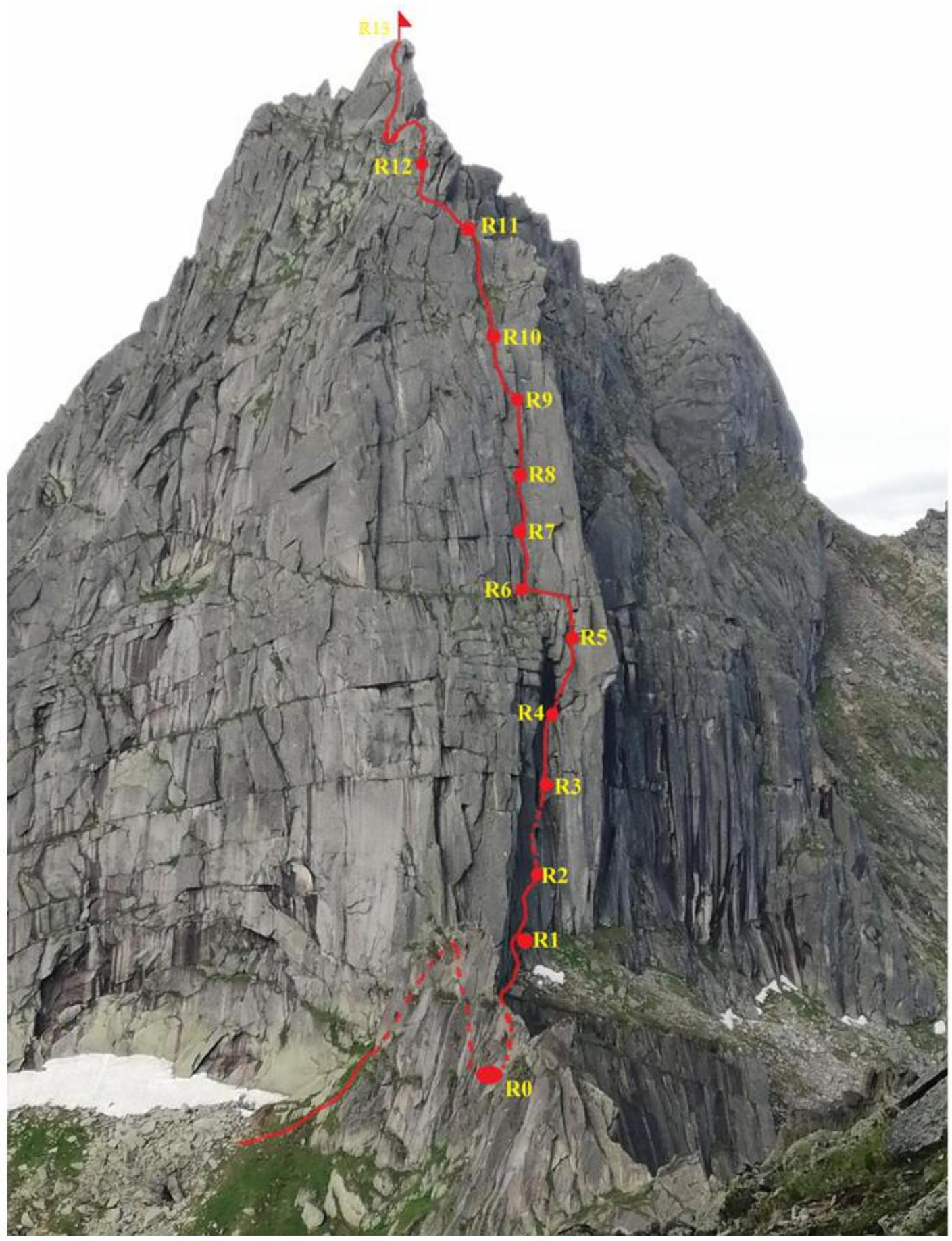
1.1. General photo of the peak
View of Ptitsa: NE wall
1 – Tsyganov's Route 5A
2 – Railko's Route 5A
3 – Route climbed by the team
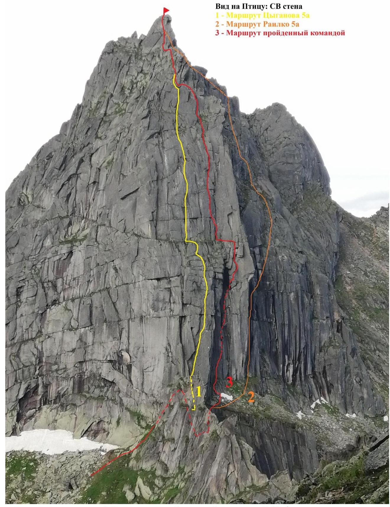
Route climbed by team № 3
Drawn profile of the route
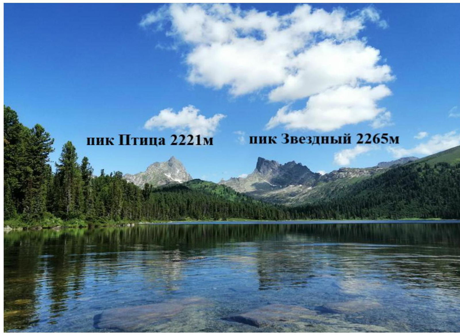
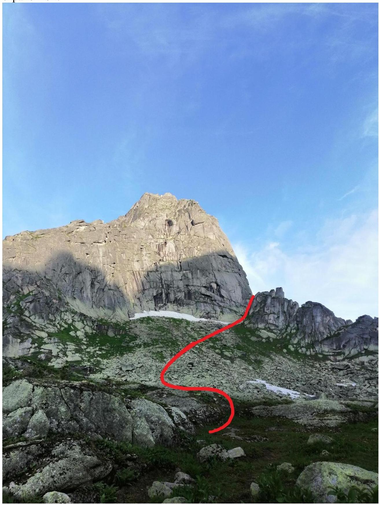
1.3. Photopanorama of the area, view from the south
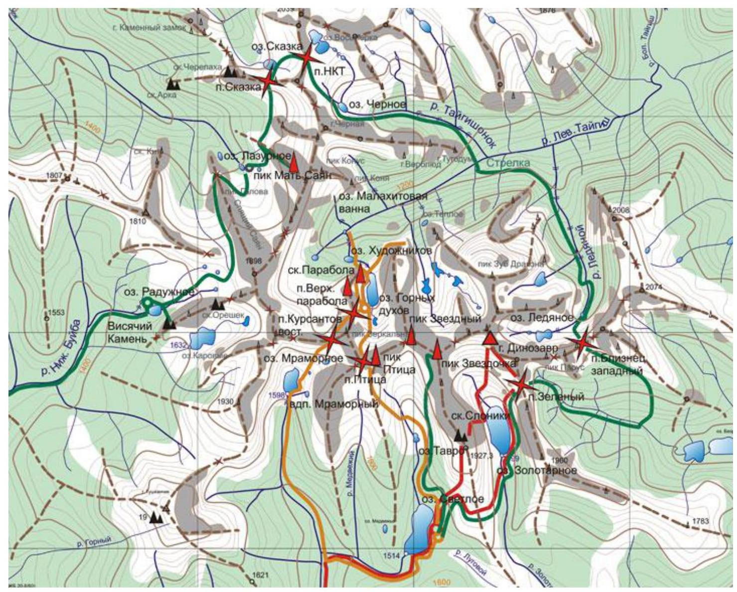
1.4. Map of the area
2. Characteristics of the Route
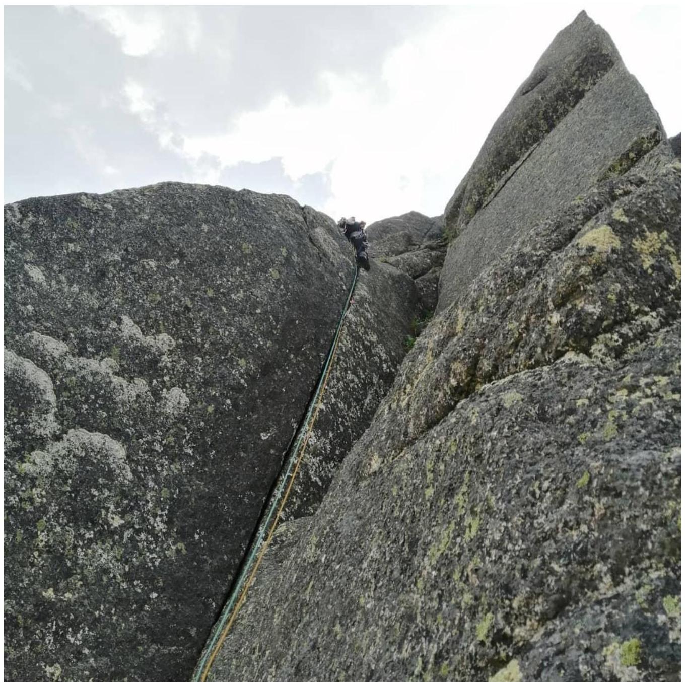
2.1. Technical photograph of the route
2.2. Tactical actions of the team and impressions of the route.
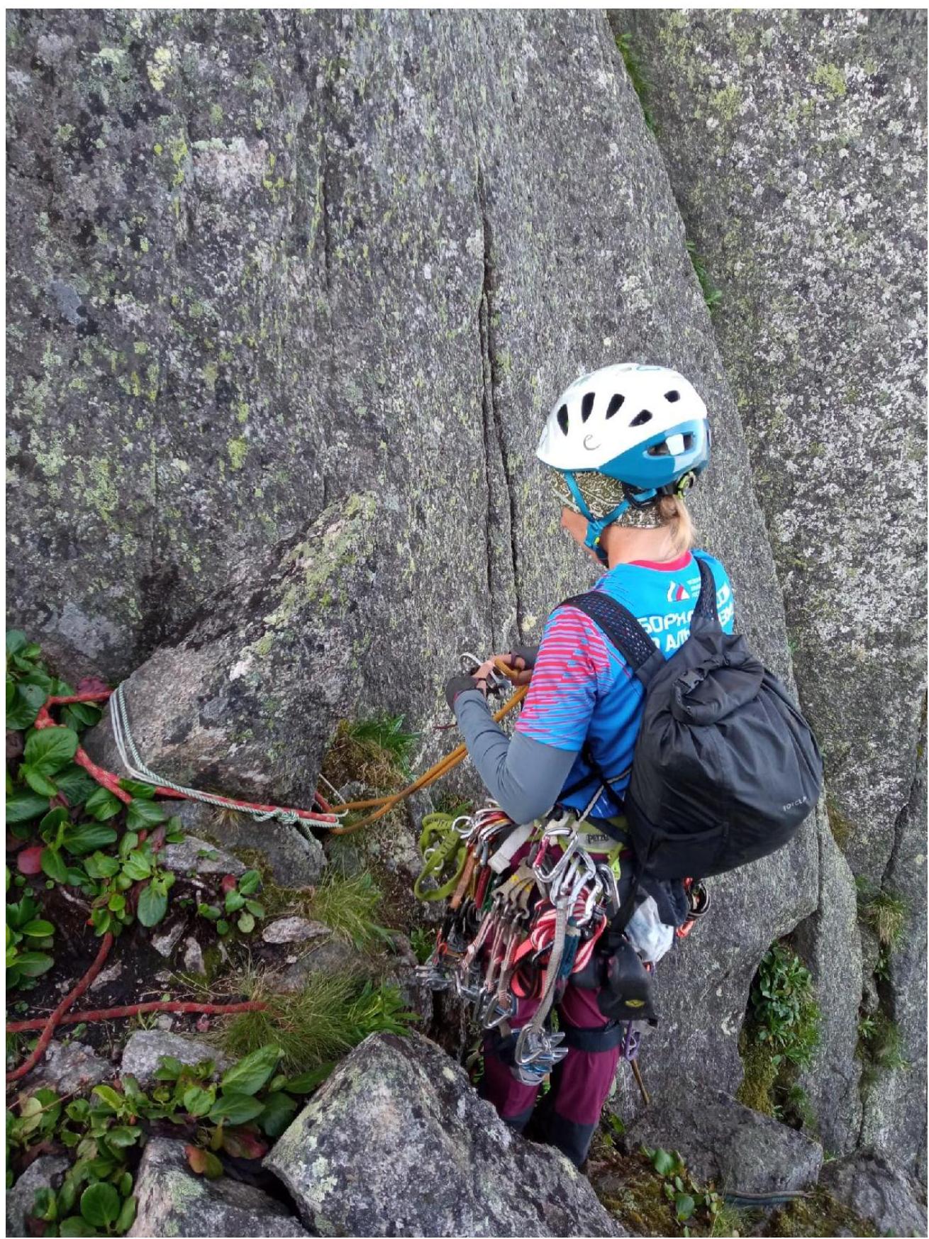
Before climbing the planned line, the team conducted reconnaissance and photographed the intended route. The ascent was postponed about 3 times due to unstable weather in the ascent area. To prepare for the first ascent, we climbed the neighboring Tsyganov's route 5A to review the complexity of the upcoming first ascent. However, we were unable to see the entire terrain. We also climbed another route on the Northeast wall — Galatsevich 5A for training and to get accustomed to the terrain.
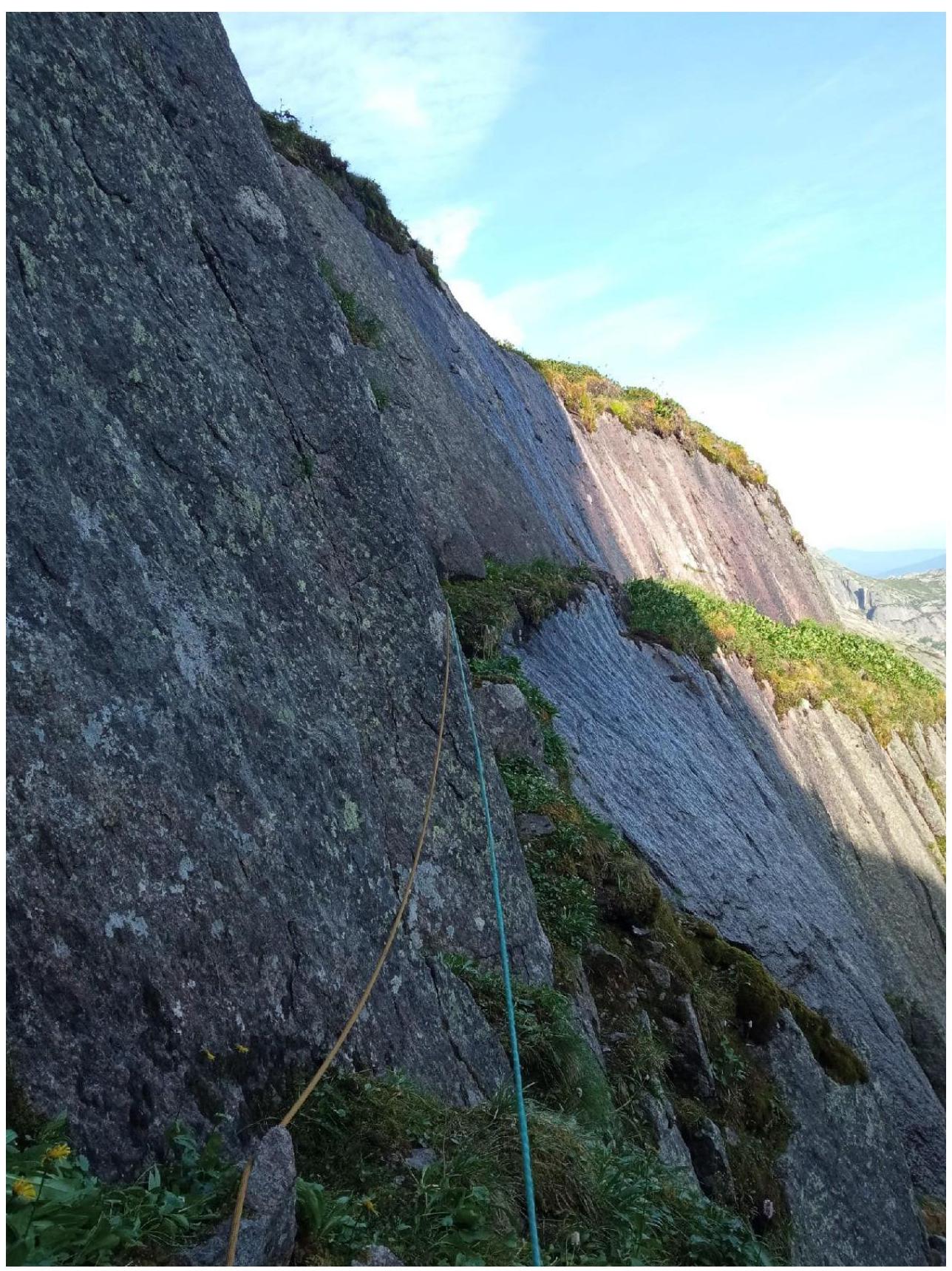
On July 23, 2021, at 6:00, we set out to the planned line, knowing only that there would be cornices on this route — this is visible in the photos we took. The approach took 1.5 hours, and at 7:35, we began working on the route. It is worth noting that this route is an order of magnitude more complex than those we had climbed on Ptitsa before. The first 6 ropes are wet, местами камнеопасные vertical slots and internal corners. All initial ropes are completely wet, and this is after a whole day without rainy weather! We are inclined to think that it is always wet here. The dampness is also due to the fact that until the large ledge, we were constantly under a huge cornice, from which water seeped and dripped. We had to move using AIT. On neighboring routes, this was not observed, as they receive sunlight in good weather and dry quickly. Our route, due to the features of the relief of the first part, is always in the shade. State of the relief:
- the route is practically wet throughout its entire length;
- in the depths of the large chimney with a plug, there was even ice;
- only after the 10th rope did the relief and its condition allow us to switch to climbing.
Movement and orientation on the ridge did not cause difficulties, as we had been here before. Thus, considering all the above — the complexity and condition of the relief, the number of ropes passed on AIT — we believe that this route is a solid 5B.
The route was climbed relatively quickly due to the use of simultaneous movement technique, when the second, moving along the fixed ropes, simultaneously belays the first through a Grigri, thereby increasing the speed of movement by one and a half times compared to traditional alternating belay technique.
2.4. Scheme of the route in UIAA symbols

3. Photographs and description of the route's ropes
3.1. General photo of the approach to the route from the circus to the couloir. In the couloir, up to the exit to the saddle, the climbing level is III–IV; it's better to go tied and with belay!
3.2 rappel from a rock with old loops for 30 m to a ledge. Be careful, it's shaky!
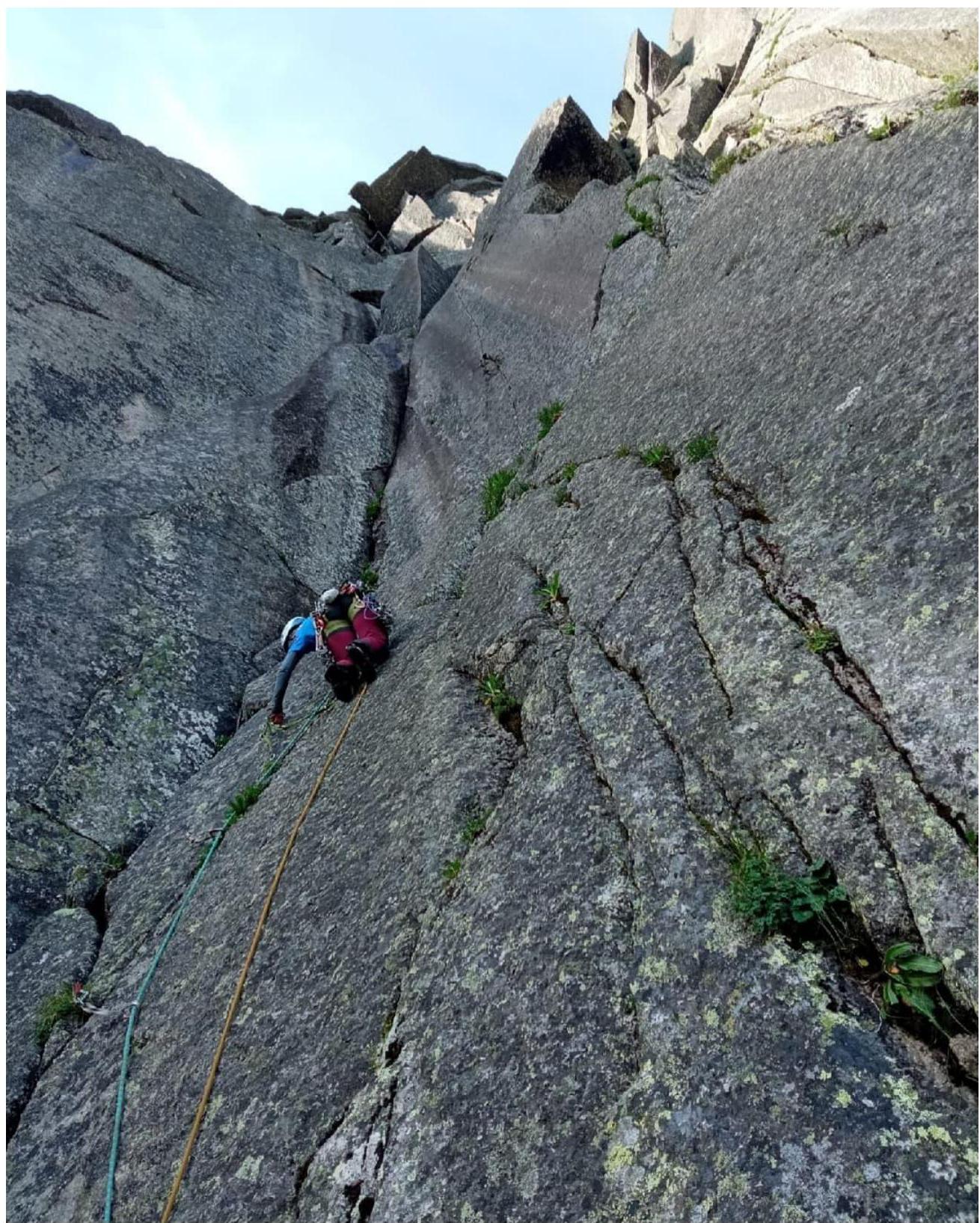
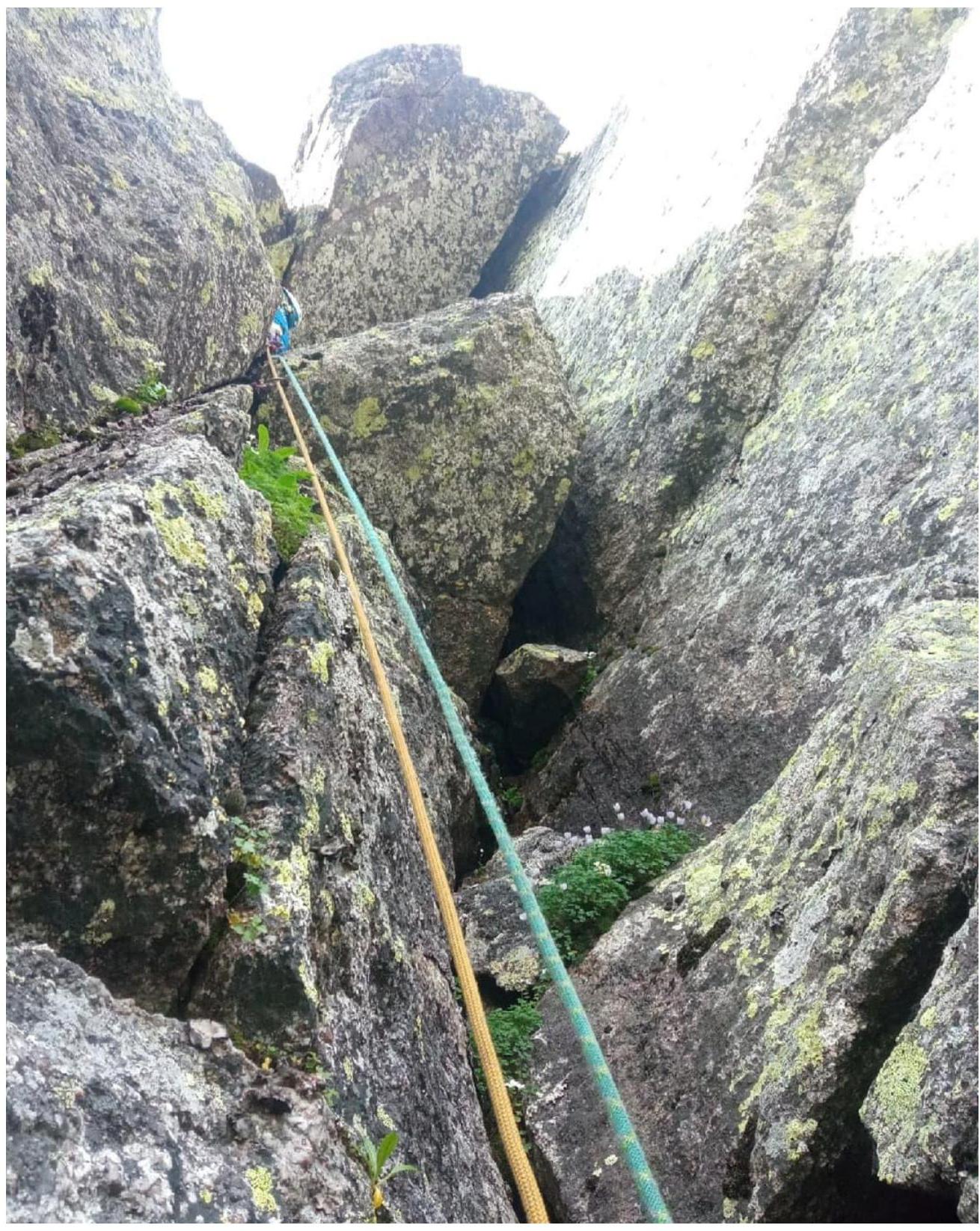
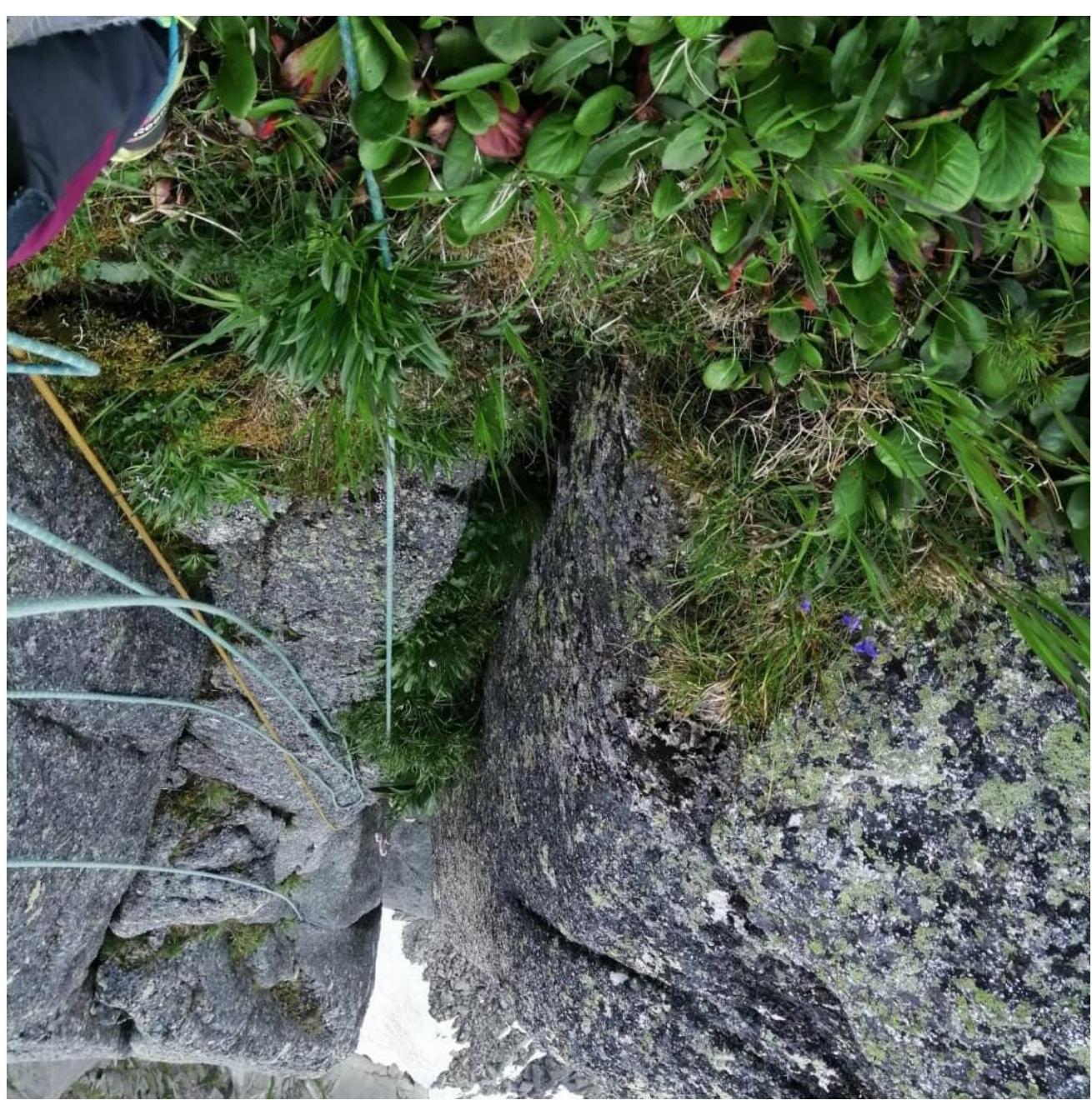
R0–R1. Traverse along a small ledge to the right. Reach the wet internal corner, go up it, and exit to a large ledge. From the middle part of the ledge, the main part of the route begins.
R1–R2. Closer to the left corner, there's a flake with a slot — this is the beginning of the main part of the route. Go up it to a system of slots, gradually moving to the right to a small ledge, then traverse to the corner. Here, move up (there are loose rocks) to an internal wet corner, and before it, there's a hanging belay. Since everything is wet, movement is on AIT.
View of the wet corner from the belay.
R2–R3. Move up the internal wet corner, then to the right under an overhanging section on AIT. The belay is hanging.
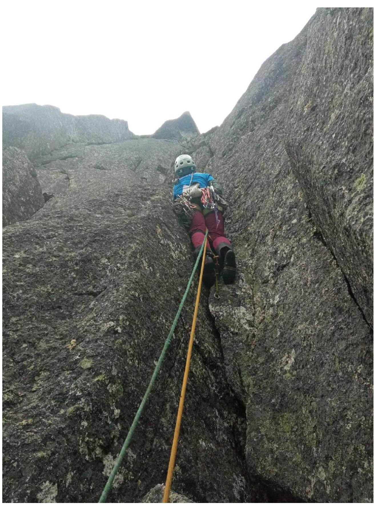
R4–R5. Move to the right to an overhanging flake-corner on AIT; large-size friends are used here (camlots 3 and 4). Climb over the flake, then move up and to the right around the corner to a ledge, and along the ledge to the right, then left to a good vertical slot with medium cams (possibly free climbing). Exit to positive relief, and on the right, in a small grotto, there's a belay on a large boulder.
R5–R6. Move up to a cornice and then on AIT to overcome the cornice; small camlots are needed. Exit to a grassy ledge, then left to a huge boulder, where there's a belay. Recommend taking large camlots (4 and 3) or a yellow one for the traverse. If the second climber is on jumars, belay is necessary.
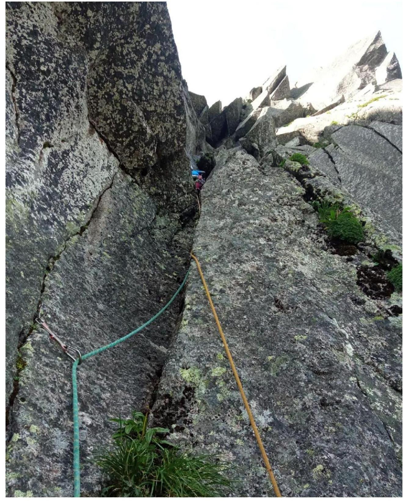
R6–R7. From the belay, move up to a ledge, then to an internal corner on the left with a good but wet slot, and move up on AIT. Enter the beginning of a chimney. The belay is inconvenient and hanging.
R7–R8. Continue up a large wet chimney with an overhang. AIT with foot placements up to a huge plug, where there's a belay. Climbing is complicated due to the wet chimney and limited protection. View from the chimney.
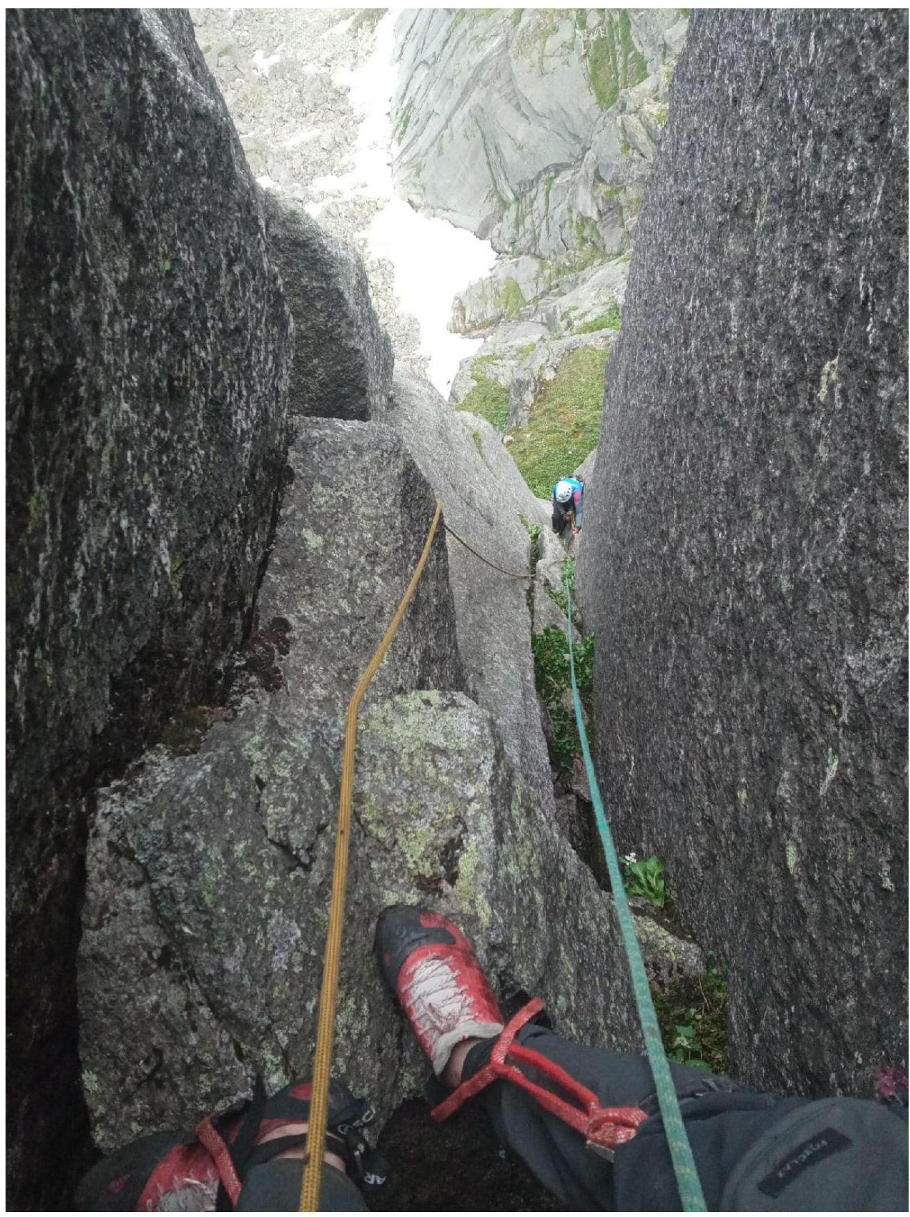
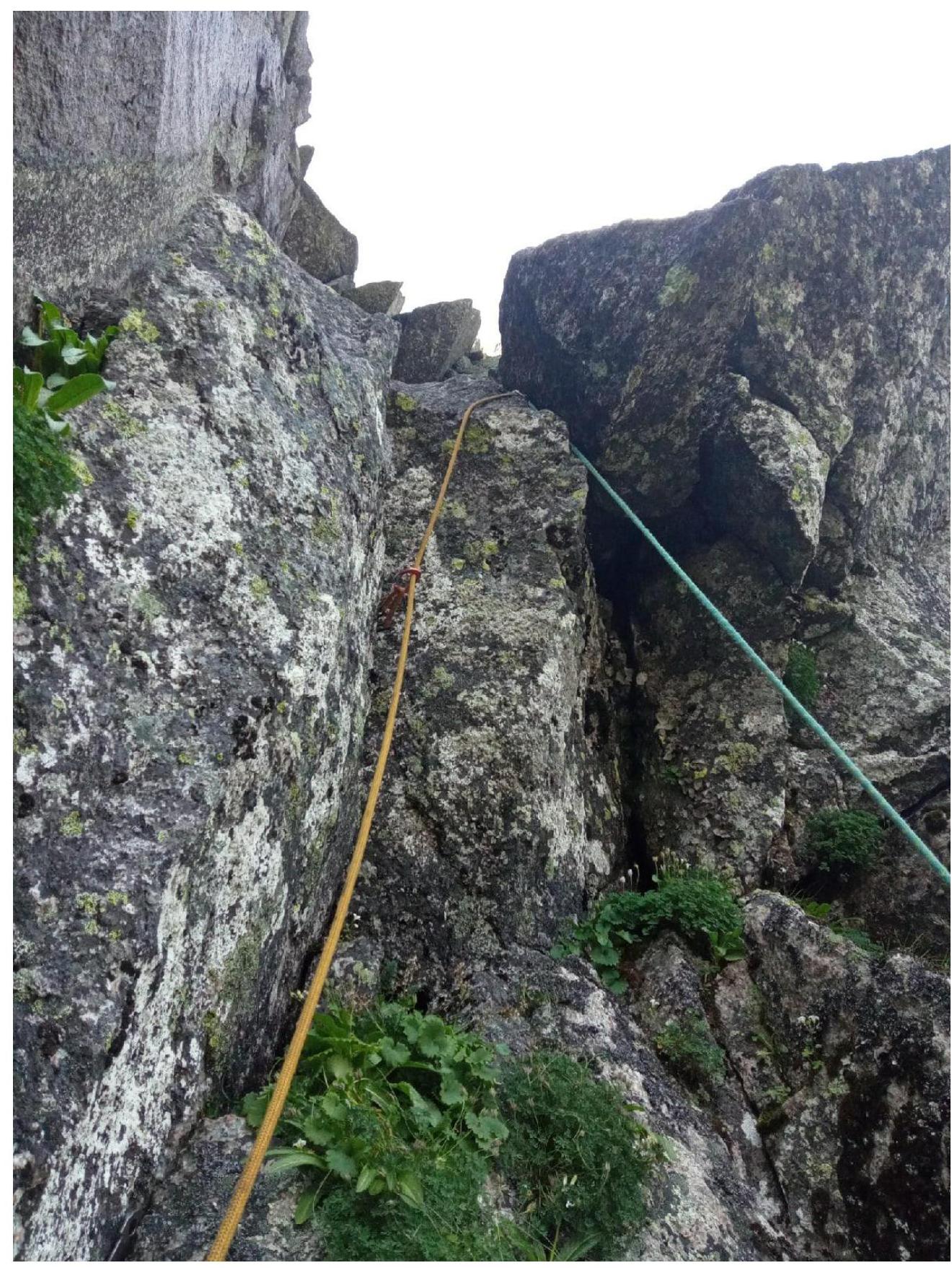
R8–R9. From the plug, move to the right along a slot to an internal corner, and up it on AIT with small friends and anchors with bend. Slightly higher, there's a belay before the start of a traverse.
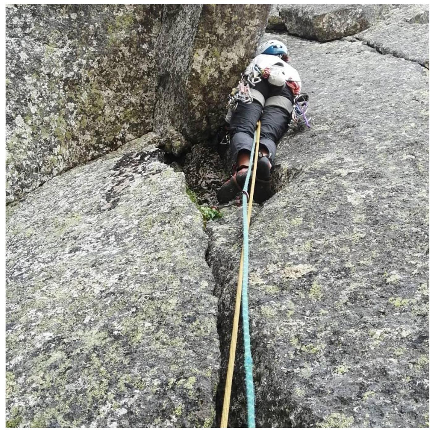
R9–R10. Traverse to the left to a wet chimney; on the left of it, on the wall, there's a good slot for medium cams. Move along this slot on AIT to exit to positive relief. Then climb up towards a grassy tongue, and there's a belay on friends and an anchor.
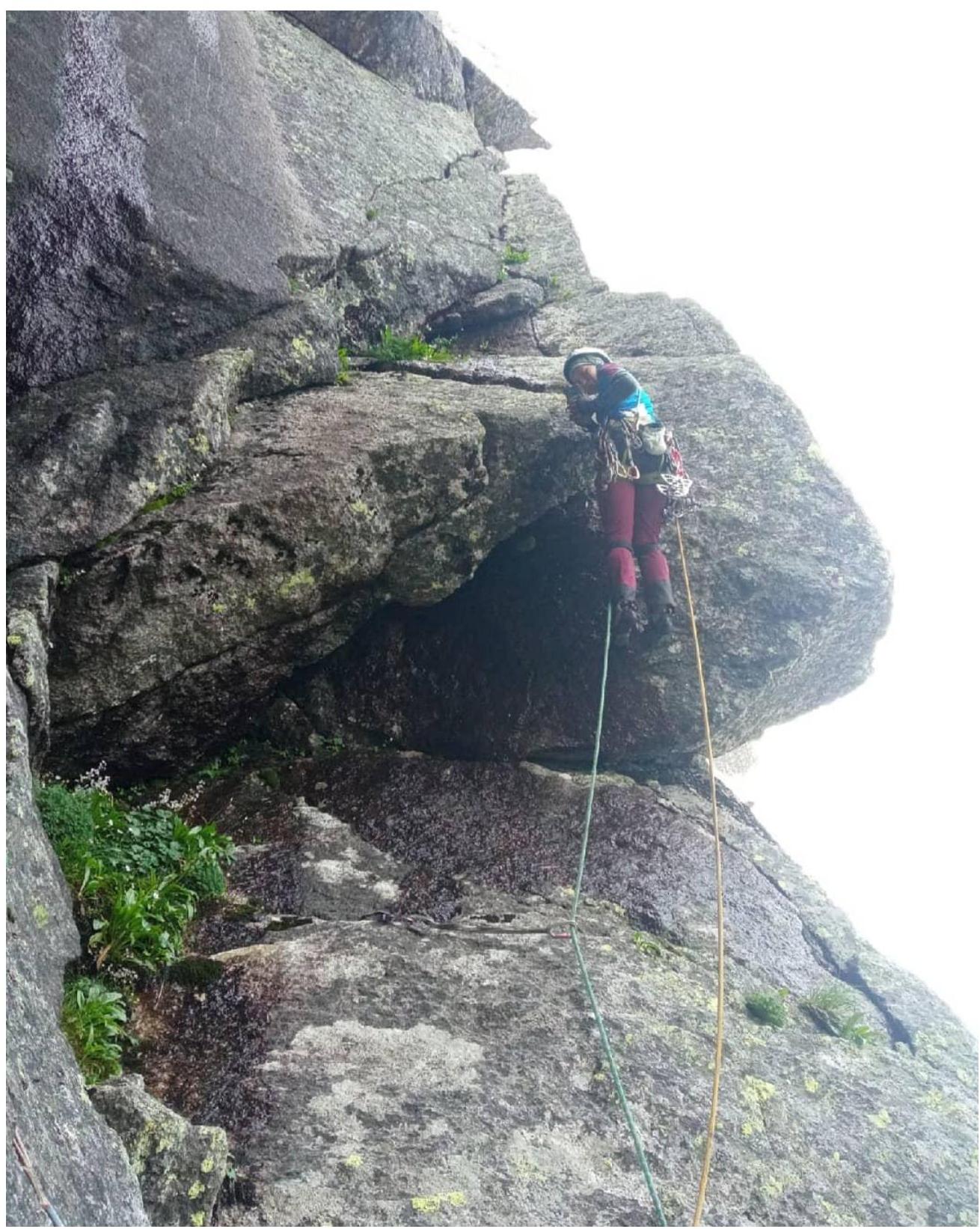
R10–R11. Move left of the ridge along internal corners with free climbing; possible foot placements on AIT, and exit to a large ledge — a bowl in a cirque.
R10–R11

R11–R12. Climb along internal corners left of the ridge and up, then along a system of slots to the left to a corner, enter it, and move up. There's a belay.
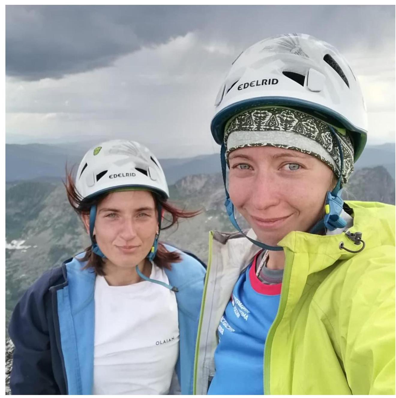
R12–R13. From the belay, move simultaneously in a rope team along the ridge towards the peak. Continue to the peak through a small wall (12 m) with climbing along good slots. In good weather, orientation on these ropes is not difficult. Photo of the participants on the peak!
Comments
Sign in to leave a comment