
Report
on the ascent to the summit Zvezdny, 2265 m via the left part of the South wall, 5B, cat. diff.
Second passage by the team Moscow–St. Petersburg On July 7, 2021
I. Ascent Report
| 1. General Information | ||
|---|---|---|
| 1.1 | Full name, sports rank of the leader | Balagurin S.O. (CMS) |
| 1.2 | Full name, sports rank of participants | Yablokov E.A. (CMS) |
| 1.3 | Full name of coach | Timoshenko T.I., Kutkin S.A. |
| 1.4 | Organization | Moscow Alpinism Federation, St. Petersburg Alpinism Federation |
| 2. Characteristics of the Ascent Object | ||
| 2.1 | Region | Western Sayan |
| 2.2 | Valley | Ergaki Valley |
| 2.3 | Number of section according to the 2013 classification table | 6.6.2 |
| 2.4 | Name and height of the summit | Zvezdny, 2265 m |
| 2.5 | Geographical coordinates of the summit (latitude/longitude), GPS coordinates | 52°49′44.52″ N 93°24′52.81″ E |
| 3. Characteristics of the Route | ||
| 3.1 | Name of the route | left part of the south wall |
| 3.2 | Proposed category of difficulty | 5B |
| 3.3 | Degree of route exploration | Second passage |
| 3.4 | Nature of the route terrain | Rock |
| 3.5 | Height difference of the route (altimeter or GPS data) | 350 m |
| 3.6 | Length of the route (in meters) | 425 m |
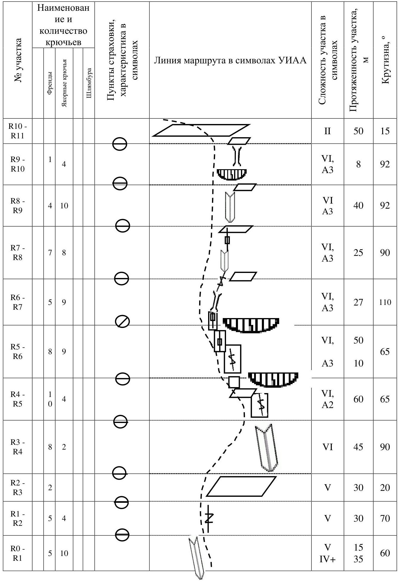
| 3.7 | Technical elements of the route (total length of sections of varying difficulty with indication of terrain type (ice-snow, rock)) | II cat. diff. rock – 50 m. III cat. diff. rock – 0 m. IV cat. diff. rock – 35 m. V cat. diff. rock – 75 m. VI cat. diff. rock – 155 m. Rock VI, A3 – 110 m |
| 3.8 | Average steepness of the route, (°) | 75° |
| 3.9 | Average steepness of the main part of the route, (°) | 84° |
| 3.10 | Descent from the summit | Via SW edge |
| 3.11 | Additional characteristics of the route | Main part of the route is AID on anchors and small friends |
| 4. Characteristics of the Team's Actions | ||
| 4.1 | Time of movement (team's walking hours, in hours and days) | 4 h 30 min, 1 day |
| 4.2 | Overnights | – |
| 4.3 | Time of route preparation | 0 h, 0 days |
| 4.4 | Start of the route | 9:00 July 7, 2021 |
| 4.5 | Arrival at the summit | 13:30 July 7, 2021 |
| 4.6 | Return to the base camp | 15:00 July 7, 2021 |
| 5. Characteristics of Weather Conditions | ||
| 5.1 | Temperature, °C | 20–23 °C |
| 5.2 | Wind speed, m/s | 3–5 m/s |
| 5.3 | Precipitation | none |
| 5.4 | Visibility, m | full |
| 6. Person Responsible for the Report | ||
| 6.1 | Full name, e-mail | Balagurin S.O. skin128@yandex.ru |
II. Description of the Ascent
1. Characteristics of the Ascent Object
1.1. General photo of the summit
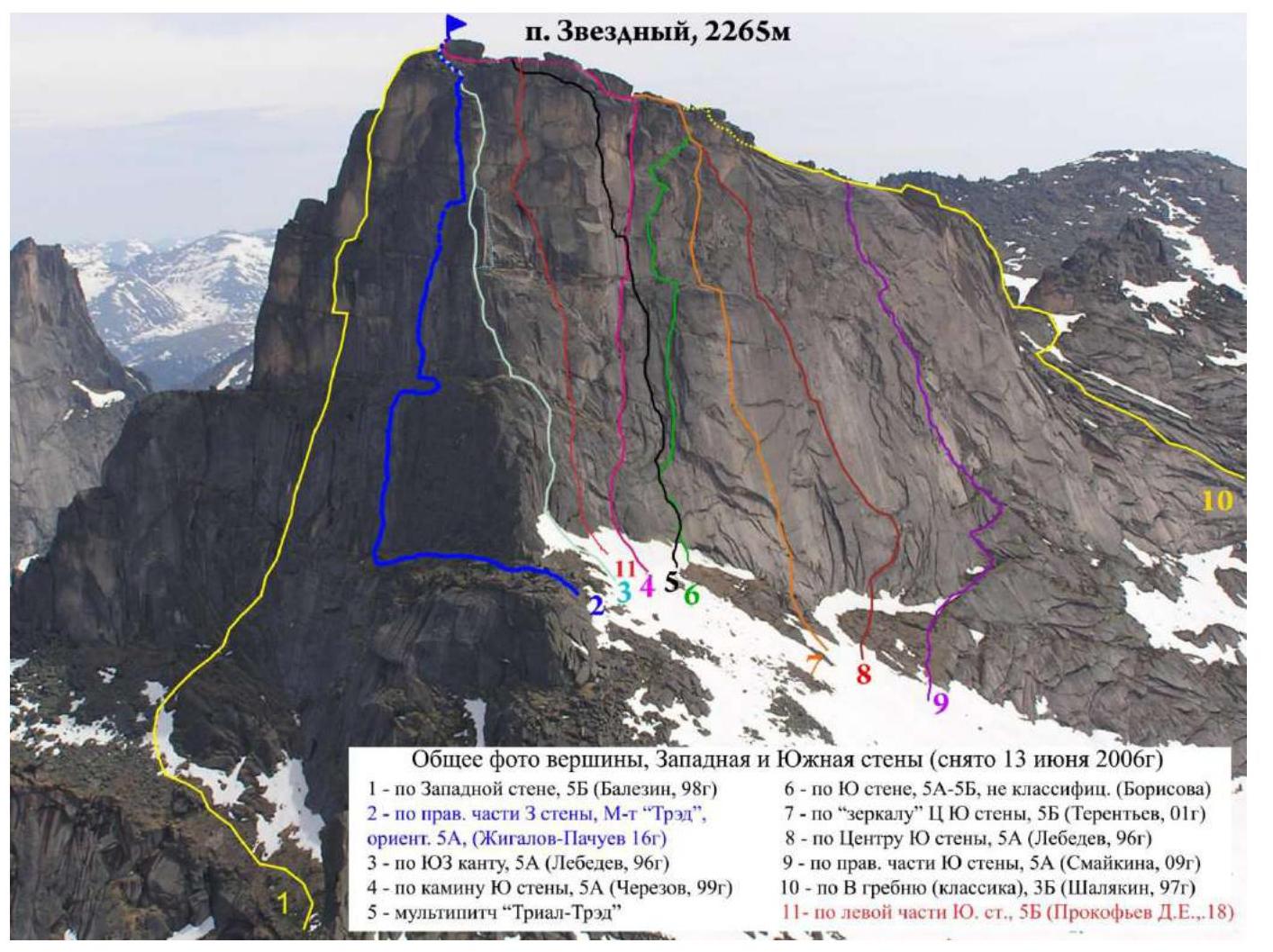
Route taken by the team
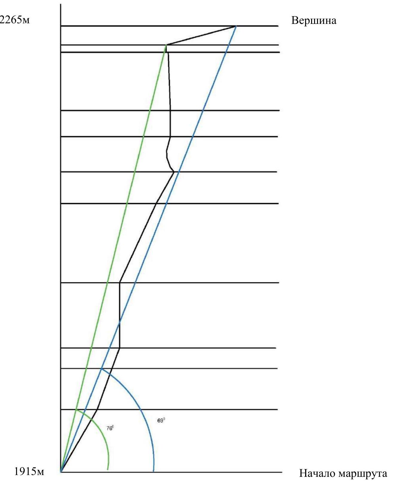
1.2. Photo of the route profile
1.3. Hand-drawn profile of the route
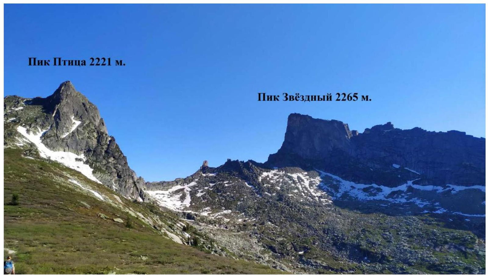
1.4. Photopanorama of the area
1.5. Map of the area
2. Characteristics of the Route
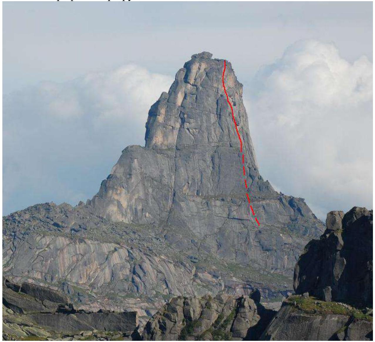
2.1. Technical photograph of the route

2.3. Route diagram in UIAA symbols
3. Characteristics of the Team's Actions
Peak Zvezdny, 2265 m. The highest point of the area. Ergaki Ridge, Western Sayan.
Zvezdny is bounded by walls on three sides — northeast, south, and west. The easiest, classic route is 3B via the Eastern ridge. This route is also used for descent.
The most visited routes are laid on the southern and western walls of Zvezdny — these are classic 5th category routes for the area.
On the Northeast wall of Zvezdny, there is a single route of 6A category of difficulty via the center of the Northeast wall (Khvostenko, 2001).
The start of the route is near the 5A route by Lebedev on the SW wall, about 50–60 m to the right of the "Kant".
3.1. Brief description of the route passage
The beginning of the route passes through a series of cracks, some of which are overgrown with grass. The start is to the right of the "Kant" about 50–60 m.
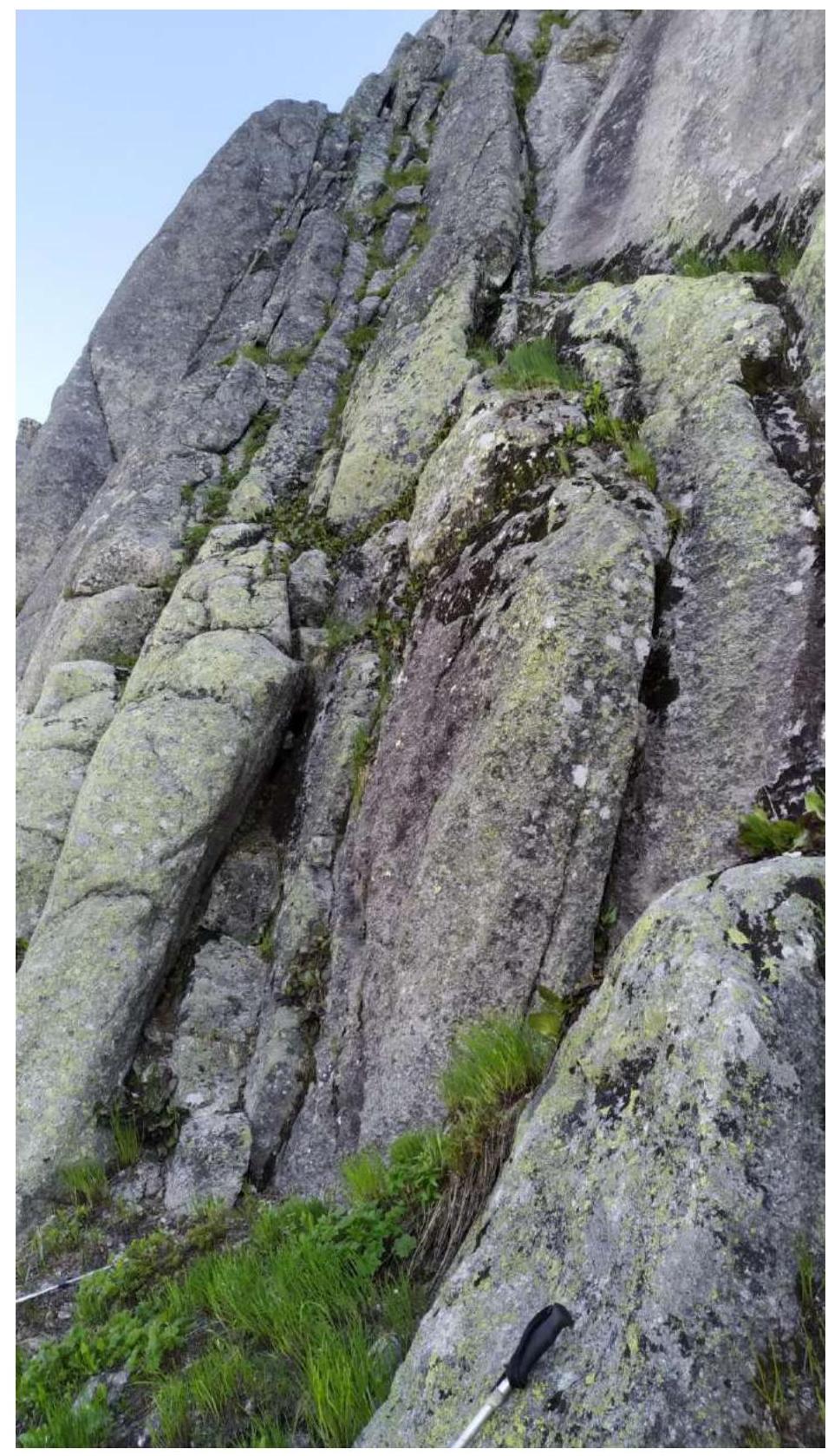
Fig. 1. Start of the route. Movement through a system of cracks to the left of the black streak.
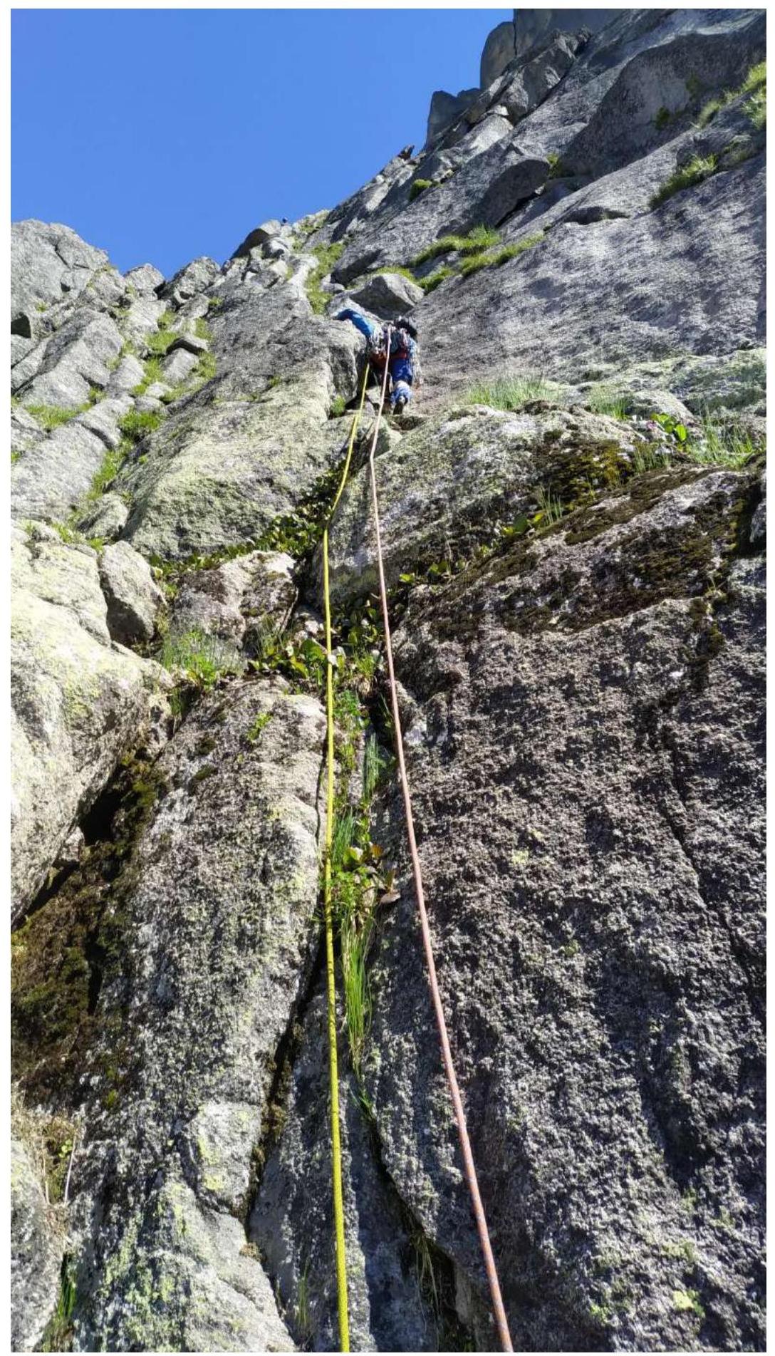
Fig. 2. Section R0–R1 passes through a system of internal corners and cracks.
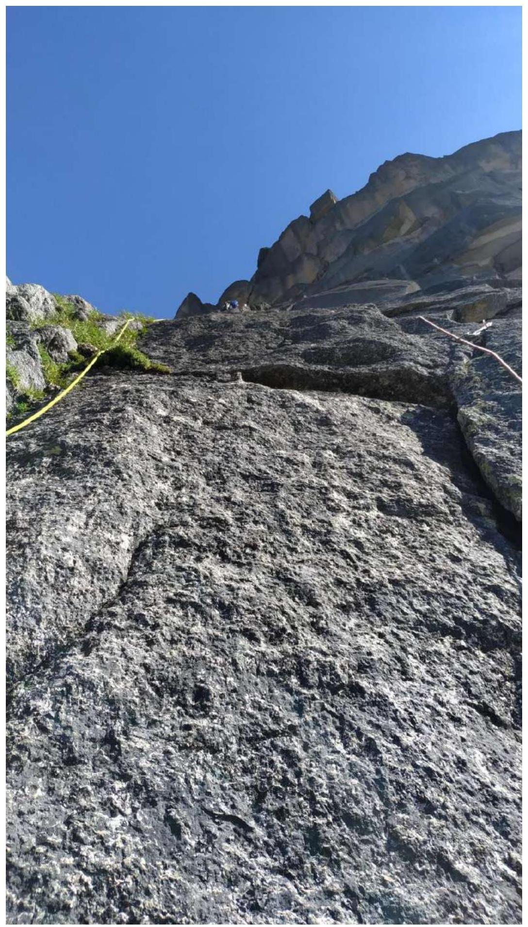
Fig. 3. Section R1–R2. Further, the wall becomes slightly steeper, and there is an exit to a sloping shelf with grass.
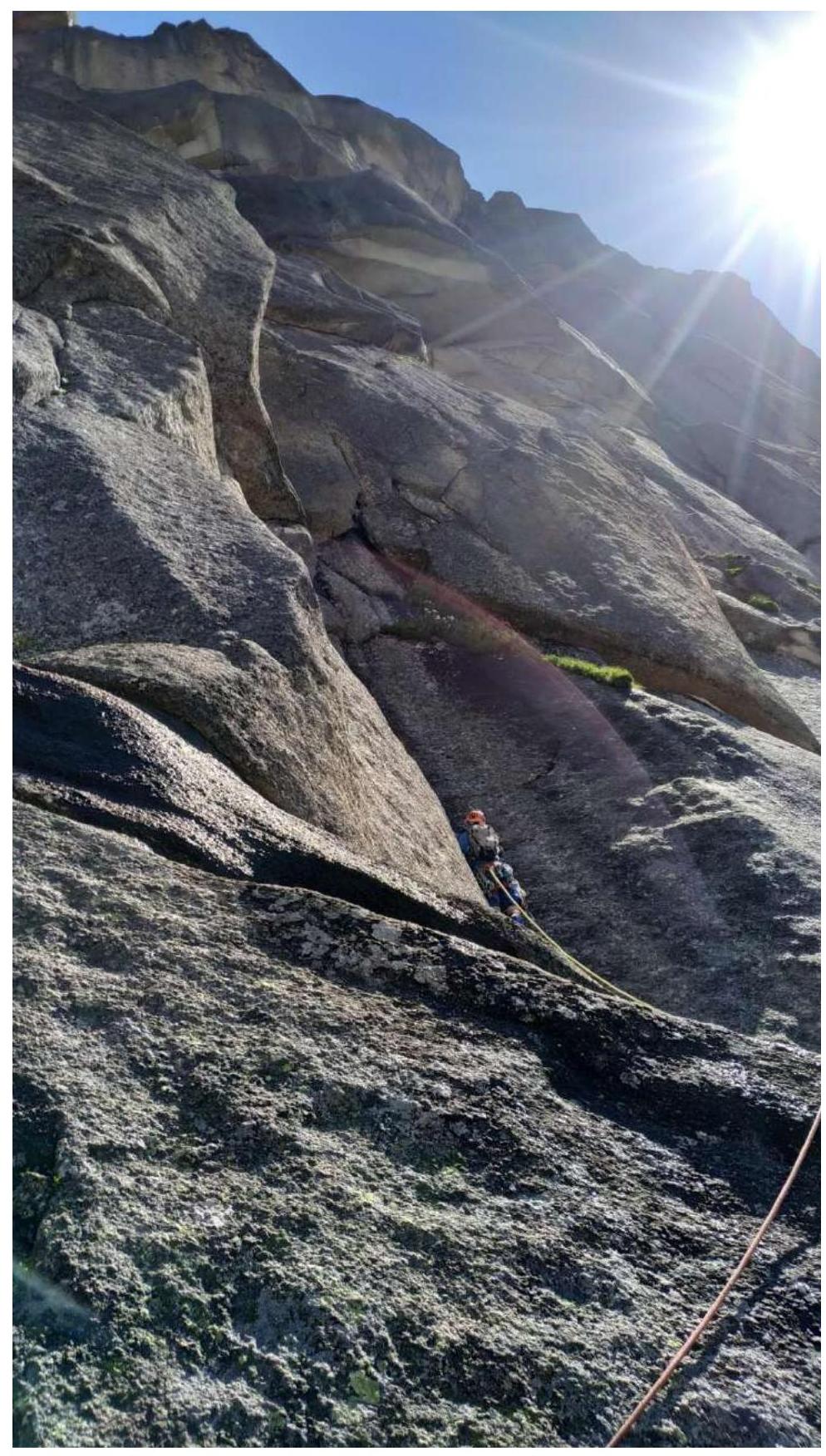
Fig. 4. Section R3–R4. Along the shelf, traverse right about 30 m. We enter a large global S-shaped internal corner.
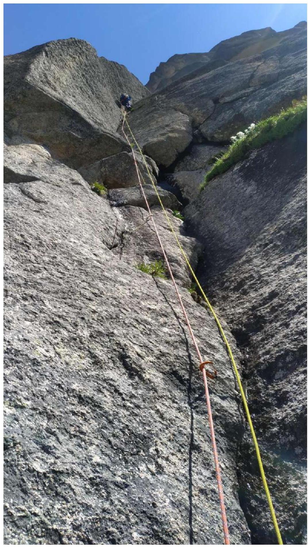
Fig. 5. Section R3–R4. Movement along the corner. Difficulty gradually increases.
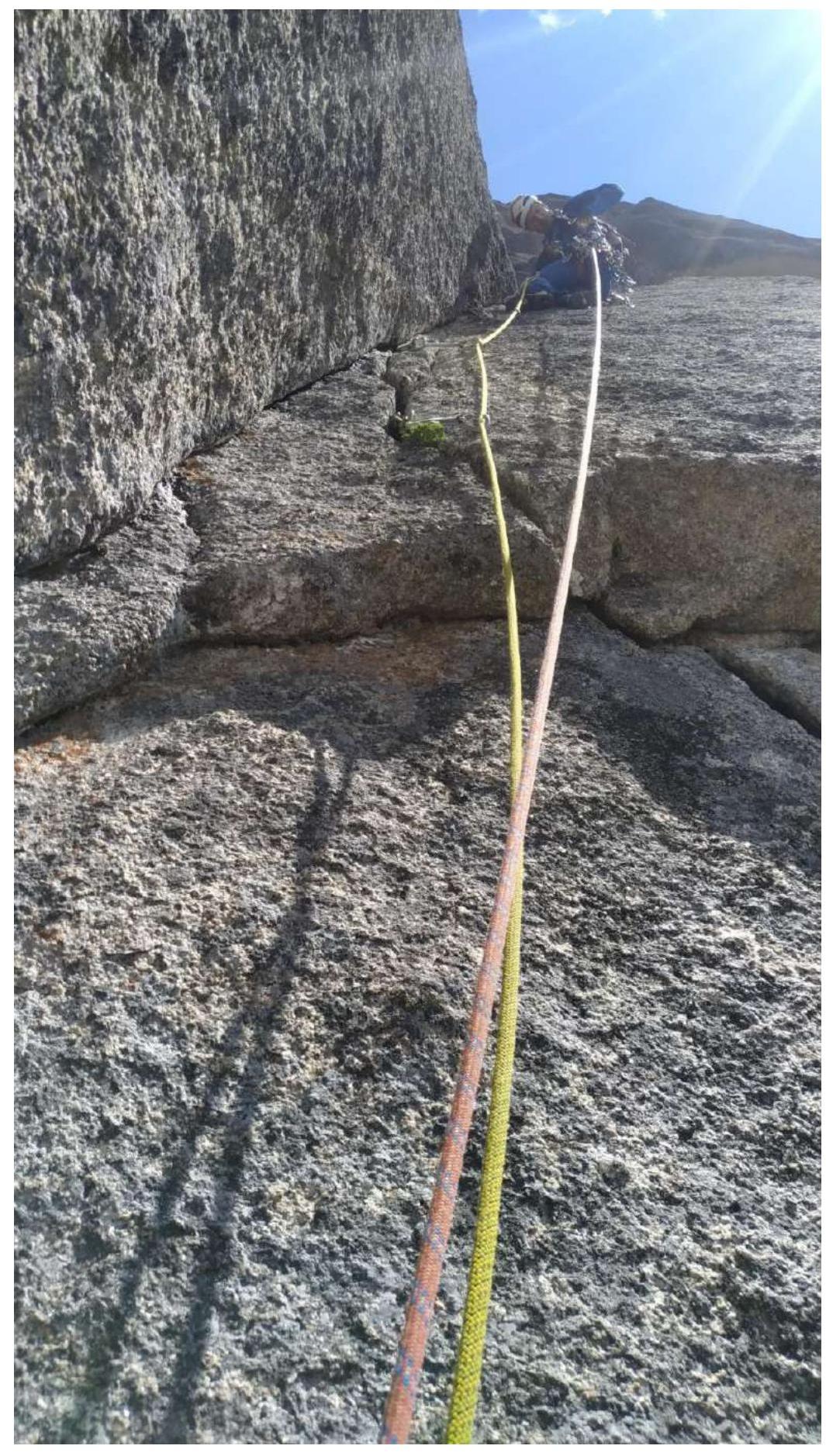
Fig. 6. Section R4–R5. Exit from the corner, belays are diagonal and overhanging. Laborious for the second person.
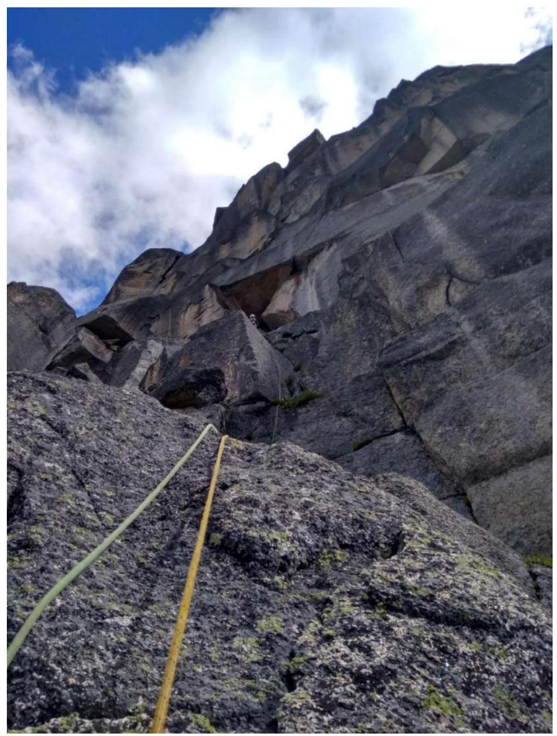
Fig. 7. Section R5–R6. Movement towards the "wet" cornice (clearly visible from below the route) through a system of walls and corners. Approach to the cornice on AID.
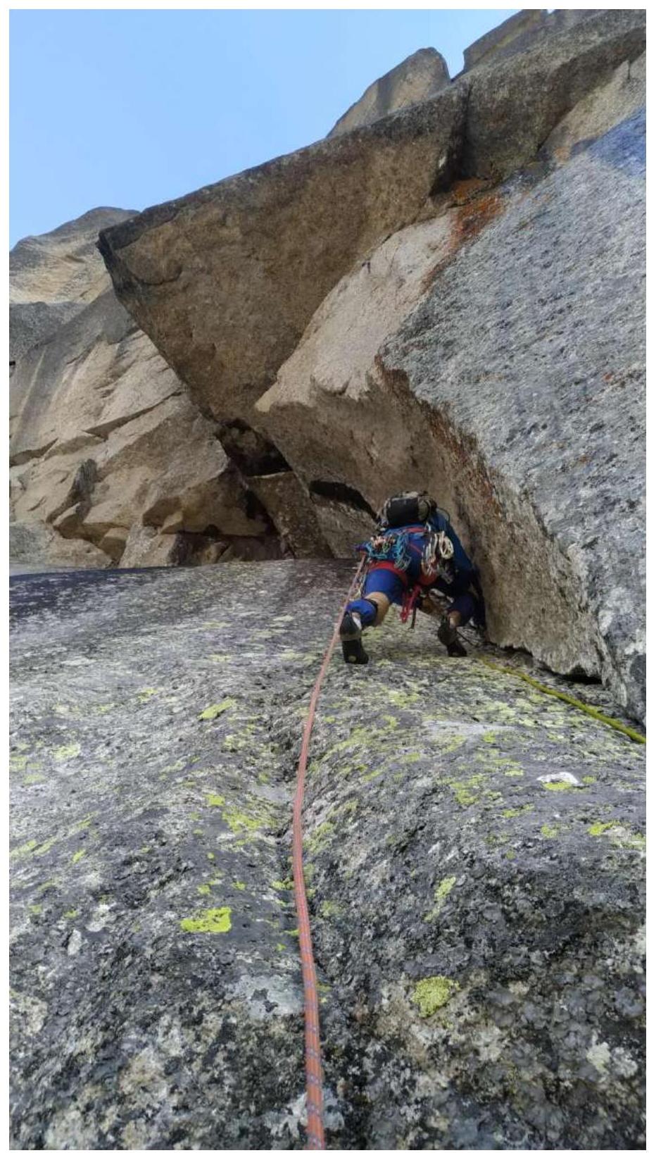
Fig. 8. Section R6–R7. Passage of the cornice and movement along the overhanging crack. Anchors with offset work well. At the base of the cornice, an anchor hook is left so that the second person can safely compensate for the pendulum from under the cornice. Further, the overhanging crack turns into a chimney, and there is an exit to the right onto a shelf.

Fig. 9. Section R6–R7. Passage of the cornice.
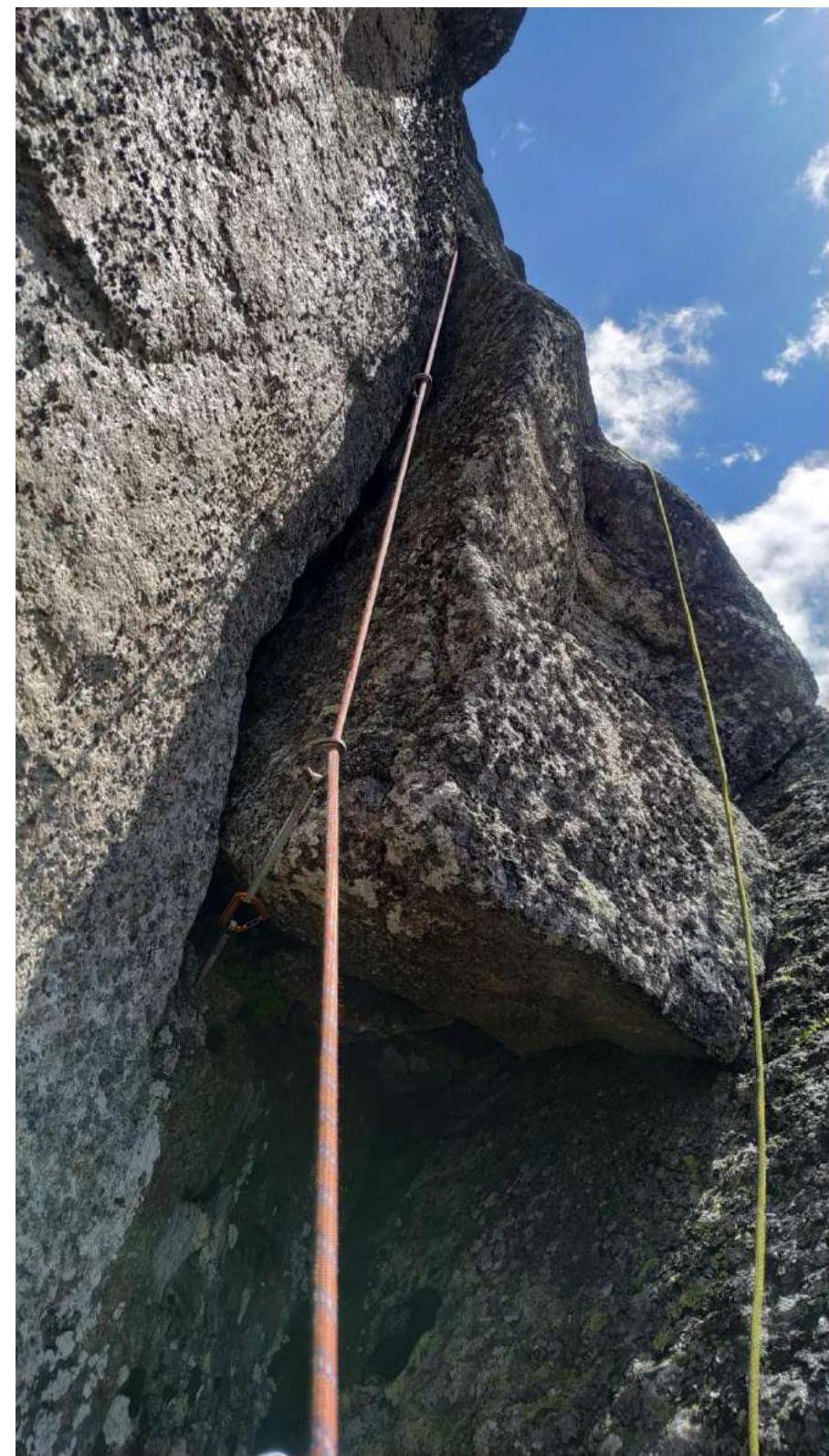
Fig. 10. Section R7–R8. Start of the section. From the shelf through a small overhang and further up along the internal corner.
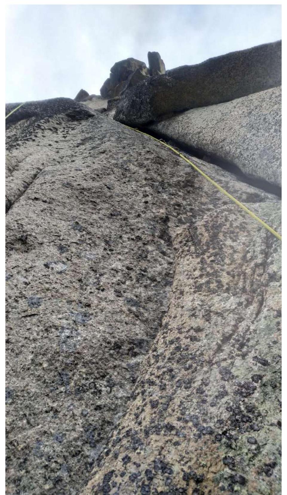
Fig. 11. Section R7–R13.
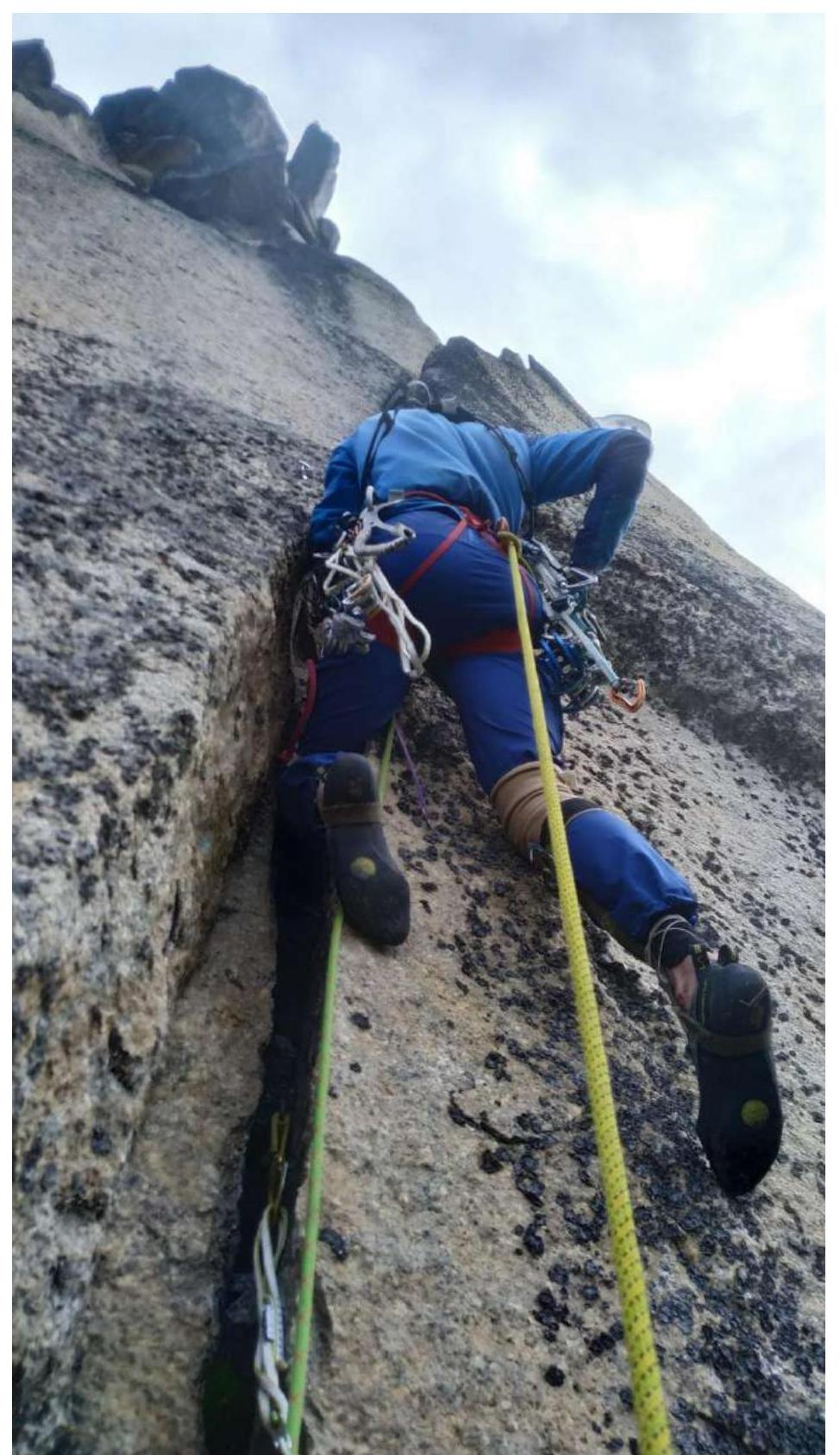
Fig. 12. Section R7–R8. Up the crack 10 m.
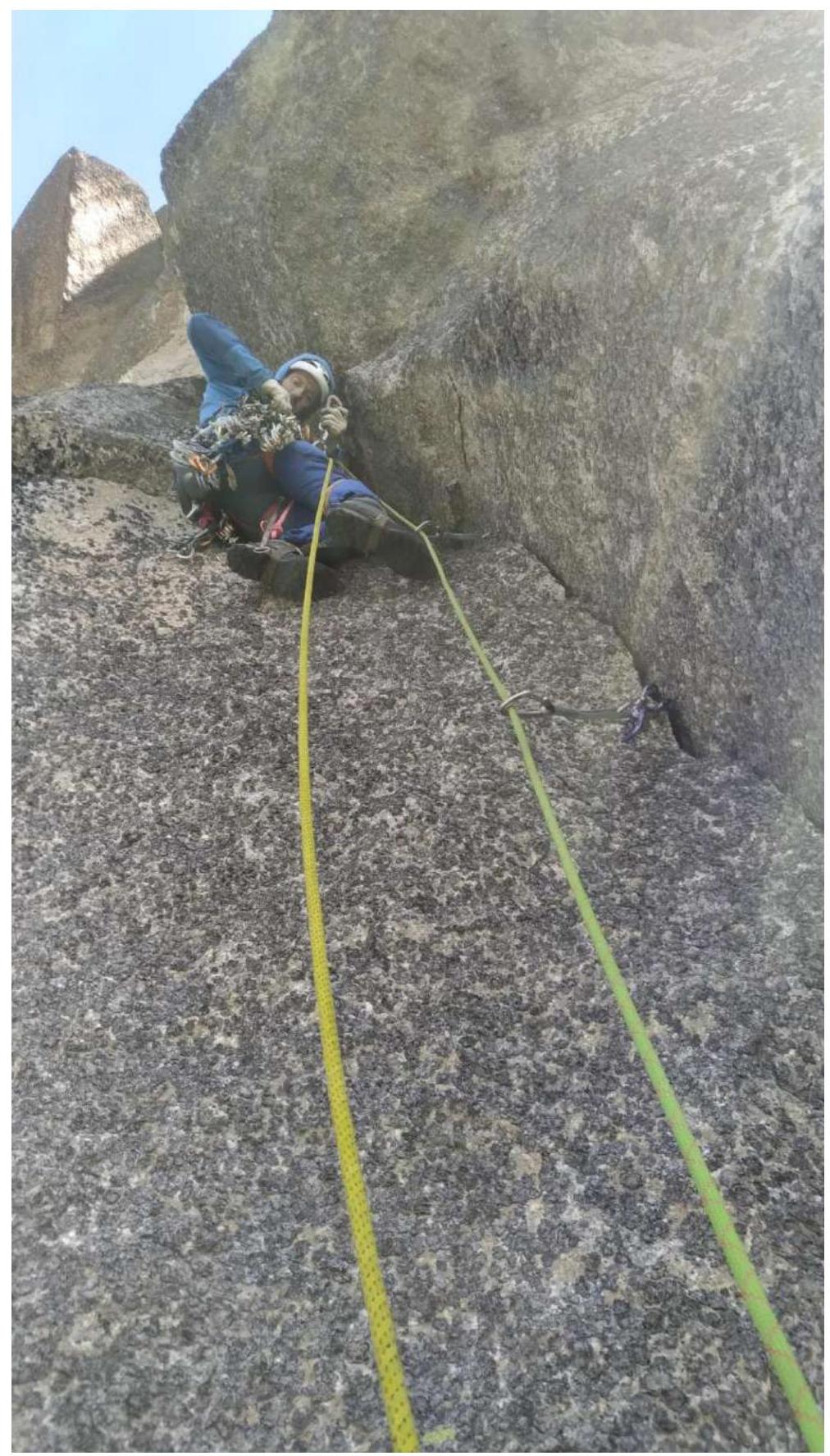
Fig. 13. Section R8–R9.
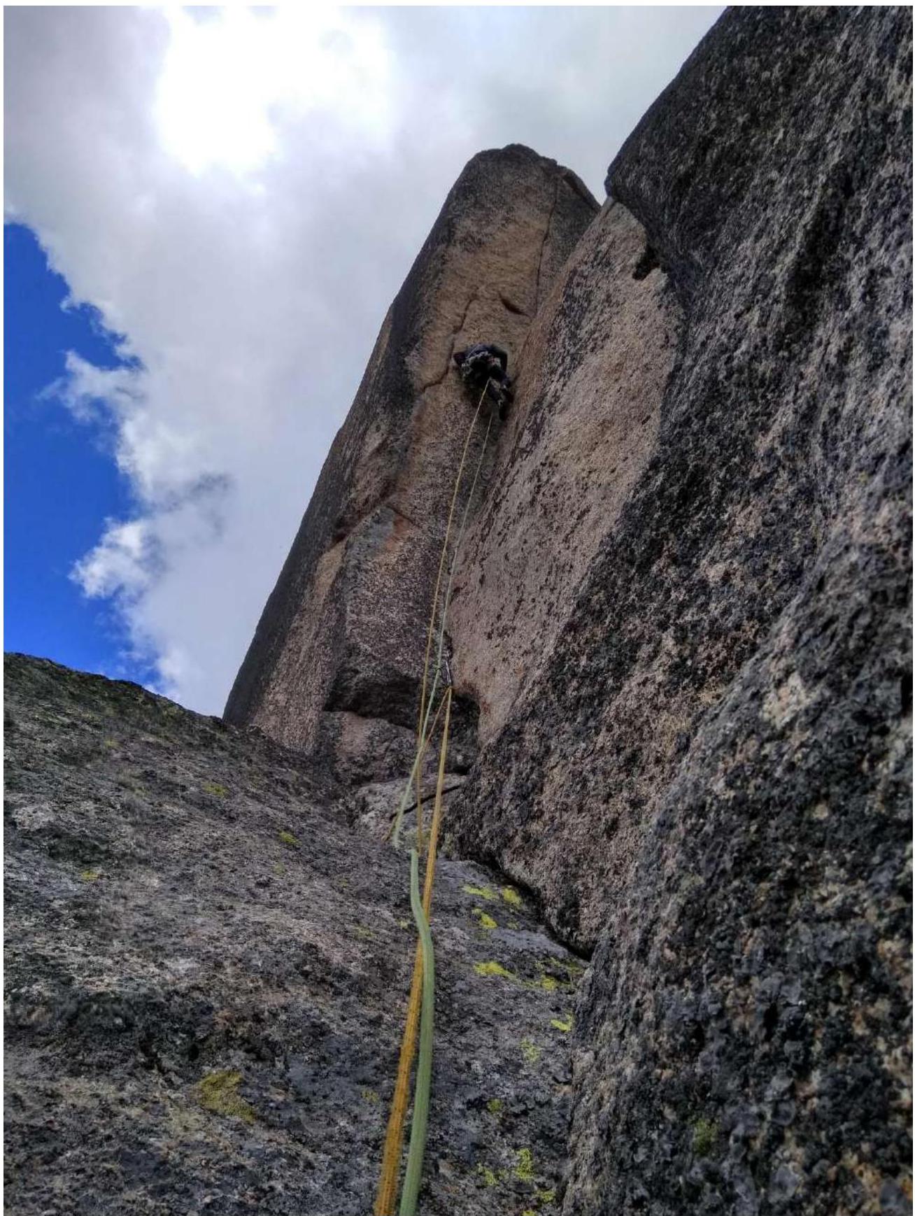
Fig. 14. Section R7–R9, up the internal corner, which is vertical.
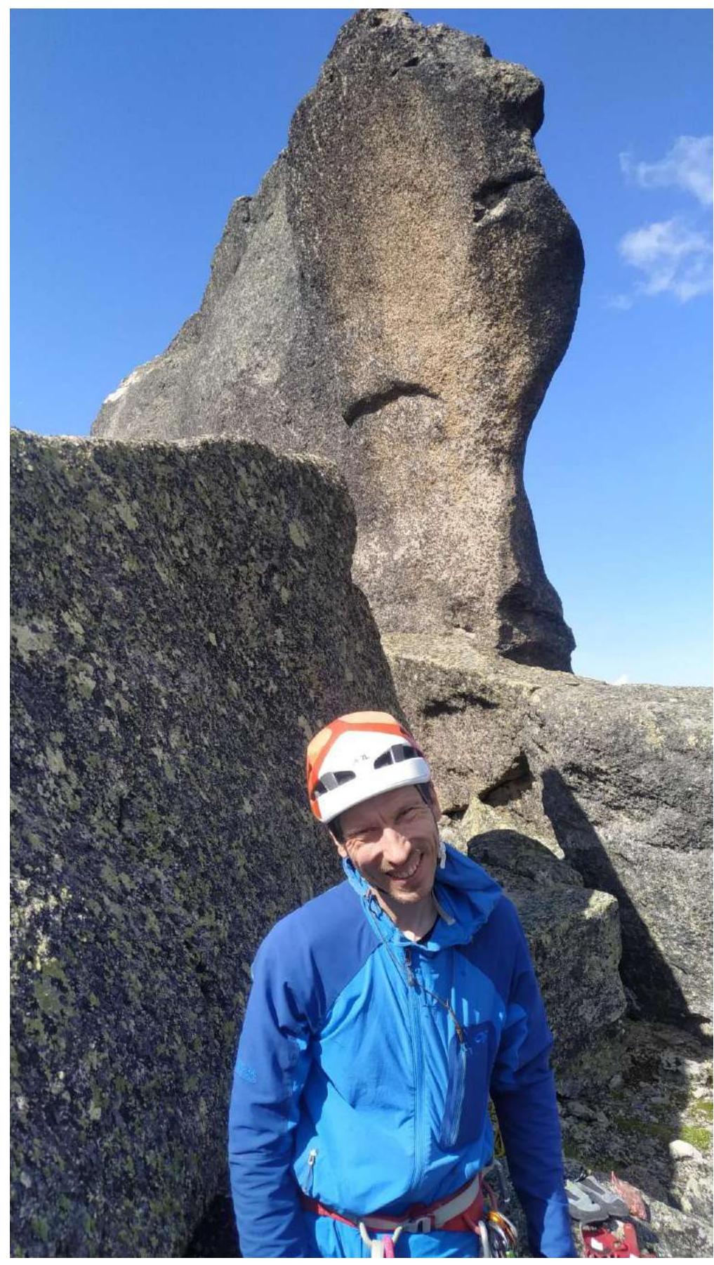
Fig. 15. Exit from the wall part of the route to the ridge. To the summit, 50 m, easy rocks, simultaneous movement.
Description of the route by sections
| Section # | Description | Photo # |
|---|---|---|
| R0–R1 | System of internal corners and cracks 50 m, 60° | 1,2 |
| R1–R2 | The wall becomes steeper, careful friction climbing 30 m, 70° | 3 |
| R2–R3 | Traverse right to the green shelf 30 m | N/A |
| R3–R4 | Up the internal corner, difficulty increases, the corner becomes vertical 30 m, 70°, 20 m, 90° | 4,5 |
| R4–R5 | Up the smooth wall, then through a series of shelves and walls movement towards the "wet" black cornice 60 m, 50° | 6 |
| R5–R6 | Left up under the cornice on a "coil" (smooth wall), belays on the crack to the right (wet and slippery) 60 m, 45–60° | 7 |
| R6–R7 | Through the cornice up, movement along the overhanging crack. Anchors with offset, small friends. Then along the chimney 5 m, exit to the shelf, from it along the crack up 10 m 65–70° | 8,9 |
| R7–R8 | Vertical internal corner, then it becomes slightly easier and up the crack 10 m, which leads to a large internal corner. 30 m, 90° | 10,11,12 |
| R8–R9 | Movement along the large internal corner 40 m, 85°, A2. | 13,14 |
| R9–R10 | Cornice 1.5 m, then chimney 5 m (wide sling) | |
| R10–R11 | To the summit 50 m, easy rocks, simultaneous movement | 15,16,17 |
3.2. Photo of the team at the summit by the control tour.
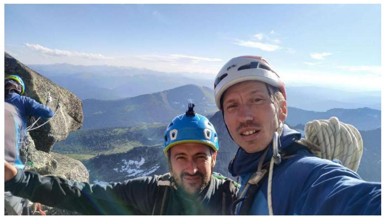
Fig. 16. Summit.
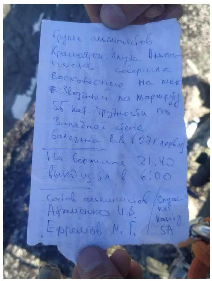
Fig. 17. Note from the summit.
3.3. The route is monolithic and objectively safe.
The route is monolithic and objectively safe. The thread of the route is logical and passes through a system of cracks and corners, some of which are overgrown with grass. It does not intersect with any of the existing routes.
At the same time, the route is completely independent and has high technical complexity, as it passes through a series of overhangs and cornices in the upper part. The route combines both free climbing (lower part) and a pronounced labor-intensive second part, where it is necessary to move using climbing techniques on the terrain and apply AID techniques.
There are no bolts and prepared stations on the route, which makes it more labor-intensive compared to classic routes in the area.
The route is a modern 5th category and significantly surpasses neighboring 5A routes in this area, which we passed during the preparation for the Russian Championship in the technical class, so the team believes that the route is of 5B category.
Based on the team's climbing experience, we believe that the difficulty level of this route corresponds to 5B.
Descent
From the summit, it is possible to descend via two options:
- Descent via the SW edge route, 5A "KANT" consists of 7 rappels along a straight line. Recommended in bad weather.
- Descent via the 3B category route along the Eastern ridge. Consists of two rappels of 50 m and two small ones of 6 m and 15 m. The first rappel — descent from the ridge to a shelf, then a large rappel, followed by a short rappel to a clearing, then walk 300 m along a grassy shelf and a large rappel, from which you arrive at the start of the route.
Equipment used
2 ropes (60 m), 20 quickdraws (15–120 cm), set of nuts — 8 pcs., set of cams — 10 pcs., anchors, Fifi hooks — 15 pcs., Jumars — 2 pcs., pulley, ladders and other personal gear.
Comments
Sign in to leave a comment