Report
On ascending to the summit of Golova Sayana via the W. wall, 3A cat. diff. by team 5 of the training center for military-sports training on June 16, 2020.
I. Ascent Passport
| №№ p.p. | 1. General Information | |
|---|---|---|
| 1.1 | Full name, sports rank of the leader | Kraitor Sergey Grigorievich, CMS |
| 1.2 | Full name, sports rank of the participants | Shirnin Viktor Vladimirovich, 2nd sports rank. Shustov Anton Mikhailovich, 2nd sports rank. |
| 1.3 | Full name of the coach | Kraitor Sergey Grigorievich |
| 1.4 | Organization | 5th training center for military-sports training |
| 2. Characteristics of the ascent object | ||
| 2.1 | Region | Western Sayan |
| 2.2 | Valley | Ergaki Ridge |
| 2.3 | Section number according to the 2013 classification table | 6.2 |
| 2.4 | Name and height of the summit | Golova, 1970 m |
| 2.5 | Geographical coordinates of the summit (latitude/longitude), GPS coordinates *(1) | --- |
| 3. Characteristics of the route | ||
| 3.1 | Route name | via W. wall |
| 3.2 | Proposed category of difficulty | 3A |
| 3.3 | Degree of route exploration | --- |
| 3.4 | Relief characteristics of the route | Rock |
| 3.5 | Height difference of the route (altimeter or GPS data) | 193 m (1941–1748) |
| 3.6 | Route length (in meters) | 270 m |
| 3.7 | Technical elements of the route (total length of sections of varying difficulty with relief characteristics) | I cat. diff. rocks — m II cat. diff. rocks — 195 m III cat. diff. rocks — 25 m IV cat. diff. rocks — 50 m Descent rappel (on descent) — (number of ropes and total meters) |
| 3.8 | Descent from the summit | Via the ascent route (270 m), 3A |
| 3.9 | Additional route characteristics | Presence (absence) of water |
| 4. Characteristics of the team's actions | ||
| 4.1 | Time of movement (team's walking hours, in hours and days) | 7.5 hours |
| 4.2 | Overnight stays | no |
| 4.3 | Departure on the route | 7:00 June 16, 2020 |
| 4.4 | Reaching the summit | 12:15 June 16, 2020 |
| 4.5 | Return to the base camp | 14:30 June 16, 2020 |
| 5. Person responsible for the report | ||
| 5.1 | Full name, e-mail | Kraitor Sergey Grigorievich, kraitor@bk.ru |
II. Route Description.
1. Characteristics of the Ascent Object

Photo 1. General photo of the summit (taken from the 5A Prokofiev report)
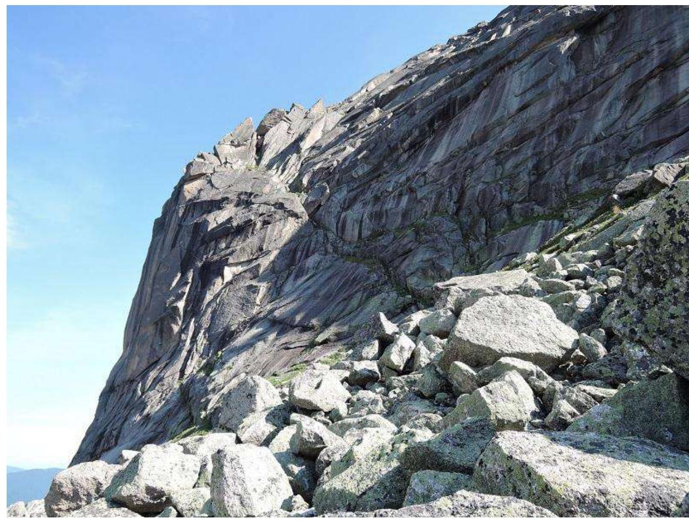
Photo 2. Photo of the route profile
2. Route Characteristics.
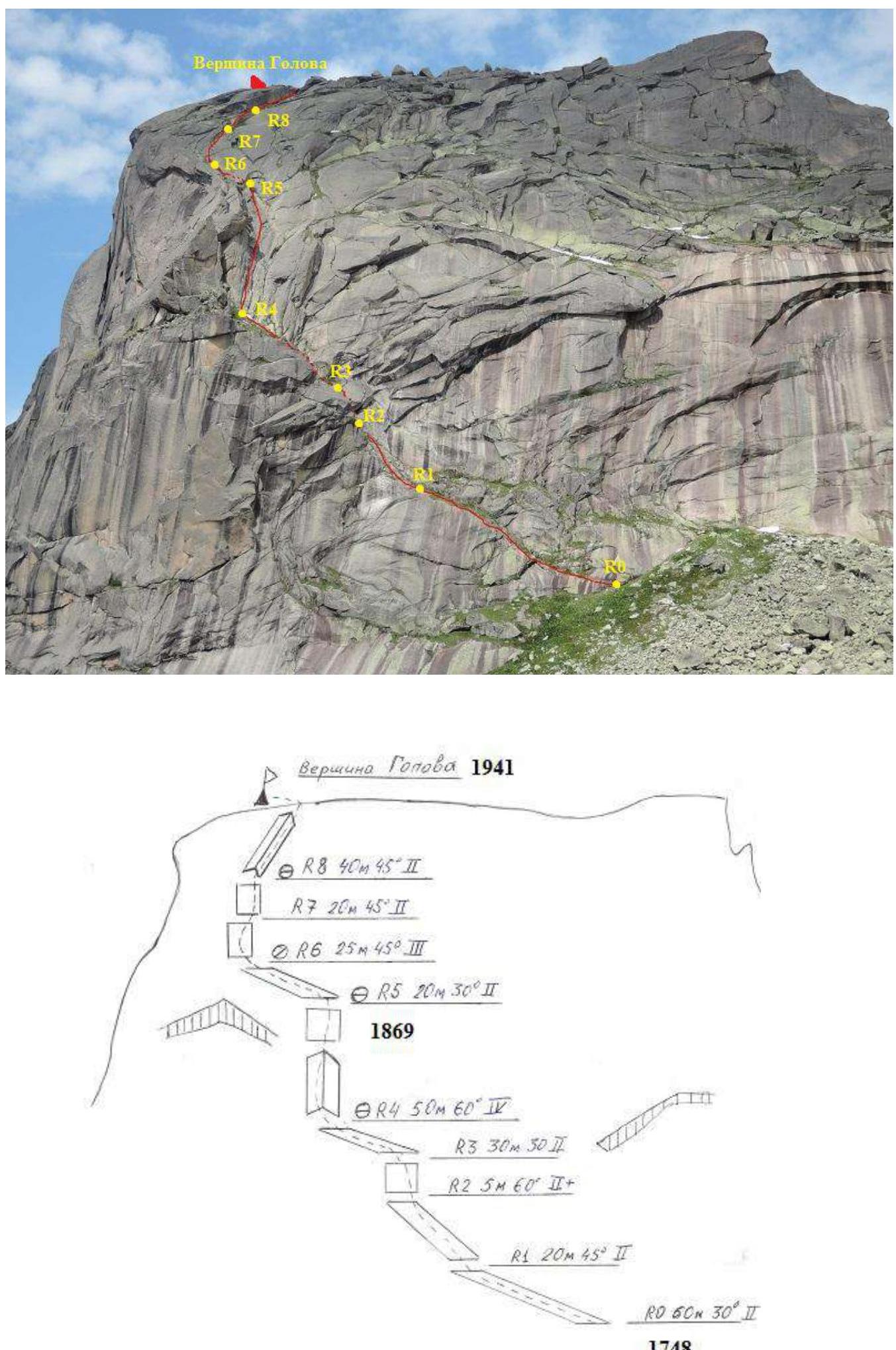
Route Description by Sections.
R0–R1 60 m. 30°, II cat. diff. The section is traversed left upwards along a ledge-crack. Protection via rocks (medium-sized friends). Climbing is straightforward.
R1–R2 20 m. 45°, II cat. diff. The crack turns into a wall, which is traversed centrally. Sufficient holds and protection points. Protection via rocks (medium-sized friends).
R2–R3 5 m. 60°, II+ cat. diff. The rock wall, leading to a grassy ledge, is traversed on the right side. Climbing is straightforward.
R3–R4 30 m. 30°, II cat. diff. The grassy ledge is traversed with protection on the rocks.
R4–R5 50 m. 60°, IV cat. diff. The key section of the route. The inner corner at the top of the section turns into a wall. Limited protection points. Holds are sparse and limited. Traversed on the left side of the corner, moving right at the top.
R5–R6 20 m. 30°, II cat. diff. The grassy ledge is traversed with protection on the rocks.
R6–R7 25 m. 45°, III cat. diff. The wall has limited holds and protection points. The top station is set up on a rock outcrop.
R7–R8 20 m. 45°, II cat. diff. The wall is traversed via a grass-filled crack. Small friends are used for protection.
R8–R9 40 m. 45°, II cat. diff. The inner corner leads to the summit plateau.
3. Characteristics of the Team's Actions.
Before the ascent, the group camped under the route. The approach to the route from Raduzhnoe Lake takes about 1 hour. On the plateau under the route: — There are camping areas — There is water in the stream under the wall — Cellular connection is available (Tele2) In dry weather, the route is traversed without issues. In wet weather, the passage is complicated on the key section due to the limited number of obvious holds.
The ascent was made in good weather. There are small remnants of winter snow on the route. Heights on the route sections were measured using a phone's GPS.
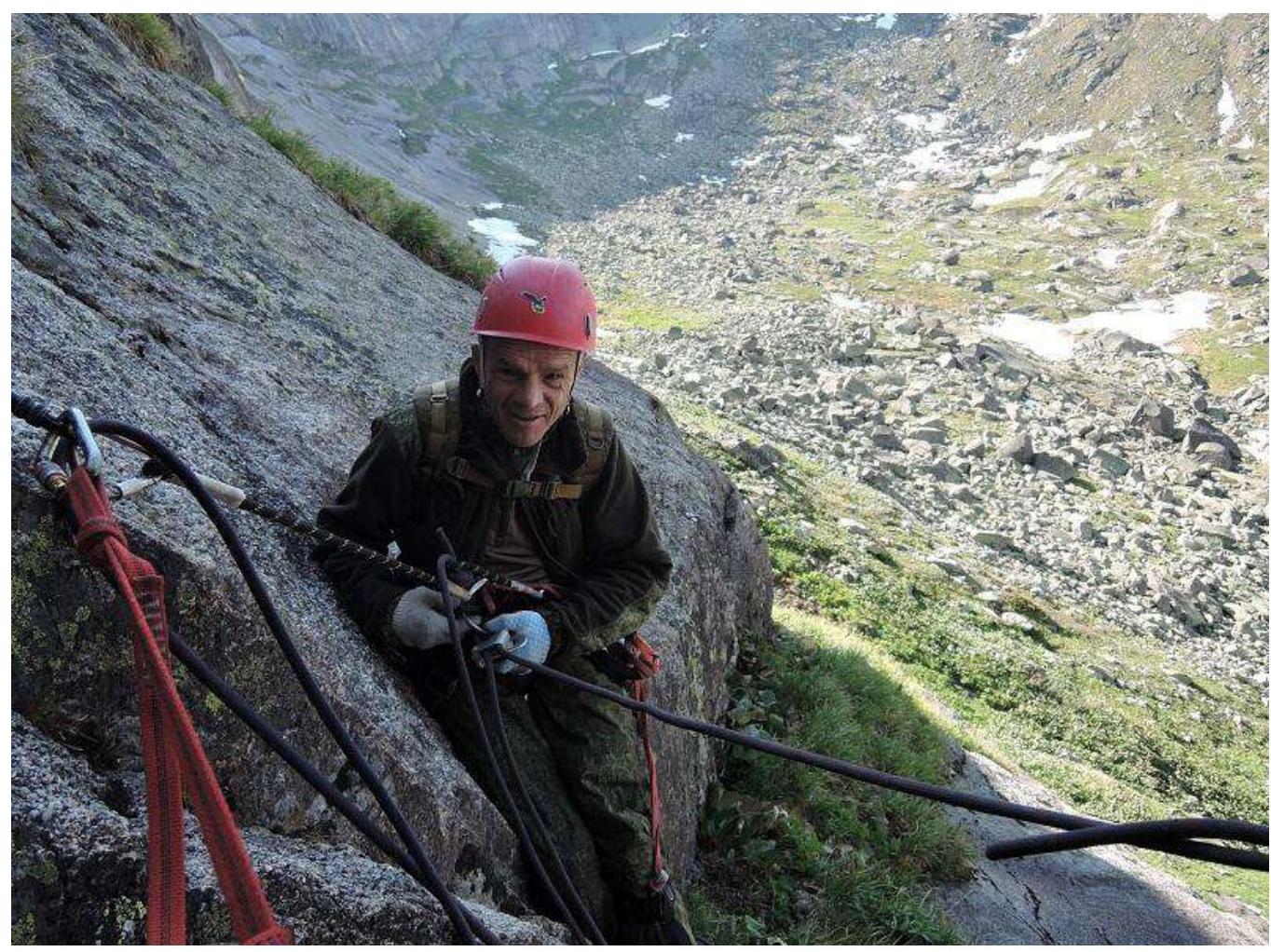
Photo 4. R1 belay station
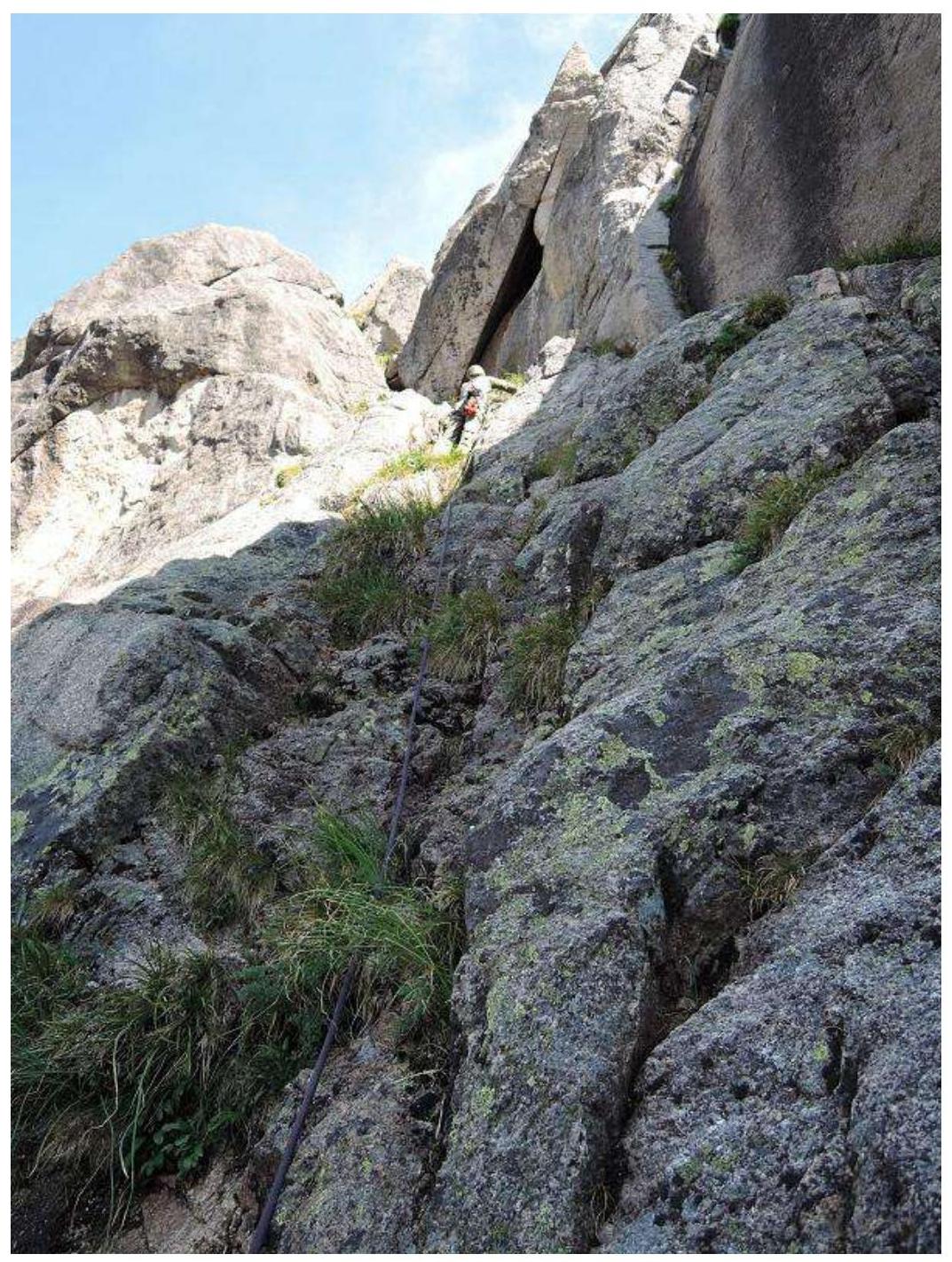
Photo 5. Traversing section R1–R2
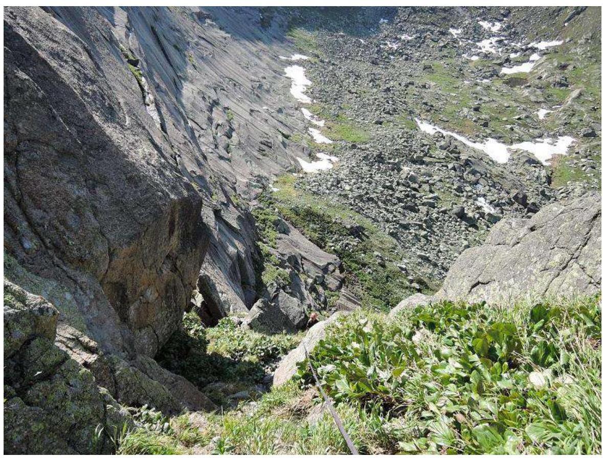
Photo 6. Section R3–R4
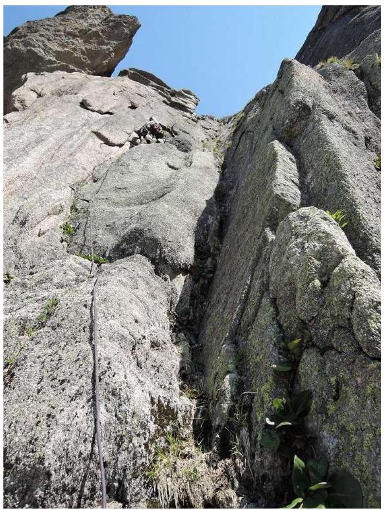
Photo 7. Section R4–R5
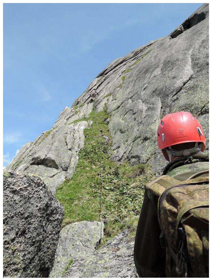
Photo 8. Section R5–R6

Photo 9. Section R6–R7
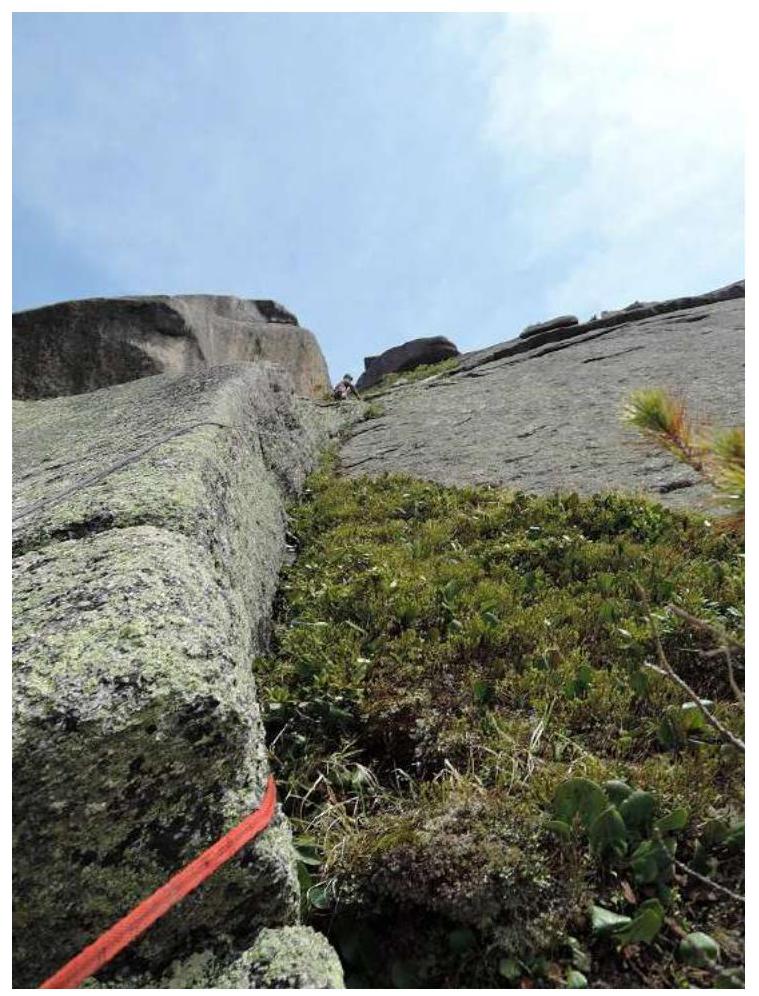
Photo 10. Section R7–R8
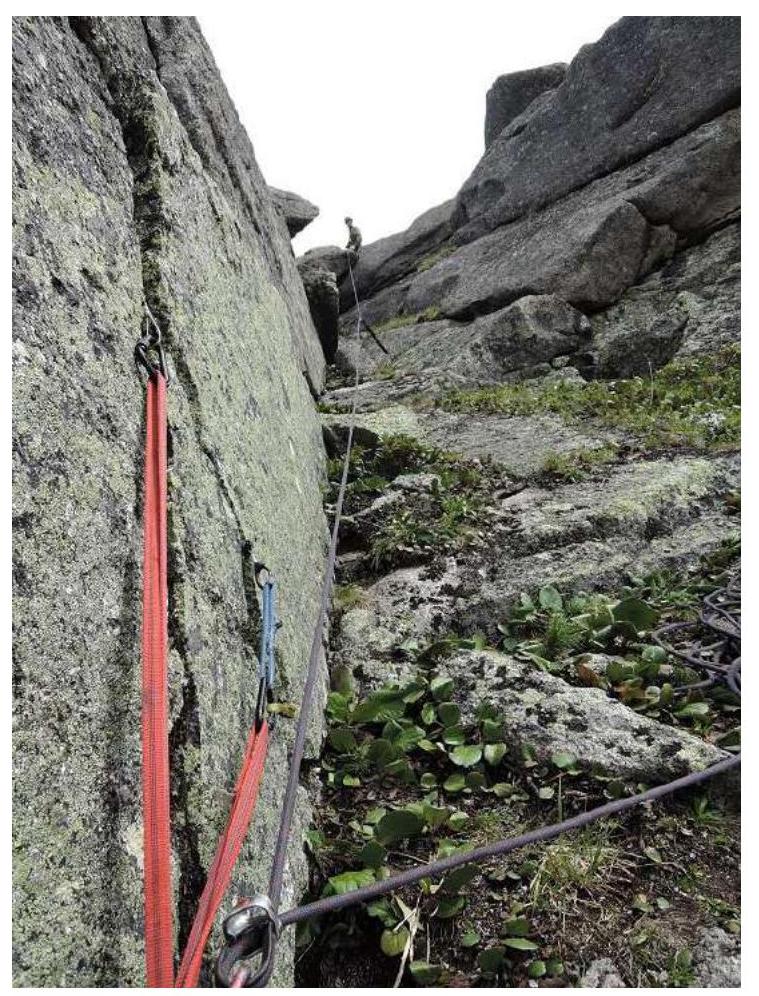
Photo 11. Section R8–R9
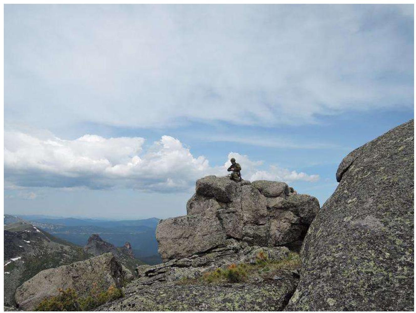
Photo 12. At the summit.