Ascent Passport
- Region — Ergaki Ridge, Western Sayan. 6.2
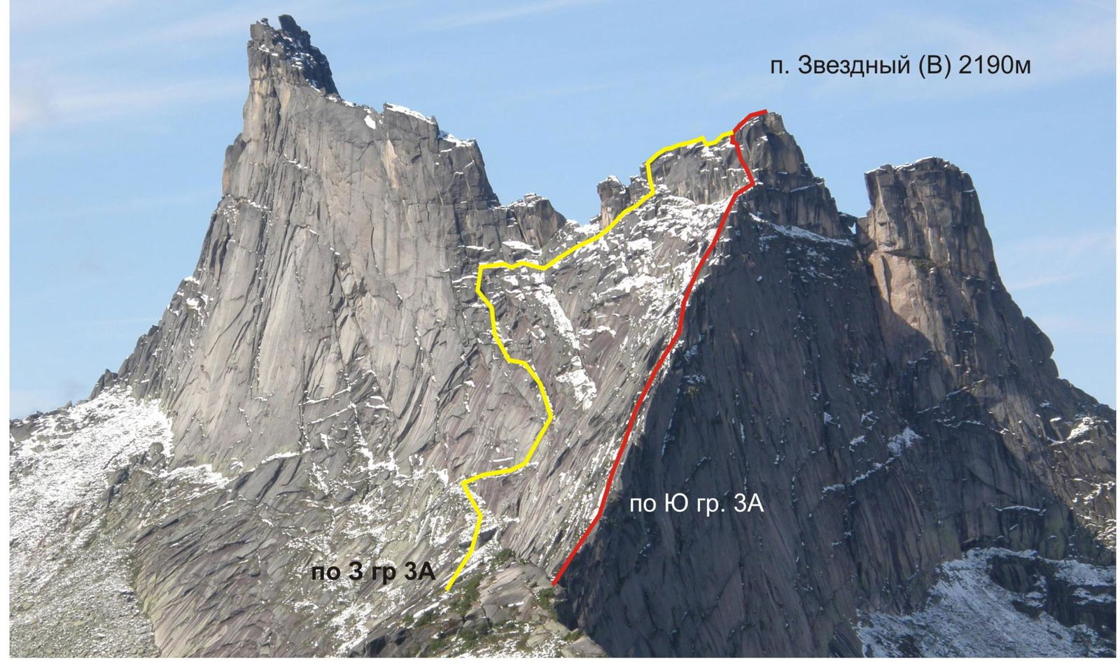
- Summit — Zvezdny Peak (V) 2190 m via South Ridge
- Proposed — Category 3A difficulty, first ascent
- Route type — Rock climbing
- Route characteristics:
Elevation gain approximately 300 m, length approximately 1000 m
- Equipment used on the route: 19 protection pieces
- Total climbing hours — 5
- Overnight stays — none
- Team composition:
Zakharov Nikolai Nikolaevich, MSMS (Master of Sports in Mountaineering) with a 3rd-class training department
- Team coach:
Zakharov Nikolai Nikolaevich, MSMS
- Dates:
Departure for the route — June 21, 1997. Summit reached — June 21, 1997. Return — June 21, 1997
- Ascent organized by — Krasnoyarsk Travelers' Center
1997
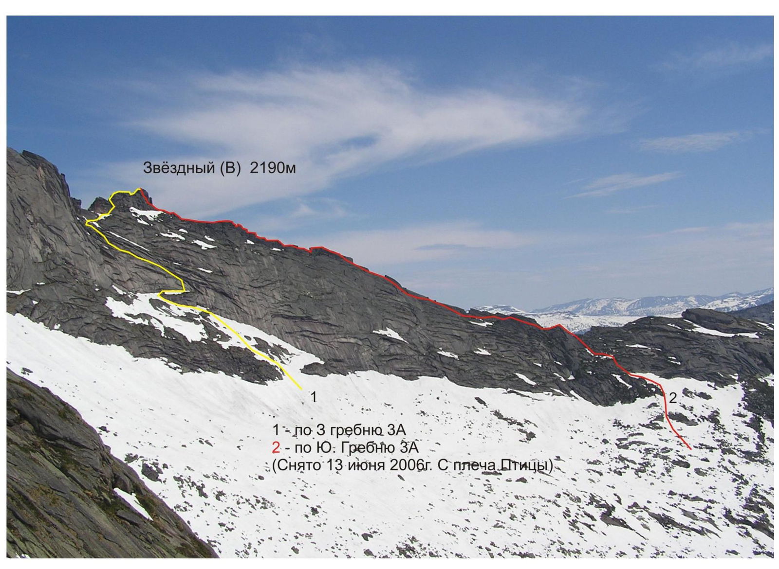
Zvezdny (V) 2190 m
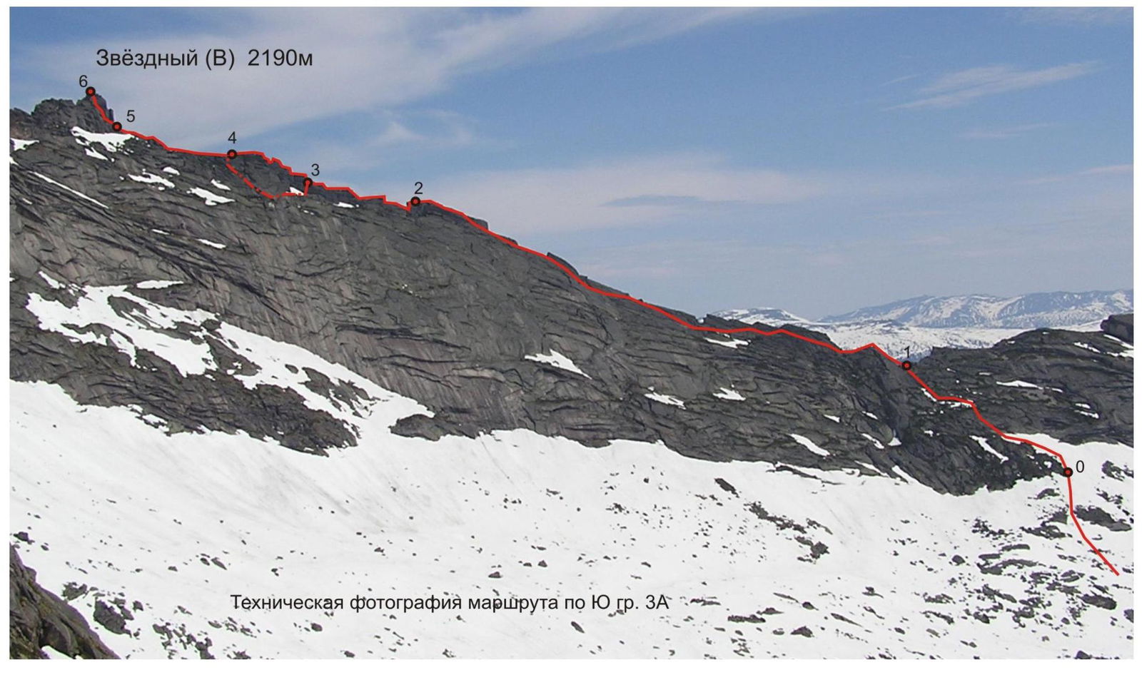
Technical photograph of the route via South Ridge, Category 3A
Route description by sections
| Section | Length | Steepness | Terrain characteristics | Difficulty category |
|---|---|---|---|---|
| 0-1 | 150 | 30-45 | Heavily overgrown ledges, corners, and small walls; exit onto the southern ridge's saddle; simple climbing. | 1-2 |
| 1-2 | 450 | 30-75 | Monolithic sharp rocky ridge; the right (eastern) side drops off with a sheer wall. The route primarily follows the left side of the ridge along a series of ledges and slabs with exits to the ridge's crest in the second half of the section. | |
| - 6+ pitches | ||||
| - 2–3 — 100 m, 30–90 seconds |
Sharp, jagged rocky ridge; complex climbing.
- passes along the ridge's crest; occasionally encounters short sections (3–4 m) of Category 5B difficulty.
- 3–4 — 5+ pitches
- 3–4 — 90 m, 30–90 seconds
Heavily jagged complex ridge, Category 5B; can be bypassed on the left:
- initially, a 10 m rappel onto a ledge
- then, along a series of ledges and walls, traverse left
- then, up and left — exit onto the ridge
If following the ridge, then — Category 5 difficulty.
Bypass — 3 | 3+ Pitches
- 4–5 — 120 m
Rocky ridge — exit onto a ledge before the summit tower.
-
2
-
5–6 — 50 m, 40–75 seconds
Monolithic rocky wall with good cracks.
- 4
- 5
Descent initially follows the 3rd ridge (Category 3A route) to a large sloping grassy ledge, where a descent trail is visible. Follow the trail down and left for about 150 m, then descend by climbing down a steep 3-meter wall with a wide crack, and approximately 20 m later, on the edge of a ledge, there will be a descent station on two anchors with a chain. From it, a 50 m rappel down a steep wall over a lip, onto a ledge, to the start of (the main part of) the Category 3A route on the 3rd ridge. Continue along the trail on sloping grassy ledges, occasionally encountering slabs up to Category 2 difficulty.
View of Zvezdny (V) from the southern ridge. The start of the routes is not visible due to p. Zvezdny 2265 m, p. Zvezdny (V) 2190 m.